233 entries match your criteria. The first 100 are listed. ⊳
Baltimore and Ohio Railroad (B&O) Historical Markers
By Devry Becker Jones (CC0), December 30, 2023
The Train Stations of Newark Marker
| 1 ► Delaware, New Castle County, Newark — The Train Stations of Newark — Pomeroy and Newark Rail Trail — |
| On Newark and Pomeroy Rail Trail at East Main Street, on the right when traveling south on Newark and Pomeroy Rail Trail. | |||
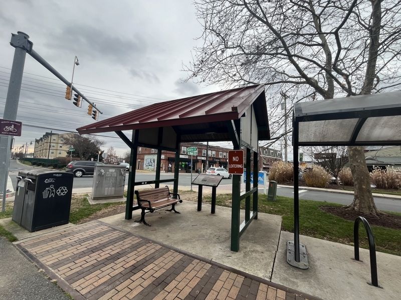
| 2 ► Delaware, New Castle County, Wilmington, Brandywine Park — Looking Back… — …over 100 years ago from this spot — |
| Near South Park Drive east of Lovering Avenue, on the right when traveling north. | |||
| 3 ► District of Columbia, Washington, Northeast Washington, NoMa/Sursum Corda — 1 — All Aboard! — Hub, Home, Heart — Greater H Street NE Heritage Trail |
| On 1st Street Northeast at Massachusetts Avenue Northeast, on the right when traveling south on 1st Street Northeast. Reported missing. | |||
| 4 ► District of Columbia, Washington, Southeast Washington, Anacostia — 11 — Transit and Trade — An East-of-the-River View — Anacostia Heritage Trail — |
| On Martin Luther King Jr. Avenue Southeast at W Street Southeast, on the right when traveling north on Martin Luther King Jr. Avenue Southeast. | |||
| 5 ► District of Columbia, Washington, Southeast Washington, Navy Yard — 1830 — Transportation Walk — |
| On M Street Southeast west of 4th Street Southeast, on the right when traveling east. | |||
| 6 ► Illinois, Will County, Plainfield — Boxcars — |
| On Lockport Street at Wood Farm Road, on the left when traveling east on Lockport Street. | |||
| 7 ► Indiana, Daviess County, Washington — 14.1992.1 — Baltimore & Ohio Southwestern Railroad Depot — |
| On South Meridian Street at Depot Street, on the left when traveling south on South Meridian Street. | |||
| 8 ► Indiana, Dearborn County, Lawrenceburg — Lawrenceburgh — First in New Modes of Transportation — 1802 — |
| On Walnut Street at High Street, on the right when traveling north on Walnut Street. | |||
| 9 ► Indiana, Dearborn County, Lawrenceburg, Lawrenceburg Township — Train Depot — 154 West Williams Street — |
| On West Williams Street at Mary Street, on the right when traveling east on West Williams Street. | |||
| 10 ► Indiana, Knox County, Vincennes — Ellis Mansion — |
| On North 2nd Street north of Busseron Street, on the right when traveling north. | |||
| 11 ► Indiana, Lake County, Gary, Downtown — The Gary Union Station — |
| On Broadway north of Interstate 90, on the right when traveling north. | |||
| 12 ► Maryland, Allegany County, Cumberland — Church of St. Patrick, Cumberland — |
| On North Centre Street at Market Street, on the right when traveling west on North Centre Street. | |||
| 13 ► Maryland, Allegany County, Cumberland — Crossroads of America Mural — |
| On Canal Street, 0.1 miles north of West Harrison Street, on the left when traveling north. | |||
| 14 ► Maryland, Allegany County, Cumberland — Cumberland — Town Map and Directory — |
| On Canal Street just north of West Harrison Street, on the left when traveling north. | |||
| 15 ► Maryland, Allegany County, Cumberland — Cumberland — |
| On Great Allegheny Passage, 0.1 miles north of Baltimore Street, on the left when traveling north. | |||
| 16 ► Maryland, Allegany County, Cumberland — Cumberland Gateway Westward — Fort Cumberland Trail — |
| Near Greene St.. | |||
| 17 ► Maryland, Allegany County, Cumberland — Cumberland Surrenders — Between the Line — Gettysburg Campaign — |
| Near Fort Avenue just north of Reservoir Avenue, on the left when traveling north. | |||
| 18 ► Maryland, Allegany County, Cumberland — Cumberland Terminus: Yesterday and Today — Chesapeake and Ohio Canal National Historical Park — National Park Service, U.S. Department of the Interior — |
| On W. Harrison Street, on the right when traveling south. | |||
| 19 ► Maryland, Allegany County, Cumberland — Irish Laborers — |
| Near Canal Street, 0.2 miles Wineow Street. | |||
| 20 ► Maryland, Allegany County, Lonaconing — The Early Years — Lonaconing, Maryland — |
| On Main Street (Maryland Route 36) at Union Street, on the right when traveling north on Main Street. | |||
| 21 ► Maryland, Baltimore, Canton — Historic Canton — The Industrial Heart of the City of Baltimore — |
| On Boston Street at South East Street, on the right when traveling east on Boston Street. | |||
| 22 ► Maryland, Baltimore, Carroll Park — Carroll Park at the Historic Pigtown Neighborhood — Gwynns Falls Trail — |
| On Washington Boulevard at Bush Street, on the right when traveling south on Washington Boulevard. | |||
| 23 ► Maryland, Baltimore, Downtown — Wendel Bollman — |
| On South Calvert Street (Maryland Route 2), on the left when traveling north. | |||
| 24 ► Maryland, Baltimore, Franklin — Carrollton Viaduct — |
| Near Washington Boulevard. | |||
| 25 ► Maryland, Baltimore, Inner Harbor — President Street Station — Erected 1842 A.D. — |
| On President Street at Fleet Street on President Street. | |||
| 26 ► Maryland, Baltimore, Inner Harbor — Welcome — Heritage Walk — |
| On East Pratt Street east of South Calvert Street (Maryland Route 2), on the left when traveling east. | |||
| 27 ► Maryland, Baltimore, Jonestown — 1781 Friends Meeting House — |
| On North Asiquith Street at East Fayette Street, on the right when traveling north on North Asiquith Street. | |||
| 28 ► Maryland, Baltimore, Mid-Town Belvedere — Mount Royal Station — Icon for the Industrial Age — |
| On Cathedral Street. | |||
| 29 ► Maryland, Baltimore, Mid-Town Belvedere — Mount Royal Station — Preserving-A Landmark For Artists — |
| On Cathedral Street. | |||
| 30 ► Maryland, Baltimore, Mount Vernon — Celebrating Culture: The Heart of the City / Contributing to Society: Baltimore's Best Address — Mount Vernon Cultural Walk — |
| On North Charles Street at East Mt. Vernon Place, on the right when traveling north on North Charles Street. | |||
| 31 ► Maryland, Baltimore, Mount Vernon — Revival — Est. 1929 — Mt. Vernon Place — |
| On West Monument Street west of Cathedral Street, on the right when traveling east. | |||
| 32 ► Maryland, Baltimore, Pigtown — B&O No. 908 — "John T. Collinson" |
| Near West Pratt Street east of South Schroeder Street, on the right when traveling east. Reported permanently removed. | |||
| 33 ► Maryland, Baltimore, Pigtown — B&O Railroad Museum — |
| Near West Pratt Street east of South Schroeder Street, on the right when traveling east. | |||
| 34 ► Maryland, Baltimore, Pigtown — Baltimore & Ohio Railroad — The Mount Clare Shops |
| On West Pratt Street. Reported permanently removed. | |||
| 35 ► Maryland, Baltimore, Pigtown — Camp Carroll — The War Came by Train |
| Near West Pratt Street east of South Schroeder Street, on the right when traveling east. Reported permanently removed. | |||
| 36 ► Maryland, Baltimore, Pigtown — CSX Corporation — |
| Near West Pratt Street east of South Schroeder Street, on the right when traveling east. | |||
| 37 ► Maryland, Baltimore, Pigtown — First Commercial Railroad Right-of-Way in America — The War Came by Train |
| Near West Pratt Street east of South Schroeder Street, on the right when traveling east. Reported permanently removed. | |||
| 38 ► Maryland, Baltimore, Pigtown — First Stone of the Balt. & Ohio Rail Road — |
| On West Pratt Street west of South Poppleton Street, on the left when traveling west. | |||
| 39 ► Maryland, Baltimore, Pigtown — James L. (Jim) Caskey, Jr. — (1945-1999) — |
| On Scott Street at Washington Blvd. on Scott Street. | |||
| 40 ► Maryland, Baltimore, Pigtown — Main Line Electrification of the Baltimore and Ohio Railroad (B&O) 1895 — IEEE Milestone in Electrical Engineering and Computing — |
| Near West Pratt Street east of South Schroeder Street, on the right when traveling east. | |||
| 41 ► Maryland, Baltimore, Pigtown — Mount Clare Shops — Nerve Center of "Lincoln's Railroad" — |
| On South Poppleton Street at West Pratt Street, on the left when traveling south on South Poppleton Street. | |||
| 42 ► Maryland, Baltimore, Pigtown — Railroads Eclipse a National Road — “Thus will scientific power conquer space.” — The Historic National Road - The Road That Built The Nation |
| Near West Pratt Street (U.S. 40). Reported permanently removed. | |||
| 43 ► Maryland, Baltimore, Pigtown — Site of Old Relay Station and Hotel — Baltimore & Ohio Railroad — |
| Near West Pratt Street west of South Poppleton Street, on the right when traveling east. | |||
| 44 ► Maryland, Baltimore, Pigtown — The National Road — The Historic National Road, America's First Federally Funded Highway — |
| On South Poppleton Street just south of West Pratt Street, on the left when traveling south. | |||
| 45 ► Maryland, Baltimore, Pigtown — The Underground Railroad — The Historic National Road, America's First Federally Funded Highway — |
| On South Poppleton Street just south of West Pratt Street, on the left when traveling east. | |||
| 46 ► Maryland, Baltimore, Pigtown — Working for the Railroad: Women |
| Near West Pratt Street east of South Schroeder Street, on the right when traveling east. Reported permanently removed. | |||
| 47 ► Maryland, Baltimore, Riverside — Swann Park — |
| On West McComas Street west of Race Street, in the median. | |||
| 48 ► Maryland, Baltimore, Riverside — The Enduring Middle Branch — |
| Near West Cromwell Street at Clarkson Street, on the right when traveling east. | |||
| 49 ► Maryland, Baltimore, Stadium Area — Baltimore Riot Trail — Last Shots at Camden Station — Baltimore – A House Divided |
| Near South Howard Street near West Camden Street. Reported permanently removed. | |||
| 50 ► Maryland, Baltimore, Stadium Area — Great Railroad Strike of 1877 — |
| Near Howard Street south of West Camden Street, on the right when traveling south. | |||
| 51 ► Maryland, Baltimore County, Catonsville — Bringing Trade to Baltimore — |
| Near Washington Boulevard (U.S. 1) at South Street. | |||
| 52 ► Maryland, Baltimore County, Catonsville — Patapsco Superlative: — "The Premiere Flour" — |
| Near Washington Boulevard (U.S. 1) at South Street. | |||
| 53 ► Maryland, Baltimore County, Ellicott City — Ellicott’s Mills — |
| On Frederick Road (Maryland Route 144) at Oella Avenue, on the right when traveling west on Frederick Road. | |||
| 54 ► Maryland, Baltimore County, Halethorpe — The Relay House — |
| On Viaduct Avenue at Soouth Rolling Road, on the left when traveling north on Viaduct Avenue. | |||
| 55 ► Maryland, Baltimore County, Relay — A Rural Vacation Spot — |
| Near Washington Boulevard (U.S. 1) at South Street. | |||
| 56 ► Maryland, Baltimore County, Relay — Masterpiece of the Early B&O Railroad — |
| Near Washington Boulevard (U.S. 1) at South Street. | |||
| 57 ► Maryland, Baltimore County, Relay — The Thomas Viaduct — |
| Near Railroad Avenue near Viaduct Avenue. | |||
| 58 ► Maryland, Carroll County, Mount Airy — Bobsled — ❄️ — |
| On North Main Street (Maryland Route 808) north of Center Street, on the right when traveling north. | |||
| 59 ► Maryland, Carroll County, Mount Airy — Mount Airy — Visitor Services — |
| On South Main Street (Route 808) just south of Center Street, on the left when traveling north. | |||
| 60 ► Maryland, Carroll County, Mount Airy — Mount Airy — History — |
| On South Main Street (Maryland Route 808) just south of Center Street, on the left when traveling north. | |||
| 61 ► Maryland, Carroll County, Mount Airy — Mount Airy — Under the Barrels — Gettysburg Campaign — |
| On South Main Street (Maryland Route 808), on the right when traveling north. | |||
| 62 ► Maryland, Carroll County, Mount Airy — Sledding in Mount Airy in the Past — |
| On South Main Street (Maryland Route 808) north of Center Street, on the right when traveling north. | |||
| 63 ► Maryland, Carroll County, Mount Airy — The Gillis Building — 1957 — Historic Downtown Mount Airy — |
| On South Main Street (Maryland Route 808) just north of Center Street, on the right when traveling north. | |||
| 64 ► Maryland, Carroll County, Mount Airy — The Mount Airy Rail Yard — Historic Downtown Mount Airy — |
| On Main Street (Maryland Route 808) south of Prospect Road, on the right when traveling south. | |||
| 65 ► Maryland, Carroll County, Mount Airy — The Mount Airy Station — Built in 1875 and Enlarged in 1882 — Historic Downtown Mount Airy — |
| On North Main Street (Maryland Route 808) north of Center Street, on the right when traveling north. | |||
| 66 ► Maryland, Frederick County, Ballenger Creek — A Crossroads of History — Monocacy National Battlefield — National Park Service, U.S. Department of the Interior — |
| Near Urbana Pike (Maryland Route 355) 1.4 miles south of New Technology Way, on the right when traveling north. | |||
| 67 ► Maryland, Frederick County, Brunswick — Brunswick — Canal Towns — |
| On Maple Avenue at Railroad Square, on the right when traveling south on Maple Avenue. | |||
| 68 ► Maryland, Frederick County, Brunswick — One Time Rivals — B&O Railroad and C&O Canal — |
| On West Potomac Street. | |||
| 69 ► Maryland, Frederick County, Brunswick — Train No. 286 Bell Memorial — |
| On Railroad Square near Maryland Avenue, on the right when traveling east. | |||
| 70 ► Maryland, Frederick County, Frederick — B & O Railroad Station — "No malice in my heart" — Antietam Campaign — |
| On South Market Street at All Saints Street on South Market Street. | |||
| 71 ► Maryland, Frederick County, Frederick — The Lower Depot Neighborhood / The Frederick Brick Works — |
| On B & O Avenue at South East Street, on the right when traveling west on B & O Avenue. | |||
| 72 ► Maryland, Frederick County, Point of Rocks — Battle at Point of Rocks — |
| On Canal Street, on the right when traveling west. | |||
| 73 ► Maryland, Frederick County, Point of Rocks — Lockhouse 28 — |
| Near C&O Canal Towpath. | |||
| 74 ► Maryland, Frederick County, Point of Rocks — Point of Rocks — Confederates Capture Train — Gettysburg Campaign — |
| On Clay Street (Maryland Route 28) east of Catoctin Mountain Highway (U.S. 15). | |||
| 75 ► Maryland, Frederick County, Point of Rocks — Point of Rocks — Point of Rocks During the War — |
| On Clay Street (Maryland Route 28) east of Catoctin Mountain Road (U.S. 15). | |||
| 76 ► Maryland, Frederick County, Point of Rocks — Point of Rocks — Chesapeake and Ohio Canal National Historical Park — National Park Service, U.S. Department of the Interior — |
| On Canal Street. | |||
| 77 ► Maryland, Frederick County, Point of Rocks — Point of Rocks — A "Landmark" Community — Canal Towns • Point of Rocks — |
| On Monroe Street at Clay Street (Maryland Route 28), on the right when traveling south on Monroe Street. | |||
| 78 ► Maryland, Frederick County, Point of Rocks — Point of Rocks — The C&O Canal — Canal Towns • Point of Rocks — |
| On Clay Street (Maryland Route 28) east of Monroe Street, on the right when traveling east. | |||
| 79 ► Maryland, Frederick County, Point of Rocks — Point of Rocks — Changes Over Time — Canal Towns • Point of Rocks — |
| On Clay Street (Maryland Route 28) just east of Commerce Street, on the right when traveling east. | |||
| 80 ► Maryland, Frederick County, Point of Rocks — Point of Rocks — |
| On Commerce Street at Clay Street (Maryland Route 28), on the right when traveling north on Commerce Street. | |||
| 81 ► Maryland, Frederick County, Point of Rocks — Point of Rocks — The B&O Railroad — Canal Towns • Point of Rocks — |
| On Commerce Street, 0.1 miles east of Monroe Street, on the right when traveling east. | |||
| 82 ► Maryland, Garrett County, Deer Park — Cleveland Cottage — |
| On Hotel Road east of Deer Park Hotel Road, on the left when traveling east. | |||
| 83 ► Maryland, Garrett County, Deer Park — Deer Park Hotel — |
| On Hotel Drive south of Hotel Road, on the right when traveling south. | |||
| 84 ► Maryland, Garrett County, Friendsville — 13 — The Railroad Era and Hotels — |
| On Chestnut Street at 1st Avenue, on the left when traveling north on Chestnut Street. | |||
| 85 ► Maryland, Garrett County, Mountain Lake Park — B&O Railroad Station — Mountain Lake Park — |
| On West 1st Avenue west of Paull Street (Maryland Route 560), on the right when traveling west. | |||
| 86 ► Maryland, Garrett County, Mountain Lake Park — You Were Gone Before We Knew It — The Children’s Monument — |
| On G Street south of Maryland Highway (Maryland Route 135), on the left when traveling south. | |||
| 87 ► Maryland, Garrett County, Oakland — 1884 Oakland Train Station — |
| On East Liberty Street west of South 2nd Street, on the left when traveling west. | |||
| 88 ► Maryland, Garrett County, Oakland — 1920 Baldwin Steam Locomotive — |
| On East Liberty Street west of South Second Street, on the left when traveling west. | |||
| 89 ► Maryland, Garrett County, Oakland — 1955 B&O Railroad Caboose — |
| Near East Liberty Street at South 1st Street, on the right when traveling east. | |||
| 90 ► Maryland, Garrett County, Oakland — A Bit of History - The Fireside — |
| On South Second Street at Alder Street, on the right when traveling south on South Second Street. | |||
| 91 ► Maryland, Garrett County, Oakland — B&O Mile Marker — |
| On East Liberty Street at South 2nd Street, on the left when traveling west on East Liberty Street. | |||
| 92 ► Maryland, Garrett County, Oakland — Fort Alice — Railroad Bridge Destroyed — |
| On Herrington Manor Road east of Fingerboard Road. | |||
| 93 ► Maryland, Garrett County, Oakland — Garrett Memorial Church — (St. Matthew’s Episcopal Church) — |
| On West Liberty Street near South 2nd Street, on the left when traveling west. | |||
| 94 ► Maryland, Garrett County, Oakland — Oakland — Confederate Railroad Raid — |
| On East Liberty Street west of South 2nd Street, on the left when traveling west. | |||
| 95 ► Maryland, Garrett County, Oakland — Oakland — Confederate Railroad Raid — Jones-Imboden Raid — |
| On East Liberty Street west of South 2nd Street, on the left when traveling west. | |||
| 96 ► Maryland, Garrett County, Oakland — Oakland, the B&O, and the Jones/Imboden Raid — |
| On West Liberty Street just west of West Liberty Street, on the left when traveling west. | |||
| 97 ► Maryland, Garrett County, Oakland — Our Benefactors — |
| Near East Liberty Street, 0.1 miles north of North 2nd Street, on the left when traveling north. | |||
| 98 ► Maryland, Garrett County, Oakland — Railroad Street — |
| Near Liberty Street. | |||
| 99 ► Maryland, Garrett County, Oakland — Rasche Blacksmith Shop — |
| On Alder Street at Second Street, on the right when traveling west on Alder Street. | |||
| 100 ► Maryland, Garrett County, Oakland — Site of Oakland Hotel — |
| On Oak Street (Maryland Route 39) 0.1 miles west of South 1st Street, on the left when traveling west. | |||
233 entries matched your criteria. The first 100 are listed above. Next 100 ⊳