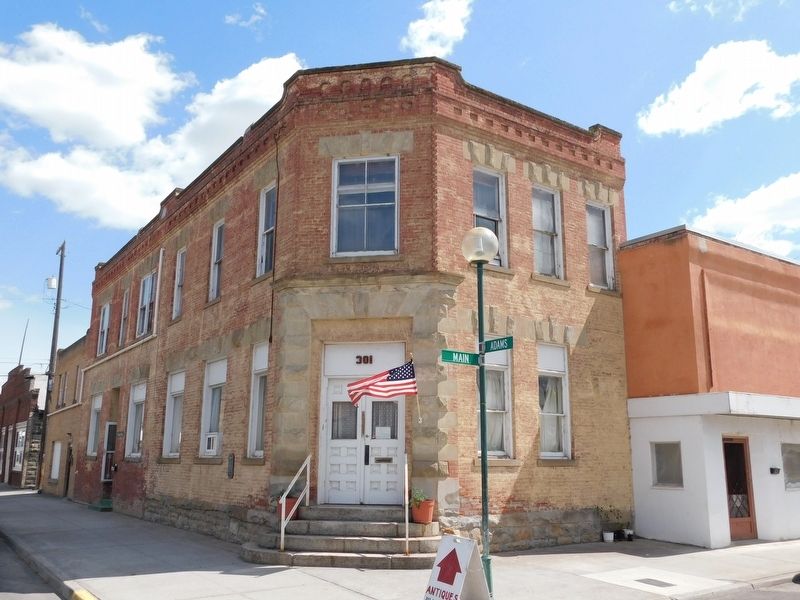
On West Main Avenue at Adams Street on West Main Avenue.
Established in 1891 by pioneer settle J.D. Bassett, the Adams County bank was the first financial institution in the county. Now the second oldest brick building in the community, the two-story structure features flat arched fenestration with . . . — — Map (db m303168) HM
On West Railroad Street at North Adams Street, on the right when traveling south on West Railroad Street.
Edgar Dewitt (E.D.) Gilson arrived in Ritzville in 1885. He played an important role in the civic life of the newly founded community, enough to place him among the prominent names listed in Spokane and the Inland Empire . The fire . . . — — Map (db m303165) HM
On West Main Avenue at North Washington Street, on the right when traveling south on West Main Avenue.
This two-story brick building was featured in The Coast Magazine , January 1908, because of its distinguishing corner turret designed in Victorian Gothic style. The rounded turret is the only one of its kind in the county and is faced in . . . — — Map (db m303163) HM
On West Main Avenue at North Washington Street, on the left when traveling south on West Main Avenue.
This was the first brick structure built in Ritzville and named "The Brick" by Mr. Greene. The stucco veneer was added in the late 1890's to create a more monumental appearance. The second floor was the Greene's residence until they built a lavish . . . — — Map (db m303161) HM
On East Main Avenue at N Division Street, on the left when traveling east on East Main Avenue.
The Pioneer State Bank was founded and built by N.H. Greene and was the second bank in the community and county. Mr. Greene also built the portico and the N.H. Greene building (#16 on your tour). The second floor was used as a Masonic hall for many . . . — — Map (db m303171) HM
On West Main Avenue at North Adams Street, on the right when traveling south on West Main Avenue.
Funded by Andrew Carnegie, this well preserved building is one of fourteen Carnegie-funded libraries in eastern Washington. It was one of the earliest dedications and one of the most generous grants made. Prior to this structure being built, the . . . — — Map (db m303158) HM
On East Main Avenue at North Division Street, on the left when traveling east on East Main Avenue.
Prior to this structure being built, there were several small framed buildings on this site. One of those framed shanties housed a newspaper printing business, Der Beobachter. This 400-seat theatre was built for Roy Irvine, who ran the . . . — — Map (db m303164) HM
On Washington Route 26 3.5 miles east of Route 261, on the left when traveling east.
Construction: 1859-1862 Here the historic Mullan Road crosses Washington State Highway 26. The Mullan Road stretched 624 miles from Fort Walla Walla in Washington to Fort Benton, Montana. Originally planned as a military highway, the Mullan . . . — — Map (db m305947) HM
On Main Street at N Tucannon Lane, on the left when traveling north on Main Street.
Washtucna Sheriff's Office/Jail
Est. 1880's
Outhouse
Deluxe model, 2 holer seater and used well during the days
Donated by: Unknown — — Map (db m303174) HM
Near 14th Street 0.1 miles south of Chris Avenue, on the left when traveling north.
Kiona Irrigation District began as the Yakima Irrigating and Improvement Company (Y. I. & I.). The Y. I. & I. was formed in 1891 headed by a former Northern Pacific railroad construction engineer, soon-to-be Tacoma Mayor, H.S. Huson. Work began in . . . — — Map (db m297689) HM
Near State Highway 24 south of State Highway 243, on the right when traveling north.
National Historic Landmark
2008
National Park Service
United States
Department of the Interior
National Historic
Mechanical Engineering Landmark
Hanford B Reactor
Construction Begun: June 1943
Reactor Loaded: . . . — — Map (db m270292) HM
On Cemetery Road 1 mile west of Travis Road, on the left when traveling west.
The Horse Heaven Cemetery was established in 1893 by pioneers who settled the area. William Dennis donated the land for the cemetery, and he was the first to be buried here. The property was later deeded to Benton County, who owns the site today. . . . — — Map (db m299889) HM
Near North Gum Street (Washington Route 397) 0.2 miles north of East Columbia Drive, on the right when traveling north.
Originally dedicated the "Golden Rivet". It was the final link to the first transcontinental highway called the Yellowstone Trail.
National Register of Historic Places
National History Day of Washington
Historical Marker . . . — — Map (db m297290) HM
On Thomas S. ‘Tom’ Foley Memorial Highway (U.S. 395) at West Hildebrand Boulevard, on the right when traveling west on Thomas S. ‘Tom’ Foley Memorial Highway.
In memory of the 2,977 men and women who lost their lives on September 11th, 2001 External vertical support column salvaged from the World Trade Center — — Map (db m297375) HM WM
On North Clover Island Drive 0.5 miles north of West Columbia Drive, on the left when traveling east.
The image shown above depicts an early 1900’s photograph of Mabel and Dorothy Smith relaxing on the Columbia River. The photo inspired the adjacent bronze sculpture “Call of the River” as it seemed to epitomize the community’s relationship to the . . . — — Map (db m297288) HM
On Paul Parish Drive at North Edison Street, on the right when traveling east on Paul Parish Drive.
The first wagon road built by the federal government in old Oregon followed this shoreline. On Jan. 7, 1853 Congress passed "An Act for Construction of Military Roads in Oregon Terr." Jefferson Davis, Secretary of War, then issued instructions to . . . — — Map (db m297282) HM
On South Carmichael Drive at Vineyard Drive, in the median on South Carmichael Drive.
In honor of the first man from Kennewick to be killed in the Vietnam war, Corporal Gerald Carmichael, USMC. The Kennewick native was a student at Kennewick High before he joined the United States Marine Corps in February 1965. He went to Vietnam in . . . — — Map (db m298149) HM WM
On Thomas S. ‘Tom’ Foley Memorial Highway (U.S. 395) at West Hildebrand Boulevard, on the right when traveling south on Thomas S. ‘Tom’ Foley Memorial Highway.
On September 11, 2001, 2,606 people lost their lives at the World Trade Center. Hundreds were killed instantly by the impacts, while the rest were trapped and died when the towers collapsed. Of the people who were at or above the floors of . . . — — Map (db m297631) HM WM
On West Keewaydin Drive 0.1 miles South Auburn Street, on the left when traveling west.
These ancient Indian petroglyphs were recovered from Blalock Island near Paterson and encased in stone pillars by representatives of the Kiwanis Club of Kennewick. They were dedicated at the west end of Keewaydin Park September 1, 1939. These . . . — — Map (db m297442) HM
On West Keewaydin Drive 0.1 miles west of South Auburn Street, on the left when traveling west.
This is a piece of railing from the old Green Bridge that used to span the Columbia River between Pasco and Kennewick. The bridge was demolished in 1990 after the Cable Bridge was built to replace it. The 3,300 foot Green Bridge was dedicated in . . . — — Map (db m297438) HM
Near South Olympia Street at W 14th Ave, on the right when traveling south.
All Gave Some - Some Gave All
In honor of those who served in the wars of Iraq and Afghanistan, the veterans of Foreign Wars Post 5785 would like to thank you and offer this memorial as a tribute to your service in providing peace and security . . . — — Map (db m297381) WM
On West Keewaydin Drive 0.1 miles west of South Auburn Street, on the left when traveling west.
In 1996, while watching the “Water Follies”, two students discovered a skeleton on the Columbia River bank.
It appeared to be one of the oldest skeletons ever found in the Americas.
Through carbon dating the human remains were identified as a . . . — — Map (db m297441) HM
Near West 10th Avenue at South Union Street, on the left when traveling west.
Dedicated to those
men and women
who served
our country
in times of
peace and war
and especially
to those who
gave their lives
in that service
Plaque A nation that honors its veterans is a nation dedicated to the preservation . . . — — Map (db m297379) WM
On South Union Street 0.1 miles north of West 24th Avenue, on the left when traveling north.
Flag & Pole Dedicated to
U.S. Military Personnel
Past & Present Memorial Day, 29 May 2006 "Old Glory" provides a majestic yet solemn reminder
to Americans of the great price of freedom.
Today She proudly waves shadowing but . . . — — Map (db m297378) WM
On Paul Parish Drive at Columbia River Way, on the left when traveling east on Paul Parish Drive.
Central Plaque
★ In honor of those who served to forge the heritage of the United States Armed Forces.
★ In tribute to those who perished to provide peace and security for our nation.
★ In gratitude to those now . . . — — Map (db m297283) WM
On Columbia Park Trail 0.1 miles east of Route 240, on the right when traveling east.
In memory of all veterans of the United States of America especially those veterans who paid the supreme sacrifice for the freedom that you all enjoy — — Map (db m297285) WM
Near North Clover Island Drive 0.4 miles north of West Columbia Drive, on the right when traveling east.
Port of Kennewick has long been a champion for engaging with the Columbia River for commerce and recreation.
Founded in 1915, Port of Kennewick was the fifth public port district established in Washington State and the very first in eastern . . . — — Map (db m297287) HM
On North Gum Street (Washington Route 397) 0.2 miles north of East Columbia Drive.
Remember With Pride
Batty, Denny A. SP4 AR 12-12-67
• Black, Mark S. PFC MC 3-30-66
• Brooks, Guy F. SP4 AR 2-2-68
• Brown, Richard L. AMH3 NA 8-13-69
• Bruce, David H. LCPL MC 12-21-69
• Cain, Rodger K. SP4 AR 11-21-67
• Carmichael, . . . — — Map (db m297289) WM
This marker commemorates the
men and women who achieved
American independence.
These Patriots, believing in the
noble cause of liberty, fought
valiantly to found a new nation.
1775-1783
In honor of the 250th anniversary of the United . . . — — Map (db m291747) WM
On West Kennewick Avenue at South Auburn Street, on the left when traveling west on West Kennewick Avenue.
P.J. Murphy Building (Roxy Theatre)
101 W. Kennewick Avenue
The first theatre building in Kennewick was The Liberty Theatre, constructed in 1920 for P.J. Murphy. The Liberty became The Roxy in 1939 when the theatre changed hands. It . . . — — Map (db m297445) HM
On West Kennewick Avenue at South Dayton Street, on the left when traveling west on West Kennewick Avenue.
The First Methodist Church, led by Rev. E. H. Rubicam and five members, was established in Kennewick in 1902 on land donated by Howard Amon. A wood frame church that was constructed on the corner of Kennewick Avenue and Dayton Street in 1906. When . . . — — Map (db m297450) HM
On North Auburn Street at West Canal Drive, on the left when traveling north on North Auburn Street.
In the lore of Kennewick history, the Halloween 1906 shootout, that left four dead, remains a great mystery. The events that led up to the shootout began the night before Halloween, when two Kennewick stores were burglarized.
Town Marshal . . . — — Map (db m297449) HM
On McNary Road 1.8 miles east of Interstate I-82 when traveling east.
During the construction of McNary Dam a total of 3,271 of these 12-ton tetrahedrons were dropped into the Columbia River to complete the closure of the last cofferdam and divert the full flow of the river through the spillway. This method of closure . . . — — Map (db m299769) HM
Near Plymouth Park Road near Christy Road. Reported unreadable.
"I gave my hand to them all and made signs of my friendly disposition"
On October 19, 1805, William Clark and three men traveling ahead of the rest of the party arrived at a Umatilla village near here. Upon seeing Clark, the villagers . . . — — Map (db m158634) HM
On Dudley Avenue east of Market Street, on the right when traveling east.
Under the provisions of the National Historic Preservation Act of 1966, this property possesses exceptional value in illustrating American History and Culture Entered in the National Register of Historic Places December 12, 1976 by U.S. Department . . . — — Map (db m129388) HM
On 6th Street at Dudley Ave, on the left when traveling east on 6th Street.
Harvey R. Fox moved to Prosser in 1903. He established his first blacksmith shop on Stacey Street around 1905. October 27, 1925, Mr. Fox purchased this site from Willis Mercer and William Rothrock. In 1926 the original building, 30' X 50' with . . . — — Map (db m299901) HM
On Meade Avenue 0.1 miles north of 6th Street, on the left when traveling north.
B.J. Pacius established the Princess Theatre in 1919, renting various downtown spaces before Pearl Bros. Construction built Pacius a permanent Spanish Mission style facility on Meade Avenue. The Princess Theatre opened May 7, 1920, hosting silent . . . — — Map (db m299898) HM
On 7th Street at Sheridan Avenue, on the left when traveling north on 7th Street.
Construction of St. Matthew's Episcopal Church began in 1903 and its dedication took place in 1907. Church members spent four years raising the money necessary to build this church and history relates that the St. Matthew's priest spent the week . . . — — Map (db m302232) HM
On Grant Avenue at 10th Street, on the left when traveling north on Grant Avenue.
Standing at this site in 1886 one would have seen Colonel William Farrand Prosser negotiating with the chief of the Yakima Indian tribe camped along the Yakima River for Lewis Heinzerling to build his dream mill when this was still Washington . . . — — Map (db m299903) HM
On Meade Avenue south of 6th Street, on the right when traveling north.
Founded by Mr. Fred Long in 1901 as the Kash Savin Stor. Moved in 1909 to this Sixth and Meade building constructed in 1904 by E.W.R. Taylor. Renamed The Golden Rule Store between 1910 and 1912.
Mr. T. B. Sampson was employed by the Kash Savin . . . — — Map (db m129390) HM
Near Crimson Way 0.2 miles south of University Drive, on the left when traveling south.
Black pioneer George Bush (c. 1790 – 1863) helped establish one of the first non-indigenous American settlements in Washington. George, his wife Isabella and others traveled the Oregon Trail to escape discrimination in Missouri, only to arrive in . . . — — Map (db m297651) HM
Near Columbia Park Trail 0.5 miles east of Columbia Center Boulevard, on the right when traveling east.
During and following World War II sleek silver trailers offered a mere 147 sq. feet of living space to accommodate an average of 3.7 people. The trailers were designed as travel trailers, but because of a severe housing shortage, many people . . . — — Map (db m297279) HM
On Symons Street at Goethals Drive, on the right when traveling west on Symons Street.
Graduate of West Point Military Academy 1870. As a 1st Lt., he surveyed the Columbia River from Fort Spokane to the mouth of the Snake River, in 1881. As a Capt. and Co-chief engineer of the Portland District, in 1890, he directed the Survey of the . . . — — Map (db m300132) HM
On Harris Avenue 0.2 miles Newcomer Street, on the right when traveling north.
The rich history of this home begins with Edith Nelson, a nurse who cared for a wealthy infirmed gentleman in Chicago. Out of generosity, in 1910, he bought a 40-acre tract of land along the Columbia River for her parents, Mr. and Mrs. Neil Nelson. . . . — — Map (db m297650) HM
Near Columbia Park Trail 0.5 miles east of Columbia Center Boulevard, on the right when traveling east.
The Hanford Irrigation Canal referred to as the “Low Line Ditch” and also the “D Canal” received its water from the Coyote Rapids Pump Station at Coyote Rapids. Irrigation water was delivered from the main canal through several laterals supplying . . . — — Map (db m297278) HM
On Lee Boulevard at Amon Park Drive, on the right when traveling east on Lee Boulevard.
This is a replica of the original gateway to Amon Park, located approximately 25 ft southwest of this location from 1911 until demolition by the Manhattan Project in 1943. The new arch was constructed by the Richland Centennial Committee as part of . . . — — Map (db m297646) HM
On Lee Boulevard 0.2 miles east of George Washington Way when traveling east.
Howard S. Amon was born in Athena, Oregon, on August 18, 1877. In 1905, Howard and his father formed the Benton Water Company, as well as purchased land in the lower Yakima Valley including the Rosencrance property in Richland. The Amon family . . . — — Map (db m297633) HM
Near Stevens Drive 0.3 miles north of Swift Boulevard, on the right when traveling north.
This Sanctuary has been placed on the Washington Heritage Register by the Governor’s Council on Historic Preservation as of February 5, 2016. Built in 1964, the Sanctuary is tied directly to the “Manhattan Project” with the establishment of the . . . — — Map (db m297647) HM
On Bradley Boulevard 0.3 miles north of Columbia Point Drive when traveling west.
The Corps of Discovery and area tribes often had to make a series of translations to communicate. In an April 1806 visit that process included English, French, Mandan/Hidatsa, Shoshoni and Walla Walla.
"we found a Shoshone . . . — — Map (db m298307) HM
On Lee Boulevard 0.2 miles east of George Washington Way when traveling east.
Within a few years of the Corps of Discovery passage through the Columbia Basin, trappers and traders from the Northwest Company entered the area. A fort was established in Wallula in 1818, and men came to the Richland area to harvest grass . . . — — Map (db m297636) HM
On Lee Boulevard 0.2 miles east of George Washington Way when traveling east.
The Columbia River system drains 259,000 square miles of the northwest United States and Canada and carries an average of 190,000 cubic feet of water per second along its path from the Rocky Mountains in Canada and the United States to the Pacific . . . — — Map (db m297639) HM
On Port of Benton Boulevard at 11th Street, on the left when traveling north on Port of Benton Boulevard.
The historic event depicted in this bas-relief sculpture is of Enrico Fermi, Leo Szilard, Arthur Compton, and Eugene Wigner producing the first self-sustaining nuclear fission chain-reaction in Chicago Pile Number 1 on December 2, 1942. The . . . — — Map (db m298573) HM
Near Port of Benton Boulevard at Richardson Road, on the right when traveling north.
Commissioned: November 10, 1959 Decommissioned: May 3, 1969 USS Triton Sail Park Dedication: November 10, 2011 Port of Benton worked with the U.S. Navy to preserve the sail and conning tower. Operation Sandblast: February 24-April . . . — — Map (db m297652) HM
Near Bypass Highway (Washington Route 240) at Swift Boulevard, on the left when traveling north.
Vietnam In honor of those from our area who gave their lives for their country Mark Black • Guy F. Brooks • Richard Lee Brown • Davice R. Bruce • Gerald Carmichael • Gary Wayne Cockley • William H. Cook • Robert J. Cope • Duane Cottingham • . . . — — Map (db m297688) WM
On West Van Giesen Street (Washington Route 224) 0.1 miles east of South 35th Avenue, on the right when traveling east.
The mouth of the Yakima River, known in the native language as Táptat, has been an abundant natural resource for thousands of years, providing food, water and shelter for people and animals. Bountiful populations of salmon once sustained the . . . — — Map (db m297685) HM
Near Washington Route 225 1 mile west of Route 240, on the left when traveling south.
The Longmire Wagon Train
In 1853, Congress authorized the survey and construction of a road from the Snake and Walla Walla Rivers through the Cascade Mountains. Secretary of War Jefferson Davis ordered Captain George McClellan to construct . . . — — Map (db m297221) HM
Near West Van Giesen Street (Washington Route 224) at Bombing Range Road, on the left when traveling west.
Remember With Pride
Batty, Denny A. Sp4 Ar 12-12-67 •
Black, Mark S. Pfc Mc 3-30-66 •
Brooks, Guy F. Sp4 Ar 2-2-68 •
Brown, Richard L. Ams Ar 8-13-69 •
Bruce, David R. Lcpl Mc 12-24-69 •
Cain, Rodger K. Sp4 Ar 11-21-67 • . . . — — Map (db m297684) WM
Near Crow Butte State Park Road 2 miles south of Route 14, on the right when traveling west.
Crow Butte is considered by tribal people to be a traditional cultural property due to its use as a winter village, a fishing area, and a place of other traditional practices from pre-contact to contemporary times. Mostly Umatilla people populated . . . — — Map (db m299896) HM
Near Crow Butte State Park Road 2 miles south of Route 14, on the right when traveling west.
During the last Ice Age, rushing floodwaters traveled southwest across the Columbia Basin, scouring the bedrock. They converged into the Columbia River Gorge and eventually emptied into the Pacific. As the Missoula Floods passed through the area of . . . — — Map (db m299891) HM
On Crow Butte State Park Road 2 miles south of Route 14, on the right when traveling west.
With the arrival of the Lewis and Clark expedition in 1805, the Columbia River Plateau became a region of national importance. In the vicinity of Crow Butte, the expedition encountered and documented densely populated winter villages along both . . . — — Map (db m299894) HM
On Crow Butte State Park Road near Lewis & Clark Highway ( Route 14).
"a moonax which the nativs had petted"
When the explorers of the Lewis and Clark Expedition passed through this area in April 1806, they observed many animals. They noticed birds such as ducks, curlews, and killdeer and reptiles such as . . . — — Map (db m310701) HM
On Crow Butte State Park Road near Lewis & Clark Highway ( Highway 14).
"my legs and feet give me much pain"
On the return trip through this area in late April 1806, Lewis and Clark traded some of their party's canoes for horses. Some of the explores rode on horseback, but most trudged through the sandy, rock . . . — — Map (db m310704) HM
"towards evening we arived at the big forks"
The Lewis and Clark Expedition arrived at the "great Columbia river" on October 16, 1806. President Thomas Jefferson had directed the Expedition to determine if the Columbia, in . . . — — Map (db m311366) HM
"friendly intentions"
Sacagawea make important contributions to the Lewis and Clark Expedition. Native people from this region interpreted her presence as a symbol of peace. Clark wrote that Sacagawea's presence signal "our friendly . . . — — Map (db m311362) HM
Near Sacajawea Park Road at U.S. 12, on the left when traveling east. Reported missing.
One of the most colorful of the early Northwest railroad towns once existed near junction of the Snake and Columbia Rivers. Ainsworth was founded, 1879, when the railroad bridge was building over the Snake River.
In its heyday it was a wild, . . . — — Map (db m297708) HM
In October 1805, the Lewis and Clark Expedition camped at the confluence of the Snake and Columbia rivers. Upon arriving here, the men wrote in amazement of the uncountable number of salmon. At that time, an estimated 16 million salmon filled these . . . — — Map (db m311407) HM
Near Cemetery Lane 0.2 miles north of North Oregon Avenue ( Route 397) when traveling north.
(Left Plaque) City of Pasco Veterans Memorial "Our debt to the heroic men and valiant women in the service of our country can never be repaid. They have earned our undying gratitude. America will never forget their sacrifices." . . . — — Map (db m300348) WM
Near Cemetery Road 0.2 miles north of North Oregon Avenue ( Route 397), on the left when traveling north.
Duty Honor Country "The willingness to sacrifice is the prelude to freedom." This memorial is dedicated with appreciation to the men and women whose loyalty and service during times of war and peace define the character of this great nation. . . . — — Map (db m300345) WM
From this place, the Lewis and Clark Expedition followed the Columbia River to the Pacific Ocean. Some who lived along its banks spoke of it as Nch?-Wána, or big river. For Lewis and Clark, the big river's many rapids and falls would present some of . . . — — Map (db m311442) HM
Near Cemetery Lane 0.2 miles north of North Oregon Avenue ( Route 397), on the left when traveling north.
Jesse Barrick was interred in this cemetery until his remains were exhumed and moved to the Tahoma National Cemetery in Pierce County to be near the grave of his wife. He was interred here after his death at the age of 82. He was awarded the medal . . . — — Map (db m300346) HM WM
On Sacajawea Park Road 1 mile south of East Ainsworth Avenue.
The Lewis & Clark exploring expedition made its first camp on the Columbia River October 16-18, 1805 (Reverse Side) The site for this marker deeded to Chapter 3 Daughters of the Pioneers of Washington Prior to 1870 by Mr. & Mrs. Thomas . . . — — Map (db m298721) HM
William Clark --- Meriwether Lewis
" my friend ... If therefore there is anything...in this enterprise which would induce you to participate with me in it's fatigues, it's dangers and it's honors, believe me there is no man on . . . — — Map (db m311396) WM
On South 10th Avenue (Washington Route 397) 0.1 miles south of West Washington Street, on the left when traveling south.
This plaque marks the northern abutment of the Tenth Street Bridge, known to generations locally as the Pasco-Kennewick Bridge. When it opened to the public October 7, 1922, it became the last link in the Yellowstone Trail, giving the nation its . . . — — Map (db m298718) HM
Near Sacajawea Park Road at U.S. 12, on the left when traveling east. Reported missing.
The Lewis and Clark Expedition camped nearby on October 16 and 17, 1805 on its way to the Pacific Ocean. One of the members of the Expedition was a young Northern Shoshone, Sacagawea.
During the winter of 1804-05 at Fort Mandan, in present-day . . . — — Map (db m297707) HM
The Lewis and Clark Expedition followed the Snake River from the Clearwater River to this place, Here, they were welcomed by many people of the Plateau. According to Clark, the Plateau people called the Snake River, "Ki-moo-e-nem." Clark . . . — — Map (db m311444) HM
Welcome to the homelands of the Nimiipuu (meaning "the people") or Nez Perce tribe and other tribes of the Columbia Plateau. As you travel the Lewis and Clark Trail and across tribal homelands, please be good stewards and respectful . . . — — Map (db m311402) HM
On South 10th Avenue (Washington Route 397) 0.1 miles south of West Washington Street, on the left when traveling south.
In 1967, the Intercity Bridge Committee, headed by Ed Hendler, initiated replacement of the old Pasco-Kennewick Bridge which resulted in the building of the new Intercity Bridge. The Intercity Bridge was the first major cable-stayed bridge in the . . . — — Map (db m298720) HM
Near Palouse Falls Road 2.4 miles west of Highway 261.
Raging Ice Age floodwaters carved spectacular features throughout eastern Washington, creating unique landscapes. Follow the path of the floods and discover more about this amazing story.
Path of Least Resistance
As floodwaters rushed . . . — — Map (db m83044)
Near Palouse Falls Road 2.4 miles west of Highway 261.
You are standing in the pathway of some of the largest floods ever known. They carved steep-walled canyons, sculpted immense waterfalls, and left behind landscapes found nowhere else on earth.
Massive Glacial Dams and Lakes
During the . . . — — Map (db m83019)
Near Palouse Falls Road 2.4 miles west of Highway 261.
Geologist J Harlen Bretz spent decades meticulously documenting evidence to support his theory that massive Ice Age floods carved the Channeled Scabland of eastern Washington. But the geologic community only ridiculed and scorned his work ... until . . . — — Map (db m83025) HM
Near Palouse Falls Road 2.4 miles west of Highway 261.
Long before the Ice Age floods could carve the coulees, waterfalls, and cliffs that dominate this landscape, basalt was needed, and in huge quantities! Vents from deep in the earth’s crust supplied the basalt, erupting again and again to cover much . . . — — Map (db m83023)
Near Palouse Falls Road 2.4 miles west of Route 261.
Welcome to Palouse Falls, Washington's official state waterfall. Behind this designation by the state legislature is a story of how local students with a vision created state law - and made state history.
Waterfall Facts Palouse Falls is . . . — — Map (db m129494) HM
Near Palouse Falls Road 2.4 miles west of Highway 261.
Before the Ice Age floods, no stream or waterfall existed here. Instead, the Palouse River flowed through Washtucna Coulee. What caused the river to jump its course?
When the floods surged across the area, they cut a path through the fractured . . . — — Map (db m83021)
On Marmes Road at Route 261, on the right when traveling east on Marmes Road.
The Palouse River was first named Drewyers River by Lewis and Clark in honor of George Drouillard a civilian member of the expedition which arrived in this area on Oct. 13, 1805. Throughout the Lewis and Clark journals "Drewyer", as his name was . . . — — Map (db m311813) HM
Near Washington Route 261 near Lyons Ferry Road, on the right when traveling north.
You're looking at two millions years of time!
When Ice Age floodwaters poured through Palouse Canyon, they carved their way through layes of ancient basalt. The earliest floods uncovered the youngest basalt flows in this area, which are . . . — — Map (db m311811) HM
Near Washington Route 261 near Lyons Ferry Road, on the right when traveling north.
Located by
Capt. John Mullan
1858 = 1862
Pyramid Erected By
Mullan Road Assn
Tablet Furnished by
Washington State
Historical Society
1929 — — Map (db m311812) HM
Near Washington Route 261 near Lyons Ferry Road, on the right when traveling north.
You are standing in the pathway of the largest floods in North America. They lasted for days, sometimes traveling at highway speeds.
During the last ICE AGE, ice dams upriver from here failed, releasing giant lakes of water and ice. Dozens of . . . — — Map (db m311810) HM
Near Park Lake Road Northeast (Washington Route 17) 2 miles south of U.S. 2, on the left when traveling south.
Flood waters, perhaps 300 feet above you, once rushed over these cliffs. During the ice age, glaciers to the north blocked the Columbia River and forced it to find a new route. The river, swollen from melting glacial ice, began to carve a new . . . — — Map (db m129678) HM
Near Park Lake Road Northeast (Washington Route 17) 2 miles south of U.S. 2, on the left when traveling south.
Raging Ice Age floodwaters carved spectacular features throughout eastern Washington, creating unique landscapes. Follow the path of the floods and discover more about this amazing story.
Gouging Deep Coulees The powerful floods cut . . . — — Map (db m129681) HM
Near State Highway 155, on the right when traveling north.
Near this site President Roosevelt, accompanied by Mrs. Roosevelt delivered the address dedicating Grand Coulee Dam. Nearly 20,000 people attended the ceremony which was preceded by an inspection of the dam’s construction. — — Map (db m99855) HM
Near Park Lake Road Northeast (Washington Route 17) 2 miles south of U.S. 2, on the left when traveling south.
You are standing in the pathway of some of the largest floods ever known. They carved steep-walled canyons, sculpted immense waterfalls, and left behind landscapes found nowhere else on earth.
Massive Glacial Dams and Lakes During the last . . . — — Map (db m129680) HM
Near Park Lake Road Northeast (Washington Route 17) 2 miles south of U.S. 2, on the left when traveling south.
These cliffs are skeletal remnants of what was once the world’s largest waterfall. They bear stark witness to the tremendous power of catastrophic floods that swept over Eastern Washington at the end of the last Ice Age.
The falls began 20 mi. to . . . — — Map (db m129677) HM
On Washington Route 17 at milepost 88, 0.1 miles south of Moore Road Northeast, on the right when traveling north.
Indians lived in this coulee many centuries ago. You are standing on an ancient Indian camp site. The Indian trail came down the steep hill behind you and crossed the coulee to the east. The famous Cariboo Cattle Trail crossed the coulee here going . . . — — Map (db m208186) HM
Near State Highway 155, on the right when traveling north.
Grand Coulee Dam is the key structure in water utilization for the Columbia River Basin. The dam began operation in 1942 and is one of the world’s largest concrete structures. It is a mile long and contains almost 12 million cubic yards of concrete . . . — — Map (db m99853) HM
Near Park Lake Road Northeast (Washington Route 17) 2 miles south of U.S. 2, on the left when traveling south.
The sheer cliff in front of you was once the world's greatest waterfall. From here, you see only the western portion of this remarkable Ice Age floods feature. With the end of the last Ice Age, floodwaters no longer swept through Grand Coulee, . . . — — Map (db m129679) HM
Near Columbia Avenue (State Highway 155) south of Lincoln Avenue, on the left when traveling south.
Begun in time of adversity it stood in war as a sentinel of strength safeguarding the nation. Forever a monument to those who shared in its conception and its construction in peace it is the key to new American frontiers of opportunity in . . . — — Map (db m129615) HM
243 entries matched your criteria. The first 100 are listed above. Next 100 ⊳