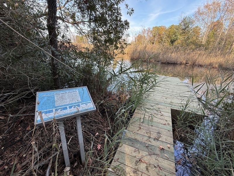
Near Flag Ponds Parkway east of Solomons Island Road (Maryland Route 2/4), on the left when traveling east.
These old pilings, visible in the pond, are the remains of a pier used by the fishermen to bring their catch ashore. As recent as the 1930s, this pond edge was part of the Chesapeake shoreline. A harbor was created when a sand spit grew like a . . . — — Map (db m287747) HM
Near Flag Ponds Parkway east of Solomons Island Road (Maryland Route 2/4), on the left when traveling east.
Since pound-nets remained in the water for months at a time, the fishermen coated the netting with a preservative to prevent rot and fouling. Flag Ponds fishermen used melted tar for this purpose, setting up several net-tarring stations in the . . . — — Map (db m287750) HM
On Flag Ponds Parkway 1 mile east of Solomons Island Road (Maryland Route 2/4), on the left when traveling north.
Part of this trail was once a roadway and a main access route for travel from Prince Frederick to Cove Point. In the 1930's, this road was closed when route 2/4 was built. Today, the historic roadway is a route through some of nature's finest . . . — — Map (db m287740) HM
On Flag Ponds Parkway 1 mile east of Solomons Island Road (Maryland Route 2/4), on the left when traveling east.
Known as the Buoy Hotel, the shanty shows the close quarters and simple lifestyle of bay watermen. Bunking together over the summer months, the men plied the waters and tended and tarred their nets, away from their homes and families. The shanty . . . — — Map (db m287745) HM
On Flag Ponds Parkway 1 mile east of Solomons Island Road (Maryland Route 2/4), on the left when traveling east.
Flag Ponds was the site of a pound-net fishery from about 1915 to 1958. The men fished the waters each spring, some journeying from as far as the Eastern Shore to the Cliffs of Calvert. Using small boats called lighters, they would set their . . . — — Map (db m287746) HM
On Flag Ponds Parkway 1 mile east of Solomons Island Road (Maryland Route 2/4), on the left when traveling east.
Ideal for Fishing
Flag Ponds is distinctive from the rest of Calvert County's Chesapeake shore because of the absence of high cliffs. From 1915-58, this low, flat beach and its protected harbor were an ideal camp for harvesting fishes from . . . — — Map (db m287741) HM
On The Boardwalk at 14th Street, on the right when traveling north on The Boardwalk.
The neighborhood known as "The Campground" was located in this area when the Chesapeake Beach Resort opened in 1900. By the 1920s, small summer residences were being built here. The High View Hotel, was located south of this location, and the Water . . . — — Map (db m162775) HM
On Harbor Road 0.1 miles west of Bayside Road (Maryland Route 261), on the right when traveling west.
Capt. Fred Abner, along with John Sens, bought 7 lots, 175' on Fishing Creek in 1956. Fred Abner's son, Bobby was granted the property for 7 years during this time Abner's crab house was opened on September 4, 1966. Bobby purchased all the . . . — — Map (db m162785) HM
Near Mears Avenue just east of Bayside Road (Maryland Route 261), on the right when traveling west.
Bald Eagles typically nest within a half-mile of water. The resident Bald Eagle's nest downstream from this viewing platform is in a forested area. It is important to stay a reasonable distance from Bald Eagle nests when observing. Human . . . — — Map (db m162783) HM
On The Boardwalk 0.1 miles east of B Street, on the right when traveling north.
The present location of what is now known as Bay Front Park encompasses the boardwalk and the beach. Bay Front Park was affectionately called and is still referred to as Brownie's Beach by long-time residents. Its name was taken from the Brown . . . — — Map (db m162774) HM
On Chesapeake Beach Railway Trail 0.2 miles east of Delores Court, on the left when traveling east.
Ospreys build their nests on man-made structures such as the channel markers along the stream. They travel up Fishing Creek to hunt for fish, which make up 99 percent of the osprey's diet.
Only the male red-winged blackbird has a bright red . . . — — Map (db m162791) HM
On 17th Street at C Street, on the right when traveling east on 17th Street.
17th Street marks the southern boundary of Chesapeake Beach Park from 1946 to 1972. The street names in Chesapeake Station are reminders of the rich Park history. The names Arcade, Bandshell, Carousel, and Dentzel, bring back fond memories of happy . . . — — Map (db m162778) HM
On Mears Avenue at Bayside Road (Maryland Route 261), in the median on Mears Avenue.
Built by Otto Mears of Colorado in 1897. The train track linking Washington, D.C. to Chesapeake Beach crossed here. The original depot to the east is now the Railway Museum. Excursion steamboats also brought passengers to Chesapeake Beach from . . . — — Map (db m731) HM
Near Mears Avenue just east of C Street, on the right when traveling east.
From 1900 until 1935 the Chesapeake Beach Railway carried Washington excursionists through the honeysuckle-scented countryside of Southern Maryland, giving the railway the name of The Honeysuckle Line. The last train left Chesapeake Beach on . . . — — Map (db m162780) HM
This Property has Been Placed
on the
National Register
of
Historic Places
By the United States
Department of the Interior
This railroad station, erected in 1898-1899, is the original eastern terminus of the Chesapeake Beach Railway. . . . — — Map (db m109617) HM
On Harbor Road 0.3 miles east of Delores Court, on the right when traveling east.
Look and see if you can see any of these fish or reptiles swimming in the creek below.
Keep an eye out for turtles sunning sunning themselves on rocks and the banks of the creek.
• Red-eared sliders can live up to 30 years. They have . . . — — Map (db m181868) HM
On Chesapeake Beach Railway Trail 0.2 miles west of Delores Court, on the left when traveling west.
The forest that you are looking at was planted when this trail was built in 2011. The new forest will add to the habitat for wildlife in the area, helping to reduce the conflict between human activity and animals.
[Sidebar:] . . . — — Map (db m162796) HM
On Bayside Road (Maryland Route 261) at Chesapeake Beach Road ( Route 260), on the right when traveling north on Bayside Road.
★ Alanson S. Ackerman •
Everett W. Ackerman •
Henry W. Bowman •
Gilbert Brown •
Charles M. Buckmaster •
Earl Chaney •
William Chaney, Jr. •
W. Arthur Clark •
Martin Cochran •
William M. Daymude •
Joseph E. Dodge . . . — — Map (db m138561) WM
Near Mears Avenue 0.1 miles east of C Street, on the right when traveling east.
The Chesapeake Beach Railway ran trains to Chesapeake Beach from 1900 until the bankruptcy of the Railway in 1935. After that time the East Washington Railway operated out of the maintenance yard and roundhouse at Seat Pleasant, Maryland. Between . . . — — Map (db m162781) HM
On Mears Avenue just east of Bayside Road ( Route 261), on the right when traveling west.
Here you can see the evidence of the railroad that used to bring visitors from Washington D.C. to Chesapeake Beach during the summertime. The Mears Avenue road bed is the same road bed as the Railroad. The Railroad went west along Fishing Creek . . . — — Map (db m162784) HM
On Chesapeake Beach Railway Trail 0.3 miles west of Delores Court.
Here you can see the evidence of the railroad that used to bring visitors here from Washington, D.C., to Chesapeake Beach during the summertime. The concrete path you have just walked along is the railroad bed. The railroad crossed Fishing Creek . . . — — Map (db m181862) HM
The grand Belvedere Hotel stood at this corner from 1900 until it burned in 1923. This was also the location of the southern end of the Boardwalk. A walkway from the Boardwalk to the shore joined 17th Street at the water's edge. From 1914 until the . . . — — Map (db m162777) HM
Near this spot in the early 20th century, steam trains from The Chesapeake Beach Railway discharged passengers from Washington DC. They arrived with great expectations for a busy day enjoying the many amusements of the beach and park. The park . . . — — Map (db m109665) HM
On Chesapeake Beach Railway Trail 0.1 miles south of Delores Court, on the right when traveling west.
The tree canopy is ahead of you serves as a home to birds and other marsh dwelling animals. Some of the trees that you will see here and along with other parts of the trail includes: black locust, sweetgum, and black cherry trees. . . . — — Map (db m162788) HM
On Chesapeake Beach Railway Trail 0.1 miles west of Delores Court, on the left when traveling west.
Clean watersheds are important to the ecology of the Chesapeake Bay. The local Fishing Creek watershed is somewhat small in size and serves as a nursery and breeding grounds for many species of wildlife. It is important that we keep the . . . — — Map (db m162794) HM
On Chesapeake Beach Railway Trail, on the left when traveling east.
Switchgrass, a native plant species, has a growing season which occurs from late spring to early fall. During the colder months it becomes dormant. Switchgrass is abundant throughout the United States east of the Rocky Mountains, and into Canada. . . . — — Map (db m181864) HM
On Chesapeake Beach Railway Trail 0.3 miles east of Delores Court, on the left when traveling east.
During the summer months, white-tailed deer can be seen eating along the creek in the early morning or late afternoon. Deer are good swimmers and can run at up to 30 miles per hour.
You may get a chance to see a river otter along the trail. . . . — — Map (db m181866) HM
On Lighthouse Boulevard just east of Hemlock Drive, in the median.
Hours:
May - September
Wednesday, Saturday, and Sunday
1 p.m. - 4 p.m.
Restored and repurposed in 2012 by the Calvert Marine Museum, the active lighthouse and Keeper's residence sit on seven . . . — — Map (db m287622) HM
Near Dowell Road west of Pier 66, on the right when traveling west.
Commemorating The World War II
U. S. Naval Amphibious Training Base
Solomon's, Maryland
1942 - 1945
Dedicated August 11, 2007
Sculptor Antonio Tobias Mendez
The U.S. Amphibious Training Base, located at the end of . . . — — Map (db m287625) HM WM
On Dowell Road 1.2 miles south of Solomons Island Road ( Route 2/4), on the right when traveling south.
This nation's first naval amphibious training base was established here at Solomons where between 1942 and 1945 some 68,000 sailers, marines, coast guardsmen, and soldiers were trained. They formed the major components of the amphibious forces which . . . — — Map (db m3435) HM
On Dowell Road just south of Admiral Hewitt Drive, on the left when traveling south.
The commodore's residence was perhaps the most impressive building on the base, built in 1942 - 43 in the Colonial Revival style. It sits on the site of the Hellen family home, dating from 1809, and torn down, together with all other homes on the . . . — — Map (db m287624) HM
On Dowell Road south of Fairwinds Drive, on the left when traveling south.
Pump House Well No. 2 sits next to a 150 million gallon water tank. when the navy acquired the peninsula, it drilled a number of deep wells to supply water, causing shallower wells in Solomons to dry up, a source of contention for local . . . — — Map (db m287623) HM
On Southern Maryland Boulevard (Maryland Route 4) at Ferry Landing Road, on the right when traveling south on Southern Maryland Boulevard.
The brick church, dedicated in 1840, is the oldest standing Methodist church in Calvert County. The Calvert Circuit began in 1781 with services in homes. By 1789 this circuit had the largest membership in the United States. Fielder B. Smith gave . . . — — Map (db m3417) HM
Near Kings Landing Court south of Kings Landing Road, on the left when traveling south.
Kings Landing Park was home of Camp Mohawk, a summer camp for African-American youth that was run by the Baltimore YMCA. The camp offered cabins, campfires, swimming, tennis, canoeing, archery and other outdoor recreation.
Of the original . . . — — Map (db m307398) HM
Near Kings Landing Road 2.5 miles west of Huntingtown Road.
War vessels passed by here in 1814. The Chesapeake Flotilla, consisting of 50- and 75-foot gun barges, sought safety in shallow waters upstream. British ships hotly pursued, and Americans eventually scuttled the flotilla to keep it from . . . — — Map (db m68044) HM
On Lower Marlboro Rd. (Maryland Route 262) west of Southern Maryland Blvd. ( Route 4). Reported missing.
Before the American Revolution, Lower Marlborough (the spelling officially changed to Marlboro in the 19th century) was a thriving port town with large homes, inns, stores, warehouses, a sawmill, a tobacco inspection station, and the British . . . — — Map (db m94704) HM
A British force of about 160 Royal Marines and 30 Colonial Marines (former slaves) took Lower Marlboro on June 15, 1814, without and resistance. Occupying the town overnight, they burned warehouses full of tobacco, stole a schooner, livestock, and . . . — — Map (db m80885) HM
On Lighthouse Boulevard east of Hemlock Drive, on the right when traveling east.
This small structure was built to house a compressed-air fog signal, powered by an internal combustion engine. It replaced an earlier iron tower containing a manually operated fog bell. The bell was relocated to the new roof as an emergency . . . — — Map (db m307388) HM
On Lighthouse Boulevard east of Hemlock Drive, on the left when traveling east.
Calvert Cliffs
The Calvert Cliffs stretch more than thirty miles, from Drum Point, Calvert County, to Fairhaven, Anne Arundel County, rising in places to a height of more than 100 feet. The cliffs represent the eroded sides of the . . . — — Map (db m307391) HM
On Lighthouse Boulevard east of Hemlock Drive, on the right when traveling east.
The community of Cove Point largely dates from the 1930s when a company called Cove Point Beach, Inc., began developing the adjacent land as a summer community. The property was owned by Joseph C. Webster of Solomons, a prominent businessman and . . . — — Map (db m307377) HM
Near Lighthouse Boulevard east of Hemlock Drive, on the right when traveling east.
The beaches just south of the lighthouse were used by the U.S. Army and Marine Corps in World War II as a dress rehearsal for the large amphibious landings in Europe and the Pacific. Troops and landing craft operated from the naval amphibious . . . — — Map (db m307383) HM
On Cove Point Road (Maryland Route 497) 0.2 miles west of Solomons Island Road ( Route 2/4), on the right when traveling east.
Built in 1828, the oldest operating lighthouse in Maryland. The prism lens used today was manufactured in Paris and installed in 1897. The original 38-foot tower was built of locally manufactured brick and was raised about 1912 to 51 feet. In 1953 . . . — — Map (db m259819) HM
On Lighthouse Boulevard east of Hemlock Drive, on the right when traveling east.
As a wartime measure, a third keeper was added in the 1940s, drawing from the enlisted ranks of the U.S. Coast Guard. The former garage was used as living quarters until this cottage was built around 1950. — — Map (db m307380) HM
On Lighthouse Boulevard east of Hemlock Drive, on the right when traveling east.
When the first fog signal building proved inadequate, the electric fog signaling equipment was moved into this structure, built in 1950. The building contains an automatic fog detector that activates the fog horn when visibility drops below three . . . — — Map (db m307384) HM
On Lighthouse Boulevard east of Hemlock Drive, on the right when traveling east.
When the first fog signal building proved inadequate, the electric fog signaling equipment was moved into this structure, built around 1950. The building contained an automatic fog detector that activated the fog horn when visibility dropped . . . — — Map (db m307386) HM
On Lighthouse Boulevard east of Hemlock Drive, on the right when traveling east.
The original keeper's residence was a one-and-a-half story brick building measuring twenty by twenty-four feet with attached kitchen wing. In 1883 the house was altered to two stories. The last major change occurred in 1925 when it was rebuilt . . . — — Map (db m307390) HM
On Lighthouse Boulevard east of Hemlock Drive, on the right when traveling east.
The brick tower remains relatively unaltered since it was built in 1828. Forty feet high, it is topped by an octagonal iron lantern housing a fourth order Fresnel lens. The walls are three feet thick at the base, tapering to twenty inches at the . . . — — Map (db m307389) HM
On Lighthouse Boulevard east of Hemlock Drive, on the right when traveling east.
These concrete blocks are all that remain of the former signal tower, built around 1900, when Cove Point became a vessel reporting station. During daytime, keepers were required to report vessel movements to the Baltimore Chamber of Commerce, . . . — — Map (db m307381) HM
On H G Trueman Road (Maryland Route 765) 0.8 miles north of Cove Point Road ( Route 497), on the right when traveling north.
Founded, 1684, as a chapel of ease in Christ Church parish and named for Middleham, Yorkshire, England. The site has been used for worship since the founding, but the chapel was rebuilt in 1748. The bell, given by John Holdsworth, is dated 1699. — — Map (db m251562) HM
On Sollers Wharf Road at Wohlgemuth Road, on the right when traveling south on Sollers Wharf Road.
The tract, originally known as Morgan’s Fresh, was granted, 1651, to Philip Morgan, a captain in the Puritan militia. The house, which overlooks St. Leonard Creek, was built before 1670 and served as a lookout station in the War of 1812 and the . . . — — Map (db m251564) HM
On Pardoe Road (Maryland Route 765) at Solomons Island Road ( Route 2/4), on the right when traveling west on Pardoe Road.
Home of Richard Preston, Commander of the North Bank of the Patuxent River 1649. Seat of the Puritan Government of Maryland where the colonial records were kept 1653–1657. — — Map (db m3462) HM
On Bay Avenue at 3rd Street, on the right when traveling north on Bay Avenue.
The Town of North Beach, Calvert County's northernmost municipality, was originally called "North Chesapeake Beach" when it was first developed for summer cottages in 1900. Before then, this view of the beach itself had changed relatively little . . . — — Map (db m138545) HM
Near Bay Avenue just south of 5th Street, on the right when traveling north.
The Beach Buccaneers Youth Club is non-profit organization dedicated to encouraging youth to participate in sports. Founded by the first club President, Yogi Sweeney along with Buddy Simonds, John Thomas and Bill Thomas, the Buccaneers had their . . . — — Map (db m138536) HM
On Bay Avenue at 1st Street, on the right when traveling north on Bay Avenue.
The Cliffs of Calvert dominate the shoreline for 30 miles along the coast of Calvert County. They are as impressive a sight today as they were in 1608 when Captain John Smith came upon them "Rickard Cliffs". The cliffs were formed over 15 million . . . — — Map (db m138550) HM
On 4th Street at Dayton Avenue, on the left when traveling east on 4th Street.
The shores of the Chesapeake Bay are the perfect place to watch the ebb and flow of the tides. Just as with the tides, the small town of North Beach has experimented many changes in its history.
The town's original heyday began in the early . . . — — Map (db m138559) HM
Near Bay Avenue just south of 5th Street, on the right when traveling north.
In memory of
Lt Brendan Looney,
Seal Team 3 Afghanistan,
September 21, 2010
Lt. Stephen Clagett, Jr.,
Calvert County, Dematha
and Seal teammate
— — Map (db m138540) WM
On Bay Avenue just north of 2nd Street, on the right when traveling north.
There was a boardwalk in North Beach as early as the 1930's. The structure was only two blocks long, from 5th to 7th Street on Atlantic Avenue. It was destroyed by the hurricane of 1933. The boardwalk was rebuilt several times following storm . . . — — Map (db m138547) HM
Near Bay Avenue just south of 5th Street, on the right when traveling north.
A pier has stood on this site since the 1920's, when Captain Oscar Marshall's Crab House was at the end of the pier facing a dance pavilion The original pier was destroyed in the 1933 hurricane. A larger pier replaced it that included a lower deck . . . — — Map (db m138538) HM
Near Bay Avenue just south of 5th Street, on the right when traveling north.
May the road rise to meet you
May the wind be always at your back
May the sunshine warm
Upon your face
May the rains fall soft upon your fields
And until we meet again
May God hold you in the palm of
His . . . — — Map (db m138542) HM
On Atlantic Avenue just south of 7th Street, on the right when traveling north.
Sharps Island Lighthouse, one of the cassion-type lighthouses left on the Bay, sits on the sand bar of Tilghman Island. The lighthouse leans to one side because of damage caused by ice in the early 1970's. The sand bar is all that remains of Sharps . . . — — Map (db m138535) HM
Near Bay Avenue just south of 5th Street, on the right when traveling north.
Look to the north on a clear day and you can catch a glimpse of the William Preston Lane, Jr. Memorial Bridge, commonly referred to as the Bay Bridge. Spanning the Chesapeake Bay between Sandy Point and Stevensville, the bridge stretches more than 4 . . . — — Map (db m138539) HM
On Bay Avenue close to 2nd Street, on the right when traveling north.
The Town of North Beach was incorporated in 1910. It was developed and marketed as a waterfront resort by the North Beach Land and Improvement Company. In 1906, the company opened a road between Chesapeake Beach and what was then called North . . . — — Map (db m138548) HM
Near Bay Avenue just south of 5th Street, on the right when traveling north.
The Chesapeake Bay has a long tradition of providing a livelihood for working watermen. More crabs have been harvested from the Bay than from any other body of water in the world. Innumerable crab pot buoys, each painted a different color and . . . — — Map (db m138537) HM
British raiding parties brought the war to Calvert County in 1814, destroying plantations and towns and carrying away the spoils. With the county’s tobacco-based economy and England as its primary market at the start of the war, Britain’s blockade . . . — — Map (db m80882) HM
On Southern Maryland Boulevard (Maryland Route 4) at Chaneyville Road, on the right when traveling south on Southern Maryland Boulevard.
Established as Patuxent County in 1654, it was given Lord Baltimore’s family name in 1658. Now the state's smallest county, it once encompassed most of Prince George’s County and parts of Anne Arundel and St. Mary’s counties. A narrow peninsula with . . . — — Map (db m3415) HM
On Lower Marlboro Road (Maryland Route 262) 4.1 miles Southern Maryland Boulevard ( Route 4), on the right when traveling west.
Originally Cox Town, named for early settlers Thomas and Henry Cox (1663). Changed to Marlborough to honor Duke for defeating French at Battle of Blenheim (1704), which reduced French and Indian attacks on the colonies. An early port of entry . . . — — Map (db m3418) HM
On Broomes Island Road (Route 264) 0.4 miles south of Solomons Island Road (Route 2 / 4), on the left when traveling south.
One of the original parishes of the Province of Maryland and Calvert County’s oldest continuously worshipping congregation, Christ Church began with a log church standing as early as 1672. Christ Church parish, 1692, included all the land south of . . . — — Map (db m3441) HM
On Broomes Island Road (Maryland Route 264) 0.4 miles south of Solomons Island Road ( Route 2 / 4), on the left when traveling south.
Port Republic School No. 7, built about 1870 and closed in 1932. One teacher usually taught seven grades. Children walked to school from as far as three miles away. In the 59 similar schools throughout Calvert County, enrollment averaged about 30. . . . — — Map (db m3442) HM
Near Broomes Island Road (Maryland Route 264) 0.4 miles south of Solomons Island Road ( Route 2), on the left when traveling south.
Port Republic School #7 was built on this site around 1870 and remained in continuous use until it was closed in 1932. This school is from a time when free public education for all was a new concept in post-Civil War America.
This schoolhouse . . . — — Map (db m66097) HM
On Broomes Island Road (Maryland Route 264) at Mackall Road ( Route 265), on the left when traveling south on Broomes Island Road.
James Veitch, born 1628 in Roxburghshire, Scotland. Settled at Veitch’s Cove, later known as Veitch’s Rest, an original land patent granted by Lord Baltimore in 1649. Sheriff of Calvert County 1653–1657. Died 1685. — — Map (db m3443) HM
On Main Street at Duke Street, on the right when traveling south on Main Street.
The Star-Spangled Banner National Historic Trail traces the War of 1812 in the Chesapeake. Along the trail you'll encounter tangible evidence of the war and stories that bring the people and events to life. Discover the far-reaching impacts . . . — — Map (db m287755) HM
On Dares Beach Road (Maryland Route 402) 0.5 miles east of Solomons Island Boulevard ( Route 2/4), on the left when traveling east.
Arthur Storer (c. 1642–1686), the first astronomer in the American Colonies, came to Calvert County from Lincolnshire, England. He was among the first observers to sight and record data describing Haley's comet on its return in 1682. His . . . — — Map (db m3450) HM
On Grays Road 0.1 miles south of Sixes Road ( Route 506), on the right when traveling south.
A Bald Cypress Reserve and amphibian sanctuary. One of the last remaining stands of Bald Cypress in Maryland, and the most northerly growth in the Country. Registered as a National Landmark, 1965. — — Map (db m3451) HM
British forces landed at Hallowing Point July 21, 1814. They took 21 slaves and destroyed the home and barn of Colonel Benjamin Mackall. This was perhaps retaliation for the house being used by Calvert County militia.
“About 300 men landed . . . — — Map (db m80892) HM
Near Stoakley Road east of Solomons Island Road ( Route 2/4), on the right when traveling west. Reported missing.
Joseph Wilkinson was colonel in the Revolution and a legislator. His younger brother James, an adventurer, first attained general’s rank in 1777 at the age of 20. James built a grist-mill nearby, became General-in-Chief of the army, was Military . . . — — Map (db m259822) HM
On Dares Beach Road (Maryland Route 402) 1.2 miles east of Maryland 2/4, on the left when traveling east.
Oldest standing one-room schoolhouse for
African American students in Calvert County.
Offered education for grades 1-7 in the
Wallville community. Illustrates the
segregated educational facilities of the late
19th and early 20th centuries. . . . — — Map (db m54367) HM
On Main Street (Maryland Route 765) at Duke Steet, on the right when traveling south on Main Street.
Imagine the horror of a night-time raid!
Residents of Prince Frederick must have known they were British targets, as recent raids had already devastated nearby Lower Marlboro, St. Leonard, and Huntingtown. Alarm spread with news of . . . — — Map (db m68045) HM
On Duke Street 0.1 miles east of Solomons Island Road ( Route 2/4), on the left when traveling east.
The west wing of this library was built in 1903 on Main Street as the County’s first bank. In 1913, it was replaced, moved and became the County’s first library; 1916 County’s first Boy Scoot Troop met there; 1921 it was County’s first high school; . . . — — Map (db m3454) HM
On Hallowing Point Road (Maryland Route 231) 2.8 miles west of Solomons Island Road ( Route 2/4), on the right when traveling west.
On this site stood St. John’s Holiness Church. Dedicated 1900. Removed 1936. Rededicated to Prince Frederick Methodist Cemetery Corporation 1986. — — Map (db m3455) HM
Near Main Street (Maryland Route 765) west of Duke Street ( Route 231).
Monument 1 [north lawn] :
Veterans Green
Dedicated
Memorial Day
May 31, 1999
World War II Memorial [west lawn, north face]:
Dedicated to the glory of almighty God in memory of Calvert County men and women who . . . — — Map (db m45309) WM
On Dares Beach Road (Maryland Route 402) east of Solomons Island Road ( Route 2), on the right when traveling east.
The first public high school for African Americans in Calvert County was opened in 1938 and served until desegregation in 1966. Named for William Sampson Brooks (1865–1934). Born in Calvert County, Rev. Brooks was an advocate of education, 44th . . . — — Map (db m29522) HM
On Main Street at Duke Street, on the right when traveling south on Main Street.
During the War of 1812 the young United States was embroiled in conflict with Great Britain. From 1812 to 1815 Americans fought to protect their rights and economic independence. They faced superior enemy forces on the homefront and the . . . — — Map (db m287757) HM
On Main Street (Maryland Route 765) 0.2 miles Church Street ( Route 231), on the right when traveling south.
The soldiers and sailors from Calvert County who lost their lives in the World War.
George Armiger • Solomon Barnes • Wm T Dorsey • Arck L Lore • William N Marquess • Thomas Osborne • Reuben Pitcher • Murray A Sherbert • Irving R Stallings • . . . — — Map (db m45294) HM
Near Solomons Island Road South south of Lore Road, on the right when traveling north.
The Star-Spangled Banner National Historic Trail traces the War of 1812 in the Chesapeake. Along the trail you'll encounter tangible evidence of the war and stories that bring the people and events to life. Discover the far-reaching impacts . . . — — Map (db m287672) HM
On Solomons Island Road South north of Charles Street, on the right when traveling south.
Named after the Admiral of the Navy, George Dewey, the Dewey dry dock was built in 1905 by the Maryland Steel Company at Sparrows Point in Baltimore, Maryland. At that time, it was the world's largest floating dry dock, measuring 500' by . . . — — Map (db m287631) HM
Near Solomons Island Road South (Maryland Route 2) south of Thomas Johnson Road, on the left when traveling south.
Scoot was built in 1989 by Winslow Womack of St. Michaels, Maryland. Her design is based on plans by Howard I. Chapelle for a 20-foot Chesapeake "sharpie," a craft with a double-ended hull and a shallow, V-shaped bottom. The boat is similar . . . — — Map (db m138601) HM
Near Solomons Island Road South (Maryland Route 2) just south of Thomas Johnson Road, on the left when traveling south.
Spirit was designed and built by Ernest H. "Dick" Hartge at Eustis, Florida, in 1976. Dick Hartge was originally from Galesville, Maryland, where he built many of the well-known Chesapeake 20s. Spirit resembles a Chesapeake 20 but with . . . — — Map (db m138599) HM
Near Solomons Island Road South (Maryland Route 2) at Thomas Johnson Road when traveling north. Reported permanently removed.
Five thousand pound anchor from the USS Valcour, a seaplane tender and a research vessel. Vessel was stripped for salvage at the U.S. Navy Ordinance Testing Station at Solomons in 1976. Anchor was originally aboard USS Portsmouth . . . — — Map (db m138562) HM
Near Solomons Island Road South (Maryland Route 2) just south of Thomas Johnson Road, on the left when traveling south. Reported permanently removed.
Iron anchor from round stern, gaffed-rigged bugeye Catherine. The anchor was found in the Chesapeake Bay off Dares Beach and recovered by Capt. Martin O'Berry. The Catherine was built by M. M. Davis in Solomons in 1911 and owned by . . . — — Map (db m138563) HM
On Thomas Johnson Road at Governor Thomas Johnson Bridge ( Route 4), on the right when traveling west on Thomas Johnson Road.
The point to the north protruding into the river is appropriately called “Point Patience” as it was difficult to maneuver around in the era of sail. The south side of the point provided good anchorage, visibility, protection from other ships, and . . . — — Map (db m81121) HM
On Farren Avenue north of Carls Way, on the right when traveling south.
Beaven Hall is the oldest state-funded building on the CBL campus, built in 1931 on land donated by the citizens of Solomons. Re-dedicated in 1992 to honor Dr. George F. Beaven (1903-1964), a pioneer in the field of marine biology and widely . . . — — Map (db m287640) HM
Near Williams Street north of Carls Way, on the right when traveling north.
Beaven Hall is the oldest state-funded building on the CBL campus, built in 1931 on land donated by the citizens of Solomons. Re-dedicated in 1992 to honor Dr. George F. Beaven (1903-1964), a pioneer in the field of marine biology and widely . . . — — Map (db m287653) HM
On Charles Street just east of Williams Street, on the right when traveling east.
Built in 1924 by Clarence Davis as a general store operated by Gus, Sam and Hyman Becker; later converted to a laundromat. Acquired by CBL in 2000. — — Map (db m138618) HM
Near Solomons Island Road South (Maryland Route 2) just south of Thomas Johnson Road, on the left when traveling south.
This flat-bottom crabbing skiff was built around 1920 by Harry Benning at Galesville, Maryland. A Clinton air-cooled engine was installed in the 1930s, but the former sail rig was retained. She is currently outfitted for trotlining. A trotline . . . — — Map (db m138575) HM
On Williams Street south of Charles Street, on the left when traveling north.
Built in 1994 and re-dedicated in 1998 to honor former Maryland State Senator C. Bernard "Bernie" Fowler in recognition of his efforts to protect the Chesapeake Bay watershed. He is particularly known for his annual "wade-in" in the Patuxent . . . — — Map (db m287666) HM
Near Solomons Island Road South (Maryland Route 2) just south of Thomas Johnson Road, on the left when traveling south.
John A. Ryder represents the most common type of Chesapeake Bay workboat, with its V-bottom and flat box-stern. These gradually replaced earlier powerboats like the adjacent Penguin.John A. Ryder was built in 1944 as the . . . — — Map (db m138589) HM
Near Solomons Island Road South (Maryland Route 2) just south of Thomas Johnson Road, on the left when traveling south.
"The Chesapeake Bay has been known from the earliest times for the speed and beauty of its vessels" — Henry Hall, 1884
For centuries, wooden boats served as the primary means of transportation and communication, and chief tool . . . — — Map (db m138566) HM
On Solomons Island Road (Maryland Route 2) at Lore Road, on the right when traveling south on Solomons Island Road.
Established as Patuxent County in 1654, it was given Lord Baltimore’s family name in 1658. Now the state's smallest county, it once encompassed most of Prince George’s County and parts of Anne Arundel and St. Mary’s counties. A narrow peninsula with . . . — — Map (db m3416) HM
771 entries matched your criteria. The first 100 are listed above. Next 100 ⊳