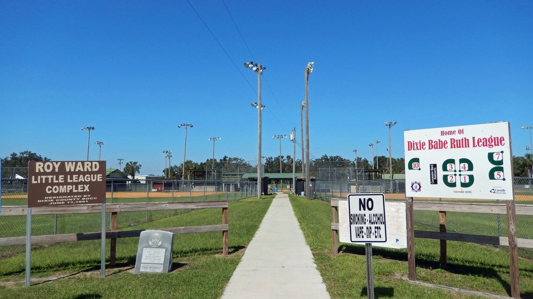
On U.S. 19 0.1 miles west of Northeast 223rd Avenue (County Road 351A), on the right when traveling north.
Putnam Lodge, built in 1927-28 by the Putnam Lumber Company, is part of a bygone era in Florida's forestry history. Here, beside the old Dixie Highway, Putnam Lodge, part of the "company town" of Shamrock, accommodated tourists, transients and . . . — — Map (db m77791) HM
On Northeast 106th Street at Northeast 216th Avenue, on the right when traveling north on Northeast 106th Street.
This church, built in 1929, was originally a wood-framed structure and the first church erected in the African-American community of Cross City. The architectural character was retained when it was remodeled and enlarged in 1942. The hand-made . . . — — Map (db m67597) HM WM
On County Road 351 2.4 miles north of 1st St, Horseshoe Beach, on the left when traveling south.
On December 26, 1817, U.S. Secretary of War John C. Calhoun directed General Andrew Jackson to protect citizens trying to settle in Florida. Jackson arrived in Florida with the largest army ever to invade the state to date -- 2,000 Creek Warriors . . . — — Map (db m61566) HM
On State Road 349 0.6 miles north of Pine Crest Drive, on the left when traveling north.
The Fletcher Community was established when Dixie County was part of Lafayette County and both were part of their parent county, Madison. In the early 1850s Fletcher families and other families emigrated south from the Carolinas through Georgia, . . . — — Map (db m67595) HM
On County Route 55A at County Route 349, on the right when traveling east on County Route 55A.
On April 1, 1899, Orren Y. Felton and his wife, Lille F. Felton, gave deed to the Board of Public Instruction for Old Town School. On May 23, 1911, Ruby E. Chaires and her husband McQueen Chaires gave additional deed to the Board of Public . . . — — Map (db m165868) HM
On U.S. 19 at State Road 349, on the right when traveling west on U.S. 19.
Inhabited by the Upper Creeks, Oldtown, often called Suwanee Oldtown, was one of the largest Indian villages in northern Florida. In Andrew Jackson's punitive expedition into Florida in April, 1818, Oldtown was captured. Most of the renegade Indians . . . — — Map (db m17712) HM
Near County Route 349 just east of Canal Street(Southeast 199th Street).
Captain Francis Langhorne Dade, U.S. Army and his 120-man Companies A,B,D,H and N, built Fort Duval in November 1826 at the mouth of the Suwannee River. The structure was 140 by 130 feet and six feet high with portholes for firing. The fort was . . . — — Map (db m167492) HM
On South Jefferson Street (U.S. 19) 0.5 miles north of Apalachee Parkway (U.S. 27), on the right when traveling north.
This excellent example of a "Carpenter Classic" style farmhouse was probably built c. 1836 for Burwell McBride shortly after he moved to Jefferson County from South Carolina. He was the grandfather of Margaret McBride who married Asa May, a wealthy . . . — — Map (db m126389) HM
On Ashville Highway (County Route 146) at Livingston Road, on the left when traveling east on Ashville Highway.
Livingston Place, a former Antebellum cotton plantation, is located in the heart of the Red Hills, a distinct American landscape of large wild quail hunting preserves rich in natural and cultural resources. From 1926 to 1994, this land was the . . . — — Map (db m264338) HM
On West Capps Highway (U.S. 27) north of County Road 257, on the right when traveling south.
Lamont began existence in 1848 when a U.S. post office was established at Beasley's Store which also served as a horse changing station on the stagecoach line between Tallahassee and St. Augustine. After the Civil War, the small settlement that had . . . — — Map (db m127036) HM
Near West Washington Street (Florida Route 10) at North Hickory Street.
In honor of the Confederate
Soldiers of Jefferson County
and the south land who
who served the South and the
Confederate States of
America from 1861-1865.
Donated by the Sons of the
Confederate Veterans, Major . . . — — Map (db m239653) WM
On West Washington Street west of Mahan Drive, on the right when traveling west.
It’s October 3, 1539…
Hernando de Soto’s army has crossed a large swamp to the east of here and is attacked by Apalachee warriors –
Our cavalry proved useless against this attack, as the trails are too narrow. We were forced to . . . — — Map (db m126590) HM
Near Sunray Road 0.6 miles south of Mahan Drive (U.S. 90), on the right when traveling south.
Archaeologists have many types of tools for unearthing the story of human cultures. Between 2002 and 2005, archaeologists conducted several digs at Letchworth-Love Mounds Archaeological State Park. They used a variety of methods to learn about the . . . — — Map (db m153300) HM
On Groover Road (County Road 6) at Rains Road, on the right when traveling north on Groover Road. Reported missing.
The Elizabeth School, a three-room, vernacular shingle-clad building, was a school for Black students on Groover Road in 1938 and was funded by parents and the Works Progress Administration (WPA). Miles Edward Groover (1887-1966) and his wife, Daisy . . . — — Map (db m67601) HM
On West Washington Street (U.S. 90) 0.1 miles west of Mahan Drive, on the right when traveling west.
In recognition of Platoon Sergeant Ernest I. Thomas U.S.M.C.R. who, on February 23, 1945, led his platoon to raise the first flag on Iwo Jima, the first Japanese territory taken in World War II. On March 3rd, eight days after the first flag . . . — — Map (db m62109) WM
Near Interstate 10 9 miles east of Route 257, on the right when traveling east.
The light of freedom still burns brightly in our world today because
of the service and sacrifice of America’s men and women in uniform.
Our Nation’s servicemen and women have fought the forces of tyranny and
won victories for liberty, . . . — — Map (db m154514) WM
Near Interstate 10 9 miles west of Route 150, on the right when traveling west.
The light of freedom still burns brightly in our world today because
of the service and sacrifice of America’s men and women in uniform.
Our Nation’s servicemen and women have fought the forces of tyranny and won victories for liberty, . . . — — Map (db m154516) WM
On 2nd Street at Park Avenue, on the right when traveling east on 2nd Street.
This historic marker recognizes Howard Academy Elementary/Junior High School, which eventually became Howard Academy High School. In 1957, the first phase of Howard Academy Elementary and Junior High School was constructed on Second Street. The . . . — — Map (db m67639) HM
On Mamie Scott Drive north of Cypress Street, on the left when traveling north.
Howard Academy High School's Building 1 opened on Chestnut Street in 1936 with one structure containing several classrooms. In 1940, a similar, second building was constructed and financed by the county, parents and The Julius Rosenwald Fund. . . . — — Map (db m67656) HM
On Jefferson Street (Courthouse Circle) (U.S. 19) at Washington Street (U.S. 90), on the left when traveling north on Jefferson Street (Courthouse Circle).
(front/north side)
Erected 1899 by the Ladies’ Memorial
Association of Jefferson County Fla.
Our Fallen Heros
(west side)
Let this testimonial of Woman’s deathless fidelity to Man’s imperishable valor speak to the sons . . . — — Map (db m126495) WM
On West Washington Street (Florida Route 10) at South Water Street, on the left when traveling west on West Washington Street.
Jefferson County High School
Erected 1852
Charter Granted in 1852 by Legislative Council
First brick school building constructed in state
Bricks made on George Taylor Plantation
Building constructed by Samuel Carroll with slave . . . — — Map (db m239585) HM
On Jefferson Street (Courthouse Circle) (U.S. 19) at Washington Street (U.S. 90), on the left when traveling north on Jefferson Street (Courthouse Circle).
When Florida’s Territorial Legislative Council established Jefferson County in January, 1827, settlers from the seaboard states already had begun to develop cotton plantations in this area. In December, 1827, the county seat received the name . . . — — Map (db m126297) HM
Near Sunray Road 0.6 miles south of Mahan Drive (U.S. 90), on the right when traveling south.
If you were able to travel back in time over 1,100 years to the peak period of the Weeden Island civilization, you would witness the construction of one of the greatest feats of American Indian architecture in the region now known as Florida. You . . . — — Map (db m153298) HM
Near Sunray Road 0.6 miles south of Mahan Drive (U.S. 90), on the right when traveling south.
Cultures throughout history left their mark through art. Come and explore the art of architecture from an earlier time and culture here at Letchworth-Love Mounds Archaeological State Park. Constructed between 1,800 and 1,100 years ago by the Weeden . . . — — Map (db m153296) HM
On Interstate 10, on the right when traveling west.
Named for President Thomas Jefferson, Jefferson County is home to the Monticello courthouse and opera house. Monticello's 1909 courthouse remains Florida's last historic courthouse square model still in active use. Surrounded by antebellum homes, . . . — — Map (db m293070) HM
On Walnut Street at North Olive street, on the left when traveling east on Walnut Street.
This church was on the Leon Circuit, Tallahassee District, South Carolina Conference of the Methodist Episcopal Church in 1828.
Adam Wirick, a minister on the Leon Circuit, from 1828 to 1832, “located” in Monticello and his name heads the . . . — — Map (db m239560) HM
On Boston Highway (County Road 149) 1.2 miles north of Fulford Road, on the left when traveling north.
The Olive Baptist Church was begun in 1831, and at that time the property was in the state of Georgia. In 1872 the U.S. Congress designated this land to be a part of Florida. On Tuesday, November 22, 1853, in the Eleventh Annual Session of the . . . — — Map (db m110980) HM
On West Washington Street (U.S. 90) at Jefferson Street (Courthouse Circle) (U.S. 19), on the right when traveling east on West Washington Street.
A Landmark of American Music
Perkins Opera House
Erected in 1890 by John H. Perkins, a Monticello merchant and patron of the theatre. Touring theatrical, musical and community performances were presented until 1928. The upstairs auditorium . . . — — Map (db m126298) HM
On East Washington Street (U.S. 90) 0.1 miles east of North Marvin Street, on the right when traveling west.
Built in 1890, John Howard Girardeau and his wife, Agnes, constructed this Folk Victorian style house for their large family on 11 children. It faces north toward Dogwood Street. Girardeau planted 46 oaks along the street, which provided a grand . . . — — Map (db m200398) HM
Near Sunray Road 0.6 miles south of Mahan Drive (U.S. 90), on the right when traveling south.
Believe it or not, the discovery of the Great Mound was like finding a needle in a haystack. Although archaeologists began searching for the mound as early as the 1930s, and some even found the site, it was not officially recorded until 1975. The . . . — — Map (db m153299) HM
Near Sunray Road 0.6 miles south of Mahan Drive (U.S. 90), on the right when traveling south.
Imagine standing in this spot over 1,100 years ago. Surrounding you would be a large architectural complex, complete with ten small mounds, two cleared plazas and the Great Mound, with its platforms, earthen ramp and pyramid-like peak. While form . . . — — Map (db m153297) HM
On North Jefferson Street (U.S. 19) south of West Pearl Street, on the right when traveling south.
Jefferson County became Territorial Florida's 13th county in January, 1827. In December of that year, the town of Monticello, named in honor of Thomas Jefferson's famous Virginia home, was laid out and lots began to be sold. During the 1830s and . . . — — Map (db m126300) HM
On Methodist Church Road 0.1 miles east of Waukeenah Highway (County Road 259), on the right when traveling east.
175th Anniversary of the Waukeenah
United Methodist Church
In the year 1837, the Waukeenah United Methodist Church was
established. It began as the Waukeenah Methodist Episcopal
Church. The story of the Waukeenah United Methodist Church . . . — — Map (db m136051) HM
On West Main Street (U.S. 27) at Monroe Street, on the right when traveling west on West Main Street.
Lafayette County was created December 23, 1856, from Madison County. The county was named in honor of the Marquis de Lafayette, the French citizen who rendered invaluable assistance to the Colonies during the Revolutionary War. The famed Suwannee . . . — — Map (db m17725) HM
On West Main Street (U.S. 27) west of North Fletcher Avenue (State Road 51), on the right when traveling west.
Established in 1874 by John B. Whitfield, Mayo was named in honor of James M. Mayo, a colonel in the Confederate Army and father of Nathan Mayo, who served as State Commissioner of Agriculture from 1923 to 1960. Mayo became the county seat of . . . — — Map (db m132099) HM
On Oak Street just south of U.S. Alt 27, on the right when traveling north.
Constructed in the 1880s, this frame vernacular building was the residence of Dr. James Middleton Jackson and his wife, Mary Glenn (née Shands). Around 1846, the Jackson and Shands families migrated to Hamilton County, Florida, from Chester County, . . . — — Map (db m202821) HM
Florida was provided with its first cross-state railroad in 1861 when the Florida Railroad Company line reached Cedar Key. Overcoming early financial troubles, the line had begun construction from Fernandina, on the Atlantic, in 1856, but building . . . — — Map (db m61565) HM
On 2nd Street at C Street, on the right when traveling east on 2nd Street.
This monument is dedicated to the Men and Women of Cedar Key who served their country in times of war.
World War II
12-7-41 12-31-45
Alford, Jack • Alford, Peachman • Allen, J. C. • Allen, James • Allen, Robert • Andrews, Dan • . . . — — Map (db m237730) WM
John Muir, noted naturalist and conservation leader, spent several months in Florida in 1867. He arrived at Cedar Key in October, seven weeks after setting out from Indiana on a "thousand-mile walk to the Gulf." Muir's journal account of his . . . — — Map (db m17705) HM
On G Street at Third Street, on the right when traveling north on G Street.
(Side 1)
Harvesting redcedars (a form of juniper) for pencil manufacturing, along with pines and baldcypress for lumber, was of great importance to the Cedar Keys and the early development of North Florida in the late 1800s and early 1900s. . . . — — Map (db m155931) HM
On South Main Street at East Park Avenue, on the right when traveling south on South Main Street.
Barn Quilt # 691
Artist - 4 Seasons Barn Quilts
What is a Barn Quilt?
Barn Quilts are a homegrown art form combining a few aspects of traditional Americana - barns, quilts, and road trips.
Donna Sue Groves of Manchester, . . . — — Map (db m275585) HM
Near NW 115th Street (Florida Route 320) 0.5 miles west of North Young Boulevard (U.S. 98).
Having borrowed a canoe from some Indians, I visited a very grat and most beautiful fountain or spring which boils up from between the hills about 300 yards from the river, throwing up great quantities of white small pieces of shells & white shell . . . — — Map (db m191194) HM
Near NW 115th Street (Florida Route 320) 0.5 miles west of U.S. 98.
Rainfall, which is slightly acidic, dissolves limestone as it passes through the ground. As water travels underground toward the springs, it sometimes creates large cave passages through the porous limestone. On the surface, as this limestone breaks . . . — — Map (db m191209) HM
Near NW 115th Street (U.S. 320) 0.5 miles west of North Young Boulevard (U.S. 98) when traveling west.
"With their abundant food supply and pleasant surroundings, Indians at Manatee Springs probably lived a fairly comfortable life. The village was home to them, a place to which to return for rest and relaxation after the exertions of the . . . — — Map (db m191207) HM
Near U.S. 27/98, on the right when traveling east.
The Fanning Springs Bridge was built by the State of Florida.
In 1934 it was officially named the Benjamin Chaires Bridge in honor of a prominent pioneer settler of Dixie County.
Located 29 miles north of the Gulf of Mexico, it held the . . . — — Map (db m17709) HM
On U.S. 19 0.1 miles north of County Route 326, on the right when traveling south.
Side 1
The Grove-Dowling company used five locomotives, four large locomotive cranes, two log loaders, and one skidder machine for logging. One locomotive, No. 2411, was a 2-8-0 steam engine built in November 1915 by the Vulcan Iron Works of . . . — — Map (db m163004) HM
On State Road 19, on the right when traveling south.
This locomotive, known locally as "Three Spot", often pulled 30 to 40 cars as it transported logs from area woodlands to the Patterson-McInnis Sawmill. Originally a wood burning engine thought to be built around 1915, it was converted to steam . . . — — Map (db m19402) HM
Near Canal Road (Spillway Road) 0.8 miles south of Route 40, on the left when traveling west.
Unintended Consequences In the 1960s, the U.S. Army Corps of Engineers cut through and plugged the Withlacoochee River to make way for the Cross Florida Barge Canal. Blocking the river entirely would have devastated downstream ecosystems. The . . . — — Map (db m167893) HM
Near West Riverwood Drive 1.7 miles east of North Basswood Avenue, on the left when traveling east.
Bisecting a State, Bisecting a River Inglis Island sits at the center of the Withlacoochee River, Lake Rousseau, and the Cross Florida Barge Canal. From here you can see where the canal bisected the river. Look for an earth and concrete berm on . . . — — Map (db m167499) HM
Near Southeast 90th Avenue 0.3 miles south of Route 40, on the right when traveling south.
A Stairway to the Top of the Canal Lake Rousseau sits almost 30 feet above the western edge of the Cross Florida Barge Canal. How do you move a barge up 30 feet? You build a lock. Think of a lock like water stairs. A barge enters the lock . . . — — Map (db m167500) HM
Near West Riverwood Drive 1.7 miles east of North Basswood Avenue, on the left when traveling east.
Changing the Face of Florida At the end of the 19th century, prospectors and entrepreneurs flocked to Dunnellon, 10 miles east of here. They came to mine phosphate, a valuable ingredient in fertilizer. In just five years, Dunnellon transformed . . . — — Map (db m167501) HM
On State Road 24, on the right when traveling north.
Racial violence erupted in the small and quiet Rosewood community January 1-7, 1923. Rosewood, a predominantly colored community, was home to the Bradley, Carrier, Carter, Goins, and Hall families, among others. Residents supported a school . . . — — Map (db m17707) HM
Near SE 1st Avenue at SE 6th Street, on the right when traveling east.
An electrical distribution system was purchased for $33,000 on June 11, 1923, from the Williston Manufacturing Company. Included was the generator, ice plant, cold storage plant, water tank, a ten-year-old bay horse named Charlie, and a wagon with a . . . — — Map (db m244277) HM
Near SE 1st Avenue at SE 6th Street, on the right when traveling east.
Williston was incorporated as a town in 1897; charted as a city in 1929.
On October 10, 1914, this area was designated as a public park by the mayor and town council in a deed from J.B. And P.A. Epperson.
An electrical distribution system . . . — — Map (db m244281) HM
Near SE 1st Avenue at SE 6th Street, on the right when traveling east.
This Howitzer 8" M2 Cannon was secured by the City from the Anniston Alabama Army Depot on April 30, 1975.
Williston was incorporated as a town in 1897 and chartered as a city in 1929. On October 10, 1915 this area was designated as a public . . . — — Map (db m244282) HM WM
On NE Drew Way 0.2 miles east of U.S. 90, on the left when traveling east.
Drew Mansion Site
Located approximately one-half mile to the northwest is the site of the Drew Mansion, home of George F. Drew, governor of Florida during the difficult period of readjustment following Civil War Reconstruction, 1877-1881. . . . — — Map (db m19939) HM
On Northwest 140th Street at Northwest Heron Drive, on the left when traveling north on Northwest 140th Street.
(side 1)
For the glory of God, the church was constituted June 20, 1841. The charter members were: Richard J. and Eliza Mays; Joshua W.P. and Mary McCall; William T., Elizabeth and Harriet Johnson; black servants, Elbert, Phillis, . . . — — Map (db m67604) HM
On U.S. 90 0.1 miles west of Northwest Elizabeth Sims Loop, on the right when traveling east.
The Miccosukee Indian chief, John Hicks (English name for Tuckose Emathla) was a prominent Indian leader in the period between the First and Second Seminole Wars (1818-1835). It is believed that after General Andrew Jackson destroyed the . . . — — Map (db m210908) HM
This home is a reconstruction of the home where musician Ray Charles (1930-2004) lived with his mother, Aretha Williams, and adopted grandmother, Margaret "Muh" Robinson, shortly after his birth in 1930, until about the age of five. "RC", as Ray was . . . — — Map (db m52361) HM
On U.S. 90 at Broad Street, on the right when traveling east on U.S. 90.
Begun as Sandy Ford, 1850, Samuel Williams was the first postmaster in 1854. Called Station 5 on the Pensacola-Georgia R.R., the name Greenville, for Greenville, S.C., came in the 1860's. Elijah Hays helped its expansion after 1876. Incorporated in . . . — — Map (db m172571) HM
Near Interstate 10 (Interstate 10 at milepost 265), 3.5 miles east of County Road 255, on the right when traveling west.
The light of freedom still burns brightly in our world today because
of the service and sacrifice of America’s men and women in uniform.
Our Nation’s servicemen and women have fought the forces of tyranny and
won victories for liberty, . . . — — Map (db m153185) WM
Near U.S. 10 at milepost 265 west of County Road 255.
The light of freedom still burns brightly in our world today because
of the service and sacrifice of America’s men and women in uniform.
Our nation’s servicemen and women have fought the forces of tyranny and
won victories . . . — — Map (db m153189) WM
On U.S. 90 at Northeast Macedonia Church Road, on the right when traveling west on U.S. 90.
MIDDLE FLORIDA MISSIONARY BAPTIST ASSOCIATION
The Middle Florida Baptist Association was formed at Macedonia Church, November 9, 1900, by a group of churches formerly in The Florida Association. Reverend, J.T. Farnell was the First . . . — — Map (db m173106) HM
On SE Boundary Bend Trail 2.8 miles east of County Road 255, on the left when traveling east.
It’s September 23, 1539…
Conquistador Hernando de Soto and his men have reached a large river, the present-day Suwannee –
My nose is broken, and we are weary from battle. We will rest here for two days before crossing. Envoys of . . . — — Map (db m126587) HM
On Northwest Marion Street just east of Northwest Meeting Avenue, on the left when traveling east.
“The Dream House is not one of the larger homes but in architecture, construction, mill-work, and general floor plan it is said to follow the Prince Archilles Murat Home in Tallahassee. Built in 1849, it is 11 years younger than Madison. Mr. . . . — — Map (db m172364) HM
On Southwest Range Avenue just south of Base Street, on the left when traveling south.
Awarded the Navy Cross 1942 while in service to his country Served the people of Madison County 32 years as Clerk of Circuit Court — — Map (db m299178) HM
Near Southwest Pinckney Street just east of Shelby Street, on the right when traveling east.
This Post Office is dedicated to the memory of Captain Colin P. Kelly, Jr. who served his country and his men with distinction and bravery, giving his life in the Pacific December 1941 Established by an Act of Congress July . . . — — Map (db m172574) HM WM
On East Base Street (U.S. 90) at Southwest Shelby Avenue, on the right when traveling east on East Base Street.
Captain Richard G. Bradford of Madison was killed October 9, 1861, during the Battle of Santa Rosa Island. This battle was fought in an attempt to capture Fort Pickens which protected Pensacola Harbor. Bradford was the first Confederate officer from . . . — — Map (db m149388) HM
On Southwest Rutledge Street at Southwest Horry Avenue, on the right when traveling east on Southwest Rutledge Street.
Madison was founded on land secured from Madison C. Livingston, May 2, 1838, and established as the county seat after its removal from San Pedro. An early political center, it was along the escape route of Confederate Secretary of War John C. . . . — — Map (db m149420) HM
On Northeast Marion Street at Northeast Range Avenue, on the right when traveling west on Northeast Marion Street.
This late Victorian mansion was built c. 1880 for Major William H. Dial (1830-1905), a Confederate veteran of the Civil War. Dial was a surveyor who moved from South Carolina to Madison, Florida in the 1850s. This house is one of the finest examples . . . — — Map (db m102441) HM
On West Pinckney Street at South Orange Street, on the right when traveling west on West Pinckney Street.
This structure represents an adaptation of the Queen Anne style of architecture to local ecclesiastical needs and traditional building materials. Both the stimulus for constructing a new sanctuary and the idea for its basic design are attributed to . . . — — Map (db m17726) HM
On Northwest Meeting Avenue 0.1 miles north of Northwest Livingston Street, on the right when traveling north.
An early community cemetery, Oak Ridge presents a profile of North Florida history. Located on approximately eleven acres, the cemetery was established on land donated by two pioneer citizens.
Buried here are: William Archer Hammerly, Master . . . — — Map (db m149419) HM
On West Base Street (U.S. 90), on the right when traveling east.
Begun here for God's glory in 1835, the church was named Madison Baptist Church in 1854 and received its present name in 1922. Founders were Abraham Moseley and R.J. Mays. Early pastors were B. Fiddler, W.B. Cooper, H.Z. Ardis, and first deacon . . . — — Map (db m17744) HM
On East Base Street (U.S. 90) east of Northeast Range Avenue, on the right when traveling west.
On this site stood a Blockhouse erected by the citizens of the area to protect women, children, and old people in the threatening period of 1835-1842. It served as an informal Court House before Adoniram Vann completed the regular Court House in . . . — — Map (db m149386) HM
Near Northwest 205th Street at Northwest 140th Street.
(side 1)
To The Glory of The Most High God a group of Christians led by the Reverend John Gramling organized Shiloh Methodist Church here, December 24, 1845. Born in 1785 in South Carolina, the son of German Emigrants Adam and Elizabeth . . . — — Map (db m67603) HM
On State Road 14 0.1 miles north of County Road 360, on the right when traveling south.
In the mid 1600's San Pedro de Potohiriba, a Spanish mission, was established in this area on the Old Spanish Trail. The first courthouse of Madison County was erected at San Pedro, the county seat from 1828 to 1838. San Pedro, located about ten . . . — — Map (db m129387) HM
On North Duval Street (Florida Route 145) at Northeast Marion Street, on the right when traveling north on North Duval Street.
Madison Lodge Number 11, F.& A.M. founded the St. Johns Seminary of Learning on the southwest corner of this block in 1850. This institution became the basis for Madison High School in 1886. W.B. Cates established the Florida Normal Institute here . . . — — Map (db m149389) HM
On Northeast Horry Avenue at Marion Street, on the right when traveling north on Northeast Horry Avenue.
The congregation of St. Mary's Episcopal Church was organized in 1859, but the parish became dormant during the Civil War when services were held irregularly. Twenty years later, on July 6, 1879, the congregation appointed a committee to coordinate . . . — — Map (db m93267) HM
On South Range Street (State Road 14), on the left when traveling north.
Across Range Street, this Unit was used in Cotton and Peanut processing until 1919 and later carried to Taylor County for use in the Lumber Industry. With a 5-foot Piston Stroke and a 16-foot Drive Wheel, this 500 HP Engine pulled 65 Gins in the . . . — — Map (db m17752) HM
On Lakeshore Drive at Priest Street, on the right when traveling west on Lakeshore Drive.
Established at Columbus, February 17, 1842, moved across the Suwannee to serve a Sawmill Complex, 1867, the office became Ellaville, 1872. Some postmasters were George F. Drew, 1867-1883, Robert L. Millinor, 1893-1912, Frederick Stroud, 1914-1922, . . . — — Map (db m67606) HM
On Southwest Range Avenue (Florida Route 14) at Southwest Santa Fe Street, on the right when traveling north on Southwest Range Avenue.
Captain John L. Inglis began in this area The Florida Manufacturing Company in 1874. This plant ginned as many as ten thousand bales of Sea Island Long Staple Cotton in one year. The thread was widely used for general purposes and making English . . . — — Map (db m149433) HM
On East Base Street (U.S. 90) at Northeast Range Avenue, on the right when traveling west on East Base Street.
The Four Freedoms were stated by President Franklin D. Roosevelt in his Annual Message to Congress, January 6, 1941. Freedom of speech and expression, freedom of worship, freedom from want, and freedom from fear everywhere in the world, became the . . . — — Map (db m149384) HM
On West Base Street (U.S. 90), on the left when traveling east.
The Wardlaw-Smith House was erected in the early 1860's for Benjamin F. Wardlaw, a prominent local citizen. Following the Civil War Battle of Olustee in February, 1864, it served as a Confederate hospital. This fine example of Greek Revival . . . — — Map (db m17745) HM
On Southwest Rutledge Street at Southwest Range Avenue, on the right when traveling west on Southwest Rutledge Street.
Built in 1892 by William Turner (W.T.) Davis, this building is one of the few remaining buildings in Florida covered with a galvanized sheet metal facade, in this example produced by the Mesker Brothers Iron Works of St. Louis, Missouri. This use of . . . — — Map (db m96934) HM
On West Base Street (U.S. 90), on the left when traveling east.
The Wardlaw-Smith House was acquired by Mr. and Mrs. William M. Goza in January, 1978 in a state of disrepair. It was meticulously restored and landscaped by them under the supervision of Dawson Rutherford, Master Contractor. Mr. and Mrs. Goza . . . — — Map (db m17750) HM
On Hampton Spring Road, on the right when traveling west.
The Hampton Springs Hotel was built in 1908 and was destroyed by fire in 1954. The hotel was world renowned for its sulphur springs and baths known for their healing and medicinal powers. The luxurious hotel boasted lush gardens with elaborate . . . — — Map (db m17720) HM
Near North Jefferson Street (U.S. 221) at West Cherry Street, on the right when traveling north.
"Liberation of Kuwait”
January 16, 1991 - February 27, 1991
In honor of those who served
In honor of those who died
Wounded 213
Deaths 133
POW/MIA 46
Total Casualties 392 — — Map (db m229936) WM
Near North Jefferson Street (U.S. 221) at West Cherry Street.
“POW / MIA Flag”
In honor and memory
of all Prisoners of War / Missing in Action
Veterans past - present and future
for unselfish Service, Valor and Sacrifice
Sponsored by
By Al and Ola Mae Grubbs
Roy and LaDonna . . . — — Map (db m229908) WM
Near U.S. 19/27 0.2 miles south of Providence Road, on the right when traveling south.
The light of freedom still burns brightly in our world today because of the service and sacrifice of America’s men and women in uniform.
Our Nation’s servicemen and women have fought the forces of tyranny and won victories for liberty, human . . . — — Map (db m230037) WM
On U.S. 19 at Forest Park Drive, on the right when traveling south on U.S. 19.
Silviculture, commonly known as forestry, has been an integral part of Florida's economic sectors since statehood. Many North Florida townships were built around sawmill operations. The major exports of the first raitroads to be built in the state . . . — — Map (db m309142) HM
On Martin Luther King Jr. Avenue at 6th Street, on the left when traveling west on Martin Luther King Jr. Avenue.
In 1853, a family of free blacks established the Spring Hill Missionary Baptist Church in what was then known as Rosehead, later Perry. The roots of African-American education in Taylor County began with this church, which remains the oldest . . . — — Map (db m67600) HM
Near North Jefferson Street (U.S. 221) at West Cherry Street, on the right when traveling north.
The first war in which a world organization, the United Nations (UN), played a military role. The Korean War was a major challenge for the United Nations, which had come into existence only five years earlier. United Nations military lost 628,833 . . . — — Map (db m229965) HM WM
Near North Jefferson Street (U.S. 221) at West Cherry Street, on the right when traveling north.
The “Forgotten War” is what the Korean War of 1950 through 1953 has been deemed, for many, it was a war that does not bring anything to memory. But for those who fought in it, and the family members who had loved one who fought and died, it has many . . . — — Map (db m229979) HM WM