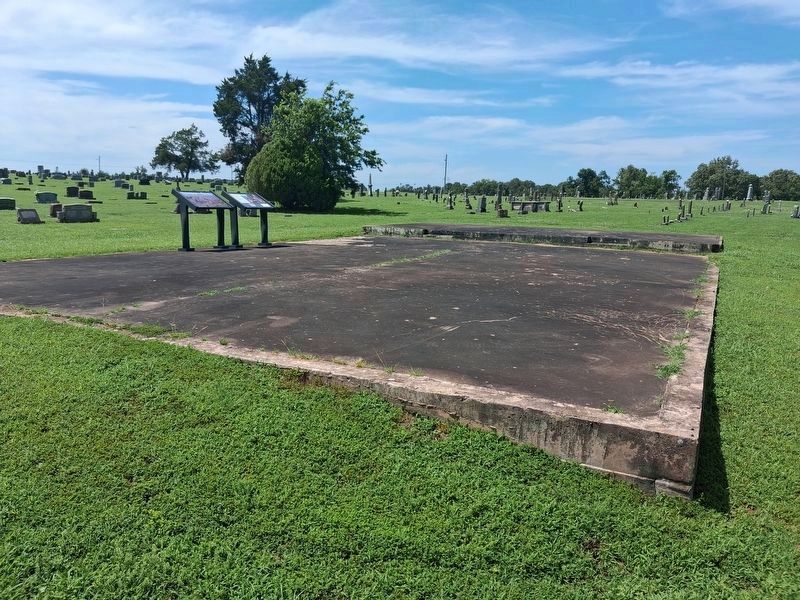
On Cemetery Road north of West Doyle Avenue, on the left when traveling north.
Between June 1839 and March 1839, more than 16,000 Cherokee Nation citizens trekked west from their traditional eastern homeland to Indian Territory (present-day Oklahoma) over the "Trail of Tears." More than 1,000 died during the journey . . . — — Map (db m300602) HM
On South Highway 59 (National Highway 1), on the right when traveling north.
This property is listed on the National Register of Historic Places by the United States Department of the Interior
Stilwell Kansas City Southern Railway Depot 1915 — — Map (db m304483) HM
On US 59 (Highway 1), on the right when traveling north.
The End of the Journey
Between June 1838 and March 1839, more than 15,000 Cherokee trekked west from
their traditional eastern homeland to Indian Territory (present-day Oklahoma) over the “Trail of Tears.” More than 1,000 died during the . . . — — Map (db m304920) HM
On U.S. 59 at Main Street, on the right when traveling south on U.S. 59.
Established in 1838 by Lt. Col. R.B. Mason, 1st Dragoons, U.S. Army, at request of Arkansas citizens fearing Cherokees who were being removed from southeastern U.S. Named in honor of Gen. "Mad" Anthony Wayne, the fort was originally located in NE . . . — — Map (db m181594) HM
On Old Mission Mountain Road 0.7 miles south of Local Road 670, on the right when traveling south.
About 4 mi. N. and W. Established by Rev. Jesse Bushyhead in 1839, and known as Bread Town by the Cherokees. Rev. Evan Jones was missionary in charge. The Cherokee Messenger printed there beginning in August, 1844, was 1st. periodical in . . . — — Map (db m298969) HM
On Old Mission Mountain Road 0.7 miles south of Local Road 670, on the right when traveling north.
Rev. Jesse Bushyhead settled here in 1839 following the Cherokee removal from the East and held church services at his home until the Baptist Mission was established in 1841 by Rev. Evan Jones. This site was also one of the ration stations known . . . — — Map (db m298971) HM
On Old Mission Mountain Road, on the right when traveling north.
Home in the West
George Woodall's farm was a busy scene as groups of Cherokee Nation citizens arrived here after their 800-mile trek west from their southern Appalachian homelands. As detachments arrived, they ended their journey at a . . . — — Map (db m304748) HM
On Old Mission Mountain Road north of Local Road 680, on the right when traveling north.
A signer of the Treaty of New Echota and grandfather of famed Will Rogers. Robert Rogers moved with his wife, Sally Vann to Indian Territory about 1837, and established a home about 1 mile NW. He was killed in 1842 in a tribal feud as were many of . . . — — Map (db m298970) HM
On Old Mission Mountain Road, on the right when traveling north.
The End of the Journey
Between June 1838 and March 1839, more than 16,000 Cherokee Nation citizens trekked west from their traditional eastern homeland to Indian Territory (present-day Oklahoma) over the "Trail of Tears." More than . . . — — Map (db m304751) HM
On State Highway 11 6 miles east of U.S. 64, on the left when traveling west.
First white men to see Salt Plains. In summer of 1811 group composed of 8 white men and 6 Osage passed here after crossing north portion of Salt Plains from east to southwest. — — Map (db m216882) HM
On State Highway 11 west of County Road 630, on the left when traveling west.
Buildings near here from 1897. Under auspices of Friends Church, the Academy was noted for high moral, spiritual and scholastic standards. Closed 1922. Named for the teacher of first school (1893) in this vicinity, a sod house near Stella Church . . . — — Map (db m216941) HM
On State Highway 8 at E0374 Road, on the right when traveling north on State Highway 8.
Built by Marshal McCully who staked land on which house stands during Cherokee Strip Run, September, 1893.
Plowed sod for and erected house August 1894. Used as McCully home until large frame house constructed 1909.
Of the many . . . — — Map (db m311809) HM
On Main Street (U.S. 64) at 1st Street, on the right when traveling west on Main Street.
Declaration This Memorial Honors Men and Women Who Served Our Country in Time of War. In Time of Conflict or Peace. And Especially Those Who Lost Their Lives. Who Were Wounded or Maimed. And Who Were Held as Prisoners of War. These Stones . . . — — Map (db m181753) WM
On Harper Road 1 mile west of State Highway 38, on the right when traveling west.
The National Wildlife Refuge system is broken down into regions of the United States. The southwest region of the National Wildlife Refuge System encompasses Oklahoma, Texas, New Mexico and Arizona. Oklahoma has nine national wildlife refuges across . . . — — Map (db m216689) HM
On Court Street east of Delaware Avenue, on the right when traveling east.
By Concurrent Senate and House Resolution No. 93 adopted April 20, 1988 by the Oklahoma State Legislature and which was approved by the Oklahoma Transportation Commission on May 2, 1988, Oklahoma Highway 3 between Ada and Broken Bow, Oklahoma . . . — — Map (db m72490) HM
On South Park Lane 1.5 miles north of W Boggy Depot Rd, on the left when traveling north.
Cyrus Harris, who would become the first elected Chickasaw Governor, arrived with one of the first parties to reach Boggy Depot. He built the first log cabin on the ridge between Clear Boggy and Sandy Creeks.
Harris was born August 22, 1817, near . . . — — Map (db m284165) HM
On Court Street east of Delaware Avenue, on the right when traveling east.
Born about 1792
Died during Civil War
Signed Treaty of
Dancing Rabbit Creek
in 1830.
Led Band of Choctaws to this area,
settling near Crystal in 1834.
Capt. Atoka was a noted
athlete, Choctaw subchief
and respected leader. . . . — — Map (db m72492) HM
On South Park Lane 1.5 miles north of W Boggy Depot Rd, on the left when traveling north.
The American Civil War took place a little more than a generation after removal. Although none of the tribes had a direct stake in the crisis, the tribes were unable to stay out of the conflict entirely. Virtually all of the tribes were split on . . . — — Map (db m284163) HM
On South Park Lane 1.5 miles north of W Boggy Depot Rd, on the right when traveling north.
Chief Wright had many notable accomplishments. Cyrus Kingsbury, co-founder of Boggy Depot's church, sponsored Wright's education at Pine Ridge Mission School near Doaksville. He then entered Spencer Academy in 1844. He was one of five Choctaw boys . . . — — Map (db m284164) HM
Near North Mississippi Avenue (U.S. 69) 0.8 miles north of West Liberty Road (U.S. 75), on the right when traveling north.
On September 16, 1857, the John Butterfield Company received a Federal contract to transport mail from Missouri to San Francisco in under 25 days. Semiweekly service began a year later. Twelve relay stations lined the Butterfield Trail in Indian . . . — — Map (db m64072) HM
The Confederate Encampment here at Middle (or Muddy) Boggy Crossing on the Boggy Depot Road held by Lieut. Col. John Jumper's Seminole Battalion, Capt. Adam Nail's Company A of First Choctaw and Chickasaw Cavalry and a detachment of the Twentieth . . . — — Map (db m244746) HM
On South Mississippi Avenue 0.1 miles north of W Chicken Fight Road, on the right when traveling south.
St. Patrick's Church of Atoka was built in 1872. Fr. Michael Smythe from Ft. Smith served here. Fr. Isidore Robot, O.S.B. was 1st resident' priest. He later was 1st Prefect Apostolic of Ind. Ter., and founded Sacred Heart Mission west of Atoka, 1876. — — Map (db m284167) HM
On Park Drive 1.5 miles north of W Boggy Depot Rd, on the left when traveling north.
Before the arrival of white settlers, much of Oklahoma was covered by a thick blanket of native grasses. Big and little bluestem, Indian grass and switchgrass were among the plants which covered the vast prairie. Wild fire kept Nature's forest . . . — — Map (db m284160) HM
On Court Street east of Delaware Avenue, on the right when traveling east.
In honor of the men and women
that served their country
in Vietnam and to those that
made the supreme sacrifice,
we dedicate this memorial
in their behalf
Dean Armstrong • Larry Culverson • Sam Daily
John C. Deaton • Forbes P. . . . — — Map (db m72491) WM
On Court Street at Reba McIntire Street, on the right when traveling east on Court Street.
In memory of all veterans
of all wars of the
United States of America
especially to those veterans
who paid the supreme sacrifice
for the freedom that you enjoy. — — Map (db m72488) WM
On Lake Road 0.5 miles south of Lake Shore Drive, on the right when traveling south.
Here was located a stage stand of the Butterfield Overland Mail Route, under Act of Congress, March 3, 1857. First mail stage arrived here in September, 1858, enroute to San Francisco. Service continued until the outbreak of the War between the . . . — — Map (db m284215) HM
On North Mississippi Avenue (U.S. 69) south of Ash Street, on the right when traveling south.
Near this place on Aug. 5, 1932, Atoka County Sheriff C.G. Maxwell and Deputy Sheriff Eugene Moore were involved in a shoot-out with Clyde Barrow, Raymond Hamilton, and Everett Milligan. The incident occurred when the two lawmen tried to arrest the . . . — — Map (db m64070) HM
On State Highway 7 0.1 miles west of South Park Road, on the left when traveling west.
Site of town noted for distinguished citizens in state history. 1st house built 1837 by Cyrus Harris, later Chickasaw Governor. Later Choctaw Capital and Overland Mail stage stand to San Francisco (1858-61). Home of Principal Chief Allen Wright, . . . — — Map (db m284166) HM
On State Highway 23 8 miles south of U.S. 412, on the left when traveling south.
You Are Now Entering Old
No Man's Land
Colorado Kansas 37th Parallel
Called "No Man's Land" until 1890
Known Then as
Beaver County
Became the Panhandle of Okla. Statehood 1907
Texas State Line 36° 30" Parallel
The . . . — — Map (db m93483) HM
Tales of bravery, mischief and morals make up the popular children's book series
"Hank the Cowdog"
What you may not know is that the lively main character in these books was inspired by a real cowdog named Hank who lived and worked on . . . — — Map (db m162469) HM
This 168 mile trail from Mobeetie, Texas, to Dodge City, Kansas,
was laid out by Ed Jones and Joe Plummer in 1874, originally as a
freight trail for hauling buffalo hides purchased from the Buffalo
Hunters in the Texas Panhandle for sale at . . . — — Map (db m162472) HM
On U.S. 64 at N1680 Road, on the right when traveling east on U.S. 64.
You are now entering old ”No Man’s Land”
Colorado/Kansas • 37th Parallel Texas State Line • 36° 30’ parallel New Mexico • 103rd Meridian Cherokee Outlet • 100th Meridian
Called “No Man’s Land” until 1890 Known then . . . — — Map (db m131421) HM
On Mendenhall Street (County Route 12) 0.1 miles north of Panhandle Street (U.S. 64), on the right when traveling north.
Eureka was established in 1908 with 18 square miles. The high school was started in 1919 when Center, Lincoln, and one half of Pleasant View were consolidated. In 1923, the Nabisco, Happy Flat, and East Banner districts were added and a new building . . . — — Map (db m78816) HM
On County Highway 1230 at County Highway 2000, on the left when traveling west on County Highway 1230.
In honor of the people who lived here from 1892 to 1957, and built this community.
Life in the community, which at one time included 2 general stores, a barber shop, blacksmith shop, grain grinding mills, church and family residences, centered . . . — — Map (db m209528) HM
On West 2nd Street, on the right when traveling west.
More than 6 million cattle went up this trail from Texas to Kansas between 1874 and 1888.
The trail crossed this area approximately 10 miles east of this location. — — Map (db m162452) HM
His hot brand number was 018
But he was called Ole Cowtown,
Many a bullrider put a rope on him
And most every time they hit the ground.
Over 350 times they nodded their heads
But only 5 made the judges book,
Ole Cowtown not only would . . . — — Map (db m162455) HM
On West 2nd Street just west of North Pioneer Road, on the left when traveling west.
Built & displayed by
Dr. Dennis Friesen
Dedicated 2001
"The railroad is the reason why Elk City exists and I want people to know what the railroad has really meant to Elk City. I share this for people to . . . — — Map (db m255418) HM
On West 2nd Street, on the right when traveling west.
Entrepreneurs, pioneering a new industry - a new way to receive a broadcast television signal. Inventing the first cable television system west of the Mississippi river, here in Elk City, Oklahoma. — — Map (db m162454) HM
Beutler and Son PRCA Bareback Bucking Horse of the Year 1998, 1999, and 2000 NFR Bareback Horse of the Year 1997.
Commotion had ten straight trips to the NFR in Las Vegas, Nevada before retiring in 2006.
The 1-1/3 life-sized bronze by . . . — — Map (db m162468) HM
This is dedicated in loving memory of Elmer "Red” and Elsie G. Cruze,
early day settlers of the Indian Creek area, north of Carter, Oklahoma.
Elsie moved to the Indian Creek area at the age of 3, with her parents
Pearl J. and Kate King, . . . — — Map (db m162457) HM
On West 3rd Street (Business Interstate 40) west of North Pioneer Road, on the right when traveling west.
Ernest Martin of Leedey purchased this gas pump at public auction in 1946 to use on his farm. When ill health forced him to sell the farm in 1974, his daughter and son-in-law, Hellen & Derrel Weaver, bought the pump and donated it to the museum. — — Map (db m187259) HM
On West 3rd Street (Business Interstate 40) west of Pioneer Road, on the right when traveling west.
Established in 1998, the National Route 66 and Old Town Museum Complex preserves the history of Route 66 in Western Oklahoma.
Recognized by Hampton Hotels Save-A-Landmark program as a site worth seeing — — Map (db m183510) HM
Sold to the city of Elk City
by C.H. Nesser for $10.00 in 1931.
This grader was used to help build
Route 66 in 1926.
C.H. Nesser was grandfather to Norman, Harold and Herman Nesser,
(sons of Ernie Nesser) and Neil, Ray and Ron Nesser . . . — — Map (db m162451) HM
Jaycee project 1976
Rock Bluff School
Est. 1894-1926
Donated by Trigg Music Family
Cornerstone:
Rock Bluff School
1894 - 1976
Building donated by
The Trigg Music Family
Ron Savage Jr. Chairman
Western Oklahoma . . . — — Map (db m162462) HM
On U.S. 66 near North Pioneer Road, on the left when traveling east.
The deep Anadarko Basin of Western Oklahoma is one of the most prolific gas provinces of North America. Wells drilled here have been among the world's deepest. The Bertha-Rogers No. 1 in Washita County, drilled in 1971 to 31,441 feet, was then . . . — — Map (db m162463) HM
Oklahoma is home to several
prehistoric sites as well as two
truly fearsome dinosaurs. Our
state fossil, Saurophaganax
maximus (shown here), was
known as the "king of the
dinosaurs." Discovered near
Kenton, this predator was one
of the . . . — — Map (db m312076) HM
On South Sheb Wooley Street south of West 3rd Street, on the right when traveling south.
Formerly the City Meat Market, this is known as the oldest brick building in Erick. It is now the home of Harley and Annabelle, "The Mediocre Music Makers."
Recognized by Hampton Hotels Save-A-Landmark program as a site worth . . . — — Map (db m183509) HM
Beckham county was created at statehood from portions of territorial Greer and Roger Mills counties. It was named for J.C. Beckham, former governor of Kentucky. Sayre, a town founded in 1891 and named for a railroad promoter, won the title of . . . — — Map (db m160832) HM
In honor of veterans of all wars
who sacrificed for democracy, peace
and justice.
Sponsored by Mildred Lee Chapter No. 1822
United Daughters of Confederacy
MCMLXXI — — Map (db m160833) WM
In 1888 Thomas and Millie Price were one of the first families to settle in this portion of old Greer Co, now Beckham Co. Price built a cotton gin ½ mi. east of Delhi in 1903. The one-roomed Delhi Academy was established in 1921. The Academy . . . — — Map (db m54903) HM
On North 4th Street (U.S. 283) at Elm Avenue, on the right when traveling north on North 4th Street.
This underpass was a 1939 WPA Works Project. In 1939 the Sayre Grade School was located one block east of this location the underpass was built to provide safe passage for children and pedestrians crossing under the very busy Route 66. It is still a . . . — — Map (db m187260) HM
On Old Route 66 0.2 miles west of Texas Avenue, on the right when traveling west.
June 26, 1952, on this location, Route 66 was rededicated as the Will Rogers Highway. This was one of the many ceremonies that took place on the state lines of Illinois, Missouri, Kansas, Texas, New Mexico, Arizona, California as well as Oklahoma, . . . — — Map (db m100328) HM
On a late fall afternoon in 1903, a stranger with a new
wagon, fine team and money (something the local people
had little of) arrived at the store in Craig located in the NW/4 of Section 24 T19N R10W. He wore nice, but foreign clothes, and spoke . . . — — Map (db m160285) HM
Near Local Road P20 0.4 miles State Highway 8A, on the right.
Chief Henry Roman Nose, for whom this park is named, was one of forty-four chiefs of the Southern Cheyenne tribe. He was a council chief from 1897 until his death in 1917. Born in 1856, Roman Nose (Woqini in the Cheyenne language) grew up during . . . — — Map (db m184807) HM
On State Highway 8A 3 miles north of State Highway 8, on the left when traveling north.
One of Oklahoma's original seven state parks, the vision of Roman Nose State Park was realized through the combined efforts of the Civilian Conservation Corps, the National Park Service, community leaders, and the State of Oklahoma.
Work . . . — — Map (db m185621) HM
The Civilian Conservation Corps begun construction of Roman Nose State Park on September 10, 1935, bringing the vision of the local community to life. While the community gathered the land, the design, supervision, and funding of the project came . . . — — Map (db m185579) HM
On U.S. 70 0.1 miles east of Ballpark Road, on the right when traveling west.
Armstrong Academy, established by Choctaw Nation and named for Wm. Armstrong, Indian Agt., was opened in 1845. Rev. R.D. Potts, Supt., under Baptist Miss. Soc. Post Office established Nov., 1850. Confederate Capitol during Civil War. Choctaw . . . — — Map (db m77938) HM
On Ford Washita Entrance Road north of State Highway 199 when traveling north.
As a memorial to Charley Colbert, his wife Abbie Davis Colbert, and their children, this monument is erected.
Charley Colbert was born May 20, 1863 at Colbert, Indian Territory, died June 13, 1955. His wife Abbie, born January 10, 1877, died . . . — — Map (db m206669) HM
On Buffalo Street (State Highway 22) west of Main Street, on the right when traveling east.
Ben Siegel at age 14 came to America from Lithuania. He established a business in Caddo, Indian Territory in 1895. One of Bryan County's first merchants, he was an important part of the early trade area. — — Map (db m73423) HM
On Buffalo Street (State Highway 22) west of Main Street, on the left when traveling east.
Lieutenant Governor 1955-1959
State Treasurer 1963-1967
Born: April 9, 1892 at Newberry, SC
Died: April 1, 1976 at Caddo, OK
Building erected: 1900 — — Map (db m73425) HM
On Buffalo Street (State Highway 22) west of Main Street, on the right when traveling east.
In 1955 the Craighead family purchased this store which for over four decades has served and intrigued children as well as adults:
Partial records show previous owners as:
E. F. Nichols - original site - 1905
Boone Styron Dry Goods - . . . — — Map (db m73424) HM
On Buffalo Street (State Highway 22) at Main Street, on the right when traveling east on Buffalo Street.
John S. Hancock and his young son Clement Allen Hancock followed the MKT Railroad to Caddo in 1872. They established a business at this location and became two of Caddo's founding businessmen and community leaders. — — Map (db m73410) HM
On Buffalo Street (State Highway 22) west of Main Street, on the right when traveling east.
Built by Woodmen of the World, this site has served businesses as well as Caddo schools as a classroom. One of its most famous occupants was John L. "Judge" Boland, opening a law office in 1910. He served as city attorney and a civic leader . . . — — Map (db m73426) HM
On Burney Street at South Franklin Street, on the right when traveling north on Burney Street.
Ferry owned by B.F. Colbert, at old crossing on Red River 3 miles south, was noted on the Butterfield Overland Mail line, organized, 1857; first U.S. mail route by stage between cities of St. Louis and San Francisco. Colbert post office was . . . — — Map (db m189885) HM
On Timothy Drive north of Moore Avenue, on the right when traveling north.
North span first free bridge across Red River erected 1931, replaced 1996. Oklahoma Gov. "Alfalfa" Bill Murray defied Federal Court injunction plowed up road to "toll" bridge forcing opening of "free" bridge linking Texas & Oklahoma hwy's. Gov. . . . — — Map (db m189824) HM
On River Road 0.5 miles east of McGee Road, on the right when traveling east.
Here was located a stage stand of the Butterfield Overland Mail Route, under Act of Congress, March 3, 1857. First mail stage arrived here in September, 1858, enroute to San Francisco. Service continued until the outbreak of the War between the . . . — — Map (db m284094) HM
On Alternate U.S. 69/75 north of Uptown West River Road, on the right when traveling north.
Before Oklahoma was a state, this tree gained the title of “The Message Tree”. Everyone in this area who needed to communicate with a loved one or business partner knew to nail a message to this tree.
This area where the travel center is . . . — — Map (db m244745) HM
Near Hina Hanta Way east of Cale Switch Road, on the right when traveling south.
Our ancestors enjoyed a rich spiritual and ceremonial life. The dance ground, located at a town's center, was the venue where Choctaw religious and social life converged. The stealing partners dance, drink water dance, friendship dance, war . . . — — Map (db m242790) HM
On West Evergreen Street at N 4th Ave, on the left when traveling east on West Evergreen Street.
In Honor of All American Men and Women Veterans of All Wars
Where Eagles Soar
U.S. Army •
U.S. Air Force •
U.S. Navy •
U.S. Coast Guard •
U.S. Marine •
U.S. Merchant Marine — — Map (db m284099) WM
On West Evergreen Street at N 4th Ave, on the left when traveling east on West Evergreen Street.
Killed or Missing in Action
"Lest we forget, freedom is not free. Remember our Bryan County veterans for the sacrifice they made."
World War I
James E. Andrews •
Calvin R. Bryant •
John H. Green •
Charles J. Porter •
John F. . . . — — Map (db m284098) WM
Near State Highway 199 3.5 miles west of State Highway 78, on the right when traveling west.
During the late 1830s and early 1840s, Chickasaw Indians removed by the United States Government from Alabama and Mississippi passed near here on their way to a new home in present-day south-central Oklahoma. In 1837 alone, an estimated 6,000 . . . — — Map (db m77936) HM
On West Beech Street just west of North 3rd Avenue, on the left when traveling west.
Home of Robert Lee Williams, one of Oklahoma’s foremost citizens. Member Constitutional Convention; Chief Justice State Supreme Court; and Governor, 1915-19. Later, was Judge on U.S. District Court, and Judge on U.S. Appeals Court, 10th Circuit at . . . — — Map (db m277469) HM
On North 1st Avenue (State Highway 78) at Armstrong Road, on the right when traveling north on North 1st Avenue.
Home of Robert Lee Williams, one of Oklahoma's foremost citizens. Member Constitutional Convention Chief Justice State Supreme Court; and governor, 1915-19. Later was judge on U. S. District Court; and judge on U.S. Appeals Court, 10th Circuit at . . . — — Map (db m284101) HM
On North 1st Avenue (State Highway 78) just south of Evergreen Street, on the right when traveling south.
The Choctaw people traveled the “Long Walk” Trail of Tears from their eastern homes to settle in new Choctaw Nation in Indian Territory. The first home in Durant belonged to Fisher Durant and was located on the site of Northside or Dixon Durant . . . — — Map (db m286674) HM
On State Highway 199 3.5 miles west of State Highway 78, on the left when traveling east.
Site selected and named 1842, by Gen. Zachary Taylor, later Pres. of U.S. Fort established 1842 by 2nd Dragoons, occupied by several rifle, infantry, cavalry, and artillery companies. Built to protect the Chickasaw and Choctaw Indians from the . . . — — Map (db m81743) HM
Near State Highway 199 3.5 miles west of State Highway 78, on the right when traveling west.
"Kind and sympathetic by nature, generous to a fault, he was an honest man of noble impulses, and born and bred a gentleman." These were the words of a contemporary of General Douglas Hancock Cooper, C.S.A.
Cooper was appointed U.S. Agent to . . . — — Map (db m77935) HM
On North 1st Avenue (State Highway 78) just south of Evergreen Street, on the right when traveling south.
An aviation pioneer and American hero, was educated at Southeastern. The 1917 graduate set numerous flying records in the 1920’s. As General of the United States Army Air Forces, he commanded the Eighth Air Force during World War II. Eaker was . . . — — Map (db m286633) HM
On North 6th Avenue just north of University Boulevard, on the right when traveling south.
On April 1st, 1928, Oklahoma Governor Henry S. Johnston visited campus and delivered a speech opening Southeastern’s new library. Built at a cost of $114,000, the Greco-Roman structure consisted of three floors and a mezzanine. After a fire in 1934 . . . — — Map (db m276997) HM
On North 5th Avenue just north of University Boulevard, on the left when traveling north.
The first building, which anchors Southeastern’s Magnolia-lined campus mall, was constructed in 1910 on the site of Dr. J. L. Schuler’s peach orchard at a cost of $94,385. Opened in January 1911, the facility greatly enhanced Southeastern Normal . . . — — Map (db m276995) HM
On U.S. 70 at Berry Street, on the left when traveling west on U.S. 70.
In 1835 Ramsey Potts and his wife came to the Choctaw Nation as missionary teachers. On October 5, 1837 he constituted the first Baptist church in the Choctaw Nation with 4 charter members. First named Ramsey in honor of Potts, it was originally . . . — — Map (db m287516) HM
On North 1st Avenue (State Highway 78) just south of Evergreen Street, on the right when traveling south.
He was a lawyer, a judge, and politician who served as the third Governor of the State of Oklahoma from 1915-1919. He moved to Durant in 1896 and served as the first town attorney in 1899. Williams helped draft the State’s Constitution, served as . . . — — Map (db m286678) HM
On Fisher Station Road near County Road 3685, on the left when traveling south.
Here was located a stage stand of the Butterfield Overland Mail Route, under Act of Congress, March 3, 1857. First mail stage arrived here in September, 1858, enroute to San Francisco. Service continued until the outbreak of the War between the . . . — — Map (db m284096) HM
On North 6th Avenue at University Boulevard, on the right when traveling south on North 6th Avenue.
In 1917, Governor Robert L. Williams sent an executive request to the legislature asking for funds to build campus homes for the presidents of Oklahoma’s six regional normal schools. Williams was successful, and by the Spring of 1918, President T. . . . — — Map (db m276998) HM
On North 5th Avenue just north of University Boulevard.
Reflecting a decade of growth and progress, in 1921 President Henry Garland Bennett hosted the formal dedication of Southeastern’s new education building. The James Earl Russell Memorial Building was named in honor of Bennett’s major professor at . . . — — Map (db m276996) HM
On North 1st Avenue (State Highway 78) just south of Evergreen Street, on the right when traveling south.
The Square Cafe was constructed in the early 1900’s as public restrooms since the area of town was the hub of trade for Bryan County. As the Square became a destination, a cafe was operated in the building for many years. Market Square was one of . . . — — Map (db m286778) HM
On Main Street west of 4th Street, on the left when traveling east.
Hendrix School served the Bryan County community of Hendrix, Oklahoma, well for many years and was a vital part of the lives of people that lived here. Records indicate that the school was one of two high schools in the county to be labeled as a . . . — — Map (db m309666) HM
On State Highway 22 2.3 miles west of State Highway 48, on the right when traveling west.
Earthworks 1.5 mi. S.E. constructed early in 1862 by Gen. Albert Pike, C.S.A. as major Confederate stronghold in southern Indian Territory. Named for Gen. Ben McCulloch, who fell at Pea Ridge. Fort had 18 pieces of artillery; 3,000 soldiers . . . — — Map (db m206451) HM
Near Nails Crossing Road, on the right when traveling west.
Butterfield Overland Mail site of Nail's CrossingHere was located a stage stand of the Butterfield Overland Mail route, under act of Congress, March 3, 1857. First mail service arrived here in September 1858, enroute to San Francisco, service . . . — — Map (db m40707) HM
On East Central Boulevard (State Highway 9) 0.3 miles east of Southeast 7th Street, on the right when traveling west.
Most decorated Indian soldier in United States history who was honored by receiving forty-two awards and medals from the U.S. Armed Forces including five Bronze Stars, four Silver Stars, three Purple Hearts and one Air Medal.
The brave combat . . . — — Map (db m182082) HM
Near East Central Boulevard (State Highway 9) 0.3 miles east of Southeast 7th Street.
B. 1852 - D. 1935 Educator, Humanitarian, Interpreter
Donors Mr. & Mrs. Tom Garrard & Mrs. William S. Key Willard Stone: Sculptor — — Map (db m187719) HM
On West Broadway Street 0.1 miles west of Southwest 2nd Street, on the right when traveling west.
The present location of the Anadarko Community Library was previously an auto garage then car dealership that was built in 1902 and remodeled in 1916. In 1925, it became an Auto Electric and Battery Shop.
In the mid 1980's, the library board . . . — — Map (db m181825) HM