By Cosmos Mariner, September 22, 2024
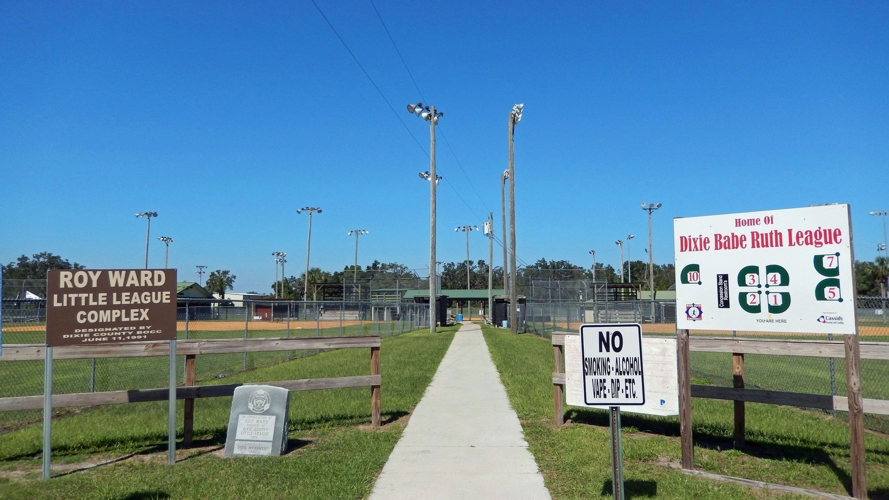
Roy Ward Little League Park Entrance
GEOGRAPHIC SORT Title Sort Marker Number Sort Marker Number Sort for Trails Publication Order Sort Publication Order Sort A Erected Year Sort Most Viewed Sort Most Recent-Interest Sort Most Recently Changed Sort SEE FAQ #33 FOR DESCRIPTIONS
On Northeast 241st Street at Northeast 165th Avenue, on the left when traveling east on Northeast 241st Street.
On U.S. 19 0.1 miles west of Northeast 223rd Avenue (County Road 351A), on the right when traveling north.
On Northeast 106th Street at Northeast 216th Avenue, on the right when traveling north on Northeast 106th Street.
On County Road 351 2.4 miles north of 1st St, Horseshoe Beach, on the left when traveling south.
On State Road 349 0.6 miles north of Pine Crest Drive, on the left when traveling north.
On County Route 55A at County Route 349, on the right when traveling east on County Route 55A.
On U.S. 19 at State Road 349, on the right when traveling west on U.S. 19.
Near County Route 349 just east of Canal Street(Southeast 199th Street).
On South Jefferson Street (U.S. 19) 0.5 miles north of Apalachee Parkway (U.S. 27), on the right when traveling north.
On Ashville Highway (County Route 146) at Livingston Road, on the left when traveling east on Ashville Highway.
On West Capps Highway (U.S. 27) north of County Road 257, on the right when traveling south.
On Courthouse Circle (U.S. 90) at South Jefferson Street (U.S. 19), on the right when traveling east on Courthouse Circle.
Near West Washington Street (Florida Route 10) at North Hickory Street.
On West Washington Street west of Mahan Drive, on the right when traveling west.
Near Sunray Road 0.6 miles south of Mahan Drive (U.S. 90), on the right when traveling south.
Paid Advertisement
On Groover Road (County Road 6) at Rains Road, on the right when traveling north on Groover Road. Reported missing.
On West Washington Street (U.S. 90) 0.1 miles west of Mahan Drive, on the right when traveling west.
Near Interstate 10 9 miles east of Route 257, on the right when traveling east.
Near Interstate 10 9 miles west of Route 150, on the right when traveling west.
On 2nd Street at Park Avenue, on the right when traveling east on 2nd Street.
On Mamie Scott Drive north of Cypress Street, on the left when traveling north.
On Jefferson Street (Courthouse Circle) (U.S. 19) at Washington Street (U.S. 90), on the left when traveling north on Jefferson Street (Courthouse Circle).
On West Washington Street (Florida Route 10) at South Water Street, on the left when traveling west on West Washington Street.
On Jefferson Street (Courthouse Circle) (U.S. 19) at Washington Street (U.S. 90), on the left when traveling north on Jefferson Street (Courthouse Circle).
Near Sunray Road 0.6 miles south of Mahan Drive (U.S. 90), on the right when traveling south.
Near Sunray Road 0.6 miles south of Mahan Drive (U.S. 90), on the right when traveling south.
On Interstate 10, on the right when traveling west.
On Walnut Street at North Olive street, on the left when traveling east on Walnut Street.
On Boston Highway (County Road 149) 1.2 miles north of Fulford Road, on the left when traveling north.
On West Washington Street (U.S. 90) at Jefferson Street (Courthouse Circle) (U.S. 19), on the right when traveling east on West Washington Street.
On East Washington Street (U.S. 90) 0.1 miles east of North Marvin Street, on the right when traveling west.
Paid Advertisement
Near Sunray Road 0.6 miles south of Mahan Drive (U.S. 90), on the right when traveling south.
Near Sunray Road 0.6 miles south of Mahan Drive (U.S. 90), on the right when traveling south.
On North Jefferson Street (U.S. 19) south of West Pearl Street, on the right when traveling south.
On Methodist Church Road 0.1 miles east of Waukeenah Highway (County Road 259), on the right when traveling east.
On West Main Street (U.S. 27) at Monroe Street, on the right when traveling west on West Main Street.
On West Main Street (U.S. 27) west of North Fletcher Avenue (State Road 51), on the right when traveling west.
On Oak Street just south of U.S. Alt 27, on the right when traveling north.
On A Street, on the left when traveling south.
On 2nd Street at C Street, on the right when traveling east on 2nd Street.
On 2nd Street at B Street, on the left when traveling east on 2nd Street.
Near SW 166th Court, in the median.
On G Street at Third Street, on the right when traveling north on G Street.
On South Main Street at East Park Avenue, on the right when traveling south on South Main Street.
Near NW 115th Street (Florida Route 320) 0.5 miles west of North Young Boulevard (U.S. 98).
Near NW 115th Street (Florida Route 320) 0.5 miles west of U.S. 98.
Near NW 115th Street (U.S. 320) 0.5 miles west of North Young Boulevard (U.S. 98) when traveling west.
Paid Advertisement
Near U.S. 27/98, on the right when traveling east.
On U.S. 19 0.1 miles north of County Route 326, on the right when traveling south.
On State Road 19, on the right when traveling south.
Near Canal Road (Spillway Road) 0.8 miles south of Route 40, on the left when traveling west.
Near West Riverwood Drive 1.7 miles east of North Basswood Avenue, on the left when traveling east.
Near Southeast 90th Avenue 0.3 miles south of Route 40, on the right when traveling south.
Near West Riverwood Drive 1.7 miles east of North Basswood Avenue, on the left when traveling east.
On State Road 24, on the right when traveling north.
Near SE 1st Avenue at SE 6th Street, on the right when traveling east.
Near SE 1st Avenue at SE 6th Street, on the right when traveling east.
Near SE 1st Avenue at SE 6th Street, on the right when traveling east.
On NE Drew Way 0.2 miles east of U.S. 90, on the left when traveling east.
On Northwest 140th Street at Northwest Heron Drive, on the left when traveling north on Northwest 140th Street.
On U.S. 90 0.1 miles west of Northwest Elizabeth Sims Loop, on the right when traveling east.
On SW Ray Charles Avenue.
On U.S. 90 at Broad Street, on the right when traveling east on U.S. 90.
Paid Advertisement
Near Interstate 10 (Interstate 10 at milepost 265), 3.5 miles east of County Road 255, on the right when traveling west.
Near U.S. 10 at milepost 265 west of County Road 255.
On U.S. 90 at Northeast Macedonia Church Road, on the right when traveling west on U.S. 90.
On SE Boundary Bend Trail 2.8 miles east of County Road 255, on the left when traveling east.
On Northwest Marion Street just east of Northwest Meeting Avenue, on the left when traveling east.
On Southwest Range Avenue just south of Base Street, on the left when traveling south.
Near Southwest Pinckney Street just east of Shelby Street, on the right when traveling east.
On East Base Street (U.S. 90) at Southwest Shelby Avenue, on the right when traveling east on East Base Street.
On Southwest Rutledge Street at Southwest Horry Avenue, on the right when traveling east on Southwest Rutledge Street.
On Northeast Marion Street at Northeast Range Avenue, on the right when traveling west on Northeast Marion Street.
On West Pinckney Street at South Orange Street, on the right when traveling west on West Pinckney Street.
On Northwest Meeting Avenue 0.1 miles north of Northwest Livingston Street, on the right when traveling north.
On West Base Street (U.S. 90), on the right when traveling east.
On East Base Street (U.S. 90) east of Northeast Range Avenue, on the right when traveling west.
Near Northwest 205th Street at Northwest 140th Street.
On State Road 14 0.1 miles north of County Road 360, on the right when traveling south.
Paid Advertisement
On North Duval Street (Florida Route 145) at Northeast Marion Street, on the right when traveling north on North Duval Street.
On Northeast Horry Avenue at Marion Street, on the right when traveling north on Northeast Horry Avenue.
On South Range Street (State Road 14), on the left when traveling north.
On Lakeshore Drive at Priest Street, on the right when traveling west on Lakeshore Drive.
On Southwest Range Avenue (Florida Route 14) at Southwest Santa Fe Street, on the right when traveling north on Southwest Range Avenue.
On East Base Street (U.S. 90) at Northeast Range Avenue, on the right when traveling west on East Base Street.
On West Base Street (U.S. 90), on the left when traveling east.
On Southwest Rutledge Street at Southwest Range Avenue, on the right when traveling west on Southwest Rutledge Street.
On West Base Street (U.S. 90), on the left when traveling east.
On Hampton Spring Road, on the right when traveling west.
Near North Jefferson Street (U.S. 221) at West Cherry Street, on the right when traveling north.
Near North Jefferson Street (U.S. 221) at West Cherry Street, on the right when traveling north.
Near North Jefferson Street (U.S. 221) at West Cherry Street, on the right when traveling north.
Near North Jefferson Street (U.S. 221) at West Cherry Street.
Near U.S. 19/27 0.2 miles south of Providence Road, on the right when traveling south.
On U.S. 19 at Forest Park Drive, on the right when traveling south on U.S. 19.
Paid Advertisement
On North Jefferson Street (U.S. 221) just north of East Lafayette Street, on the right when traveling north.
On Martin Luther King Jr. Avenue at 6th Street, on the left when traveling west on Martin Luther King Jr. Avenue.
Near North Jefferson Street (U.S. 221) at West Cherry Street, on the right when traveling north.
Near North Jefferson Street (U.S. 221) at West Cherry Street, on the right when traveling north.
Near N. Jefferson Street at W. Cherry Street.
︽
152 entries matched your criteria. The first 100 are listed above.
The final 52 ⊳