135 entries match your criteria. The first 100 are listed. ⊳
Former U.S. Presidents: #12 Zachary Taylor Historical Markers
By Sandra Hughes, September 13, 2013
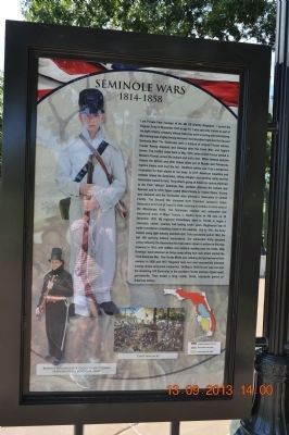
Seminole Wars Marker
| 1 ► Alabama, Madison County, Huntsville — Seminole Wars / Mexican War — |
| On Monroe Street Northwest at Washington Street Northwest, on the left when traveling east on Monroe Street Northwest. | |||
| 2 ► Alabama, Madison County, Huntsville — War of 1812 — 1812 - 1815 — |
| On Monroe Street Northwest at Washington Street Northwest, on the left when traveling east on Monroe Street Northwest. | |||
| 3 ► Arkansas, Benton County, Bella Vista — United States Commanders in Chief — |
| 4 ► Arkansas, Crawford County, Van Buren — Overlooking His Domain — |
| Near North 3rd Street, 0.1 miles south of Knox Street, on the right when traveling south. | |||
| 5 ► California, Nevada County, Rough and Ready — 294 — Rough and Ready — |
| On Rough and Ready Highway at Mountain Rose Road, on the right when traveling west on Rough and Ready Highway. | |||
| 6 ► California, San Francisco City and County, San Francisco, Chinatown — 119 — Portsmouth Plaza — An Historic Shrine — |
| Near Kearny Street near Washington Street. | |||
| 7 ► California, San Francisco City and County, San Francisco, South Beach — King Street — |
| On King Street near 2nd Street. | |||
| 8 ► Delaware, Kent County, Dover — John M. Clayton — |
| Near South Governor's Avenue, 0.1 miles south of W North Street, on the right when traveling south. | |||
| 9 ► Delaware, Kent County, Milford — KC-92 — Parson Thorne Mansion — (Silver Hill) — |
| Near NW Front Street (Delaware Route 14) near Maple Avenue, on the left when traveling east. | |||
| 10 ► Delaware, New Castle County, New Castle — NC-15 — Buena Vista — |
| Near U.S. 13. | |||
| 11 ► Delaware, New Castle County, Wilmington — NC-181 — Lincoln's Speech — |
| On 4th Street just south of Market Street, on the left when traveling north. | |||
| 12 ► Delaware, Sussex County, Dagsboro — SC-59 — Dagsboro — |
| On Main Street, (Delaware Route 26), (Delaware Route 20) near Canal Street, on the right when traveling north. | |||
| 13 ► District of Columbia, Washington, Northwest Washington, Penn Quarter — The New Willard — Erected 1901 — |
| On Pennsylvania Avenue Northwest at 14th Street Northwest (Highway 1), on the right when traveling west on Pennsylvania Avenue Northwest. | |||
| 14 ► Florida, Highlands County, Fort Basinger — F-54 — Fort Basinger — |
| On U.S. 98, 0.1 miles north of County Road 721, on the right when traveling north. | |||
| 15 ► Florida, Hillsborough County, Tampa — Officers Quarters Fort Brooke — Brigadier General Zachary Taylor — (12th President of the United States) — |
| On South Franklin Street south of East Whiting Street, on the right when traveling north. | |||
| 16 ► Florida, Okeechobee County, Okeechobee — Battle of Okeechobee — |
| On Southeast 38th Avenue, 0.2 miles north of U.S. 98/441, on the right when traveling north. | |||
| 17 ► Florida, Polk County, Highland City — Fort Fraser — |
| Near Bartow Road (U.S. 98) at County Road 540A, on the right when traveling north. | |||
| 18 ► Florida, Polk County, Lake Wales — Fort Gardiner |
| On Camp Mack Road at Rosalie Boulevard, on the right when traveling east on Camp Mack Road. Reported permanently removed. | |||
| 19 ► Florida, Seminole County, Sanford — Mount Vernon Grove — Featured Tree — Mount Vernon Red Maple — |
| Near West 7th Street just west of Myrtle Avenue, on the right when traveling west. | |||
| 20 ► Florida, Taylor County, Steinhatchee — F-461 — Deadman Bay, Stephensville and Steinhatchee — |
| On Riverside Drive (State Road 51) at 11th Street East, on the right when traveling west on Riverside Drive. | |||
| 21 ► Georgia, Jeff Davis County, Hazlehurst — 080-1 — Jeff Davis County — |
| On Jeff Davis Street, on the left when traveling north. | |||
| 22 ► Georgia, Richmond County, Augusta — 121-36 — Summerville Cemetery — |
| On Cumming Road at Johns Road, on the right when traveling east on Cumming Road. | |||
| 23 ► Georgia, Taylor County, Butler — 133-4 — Taylor County — |
| On West Main Street (Georgia Route 137) at South Broad Street (U.S. 19) when traveling east on West Main Street. | |||
| 24 ► Illinois, Adams County, Quincy — A Quincy "Copperhead" — Looking for Lincoln — |
| On Maine Street at 5th Street, on the right when traveling east on Maine Street. | |||
| 25 ► Illinois, Adams County, Quincy — Lincoln Correspondent — Looking for Lincoln — |
| On North 5th Street at Hampshire Street on North 5th Street. | |||
| 26 ► Illinois, Hancock County, Warsaw — Fort Edwards Monument — |
| On Fort Edwards Street west of North 3rd Street, on the right when traveling west. | |||
| 27 ► Illinois, Hancock County, Warsaw — Forts on the Bluffs — |
| On Fort Edwards Street west of North 3rd Street, on the right when traveling west. | |||
| 28 ► Illinois, Rock Island County, Hillsdale — Black Hawk War Campsite — |
| On Hurd Road, 0.2 miles east of Jackson Street, on the right when traveling east. | |||
| 29 ► Illinois, Sangamon County, Springfield — Lincoln's Hat — Looking for Lincoln — |
| On 5th Street just north of E. Adams Street. | |||
| 30 ► Indiana, Carroll County, Pyrmont — Pyrmont / 1812 Hopkins’ Expedition — |
| On South 800 West at West 550 South on South 800 West. | |||
| 31 ► Indiana, Knox County, Vincennes — Sarah Knox Taylor — |
| On Park Street south of Harrison Street, on the left when traveling south. | |||
| 32 ► Indiana, Vigo County, Terre Haute — Fort Harrison — 1812 - 1912 — |
| Near McCullough Avenue (becomes 4th Street) north of Fort Harrison Road. | |||
| 33 ► Indiana, Vigo County, Terre Haute — Ft. Wm. Henry Harrison — 1811-1822 |
| On U.S. 41 at Fort Harrison Road, on the right when traveling south on U.S. 41. Reported missing. | |||
| 34 ► Indiana, Wabash County, Wabash — Quarters of Lewis Cass — Governor of Michigan — |
| Near E. Market Street, 0.2 miles east of S. Allen Street. | |||
| 35 ► Iowa, Scott County, Bettendorf — 1 — Historic Davenport / Interstate 80 Bridge — |
| Near Interstate 80 at milepost 300,, 1.9 miles east of Interstate 74, on the right when traveling east. | |||
| 36 ► Iowa, Scott County, Bettendorf — 2 — Historic Davenport / Interstate 80 Bridge — |
| Near Interstate 80 at milepost 300,, 1.1 miles west of Middle Road, on the right when traveling west. | |||
| 37 ► Kansas, Bourbon County, Fort Scott — Infantry Life — |
| Near Old Fort Boulevard. | |||
| 38 ► Kansas, Linn County, Trading Post — Sounds along the byway...saws, picks and axes. — Frontier Military Historic Byway — |
| 39 ► Kansas, Shawnee County, Topeka — Corridor of Flags — |
| Near NW Railroad Street near NW Curtis Street, on the left when traveling west. | |||
| 40 ► Kentucky, Boone County, Richwood — 1194 — Major John P. Gaines — |
| On Richwood Road (Kentucky Route 338), on the right when traveling west. | |||
| 41 ► Kentucky, Franklin County, Frankfort — 1154 — Crittenden House / An Eminent Statesman — |
| On West Main Street at Washington Street, on the left when traveling west on West Main Street. | |||
| 42 ► Kentucky, Franklin County, Frankfort — 1653 — Liberty Hall / John Brown (1757-1837) — |
| On Wilkinson Street, on the right when traveling south. | |||
| 43 ► Kentucky, Jefferson County, Louisville — 2376 — Croghans of Locust Grove / Major William Croghan — 1752-1822 — |
| Near Payne Street. | |||
| 44 ► Kentucky, Jefferson County, Louisville — 111 — Zachary Taylor Home — Zachary Taylor (1784 - 1850) — |
| On Blankenbaker Lane at Apache Road on Blankenbaker Lane. | |||
| 45 ► Kentucky, Jefferson County, Louisville — 1849 — Zachary Taylor Home — |
| On Apache Road. | |||
| 46 ► Kentucky, Jefferson County, Louisville — 1412 — Zachary Taylor National Cemetery — |
| On Brownsboro Road (U.S. 42), on the right when traveling west. | |||
| 47 ► Kentucky, Taylor County, Campbellsville — 995 — Campbellsville / Taylor County — |
| On East Broadway (Kentucky Route 68) at North Columbia Avenue, on the right when traveling east on East Broadway. | |||
| 48 ► Louisiana, Ascension Parish, Gonzales — The Mexican-American War — The Louisiana Connection — |
| Near South Irma Boulevard, 0.3 miles north of East Worthey Street, on the right when traveling north. | |||
| 49 ► Louisiana, Ascension Parish, Gonzales — The Mexican-American War — 1846-1848 — |
| Near South Irma Boulevard, 0.3 miles north of East Worthey Street, on the right when traveling north. | |||
| 50 ► Louisiana, East Baton Rouge Parish, Baton Rouge, Downtown — Pentagon Barracks — A Four-Sided Pentagon — |
| On North 3rd Street north of State Capitol Drive, on the right when traveling north. | |||
| 51 ► Louisiana, East Baton Rouge Parish, Baton Rouge, Downtown — Zachary Taylor — |
| On North 3rd Street at Spanish Town Road, on the left when traveling south on North 3rd Street. | |||
| 52 ► Louisiana, East Baton Rouge Parish, Baton Rouge, Downtown — 1 — Zachary Taylor Home Site — |
| On Lafayette Street west of North 3rd Street, on the right when traveling south. | |||
| 53 ► Louisiana, East Baton Rouge Parish, Baton Rouge, Highlands/Perkins — John Baptiste Kleinpeter — 1797-1861 — |
| On Oxford Avenue, 0.1 miles south of East Parker Boulevard, on the left when traveling south. | |||
| 54 ► Louisiana, Natchitoches Parish, Natchitoches — The American Transition — |
| On 2nd Street at Sibley Street, on the left when traveling north on 2nd Street. | |||
| 55 ► Louisiana, Natchitoches Parish, Natchitoches — The Red River Campaign — |
| On Front Street (State Highway 6) at Trudeau Street, on the right when traveling north on Front Street. | |||
| 56 ► Louisiana, Orleans Parish, New Orleans, French Quarter — The Washington Artillery Park — American Revolution Bicentennial: 1776-1976 — |
| On Decatur Street east of St. Peter Street, on the right when traveling east. | |||
| 57 ► Louisiana, Rapides Parish, Pineville — The Red River Campaign — March 1864 — |
| On Riverfront Street west of Main Street, on the left when traveling west. | |||
| 58 ► Louisiana, Sabine Parish, Many — Fort Jesup — |
| On Old Louisiana 6 (State Highway 3118) at Geoghangan Road, on the right when traveling north on Old Louisiana 6. | |||
| 59 ► Maryland, Calvert County, St. Leonard — The Garden of Remembrance — |
| On St. Leonard Road (Maryland Route 765) 0.1 miles south of Calvert Beach Road, on the right when traveling south. | |||
| 60 ► Maryland, Garrett County, Grantsville — Casselman River Bridge State Park — Bicentennial 1813-2013 — |
| Near Casselman Road, 0.1 miles National Road (Route Alt-40). | |||
| 61 ► Maryland, Garrett County, Grantsville — Casselman River Bridge State Park — Bicentennial 1813-2013 — |
| On National Pike (Route Alt-40) 0.3 miles east of Patton Lane, on the left when traveling east. | |||
| 62 ► Maryland, Garrett County, Grantsville — Mountain Maryland Gateway to the West — Garrett County, Maryland — |
| On Casselman Road, 0.2 miles west of National Pike (Alternate U.S. 40), on the left when traveling west. | |||
| 63 ► Maryland, Prince George's County, Laurel — 12 — Early Buildings on St. Mary's Place — City of Laurel Walking Tour — Site 12 — |
| On Saint Marys Place south of Main Street, on the left when traveling north. | |||
| 64 ► Maryland, Washington County, Hagerstown — Hagerstown & The National Road — |
| On West Washington Street (Maryland Route 144) just west of West Side Avenue, on the right when traveling west. | |||
| 65 ► Massachusetts, Barnstable County, Chatham — History of Chatham Lighthouse — |
| On Main Street. | |||
| 66 ► Michigan, Wayne County, Taylor — Town Hall — |
| Near Pardee Road, 0.3 miles north of Northline Road. | |||
| 67 ► Minnesota, Ramsey County, Saint Paul, West Seventh - Fort Road — Alexander Ramsey House — |
| On Exchange Street South at Walnut Street, on the right when traveling west on Exchange Street South. | |||
| 68 ► Mississippi, Jackson County, Pascagoula — Camp Twiggs and the Military Asylum 1849-1855 — |
| On Beach Boulevard, 0.1 miles east of Westwood Street, on the right when traveling east. | |||
| 69 ► Mississippi, Jackson County, Pascagoula — President Zachary Taylor's Summer Home Site — United States of America — |
| On Beach Boulevard west of City Park Street, on the right when traveling west. | |||
| 70 ► Mississippi, Jackson County, Pascagoula — The Round Island Affair - 1849 — |
| On Beach Boulevard at Pascagoula Street, on the right when traveling east on Beach Boulevard. | |||
| 71 ► Mississippi, Jefferson County, Rodney — History of Rodney - Her Rise — Windsor Battlefield Tour — |
| On Muddy Bayou Road near Rodney Road, on the right when traveling north. | |||
| 72 ► Missouri, Lincoln County, Troy — Troy — |
| On Boone Street at Main Street, on the right when traveling east on Boone Street. | |||
| 73 ► Missouri, Lincoln County, Troy — Woods Fort — |
| On Main Street at Boone Street, on the right when traveling south on Main Street. | |||
| 74 ► New York, Erie County, Buffalo, Downtown — From Frontier to Major City / Buffalo City Hall — Buffalo History and Architecture — Niagara Square West — |
| Near Niagara Square at Niagara Street. | |||
| 75 ► New York, Orange County, West Point — Wars That Shaped the Nation — The Mexican War — |
| On Washington Road, on the right when traveling west. | |||
| 76 ► New York, Saratoga County, Ballston Spa — Captain Abner Doubleday — Major General, United States Army — |
| On Front Street near Court Street, on the right when traveling west. | |||
| 77 ► North Carolina, Lenoir County, Kinston — John Taylor Wood, CSN — And the Sinking of the USS Underwriter |
| On South Heritage Street at West Caswell Street, on the right when traveling south on South Heritage Street. Reported permanently removed. | |||
| 78 ► Ohio, Champaign County, Urbana — Champaign County Mexican War Memorial — |
| On U.S. 68 at Pearce Place on U.S. 68. | |||
| 79 ► Ohio, Mahoning County, Canfield — 31-50 — Elisha Whittlesey — |
| On South Broad Street (U.S. 62) at Newton Square Drive, on the right when traveling south on South Broad Street. | |||
| 80 ► Oklahoma, Bryan County, Durant — 183 — Fort Washita — |
| On State Highway 199, 3.5 miles west of State Highway 78, on the left when traveling east. | |||
| 81 ► Oklahoma, Choctaw County, Fort Towson — Transportation Crossroads — |
| On Fort Towson Historic Site Road (County Road E2060) 0.5 miles west of County Road N4375. | |||
| 82 ► Pennsylvania, Cumberland County, Shippensburg — General Samuel Sturgis: Hero of Antietam's Burnside Bridge — Shippensburg Civil War Trail — |
| On West King Street (U.S. 11) west of Earl Street, on the left when traveling west. | |||
| 83 ► Pennsylvania, Delaware County, Glen Mills, Concord Township — War of 1812 / Mexican War — Concord Township American Hero Memorial — Honor • Remembrance • Courage • Fortitude — |
| On Smithbridge Road east of Bob Mench Drive, on the left when traveling east. | |||
| 84 ► Pennsylvania, Fulton County, McConnellsburg — Traveling the Lincoln Highway — Lincoln Highway Heritage Corridor — |
| On Lincoln Highway East (Pennsylvania Route 16), on the left when traveling east. | |||
| 85 ► Pennsylvania, Lancaster County, Lancaster — Old Center Square (Penn Square) — |
| On Queen Street at King Street, on the right when traveling north on Queen Street. | |||
| 86 ► Pennsylvania, Susquehanna County, Lanesboro — Starrucca Viaduct - The Bridge of Stone — |
| On Depot Street east of Starrucca Viaduct, on the right when traveling east. | |||
| 87 ► Pennsylvania, Westmoreland County, Latrobe — The Johnston House at Kingston — Est, 1815 — Lincoln Highway Heritage Corridor — |
| 88 ► Tennessee, Benton County, Eva — Injuring Sherman — |
| Near Pilot Knob Road (Tennessee Route 191) 0.2 miles east of Cherry Ridge Road. | |||
| 89 ► Tennessee, Giles County, Pulaski — Neill Smith Brown — (1810-1886) — |
| Near South Rhodes Street north of East Cemetery Street, on the right when traveling north. | |||
| 90 ► Tennessee, Shelby County, Memphis — Waterproof, Louisiana/Ashland Landing, Mississippi — Panel # 27 — |
| On Island Drive. | |||
| 91 ► Texas, Cameron County, Boca Chica — 4739 — Site of Camp Belknap — |
| On Boca Chica Boulevard (State Highway 4) 0.1 miles west of Quicksilver Avenue. | |||
| 92 ► Texas, Cameron County, Brownsville — 641 — Cameron County — |
| On East 11th Street north of East Madison Street, on the right when traveling north. | |||
| 93 ► Texas, Cameron County, Brownsville — Federal Court Site — |
| On East Elizabeth Street at East 12th Street (Business U.S. 77), on the left when traveling south on East Elizabeth Street. | |||
| 94 ► Texas, Cameron County, Port Isabel — 4082 — Port of Matamoros — |
| Near Maxan Road. | |||
| 95 ► Texas, Guadalupe County, Seguin — 2298 — Guadalupe County, C.S.A. — |
| On East Donegan Street, on the right when traveling west. | |||
| 96 ► Texas, Hale County, Plainview — 2327 — The Hackberry Groves — Birthplace of City of Plainview — |
| On Cedar Street south of 2nd Street, on the left when traveling south. | |||
| 97 ► Texas, Hardin County, Kountze — 11149 — General Braxton Bragg, C.S.A. — (1817-1876) — |
| On State Highway 326, on the left when traveling east. | |||
| 98 ► Texas, Kinney County, Brackettville — 18148 — John Horse — |
| On Travis Road at Cam Hacinda, on the left when traveling east on Travis Road. | |||
| 99 ► Texas, Kleberg County, Kingsville — 5206 — Taylor Camp Site, 1846 — |
| On South 6th Street (Business U.S. 77) south of Cecil Avenue, on the right when traveling south. | |||
| 100 ► Texas, Kleberg County, Riviera — 5588 — U.S. Army March to Rio Grande, 1846 — Approximate Route of — |
| On U.S. 77, 0.9 miles north of Ranch to Market Road 628, on the right when traveling south. | |||
135 entries matched your criteria. The first 100 are listed above. The final 35 ⊳