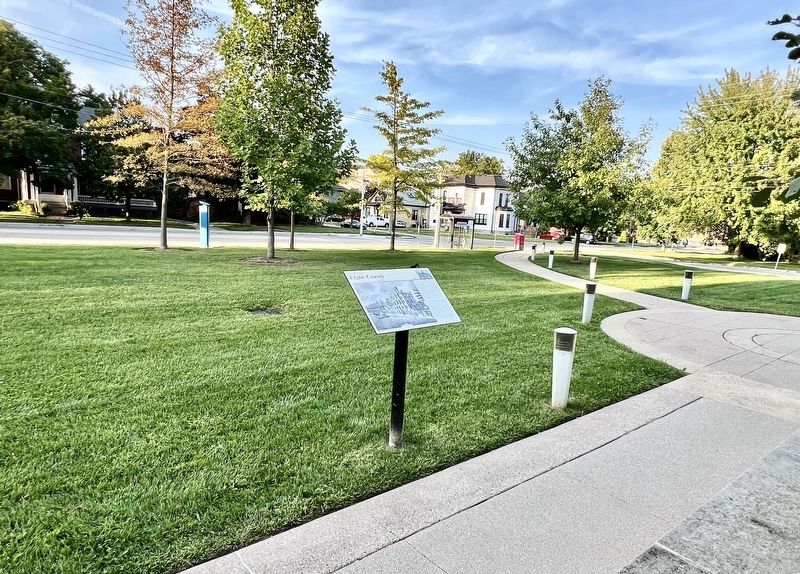
The Elgin County Courthouse was built in 1852-53 and is one of the earliest pre-Confederation county courthouses in Ontario. Along with the courthouses of Brant and Norfolk Counties, the
Elgin County Courthouse is one of the three . . . — — Map (db m255667) HM
After a fire in 1898, St. Thomas architect Neil R. Darrach was commissioned to repair and enlarge the courthouse to meet its growing needs. Darrach's plans closely followed the designs done by the original architect John Turner when he . . . — — Map (db m255665) HM
The Elgin County Courthouse has stood as a St. Thomas cultural landmark for more than 150 years. Its restoration and renovation will preserve its historical stature and allow it to continue serving the local and the extended community for . . . — — Map (db m255657) HM
On Sunday, June 25 1916, a crowd of 20,000 gathered at the Michigan Central Station to see off the 940 men of the Elgin Regiment's 91st Battalion.
Travelling by train from St. Thomas to Halifax, they crossed the Atlantic aboard the Olympic and . . . — — Map (db m255841) HM
Ontario's eleventh prime minister was born in nearby Yarmouth Township and educated at St. Thomas Collegiate. After serving in World War I, he was elected to the federal parliament in 1926 as member for Elgin West. In 1930 he was named leader of the . . . — — Map (db m255738) HM
On September 15, 1885, the giant African elephant, star of the Barnum and Bailey Circus, met a untimely death when struck in St. Thomas by a Grand Trunk locomotive. To commemorate the one hundredth anniversary of this tragic event, the citizens of . . . — — Map (db m78342) HM
In a fall of 1814 American general Duncan McArthur lead an expedition of 600 mounted riflemen, mostly Kentucky and Ohio volunteers, into Upper Canada from Detroit. He intended to attack Burlington Heights, the closest British encampment, in concert . . . — — Map (db m255604) HM
RCAF Technical Training School
The only facility of its kind in Ontario during the Second World War, No. 1 Technical Training School, St. Thomas, was established by the Royal Canadian Air Force in 1939 to produce skilled ground crews for . . . — — Map (db m255293) HM
[English] The St. Thomas Canada Southern (CASO) Station, financed by American railway promoters, was constructed between 1871 and 1873 to serve as both the passenger station for St. Thomas and CASO's corporate headquarters. During the 1920s, . . . — — Map (db m198268) HM
The St. Thomas Street railway opened in 1879. Although it was originally a horse drawn trolley line, the ten mile line was modernized with electrical power in 1898. By 1908, St. Thomas was home to seven different railways. It was then that St. . . . — — Map (db m255838) HM
This church was completed in 1824 on land given by Capt.
Daniel Rapelje, the founder of the city of St. Thomas.
It is one of the province's finest remaining examples
of Early English Gothic Revival architecture. In 1825
a tower, steeple and . . . — — Map (db m255608) HM
This property once belonged to John Rolph, a prominent
physician, lawyer and legislator. Born in England, he
emigrated to Upper Canada in 1812. In 1824, with Dr.
Charles Duncombe, he established at St. Thomas the
province's first medical school, . . . — — Map (db m255560) HM
Jonathan Doan (1765-1847), a member of the Society of Friends, came to Upper Canada from Pennsylvania about 1789. He settled first in the Niagara peninsula, and then purchased 200 acres of wilderness here in south Yarmouth Township in . . . — — Map (db m252787) HM
On this site stood the home of Samuel Edison, a Loyalist from New Jersey who had moved to Nova Scotia in 1783 and settled here in 1811. During the War of 1812 he served as a captain in the 1st Middlesex Militia. Tradition maintains that this . . . — — Map (db m283492) HM
Born and educated in Walllacetown, Sifton joined the 18th Battalion, Canadian Expeditionary Force, in October, 1914. During the Canadian attack on Vimy Ridge on April 9, 1917, his company was held up by the fire of a German machine gun. . . . — — Map (db m253504) HM
Elgin County's first settlers arrived near this spot in 1809 and by the time the War of 1812 broke out they had only been on the land for a few years. Outside of occasional militia service, the war had little impact on their lives until the fall of . . . — — Map (db m253508) HM
A fine example of early Gothic Revival-architecture, this
Anglican church lies in the midst of the original Talbot
Settlement. The nave was erected by the congregation in 1827.
The belfry and tower, added in 1845 to accommodate a bell
donated by . . . — — Map (db m253500) HM
• One of Elgin County's most successful early communities, Tyrconnell was a busy port community during pioneer days.
• Mills, greatly needed in the region, were established as early as 1817. Other early additions included a warehouse, post . . . — — Map (db m255471) HM
At the beginning of the war of 1812, US General William Hull briefly invaded Southwestern Ontario from Fort Detroit. General Sir Isaac Brock both military commander and civilian governor of Upper Canada at the start of the war, responded by . . . — — Map (db m255473) HM
Amherstburg First Baptist Church
Constructed by 1848-1849, at a terminus of the Underground Railroad near the
United States border, this church offered sanctuary to African Americans fleeing slavery and helped foster a . . . — — Map (db m300323) HM
[West Historic Marker]:Amherstburg Navy Yard
A Navy Yard was built here in 1796 to replace Detroit as the base and supply depot for the Provincial Marine on Lakes Erie and Huron. In 1812 the GENERAL HUNTER and QUEEN CHARLOTTE, built . . . — — Map (db m37552) HM
Belle Vue
Built between 1816 and 1819 for Robert Reynolds, Deputy Assistant Commissary
General of the garrison at Fort Malden,
Belle Vue is one of the finest examples of Palladian architecture in Canada.
In keeping with this . . . — — Map (db m300330) HM
This house, one of the finest remaining examples of domestic Georgian architecture in Ontario, was commenced in 1816 and completed about 1819, by Robert Reynolds, the commissary to the garrison at Fort Malden. Bellevue was also the home of his . . . — — Map (db m103677) HM
Boblo Island
For many centuries the island you see in front of you was used for hunting and fishing by First Nations people. Called Île aux Bois Blancs by the French, Boblo Island's key location made it a site for . . . — — Map (db m71185) HM
Brick Officers' Guard Room
and Staff Sergeant's Quarters
(1839)
Poste de garde des officiers en
briques et quartiers du sergent
de l'etat-major (1839) — — Map (db m71220) HM
On January 9, 1838, a force of Canadians and Americans sympathizing with Mackenzie's rebellion, sailed from United States territory and landed on Bois Blane Island. The schooner "Anne," supporting the invasion, cruised along the Canadian mainland . . . — — Map (db m37246) HM
This church was built in 1818-19 on land donated by Col. William Caldwell. One of the earliest Anglican places of worship in western Upper Canada, it was constructed through the efforts of the Reverend Richard Pollard, an itinerant missionary . . . — — Map (db m300326) HM
Near this site stood the house erected in 1784 by Matthew Elliott. Born in Ireland, he emigrated to the American Colonies in 1761, and during the Revolution served with the British forces as a captain in the Indian Department. He was an Indian agent . . . — — Map (db m37286) HM
Connection to Town
Fort Malden (originally called Fort Amherstburg) was the anchor of the town, which grew to the south. In this view, you are looking past the parade grounds of the fort (now a park) down Dalhousie Street . . . — — Map (db m71192) HM
Detroit River Heritage
This river not only forms the border between two great nations, but is also a vital transportation artery into the upper Great Lakes. Imagine the vessels that have travelled on it … First National canoes, . . . — — Map (db m71160) HM
The post was begun by the Royal Canadian Volunteers in 1796 to replace Detroit and to maintain British influence among the western Indians. As the principal defense of the Detroit frontier in 1812, it was here that Isaac Brock gathered his forces . . . — — Map (db m34353) HM
Fort Defences
In front of you is a recreated piece of the fort's palisade, a vertical wall of sharpened logs. This wall surrounded the fort, linking the four diamond-shaped corner projections, called bastions. Around each . . . — — Map (db m71173) HM
Fort Malden Points of Interest • Fort Malden Points d'intérêt
(1) Visitor Centre
1939
Centre d'accueil
1939
(2) Military Pensioner's Cottage
circa 1851 (Restoration) . . . — — Map (db m71278) HM
Indian Council House
Two hundred years ago a small building stood about 100 metres north of here, close to the water's edge. This was where meetings took place between the representatives of the British government and those of . . . — — Map (db m71170) HM
Born about 1750 in Fermanagh County, Ireland, Caldwell emigrated to Pennsylvania in 1773. During the American Revolution he served with the British forces as a captain in Butler's Rangers at Niagara and Detroit. In 1784 he obtained land near the . . . — — Map (db m37291) HM
Born at Queenston in Upper Canada, John Richardson served as a volunteer at Fort Malden during the War of 1812 and was taken prisoner by the Americans at Moraviantown. He was released at war's end, retired on half-pay in 1818, and spent . . . — — Map (db m278028) HM
Park House
This 18th-century house is a rare example of a once-common building
type, with its French-framed poteaux-en-coulisse (grooved post) construction,
asymmetrical design, and centre-passage plan. Its original waterfront . . . — — Map (db m300322) HM
Pensioner's Cottage
This cottage was built in the early 1850s for a retired soldier and his family. About 85 of these homes were constructed just east of the Fort, and leased at a modest rate to veteran soldiers in return for light . . . — — Map (db m71167) HM
Privy
The foundations in front of you are from a communal privy (toilet) for enlisted men and their families that stood here in 1840. The women and children had a small room - the soldiers made do with an open structure offering . . . — — Map (db m71221) HM
River Canard Bridge
Built in 1937 as part of the Ontario government's Depression-era public works program, the construction of this bridge was funded jointly by the Province and Essex County and provided essential unemployment . . . — — Map (db m300234) HM
Shoreline Breakwall
Over time, the force of water and ice has eroded the river bank, creating the need to stabilize the shore. Parks Canada, the Essex Region Conservation Authority (ERCA) and Environment Canada partnered to . . . — — Map (db m71161) HM
Girty's life crossed cultural boundaries between native and white societies on the frontier of American settlement. In 1756 his family was captured by a French-led native war party in Pennsylvania. Simon was adopted by the Seneca, then repatriated . . . — — Map (db m34688) HM
English:
Skirmishes at the Canard River
In the War of 1812, the first engagement in Canada involving British and American forces in significant numbers occurred here on the Canard River. On July 12, 1812, Brigadier-General . . . — — Map (db m34336) HM
Strategic Location
A deepwater channel between here and Boblo Island brings ships close to shore, a fact dramatically illustrated when a north-bound lake freighter passes by. This was why Fort Amerstburg was originally located . . . — — Map (db m71191) HM
Tradition has it that the Indian leader Tecumseh stood upon this stone to deliver a final address to the British at Amherstburg after the Battle of Lake Erie. Donated in 1939, it originally stood near the corner of Dalhousie and Gore Streets. In . . . — — Map (db m34412) HM
In September 1813 the British squadron under R. Barclay sailed from Amherstburg to collect desperately needed food supplies. They were met by the larger, more heavily armed American squadron commanded by O. Perry. The British had the initial . . . — — Map (db m37707) HM
The office for the Commissariat Department was built in 1831 near the government wharf and storehouse. Commissary officials purchased from local contractors the flour, beef, straw and firewood used by troops. They also managed Fort Malden's . . . — — Map (db m37356) HM
Part of an ancient network of Indian paths, the Great Sauk Trail, as it came to be known, extended from Rock Island in present-day Illinois to the Detroit River. It played a significant role in the communications between the native peoples in the . . . — — Map (db m36976) HM
The Nazrey African Methodist Episcopal (AME) Church
In 1848, refugees from American slavery built this church by hand to serve Amherstburg's growing Black community. It is named for Bishop Nazery, who led many congregations, . . . — — Map (db m300325) HM
The Site Over Time
Today the site looks very different than it would have 170 years ago, when Fort Malden was at its height. Almost all the buildings from that period have been lost, and most of the ditch and wall that encircled . . . — — Map (db m71174) HM
This area was once the home of the Wyandot, remnants of the Huron, Neutrals, and Petuns who were dispersed by the Iroquois in the 1640's. Some eventually reunited and settled along the Detroit River, where they became known as the Hurons of Detroit, . . . — — Map (db m37340) HM
First Baptist Church, Puce
The origins of First Baptist Church go back to the 1840s,
when black settlers from the United States began to form
a farming community in this area. Their numbers increased
during the 1850s when the . . . — — Map (db m299914) HM
While the first Blacks arrived in the Puce River area during the 1830s, the community owed its existence largely to the Refugee Home Society. This abolitionist organization led by Henry and Mary Bibb offered support to escaped slaves who travelled . . . — — Map (db m299913) HM
The Founding of Belle River
The settlement of this area began following the survey in
1793 of the lots fronting on the Belle River. Among the early settlers were many French Canadians from the vicinity of the Detroit River. When . . . — — Map (db m299911) HM
C. 1900 historic building
former home of Craig Ainslie
general merchant
Masonic Parvaim Lodge
restored in 2024 by Alex Toth
Sem Construction
Baird AE — — Map (db m299872) HM
Built in 1887 by the Michigan Central Railway, the Essex Railway Station and the train tracks laid across the Talbot Trail established Essex Centre as the shipping hub of Essex County. The building was the only station of stone construction on the . . . — — Map (db m300426) HM
This unique car was one of two cars built
circa 1909 at the Essex Terminal Railway
yard. It sits on arch bar trucks from
steam locomotive tenders. These trucks
were banned in the 1920's and the car was
limited to use on Essex Terminal . . . — — Map (db m300428) HM
Before European settlement, First Nations living in the area of what is now the Town of Essex included the Three Fires Confederacy, comprised of the Ojibway, Odawa, and Potawatomi Peoples, and the Huron-Wendat Peoples. To open the area between . . . — — Map (db m300416) HM
Unitarian Universalist Church of Olinda. The Universalist faith developed in New England in the late 1700s and reached Canada in the early 1800s. Its central doctrine of universal salvation made it more liberal and inclusive than . . . — — Map (db m300505) HM
The Foundation of Stoney Point
French-speaking settlers from the Detroit-Sandwich area and Lower Canada (Quebec) were the first to locate in Tilbury West Township after it was surveyed in 1824. They established farms along Lake . . . — — Map (db m299874) HM
On the night of February 23-24, 1838, a small force of “Patriots" was ferried from Detroit to Fighting Island, opposite here, whence an attack against Sandwich was planned. They were joined the following day by "General” Donald McLeod, a British . . . — — Map (db m300223) HM
Middle Island
Middle Island is the most southern piece of land in Canada. Only a few metres from the Canada-US border, the tiny 22-hectare island is part of the western Lake Erie archipelago. Migrating birds and insects use the island to . . . — — Map (db m124119) HM
Parts of Mersea Township were surveyed in the 1790's, but it
was not until 1833 that Alexander Wilkinson, who had acquired land elsewhere in the township by 1810, obtained his patent for a lot now located in the heart of Leamington. A settlement . . . — — Map (db m300508) HM
Construction of this Lighthouse by the Oartier family in 1818 and its predecessor. A frame structure destroyed by fire in the latter years of the War of 1812. Established an enduring landmark at the river mouth and a dynasty by the Oartler family as . . . — — Map (db m198365) HM
Beginning in the 1830s, at least 30 families fleeing enslavement and racial oppression in the United States settled in the Banwell Road area in Sandwich East. They had the opportunity to purchase land through two Black-organized land settlement . . . — — Map (db m90183) HM
The cornerstone of St. John’s Church was laid with Masonic Honours on June 24th, 1872 by M. W. Bro William Mercer Wilson Grand Master of the Grand Lodge of Canada. Ancient free and accepted Masons assisted by Great Western Lodge #47. William Mercer . . . — — Map (db m286029) HM
Oliver Hazard Perry, only 27 when named commander of the Lake Erie fleet, won acclaim and respect for his tactical brilliance. By defeating the British (the first time an entire British fleet was captured) the Americans took control of Lake . . . — — Map (db m279043) HM
When the British withdrew from Detroit in 1796, they transferred the courts of the Western District to Sandwich (Windsor). An abandoned blockhouse, relocated from Chatham, served briefly as the court house and gaol until fire destroyed it in 1797. . . . — — Map (db m282917) HM
2:1 | Fur Trade Transportation in early Canada depended almost entirely upon the waterways. This area’s advantageous geography and rich natural resources, coupled with plentiful beaver, muskrat, bear, fox and fish explains the attraction to . . . — — Map (db m280026) HM
With honor and pride in memory of Gregory Robert McGregor Esq. Born 1737 Perthshire, Scotland, served in the French-Indian War then settled near Fort Detroit where he rose to prominence as 1st Sheriff of the District of Hesse in 1788, . . . — — Map (db m281630) HM
Massachusetts born, Hiram Walker had by the 1850s become a successful general merchant, distiller and grain dealer in Detroit. After Michigan adopted prohibition in 1855 he acquired land across the river in Canada where he established a distillery . . . — — Map (db m37377) HM
On July 4, 1812, Brigadier-General William Hull, commander of the North Western Army of the United States, landed with about 2,000 men near this site. He issued a proclamation stating that he came here to liberate Canada from oppression. The British . . . — — Map (db m34302) HM
5:1 | Introduction – The Great Lakes Basin The Great Lakes Basin is the home to the largest body of fresh water on earth. Connected by a capillary of rivers and lakes they form a network of transportation systems. The Windsor region is a focal . . . — — Map (db m280268) HM
In 1728 a mission to the Huron Indians was established near Fort Pontchartrain (Detroit) by Father Armand de la Richardie, S.J. The mission was moved to Bois Blane Island and the adjacent mainland in 1742. In 1747 it was destroyed by disaffected . . . — — Map (db m37386) HM
Arriving as refugees from enslavement in the United States, Mary and Henry Bibb fought all their lives to improve the well-being of the African Canadian community. A year after they settled in Sandwich in 1850, they founded a militant abolitionist . . . — — Map (db m278965) HM
In the year 1782 the Huron First Nation gave Montreal Point to the Diocese. The Jesuit Fathers constructed the Assumption Parish in 1787, the first Roman Catholic Parish west of Montreal, Quebec. Today the park, named Assumption, is owned and . . . — — Map (db m37389) HM
4:1 | Where the River Bends Wawiiahtanan ZII BII The Indigenous presence in the Windsor region is extensive and rich with history and the memory of generations. The lakes, rivers, and people, created vibrant connections. Because of the . . . — — Map (db m280281) HM
This armoury was named after Major Fred Tilston, a true military hero of this community. Maj. Tilston, a member of the Essex Scottish, was awarded the Victoria Cross, the highest award for bravery, for his exploits at the Battle of Hochwald Forest . . . — — Map (db m42292) HM
Served as the main navigational aid for the Great Lakes mariners using the Lake Erie Pelee Passage from 1902 to 1975.
The lighthouse was re-erected by Dean Construction Co. Ltd. on the present site as a gift to the City of Windsor.
In honour . . . — — Map (db m198379) HM
River Canard Bridge
Built in 1937 as part of the Ontario government's Depression-era public works program, the construction of this bridge was funded jointly by the Province and Essex County and provided essential unemployment relief. A . . . — — Map (db m300236) HM
21:1 | Sandwich and the Underground Railway It is estimated that in the Underground Railroad era, 30,000 African Americans made the dangerous and arduous journey to Canada to pursue freedom from slavery. For many, the mile-wide Detroit River . . . — — Map (db m280068) HM
Following the cession of Detroit to the United States in 1794, and the withdrawal of the British garrison two years later, many residents moved to the Canadian side of the river where they founded the community of Sandwich. Early Anglican services . . . — — Map (db m278959) HM
In his diary for December 4, 1838, Col. John Prince wrote: “A cold day. Awoke at 6 am by an alarm gun at Sandwich. Rose & saw a fire at Windsor. Proceeded there with the militia & found it in possession of Brigands & Pirates. We attacked . . . — — Map (db m278974) HM
Early on December 4, 1838 a force of about 140 American and Canadian supporters of William Lyon MacKenzie crossed the river from Detroit and landed about one mile east of here. After capturing and burning a nearby militia barracks, they took . . . — — Map (db m37172) HM
English:
The Capture of Detroit
Confident of victory, General Hull had invaded Canada in July 1812, but failed to take advantage of his early success and the demoralization of the defenders. Fear of the Indians then rallying . . . — — Map (db m34321) HM
In 1701, the French built a military and trading post at Detroit that governed this area of Canada. Jesuit Father de La Richardie came in 1728 at the request of the Huron Indians to establish “The Mission of the Assumption of the Blessed Virgin . . . — — Map (db m278952) HM
English:
The François Baby House
This house and adjacent farmland were the property of François Baby (1763-1856), first member for Kent in the Legislative Assembly of Upper Canada (1792-96), militia officer and Assistant . . . — — Map (db m34303) HM
The main line of “The Great Western”, from Niagara Falls through Hamilton and London to Windsor, was opened in 1854. The company extended its line from Hamilton to Toronto in 1855, from Komoka to Sarnia in 1858, and from Glencoe to Fort Erie (the . . . — — Map (db m100728) HM
Alexander Grant, son of the seventh Laird of Glenmoriston, was born in Inverness-shire, Scotland. During the Seven Years’ War, he served with Montgomery’s Highlanders, eventually commanding a sloop on Lake Champlain. In 1776, Grant became . . . — — Map (db m278958) HM
The Rt. Hon. Gray represented the west side
of Windsor in the House of Commons
from June 1962 to January 2002.
He was elected thirteen consecutive times
- a record - and set another record for continuous days
of service in the House of . . . — — Map (db m37496) HM
Shortly after the founding of Detroit in 1701 a village of Ottawa Indians was established on the south shore of the river in this vicinity and its inhabitants lived on friendly terms with the French garrison and settlers. However after the British . . . — — Map (db m36944) HM
This government reserve, established when the Town of Sandwich was founded in 1797, has been in school use since 1808. The Western District Grammar School, called “The Stone College”, served as a barracks during the War of 1812. It was again . . . — — Map (db m278982) HM
6:1 | The Story of the Anchor With the projected opening of the St. Lawrence Seaway being built to allow larger ocean-going vessels direct access to the upper great lakes scheduled for 1959, the need for larger vessels and other innovative . . . — — Map (db m280017) HM
English:
The Underground Railroad in Canada
From the early 19th century until the American Civil War, settlements along the Detroit and Niagara rivers were important terminals of the Underground Railroad. White and black . . . — — Map (db m284001) HM
The first professionally trained lawyer appointed a judge in what is now Ontario, Powell was born in Boston and educated abroad. He opened a legal practice in Montreal in 1779 and quickly gained a reputation as a brilliant advocate able to conduct . . . — — Map (db m278961) HM
Front - In English
Windsor is the oldest known site of continuous settlement in Ontario. The government of New France, anxious to increase its presence on the Detroit River, offered land agricultural settlement on the south shore in 1749. . . . — — Map (db m37343) HM
Born in Delaware to free African American parents, Mary Ann Shadd was an experienced teacher, abolitionist, and author prior to arriving in Windsor in 1851. Here, Shadd established an integrated school. Her 1852 monograph, a Plea for Emigration . . . — — Map (db m240809) HM
“Maria Theresa Philomena” received her name on July 3, 1869, and was placed in a temporary belfry, erected beside St.
Alphonsus Church which at the time was a small wooden structure, built in 1857.
With the laying of the cornerstone of the . . . — — Map (db m300009) HM
532 entries matched your criteria. Entries 101 through 200 are listed above. ⊲ Previous 100 — Next 100 ⊳