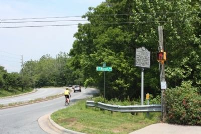
On Broadway (State Highway 1791) at WT Weaver Blvd, on the right when traveling north on Broadway.
Established 1927; became Asheville-Biltmore College 1936. Moved here in 1961. A campus of The University of North Carolina, 1969. — — Map (db m55545) HM
On Beaverdam Road (State Highway 2230) at Merrimon Avenue (U.S. 25), on the left when traveling east on Beaverdam Road.
Bishop of the Methodist Episcopal Church,
1784-1816, often visited and preached at the
home of Daniel Killian which was one mile east. — — Map (db m31456) HM
On Merrimon Avenue (U.S. 25) at Beaverdam Road (North Carolina Highway 2230), on the right when traveling north on Merrimon Avenue.
Territorial Governor of Oregon, 1848-50,
Vice-Presidential candidate, 1860, U.S.
Senator, major general in Mexican War.
Born 3 miles east. — — Map (db m31534) HM
On Charlotte Street at Macon Avenue, on the right when traveling north on Charlotte Street.
>Saint Mary's Parish - 1914
Has been placed on the
National Register
of Historic Places
By the United States
Department of the Interior — — Map (db m267479) HM
On Avon Road north of Tunnel Road (U.S. 70), on the right when traveling north.
The American Chestnut
An American Icon
More than a century ago, an estimated four billion American chestnuts were flourishing in the eastern United States from Maine to Alabama, the tree's native range. In some parts of the . . . — — Map (db m284498) HM
On Biltmore Avenue near Doctors Drive, on the right when traveling north.
Established before 1793 as Union Hill Academy. Named for George Newton. Later site of a public school. Building stood 200 feet east. — — Map (db m2277) HM
Near Dalton Street 0.3 miles north of Wyoming Road, on the right when traveling north.
George Avery, a 19-year-old enslaved blacksmith, joined Co. D, 40th United States Colored Troops, in Greeneville, Tennessee, in 1865. According to local tradition, his master, Confederate Maj. William W. McDowell, sent Avery to enlist for a post-war . . . — — Map (db m75527) HM
On Broadway Street (State Highway 1791) at WT Weaver Blvd, on the left when traveling north on Broadway Street.
Opened up western N.C. Built, 1824-28; the 75-mi. long route from S.C. line to Tenn. line, used by settlers & livestock drovers, passed nearby. — — Map (db m55544) HM
On Montford Avenue north of Chestnut Street, on the right when traveling north.
Caney [Canie] Brown, an Asheville native, founded the successful Swannanoa Laundry on Church Street in 1902. He also served as president of the Asheville Chamber of Commerce, a charter member and president of the Asheville Rotary Club, and . . . — — Map (db m187805) HM
On Montford Avenue north of Chestnut Street, on the right when traveling north.
Markus Reich was a Holocaust escapee from Poland who made his way to Asheville with his wife, Maria, after the war and opened the successful American Tool and Mold business here. The University of North Carolina at Asheville Center for Jewish . . . — — Map (db m187806) HM
Near Birch Street west of Pearson Drive when traveling west.
Two notable Buncombe County brothers are buried here. Zebulon B. Vance (1830-1894) was North Carolina's Civil War governor and served as a U.S. senator from 1879 to 1894. His elder brother, Robert B. Vince (1828-1899), led the 29th North Carolina . . . — — Map (db m209950) HM
Near Montford Avenue at Hill Street, on the right when traveling south.
During the war, many large buildings such as schools, warehouses, and churches became temporary prisons in Southern cities. After Asheville's jail on Pack Square overflowed with Confederate draft evaders, deserters, Union prisoners of war, and . . . — — Map (db m59170) HM
On Depot Street 0.1 miles south of Lyman Street, on the left when traveling south.
The American Railway Union, founded in 1893, fought for and won higher wages and shorter work days for its members. It also excluded Black people from membership. In 1925, Black rail workers formed a union to fight for their rights: The Brotherhood . . . — — Map (db m282533) HM
On Depot Street 0.1 miles south of Bartlett Street, on the right when traveling south.
Jim Crow laws legalized racial segregation throughout the South from the 1870s through the 1970s. For example, Black people were only allowed to use entrances and bathrooms marked "Colored" in White-majority areas. Blacks in Asheville invested in . . . — — Map (db m282853) HM
On River Arts Place at Lyman Street, on the left when traveling north on River Arts Place.
The Asheville Black Cultural Heritage Trail
Dignity, Humanity, and Agency
Did you know that Black people helped create this region's first non-indigenous households? Did you know that Black people helped build Asheville and connected . . . — — Map (db m282511) HM
On Depot Street at Lyman Street, on the right when traveling south on Depot Street.
The 13th Amendment to the U.S. Constitution abolished slavery, yet it created involuntary servitude as a punishment for even petty crimes such as being unemployed. The railroad industry used prisoners for labor throughout the U.S.
Black men and . . . — — Map (db m282531) HM
On River Arts Place north of Lyman Street, on the left when traveling north.
River Walk
Just steps from where you're standing, a paved greenway runs along the French Broad River, stretching two miles from Hill Street, to the north down to Amboy Road, to the south. Named for the writer, historian, and environmental . . . — — Map (db m282509) HM
On Bartlett Street at Depot Street, on the left when traveling east on Bartlett Street.
The U.S. Supreme Court Decision Plessy v. Ferguson in 1896 provided legal justification for segregation in public facilities including theaters, schools, trains, and buses. Black citizens organized during the Civil Rights Movement from the . . . — — Map (db m282844) HM
On Southside Avenue (U.S. 25) at South Lexington Avenue, on the right when traveling south on Southside Avenue.
The Asheville Black Cultural Heritage Trail
Dignity, Humanity, and Agency
Did you know that Black people helped create this region's first non-Indigenous households? Did you know that Black people helped build Asheville and connected . . . — — Map (db m282881) HM
On Coxe Avenue near Buxton Avenue, on the right when traveling north.
For nearly 100 years following emancipation, Jim Crow laws ensured that Black women would only be offered physically demanding jobs. In Asheville, most of those jobs required washing and ironing clothes, and cooking and cleaning in White households . . . — — Map (db m282912) HM
On Patton Avenue, on the left when traveling west.
Every town has its legendary businesses and The Man Store was certainly one of those. Most people who lived in or anywhere near Asheville from 1922 until the store left downtown in the early 1970s were familiar with it. Coleman Zageir (1894-1975) . . . — — Map (db m210017) HM
On North Pack Square (Alternate U.S. 74) at Broadway (U.S. 25), on the left when traveling east on North Pack Square.
Native American trails guided settlers to this site, where in 1793 the Buncombe County Court placed the first courthouse, prison, and stocks. With the opening of the Buncombe Turnpike in 1827, this public square became a crossroads for stagecoach . . . — — Map (db m97553) HM
On SW Pack Square (U.S. 25) at Patton Avenue (Alternate U.S. 74), on the left when traveling north on SW Pack Square. Reported missing.
City Center
The intersection before you was an important crossroads long before Asheville came to be. indigenous people traveled the path of this road that would later become a popular route with drovers bringing their livestock to market. . . . — — Map (db m283132) HM
On Patton Avenue near Church Street, on the right when traveling west.
Dr. Blackwell was the first woman awarded a medical degree in the United States. She began privately her medical studies in Asheville in 1845 under Dr. John Dickson, for whom she taught music at Dickson private school for girls. The school was . . . — — Map (db m31663) HM
On Patton Avenue (Alternate U.S. 74) west of Biltmore Avenue (U.S. 25), on the left when traveling east.
Japanese photographer. Born Masahara Iizuka. Advocate of Great Smoky Mountains National Park and Appalachian Trail. His studio was nearby. — — Map (db m204936) HM
Near Church Street at Patton Avenue (Alternate U.S. 74), on the left when traveling south.
Reminiscent of Asheville's Victorian past, the Drhumor Building across Church Street was built in 1895 by William J. Cocke and family. Fred Miles, Biltmore Hourse sculptor, carved the limestone frieze. Immortalized in stone is on the east side is . . . — — Map (db m97545) HM
Near Patton Avenue (Alternate U.S. 74) at Church Street.
William Sydney Porter, whose pen name was O. Henry, rented an office nearby in 1909-1910. Popular for his short stories, especially "The Gift of the Magi," he was inspired to write "Let Me Feel Your Pulse" by a visit to an Asheville physician. . . . — — Map (db m97533) HM
On Biltmore Avenue (U.S. 25) near Patton Avenue (U.S. 74E), on the right when traveling north. Reported permanently removed.
Erected and Dedicated by the
United Daughters of the Confederacy
and Friends
In loving memory of
Robert E. Lee
and to mark the route of the
Dixie Highway
“The shaft memorial and highway straight
attest his worth — he . . . — — Map (db m31578) HM
Near Patton Avenue (Alternate U.S. 74) at South Lexington Avenue, on the right when traveling east.
The coming of the railroad and tuberculosis sanitariums in the 1880s prompted a population explosion in Asheville. On Patton Avenue the Grand Central Hotel opened circa 1880 and the Grand Opera House in 1890. Later, vaudeville and motion picture . . . — — Map (db m97550) HM
On Coxe Avenue at Buxton Avenue, on the right when traveling north on Coxe Avenue.
Prior to integration, Black entrepreneurs and civic leaders created social and economic opportunities for Black communities. Spanish-American War veteran Edward Walton "E.W." Pearson and his wife Annis Bradshaw Pearson established a legacy of Black . . . — — Map (db m282909) HM
On Coxe Avenue at Banks Avenue, on the right when traveling north on Coxe Avenue.
During the Great Depression, President Franklin D. Roosevelt passed the National Housing Act of 1934 as part of the New Deal. The Housing Act created low-cost home buying, farm buying, home improvement, and farm improvement loans for White people. . . . — — Map (db m282914) HM
On Aston Street near Church Street, on the left when traveling east.
Designed by Bertram Grosvenor Goodhue
of
Cram, Goodhue and Ferguson, New York
Has been placed on the
National Register
Of Historic Places
By the United States
Department of the Interior — — Map (db m32324) HM
On Craven Street at Emma Road (County Road 1338), on the left when traveling east on Craven Street.
Lynching in America
Between 1865 and 1950, white mobs lynched thousands of African Americans across the U.S. Following the Civil War, white Southerners fiercely resisted equal rights for African Americans and sought to uphold an ideology of . . . — — Map (db m204979) HM
On Brevard Road (State Highway 191) near Bent Creek Ranch Road, on the right when traveling north.
Leader in fight against tuberculosis in North Carolina, Superintendent of State Sanatorium
in Hoke County, 1914–24. His birthplace is 400 ft. W. — — Map (db m56701) HM
On Blue Ridge Parkway (at milepost 394) at North Carolina Highway 191, on the right when traveling north on Blue Ridge Parkway.
The French Broad River played a major role in this region’s early development. Initially called the “Broad River” by eighteenth-century French hunters and traders, it was later named the French Broad River. With headwaters on Pisgah . . . — — Map (db m58937) HM
Walk or bike down to the Lagoon via Deer Park Trail. This trail takes its name from the 250-acre area on the south and west sides of Biltmore House. Landscape architect Frederick Law Olmsted designed this park to provide pastoral views for George . . . — — Map (db m209744) HM
George Vanderbilt selected Frederick Law Olmsted, the founding father of American landscape architecture , to design the gardens and grounds of his estate. Perhaps best known as the designer of Central Park in New York City, Olmsted envisioned . . . — — Map (db m209821) HM
Near Approach Road south of Winery Road, on the left when traveling south.
Welcoming more than 1 million guests each year, Biltmore is one of the most popular historic sites in the country. Its centerpiece is America's largest privately owned home — 250-room Biltmore House, completed in 1895. Biltmore's founder, George . . . — — Map (db m209731) HM
To get a better use of the distant scenery from the future Biltmore House, observation towers were constructed in two locations near this spot. Today's views are the same ones that
compelled George Vanderbilt to buy this land. The South Terrace was . . . — — Map (db m209743) HM
Also referred to as the Ramble by landscape architect Frederick Law Olmsted, this space features meandering paths similar to his design for New York's Central Park. The Shrub Garden beautifully illustrates Olmsted's ability to design for both form . . . — — Map (db m209745) HM
Frederick Law Olmsted designed this terraced garden to mirror the formality of the French Renaissance-style house-a departure from his signature style of highly naturalistic landscape design seen in Central Park. From the Italian Garden down to the . . . — — Map (db m209742) HM
The Italian Garden next to Biltmore House was created by landscape architect Frederick Law Olmsted to offer a spot for outdoor activities such as croquet and enjoying magnificent reflections of America's Largest Home. Originally referred to as the . . . — — Map (db m209741) HM
Near Old U.S. 70 west of Pine Circle, on the right when traveling west.
President Abraham Lincoln delivered the Gettysburg Address on November 19, 1863, at the dedication of the Soldiers' National Cemetery in Gettysburg, Pennsylvania, an early national cemetery for the Civil War dead. Starting in 1909, a date . . . — — Map (db m284224) HM WM
Ashe Metamorphic Suite
Neoproterozoic - Cambrian
1,000 to 488 million years old
Bakersville, Mitchell County
Thanks to Vulcan Materials Company
Spruce Pine Quarry — — Map (db m209890) HM
On Sutton Avenue just east of Cherry Street, on the right when traveling east.
You Have Arrived
The Swannanoa River Valley was known as "Grey Eagle" in the time when the Cherokee and Catawba people lived here. By the late 1800s, surveyors had deemed the neighboring Black Mountains range the highest in the Eastern . . . — — Map (db m209919) HM
At the height of rail travel, as many as 10 trains a day stopped at Black Mountain.
Horse-drawn buggies and, later, motor car taxis would line up to wait for disembarking passengers to take them to one of the many boarding houses, hotels, and . . . — — Map (db m179640) HM
Tectonic events beginning over 1 billion years ago influenced the
type and structure of rock that formed, guiding where mountains,
valleys, streams, and rivers developed. Take a look at the first rock in
our garden, which was mined right here in . . . — — Map (db m209886) HM
On Sutton Avenue at Cherry Street, on the right when traveling east on Sutton Avenue.
"My father lived and breathed Southern Railways. He would take us to the Black Mountain Train Depot and the Swannanoa Tunnel to watch the trains go by. I remember him saying, "I've walked track through these tunnels many a day."
Leslie Allen . . . — — Map (db m176984) HM
Earlier Gap Biotite Gneiss
Mesoproterozoic
1 to 1.6 billion years old
Asheville, Buncombe County
Thanks to Hedrick Industries
North Buncombe Quarry — — Map (db m209887) HM
On Sutton Avenue, on the left when traveling west.
This community was incorporated n March 4, 1893 as the town of Black Mountain with its limits measuring one mile from this point. In 1993, the town's Centennial Commission dedicated this monument to the following first century families.
Marcus . . . — — Map (db m209915) HM
On Sutton Avenue at Cherry Street, on the left when traveling west on Sutton Avenue.
Across the street from the depot, passengers could grab a last-minute souvenir or soda at the local drug store, dine at the New York Café, or rent a room above the Star Café, which advertised, "Locks on All Doors."
Train travel was the primary . . . — — Map (db m176971) HM
On Yates Avenue west of Kitazuma Road (North Carolina Road 2700), on the right when traveling west.
Dedicated to the incarcerated workers who died in the construction of the Mountain Division of the Western North Carolina Railroad between 1875 and 1879. The workers, most of whom were African Americans arrested under unjust Jim Crow laws put in . . . — — Map (db m284175) HM
Ashe Metamorphic Suite
Neoproterozoic - Cambrian
1,000 to 488 million years old
Black Mountain, Buncombe County
Thanks to Hedrick Industries
Grove Stone & Sand — — Map (db m209889) HM
On West State Street (U.S. 70) just east of Sutton Avenue, on the right when traveling east.
Left: John Myra Stepp (1850-1955) and Right: Garland Alfred Burnette (1881-1954), the paternal and maternal great-grandfathers of Dwain Lynch (born 1960, Center), represent the rich multicultural and multigenerational string music tradition of the . . . — — Map (db m284220) HM
Henderson Gneiss
Cambrian
542 to 488 million years old
Henderson, Henderson County
Thanks to Vulcan Materials Company
Hendersonville Quarry — — Map (db m209891) HM
Spruce Pine Pegamatitic
Devonian
416 to 359 million years old
Spruce Pine, Mitchell County
Thanks to The Quartz Corp
Spruce Pine, NC — — Map (db m209893) HM
On State Highway 9 south of Interstate 40, on the right when traveling south.
Builder who developed tile construction method widely used in vaults & domes. Designed vaulted ceilings at Biltmore in 1894. Lived 1 mile SE. — — Map (db m203542) HM
On Broadway Street (North Carolina Route 9) 0.1 miles north of Sutton Avenue, on the left when traveling south.
February 10, 1937, in Black Mountain, NC
Roberta Flack is a Grammy-winning singer, songwriter, and pianist renowned for her smooth, "velvety" voice. Born in Black Mountain in Buncombe County on February 10, 1937, she was one of four . . . — — Map (db m250913) HM
Black Mountain's original depot was rebuilt in 1898 and rebuilt again, for the final time in 1909.
This depot still stands here today and conformed to plans from the Southern Railway's Washington office, which mandated two waiting rooms, one . . . — — Map (db m176985) HM
In an effort to save money, the track to Black Mountain was laid by convicts leased from the state. It cost 30 cents per day to house an inmate, whereas a free laborer made about $1.00 a day.
More than 500 convicts at a time, primarily . . . — — Map (db m179638) HM
Prior to the coming of the railroad, Black Mountain was known as Grey Eagle, and its development centered around the stagecoach route through the valley (now State Street).
Once the railroad established a station in 1880 at this location, the . . . — — Map (db m179639) HM
On Sutton Avenue at Cherry Street, on the right when traveling east on Sutton Avenue.
Celebrating 25 Years of Service to the Community April 27, 1976 to April 27, 2001
Dedicated to the efforts of the original members of the Old Depot Association who were instrumental in saving The Old Depot from destruction. — — Map (db m176977) HM
Connecting Black Mountain to the growing network of railways across the nation proved to be a nearly impossible task.
Stalled by the Civil War, embezzlement, and -finally- by the extremely steep grade between Old Fort, at the foot of the Blue . . . — — Map (db m179637) HM
On Sand Hill Road (State Highway 3412), on the right when traveling north.
Here on land granted him in 1787.
He erected the first house of white
settlers west of the Blue Ridge.
Capt. Moore and his troops camped near
here when on the Rutherford Expedition
against the Cherokee in 1776.
Erected by Unaka . . . — — Map (db m56431) HM
On Sand Hill Road (Route 3412), on the left when traveling south.
Captain of militia force which marched against the Cherokee in Nov., 1776. A fort which he built stood near here. His home was 200 yds. E. — — Map (db m57152) HM
On Charlotte Highway (Alternate U.S. 74) south of Clarke Lane, on the left when traveling south.
(preface)
On March 24, 1865, Union Gen. George Stoneman led 6,000 cavalrymen from Tennessee into southwestern Virginia and western North Carolina to disrupt the Confederate supply line by destroying sections of the Virginia and Tennessee . . . — — Map (db m209727) HM
On Charlotte Highway (U.S. 74) near Ager Lane, on the right when traveling east.
Established in 1834 to serve travelers crossing Hickory Nut Gap. In continuous service until 1909. House stands 300 yards south. — — Map (db m209726) HM
Near Assembly Drive at Georgia Terrace, on the left when traveling north.
Woolly Adelgid Devastation The hemlock woolly adelgid is an invasive aphid-like species which was accidentally imported to Virginia on nursery stock around 1951. Adelgids insert long sucking mouthparts into the base of needles and . . . — — Map (db m237796) HM
On Assembly Drive (Greybeard Trail) at Georgia Terrace, on the right when traveling north on Assembly Drive (Greybeard Trail).
The original dam on this lake, built in 1910, was made of wood. A gift in 1924 from Allen Graham of Greenville, South Carolina, and his mother Mrs. C. E. “Susan” Graham, was used to build the first stone and concrete dam. Mrs. Graham, her . . . — — Map (db m237198) HM
On Lookout Road, on the right when traveling east.
In the late 1800s, John Collins, a Congregational minister from Connecticut, and other Christian lay leaders came to this cove. Their desire was to "establish and maintain a municipality containing assembly grounds for the encouragement of Christian . . . — — Map (db m209897) HM
On Yates Avenue at Old U.S. 70, on the left when traveling north on Yates Avenue.
Look out over the Swannanoa Gap to the base of the mountains below. Hundreds of men unwillingly gave their lives to construct the railroad line up this steep grade.
Until 1879, travelers — and supplies —could only reach western NC by . . . — — Map (db m284191) HM
On Ridgecrest Drive at Tupper Road, on the left when traveling north on Ridgecrest Drive.
One of the most widely known and respected Southern Baptists in the world, Rev. Billy Graham's ministry exemplifies the simplicity of the Gospel message, "God loves you and sent his Son to die on the Cross for your sin."
As the scripture . . . — — Map (db m284213) HM
On Yates Avenue north of Old U.S. 70, on the left when traveling north.
Directly below you is the Swannanoa Tunnel. At 1,832 feet in length, it is the longest of the 7 tunnels cut into the mountain and was the deadliest to build.
Asheville Junction,
Swannanoa Tunnel
All caved in, babe
All . . . — — Map (db m284196) HM
On Old U.S. 70 E, on the right when traveling west.
Southern troops turned back Stoneman's U.S. cavalry, raiding through western North Carolina, at Swannanoa Gap, near here, April 20, 1865. — — Map (db m55830) HM
On Yates Avenue near Kitazuma Road, on the right when traveling south.
Used by Indians and pioneers in crossing Blue Ridge. General Rutherford's expedition against Cherokee passed here, September, 1776. — — Map (db m57036) HM
On Yates Avenue north of Old U.S. 70, on the left when traveling north. Reported permanently removed.
(preface) On March 24, 1865, Union Gen. George Stoneman led 6,000 cavalrymen from Tennessee into southwestern Virginia and western North Carolina to disrupt the Confederate supply line by destroying sections of the Virginia and . . . — — Map (db m284170) HM
On Yates Avenue north of Old U.S. 70, on the left when traveling north.
(Preface) On March 24, 1865, Union Gen. George Stoneman led 6,000 cavalrymen from Tennessee into southwestern Virginia and western North Carolina to disrupt the Confederate supply line by destroying sections of the Virginia and . . . — — Map (db m284171) HM
On Yates Avenue at Royal Gorge Road, on the right when traveling north on Yates Avenue.
Longest (1,800 ft.) of 7 on railroad between Old Fort and Asheville. Constructed by convict labor, 1877-79. West entrance 300 yds. S.E. — — Map (db m56855) HM
On Yates Avenue north of Old U.S. 70, on the left.
Life at the stockade was brutal.
Prisoners were forced to endure bitter winters and sweltering summers with little protection from the elements. Rations were cornbread and beans; bacon and cabbage when available.
Each stockade, . . . — — Map (db m284192) HM
On Reems Creek Road (State Highway 1003), on the right when traveling north.
Here were born two notable Buncombe County brothers, Zebulon Baird Vance (1830-1894) and Robert Brank Vance (1828-1899).
Zebulon Vance was a Whig and supporter of the Union who opposed secession until the last moment. At the outbreak of war in . . . — — Map (db m225431) HM
People have built vacation homes in the Southern Appalachians for centuries. The beautiful scenery, cool mountain breezes, and abundant wildlife make these mountains a favorite summer destination. Rattlesnake Lodge served as one of these early . . . — — Map (db m140151) HM
On Merrimon Avenue (Business U.S. 19) at Brown Street, on the right when traveling south on Merrimon Avenue.
Founded as Weaverville College, 1873; Methodist, coeducational. In 1934 merged with Rutherford to form Brevard College. Campus was one block W. — — Map (db m266213) HM
On North Main Street (Business U.S. 19) at Church Street, on the left when traveling south on North Main Street.
Weaverville United Methodist Church
Founded in 1805
Has been placed on the
National Register
of Historic Places
by the United States
Department of the Interior — — Map (db m266214) HM
On Merrimon Avenue (Business U.S. 19) at Ponder & Worley Drive, on the right when traveling north on Merrimon Avenue.
Civil War governor. He led state, 1862-65, and 1877-79; U. S. Senator, 1879-94. Colonel, 26th N.C. Regiment, 1861-62. Birthplace 6 mi. N.E. — — Map (db m266212) HM
On Haywood Road (State Highway 19/23) west of Jarrett Street.
The West Asheville & Sulphur Springs Electric Railway ran from the springs to Government Street, at what is now Pritchard Park
Fare 5¢ — — Map (db m17055) HM