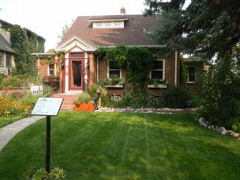
On North 31st Street near 12th Avenue North, on the right when traveling north.
pedimented entryway and multi-pane transom window are among the Greek Revival style elements that decorate this side-gable brick home, built c. 1932 for Julius and Anna Clavadetscher. A talented cellist, Julius played with the Minneapolis Symphony . . . — — Map (db m166648) HM
On North 32nd Street at 12th Avenue North, on the right when traveling north on North 32nd Street.
Civil engineer Bill Lowe designed and built this house for his family circa 1940. The modest-looking home has several features more typically found in high-style homes. These include the clay tile roof, decorative chimney caps, and a bow window, . . . — — Map (db m166661) HM
On North 31st Street at 12th Avenue North, on the right when traveling north on North 31st Street.
Rapid changes in technology, industry, and social customs marked the Jazz Age of the 1920s. In the face of short skirts and speakeasies, many Americans longed for a supposedly simpler past. The Tudor style’s story-book charm and emblematic . . . — — Map (db m166649) HM
On North 32nd Street near 9th Avenue North, on the right when traveling north.
The Prairie style is well represented in this two-story America Fou1915. A low hipped roof, extended eaves with exposed rafter tails, symmetrical façade, and lap siding emphasize horizonal lines. These architectural features especially distinguish . . . — — Map (db m166719) HM
On North 31st Street near 11th Avenue North, on the right when traveling north.
Robert Martin (Bob) was born in 1912. He won a cute baby contest in 1913 and was kissed by Theodore Roosevelt. The attended Mckinley (sic), Broadwater and Jefferson Elementary Schools, and Billings High School which is now the Lincoln Center. He was . . . — — Map (db m166530)
On 10th Avenue North near North 32nd Street, on the right when traveling west.
One of two existing storefronts in the North Elevation Historic District, this one-story Western Commercial style grocery store features a stylized stepped parapet and large display windows. Sam Chichas, the Greek proprietor of a grocery on North . . . — — Map (db m166433) HM
On Montana Avenue (Business Interstate 90) near North 26th Street, on the right when traveling east.
The famous cowboy movie star William S. Hart and his horse Fritz, are immortalized in the local statue "Range Rider of the Yellowstone." The statue, overlooking the city of Billings from atop the rimrocks, was dedicated on July 4, 1927, with Hart's . . . — — Map (db m166310) HM
On North 27th Street (State Highway 3), on the right when traveling north.
J. Collins West, Exalted Ruler of Lodge 394 of the Elks Club, planned this turn-of-the-century Italian Renaissance Revival style building as a lodge hall. Billings Elks members attending the St. Louis Exposition in 1904 purchased a bar for their . . . — — Map (db m166404) HM
On Montana Avenue (Business Interstate 90) near North 22nd Street, on the right when traveling east.
Billings was founded as a railroad town in 1882. The first passenger depot was the Headquarters Hotel, located on what was then North 28th and Montana Ave. It served as the stopping point for passengers and freight. In 1891, the Headquarters Hotel . . . — — Map (db m167971) HM
On Montana Avenue (Business Interstate 90) near North 26th Street, on the right when traveling east.
In 1906, the Northern Pacific Railroad moved its central railroad transfer point from Billings to Laurel. The move opened new tracts of land for development along the railroad right-of-way. These lots had the advantage of bordering both the tracks . . . — — Map (db m166311) HM
On Montana Avenue (Business Interstate 90) near North 23rd Street, on the right when traveling east.
At the turn of the twentieth century, Billings was ready to shed its frontier image as a rough-and-tumble cowtown and emerge as a regional commercial center. Billings was already at the juncture of the Northern Pacific and the Chicago, Burlington, . . . — — Map (db m166227) HM
On Montana Avenue (Business Interstate 90) near North 25th Street, on the left when traveling east.
Martha "Calamity Jane" Canary (1852-1903) of Deadwood fame lived in a cabin at Canyon Creek, west of Billings, during her visits to the Yellowstone Valley between stints in Buffalo Bill Cody's Wild West Show. A pistol packing, cross-dressing . . . — — Map (db m166079) HM
On Montana Avenue (Business Interstate 90) near North 26th Street, on the left when traveling east.
Plenty Coups (1848-1932) became a chief of the Crow Tribe by the age of twenty-eight after attaining distinction as both a warrior and a visionary for his people. Plenty Coups, recognized as a leader in defending Crow ancestral lands and promoting . . . — — Map (db m166075) HM
On Montana Avenue (Business Interstate 90) near North 23rd Street, on the right when traveling east.
Joe Medicine Crow, a Crow historian, indicated the Crow (Apsalooke) Indians migrated west from what is now North and South Dakota, to the Yellowstone River Valley over 400 years age. Their migration was prior to the introduction of horses, guns, and . . . — — Map (db m168014) HM
Developing Our Quiet Spaces
In the 1910s, Charles H. Ramsdell, a landscape architect from Minneapolis who designed plans for city park improvements, suggested that "interesting drives in and about these park lands would appeal to the . . . — — Map (db m167885) HM
On Montana Avenue (Business Interstate 90) near North 22nd Street, on the right when traveling east.
Born in 1849 in Geneva, New York, Luther Sage "Yellowstone Kelly was a trapper, hunter, and guide in Montana during the 1860s and 1870s. He also served as a military scout and hunter during the United States' campaign against the Indian tribes of . . . — — Map (db m168012) HM
On Montana Avenue (Business Interstate 90) near North 22nd Street, on the right when traveling east.
The Northern Pacific Railroad Company was created by an Act of Congress and signed by President Lincoln on July 2, 1864. Along the developing tracks, new towns were spaced apart every 100-120 miles. In the Yellowstone River Valley, Glendive, . . . — — Map (db m167972) HM
On Chief Black Otter Trail near Rimtop Drive, on the right when traveling south.
(Twelve panels make-up this marker. The kiosk where this marker is found has three sides. On each side there are four panels. Panels are present clockswise beginning at the upper left.)
Luther Sage Kelly, 1870s.
. . . — — Map (db m167406) HM
Near Montana Avenue (Business Interstate 90) near North 26th Street, on the right when traveling east.
National cigar and tobacco wholesaler Louis Cohn occupied this two-story brick building, constructed in 1919. Cohn was one of three wholesalers supplying Billings’ five cigar manufacturers with tobacco. In 1923, the building became home to Harry . . . — — Map (db m166313) HM
On Montana Avenue (Business Interstate 90) near North 22nd Street, on the right when traveling east.
According to geologists, during much of the Cretaceous Period (144 to 65 million years ago), a large portion of Montana was covered by a shallow inland sea called the Western Interior Seaway. The rims towering above Billings are composed of a . . . — — Map (db m167970) HM
Near Montana Avenue (Business Interstate 90) at North 25th Street, on the left when traveling east.
A twist of fate landed 16-year-old German immigrant Alfred Heimer a job with Buffalo Bill Cody’s Wild West Show in 1894. Although the irascible Colonel Cody fired young Heimer three times during that first day, the youth remained as steward of . . . — — Map (db m166114) HM
On Montana Avenue (Business Interstate 90) at North 23rd Street, on the left when traveling east on Montana Avenue.
The delicious odor of roasting coffee must have added a pleasing dimension to this industrial area when Sawyer Stores, Inc. opened its plant here in 1928. The facility served as the main office of a grocery chain that operated stores in Montana and . . . — — Map (db m166176) HM
On Chief Black Otter Trail near Rimtop Drive, on the right when traveling east.
(Three panels make up this marker.)
Last Will and Testament, 1927
"I, Luther S. Kelly, direct that in the last event, my body be encased in a suitable casket, plain but substantial, together with my Spanish War Saber, a . . . — — Map (db m167549) HM
Near Montana Avenue (Business Interstate 90) near North 26th Street, on the right when traveling east.
The American Railway Union, led by Eugene Debs, went on strike against the Pullmans Works of Chicago in June of 1894. Railroad workers throughout America showed their support for the strike by refusing to handle any Pullman cars. Troops from Fort . . . — — Map (db m166384) HM
On Montana Avenue (Business Interstate 90) near North 25th Street, on the right when traveling east.
The Beanery was the Northern Pacific lunchroom where railroad workers, passengers and locals could get a hot cup of coffee or a bite to eat. The lunchroom waitresses, called beanery queens, took orders and served up hot food around the clock. . . . — — Map (db m166251) HM
Near Montana Avenue (Business Interstate 90) near North 23rd Street, on the left when traveling east.
Touted as "The Beer that Made Milwaukee Jealous." In 1910, an electro sign was installed atop the brewery, becoming a distinguishing feature of the company and a city landmark. The flashing sign "Drink Old Fashion Beer" was made up of 920 white and . . . — — Map (db m166169) HM
On Montana Avenue (Business Interstate 90) near North 25th Street, on the left when traveling east.
The Eagle Hotel was built by Austrian immigrant Matthias Thomas, who raised his five children in a second-floor apartment of the hotel. The hotel was reportedly used as an auxiliary hospital during the flu epidemic of 1918.
Local entrepreneur . . . — — Map (db m166112) HM
On Montana Avenue (Business Interstate 90) near North 23rd Street, on the left when traveling east.
After weeks of rain and moderate flooding, Billings received four inches of rain on the evening of June 11, 1937. The irrigation ditch near the Hilands Golf Course on Poly Drive broke apart and water raged through the downtown area. Central downtown . . . — — Map (db m166168) HM
On Montana Avenue (Business Interstate 90) near North 24th Street, on the left when traveling east.
This two-story red brick building in Victorian Italianate style was built around 1912. The City condemned the building for use as a hotel in 1981. As antique dealer Mike Gregory was negotiating to buy the hotel's furniture, he made a deal to . . . — — Map (db m166113) HM
On Montana Avenue (Business Interstate 90) near North 22nd Street, on the left when traveling east.
The Purity Bread Company, based in Minneapolis, was among the first corporate wholesale bakeries to introduce packaged, sliced white bread to Billings. One Purity Bread advertisement boasted, "The well-bred run for gladness' sake to get this loaf . . . — — Map (db m311898) HM
On Montana Avenue (Business Interstate 90) at North 23rd Street, on the left when traveling east on Montana Avenue.
This two-story brick building, across the street from the depot, was built by Frank Jacoby and Son in 1928 to house the Sawyer Food Company's regional headquarters and a distribution center to supply the company's 26 retail stores in eastern Montana . . . — — Map (db m166178) HM
Near Montana Avenue (Business Interstate 90) at North 23rd Street, on the left when traveling east.
This prominent building, situated across from the railroad depot, was also known as "Enterprise Garage and Sales" and was a repair shop for many years. It was recently renovated to house several retail businesses. — — Map (db m166179) HM
River of the "Yellow Stone"
The snowfall in the mountains surrounding Yellowstone National Park feeds the Yellowstone River and its tributaries. Along the Yellowstone River's 678 miles are changes in water temperature, turbidity . . . — — Map (db m167882) HM
Near Chief Black Otter Trail near East Airpot Road, on the right when traveling east.
Born on July 27, 1late 1860s and 1870s. Kelly, a native of Geneva, New York, is best known as an army scout during the Army's closing campaign against the nomadic Indian tribes of the Northern Plains.
Always a restless spirit, Luther S. Kelly . . . — — Map (db m166850) HM
On Chief Black Otter Trail near East Airpot Road, on the right when traveling east.
To the monotonous beat of muffled drums, Luther Sage “Yellowstone” Kelly’s funeral cortege wound its way through downtown Billings on June 26, 1929. A second procession along the rimrocks to the grave site followed strict military . . . — — Map (db m166851) HM
On U.S. 3 0.2 miles west of U.S. Highway 3 and Zimmerman Trail, on the left when traveling west.
The original Zimmerman Trail was built during the summers of 1890 and 1891 by the brothers Joseph and Frank Zimmerman, born in Fellering, (Alsace-Lorraine) Germany. Joseph immigrated to the United States in 1872; two years later, upon enlisting . . . — — Map (db m169996) HM
On Chief Black Otter Trail near Rimtop Drive, on the right when traveling east.
(Three panels make up this marker.)
The Nomadic Experience
For thousands of years, native peoples of the Northern Plains enjoyed a lifestyle marked by freedom of movement. Families, friends, and foes interacted through a . . . — — Map (db m167661) HM
Near Montana Avenue (Business Interstate 90) near North 23rd Street, on the right when traveling east.
The Northern Pacific Railway created Billings, but irrigation made the land productive. The use of the Yellowstone River for irrigation allows for the production of alfalfa, sugar beets, pinto beans, and corn. It also provides water for trees and . . . — — Map (db m168722) HM
On Minnesota Avenue near South Broadway, on the left when traveling east.
Billings, located halfway between Minneapolis and Spokane, boasted railroads running in seven directions by 1916. Quantities of freight arrived each day from points east, and large warehouses lined the tracks, filled with goods awaiting resale. . . . — — Map (db m165813) HM
On Montana Avenue (Business Interstate 90) near North 22nd Street, on the right when traveling east.
This famous battle pitted federal troops of the U.S. Army's 7th Cavalry, led by Lt. Colonel George Armstrong Custer, against Lakota (Sioux), Northern Cheyenne, and Arapaho warriors. Custer and his command of 259 men were soundly defeated. "Custer's . . . — — Map (db m168088) HM
On North 29th Street just south of Montana Avenue (Business Interstate 90), on the right when traveling north.
When Billings was founded, the Northern Pacific Railway placed the railroad tracks through the center of town. The two primary streets in 1882, running parallel to the tracks, were named for the Minnesota & Montana Land & Improvement Company, a . . . — — Map (db m308893) HM
Near Montana Avenue (Business Interstate 90) near North 22nd Street, on the right when traveling east.
Originally coming to Montana for the 1860s gold rush, the Chinese made up almost 10% of Montana's population during the 1870s. They were also two-thirds of the labor force for early railroad construction. After a rail line was completed, many of the . . . — — Map (db m168090) HM
Near Montana Avenue (Business Interstate 90) near North 23rd Street, on the right when traveling east.
In 1918, Doctors A.J. Movius and J.H. Bridenbaugh formed a medical partnership, establishing the Movius-Bridenbaugh Clinic, which later became Billings Clinic, on the top floor of the Hart Albin building in downtown. The Billings Clinic was a . . . — — Map (db m169023) HM
On South Broadway near Minnesota Aveuer, on the left when traveling south.
Offering an eclectic architectural mix, Old Town tells the story of Billings’ growth. The Northern Pacific founded the community as a railroad hub in 1882, and by the end of 1883, some 400 canvas tents and crude buildings lined the streets. The 1882 . . . — — Map (db m165811) HM
On Montana Avenue (Business Interstate 90) near North 23rd Street.
The town of Billings is named for Frederick Billings. He was a gold rush lawyer, railroad baron, and conservationist. Born and educated in Vermont, he arrived in California with his law degree during the 1849 gold rush. He was California's first . . . — — Map (db m168301) HM
Near Montana Avenue (Business Interstate 90) near North 23rd Street, on the right when traveling east.
Soon after the first car arrived in Billings in 1904, the Montana and Wyoming Oil Company formed as a response to the growing need for fuel. John D. Losekamp, the first director, secured the lease of a major gas discovery on Edward Jones' farm near . . . — — Map (db m168491) HM
Near Montana Avenue (Business Interstate 90) near North 23rd Street, on the right when traveling east.
Red Lodge and Bearcreek, both south of Billings, prospered as coal mining towns in the first decades of the 20th century, with the
focus on underground coal mining. By the 1930s, strip mining, located southeast of Billings, was producing most of . . . — — Map (db m169024) HM
On Minnesota Avenue near North Broadway when traveling east.
Billings rancher and businessman James R. Conway built this handsome, brick double-front store with an upstairs boardinghouse in 1900. Conway opened the Crystal Saloon in the west half and J.C. Staffek ran a cigar ship in the east half. The two . . . — — Map (db m165810) HM
On South 30th Street at 2nd Avenue South, on the left when traveling south on South 30th Street.
Early Billings relied on the volunteers of the Maverick Hose Company to fight fires. Their equipment included two- wheeled hose carts, which the firefighters pulled by hand. In 1894, the company purchased its first team of fire horses and hired its . . . — — Map (db m165806) HM
On Montana Avenue at North 29th Street, on the right when traveling east on Montana Avenue.
Founder
City of Billings
Northern Pacific Railway President from 1879-1881
His foresight and keen business mind resulted in the establishment of Billings - The Magic City - where it is today.
This statue was presented to the City of . . . — — Map (db m165861) HM
Near 1st Avenue South near South 33rd Street, on the left when traveling south.
Built in 1901, Billings’ fourth school had six classrooms and an auditorium. A third-floor gymnasium, the first in the city, was added a year later. By 1906, 340 children attended Garfield School. The homesteading boom, the growth of sugar . . . — — Map (db m166733) HM
On Montana Avenue (Business Interstate 90) at North 26th Street, on the right when traveling east on Montana Avenue.
In the 1910s, Billings promoted itself as the capital of the “Midland Empire.” That economic domain covered thirty thousand square miles and boasted hundreds of communities that relied on Billings for supplies. No wonder Helena-based distributor . . . — — Map (db m166312) HM
Near Montana Avenue (Business Interstate 90) near North 23rd Street, on the right when traveling east.
Across the railroad tracks on Minnesota Avenue was Billings' primary prostitution area, known as the "Red Light District" or "Restricted District." Saloons and "female boarding houses" occupied four blocks east of South 27th in the early 1900s. . . . — — Map (db m168725) HM
Near Montana Avenue (Business Interstate 90) near North 23rd Street, on the right when traveling east.
In early Montana history, residents primarily received their news via the newspaper, personal letters, the gossip tree, and telegrams. After its founding in 1882, Billings had three main newspapers: the Billings Post, the Billings Herald, and the . . . — — Map (db m168155) HM
On North 29th Street just south of Montana Avenue (Business Interstate 90), on the right when traveling north.
For thousands of years, indigenous people adapted to the challenging climate, diverse landscapes, and shifting food sources of the Yellowstone River Valley. Ancestors of the Crow, or Apsáalooke, split from the Hidatsa in the 1400s and established . . . — — Map (db m308894) HM
On Montana Avenue (Business Interstate 90) near North 28th Street, on the right when traveling east.
This log cabin was built in 1946 by the renowned western artist. It served as his studio for 40 years, located 3 miles west of Billings along Grand Avenue, commercial growth gradually surrounded the cabin. In 1988 it was moved to the campus at Rocky . . . — — Map (db m165858) HM
On Minnesota Avenue at South 27th Street, on the right when traveling east on Minnesota Avenue.
In 1884, two years after the Northern Pacific founded the town of Billings, a one-story wooden grocery store stood on this site. Twelve years later, the corner of Minnesota and Twenty-seventh boasted one of the South Side's first brick buildings. . . . — — Map (db m165854) HM
On Montana Avenue (Business Interstate 90) near North 23rd Street.
The ancestral relatives of the Northern Cheyenne, the Tsitsistas and Suhtai, merged as one tribe in the 1700s. The unified Cheyenne made their home in the Dakotas and Northern Plains. After signing of the 1825 Friendship Treaty, U.S. armed forces, . . . — — Map (db m168091) HM
Near Montana Avenue (Business Interstate 90) near North 23rd Street, on the right when traveling east.
Billings’ first depot was built in 1883, a year after the arrival of the Northern Pacific. Because the first depot failed to meet railroad specifications, the nearby Headquarters Hotel served instead as the passenger station. The hotel burned a few . . . — — Map (db m166167) HM
On Montana Avenue at North 27th Street, on the right when traveling east on Montana Avenue.
The homesteading boom was in full swing in 1910, but not all of Montana's newcomers came to farm. With the arrival of three transcontinental railroads, Billings became established as a regional hub of commerce. Many businesses saw opportunity in the . . . — — Map (db m165857) HM
Near Montana Avenue (Business Interstate 90) near North 23rd Street, on the right when traveling east.
At Billings' founding in 1882, the Minnesota and Montana Land Improvement Company was responsible for selling the railroad's lots. They included two parks in the new town's design: North Park and South Park. These park lands would be owned by the . . . — — Map (db m168302) HM
On Minnesota Avenue near South 26th Street, on the left when traveling east.
The later 1940s and the aftermath of World War II brought economic prosperity. Americans became more stable financially, mobility increased, and so did the demand for automobiles. Price Motor Sales, one example of this trend, opened in 1948 to serve . . . — — Map (db m165855) HM
Near Montana Avenue (Business Interstate 90) near North 23rd Street, on the right when traveling east.
Ranching has been a part of the Yellowstone River Valley history since the beginning of the homesteading days. Settlers focused on raising livestock, primarily cattle and sheep for livelihoods.
The lure of Montana and the West created the . . . — — Map (db m169025) HM
Near Montana Avenue (Business Interstate 90) near North 23rd Street, on the right when traveling east.
St. Vincent Hospital, Billing's (sic) first hospital, opened in 1899. The Sisters of Charity of Leavenworth, Kansas organized the original hospital at the corner of Division Street and Broadwater Avenue. An early admissions book recorded patients . . . — — Map (db m168490) HM
Near Montana Avenue (Business Interstate 90) near North 23rd Street, on the right when traveling east.
The town of Coulson was founded along the north bank of the Yellowstone River in 1877. Residents named the community after the Coulson Steamboat Packet Company, hoping to prosper from expected steamboat traffic. The town hosted a post office, a . . . — — Map (db m168157) HM
On Minnesota Avenue near South 26th Street, on the left when traveling east.
Gustavus Swift of Sagamore, Massachusetts, founded a meat-packing company in 1850 that revolutionized the industry. His contributions included assembly-line processing, promotion of the safety of pre-cut and processed meat, and improvement and use . . . — — Map (db m165856) HM
On Montana Avenue (Business Interstate 90) near North 23rd Street, on the right when traveling east.
An address delivered at the depot by former President Theodore "Teddy" Roosevelt in 1918 drew the largest gathering in the history of Billings to that point. Roosevelt's address encouraged local enlistment in support of the United States war effort. . . . — — Map (db m166229) HM
Near Montana Avenue (Business Interstate 90) near North 23rd Street, on the right when traveling east.
Billings is home to two accredited colleges: Rocky Mountain College, a private liberal arts school, and Montana State University Billings, a state university.
ROCKY MOUNTAIN COLLEGE
Rocky Mountain College is a merger of . . . — — Map (db m168726) HM
On Montana Avenue (Business Interstate 90) near North 23rd Street, on the right when traveling east.
The Nez Perce (Nee-Me-Poo) National Historic Trail marks the path of U.S. soldiers pursuing Chief Looking Glass and Chief Joseph of the Nez Perce during the summer of 1877. Treaties forced bands of Nez Perce from their homes In Idaho and Oregon. . . . — — Map (db m168015) HM
On South 27th Street (State Highway 3) near 8th Avenue South.
This monument is dedicated to the men and women of Montana, past and present.
The Centennial Cattle Drive originated in Roundup Montana, September 4, 1989 with cattle herds numbering several thousand and riders from every corner of the state . . . — — Map (db m166392) HM
Near Montana Avenue (Business Interstate 90) near North 23rd Street, on the right when traveling east.
(The marker is composed of three panels.) (Panel 1:)
1879, May
Frederick Billings becomes president of the Northern Pacific Railway. One of the original members of the NP Board of Directors, he had served as director for . . . — — Map (db m168492) HM
On Montana Avenue (Business Interstate 90) near North 25th Street, on the right when traveling east.
Built around 1900, the McCormick Hotel is a three-story gray brick building with raised patterns of buff-colored brick and cast stone window lintel keystones, reflecting elements of the Renaissance Revival style. The hotel was, for a time, the home . . . — — Map (db m166253) HM
On Montana Avenue (Business Interstate 90) near North 23rd Street, on the right when traveling west.
The depot was opened in 1909 for use by three railroad companies: the Northern Pacific, Great Northern, and Chicago, Burlington and Quincy. Designed in the Beaux Arts Eclectic style, the depot was designed by the Northern Pacific Railroad's chief . . . — — Map (db m166249) HM
On North 29th Street just south of Montana Avenue (Business Interstate 90), on the right when traveling north.
Founded in 1882, Billings, was named for former Northern Pacific Railway president, Frederick Billings. Although Frederick never lived here, his eldest son, Parmly, spent four years in Billings. Following Parmly's untimely death at age 25, the . . . — — Map (db m308900) HM
Near Montana Avenue (Business Interstate 90) near North 23rd Street, on the right when traveling east.
The Moss Mansion Historic House Museum faces Division Street on the west edge of downtown Billings. Preston Boyd Moss, who moved to Billings in 1892, was a prominent civic leader who owned and operated the First National Bank, Billings Light and . . . — — Map (db m168304) HM
On North 29th Street just south of Montana Avenue (Business Interstate 90), on the right when traveling north.
Congress authorized the charters for three transcontinental railroads in the 1860s. The Northern Pacific Railway (NPR) operated along the northern states with the goal of connecting the Great Lakes with Puget Sound on the Pacific. The federal . . . — — Map (db m308895) HM
On Montana Avenue (Business Interstate 90) near North 28th Street, aka North Broadway, on the right when traveling east.
One of Billings' most devastating fires destroyed the original Babcock/Selvidge Building in June of 1919. After being completely rebuilt, the building housed various motor supply and automobile dealers including Hines Motor Supply Company and the . . . — — Map (db m166387) HM
On Montana Avenue (Business Interstate 90) near North 28th Street, aka North Broadway, on the right.
The Stockman Bar originally opened at 2805-2807 Montana Avenue in 1933. After the building was gutted by fire in 1943, the popular gathering place for cattlemen and locals was rebuilt on the adjacent lot at 2809-2811 Montana Avenue. — — Map (db m166315) HM
On North 29th Street just south of Montana Avenue (Business Interstate 90), on the right when traveling north.
The Billings Public Library moved out in 1968, leaving the historic building vacant. Community leaders, led by local architect Vernon Drake, worked to save the building and the Northern Pacific Railway transferred the deed to Yellowstone County. . . . — — Map (db m308890) HM
On Montana Avenue (Business Interstate 90) near North 23rd Street.
The origin of the Yellowstone River name came from early French fur traders who called it La Roche Jaune, the 'River of the Yellow Rock,' after the orange and yellow colored rimrocks rising from the river valley.
The Yellowstone River is led by . . . — — Map (db m168156) HM
On Minnesota Avenue near North Broadway, on the right when traveling east.
Once considered the “wrong side of the tracks,” Minnesota Avenue was known for its many bars, brothels, cigar stores, and Chinese restaurants. (Chinese districts often bordered red light districts, serving inexpensive food to the working women and . . . — — Map (db m165807) HM
On Interstate 94 at milepost 41, on the right when traveling west.
Buffalo meant life to the Plains Indians, and the mountain Indians used to slip down from the hills for their share, too. Some tribes would toll buffalo into a concealed corral and then down them; another system was to stampede a herd over a . . . — — Map (db m165475) HM
On 8th Street near 4th Avenue, on the right when traveling south.
By mid-April 1876, Colonel John Gibbon's most immediate concern was crossing to the north side of the Yellowstone before reaching the confluence of the Bighorn River. Plans called for the Montana Column to patrol the lower Yellowstone from the . . . — — Map (db m165445) HM
On Interstate 94, on the right when traveling east.
The mouth of the Bighorn River as it enters the Yellowstone, 13 miles east of here, is one of the most significant areas in Montana history.
The Crow Indians knew the Yellowstone as the Elk River. French explorers called it the
la Roche . . . — — Map (db m163404) HM
Near Interstate 94 at milepost 41, on the right when traveling west.
The area that surrounds the mouth of the Bighorn River as it enters the Yellowstone 13 miles east of here is one of the most significant areas in Montana history.
The Indians knew the Yellowstone as the Elk River. French explorers called . . . — — Map (db m165450) HM
Near Interstate 94 at milepost 41, on the right when traveling west.
Motoring was an adventure in the second decade of the 20th century and people usually didn't travel very far from home. There were a few paved roads, most were choked with dust during the summers, knee-deep in mud in the rainy seasons, and . . . — — Map (db m165449) HM
Near Railroad Highway 0.2 miles west of South 8th Road, on the left when traveling west.
This homestead house was constructed around 1910 in Ballantine, Montana. The house features three rooms, no running water and no electricity. The bedroom and parlor were most likely added onto the one room structure. Like many initial homesteaders, . . . — — Map (db m309098) HM
On Northern Avenue just east of Shopis Avenue, on the right when traveling east.
Dedicated to the memory of: The Nine Military men killed and Seven seriously injured when a C-119 "Flying Box Car," crashed 10 miles East of Billings, Montana on November 18, 1952 while enroute from Great Falls, Montana to Denver, Colorado. With the . . . — — Map (db m252927) HM
Near Railroad Highway 0.2 miles west of South 8th Road, on the left when traveling west.
Before the advent of mechanized diggers, a farmer could only harvest as many potatoes that he could dig by hand. This mechanized digger, invented by Isaac Hoover, could harvest hundreds of bushels a day. It could dig the potatoes, sift and separate . . . — — Map (db m308974) HM
Near Railroad Highway 0.2 miles west of South 8th Road, on the left when traveling west.
This grader was invented by Rev. B.F. Shuart on the Hesper Farm just west of Billings, Montana about 1890. Shuart sold the Hesper Farm in 1892 to procure money to promote a “Short Grader” he had patented on the farm. He moved to Oberlin, Ohio and . . . — — Map (db m309099) HM
Near Railroad Highway 0.2 miles west of South 8th Road, on the left when traveling west.
Originally this building was built as a one room schoolhouse, large in comparison to other schoolhouses at the time. It was built in 1908, north of where it stands today. The building was sold and moved to this location in 1922 where it served as . . . — — Map (db m308897) HM
Near Railroad Highway 0.2 miles west of South 8th Road, on the left when traveling west.
This 16' x 20' Russian Style Barn was built by Jacob Baum in 1911. Made of cottonwood 2" x 4"s sawed by Charlie Kindmoth, the boards were laid flat for better strength. The structure was actively used as a livestock barn from 1911 to 1978 and was . . . — — Map (db m309154) HM
Near Railroad Highway 0.2 miles west of South 8th Road, on the left when traveling west.
The building to your left is a Russian style barn, a century-old reflection of Volga German homesteaders who came to this area at the beginning of the 20th century. The influence of Volga Germans on the Huntley Project is still felt today. Since . . . — — Map (db m309171) HM
Near Railroad Highway 0.2 miles west of South 8th Road, on the left when traveling west.
The Ruth Dredger was purchased in 1936 for $10,000 by The Huntley Project Irrigation District. It was used to dredge lateral ditches on the Huntley Project from 1936-1952. The dredger had a swinging boom that carried the buckets and could swing 90 . . . — — Map (db m308898) HM
Near Railroad Highway 0.2 miles west of South 8th Road, on the left when traveling west.
Germans settled in Russia’s Volga River Valley beginning in 1762, when Catherine the Great launched an aggressive campaign to increase agricultural production. She promised Germans freedom of religion, free land or cash grants to obtain farm . . . — — Map (db m309188) HM
Near Railroad Highway 0.2 miles west of South 8th Road, on the left when traveling west.
This museum tells the unique story of the Huntley Irrigation Project, founded over a hundred years ago and built with hard work and determination. This area was shared hunting grounds among Native Americans for centuries. The prairies . . . — — Map (db m308899) HM
Near Railroad Highway 0.2 miles west of South 8th Road, on the left when traveling west.
This building was located in Worden. It was here that William Fricke created wooden items for sale on his lathe and drill press during the 1930s and the 1940s. This is a wonderful example of the ingenuity of the settlers of the Huntley Project. . . . — — Map (db m309030) HM
On 4th Avenue near West 1st Street, on the left when traveling north.
Turned porch supports, elaborately carved brackets, a baluster frieze, and decorative cresting along the roofline ornament this gable-front-and-wing residence. Railroads brought these precut architectural elements to small towns along their tracks, . . . — — Map (db m190837) HM
On Lipp Road at Buffalo Trail Road, on the right when traveling north on Lipp Road.
As soldiers and warriors exchanged fire here at the Canyon mouth, most of the Nez Perce were escaping up a side canyon to the plateau above. The US Army incurred too many casualties to pursue. At the base of the butte near the cottonwoods they . . . — — Map (db m154002) HM WM
On Lipp Road at Buffalo Trail Road, on the right when traveling north on Lipp Road.
In the distance the US Army troops were approaching at a gallop in pursuit of the Nez Perce. After fleeing for 26 miles, the Nez Perce chose this place to make a stand because of the canyon mouth offering natural defenses. Positioned high on the . . . — — Map (db m154003) WM