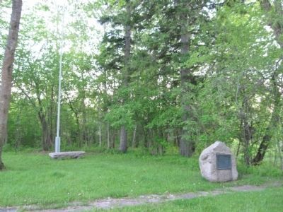
Site of Ojibway Village
from earliest known period
Daniel Greysolon, Sieur du Luth
was here in 1679
Astor's American Fur Company
established a trading post
on this spot about 1817
First Ojibway Treaty in Minnesota
made here in 1826 . . . — — Map (db m43725) HM
In 1875, located just north of this point on the east bank of the Red Lake River was the settlement known as Fisher’s Landing. It began as a terminus of exchange of freight and passengers from steamboats plying the Red Lake and Red Rivers to and . . . — — Map (db m307145) HM
The Marquette was owned and operated by the U.S. Army Corps of Engineers. Her home port was Duluth, Minnesota. The Marquette was built in 1942 by Equitable Equipment Co. at New Orleans, Louisiana. She measured 103 feet long, 26 feet wide, and 11 . . . — — Map (db m214169) HM
The scenery of the region between Split Rock and Beaver Bay is the direct result of important events of early geologic time.
Lava flows, which had accumulated in this region to a thickness of about 30,000 feet, were lifted and arched by a . . . — — Map (db m76280)
The Lighthouse In 1855, Michigan's Sault Saint Marie Locks opened, linking the country's farthest "inland sea" with the lower Great Lakes. The North Shore quickly became busy with pleasure boats carrying wealthy easterners to cabins and ships . . . — — Map (db m266800) HM
Diver Discovery
The cold, clear waters of Lake Superior have preserved the remains of many important shipwrecks. In 1961, two divers located the wreck of the bulk freight steamer Hesper along the western breakwaters of the harbor. . . . — — Map (db m203364) HM
The gargoyle-like carvings on this 1896 building are the work of L.H. Moore, a Pipestone businessman and contractor, as well as a sculptor of considerable skill and humor. Duluth sandstone was used for the sculptures, and quartzite for the facade . . . — — Map (db m256687) HM
On October 28, 1865, geologist Henry H. Eames returned to St. Paul after initiating a survey of the mineral wealth present in the Lake Vermilion area only to find an abundance of rumors concerning a valuable gold strike on the shores of that . . . — — Map (db m104381) HM
Named for Charlemagne Tower, one of the developers of the Vermilion Range and Duluth and Iron Range Railroad. It was incorporated as a village in 1884 and as a city in 1889. A saw mill was established here in 1882.
An Indian settlement was . . . — — Map (db m207695) HM
By the early 19th century, Great Lakes abundant natural resources drew a massive influx of European immigrants and settlers from the original 13 colonies to the region. With this great migration came development: farming, timber, mining, railroads, . . . — — Map (db m204824) HM
(Front):Memorial to the Grand Army of the Republic (Left):Senior Vice Commander in Chief of the G.A.R. Albert Woolson of Duluth, Minnesota the last survivor (Right):Dedicated on September 12, 1956 by National Auxiliary to Sons . . . — — Map (db m14539) HM
The familiar sandstone outcroppings along Lake Superior's shoreline provided a popular building material for grand and massive structures all over the Midwest and Eastern United States throughout the last half of the Nineteenth and into the . . . — — Map (db m201591) HM
The installation — known as a "battery" — would join three others proposed to protect the Twin Cities at Bethel and Farmington, Minnesota, and Roberts, Wisconsin. All would be overseen by a headquarters command post at Fort Snelling. Some area . . . — — Map (db m211133) HM
Story adopted from "On This Day In History: The Battle of Sugar Point" by Kayla Duoos, Leech Lake News, Oct. 5, 2020 On the early Wednesday morning of October 5th, 1898, a handful of young Pillager Ojibwe men held off . . . — — Map (db m266796) HM
So named in honor of Clarence R. Magney (1883-1962), lawyer, mayor of Duluth, district judge, justice of Minnesota’s Supreme Court, student of Minnesota history, defender of its wilderness areas, champion of their preservation.
As a young man . . . — — Map (db m232202) HM
Baudette-Spooner FireFire conditions in northern Minnesota were extreme in the autumn of 1910. Several small fires developed in the dry slash left in the wake of logging operations throughout Lake of the Woods County. The fires . . . — — Map (db m237400) HM
Fond du Lac was incorporated in 1857 and became a part of the City of Duluth in 1895. This is the site of a major Chippewa Indian settlement from the sixteenth through the nineteenth centuries and is situated on the early canoe route along the St. . . . — — Map (db m43723) HM
Below: Map of the Arrow Line route as advertised.
Above: Portion of an Arrow Line stock certificate.
Construction by the Twin Cities & Lake Superior Railway Company took place in 1907-1909. Forty miles of . . . — — Map (db m229960) HM
Campus Heritage Marker
University of Minnesota Duluth
Glensheen, A Family Legacy
Glensheen estate was built between 1905 and 1908 for attorney Chester Adgate Congdon, his wife Clara Bannister Congdon and their . . . — — Map (db m6603) HM
The Welland Ship Canal is the fourth in a series of successively larger canals that were built to join Lakes Ontario and Erie - the first being completed in 1829. The present Canal was opened in 1932. It forms part of the St. Lawrence Seaway/Great . . . — — Map (db m76328) HM
This road was constructed to facilitate the transportation of mail between Thunder Bay and Duluth during the winter months when navigation was closed on Lake Superior. Demands for a reliable year-round mail service arose with the development of the . . . — — Map (db m261698) HM
Built near here in 1686 by the French explorer Duluth, this fort was the second white settlement in lower Michigan. This post guarded the upper end of the vital waterway joining Lake Erie and Lake Huron. Designed to bar English traders from the . . . — — Map (db m212488) HM
Or “Friend” in Ojibwe, was built at Grand Marais in 1936 by the Scott Family. While other fishing tugs fished from this harbor, only the Neegee was built here. A typical Lake Superior fishing tug, the Neegee was intended to fish off shore. In the . . . — — Map (db m267430) HM
Fitger of Duluth used this location on the railroadsiding east of the Soo Line Depot as a storage place for its beer, which came in by freight train. The building was an icebox to keep the beer cold. The manager lived in the upper story. — — Map (db m278414) HM
Constructed 1947 - 1951
under supervision
of
Duluth District
Corps of Engineers
Department of U.S. Army
Zenith Dredge Company
Duluth, Minnesota
Contractor — — Map (db m78821) HM
Daniel Greysolon, Sieur DuLuth
On July 2, 1679 Daniel Greysolon, Sieur DuLuth, wrote of planting the flag of France's King Louis XIV at a large village on Mille Lacs Lake, "...where never a Frenchman had been." Many believe that . . . — — Map (db m237854) HM
In this vicinity stood the grand Sioux village of Izatys where Duluth planted the French arms on July 2, 1679.
The settlement was visited by Father Hennepin in 1680. About 1750 the Chippewa moving westward from Lake Superior, captured the . . . — — Map (db m19760) HM
Erected in 1952 to the Memory of Reverend Francis Xavier Pierz "Father of the Diocese of St. Cloud" 1785-1880 By assignment of Bishop Joseph Crétin of St. Paul he came to the Upper Mississippi and its tributaries in 1852 to convert the Indians and . . . — — Map (db m213533) HM
Lake Avenue, one of the most historic streets in White Bear, was once the most traveled path of residents and visitors alike. State Highway 1 followed roughly the route of today's highway 61 from the south and curved around this corner to follow . . . — — Map (db m254512) HM
Department of the Navy • United States of America —
Navy Operational Support Center • Duluth, Minnesota
May all who pass this memorial recognize the brave men and women who have served in the United States Navy. This memorial stands . . . — — Map (db m5818) HM
Conventional ship's anchor used from about 1870 to 1910, from the Whaleback steamer Thomas Wilson, sunk a half mile outside Duluth Piers. Recovered in 1973 by the U.S.C.G. Cutter Woodrush with divers Elmer Engman, Dave Anderson, Dan Goman and Paul . . . — — Map (db m21027) HM
The estate housed three head gardeners before employing a Scotsman named George Wyness in 1921. His arrival in Duluth, along with his wife and three sons, marked the beginning of a family gardening dynasty. In 1955, George turned the position . . . — — Map (db m266391) HM
The greenhouse allowed the Congdons to enjoy what the short Duluth summers could not give them — homegrown exotic fruit and flowers. Their indoor harvest included fruit from full-sized banana trees, as well as orchids, Easter lilies and poinsettia . . . — — Map (db m266602) HM
Chester Congdon envisioned Glensheen as a self-sufficient estate. To help feed the family and staff, a large garden was planted from thousands of seedlings started in the greenhouse. According to family records, the plot produced many common . . . — — Map (db m266392) HM
McQuade Small Craft Harbor is a great place to watch for interlake and ocean-going freighters ("salties"). You'll also see workboats, fishing boats, and recreational craft of all kinds. The largest inland port in the United States, . . . — — Map (db m266794) HM
Jane McCrea was a Fort Edward area resident in 1777 during the Saratoga Campaign. With the approach of the British army, Jane’s brother, Colonel John McCrea a supporter of the Patriot cause, evacuated his farm on the West bank of the Hudson River, . . . — — Map (db m136212) HM
A spur track connected the slaughterhouse with the main line of the Northern Pacific Railroad. Ice from the icehouses to your right were used to cool the refrigerator cars when the meat was loaded into them. The Marquis owned cold storage . . . — — Map (db m87799) HM
Near here in 1882, Daunais made his first important discovery, the Rabbit Mountain Silver Mine. One of the best-known prospectors and mining promoters of his day, he was born at St. Ours, Quebec, and came to this region about 1870. Among other . . . — — Map (db m261697) HM
This was the "common anchor" of the Great Lakes. It was used from the beginning of lake navigation until around 1890. The wooden stock is split to receive the shank, and then bolted closed and secured.
This particular anchor was discovered . . . — — Map (db m226589) HM
To the honor of A. Lincoln Post No. 19, Dept. Of Mich. Grand Army of the Republic whose 296 members fought from 1861 till 1865 to save the Union, and to A. Lincoln Woman’s Relief Corps No. 89, whose devoted services for forty years have helped . . . — — Map (db m150271) WM
In commemoration of the first Reserve Unit in the United States to be called into active service in World War I. Forty eight men, composing the Fifth Division of the Minnesota Naval Militia, were mustered in for service directly to the southwest of . . . — — Map (db m235294) HM
The name Leech Lake Village was changed to Walker, Minnesota when a lumber baron from Ohio by the name of Thomas B. Walker came to the area in 1862 and began buying up all the timberland around the area. The Village of Walker was named after him and . . . — — Map (db m235798) HM
On July 2, 1864 President Abraham Lincoln signed an Act of Congress creating the Northern Pacific Railroad Company.
Following closely the route taken by a government expedition in 1854, the northern railroad route to the west coast would . . . — — Map (db m239998) HM
Locomotive 500-A, nicknamed Sweet 'Soo', was the first passenger diesel on the Minneapolis, St. Paul and Sault Ste. Marie Railway ("Soo Line"). The 1,500 h.p. FP7 heavy passenger engine was built in November of 1949 by the Electro-Motive Division of . . . — — Map (db m55110) HM
This anchor was recovered from the steamer "North Star" by diver John Steele, of Waukegan, Illinois, in
the summer of 1972 and donated to the Port Sanilac Harbor. The "North Star" was a steel propeller
driven package freighter built February 12, . . . — — Map (db m239290) HM
Leif Erikson
Discoverer of America
1000 A. D.
sponsored and erected by the
Norwegian American League
of
Duluth, Minnesota
and
Popular Subscription
presented to the City of Duluth, Minnesota
August 25, 1956.
Designed . . . — — Map (db m6323) HM
Lake Superior is famous for its wild beauty and extreme weather, but it's also a busy maritime corridor. There are many types of boats that frequent the waters around the Keweenaw Peninsula. Chances are you can see a ship right now. What's on . . . — — Map (db m153998) HM
Patience is a virtue we are often told. But impatience spawns innovation and that's how the first iron ore pocket dock came to be. In 1857 Captain George Judson became impatient with the slow transfer of iron ore from trams on the dock to the . . . — — Map (db m216246) HM
The St. Clair River has always been an important part of the Great Lakes system. For centuries native people traveled throughout the region in canoes, as did the early French fur traders. In 1679, LaSalle's Griffon was the first sailing . . . — — Map (db m76015) HM
The railroad bridge west of this spot marks the location of the first bridge over the Red River. In early 1872, the Northern Pacific Railway built west from Duluth and reached the river — this is where Moorhead was founded. Bridge construction . . . — — Map (db m213595) HM
In 1856 post offices were established at Grand Marais and Grand Portage on a mail route connecting Duluth, Minnesota, and Fort Williams, Canada. Since there were no roads, mail was carried in summer by boat on Lake Superior. In winter, dog teams . . . — — Map (db m254468) HM
Roy J. Cunningham
1890-1924
Roy Cunningham was 33 years old when he lost his life in the Milford Mine disaster. He was born in Illinois. He moved to the Cuyuna Iron Range and married Effie Thomson, whose father had an investment in the Thomson . . . — — Map (db m289857) HM
It looks out upon the waters of Lake Superior, the largest fresh water lake in the world, known by the Chippewas as Kitchi Gummi. From this point the lake extends easterly 400 miles and westerly 30 miles. Raddison and Grosseillers canoed this lake . . . — — Map (db m180428) HM
Formed by Forces of Fire and Ice: Massive geological forces hewed the North Shore's dramatic cliffs and rocky beaches. Approximately 1.2 billion years ago, volcanic lava poured from a gigantic rift in the continent. During the last Ice Age, . . . — — Map (db m266793) HM
Born in Pennsylvania, 1820; Died in Duluth, 1902.
First permanent settler. In 1852 resided and traded on Minnesota Point. Government surveyor. Discovered iron ore before 1870 on Vermilion. Discovery of Missabe Range followed in 1890. Built . . . — — Map (db m2840) HM
More than three billion tons of iron ore, along with millions of tons of grain, lumber, fish, and coal, have passed through the Duluth-Superior harbor since the beginning of Minnesota’s Iron Age. The first ore from the rich Mesabi Range left the . . . — — Map (db m3094) HM
Jane McCrea was a Fort Edward area resident in 1777 during the Saratoga Campaign. With the approach of the British army, Jane’s brother, Colonel John McCrea
a supporter of the Patriot cause, evacuated his farm on the West bank of the Hudson River, . . . — — Map (db m134108) HM
The first steamboat to reach the upper Missouri was the American Fur Company's Yellow Stone, which arrived at Fort Union in 1832. Nearly 30 years later, steamers began reaching Fort Benton, Montana, the head of navigation on the Missouri. From then . . . — — Map (db m235097) HM
On September 21st 1920, two Norwegian Lutheran congregations — Grace (14th and Duluth-later purchased by the Jewish congregation of Mt. Zion) and St. Olaf (on the present site of 12th and Dakota) merged — becoming First Lutheran Church. The newly . . . — — Map (db m208646) HM
The Great Lakes whaleback fleet was the revolutionary result of Capt. Alexander McDougall's attempts to improve conventional ship design. Between 1888 and 1898, 43 whalebacks were launched and became forerunners of the bulk fleet on the Great Lakes . . . — — Map (db m201029) HM
The 4008 steam locomotive was used to haul freight from Rainy River in the 1950's. The 4008 was donated to the Rainy River and District Chamber of Commerce on July 30, 1960 by R.J. McMillan, V.P. of the C.N.R. The original site location for the . . . — — Map (db m254921) HM
[Français] La batellerie du Saint-Laurent La taille des écluses limite celle des bateaux qui les empruntent. Les quatre grandes périodes dans l'histoire de la canalisation du Saint-Laurent ont chacune connu une . . . — — Map (db m301565) HM
Commissioned by William Janzen, this house has served residents of Marquette County since 1893. It was designed by Lovejoy and Demar, architects for the Old City Hall on Washington Street. Following a fire in 1983, Doris Seavoy Bullock donated the . . . — — Map (db m214540) HM
The flagship of the Oglesbay-Norton fleet sailed for 6,857 days on the Great Lakes carrying iron ore to feed the steel mills of Michigan and Ohio. She was built at the Great Lakes Engineering Works at River Rouge, Michigan- Nine miles west of here. . . . — — Map (db m120859) HM
In 1862, President Abraham Lincoln signed the Homestead Act, which gave an applicant free title to 160 acres of undeveloped federal land west of the Mississippi River. Twelve years later, on August 6, 1874, both Henry Stovall & George LeBorneau . . . — — Map (db m235756) HM
On Leech Lake, Bugonaygeshig is celebrated as a symbol of resistance by both the Indian and white communities. He lived a long life, steadfast in his Indian ways and Bugonaygeshig School in Bena, MN is named in his honor. On September 15, 1898, he . . . — — Map (db m235754) HM
Pellet Island claims its third victim
Fierce winds and forceful waves prove undoing for modern, powerful vessel.
Thanksgiving Day, 1979 started out like any other day for Captain Clyde Trueax and his crew aboard the 600-foot bulk . . . — — Map (db m203366) HM
This tablet is placed here to commemorate the arrival of the Northern Pacific Railway at Perham September 30, 1871. The first railroad to enter Otter Tail County, Minnesota. Dedicated by the Otter Tail County Historical Society June 28, . . . — — Map (db m233683) HM
Dedicated
in grateful memory of
her son and all others
who made the supreme
sacrifice and all who
served in defense of
their country
in
World War I 1917 • 1918
World War II 1941 • 1945
Korean War 1950 • 1954
by
Mary . . . — — Map (db m52092) HM
The Soo Line Railroad, which ran south of the elevators, was the backbone of commerce for the businesses in Manfred. 1. Built in 1894 by Gullik Nordtorp as Rogers Lumber Company, this was Manfred's first business. The building was . . . — — Map (db m305793) HM
The location for the town of Manfred was determined by the Soo Line Railroad. Train engines powered by steam required a water stop every 7 to 10 miles, and railroad surveyors determined that this site along the James River would make an ideal water . . . — — Map (db m305798) HM
Since 1974 the Ridgetown has been a familiar sight at the
entrance to the Port Credit harbour. The Ridgetown was
built as the S.S. William E. Corey, and was launched on June
24, 1905 by the Chicago Shipbuilding Company. She served
as . . . — — Map (db m258756) HM
Église Saint-Jean-Baptiste
L'actuelle église Saint-Jean-Baptiste est la troisième à occuper ce site. C'est en 1872 que débute la construction de la première église et le développement d'un noyau institutionnel.
En cette . . . — — Map (db m292758) HM
Famous landing place for 17th century adventurers, explorers, voyageurs, traders, coureurs de bois, soldiers and missionaries, who followed Indian routes to this shore; — Brule, Nicolet, Dablon, Marquette, Perrot, Jolliet, La Salle, Hennepin, . . . — — Map (db m139461) HM
The Treaty of 1837, made between Wisconsin Territorial Governor Henry Dodge and the Chippewa nation of Indians, ceded to the United States a large area of Chippewa territories, the St. Croix and its headwaters up to a line 30 miles south of Duluth. . . . — — Map (db m216748) HM
When Newton H. Winchell, Minnesota's state geologist, and, Ulysses S. Grant II (the president’s son) surveyed this area in the 1890s, they concluded that a peak in the Misquah Hills was the state's highest point. Using an aneroid barometer, . . . — — Map (db m151362) HM
Henry Mayhew, explorer, prospector, entrepreneur and county commissioner, was credited with developing Gunflint Trail and Grand Marais. Capitalizing on the North Shore's well-established commercial fishing and tourism industries, he constructed the . . . — — Map (db m203209) HM
No one knows for sure who built this fireplace, but it's thought that it was constructed in the early 1900s by a Duluth businessman.
Local legend has it that Frank Day was smitten by love and planned to marry. The fireplace was the first item . . . — — Map (db m231188) HM
The Congdons hired renowned landscape architect Charles Leavitt Jr. to create a gracious formal estate, while preserving the natural beauty of the property. Mr. Leavitt took the challenge, designing the Glensheen grounds almost exclusively from his . . . — — Map (db m266398) HM
The 225 was purchased by the Duluth Missabe and Iron Range Railway Co. in June of 1941 and hauled over 44 million tons of iron ore from the Mesabi and Vermillion ranges.
The length of the engine and tender is 127 feet 8 inches, and stands over . . . — — Map (db m78615) HM
When iron ore was discovered on the Vermilion Range, Charlemagne Tower, Sr., George Stone, Charlemagne Tower, Jr., and George Stuntz formed the Minnesota Iron Company and acquired the Duluth and Iron Range Railway (D&IR). In 1883, they constructed a . . . — — Map (db m127863) HM
When the Erie Canal was completed here in October 1825, Buffalo was transformed from a small lakefront hamlet to a thriving muscular metropolis. Buffalo was the port where grain, lumber, and other products from the interior of the American continent . . . — — Map (db m84859) HM
The history of our Nation is the history of the U.S. Army Corps of Engineers. Army engineers played a crucial role in the growth of the young republic — surveying routes for canals and railroads and serving as explorers, surveyors, and mapmakers . . . — — Map (db m192551) HM
Marine Colonel Robert F. Overmyer was born July 14, 1936 in Lorain, but always considered Westlake, where his family had lived since 1941, to be his hometown. He graduated from Westlake High School in 1954. After earning a bachelor’s degree in . . . — — Map (db m300040) HM
Fort Dakota was established in 1865 at the abandoned Sioux Falls City town site. Regulars of the 22nd U.S. Infantry Regiment were stationed there in 1866. Four men from this regiment died before the fort was closed in 1869. They were buried in the . . . — — Map (db m206795) HM
Capital-St. Paul
Daniel Greysolon, Sieur Duluth, let an expedition to the area in 1679. French fur traders worked in the region until France ceded it to England after the French and Indian War in 1763. The eastern portion became part of the . . . — — Map (db m194660) HM
Aaniin, visitors. Welcome to Mooningwaanikaaning, the homeland of the Ojibwe people. The Ojibwe name for Madeline Island means “home of the yellow-breasted flicker bird.” This island was the last-foretold stopping point on the Ojibwe migration . . . — — Map (db m234361) HM
The Brule River flows in the former channel of a larger river which once flowed in the opposite direction and drained melting ice from glacial lake Duluth. The receding glacier created Lake Superior and also carved the valley now occupied by the . . . — — Map (db m58502) HM
Approximately one mile northeast of this point, a continental divide separates the watersheds of the Brule and St. Croix Rivers. The Brule flows north to Lake Superior and the St. Croix flows southerly to the Mississippi. A time worn trail . . . — — Map (db m23482) HM
The Economic Engine of the Lakehead Wheat from the west, coal from the east. White pine from the woods, whitefish from the lakes. Barley and beef, iron and ice. From the 1880s to the mid-1900s, the railroad carried thousands of tons of freight . . . — — Map (db m243797) HM
Front
The Crescent was an exclusive train of Southern Railway (SR) and Alabama affiliates Western Railway of Alabama (WRA), Atlanta & West Point Railway (AWPR), and Louisville & Nashville Railway (LNR). Excepting SR, these . . . — — Map (db m98305) HM
Born in Duluth, Minnesota, on February 14th, 1913. In the 1930s he won the junior pilot aerobatic meet, barnstormed the country, operated two flying schools and competed in air races. In 1941 he joined the Lockheed Aircraft Corporation and tested . . . — — Map (db m115527) HM
"I have discovered the machine I want to design and build, a portable 'Ferris Wheel'", W. E. Sullivan, 1893.
A young man's dream became reality when W. E. Sullivan of Roodhouse, Illinois, designed and built a small, portable, revolving wheel, . . . — — Map (db m57658) HM
The maritime artifacts displayed in this community fountain were salvaged from the S.S. Kiowa - a steel freighter built in 1920 by the Detroit Shipbuilding Company. S.S. Kiowa measured 251 feet in length, 43 feet in beam, 24 feet in depth, . . . — — Map (db m278450) HM
The Cuyuna Range iron mining era began in 1907 when the Roger Brown Ore Company developed the Kennedy Mine north of Crosby. The mine began stockpiling in August 1908, but the lack of convenient and economical transportation slowed Cuyuna Range . . . — — Map (db m278545) HM
Named for entrepreneur Cuyler Adams and his faithful dog Una, the Cuyuna Ranges lies at the westernmost edge of a ring of iron ore that circles Lake Superior. The smallest of Minnesota’s three northern iron ranges, the Cuyuna was also the last to be . . . — — Map (db m43934) HM
William Colvill,
Col. 1st Regt. Minn. Vols.
Born April 5, 1830.
Died June 12, 1905.
In Memory Of
Colonel William Colvill and the 1st Reg. Minn. Vols. which he commanded at the Battle of Gettysburg on July . . . — — Map (db m46813) HM