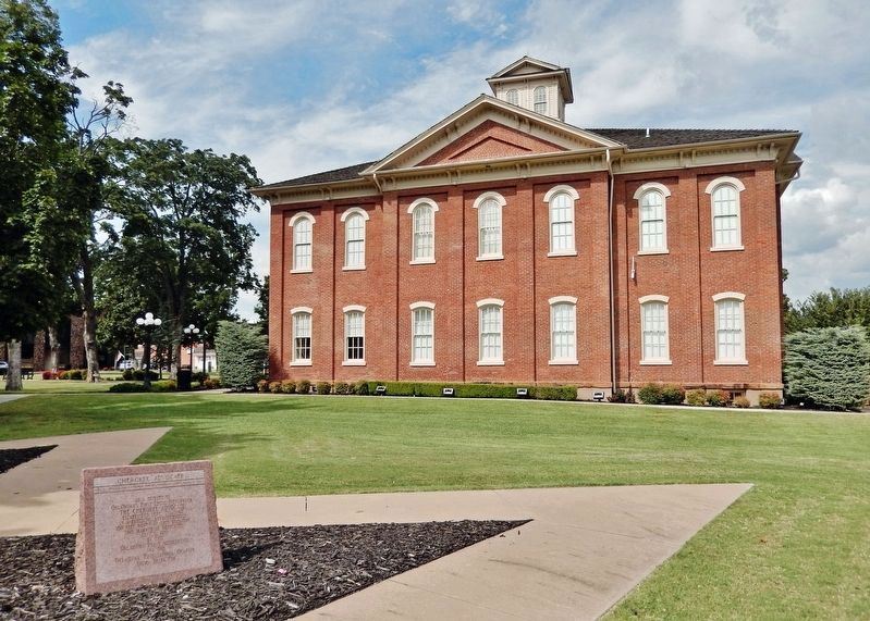
Near East Keetoowah Street just east of South Muskogee Avenue (Business U.S. 62), on the left when traveling east.
As a tribute to Oklahoma’s First Legal Newspaper The Cherokee Advocate established Sept. 26, 1844 in a building approximately 100 feet north of this location. This marker is dedicated Sept 6. 1957 by the Oklahoma Press Association and the . . . — — Map (db m259291) HM
On South Muskogee Avenue (Business U.S. 62) just north of East Keetoowah Street, on the right when traveling north.
has been designated a Registered National Historic Landmark under the provisions of the Historic Sites Act of August 21, 1935 This site possesses exceptional value in commemorating and illustrating the history of the United States . . . — — Map (db m259277) HM
On Cottonwood Street 0.1 miles south of Muskogee Avenue (U.S. 62), on the left when traveling south.
(front)
A grateful Cherokee Nation dedicates
this memorial to all men and women,
both living and dead,
who have defended their families
their people and their homeland
(rear)
These names are carved in stone forever
so that . . . — — Map (db m108886) WM
On South Muskogee Avenue (Business U.S. 62) at East Delaware Street, on the right when traveling north on South Muskogee Avenue.
Here in September 1885 the first telephone in Oklahoma was connected for service. It was the first telephone in the Mississippi Valley west of St. Louis. The company was organized by a group of Cherokees, namely: D. W. Lipe, L. B. Bell, R. M. . . . — — Map (db m259365) HM
On South Muskogee Avenue (Business U.S. 62) at East Keetoowah Street, on the left when traveling south on South Muskogee Avenue.
The Cherokee Advocate owned by the Cherokee Nation was published here. It was printed in Cherokee and English. One half block west in 1848 the first Masonic Lodge was established in what is now Oklahoma. The first telephone in this country was . . . — — Map (db m259305) HM
On South Park Avenue at East Delaware Street, on the right when traveling north on South Park Avenue.
In 1839, after the forced removal from their homeland in the southeastern United States, the Cherokee people began to settle on their new land in Indian Territory. A few years later, the tribe decided that Tahlequah would become the capitol city of . . . — — Map (db m259397) HM
On South Muskogee Avenue (Business U.S. 62) at East Delaware Street, on the right when traveling north on South Muskogee Avenue.
The first man to speak on the telephone west of the Mississippi from Ft. Gibson to Tahlequah. Replacement monument donated to the Cherokee Nation by the Stapler, Bradshaw, Morgan and Jerrems families. — — Map (db m259363) HM
Near East Keetoowah Street just east of South Muskogee Avenue (Business U.S. 62), on the left when traveling east.
Principal Chief of the Cherokee 1828-1866 Born October 3, 1790 in Turkeytown, Alabama. The son of a one-quarter Cherokee maiden and a Scotsman, John Ross was elected as the first Principal Chief of the Cherokee Indians in 1828 and . . . — — Map (db m259375) HM
Near North Grand Avenue just north of Spring Street, on the left when traveling north.
This gathering place is established on the 100th anniversary of the founding of Northeastern as an Oklahoma Normal School dedicated to the preparation of teachers with its home in historic Seminary Hall. The Plaza commemorates the enduring . . . — — Map (db m259439) HM
On South Muskogee Avenue (Business U.S. 62) at East Keetoowah Street, on the left when traveling south on South Muskogee Avenue.
With the faith and courage of their forefathers who made possible the freedom of these United States The Boy Scouts of America dedicate this replica of the Statue of Liberty as a pledge of everlasting fidelity and loyalty 40th . . . — — Map (db m259400) HM
On West Choctaw Street just east of South Morris Avenue, on the left when traveling west.
Cherokee constitution adopted here, Sept. 6, 1839, in convention of leaders including George Lowry, Sequoya, Walter S. Adair, Stephen Foreman, Joshua Buffington, George Brewer, Chief John Ross. Town incorporated 1843. “The Cherokee Advocate” . . . — — Map (db m259283) HM
Near East Choctaw Street at South Water Avenue, on the left when traveling east.
Blacksmithing was one of the trades taught to prisoners at the Cherokee National Prison during their incarceration. The thought was to give men and women a skill set they could use upon their release to better their lives and not continue to commit . . . — — Map (db m259510) HM
On North Muskogee Avenue just south of Downing Street (Business U.S. 62), on the right when traveling south.
Perched proudly above N Muskogee Ave, The Workman's Horse was lovingly brought to Tahlequah by Charles and Robert Workman in 1983. Instantly embraced by the community, the hose became a cherished Tahlequah landmark, casting its watchful gaze for . . . — — Map (db m259399) HM
Near East Keetoowah Street just east of South Muskogee Avenue (Business U.S. 62), on the left when traveling east.
In memory of all veterans of all wars of the United States of America by Disabled American Veterans, Chapter No. 31 Tahlequah, Oklahoma, Nov. 11, 1971 — — Map (db m259398) WM
Near Red Road 1 mile north of U.S. 70, on the right when traveling north.
"Doaksville is a small but pleasant looking village. There are a number of neat, if not tasteful dwelling houses, and two stores, which I found contained a little of almost everything from hoops to hunting shirts. It has a respectable looking . . . — — Map (db m237362) HM
Near Red Road 0.8 miles north of Tram Road, on the right when traveling north.
This is one of three wells known in Doaksville; one is a short distance to the north while the other is in the vicinity of the hotel. At this location, archaeologists found that a stone pavement surrounded the well. Archaeological evidence . . . — — Map (db m238724) HM
Near Red Road 0.8 miles north of Tram Road when traveling north.
The building that was once at this location is very different from other excavated at Doaksville. Here, a rock-walled cellar defines the footprint of a small building with a large fireplace. The cellar, which was excavated by archaeologists and . . . — — Map (db m238332) HM
Near Red Road 0.8 miles north of Tram Road, on the right when traveling north.
Archaeologists found the partial remains of two different buildings when this site was excavated in 1995 and 1996. All that remained of one building was a section of stone foundation. The construction of this wall showed that it was the northwest . . . — — Map (db m238985) HM
Near Red Road 1.2 miles north of U.S. 70, on the right when traveling north.
Despite the importance of Doaksville prior to the Civil War, there is very little information about what the town looked like at that time. In order to have a better understanding of the town, archaeologists excavated the remains of a mercantile . . . — — Map (db m238238) HM
On East 2060 Road 0.2 miles west of North 4375 Road, on the right when traveling west.
The Soldier's Home
In 1843 and later, four new barracks to house one hundred men each were constructed, two each on opposite sides of the parade ground. The lower story was a stone basement that contained a mess hall, kitchen, and pantry. . . . — — Map (db m239623) HM
On Red Road 1 mile north of U.S. 70, on the right when traveling north.
Dedicated to veterans who served during World War I · World War II · Korean War · Vietnam War To honor men and women who bravely served their country during war and peace resting here in the Doaksville
Ft. Towson Cemetery Erected in the year of our . . . — — Map (db m236991) WM
This site is at the north end of Main Street, called "Commercial Row," in this town begun in 1831. Name of nearby post office, "Fort Towson," was changed to Doaksville on Nov. 11, 1847. — — Map (db m52564) HM
On Red Road 1 mile north of U.S. 70, on the right when traveling north.
Established in the early 1800's, and in continuous use, its name was taken from the now vanished town of the same name, just East of these grounds.
Marble Tombstones, brought by steamboat from New Orleans, show the high regard frontier . . . — — Map (db m237045) HM
On Red Road 0.9 miles north of Tram Road, on the right when traveling north.
Doaksville is a small place, containing fifty or sixty people, consisting mostly of traders and mechanics. It has six stores, two saddler shops, one tailor, one blacksmith, one cabinet, and one shoemaker shop, also a drug store and a public . . . — — Map (db m239334) HM
Near North 4375 Road 0.7 miles north of U.S. 70, on the left when traveling north.
Dorothy Jane Orton was the prime mover in urging the restoration of Old Fort Towson. Due to her untiring efforts her home community and the entire state became aware of the important of preserving Fort Towson as a part of Oklahoma's Historic . . . — — Map (db m239411) HM
Near Red Road 0.8 miles north of Tram Road, on the right when traveling north.
Archaeologists spent the summers of 1995, 1996, and 1997 digging to unravel the mysteries of this area. All that was visible before they began was a small, low, earth mound with a few protruding rocks and brick fragments. The archaeologists . . . — — Map (db m238283) HM
Near U.S. 70 west of State Route 209, on the right when traveling east.
Established May, 1824, under command of Col. Matthew Arbuckle to guard this region of Spanish border. Headquarters of Gen. S.B. Maxey, U.S. Army. Abandoned at end of Civil War. In the vicinity, Doaksville was important trading center and one time . . . — — Map (db m52576) HM
On U.S. 70 east of State Route 209, on the right when traveling east.
The Fort Towson Landing was south of here on the banks of the Red River. Also known as the Public Landing, from 1824 to 1854 it served as a receiving point for soldiers and supplies delivered by keelboats and steamboats. Traders from the Choctaw . . . — — Map (db m52578) HM
On East 2060 Road 0.2 miles west of North 4375 Road, on the right when traveling west.
The post hospital consisted of the main structure and a kitchen. A large, central fireplace heated the log building. Inside was a waiting room, office, large wardroom, smaller wardroom for the seriously ill, and a "dead room" or mortuary. The . . . — — Map (db m239662) HM
On East 2060 Road 0.2 miles west of North 4375 Road when traveling east.
Memorial
To three Native American patriots who died in the vicinity of Fort Towson. Col. George Colbert was buried in this cemetery with military honors. The other two were buried also with military honors, but their graves are unknown, . . . — — Map (db m241589) WM
Near Red Road 0.8 miles north of Tram Road, on the right when traveling north.
Many whites had settled in what is today southeastern Oklahoma prior to the removal of the Choctaws to Indian Territory following the Treaty of Dancing Rabbit Creek in 1830. This unauthorized settlement was a problem during the initial . . . — — Map (db m238771) HM
Near North 4375 Road 0.7 miles U.S. 70, on the left when traveling north.
The three houses of "Officers' Row" were the domain of Army officers and their families. The commanding officer lived in the larger, middle house flanked by quarters for other officers on either side. The houses were built of hewn logs covered . . . — — Map (db m239532) HM
On Red Road 0.1 miles north of Tram Road, on the right when traveling north.
My father and mother are both buried in the old cemetery at Doaksville. It is more than one hundred and twenty-five years old and many of our family are buried there. Clemmie G. Sacra, 1937
The Doaksville cemetery has served the . . . — — Map (db m239285) HM
Near Red Road 0.8 miles north of Wilson Street, on the right when traveling north.
"The famous old military road came in from Arkansas to Fort Towson near Doaksville, thence in a westerly direction to Armstrong Academy to Washita, Tishomingo, thence west to Fort Arbuckle." Matthew Walton James, 1937
[In 1879] . . . — — Map (db m237791) HM
Here at Doaksville, June 23, 1865, Brigadier General Stand Watie, Cherokee Indian, was the last Confederate General to surrender. — — Map (db m151958) HM
Near North 4355 Road 0.7 miles north of U.S. 70, on the left when traveling north.
The post's sutler was a civilian storekeeper permitted by the Federal government to operate a trading house on or near a fort. His general merchandise business provided goods and services not regularly supplied by the military. It was also open to . . . — — Map (db m239504) HM
Near Red Road 0.1 miles Tram Road when traveling north.
The public house is owned by Col. David Folsom one of the principal men in the Choctaw Nation. He keeps an excellent house on strictly temperance principles. He also owns the blacksmith shop. Rev. P.P. Brown, 1847
Hotels during the . . . — — Map (db m238382) HM
Near Red Road 0.8 miles north of Tram Road, on the right when traveling north.
Economic and political changes to the region surrounding Doaksville caused this community to decline rapidly in late 1860s and 1870s. There is little archaeological evidence of sustained activity at this place after about 1870.
In 1854, Fort . . . — — Map (db m239198) HM
Near Red Road 0.8 miles Tram Road, on the right when traveling north.
I remember the old stone jail at Doaksville, just a one-room affair with iron-barred slits for windows. I wondered when and by whom it was built. That old place was so interesting to me. Charles Washington Ervin, 1937
The Choctaw . . . — — Map (db m239185) HM
Near Red Road 0.8 miles Tram Road, on the right when traveling north. Reported unreadable.
To commemorate the history of Doaksville, the first historical marker was placed in 1960. A second commemorative marker was placed in 1965 to acknowledge the 100th anniversary of General Stand Watie's surrender. At the end of the Civil War on June . . . — — Map (db m238464) HM
Near Red Road north of U.S. 70, on the right when traveling north.
Prior to 1830, Mississippi was the Choctaw homeland. The Choctaw migration to a new western homeland began shortly after the Treaty of Dancing Rabbit Creek was signed in 1830. The Choctaw people relocated to Indian Territory, traveling overland . . . — — Map (db m238148) HM
On Fort Towson Historic Site Road (County Road E2060) 0.5 miles west of County Road N4375.
During the early 1800's, present Southeastern Oklahoma was a major transportation crossroads. Roads connected Fort Towson in the Choctaw Nation to military installations to the North, South and West. On the Texas side of the Red River, Jonesboro was . . . — — Map (db m52580) HM
Near Red Road 0.8 miles north of Tram Road, on the right when traveling north.
The mounds at Doaksville were once thought to have formed when masonry buildings or chimneys collapsed. Over time, it was thought the resulting pile of rubble became covered with soil. However, when archaeologists excavated this site and the jail, . . . — — Map (db m239134) HM
On Valliant Avenue (U.S. 70) just east of Main Street, on the right when traveling east.
Dedicated to these young men of Fort Towson who died to preserve our heritage, our freedom, and our way of life. You Will Be Remembered Argonne Forrest Campbell 1923-1944 Glenn L. Reding 1921-1943 Finnice C. Wallace 1925-1944 Paul . . . — — Map (db m288396) WM
On North 4th Street at East Jackson Street (Business U.S. 70), on the right when traveling south on North 4th Street.
For those who died in that terrible war: we bestow our highest honor, respect, and appreciation for they gave the supreme sacrifice.
For those who are still missing: we hope and pray for their return home.
To those who still suffer, . . . — — Map (db m61963) WM
On North 4200 Road west of Old Spring Road, on the left when traveling west.
Begun 1848 by Rev. John Lathrop of American Bd. of Foreign Miss. Rev. O.P. Stark, Supt. (1850), built 1st church. Mrs. Stark opened 1st school here. Others in the service through 100 years include W.J.B. Lloyd, J.P. Gibbons, Bella M. Gibbons, Silas . . . — — Map (db m160362) HM
On Oklahoma 271A east of County Road 4200, on the right when traveling west.
Established in 1848 by Presbyterian Church as a mission among the Choctaw and Chickasaw Indians. Organized through the efforts of Rev. Cyrus Kingsbury, Ebenezer Hotchkin, Alfred Wright, Cyrus Byington, and C. C. Copeland. Today it is the oldest . . . — — Map (db m269162) HM
Near North 4260 Road 1.5 miles south of U.S. 70, on the left when traveling south.
Representative from the Choctaw Nation in the Congress of the Confederate States of America. Oklahoma Historical Society R.L. Williams, W.B. Morrison, A.N. Leecraft, G.E. Harris, W.A. Loftin, Committee John R. Arernathy Grand Master W.S. Key, . . . — — Map (db m268857) WM
On U.S. 70 east of N4310 Road (State Route 147), on the right when traveling west.
Noted school for boys, established by Choctaw Nation 1841; named for John C. Spencer, U.S. Sec. of War. Students who were later prominent leaders included Coleman E. Nelson, Allen Wright, Jackson McCurtain, Charles S. Vinson, B. F. Smallwood, . . . — — Map (db m147475) HM
On U.S. 287 3.1 miles north of E0130 Road, on the left when traveling north.
Surveyed by J.C. Brown 1826-27
Heaviest traffic during California Gold Rush 1849
Abandoned on completion of A.T.&S.F. railroad in 1880 — — Map (db m106477) HM
On Main Street (State Highway 325) at Cimarron Avenue (U.S. 385), on the left when traveling west on Main Street.
From September 23 through 27, 1846, the Mormon Battalion crossed the northwestern portion of the Oklahoma panhandle. The little army's 500-plus volunteers, recruited for the Mexican War, were enlisted near Council Bluffs, Iowa, from among the first . . . — — Map (db m55260) HM
On U.S. 287 3.1 miles north of E0130 Road, on the left when traveling north.
(Left Panel)
The Santa Fe Trail
A Bridge Between the United States and Mexico
Before you is a portion of the historic Santa Fe Trail. Established as a wagon route by William Becknell in 1822, the Santa Fe Trail became the . . . — — Map (db m106478) HM
Near Black Mesa Road 5 miles north of Oklahoma Highway 325, on the left when traveling north.
How did Black Mesa become a Preserve?
The Land was acquired in parcels over many years, beginning in 1959 when the State of Oklahoma purchased 100 acres on the top of the Mesa.
In 1989, the Nature Conservancy acquired 1500 acres on the . . . — — Map (db m246882) HM
Near Black Mesa Trail 0.5 miles west of Black Mesa Road, on the right when traveling west.
A rich cultural history of the Old West
The famed Santa Fe Trail, a wagon route linking the eastern United States and Mexico, cut through this corner of Cimarron County. From the 1820s until the construction of the railroads in the 1860s, . . . — — Map (db m246993) HM
Near Black Mesa Road 5 miles north of Oklahoma Highway 325.
Highest point in Oklahoma 4972.97 feet above the sea as determined by a survey ordered by Governor Johnston Murray and completed May 9, 1954 by Oklahoma Highway Department under direction of C.A. Stoldt Director, G.H. Bittle Chemical Engineer, and . . . — — Map (db m247159) HM
Near Black Mesa Road 5 miles Oklahoma Highway 325, on the left when traveling north.
Imagine the Black Mesa as a giant book lying on its side.
Each layer of rock is a different chapter in geologic history. The basalt cap on top is the most recent chapter - it's less than 5 million years old. As you go down, each deeper . . . — — Map (db m247123) HM
On 325 Highway 3.5 miles north of E0190 Road, on the left when traveling north.
Established in May 1865, by Kit Carson, hero of Valverde and Brig. Gen., New Mexico Volunteers, to guard Santa Fe Trail and furnish escorts for caravans engaged in Santa Fe trade. Santa Fe Trail crossed this highway here and was first traveled by . . . — — Map (db m39798) HM
On 325 3.6 miles north of E0190 Road, on the left when traveling north.
(left panel) A Bridge Between the United States and Mexico
Before you is a portion of the historic Santa Fe Trail. Established as a wagon route by William Becknell in 1822, the Santa Fe Trail became the first major trade link between . . . — — Map (db m131308) HM
On U.S. 77 at North Main Street, on the right when traveling north on U.S. 77.
One mile northwest the Camp Holmes Treaty was signed to guarantee peace, friendship, good hunting, safe travel, as far as the western borders of the U.S.A. To negotiate their first treaty with our government and the Civilized Indian Nations, 5000 . . . — — Map (db m144841) HM
On 89er Park Street at U.S. 77, on the left when traveling east on 89er Park Street.
Birthplace & Boyhood Home
Col. John L. Smith Dec. 26, 1914 - June 10, 1972
Col. John Lucien Smith U.S.M.C. In 54 days of aerial combat in the Solomon Islands he destroyed 19 Japanese planes to become the leading air ace of World War II at that . . . — — Map (db m144843) HM WM
On James C. Nance Memorial Bridge (U.S. 77) 0.1 miles west of Southwest 5th Street, on the left when traveling west.
The Billy Hocker Bridge, pictured above, was the first across the Canadian connecting
Lexington and Purcell. It opened for traffic on September 29, 1899, and quickly became a
vital transportation link. A 24 hour crossing, it was not unusual for up . . . — — Map (db m276533) HM
On U.S. 77 at '89er Park Street, on the right when traveling north on U.S. 77.
Canadian River was south line of “Old Oklahoma” opened by Run at 12 o’clock noon, April 22, 1889. Riders started at river crossing near here. Many thousands entered the 2,000,000 a. tract north: homes were planted and tent cities . . . — — Map (db m144698) HM
On Main Street (U.S. 77) 0.1 miles north of South 8th Street, on the right when traveling north.
In 1843, General Zachary Taylor sent
Capt. Nathan Boone, youngest son of
Daniel Boone, with a complement of
nearly 100 men and officers to reconnoiter the Plains Indian tribes.
On their return march they camped
July 20, on creek east of this . . . — — Map (db m276576) HM
On East Main Street at North Jones Avenue, on the left when traveling east on East Main Street.
In the early to mid-decades of the 1900s, this historical clock was a prominent fixture of the exterior of the First National Bank, 132 East Main. The clock was not part of the original design of the bank and probably was added to the building in . . . — — Map (db m279743) HM
On College Avenue north of Elmwood Drive, on the right when traveling north.
Psi Chapter of Alpha Chi Omega was established at the University of Oklahoma with twelve founding members on January 14, 1916. On that date, Alpha Chi Omega became the fifth national sorority on the university's campus. Additionally, Psi became the . . . — — Map (db m278157) HM
On East Main Street west of South Peters Avenue, on the right when traveling east.
The city's first brick building, constructed by Pryor V. Adkins on his lot at 101 E. Main Street in 1890, was home to many businesses before it was demolished to make way for the construction and opening of the Sooner Theatre in 1927. Mr. Adkins . . . — — Map (db m279588) HM
On East Main Street at North Peters Avenue, on the left when traveling east on East Main Street.
Nearly all of the wooden buildings on the south side of Main Street in the first block east of the railroad tracks were destroyed by a massive fire in the summer of 1902. It was believed to be the city's worst fire.
The easternmost buildings, . . . — — Map (db m279615) HM
On East Main Street at North Peters Avenue, on the left when traveling east on East Main Street.
Although there was no money to grade and drag Norman's Main Street for the first few years, there were wooden sidewalks within eight months of the town's settling in 1889. In summer months, a municipal sprinkling system was activated to keep the . . . — — Map (db m279611) HM
On East Main Street at South Peters Avenue, on the right when traveling east on East Main Street.
C.W. Streeter opened Norman's first shoe and boot store in front of his home at 209 E. Main. Downtown Norman's support of movie theaters from the 1930s through the 1970s was evident in the 200 block of East Main Street. The north side of the street . . . — — Map (db m279603) HM
On East Main Street at North Jones Avenue, on the left when traveling east on East Main Street.
The Land Run of April 22, 1889, brought tens of thousands of settlers to the Unassigned Lands of the Indian Territory, in what is present-day central Oklahoma. Norman was founded on that day and its new residents brought a demand for all types of . . . — — Map (db m279748) HM
On Legacy Park Drive west of 24th Avenue Northwest.
After the bombing of Pearl Harbor in December of 1941, the U.S. entered World War II and the Navy began looking for sites to train fighter pilots. The Navy bought 2,537 acres in Norman and leased another 62,000 acres in Oklahoma, primarily for . . . — — Map (db m279886) HM
Near South Jones Avenue near East Symmes Street, on the right when traveling south.
Although the second decade of the university's existence was marked by solid advances in important areas, the prevailing notes were of tragedy, turmoil and political interference. On the positive side, the institution experience gratifying growth. . . . — — Map (db m279121) HM
Near Parrington Oval south of West Boyd Street, on the right when traveling north.
This peaceful garden is named in honor of Ada Lois Sipuel Fisher. Despite state laws in Oklahoma and sixteen other states mandating racially segregated education, she was quietly determined to secure the advantages of higher education for herself . . . — — Map (db m278427) HM
On West Brooks Street 0.1 miles west of Jenkins Avenue, on the right when traveling west.
This building is named for Arthur Barto Adams, the first dean of the College of Business Administration. Adams was born in Union County, South Carolina on January 24, 1887, and studied at the University of South Carolina and at Columbia. He came to . . . — — Map (db m277498) HM
On College Avenue south of Emerald Way, on the right when traveling south.
On April 2, 1921, the Oklahoma Delta Kappa Chapter of Alpha Tau Omega Fraternity began by initiating 27 men of the University of Oklahoma. In 2021, Delta Kappa celebrates its centennial as a leading chapter both nationally and at OU. From its first . . . — — Map (db m278163) HM
On Elm Avenue at West Brooks Street, on the right when traveling south on Elm Avenue.
Zarrow Hall is named in honor of Henry Zarrow, a lifelong philanthropist, and his wife, Anne, who shared a passion for helping others. This building was dedicated in 2011 and houses the School of Social Work. It reflects the traditional architecture . . . — — Map (db m278103) HM
Near Parrington Oval 0.1 miles south of West Boyd Street, on the right when traveling south.
In 1893, three years after the First Legislative Assembly of the Oklahoma Territory established the University of Oklahoma, the first building On campus was completed. It was the first physical evidence of President David Ross Boyd's effort to build . . . — — Map (db m278502) HM
On West Brooks Street at Van Vleet Oval, on the left when traveling east on West Brooks Street.
This library honors William Bennett Bizzell (1876-1944), the University's fifth president. Born in Texas, Bizzell received a total of seven degrees from Baylor University, The Illinois College of Law, the University of Chicago, and Columbia . . . — — Map (db m277534) HM
On East Brooks Street at South Jenkins Avenue, on the right when traveling east on East Brooks Street.
This part of the campus is named in honor of Stratton Duluth Brooks (1869-1949). Brooks was born in Everett, Missouri, grew up in Michigan, and studied at the Michigan State Normal School and at Harvard. He served as the superintendent of schools in . . . — — Map (db m277266) HM
Near Asp Avenue at Kuhlman Court, on the left when traveling west.
This building is named in honor of James S. Buchanan, fourth president of the University. Buchanan was born on October 14, 1864 in Franklin, Tennessee, not far from the Civil War battle that was engaged there at the time. He graduated from . . . — — Map (db m278454) HM
On Elm Avenue 0.1 miles south of West Boyd Street, on the right when traveling south.
This building was added to campus in 1932 to house the School of Home Economics and was named for the long time director of the school, Dr. Helen B. Burton. Dr. Burton was born in Chicago, Illinois on January 7, 1889. She studied at Indiana . . . — — Map (db m278091) HM
Near Griffin Community Park's entrance road 0.1 miles north of East Robinson Street, on the left when traveling north.
Dozens of Oklahomans boarded a train in Jacksonville, Ill., one day in 1895. They were bound for the prairie town of Norman, Oklahoma, and the newly opened private sanitarium that would care for them. That was the beginning of what is now known as . . . — — Map (db m279865) HM
Near Parrington Oval 0.1 miles south of West Boyd Street, on the right when traveling east.
This building is named in honor of the American philanthropist Andrew Carnegie (1835-1919). Following the burning of Science Hall on January 6, 1903, the growing University was in dire need of new facilities. Later that year, President David Ross . . . — — Map (db m278469) HM
Near Asp Avenue south of West Boyd Street, on the right when traveling south.
This building, which is now named in honor of Paul S. Carpenter (1895-1949), Dean of the College of Fine Arts and Professor of Violin, began its life as the Geology Building. It was built in 1919 as part of a trio of buildings that also included an . . . — — Map (db m278419) HM
On Cate Center Drive 0.1 miles west of Asp Avenue, on the left when traveling west.
First occupied in 1949 as a freshman women's dormitory, Cate Center was originally called the Women's Quadrangle and housed 52 women. Today, it is a coeducational residence hall. In 1960, the Women's Quadrangle was renamed Cate Center in honor of . . . — — Map (db m277027) HM
On Elm Avenue south of West Boyd Street, on the right when traveling south.
The music center is named for University of Oklahoma alumnus and supporter, Stanley B. Catlett Sr. Catlett was born in Sidell, Illinois on June 23, 1899 and his family and he moved to Indian Territory in 1901. He entered the University of Oklahoma . . . — — Map (db m278058) HM
On Parrington Oval 0.1 miles south of West Boyd Street, on the right when traveling south.
This building was erected in 1916 to house the expanding chemistry department, and was originally named DeBarr Hall in honor of Edwin C. DeBarr (1859-1950), one of the original four members of the faculty. DeBarr was a graduate of the Michigan State . . . — — Map (db m278652) HM
On East Eufaula Street at South Peters Avenue, on the left when traveling east on East Eufaula Street.
Norman was designated as the seat of Cleveland County shortly after the Land Run of 1889. The first permanent courthouse was located in the Original Townsite of Norman at the corner of Gray Street and Ponca Avenue. This structure was destroyed by . . . — — Map (db m121720) HM
On Van Vleet Oval 0.1 miles north of West Lindsey Street, on the left when traveling north.
Collings Hall is the home of the Jeannine Rainbolt College of Education. In 2009 and 2010, Collings Hall was enlarged and underwent major renovations. The Rainbolt family and other donors made the expansion possible. Jeannine Rainbolt was a graduate . . . — — Map (db m277649) HM
On Van Vleet Oval 0.1 miles north of West Lindsey Street, on the left when traveling north.
On Journalism Day, March 16, 1961, Dr. George Lynn Cross announced that the Journalism Building, first occupied in 1958, would be named Copeland Hall in honor of Dr. Fayette Copeland. As director of the School of Journalism, Copeland dedicated forty . . . — — Map (db m277660) HM
On Asp Avenue south of 3rd Street, on the right when traveling south.
Built in 1966 to house and provide dining services for undergraduates, Couch Center was one of the final building complexes constructed under President George Lynn Cross' administration (1943-1968). Part of the efforts of George Lynn Cross to . . . — — Map (db m276874) HM
On Cate Center Drive 0.1 miles west of Asp Avenue, on the left when traveling east.
University President George Lynn Cross initiated actions in August 1946 to establish an Air unit of the Reserve Officers Training Corps at the University of Oklahoma. His action recognized the growing importance of air power to our nation's military . . . — — Map (db m277858) HM
On Van Vleet Oval north of West Lindsey Street, on the left when traveling north.
Dale Hall, opened in 1967, and Dale Hall Tower, occupied two years later, were named for the eminent University of Oklahoma historian, Edward Everett Dale. Born in 1879, in old Greer County, Dale spent his boyhood working as a cowboy. When still a . . . — — Map (db m277669) HM
2065 entries matched your criteria. Entries 201 through 300 are listed above. ⊲ Previous 100 — Next 100 ⊳