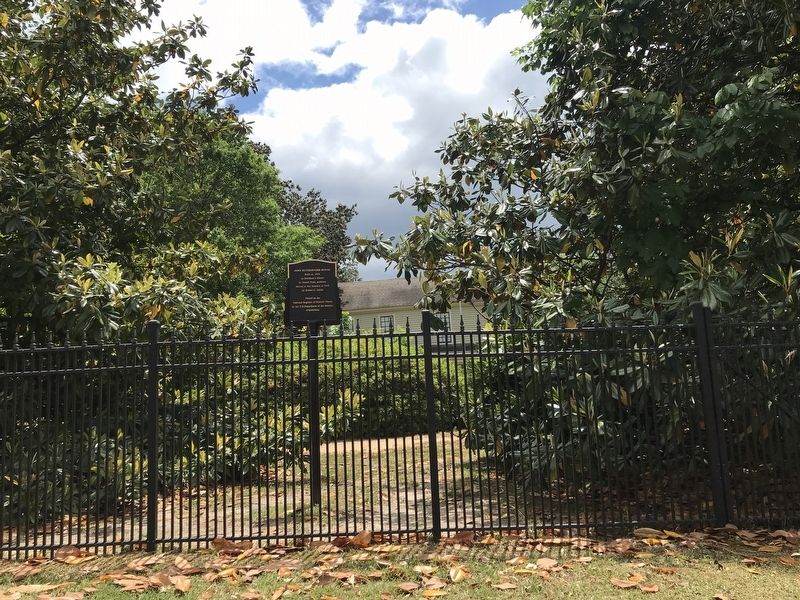
Veterans Memorial
"Flame of Freedom"
Dedicated to the veterans of all wars
from Milledgeville and Baldwin County
on the occasion of the 50th Anniversary
of the American Legion
March 15, 1969
"O, Lord, support us . . . — — Map (db m103160) WM
Charles Holmes Herty, one of America’s outstanding chemists, was born on this site December 4, 1867. He spent his early life in Milledgeville where he attended the Middle Georgia Agricultural and Military College (now Georgia College). Later he . . . — — Map (db m36294) HM
This Milledgeville Federal-style house was built c. 1825 on North Wilkinson Street for George T. Brown by English-born builder-architect John Marlor. It was operated as the U.S. Hotel and then the Beecher-Brown Hotel to serve visitors and . . . — — Map (db m13141) HM
The Union Army of 65,000 men under the command of General Wm. T. Sherman left Atlanta on November 15, 1864. Only the left wing of 30,000 men entered Milledgeville. The advance units arrived here on the 22nd. The right wing marched via Clinton and . . . — — Map (db m35995) HM
Carl Vinson, native son, farmer, lawyer, statesman, served in the United States Congress for 50 years;
Chairman of the Naval Affairs Committee; Chairman of the Armed Services Committee;
an advocate for Military Preparedness; He was credited with . . . — — Map (db m42626) HM
In 1997 a cemetery restoration began here that triggered a movement to memorialize patients buried at state psychiatric hospitals nationwide. After discovering nearby neglected cemeteries interred some 25,000 people, members of the Georgia Consumer . . . — — Map (db m53826) HM
This square was reserved for public use in the city's original survey and became the site of early church buildings. One hundred yards south of this point is a stone marking the site of the first Methodist Church erected in Georgia west of the . . . — — Map (db m53076) HM
Marching toward Milledgeville via Covington, Shady Dale and Eatonton Factory, the Union Army's 14th Corps reached this crossroad on the night of November 22, 1864. General Sherman camped at the Howell Cobb place, a few yards north of this point. . . . — — Map (db m13136) HM
The Georgia Lunatic Asylum (now Central State Hospital) “was the fifth oldest institution exclusively for the insane in the South and the fourteenth in the nation” (Dr. Peter G. Cranford). It took care of the afflicted paupers in Georgia as well as . . . — — Map (db m197781) HM
In May 1539 Hernando de Soto landed in Florida with over 600 people, 220 horses and mules, and a herd reserved for famine. Fired by his success in Pizarro's conquest of Peru, De Soto had been granted the rights, by the King of Spain, to explore, . . . — — Map (db m27275) HM
Dr. Charles Holmes Herty
Statesman - chemist
Born on this spot
Dec. 4, 1867
By his leadership
He had made America
Chemically self sufficient
He has unselfishly
Given his time and
Talent to develop
Georgia's natural . . . — — Map (db m91823) HM
Andalusia was the home of writer Flannery O’Connor from 1951 until her death in 1964. Born in Savannah in 1925, O’Connor and her family moved to Milledgeville in 1940. O’Connor left Georgia for a time, but returned to Milledgeville in 1951 after . . . — — Map (db m8982) HM
Three hundred yards east of this point stood Ft. Wilkinson, established in 1797 on Georgia's Indian boundary. Garrisoned by soldiers whose families lived outside the stockade, it was an early trading house where Creek Indians were provided . . . — — Map (db m13140) HM
On this 20-acre square stood the first Georgia State Penitentiary. Completed in 1816, the walled compound occupied 2-1/2 acres in the center of the square. The penitentiary housed approximately 245 prisoners in a brick and granite main cell . . . — — Map (db m127158) HM
On January 16, 1861, the Georgia Secession Convention met here to consider seceding from the United States. Secession began in response to Abraham Lincoln's election as president the previous November and the belief that his Republican party was . . . — — Map (db m42603) HM
After the Civil War, Georgia established the State Prison Farm at this site, creating it for women, juveniles, and men unable to perform convict-leasing or chain gang labor. Like other states and private prisons nationwide, the prison focused on . . . — — Map (db m308401) HM
In commemoration of the safeguarding
of the
Great Seal of Georgia
and the
unfinished acts of the
legislature, 1864
Within five hundred feet east of here lived Georgia's wartime Secretary of State, Nathan C. Barnett. At midnight . . . — — Map (db m197768) HM
Site of the large Baldwin County plantation of Howell Cobb, one of the 'Great Georgia Triumvirate' of Stephens, Toombs and Cobb, and his wife, the former
Mary Ann Lamar. Born at Cherry Hill in Jefferson County, Georgia Sept. 7, 1815, he graduated . . . — — Map (db m13137) HM
In Commemoration of
Marquis De Lafayette
and his visit to
Georgia's Capitol
March 27-29, 1825.
Monday March 28 a ball
and supper were given
in his honor in the State
House and a barbecue was . . . — — Map (db m103176) HM
Jarrett Springs formerly known as Commissioners Springs,
flows in an enclosed structure about 40 yards on adjacent land.
In 1803, because of the abundant and clear water supply,
this site was selected by the Georgia Legislature as the . . . — — Map (db m43164) HM
With the right wing of his army in the vicinity of Clinton and Macon, General Sherman, with the left wing, appeared at this point on November 23, 1864. The left wing, consisting of the 20th and 14th corps, was comprised of 30,000 men, 12,000 horses . . . — — Map (db m35832) HM
From March 27 to 29, 1825, General Lafayette stayed at
the Government House during his visit to Milledgeville, then Georgia's capital. — — Map (db m227241) HM
This is the oldest Masonic building in Georgia with continuous usage since its dedication on June 24, 1834. Funded through a state authorized lottery and constructed by John Marlor (also one of its architects with Samuel Tucker and James Doyle), . . . — — Map (db m36729) HM
As part of the Historic District of Milledgeville
has been placed on the
National Register
Of Historic Places
By the United States
Department of the Interior — — Map (db m42312) HM
South (Front)
CSA
This tribute to the
memory of the
Confederate Soldier,
unveiled April 26, 1912.
West
His heroism, in the
presence of the
conquering foe was
equaled only by
his . . . — — Map (db m103412) WM
In 1837, largely through the influence of Tomlinson Fort and William A. White, the legislature appropriated $20,000 for a dormitory near
Milledgeville where the state’s mentally ill could receive custodial care. A four-story building was opened on . . . — — Map (db m13135) HM
This church is named Montpelier after Fort Montpelier of 1794, 1/2 mi. below here down the Oconee. This fort & others were built during the Creek Indian troubles. Capt. Jonas Fouche was ordered to guard the Ga. frontier from the mouth of the Tugaloo . . . — — Map (db m36103) HM
The first settlement in this section was made up of four frame houses, a dozen or more cabins and a fort. It was called Federal town. Many of the soldiers died so a new fort was built several miles up the river and named Fort Fidius. It was located . . . — — Map (db m36323) HM
Where treaty of limits took place between the United States and Creek Nation of Indians June 16, 1802, ratified Jan. 11, 1803
This treaty was signed by James Wilkinson, Benjamin Hawkins, Andrew Pickens, Commissioners on the part of the United . . . — — Map (db m239149) HM
Completed in 1838, The Executive Mansion was the fifth and last residence occupied by Georgia governors when Milledgeville was the capital of Georgia. The Palladian-inspired structure is considered one of the most perfect examples of Georgian . . . — — Map (db m36124) HM
This is the site of the antebellum college established in the community of Midway by the Hopewell Presbytery in 1833. Its first president, Carlisle P. Beman, was succeded by Samuel K. Talmage. In 1861, students and faculty entered Confederate . . . — — Map (db m10803) HM
A reproduction of Georgia’s State Capitol 1807-1867 stands on the original site. Wings to the main building were added in 1828 and 1837. Here the Secession Convention met Jan. 16, 1861 and after three days of bitter debate passed the secession act. . . . — — Map (db m36405) HM
Under the care of Superintendent Dr. Theophilus Orgain Powell from 1879 to 1907, the institution adjusted to more accurate and innovative methods of diagnosis. In recognition of his long, devoted service to the institution, the Board chose the most . . . — — Map (db m197779) HM
The 3rd Wisconsin and the 107th New York Regiments, having been detailed for provost duty, encamped on this square, November 22-25, 1864. The State Arsenal on the north side of the square was burned. The magazine, which stood on the opposite side, . . . — — Map (db m208063) HM
To The Memory of
Rear Adm. John W. Wilcox, Jr.
Born Midway Ga. Mar 22, 1882
Commander of Battle Ships
Atlantic Fleet U.S. Navy
Lost at sea from his flagship
the U.S.S. Washington
on Mar 27, 1942
off Sabel Island, N. Atlantic . . . — — Map (db m52109) HM
On the morning of Nov. 23, 1864, the main body of the 20th Corps of the Union Army, commanded by Gen. A. S. Williams, reached Milledgeville from Eatonton. The Corps marched down Jackson Street to this point where companies were formed into line. . . . — — Map (db m35712) HM
The first Catholic mass was celebrated at Milledgeville in April, 1845, at the Hugh Treanor apartment in the Newell Hotel. Bishop Ignatius Reynolds of the diocese of Charleston, accompanied by Father J. F. O’Neill, visited here in 1847. In 1850 this . . . — — Map (db m36357) HM
This Church was organized in 1841 through the efforts of Bishop Stephen Elliott. The church building was completed in 1843 and consecrated Dec. 10. The vestibule, annex and Gothic roof were added later. The handmade chancel furniture was given by . . . — — Map (db m36104) HM
Largely through the efforts of William Y. Atkinson the Georgia Normal and Industrial College was founded in 1889 with J. Harris Chappell as the first president. It became a degree-granting institution in 1917 and included a liberal arts program. The . . . — — Map (db m36361) HM
This 20-acre square as the center of Georgia's state government and location of its capitol building from 1807 until 1868. The "State House," imposing Gothic edifice that dominates the square contained the offices of the governor and the chambers of . . . — — Map (db m103227) HM
On this tract of twenty acres was built the Statehouse, the original wing of which was completed in 1811. Later additions were made until 1835 when it was finished in its present form. Near the Statehouse stood the Arsenal and the Magazine, brick . . . — — Map (db m36404) HM
In grateful commemoration
of the contribution to agriculture by
Drs. Henry Dawson
and
Edwin Whitaker Allen, Brothers,
of Baldwin County, Georgia, in the discovery,
improvement and dissemination, 1920-1940, . . . — — Map (db m103162) HM
When Federal troops entered Milledgeville in November, 1864, Georgia Secretary of State Nathan C. Barnett hid the Great Seal under a house and the legislative minutes in a pig pen 30 yards east of this point. Later they were returned to the . . . — — Map (db m36358) HM
Dr. Thomas F. Green was appointed superintendent of the Georgia Lunatic Asylum in 1845. He worked for 33 years before collapsing while caring for a patient and died two days later on Feb. 13, 1879.
Under Thomas F. Green, the patient population . . . — — Map (db m197778) HM
On Nov. 15, 1864, after destroying Atlanta and cutting his communications with the North, Maj. Gen. W.T. Sherman, USA, began his destructive campaign for Savannah -- the March to the Sea. He divided his army [US] into two wings. The Right Wing (15th . . . — — Map (db m208062) HM
This marks the original site
of the Methodist Church erected
about the year 1805.
Bishop Asbury and Bishop
McKendree in 1815 held here
a conference which James O.
Andrew attended.
Bishop Capers, Dr. Lovick Pierce,
and many other . . . — — Map (db m42773) HM
On this corner stood the Milledgeville Hotel built in 1858 while Milledgeville served as Georgia's capital. In 1903 Emily Norvell Hardy took over management of the hotel. She moved into the hotel with her two youngest children, including . . . — — Map (db m15373) HM
Construction of this Executive Mansion was authorized in 1835 and completed in 1839. The governor's earlier residence, Government House, just to the south on the corner of Clarke and Greene Streets, had fallen into disrepair. The Mansion is . . . — — Map (db m103230) HM
Five miles south of this point is the Rock Landing at the head of navigation on the Oconee River and at the junction of the old Indian trading paths leading westward. In 1789 Pres. Washington sent Gen. Benjamin Lincoln here to treat with Chief . . . — — Map (db m36326) HM
These Confederate soldiers, all serving in the Georgia Militia, died at Brown Hospital in Milledgeville and were buried at this location. Their names soon became lost, and they were considered Unknown Soldiers until 2003 when their identities were . . . — — Map (db m91851) HM
The Walker Building was originally called the Male Convalescent Building. It was built in 1884 and opened for use in 1886. The Walker Building served as an admission ward for white males. This building was faithfully used to treat patients until . . . — — Map (db m197776) HM
At this site lived Tomlinson Fort (1787-1859). A leader of the Union Party, he studied medicine and wrote a widely used book on medical practice. A captain in the War of 1812, he served in the Georgia legislature and the U.S. Congress, and on the . . . — — Map (db m36134) HM
In the street near this site in June 1807, occurred the horse-whipping of Superior Court Judge Charles Tait by his political enemy John Clark, later Governor of Georgia. Clark was fined $2,000 for the assault. The incident illustrates Georgia . . . — — Map (db m36362) HM
This house, now the Du Bignon home, was once the home of John Clark, Governor of Georgia. At the age of 16, John Clark fought with his father, General Elijah Clark, distinguished Revolutionary soldier, at the decisive Battle of Kettle Creek. . . . — — Map (db m13138) HM
Gen. Sherman’s Cavalry Corps, commanded by Gen. Judson Kilpatrick, consisted of 5,000 men, 8,000 animals, and 300 wagons. It rode from Gordon to Milledgeville on Nov. 24 to join the left wing of the Union Army. On the 25th, Gen. Kilpatrick moved . . . — — Map (db m42314) HM
Born February 3 in 1811 near Greensboro, George Foster Pierce was converted while at the University in Athens; in 1830 he followed his father, Dr. Lovick Pierce, into the Methodist ministry. He was first assigned twenty-two preaching stations on the . . . — — Map (db m14731) HM
Dr. Rice was born and raised in Prattsville, Alabama. He lived most of his adult life in Greene County and had an abiding love and pride in her past, present, and future. He served her interests in many capacities: pharmacist, county historian, . . . — — Map (db m267649) HM
Affectionately known as “H”, he served as a director on the
Farm Bureau Board and as a Wildlife Ranger for the State
of Georgia where he was instrumental in the beginning of the
Aquaculture Commodities Program for the State.
He was an . . . — — Map (db m267781) HM
This church was organized on September 23, 1863, by the Right Reverend Stephen Elliott, the first Bishop of Georgia. Its original members included two Greensboro families and several women who had migrated inland from Charleston and Savannah to . . . — — Map (db m184198) HM
In 1874, the Georgia Department of Agriculture was established by Act of the Legislature with Thomas P. Janes serving as its first Commissioner, 1874-79.
Commissioner Janes, born 1823 in present Taliaferro County, (formerly the eastern part of . . . — — Map (db m14726) HM
About two miles South, in the fork of the Appalachee and Oconee rivers, stood Fort Mathews, built in 1793. From this fort, Thomas Houghton observed the activities of General Elijah Clark and his land hungry followers as they built forts and . . . — — Map (db m15809) HM
Near here, on a bluff overlooking the river, stood the home of Governor Peter Early, one of Georgia's great men. Born in Virginia, June 30, 1773, a graduate of Princeton, he was a lawyer, judge, State Senator, Congressman, Governor during the . . . — — Map (db m170378) HM
Peter Early served as Georgia governor from 1813 to 1815, during the War of 1812 with Great Britain and the Creek War of 1813-1814. Born in Virginia in 1773, he graduated from Princeton and moved to Georgia in 1795 to practice law, settling in . . . — — Map (db m267641) HM
This County, created by Act of the Legislature Feb. 3, 1786, is named for Maj. Gen. Nathanael Greene, the strategist who ranked second only to Gen. Washington. Born in Rhode Island in 1742, he died at his Georgia plantation in 1786. Seven miles . . . — — Map (db m42718) HM
[Front, top] In honor of the brave who fell defending the right of local self-government
[Front, base] Our Confederate Dead
[Right side] “Faithful unto death”
[Back side] Erected A.D. 1898 by the women of . . . — — Map (db m267625) WM
This property has been placed on the
National Register of Historic Places
Architects/builders
Atharates Atkinson, Madison, Georgia
David Demarest, Athens, Georgia — — Map (db m267623) HM
Dedicated to the memory of all veterans of Greene County, Georgia who served our country with honor during times of war armed conflict — — Map (db m267611) WM
Dedicated to the memory of all veterans who served in U.S. Armed Forces.
The freedom we enjoy today in the result of untold sacrifice and devotion to our country.
With God's help, America yet remains the land of the free.
The humble . . . — — Map (db m267647) WM
In sacred memory of the men of Greene
Co. who made the supreme sacrifice
Time shall not dim the glory of their deeds
World War I
Durham, Estes • Hubbard, Robert • Overton, M. C.
World War II
Adams, John W. • Amoss, . . . — — Map (db m267618) WM
Federal Works Agency Public Works Administration John M. Carmody Federal Works Administrator ————— Franklin D. Roosevelt President of the United States ————— City of Greensboro Mayor and Council . . . — — Map (db m197886) HM
On April 20, 1865, Gwyn Allison, an old
bachelor, the son of a Revolutionary
soldier and a first cousin of President
Andrew Jackson, realizing that his
end was near, called in his lawyer and
dictated his will.
Fortune had smile on him and . . . — — Map (db m267708) HM
Springfield Baptist Church was established on January 27, 1864 prior to the abolition of slavery, and is among the first African-American churches founded in Middle Georgia. Enslaved workers purchased land from Mrs. Nancy Bickers and began monthly . . . — — Map (db m38893) HM
Thomas W. Cobb was a United States
Representative and Senator from Georgia.
Born in Columbia County, Georgia, he pursued
preparatory studies, and studied law. He
was admitted to the bar and practiced in
Lexington, Georgia. He moved to . . . — — Map (db m267722) HM
Fauche, a Frenchman by birth, was
one of the earliest settlers of
Greene County. He was a military
man and fought in the American
Revolution as a Colonial trooper and
later distinguished himself in the
War of 1812. Immediately after Greene . . . — — Map (db m267713) HM
During the prosperous years before the War Between
the States, many “Georgia” clocks were sold around
the state. These clocks fell into two categories.
In the first category were standardized clocks
purchased directly from Connecticut . . . — — Map (db m267687) HM
Justice Cone was born on the 5th of
September 1797, and died at his home
in Greensboro on the 18th of May, 1859.
Judge Cone never seems to have aspired
much to political prominence. In 1841,
Cone was elected Associate Justice of
the Supreme . . . — — Map (db m267770) HM
In the long long ago, there was a beautiful girl who was referred to as “Sweet
Adeline”. She was the daughter of Thomas W. and Charity Grimes and became the
wife of a brilliant young lawyer by the name of Albert Gresham.
No one now living . . . — — Map (db m267729) HM
There is another grave in the Greensboro Cemetery that has
caused a lot of speculation on account of a snake that is carved
on the slab that covers the grave. Tradition says that the
lady who was buried beneath the slab died from the bite of . . . — — Map (db m267709) HM
The old rock jail in the rear of the Court House is patterned after the bastilles where prisoners were housed and punished a hundred or more years ago. Built of granite about two feet thick, it is two stories in height and has a trap door in the . . . — — Map (db m15807) HM
He was born near Madison, Virginia in 1773, the
son of Joel Early and Lucy Smith. His cousin, Jubal
Early, was the grandfather of Confederate General
Jubal Anderson Early (1816-1894). Peter Early
graduated from the Lexington Academy (current . . . — — Map (db m267646) HM
This 1895 jail is named for the legendary Sheriff, Loy Lee Wyatt, who enforced the laws in Greene County for fifty-two years until his death in 1977. Sheriff L.L. Wyatt was born on January 2, 1904, in Paulding County. He was recruited to serve the . . . — — Map (db m15997) HM
Near here ran the old Stagecoach Road from Augusta, Petersburg, Washington and Greensboro to Park’s Mill, where a toll bridge crossed the Oconee. After crossing the river the highway diverged -- the left fork going to Eatonton, Milledgeville, Macon, . . . — — Map (db m42720) HM
During the early years of its settlement, Greensborough and Greene County suffered greatly from depredations committed by Indians who occupied the West bank of the Oconee River about eight miles from here. Most tragic of these was the destruction of . . . — — Map (db m38892) HM
The Mounger Square,
located in the oldest
section of the historic
Greensboro City Cemetery,
was completely destroyed
years ago when a tree
fell and leveled all the
monuments. The people
buried in this square are of
great historical . . . — — Map (db m267690) HM
Forty ~ five unknown Confederate soldiers, “known but to God,” are buried in this cemetery. These men died of wounds or disease in the Confederate hospitals in Greensboro, 1863 ~ 1865. These hospitals were the Dawson, Bell, Polk, Court . . . — — Map (db m14728) HM
A native of Greene County, then on Georgia’s Indian frontier, he was educated in the law and admitted to the bar in 1818. The remainder of his exemplary life was spent in the public service as legislator, Captain of Volunteers in the Indian War of . . . — — Map (db m14740) HM
Served his country for four years in the United States Army as a Technician Fifth Grade during World War II. He was married to Bessie Riley with whom he raised sixteen children. He was a Mason Grand Lodge F. &. A.A.M. Born May 9 1919 Died Dec. 23 . . . — — Map (db m267616) WM
Actuated by a legacy from Josiah Penfield, Mercer University was founded here in 1833 as Mercer Institute. After considering several locations, the Trustees moved the institution to Macon in 1871 and, in 1880, transferred all holdings in Penfield to . . . — — Map (db m24726) HM
Organized in 1786, Bethany Presbyterian Church was the first church in Greene County. Dr. Francis Cummins, Dr. Francis Goulding, and other great ministers preached here. In 1886, Dr. James Woodrow was tried for heresy here in the first “monkey . . . — — Map (db m24619) HM
When Bethesda Baptist Church was organized in 1785, it was known as Whatley’s Mill Church, and was in Wilkes County before it was added to Greene in 1802. When the present building was erected in 1818, the name was changed to Bethesda. Jesse Mercer . . . — — Map (db m24724) HM
Commemorating the site of the First Regimental Reunion of Confederate Veterans
Survivors of the 3rd Georgia Regiment met at the Union Point Fair Grounds
July 30-31, 1874 — — Map (db m60774) HM
This site is described in the treaty signed by the Creek and Cherokee Indians at Augusta, Georgia, in 1773. Here began the survey of the ceded lands. — — Map (db m15712) HM
Here in 1862-1864 was located the Wayside home, operated by 14 gallant Confederate women of this city. More than one million meals were served to Confederate soldiers, sailors, and marines, passing though this town. More than ten thousand . . . — — Map (db m15803) HM
The Two Committees
Who alternated weekly
In carrying on the Wayside Home
Mrs. Jas. B. Hart Mrs. P. W. Printup
Mrs. M. L. Watson Mrs. L. Bynum
Mrs. Martha E. Forester Mrs. Ira Brown
Mrs. Dr. B. F. Carlton Mrs. Richard Dilworth . . . — — Map (db m60845) HM
American sculptor Abbott Pattison created Iron Horse, also known as, "Pegasus Without Wings", in 1954. The Curtis family rescued Iron Horse from storage in 1959 and relocated it from Athens, Georgia, to a prominent location on their . . . — — Map (db m276042) HM
291 entries matched your criteria. The first 100 are listed above. Next 100 ⊳