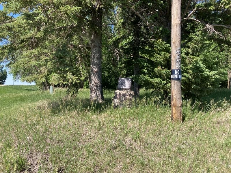
A Tribute to Pioneer Living
This small cabin was constructed in 1878
by Norwegian immigrant Carl Bjerke
Jensen and his nephew John Bjerke.
Carl moved to Dakota Territory from
Minnesota with his father, Jens, and
brothers, Hans and . . . — — Map (db m176586) HM
Kathryn, a typical prairie town, sprang
from the landscape with railroad
construction. Although the area was
settled by pioneers in the late 1870s, the
arrival of a Northern Pacific Railroad line
in 1900 and the establishment of . . . — — Map (db m279297) HM
This oak log home built in 1878
by Carl Jensen and his nephew John
Bjerkie was used as a community
center by the single men of the time.
A short distance to the north was
the Walker flour mill, one of the
earliest on the Sheyenne river.
. . . — — Map (db m175433) HM
Waldheim Church
During the mid-1880s, the Sheyenne
River Valley was beginning to fill with
settlers, many of whom were
Scandinavian Lutherans eager to
follow faith and tradition in providing
religious instruction to their . . . — — Map (db m177201) HM
Walker’s Best
The Walker family, Minnesota emigrants,
had milling in their blood. In 1879, Hiram
Walker established a mill in Valley City.
A few years later, his son Myron took over
and built a new mill at Oakville—he later
bought . . . — — Map (db m177164) HM
The Great American Barn
Rustic barns... tall silos... the Great Plains evoke nostalgic images of rural life. The disappearance of these farming icons reminds us of the changing nature of
agriculture — as large farming . . . — — Map (db m279292) HM
Left side
Site of Daily School No. 1
District No. 1 Organized in 1878.
School House Built in 1880.
Reorganized with
Kathryn Dist. No. 93 in 1954
This school served as a Learning Center, a church and a place for social . . . — — Map (db m279192) HM
The gently rolling landscape here is typical of the Glaciated Plains, a vast area that extends south from Manitoba and Saskatchewan, through northern and eastern North Dakota, into eastern South Dakota. Glaciers flowed south through this area 12,500 . . . — — Map (db m162958) HM
This rest area is located in a Tree Claim that was planted in 1884.
A Tree Claim was issued to homesteaders if they promised to plant at least 10 acres of trees for their continuous supply of fuelwood and fence posts. They would then be given . . . — — Map (db m162955) HM
“Ribbon” Rail carries the heavier loads of today. Although this short section seems rigid, the ribbon rail is actually flexible. It is welded into long sections which may be up to a quarter mile long! Due to its flexibility, this rail can be . . . — — Map (db m242765) HM
These 1895 dated rails were taken up from the building site of the Rosebud Visitor Center. While the original Northern Pacific rails at this site were laid in 1872, lighter rail such as this tend to wear out more quickly. Early locomotives were . . . — — Map (db m242599) HM
The men who organized the Midland Continental had dreams that this line would be a successful transcontinental railroad carrying heavy trains loaded with the abundant grains of the north to the shipping lines of the Texas gulf. However, the . . . — — Map (db m242708) HM
A wooden bridge was originally built at this site in 1935. Damaged over the years by farm traffic, trucks from nearby gravel pits, and occasional flooding, the bridge was reconstructed in 1969 and then totally replaced in 1995. Maryvale . . . — — Map (db m242399) HM
In 1879, land developer B.W. Benson cleared this land of the densely covered brush and platted it for residential development along the Sheyenne River. He set the center area aside for a park. Later, Benson sold the entire tract to the city for the . . . — — Map (db m242288) HM
“In front of the building [McFarland Hall] lies the winding and picturesque Sheyenne and beyond it the city, the whole of which may be seen in panorama from the front windows.... The grounds are reached on the city side across a beautiful steel . . . — — Map (db m242390) HM
The original bridge in this location was a wooden structure built in 1898. The citizens requested this bridge to access new development in the "Normal Park" addition being developed at that time. The wooden structure was replaced by a concrete . . . — — Map (db m242397) HM
The process of building a railroad has changed very little through the years (with the exception of the extensive use of power equipment today). The basic materials in a section of track is the same today as it was a century ago. After the . . . — — Map (db m242581) HM
Caboose BN11603 retired from Alliance, Nebraska and was donated to the Valley City Park District in 1989 by the Burlington Northern Railroad. A caboose though seldom used today, was used to protect the rear of the train, provide shelter and an easy . . . — — Map (db m242595) HM
The City Park is a peninsula created by an oxbow on the Sheyenne River. Three bridges were built on this oxbow to provide access to the park and for crosstown traffic. The original wooden footbridge, located at this site, was built in 1881, the . . . — — Map (db m242289) HM
Born in Germany in 1887, Herman Stern immigrated to America in 1903, where he took work at the Straus Clothing store in Carrington. Stern later managed the Straus’ North Dakota businesses from his store in Valley City, where he lived for the . . . — — Map (db m99291) HM
The original line of the Northern Pacific Railroad, now the Burlington Northern Santa Fe, descended into Valley City, crossed the Sheyenne River and continued out of the valley. Because of the steep grades, "pusher" engines were required to push . . . — — Map (db m242298) HM
Clustered around the campus of Valley City State University is a unique neighborhood of architecturally and historically significant houses dating from the 1880s to the 1930s. The neighborhood is important for its historical association with Valley . . . — — Map (db m241099) HM
King School
When the last students walked out of the
King School in 1967, their departure
marked the end of an era—the closure of the last operating one-room schoolhouse
in Barnes County. Once, over 100 of these
tiny institutions dotted . . . — — Map (db m175564) HM
This 1908 steel viaduct across the Sheyenne River Valley allowed the railroad to avoid steep grades. At 3886 feet (1184 meters) long and 155 feet (47 meters) high, it is an excellent example of this bridge type. — — Map (db m242299) HM
Sheyenne River The river was formed by the meltwater of the Wisconsinan glacier about 13,000 years ago. The valley constitutes the glacier's western edge at that time. Flowing 581 miles from its headwaters located 15 miles north of . . . — — Map (db m242287) HM
As transportation technology advanced, locomotives became more powerful, carried bigger and heavier cargo, and required heavier rails. Older, lighter rails were updated with increasingly heavier ones. Rail sections are stamped with the . . . — — Map (db m242598) HM
“Northern Pacific Times, Valley City, Dakota, July 17, 1879 — County Commissioners ordered no swimming in sight of the new bridge, several women having complained of the sight of nude bodies when crossing the bridge.” Built in 1879, the same . . . — — Map (db m242398) HM
At 581 miles, the Sheyenne River is the longest in North Dakota. When the Wisconsinan ice sheet melted about 13,000 years ago, it left behind the Sheyenne River and a trench that reaches up to 300 feet deep and a mile wide. Discover historic, . . . — — Map (db m242596) HM
There has been a succession of beautiful fountains in City Park that have been as different as its changing landscape. The first fountain, installed in the 1880s, was a bronze, one-tiered fountain with a boy holding an umbrella. The next . . . — — Map (db m242199) HM
Rails, regardless of weight, have to conform to the laws of physics. All rails will contract in severe cold, and expand in summer heat. With prolonged heat, rails can buckle into an "S"-shaped curve called a sun kink. Mild sun kinks may shrink . . . — — Map (db m242766) HM
[right side]Dedicated to our old friend and musical enthusiast D. W. Clark who organized the first band in Valley City April 5, 1881 [left side]Erected July 1931 by the Valley City Municipal . . . — — Map (db m242439) HM
The Valley City Street & Interurban Railroad was incorporated in June, 1905, by O.A. Beeman to transport passengers, goods, and rail cars between two larger lines. The Soo Line passed north of the city without a spur line to serve local . . . — — Map (db m242769) HM
Elizabeth Preston Anderson, Valley City resident, Pres. ND Woman’s Christian Temperance Union, worked for Women’s Suffrage 1893-1920. — — Map (db m205621) HM
The massive beam on which the rails are mounted was removed from the High Line Bridge about a quarter century ago. It is made by sandwiching different layers of wood and connecting the layers with steel rods. This beam can support the weight of . . . — — Map (db m242597) HM
A Taste of North Dakota What did you have for breakfast this morning? Chances are that you ate a little bit of North Dakota — the corn sweetener in your cereal, the wheat in your toast, the soybean oil in your margarine. Did you wash your hair? . . . — — Map (db m303298) HM
Authorized by the North Dakota 48th Legislative Assembly to honor the members of
The 164th Infantry Regiment, North Dakota Army National Guard
*The 164th Infantry Regiment of the Americal Division was the first US . . . — — Map (db m279070) HM
The Honored Dead Barnes County
Spanish American War
John B. Ewing
World War I
George O. Altringer •
Carl M. Askin •
Gordon S. Barr •
George O. Barnick •
John E. Barstad •
Herman Behm •
Ralph A. Bergen •
Manuel A. . . . — — Map (db m279139) WM
The Honored Dead Barnes County
World War II
Bill Baldwin •
Benjamin Barnard •
Bernard S. Bennison •
Ervin D. Bergan •
Willard Brandt •
Merrill C Brimer •
Melvin G. Busche •
William M. Carney •
Orville E. Chilson •
James . . . — — Map (db m279142) WM
Children are the innocent victims of adult hatred, ignorance, and bigotry. During the Holocaust, 1939-1945, 1.5 million Jewish children were murdered.
No child should ever be a victim again.
"How can a person not be moved by . . . — — Map (db m279149) WM
1830 Beginning of the railroad era in the United States.
1850 9,021 miles of track are completed, all east of the Mississippi.
1869 The First Transcontinental Railroad is completed when the Golden spike is driven in Utah Territory, . . . — — Map (db m183737) HM
1920 Peggy Lee is born Norma Deloris Egstrom in Jamestown, North Dakota.
1924 Norma's mother, Selma Egstrom dies.
1928 The Egstroms move from Jamestown to Nortonville.
1934 The Egstrom family moves to Wimbledon.
1936 Norma . . . — — Map (db m183734) HM
One of the original retail sites in Buffalo, this brick structure was built in 1902 by G. E. Batemen as a drugstore. This building was shortened in 1998. The interior was altered and remodeled as the use of the building changed. The false front and . . . — — Map (db m306101) HM
The First Presbyterian Church of New Buffalo, Dakota Territory, was organized in 1880 and built their first church in 1886. A new church was built on this same site in 1928. Tudor style building was designed by architect William Kurke, who also . . . — — Map (db m278991) HM
T. A. Quirk & Company was organized in 1884 by Thomas A. Quirk. This Boomtown style office building was constructed in 1908. At one time the lumber yard had a lumber shed, a store, three storage sheds, and coal facilities on the south side of the . . . — — Map (db m306159) HM
August 16, 1863, General Sibley marched over this spot with 3400 soldiers on his return after driving the Indians across the Missouri River. — — Map (db m169803) HM
The High School is the last remaining example of non-residential Classic Revival style architecture in Buffalo. It was
designed by Architect A. J. O'Shea and built in 1916 by Meineke Building Company of Fargo at a cost of $20,000. The school closed . . . — — Map (db m278980) HM
Donated by Beverly Sproul and her family to honor the men and women of the Buffalo Area who served in the Armed Forces.
John T. Backes •
Donald Deehler •
Clair N. Boyd •
Evan S. Brown •
Donald Burns •
Edwin F. W. Buttke •
C.L. . . . — — Map (db m278956) WM
The original portion of the rectory was built in 1887 and the two story front section was added in 1895. The property was donated to the Buffalo Historical Society in 1995 and opened to the public in 1998 as the Margaret Fraase Library. The wood . . . — — Map (db m278986) HM
This classical revival home was built in 1901 for S. G. and Emma More. Architect Milton Earl Beebe designed this home using
2x6 foot balloon framing, clapboard siding and field stone foundation. The More family owned the entire block and built an . . . — — Map (db m278987) HM
Built in 1885, this church was formerly the Calvary Episcopal
Chapel and the first church built in Buffalo. It was designed by
architect George Hancock who held ND architect license #1 and
was constructed of native prairie stone. The Buffalo . . . — — Map (db m278983) HM
The Peterson residence was built in 1915 by S. G. More, a prominent Buffalo banker, as a wedding gift for his daughter Edith when she married Arthur Peterson. The
Classic Revival style home was designed by Fargo architect A. J. O'Shea. Descendants . . . — — Map (db m278988) HM
This church was built in 1900 by the Hancock Brothers of Fargo and is an example of vernacular architecture. It was named after Buffalo businessman, Thomas A. Quirk, who donated most of the lumber. The Grotto and Cross were built with concrete and . . . — — Map (db m278990) HM
George M. Black was an early merchant in Fargo, opening The Black Store on Broadway in 1912. In 1929, after witnessing the stock market collapse, he bet big on Fargo and sold his store to Sears Roebuck and Company. He used the proceeds to finance . . . — — Map (db m239934) HM
In 1864, the Northern Pacific Railroad was charted to build a line from the Great Lakes to Puget Sound. The initial funding for construction would come from the sale of Northern Pacific bonds. However, in 1873 lack of funding halted construction, . . . — — Map (db m239986) HM
The new Fargo City Hall project began in 2016 and opened in 2018. The exterior of the building features 12 panels of art created by a local artist, Catie Miller, who shares her interpretation of Fargo's past, present, and future with a focus on . . . — — Map (db m240299) HM
This Northern Pacific depot, designed by nationally known architect Cass Gilbert, was built in 1898. A park with gardens and fountain surrounded it. No longer in use because of declining passenger traffic in the 1960's, the depot was in danger of . . . — — Map (db m240296) HM
Eddie and Hildegarde Kraus began their careers in the entertainment industry as teenagers (he as a waiter in an Opera House, and she as a pianist and organist). Eventually, Eddie's career led to managing several Fargo-Moorhead theatres. As . . . — — Map (db m240096) HM
On Thanksgiving Day, November 24, 1904, the Fargo Streetcar Railway accepted its first passenger. Fare was 5¢ per person and service was available from 6 AM to midnight every day, except Sunday, when hours were shorter. Seven cars were available . . . — — Map (db m239997) HM
In 1881, wishing to reduce freight charges, 23 Fargo businesses pooled $100,000 to build a railroad line. It would originate from Fargo, and run south to Ortonville, Minnesota (117 miles away).
Construction of the line began in 1883, and on the . . . — — Map (db m305976) HM
On this site, the afternoon of June 7, 1893, began what would later become known as The Great Fargo Fire. Originating at Herzman's Dry Goods Store, the fire spread its destruction north, east, and west from this location until it had consumed 31 . . . — — Map (db m305988) HM
For more than a century, the twin steeples of First Lutheran Church and the Cathedral of St. Mary have stood like beacons on north Broadway, illuminating the faith journeys of the prairie's immigrant people. The spires usher travelers into and out . . . — — Map (db m240098) HM
Just like the name hints, the Ford Building was built in 1915 as a Ford automobile plant and showroom to service the Dakotas. Built in a Chicago style along the Great Northern Railroad tracks, this building boasted the perfect location to . . . — — Map (db m240297) HM
When autos appeared in the 1890s, only the wealthy could afford to buy them. But by the 1920s assembly lines made cars affordable for the middle class, and sales soared. At the end of the decade there were 25 million cars on the road and U.S. . . . — — Map (db m100837) HM
This caboose was built by the Great Northern in August 1942 and is one of 50 wood sided, cupola cabooses. It was constructed in the St. Cloud shops. The original number was X227 (the X stands for non-revenue) and it was acquired by Burlington . . . — — Map (db m239898) HM
The Great Northern Railway started out in 1857 as the Minnesota & Pacific. It was not until 1890 that it became known as the Great Northern, and this name was given in honor of rails that crossed the great territory. The Great Northern entered . . . — — Map (db m240291) HM
In the late 1800's, the Red River Valley was a boom in agricultural development. The introduction of the Bonanza Farms and the overall increase in farming of wheat created a preference for larger threshers and powerful engines grew. Machinery Row, . . . — — Map (db m239996) HM
North Dakota State University is a land-grant institution, created under the Morrill Act of 1862. From its establishment in 1890, its mission has included research and education in scientific agriculture to benefit the public as well as students. . . . — — Map (db m240225) HM
On July 2, 1864 President Abraham Lincoln signed an Act of Congress creating the Northern Pacific Railroad Company.
Following closely the route taken by a government expedition in 1854, the northern railroad route to the west coast would . . . — — Map (db m239998) HM
Original site of Gethsemane Episcopal Cathedral. Land purchased by General Cass from the Northern Pacific Railroad. Gethsemane Church was built in 1874 and replaced with Gethsemane Cathedral in 1900. The cathedral burned in 1989. The present . . . — — Map (db m305989) HM
Osco Drug painted this advertisement after opening in 1942. This spot was originally filled by a window before Osco Drug moved in, so when the advertisement was revealed during this building's renovation in 2017, this portion of the advertisement . . . — — Map (db m239970) HM
Established in 1965 as the Red River Art Center in Moorhead, MN, the Plains Art Museum was given its current name in 1975. In 1996, the Museum moved across the river into North Dakota and embarked on renovating a former International Harvester . . . — — Map (db m240293) HM
The Native American Medicine Garden The concept for this medicine wheel garden originated with the sacred medicine wheel representing various symbolisms and teachings. It honors seasonal cycles, represents rituals, and expresses . . . — — Map (db m240295) HM
While steamboats delivered and loaded cargo up and down the Red River, recreational use of the Red River blossomed. Sleigh races, ice-skating, skiing, toboganning, and ice fishing provided winter recreation. Boating, swimming, diving, and public . . . — — Map (db m240099) HM
The story of the Red River Valley and Red River of the North began over 11,000 years ago when Lake Agassiz was formed. A glacier extended from Canada south and covered what is now the Red River Valley. As it began to melt and recede northward, . . . — — Map (db m239991) HM
As the first settlers broke up the fertile Red River Valley prairie sod, flax was usually the first crop they sowed, followed by hard red spring wheat and barley. Crop agriculture was and continues to be a major economic force in North Dakota. . . . — — Map (db m240253) HM
[2020 marker] This replica Statue of Liberty was commissioned by Industrial Builders, the company that built the Veterans Memorial Bridge, to replace the statue originally donated in 1950 to The City of Fargo by the Boy . . . — — Map (db m209100) HM WM
Roberts Commons, or as the locals call it, RoCo, is the first mixed-use parking garage in Downtown Fargo. The Carnegie Public Library once stood at the site and during excavation for Roberts Commons, the brick foundation of the library was . . . — — Map (db m240298) HM
Sodbuster: San Isidro Sodbuster: San Isidro combines the artistic traditions of the American Southwest with imagery that represents the hardworking farmers of the Red River Valley. The term "Sodbuster" is a colloquialism for farmers, . . . — — Map (db m240401) HM
At one time the Red River was home to over a dozen steamboats including the Anson Northup (later renamed the Pioneer), the International, the Selkirk, the Dakota, the Alpha, the Cheyenne, the . . . — — Map (db m239995) HM
Amendment ICongress shall make no law respecting an establishment of religion, or prohibiting the free exercise thereof; or abridging the freedom of speech, or of the press; or the right of the people peaceably to assemble, and to petition the . . . — — Map (db m239971) HM
Throughout the years, entertainment has played a major role in the quality of life in our region. Early traveling Chautauquas brought education and entertainment to the prairie with oratory, musical and dramatic productions presented under imposing . . . — — Map (db m240080) HM
The Ford Building, designed in the Chicago School style of architecture by John Graham, was one of several similarly-designed Ford Branch Plants that were built throughout the United States in the early 1900s. Fargo was the 25th such branch. The . . . — — Map (db m240100) HM
Moorhead and Fargo were platted when the Northern Pacific railroad arrived at the Red River in 1871 less than one block north of here. The towns grew up at this intersection of river and rail. Steamboats traveling the shallow Red River stopped . . . — — Map (db m100836) HM
In 1926, the Rudolph Wurlitzer Company of New York installed a new pipe organ in the Fargo Theatre to provide musical accompaniment for silent film. It consisted of a console with two keyboards and seven sets of pipes. The chambers included a . . . — — Map (db m240095) HM
Early FargoReynold's Variety House and Shea's Variety House were known for their dancing girls, ribald comedians, food and drink. Pinkham's Hall and Egbert's Hall served a variety of purposes including school, church services and theater. . . . — — Map (db m240073) HM
N.D. Votes For Women League Office on third floor of Delendrecie Bldg. 1912-1918. Suffragists worked here for voting rights for women. — — Map (db m205236) HM
Early explorers to the Red River Valley discovered a wide range of wildlife living along the Red River. One could have easily spotted a moose, American elk, mink or even a black bear. Although these animals may be uncommon now, there is a variety . . . — — Map (db m240286) HM
This dormitory, completed in 1931, was rededicated and named June 10, 1957, in honor of Omar O. Churchill respected staff member who also served for two years as acting Dean of the School of Agriculture during the period 1904-1950. Doctor Churchill . . . — — Map (db m290074) HM
Originally known as Science Hall, this building was begun in 1901 with additions in 1917 and 1930. It was renamed on June 4, 1951 in honor of Archibald Ellsworth Minard 1878-1950 whose faithful and devoted service to the college extended from . . . — — Map (db m299400) HM
Welcome to Fargo-Moorhead's most notorious photo op!
This is a "stunt double" for the equipment used in a key concluding scene of the movie FARGO.
Feel free to pose for a picture and share your experience online.
Step inside the FM . . . — — Map (db m102057) HM
Founded in 1989 by Fargo printer, Mike Stevens, the walk of fame was originally located on the city sidewalks of Mike's print shop, Express Press, in downtown Fargo. It was moved to the current site during the summer of 2000. The first inductee . . . — — Map (db m102055) HM
The son of a Kentucky frontiersman, Lincoln had to struggle for a living and for learning. Five months before receiving his party's nomination for President, he sketched his life: "I was born February 12, 1809, in Hardin County, Kentucky. My . . . — — Map (db m238199) HM
On April 30, 1789, George Washington, standing on the balcony of Federal Hall on Wall Street in New York, took his oath of office as the first President of the United States. Born in 1732, into a Virginia planter family, he learned the morals, . . . — — Map (db m238197) HM
On February 6, 1911, Ronald Wilson Reagan was born to Nelle and John Reagan in Tampico, Illinois. He attended high school in nearby Dixon and then worked his way through Eureka College. There, he studied economics and sociology, played on the . . . — — Map (db m238200) HM
Author of the Declaration of Independence and the Statute of Virginia for Religious Freedom, third president of the United States, and founder of the University of Virginia — voiced the aspirations of a new America as no other individual of his . . . — — Map (db m238198) HM
306 entries matched your criteria. The first 100 are listed above. Next 100 ⊳