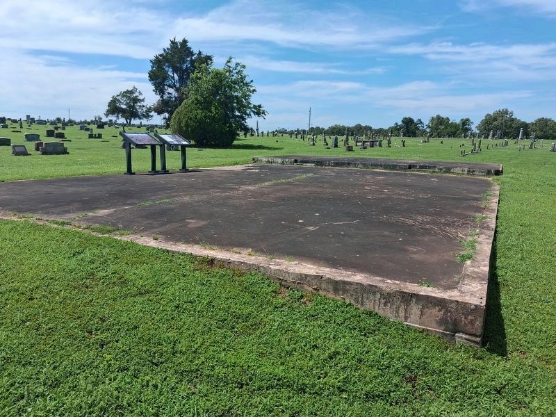
Between June 1839 and March 1839, more than 16,000 Cherokee Nation citizens trekked west from their traditional eastern homeland to Indian Territory (present-day Oklahoma) over the "Trail of Tears." More than 1,000 died during the journey . . . — — Map (db m300602) HM
This property is listed on the National Register of Historic Places by the United States Department of the Interior
Stilwell Kansas City Southern Railway Depot 1915 — — Map (db m304483) HM
The End of the Journey
Between June 1838 and March 1839, more than 15,000 Cherokee trekked west from
their traditional eastern homeland to Indian Territory (present-day Oklahoma) over the “Trail of Tears.” More than 1,000 died during the . . . — — Map (db m304920) HM
Established in 1838 by Lt. Col. R.B. Mason, 1st Dragoons, U.S. Army, at request of Arkansas citizens fearing Cherokees who were being removed from southeastern U.S. Named in honor of Gen. "Mad" Anthony Wayne, the fort was originally located in NE . . . — — Map (db m181594) HM
About 4 mi. N. and W. Established by Rev. Jesse Bushyhead in 1839, and known as Bread Town by the Cherokees. Rev. Evan Jones was missionary in charge. The Cherokee Messenger printed there beginning in August, 1844, was 1st. periodical in . . . — — Map (db m298969) HM
Rev. Jesse Bushyhead settled here in 1839 following the Cherokee removal from the East and held church services at his home until the Baptist Mission was established in 1841 by Rev. Evan Jones. This site was also one of the ration stations known . . . — — Map (db m298971) HM
Home in the West
George Woodall's farm was a busy scene as groups of Cherokee Nation citizens arrived here after their 800-mile trek west from their southern Appalachian homelands. As detachments arrived, they ended their journey at a . . . — — Map (db m304748) HM
A signer of the Treaty of New Echota and grandfather of famed Will Rogers. Robert Rogers moved with his wife, Sally Vann to Indian Territory about 1837, and established a home about 1 mile NW. He was killed in 1842 in a tribal feud as were many of . . . — — Map (db m298970) HM
The End of the Journey
Between June 1838 and March 1839, more than 16,000 Cherokee Nation citizens trekked west from their traditional eastern homeland to Indian Territory (present-day Oklahoma) over the "Trail of Tears." More than . . . — — Map (db m304751) HM
Center of Cherokee culture was one mile east on Park Hill Creek; Home of Chief John Ross, Samuel Austin Worcester, Elias Boudinot, other pioneers and The Mission Press which printed millions of pages for the benefit of the Cherokee people . . . — — Map (db m52751) HM
Established July, 1837, Rev. S.A. Worcester, Supt. Over 25 million pages were printed in Indian languages and in English by 1861. Printers and translators were John F. Wheeler, John W. Candy, Edwin Archer, Stephen Foreman. Near site are graves of . . . — — Map (db m52755) HM
First Annual Indian Mission Conference of the Methodist Church was held in Oklahoma at Riley's Chapel, Oct. 23, 1844, Bishop Thomas A. Morris presiding. Conference area was west to the Rocky Mts., east to Ark.-Mo. line. Rev. Thomas Bertholf, . . . — — Map (db m52757) HM
(front)
The United States Government, unable to conclude an agreement with the duly authorized leaders of the Cherokee Nation, signed a treaty with a minority faction willing to cede the last remaining portion of the original Cherokee . . . — — Map (db m77932) HM
As a tribute to Oklahoma’s First Legal Newspaper The Cherokee Advocate established Sept. 26, 1844 in a building approximately 100 feet north of this location. This marker is dedicated Sept 6. 1957 by the Oklahoma Press Association and the . . . — — Map (db m259291) HM
has been designated a Registered National Historic Landmark under the provisions of the Historic Sites Act of August 21, 1935 This site possesses exceptional value in commemorating and illustrating the history of the United States . . . — — Map (db m259277) HM
(front)
A grateful Cherokee Nation dedicates
this memorial to all men and women,
both living and dead,
who have defended their families
their people and their homeland
(rear)
These names are carved in stone forever
so that . . . — — Map (db m108886) WM
Here in September 1885 the first telephone in Oklahoma was connected for service. It was the first telephone in the Mississippi Valley west of St. Louis. The company was organized by a group of Cherokees, namely: D. W. Lipe, L. B. Bell, R. M. . . . — — Map (db m259365) HM
The Cherokee Advocate owned by the Cherokee Nation was published here. It was printed in Cherokee and English. One half block west in 1848 the first Masonic Lodge was established in what is now Oklahoma. The first telephone in this country was . . . — — Map (db m259305) HM
In 1839, after the forced removal from their homeland in the southeastern United States, the Cherokee people began to settle on their new land in Indian Territory. A few years later, the tribe decided that Tahlequah would become the capitol city of . . . — — Map (db m259397) HM
The first man to speak on the telephone west of the Mississippi from Ft. Gibson to Tahlequah. Replacement monument donated to the Cherokee Nation by the Stapler, Bradshaw, Morgan and Jerrems families. — — Map (db m259363) HM
Principal Chief of the Cherokee 1828-1866 Born October 3, 1790 in Turkeytown, Alabama. The son of a one-quarter Cherokee maiden and a Scotsman, John Ross was elected as the first Principal Chief of the Cherokee Indians in 1828 and . . . — — Map (db m259375) HM
This gathering place is established on the 100th anniversary of the founding of Northeastern as an Oklahoma Normal School dedicated to the preparation of teachers with its home in historic Seminary Hall. The Plaza commemorates the enduring . . . — — Map (db m259439) HM
With the faith and courage of their forefathers who made possible the freedom of these United States The Boy Scouts of America dedicate this replica of the Statue of Liberty as a pledge of everlasting fidelity and loyalty 40th . . . — — Map (db m259400) HM
Cherokee constitution adopted here, Sept. 6, 1839, in convention of leaders including George Lowry, Sequoya, Walter S. Adair, Stephen Foreman, Joshua Buffington, George Brewer, Chief John Ross. Town incorporated 1843. “The Cherokee Advocate” . . . — — Map (db m259283) HM
Blacksmithing was one of the trades taught to prisoners at the Cherokee National Prison during their incarceration. The thought was to give men and women a skill set they could use upon their release to better their lives and not continue to commit . . . — — Map (db m259510) HM
Perched proudly above N Muskogee Ave, The Workman's Horse was lovingly brought to Tahlequah by Charles and Robert Workman in 1983. Instantly embraced by the community, the hose became a cherished Tahlequah landmark, casting its watchful gaze for . . . — — Map (db m259399) HM
In memory of all veterans of all wars of the United States of America by Disabled American Veterans, Chapter No. 31 Tahlequah, Oklahoma, Nov. 11, 1971 — — Map (db m259398) WM
To honor The Confederate Soldiers of the Battle of Cabin Creek Sept. 19, 1864 Erected by Okla. Division Daughters of the Confederacy June 1961
Reverse: Battle of Cabin Creek Sept. 19, 1864 Confederate Forces --
Brig. Gen. Stand Watie - . . . — — Map (db m52268) HM
14 miles S-E, is Langley the site of the Grand River Dam Lake, covering 45,000 acres, with a shore line of 1100 miles, costing more than $20,000,000.00. The largest multiple type arch dam on earth. It was constructed as an electric and flood control . . . — — Map (db m55647) HM
Rebuilt by Tom Schwartz after the road was widened in 1963, and
purchased by the Wood and Hilburn families in 2011. Since then,
they were awarded the Guinness World Record for Most Stickers on
a Car, restored the neon sign, and installed Big Bill . . . — — Map (db m272317) HM
On June 13th, 1936, President Roosevelt stopped his re-election special train in Vinita to honor citizens' request to help fund construction of the Grand River Dam. A large, rowdy crowd estimated at 5,000 greeted him.
President Roosevelt . . . — — Map (db m184947) HM
Will Rogers formed lifelong ties to Vinita by attending school here, the Worcester Academy, 1889 and the Willie-Hasell College, 1894 and 1895 terms.
In 1934, Will returned for a WHC reunion and spoke at Old Settlers Day. He urged friends, . . . — — Map (db m67804) HM
"Not In Vain"
may be the pride of
those who survived
and the epitaph of
those who fell
Winston Churchill
Dedicated on the Eleventh Hour of the Eleventh Day of the Eleventh Month in the Year of Our Lord One Thousand Nine Hundred and . . . — — Map (db m67801) WM
Henry and Emelia Wrage opened the Quarterhorse Motel in the 1950s. In addition to regular rooms, it featured stables for horses. It became the Western in the 1970s. Today the site is also home to a giant fiberglass chief that originally stood at a . . . — — Map (db m272309) HM
Established at Vinita
Cherokee Nation, Indian Territory
by the Rev. J. W. Scroggs, D.D.
Dedicated Jan. 14, 1883
Named in honor of the
Rev. Samuel A. Worcester, D.D.
Missionary among the Cherokees — — Map (db m55648) HM
Louis Rolston Jr., the cemetery's namesake, a Cherokee Indian, was born in Georgia September 10, 1838. He enlisted in the Federal Army in 1862 and served under Col. John D. Allen in Company K. of the 16th Regiment. He participated in the Battles of . . . — — Map (db m21239) HM
Established in autumn 1839 by Lt. Col. R.B. Mason and 1st Dragoons, U.S. Army, and named in honor of Gen. “Mad” Anthony Wayne. Abandoned on May 15, 1842. Here in July 1861 Col. Stand Watie established a Confederate army post and . . . — — Map (db m99747) HM
In Flanders Fields
In Flanders Fields the poppies blow
between the crosses row on row.
that mark our place and in the sky the larks still bravely singing, fly
scarce heard amid the guns below.
We are the dead short days ago
we lived, . . . — — Map (db m224845) WM
Stand Watie was only American Indian to attain rank of Brigadier General during Civil War and was last Confederate General to surrender. Born in Georgia, December 12, 1806. He spoke only the Cherokee language until he was twelve years of age. . . . — — Map (db m25557) HM
Cherokee Mission established by Moravian Church, 1842, was out-growth of mission begun by Springplace, GA., in 1802. Church members were from noted Cherokee families named Adair, Fields,Hicks, McNair, Ridge, Vann, Ward, Watie. New Springplace . . . — — Map (db m298967) HM
On Sept. 18, 1864, a Confederate force of 2,000, mainly Gen. Stand Watie's Indian Brigade, intercepted a Union supply train enroute from Kansas to Ft. Gibson. The convoy of 130 wagons with supplies worth $1.5 million was captured after a heavy . . . — — Map (db m68101) HM
The First Mission in Oklahoma was founded in 1820 by
Rev. Epaphras Chapman
The First Press
was established and the first book printed in 1835 by Rev. Samuel Austin Worcester — — Map (db m181605) HM
Union Mission was established in 1820 by the United Foreign Missionary Society as a mission to the Osage. It was in existence only 15 years but occupies a unique position in Oklahoma history. It was the pioneer institution in bringing Christianity . . . — — Map (db m181615) HM
Crossed here: Ft. Gibson (Est. 1824) to Ft. Leavenworth. Two Cabin Creek battles in Civil War fought at old ford 5 mi.; S.W. Ketchum is east 1.5 mi. The first store, 1860, and a stage stand were at Old Sulphur Springs campground near here, N.E. . . . — — Map (db m52553) HM
Federal troops suddenly attacked a Confederate camp along the ridge near here at dawn, July 2, 1862. The surprised Confederates hardly returned fire before their officers and heavy supplies were captured. Yet hot fighting in the woods lasted all day. — — Map (db m52269) HM
The First Kansas Colored Volunteer Infantry was the first Black unit to engage in battle in the Civil War. On July 2, 1863, while escorting a wagon train bound for Fort Gibson, the First Kansas Colored was attacked here by Stand Watie's . . . — — Map (db m52266) HM
On Sept. 18, 1864, a Confederate force of 2,000, mainly Gen. Stand Watie's Indian Brigade, intercepted a Union supply train enroute from Kansas to Ft. Gibson. The convoy of 130 wagons with supplies worth $1.5 millions was captured after a heavy . . . — — Map (db m141944) HM
Pryor Creek was named in honor of Nathaniel Hale Pryor. Captain Pryor was a member of the Lewis and Clark Expedition, a veteran of the war of 1812 and was a Captain at the Battle of New Orleans, January 8, 1815. In June he was honorably discharged . . . — — Map (db m68099) HM
Oldest permanent American settlement in the state. Grew out of Chouteau's fur trade at St. Louis, with Osages after they settled this region in 1802 from Missouri. Improvements here in 1817 became residence of Col. A.P. Chouteau, West Point grad. . . . — — Map (db m64481) HM
Cherokee Indian policeman.
First Town Marshal, Tahlequah, Indian Territory, 1890.
Jail guard, Muskogee, Indian Territory, 1893.
Killed at Brush Hill Feb. 27, 1895 when he charged the hideout of Texas outlaws.
“A brave and . . . — — Map (db m282113) HM
• Was a 2290 mile transcontinental "National Trail" from Winnipeg, Canada to New Orleans, Louisiana;
• Roadway through town ran from North Broadway to Gentry Avenue, then on SW 2nd Street and back to South Broadway;
• Route formed what . . . — — Map (db m73153) HM
Established - 1890
Sanctuary Built - 1917
Has been placed on the
National Register
of Historic Places
by the United States
Department of the Interior
November 13, 1984 — — Map (db m73156) HM
Gunner's Mate 3rd Class Paul Henry Carr, USNR (1924-1944), heroic Gun Captain of the After 5-inch Mount of the Destroyer Escort, Samuel B. Roberts (DE-413), died during the battle off Samar, Battle of Leyte Gulf, 25 Oct. 1944. He was awarded a . . . — — Map (db m73155) HM
From 1898-1902, ambitious Checotah townspeople invested in the city's future by building impressive red brick Romanesque structures. The Block shown in the antique engraving was planned by Mr. W.E. Gentry, "The Father of Checotah."
This arch . . . — — Map (db m73196) HM
Birthplace: 2½ miles N.E., 1873
Creek Poet: "Dew and the Bird," "Ode to Sequoyah," and other poems. Columnist: famous "Fus Fixico" letters. Editor, "Muskogee Times" and Eufaula "Indian Journal." Supt. of Creek Orphan School; in charge of . . . — — Map (db m73198) HM
This monument is dedicated to the memory of Pioneer Methodists who built and established Asbury Manual Labor School for Indian children and youth. These stones are from the original buildings. Out of this school came First Methodist Church, . . . — — Map (db m199873) HM
A plat nearby contains graves moved from behind the Buckner home five miles southeast of here, now inundated by the Eufaula Reservoir.
Henry Frieland Buckner, D.D., his first and second wives, an infant son, the wife of J.S. Murrow, James . . . — — Map (db m199747) HM
Greatest ceremonial rite of Creek Indians was Green Corn Dance. It was held at time of year when before corn had fully matured and while grains were soft. Dance was celebration of harvest season and was of intense religious devotion.
In . . . — — Map (db m64184) HM
Mr. and Mrs. T.H. Palmer, Sr. came to Eufaula in a covered wagon in 1915. After settling down he began selling apples from Judge Mills' orchard. Then he built this little store at the edge of town. In 1927 he bought a block of property located . . . — — Map (db m200408) HM
Annie Walker Armstrong (1850-1938), Corresponding Secretary of Woman's Missionary Union, Southern Baptist Convention, made five extended trips to Indian Territory, (now Oklahoma) between 1900 and 1905 to strengthen work among women's mission . . . — — Map (db m284331) HM
Prior to the battle, Confederate
camps were located along either
side of Elk Creek and near the
Honey Springs Depot. Six
thousand men needed ample
room for themselves, their
equipment, tents, wagons, and horses.
With the battle and the . . . — — Map (db m243463) HM
Formerly a strong southerly bend in the Canadian River was located here. The course of the river was permanently changed after the construction of the Lake Eufaula Dam in 1964. It is thought that the bend is named for Cole Younger who served in the . . . — — Map (db m146401) HM
In 1861 the 1st Choctaw and Chickasaw Mounted Rifles was organized under
the command of Choctaw and Chickasaw Indian agent Douglas H. Cooper. After
his promotion to brigadier general, the regiment served under Choctaw Col.
Tandy Walker. The . . . — — Map (db m243458) HM
On July 17, 1863, at the Battle of Honey Springs, the 1st Kansas Colored Volunteers wrote a stirring page in American history, becoming one of the first Black units of the Civil War to play a key role in a Union victory as Major General James G. . . . — — Map (db m80514) HM
All-Black Towns of Oklahoma
The All-Black towns of Oklahoma represent a unique chapter in
American history. No where else, neither the Deep South nor the Far
West, did so many African American men and women come together to
live in and . . . — — Map (db m243922) HM
America's battlefields inspire us to contemplate the meaning of the battle,
its causes, consequences, and cost. They connect us to our past through such timeless virtues as duty, loyalty, honor, and courage, as well as cowardice, brutality, fear, . . . — — Map (db m243452) HM
Those who died were quickly buried, often where they lie, as the
summer heat and the high humidity led to unbearable conditions.
In 1868 contractors were hired to open the graves and remove bodies
whose uniforms had US buttons. These were . . . — — Map (db m243460) HM
"Lord God of Hosts be with us yet, lest we forget, lest we forget" This commemorative marker is respectfully dedicated to honor the brave soldiers of the Confederate States of America who gallantly fought and died here on July 17, 1863. The Battle . . . — — Map (db m52289) HM
Order Of Battle (Indian Units)
Federal Forces:
First Indian Home Guard (Cherokee)
Second Indian Home Guard (Cherokee)
Confederate Forces:
First Choctaw Regiment
Second Choctaw Regiment
First Chickasaw and Choctaw Regiment . . . — — Map (db m52286) WM
The Texas Road was the main route traveled by settlers and traders from Missouri and
Kansas to Texas. The small community of Honey Springs, named for several natural springs in the area, developed near the road. There were a few buildings, among . . . — — Map (db m243450) HM
Many resources give us information on the Civil War, including battle reports,
diaries, letters, and on-the-spot reporting. Interviews with those who participated in or were affected by the war, as well as their memoirs, offer firsthand . . . — — Map (db m243454) HM
Variously known as the Combs, Lane or
McIntosh Cemetery, this burial ground was
incorporated by the Pumpkin Ridge Cemetery
Association in the 1920's. As a private entity,
no state manpower or funds can be used on it's
upkeep.
A Confederate . . . — — Map (db m243505) HM
Following their overnight 20-mile
march from Fort Gibson and the day-long
battle, the Federal soldiers were exhausted.
The units camped on the battleground
on both sides of Elk Creek. The next day
part of the Federal Army marched back to
Fort . . . — — Map (db m243462) HM
Brig. Gen. Cooper held Scanland's and Gillette's cavalry squadrons in reserve to
guard the supply depot. As the battle progressed, he ordered the squadrons to join the
Creek regiments protecting his left flank. When the Confederate troops started . . . — — Map (db m243451) HM
The last organized Confederate resistance occurred here. As Federal troops pushed south along the Texas Road toward the Honey Springs Depot, they encountered the 1st Choctaw and Chickasaw Regiment. Armed largely with shotguns and antiquated weapons, . . . — — Map (db m243457) HM
Prior to the movement of settlers into Texas in the 1830s and 1840s, the
northern portion of the road, which passed through what would later
become Honey Springs, was known as the Osage Trace. During the late
18th and early 19th centuries, the . . . — — Map (db m243507) HM
The medical and surgical materials available in the field were
generally limited to what the surgeon carried in his case,
known as the surgeon's field companion. The regimental hospital steward
carried a hospital knapsack--a bulky, cumbersome . . . — — Map (db m243459) HM
"We here highly resolve that these dead shall not have fallen in vain" This commemorative marker is dedicated to the memory of the Union soldiers who bravely fought and died here on July 17, 1863. Major General James G. Blunt began moving 3,000 . . . — — Map (db m52288) HM
William Frederick McIntosh was the second son of Chilly McIntosh and
Leah Porter. He served under his uncle, Daniel Newnan McIntosh, as
Captain of the First Regiment of Creek Mounted Volunteers for the
Confederacy in the Civil War. He owned the . . . — — Map (db m243502) HM
479 entries matched your criteria. The first 100 are listed above. Next 100 ⊳