480 entries match your criteria. Entries 101 through 200 are listed.⊲ Previous 100 — Next 100 ⊳
Works Progress Administration (WPA) projects Historical Markers
Markers related to public works built through or associated with the Works Progress Administration, or WPA, the Great Depression-era U.S. Federal government agency which provided jobs for millions of Americans.
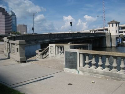
In 1907, Alfred Swann and Eugene Holtsinger constructed the original section of seawall and roadway extending from Swann Avenue to Rome Avenue. This initial section, which was called Bayshore Drive, served Suburb Beautiful, the first residential . . . — — Map (db m44647) HM
Roosevelt EraThe Cross Florida Canal got its start during the Great Depression years. President Franklin D. Roosevelt's efforts to revive the nation's ailing economy involved a wide array of projects and jobs funded by tax-payers. The . . . — — Map (db m237438) HM
"...Requesting the assistance and cooperation of every available federal agency in order to make possible, at an early date, commencement of construction on a ship canal across the peninsula." Message from Florida's Legislature to President . . . — — Map (db m166903) HM
The Peter Montague & Lord Baltimore
Chapters of the National Society Colonial Dames XVII Century mark this Martin County Court House to commemorate the historical significance of this site to Martin County, Florida and its people. Built in . . . — — Map (db m193667) HM
The Florida Keys Memorial, known locally as the “Hurricane Monument,” was built to honor hundreds of American veterans and local civilians who perished in the “Great Hurricane” on Labor Day, September 2, 1935. Islamadora . . . — — Map (db m3251) HM
The U.S. Department of the Interior has listed the Gulfport Casino in the National Register of Historic Places. This is the third such Casino on this location. The first fell in the 1921 hurricane; the second came down in the early 1930s. Using . . . — — Map (db m135952) HM
The Marquis Bayou Bridge, named for George Marquis, the owner of a local saw mill that operated in the mid-1800s, opened in 1937. A Santa Rosa County delegation that included future Florida Governor Millard Caldwell helped to make the bridge a . . . — — Map (db m98374) HM
The first recorded flight into Venice brought a crate of fresh strawberries for the Hotel Venice. Pioneer pilot Capt. George Haldeman landed his plane on Nassau Street to make his delivery on January 13, 1927, not until the mid-1930s was a . . . — — Map (db m73678) HM
Four miles east, in the gorge of the Etowah River, are the picturesque ruins of the once flourishing town of Etowah, developed by Mark Cooper around his iron furnace and rolling mill. The furnace was built in 1844, following one built in 1837 on . . . — — Map (db m56315) HM
Sam P. Jones was born October 16, 1847, in Oak Bowery, Alabama; he moved to Cartersville with his parents in 1856. After his admission to the Georgia Bar in 1868 he married Laura McElwain. In 1872 he was licensed as a Methodist Minister. His . . . — — Map (db m21695) HM
County seat Cass County 1832-1861. First decision Supreme Court of Georgia, 1846. Name changed to Manassas 1861. Town burned by Sherman 1864 and never rebuilt. — — Map (db m12359) HM
This ridge, interrupted only by major streams, extends south from the Altamaha River in Georgia to the Santa Fe River in Florida, a distance of 130 miles. It is an ancient barrier beach formerly many miles off-shore in the sea which covered this . . . — — Map (db m12423) HM
Shell Bluff on the Savannah River 15 miles northeast has been famous since Indian days because of its outcrops of fossil shells including those of giant
oysters. These lived in the Eocene sea that covered this part of Georgia some 50 million years . . . — — Map (db m13134) HM
Across the highway stands the inn built about 1823 by William McIntosh, half-breed chief of the Lower Creek Indians. Here on February 12, 1825, McIntosh and other chiefs signed the Second Treaty of Indian Springs, giving up their last Georgia land. . . . — — Map (db m395) HM
In this house Aaron Burr fleeing after duel with Alexander Hamilton, and later General Winfield Scott returning from Indian campaign in Florida, were entertained by Major Archibald Clark. W.P.A. 1936. — — Map (db m103543) HM
Ellicott’s Mound, 5 miles north, at the head of the St. Marys River, was erected February 27, 1800, to mark the boundry between the United States and Spanish Florida, as set fourth in the Treaty of 1795 with Spain. Major Andrew Ellicott noted . . . — — Map (db m9186) HM
Granted 1739 to William Stephens
Secretary
Colony of Georgia
1737 - 1740
President
1743 - 1751
Here in 1779 under
Count d'Estaing the
French landed to join
the Americans under
General Lincoln in
the Siege Of Savannah . . . — — Map (db m9149) HM
Site of ante-bellum trading post. Dam constructed in 1840 by Duncan Giddens; acquired by Miles J. Guest.1858, and enlarged by him. Water power used for grist mill and gin. Election precinct.1850-1920; Justice of Peace Court held here for area now . . . — — Map (db m102638) HM
Visionary Louis Friedlander, purchased the “Corbett Farm” in 1936 being 340 acres. Believing that Moultrie would need room to grow, he began planning for its orderly growth, to the South.
In order to begin development, it was . . . — — Map (db m41070) HM
The Colquitt County Courthouse was constructed in 1902 and has stood for almost 100 years as both a landmark and the point of pride for the citizens of Colquitt County. The Courthouse was renovated in 1956-1957 and a third floor was added to the . . . — — Map (db m197742) HM
This highway, created by an act of Congress in 1810, entered the state at Augusta passing through Warrenton, Sparta, Milledgeville, Macon and Knoxville to Coweta Town (Columbus). It was formerly known as the Stage Coach Road. A telegraph line, the . . . — — Map (db m17702) HM
On this site in 1835 Joanna Troutman gave to a company of Georgia soldiers on their way to fight for the independence of Texas, a “Lone Star” flag, which she had made and which was later adopted as the Texas emblem. — — Map (db m28024) HM
Attapulgite
There are many types of Fullers Earth clay. Attapulgite is a unique type, found in the USA only in Decatur County, GA and Gadsden County, Fl. It is also found in Spain, Russia , and China. The unique nature of Attapulgite is, . . . — — Map (db m40870) HM
A male academy was established in Attapulgus in 1836 and a female academy in 1852. A four-room frame building was built on the site after establishment of public education in Georgia in 1872. In 1921 Mariola School joined Attapulgus and a frame . . . — — Map (db m40742) HM
On the east side of Flint River, twenty-one miles southwest is the site of Camp Recovery, established during the First Seminole Indian War as a hospital base to which the sick soldiers from Fort Scott were sent to recover. A Federal Monument on the . . . — — Map (db m55668) HM
In this neighborhood Hernando de Soto and his army discovered the inland waters of the Flint River (“the River of Capachequi”) on Friday, March 5, 1540. Leaving the vicinity of the present Tallahassee, Florida, the Spaniards marched northwest, . . . — — Map (db m55921) HM
In this vicinity was the Indian trail which, during the period of Spanish occupation, became known as El Camino Real or King’s Highway. This road, connecting St. Augustine and Pensacola, Florida, crossed the Flint River at the trading post of James . . . — — Map (db m55920) HM
The First Presbyterian Church once stood here. It was a handsome building with a lofty ceiling, vestibule and three sided gallery. The lot was one-half acre in size, cost $110 and was bounded by Troup, West and Crawford Streets. The congregation was . . . — — Map (db m55493) HM
Four blocks west is the site of Fort Hughes, built in 1817, by the 7th Regiment of the U.S. Infantry under the command of Captain John M. McIntosh. This fort served as a protection for foraging parties and as a trading post and U.S. Arsenal during . . . — — Map (db m55507) HM
The Bainbridge Volunteers
Later
The Bainbridge Independents
Organized 1859, by
Captain Charles G. Campbell,
assembled here in March 1861 and
entered service under the command
of Captain John W. Evans . . . — — Map (db m57419) HM
The J.D. Chason Memorial Park
The J.D. Chason Memorial Park stands a permanent honor in memory of the late Doctor J.D. Chason. Members of his immediate family graciously presented it on December 29, 1921 to the city of Bainbridge. It is an . . . — — Map (db m55894) HM
At this point the highway was originally known as the Blackshear Road. It was planned and cut out in 1815 by Major Elijah Blackshear and a company of Georgia Volunteer Militia. This road gained fame as the alternative route used by General David . . . — — Map (db m14295) HM
Principal Chief of the Cherokee Tribe of Indians, moved to this spot about 1794 and built this dwelling. Modernized by later owners.
His ferry & trading post made this farm a tribal center. Here was negotiated final treaty for the Cherokee . . . — — Map (db m15071) HM
Where on July 18, 1864, the transfer of the command of the Army of Tennessee was made to General John B. Hood.
Atlanta Chapter
Restored by Atlanta Paper Co. 1955
Restored by Mead Containerboard 1996 — — Map (db m55625) HM
Where, in June 1867 the widow of Captain T.C. Glover called a reunion of the survivors of Company A, 21st Georgia, C.S.A. who agreed to hold annual meetings. — — Map (db m21432) HM
Palmetto was named by a member of the Palmetto Guards, a Regiment from South Carolina enroute to the Mexican War. This was in appreciation of the hospitality shown them by the community while encamped here in January, 1847 — — Map (db m26267) HM
The Military Road connecting Fort Frederica with Fort Saint Simons, crossed at this point. Built in 1738 by British forces under Oglethorpe and used during the Battle of Bloody Marsh. W.P.A. 1936 D.A.R. — — Map (db m72672) HM
This tablet is dedicated by the Atlanta Chapter of the United Daughters of the Confederacy to the memory of Miss Mary Green, who established this Resaca Cemetery –- the first in this state -- for our Confederate soldiers.
Made by . . . — — Map (db m26347) HM
Federal Works Agency Public Works Administration John M. Carmody Federal Works Administrator ————— Franklin D. Roosevelt President of the United States ————— City of Greensboro Mayor and Council . . . — — Map (db m197886) HM
This site is described in the treaty signed by the Creek and Cherokee Indians at Augusta, Georgia, in 1773. Here began the survey of the ceded lands. — — Map (db m15712) HM
The beloved Charles Henry Smith, was born here June 15, 1826. He married Mary Hutchins of Lawrenceville in 1849; began his law practice and moved to Rome in 1851. Major, Confederate Army. His Nom de plume, “Bill Arp,” was first used in 1861. . . . — — Map (db m14085) HM
For more than a century, this site has served many pursuing an education. The earliest known school, Concord Academy, initially began serving this community as an extension of Concord Baptist Church. In 1901, the Chattahoochee School was established . . . — — Map (db m174077) HM
This highway follows an old colonial road constructed in 1736 as a measure of defense against the Spanish and Spanish Indians by connecting the fighting Scotch Highlanders at New Inverness (now Darien) with Savannah. It was surveyed and cleared by . . . — — Map (db m8944) HM
This court house, built in 1836, replaced the small log structure used since the establishment of Lumpkin County in 1832. The town was named Dahlonega in October, 1833, for the Cherokee word “Talonega” meaning “golden.” From . . . — — Map (db m30859) HM
Pine Mountain to the south makes a complete loop forming a beautiful basin 4 miles in diameter known as `The Cove.` It is joined on the south by Oak Mountain, another hard quartz ridge. Flint River has avoided an easier course on either side and has . . . — — Map (db m9053) HM
One block east stood the old office of The Monroe Advertiser, where Joel Chandler Harris, creator of “Uncle Remus,” came in 1867, as a boy of nineteen, to work until 1870. Here he advanced from printer’s devil to accomplished . . . — — Map (db m25354) HM
Where in March 1866, the Ladies Aid Society organized the first Memorial Association honoring Confederate heroes. “One day” each year is theirs.
(Reverse side):
Ladies Memorial Association
Organized March 12, 1865. . . . — — Map (db m42140) HM
Here was located the office in which L.Q.C. Lamar, Statesman and Jurist, practiced law at two intervals from 1847 to 1854, thence moving to Macon and Mississippi. His family located at Covington after his father's death in 1834, and at nearby Oxford . . . — — Map (db m7119) HM
Dedicated to the Northern and the Southern men who gave their all for cherished principles; undivided Union and States’ Rights; in the battle fought here in May, 1864. — — Map (db m20841) HM
Here on the Indian Path that connected two Indian Trails, from Hartford to Fort Hawkins and from Barnard’s Crossing to the Old Creek Agency, James Abbington Everett established, in the 1820’s, the Indian Trading Post around which Fort Valley arose. . . . — — Map (db m53096) HM
The road running west of here down Talking Rock Creek to the site of Coosawatee Old Town is a portion of the Old Federal Road opened through the Cherokee Nation, in 1805, by Georgia and Tennessee. It follows the course of a trail shown on a map of . . . — — Map (db m51211) HM
Slosheye Trail was used by the Indians and white traders as an artery of travel as early as 1750 and extended from Hawkinsville on the Ocmulgee River to Drayton on the Flint River. This ancient trail passed through Hawkinsville over the present . . . — — Map (db m40328) HM
In 1808, Nicholas de L' Aigle, a French
refugee, established brick yards 1/4 mile
south which furnished Augusta with building
brick for 75 years. River clay was "pugged"
to the right constency in a cylindrical vat
by a stone turned with . . . — — Map (db m38190) HM
In 1808, Nicholas de L Aigle, a French
refugee established brick yards 1/4 mile
south which furnished Augusta with
building bricks for 75 years. River clay
was "pugged" to the right consisteney
in a cylindrical vat by a stone turned
with . . . — — Map (db m38189) HM
Residence George Walton 1792 - 1804
Signer of
The Declaration of Independence
Delegate to Continental Congress
Representative & Senator
Chief Justice and Twice Governor
of Georgia
W.P.A. 1936 D.A.R. — — Map (db m33201) HM
Near this site was the home of Captain John McIntosh Kell, Executive Officer of the Confederate cruisers Alabama and Sumter. After entering the United States Navy at the age of 17, he served in the Mexican War and in 1853 on Perry’s expedition to . . . — — Map (db m53584) HM
Near this site was the home of Captain John McIntosh Kell, Executive Officer of the Confederate cruisers Alabama and Sumter. After entering the United States Navy at the age of 17, he served in the Mexican War and in 1853 on Perry’s expedition to . . . — — Map (db m11704) HM
On this site was fought the battle of Shepherd's Plantation between Creek Indians and pioneer settlers aided by volunteer soldiers stationed at Forts Ingersol, Jones and McCreary under Major Henry W. Jernigan and Captain Hamilton Garmany.
On a . . . — — Map (db m46361) HM
The high rounded peak to the south with lookout tower is Brasstown Bald or Mount Enotah, the highest mountain in Georgia 4,748 feet above sea level. Its Indian name, Itseyi, means “place of fresh green” and refers to its grassy instead . . . — — Map (db m32613) HM
The road leading south crosses Trackrock Gap, two miles from here. Soapstone boulders in the gap are covered with tracks, symbols, and patterns carved in the rocks by primitive man. The gap was called by the Cherokee Datsu nalasgun'yi, "where there . . . — — Map (db m14150) HM
This road is a portion of Hightower Trail, old Indian path to Etowah River, which ran from High Shoals of the Appalachee westward to Shallow Ford on the Chattahoochee. It formed a boundary between Cherokee lands to the north and Creek lands to the . . . — — Map (db m33434) HM
Hernando de Soto discovered Ocmulgee River at or near Abbeville on April 3, 1540. “Here,” says the chronicler Biedma, “we found a river that had a course not southwardly, like the rest we had passed, but eastward to the sea.” Next day the Altamaha . . . — — Map (db m40106) HM
“Water has cut deeply into prairie soil. The clays and gravels of the Middle West are merely a thread on stone floors. In this loam, oak trees grass and corn take root.”
Alfred Caldwell, 1943
A peaceful oasis . . . — — Map (db m47844) HM
Alfred Caldwell Lily Pool
has been designated a
National Historic Landmark
This site is a premier example of the Prairie style of landscape architecture. Alfred Caldwell, a landscape designer, architect, teacher and poet, . . . — — Map (db m47846) HM
About the poster: The Federal Arts Project (1935 - 1943) provided employment for artists during the Great Depression and was one of the first U.S. Government programs to support the arts. Poster makers in the program used wood block, silkscreen and . . . — — Map (db m233520) HM
Increased crime during the Great Depression demanded an expanded police presence and faster communication technology. In response, the Motor Vehicle Police (established in 1921) was reorganized as the Indiana State Police in 1933. The new division . . . — — Map (db m238483) HM
Island Park
The island formed by the confluence of the Elkhart and St. Joseph Rivers could be said to be the birthplace of our community. According to folklore, the Native Americans living in the area named the Elkhart River, . . . — — Map (db m200294) HM
Col. James E. Roberts was an industrial leader and prominent citizen of Fayette County. He moved to Connersville during the Civil War era and entered the retail hardware business. In 1874 he purchased interest in a local furniture factory and for . . . — — Map (db m152022) HM
The Great Depression
Money was scarce during the depression and everyone looked for ways to stretch their dollars. Roberts Park is an excellent example of how resourceful communities were in that day. The Administration Building, for example, . . . — — Map (db m152019) HM
Built 1934 for "Boy Scouts" by W.P.A. - Local Workers Guy Smith - Project Mgr., Logs - Walter Marshall Farm, Bricks - Veedersbrg Paving. — — Map (db m34089) HM
Outhouse built by WPA during Depression costing buyer $5.00. Commonly called "Roosevelt Privies." Donated by Edward Kosta Jr. Family to Fair Grounds in 2013 — — Map (db m240749) HM
Flood of 1937 [west side]Although Madisonians are used to the ups and downs of the river, 1937 marked the year of the worst recorded flood in Ohio River history, enveloping the city below First Street. The high water mark is . . . — — Map (db m181338) HM
Side one:
Opened 1921 as Indiana's fourth state park for its natural beauty and recreation potential. Named Vinegar Mills State Park after stone-cutting mill in park. Renamed Muscatatuck State Park 1922. Stone shelters and stairways, . . . — — Map (db m45877) HM
For decades people have enjoyed strolling the bridges to Patterson Island. The small island located in the Grand Calumet Lagoon was enhanced for access during the Great Depression through the Works Progress Administration (WPA). . . . — — Map (db m226859) WM
(Side One)
Lawrence County Hospital Association was organized July 15, 1903 to build, maintain, and manage a hospital in Bedford. Opened first building 1904. State, district, and local Works Progress Administration officials and city and . . . — — Map (db m74128) HM
Postal records indicate, that the earliest mail delivery was carried by horse back in 1824, this station was known as Madison Court House. Later, with the completion of what is now known as State Road 38 mail delivery was made at . . . — — Map (db m164186) HM
Social reformer Roberta West Nicholson moved to Indianapolis ca. 1925. She co-founded the Indiana Birth Control League in 1932, renamed Planned Parenthood. As state representative, Nicholson sponsored a 1935 “Heart Balm Bill” that outlawed suing . . . — — Map (db m210951) HM
James Lankford settled in the Rockport area in 1808, moving his wife and daughter into a cave under the bluff overlooking the Ohio River. Other settlers moved into the lowland that became downtown Rockport (originally dubbed Hanging Rock). By . . . — — Map (db m47615) HM
Mishawaka's oldest park, circa 1860s; given to city (1881) by members of Battell family. Features include Civil War soldiers monument (1884); neoclassical copper-domed, brick and limestone bandshell commemorating WWI (1927); exceptional Works . . . — — Map (db m61835) HM
WPA workers were the first to help with excavations.
In April, 1939, 20 WPA (Works Progress Administration) workers reported to the Angel Site. They were part of a Depression-era job corps funded by the government.
For the next three . . . — — Map (db m227030) HM
…Near the crossroads of the nation, our parks and trails, attractions and celebrations, quality health care and good schools, makes Audubon a fine place to live, raise children, work and play. John James Audubon Clock A 21-foot clock of John . . . — — Map (db m239499) HM