By Mark Hilton, October 25, 2020
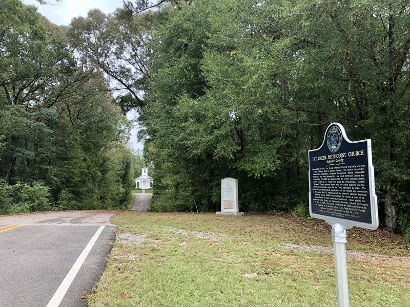
Ivy Creek Methodist Church can be see in far distance.
GEOGRAPHIC SORT Title Sort Marker Number Sort Marker Number Sort N Marker Number Sort T Publication Order Sort Publication Order Sort A Erected Year Sort Most Viewed Sort Most Recent-Interest Sort Most Recently Changed Sort SEE FAQ #33 FOR DESCRIPTIONS
On Alabama Route 14, 0.4 miles west of County Road 9, on the right when traveling west.
On Alabama Route 59 at milepost 56, on the right when traveling north.
On Fort Mims Road north of Boatyard Road (County Route 80), on the right.
On Alabama Route 225 just north of Lower Bryants Landing Road, on the left when traveling north.
On West Barbour Street, on the left when traveling west.
On North Randolph Avenue just south of East Browder Street, on the left when traveling south.
On Montevallo Road (State Highway 25) at Six Mile School Road, on the left when traveling west on Montevallo Road.
On Halso Mill Road (County Route 59) 0.1 miles south of Mt. Zion Road (County Road 65), on the left when traveling south.
Near Braggs Road (Alabama Route 263) 0.4 miles north of Sherling Lake Road (County Road 44), on the left when traveling north.
On McCullars Lane west of County Road 73, on the right when traveling east.
On Quintard Avenue (U.S. 431) at East 13th Street, on the right when traveling north on Quintard Avenue.
On B Street at 1st Place SW, on the right when traveling north on B Street.
On Railroad Street north of Main Street (State Route 22), on the left when traveling north.
On Little Drive (Little Place Cemetery Drive), 0.2 miles east of Ararat Road (County Route 23), on the left when traveling east.
Paid Advertisement
On Alabama Route 141, 0.4 miles south of County Route 404, on the left when traveling south.
On Railroad Street, 0 miles south of West College Street, on the right when traveling south.
On Brown Hawkins Road at Fall Lane, on the left when traveling north on Brown Hawkins Road.
On Alabama Route 22 west of Alabama Route 9, on the right when traveling west.
On West 3rd Street (Alabama Route 15) near Glenwood Avenue, on the right when traveling east.
On Forest Avenue at West 9th Street, on the right when traveling south on Forest Avenue.
On Glenwood Avenue at East 4th Street, on the right when traveling north on Glenwood Avenue.
On 3rd Street Northeast (U.S. 278) at 4th Avenue Southeast, on the right when traveling east on 3rd Street Northeast.
On 3rd Street Northeast (U.S. 278E) at 6th Avenue Northeast, on the left when traveling east on 3rd Street Northeast.
On County Road 846 north of County Road 844, on the right when traveling north.
On East Broad Street (Alabama Route 27) 0.2 miles east of Union Street (Alabama Route 123), on the right when traveling east.
On Alabama Route 22, on the left when traveling east.
On Vine Street at 1st Street North, on the right when traveling north on Vine Street.
On Capitol Avenue at Vine Street, on the right when traveling east on Capitol Avenue.
On Oak Street north of Fifth North Street, on the left when traveling north. Reported permanently removed.
On Oak Street, 0.2 miles 2nd Street North, on the left when traveling north.
Paid Advertisement
On Vine Street near 2nd Street North, on the right when traveling north. Reported permanently removed.
On Oak Street, 0.6 miles south of Capitol Avenue, on the right when traveling south.
Near Vine Street south of Capitol Avenue.
Near Capitol Avenue east of Vine Street.
On Vine Street, on the right when traveling north. Reported permanently removed.
Near 2nd Street North near Vine Street. Reported permanently removed.
On Vine Street, on the right when traveling north. Reported permanently removed.
On Second Street North at Vine Street, on the left when traveling west on Second Street North.
On Vine Street south of 2nd Street North, on the right when traveling north.
On Vine Street, 0.1 miles south of Capitol Street, on the left when traveling south.
On Oak Street (County Road 155), on the left when traveling north. Reported permanently removed.
On Mulberry Street south of First South Street, on the left when traveling south.
On Vine Street north of Capitol Avenue, on the right when traveling north.
On 1st Street North, on the left when traveling west. Reported permanently removed.
On Vine Street at 1st Street North, on the right when traveling south on Vine Street.
Paid Advertisement
On Capitol Avenue, on the right when traveling east.
On Vine Street, on the left when traveling south. Reported permanently removed.
Near 2nd Street North. Reported permanently removed.
On Oak Street near 2nd Street North, on the left when traveling north. Reported permanently removed.
On Oak Street north of Fifth North Street, on the left when traveling north.
Near Second North Street east of Vine Street.
On Vine Street at Capitol Avenue, on the right when traveling north on Vine Street.
Near 2nd Street North near Vine Street. Reported permanently removed.
On Vine Street at Capitol Avenue, on the right when traveling north on Vine Street. Reported permanently removed.
On Vine Street at Capitol Street, on the right when traveling north on Vine Street. Reported damaged.
Near Oak Street south of 1st Street North.
On Capitol Street at Walnut Street, on the right when traveling west on Capitol Street.
Near Second Street North east of Vine Street.
On County Road 9, 0.4 miles north of State Route 22, on the left when traveling north.
On Union Street at Furniss Avenue, on the left when traveling north on Union Street.
On Union Street at McLeod Avenue, on the left when traveling south on Union Street.
Paid Advertisement
On Broad Street (U.S. 80), on the right when traveling north.
On Tremont Street, on the right when traveling south.
On Union Street at Alabama Avenue on Union Street.
On Tremont Street at McLeod Avenue, on the right when traveling south on Tremont Street.
On Lauderdale Street at Selma Avenue, on the right when traveling north on Lauderdale Street.
On Broad Street (U.S. 80) at Water Avenue, on the right when traveling north on Broad Street. Reported permanently removed.
On Lauderdale Street, on the right when traveling north.
On Water Avenue at Washington Street, on the right when traveling east on Water Avenue.
On Mabry Street south of Jeff Davis Avenue, on the right when traveling south.
On 5th Street south of Gault Avenue North (U.S. 11), on the right when traveling north.
On Jordan Avenue near Barnett Boulevard (Alabama Route 14), on the right when traveling north.
On Lancaster Street, 0.1 miles north of Holtville Road (Alabama Route 111), on the right when traveling north.
Near West Fort Toulouse Road, 0.6 miles west of Jackson Park Road.
On North Broad Street at West Coosa Street, on the right when traveling north on North Broad Street.
On Dixon Center Road, 1.6 miles north of U.S. 29, on the right when traveling north.
Paid Advertisement
On East Street at Northeast Street, on the left when traveling east on East Street.
On Chestnut Street at South 9th Street, on the right when traveling east on Chestnut Street.
On Chestnut Street at South 11th Street, on the right when traveling east on Chestnut Street.
On South 1st Street, on the right when traveling north.
On Broad Street at North 5th Street, on the right when traveling west on Broad Street.
On Chestnut Street at South 9th Street, on the right when traveling east on Chestnut Street.
On North Jackson Avenue at Lauderdale Street NW, on the right when traveling south on North Jackson Avenue.
On Jail Springs Road east of Alabama Route 187, on the left when traveling east.
On South Commerce Street (Alabama Route 27) north of East Church Avenue, on the right when traveling south.
On South Academy Street south of East Campbell Avenue, on the right when traveling south.
On Alabama Route 39, 0.1 miles west of Alabama Route 14, on the right when traveling west.
On County Road 117, 0.1 miles east of County Road 20, on the right when traveling east.
On Mound Parkway at State Highway 69, on the right when traveling west on Mound Parkway.
On Mound Parkway, 0.6 miles west of Alabama Route 69, on the right when traveling west.
On E Peachtree Street, on the right when traveling west.
On W Maple Avenue near N Houston Street.
Paid Advertisement
Near Sawmill Road, on the right when traveling south.
On West Main Street (State Highway 117), on the left when traveling south.
Near Messer Airport Highway at University Avenue, on the right when traveling north.
On 19th Street North at 4th Avenue North, on the right when traveling north on 19th Street North.
211 entries matched your criteria. The first 100 are listed above.
Next 100 ⊳