Before it was L-A, this place was Amitgonpontook, which means "the place to dry the fish at the falls." For generations Wabanakis harvested migrating fish each spring. In 1794 Perepol described how travel made this place a part of . . . — — Map (db m186016) HM
Welcome to Auburn's Museum in the Streets® Historic Walking Tour.
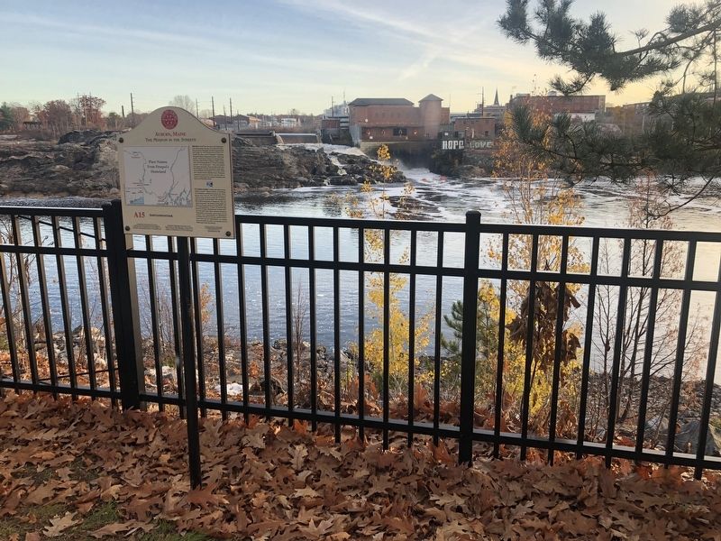
Auburn's history is a manifold tale of Native Americans and settlers; entrepreneurs and visionaries; industrialization and the American . . . — — Map (db m185956) HM
Welcome to Auburn's Museum in the Streets® Historic Walking Tour.
Auburn's history is a manifold tale of Native Americans and settlers; entrepreneurs and visionaries; industrialization and the American . . . — — Map (db m186022) HM
The Lewiston-Auburn Railroad Bridge was erected in 1909 and served as a vital link to the downtown. It also provided the connection for thousands of Canadian, Irish, Polish and other immigrants to the area. Recognizing the bridge’s historic . . . — — Map (db m1050) HM
Squire Edward Little is called the "father" of Auburn and Lewiston. He inherited vast tracts of land from his father. In 1826, at the age of 53, he moved to Danville (now Auburn) and built what his father called an "extravagant" . . . — — Map (db m185965) HM
Oldest frame house of Goffs Corners, Lewiston Falls, and Auburn Village Corp. Now the Civic Center of the City of Auburn Inc. 1869 — — Map (db m186024) HM
Wabanaki History: From Amitgonpontook to Lewiston-Auburn
During the 1680s several hundred Wabanakis fled the English wars of conquest in the south and gathered here at the town of Amitgonpontook. Nearby fish, farm crops, and . . . — — Map (db m185978) HM
Welcome to part of the Wabanaki homeland, Wabanakis—the People of the Dawnland—are the Indigenous peoples of northern New England and southeastern Canada. The four federally recognized peoples in Maine are the Penobscots, . . . — — Map (db m185980) HM
The Lewiston-Auburn Railroad Bridge was erected in 1909 and served as a vital link to the downtown. It also provided the connection for thousands of Canadian, Irish, Polish and other immigrants to the area. Recognizing the bridge's historic . . . — — Map (db m185981) HM
The Grand Trunk Depot, known simply as "The Depot," is a longstanding monument of Lewiston-Auburn's social and industrial history. Around the time of the Civil War, Lewiston's economy was booming as many Canadians immigrated to the . . . — — Map (db m185989) HM
Welcome to Lewiston's Museum in the Streets® historic walking tour.
Along this trail you will discover the rich heritage of Maine's second largest city. Illustrated panels guide you along the Androscoggin River and through the . . . — — Map (db m185985) HM
Welcome to Lewiston's Museum in the Streets® historic walking tour.
Along this trail you will discover the rich heritage of Maine's second largest city. Illustrated panels guide you along the Androscoggin River and through the . . . — — Map (db m186042) HM
English:
Wabanaki Native Americans were this area's original inhabitants, hunting, gathering and traveling along these waterways. In the 1780's, the Upper St. John Valley began to be settled by French-Canadians and Acadians. By . . . — — Map (db m148193) HM
English:
To St. John Valley residents, the river was never a dividing boundary. In 1842, distant governments finally agreed to divide the U.S. and Canada along the St. John River. Generations before, Acadians had settled the . . . — — Map (db m148168) HM
The Aroostook War was an undeclared, bloodless “war” that occurred in 1839.
The peace treaty that ended the American Revolution in 1783 had not satisfactorily determined the boundary between New Brunswick and what is now Maine.
The . . . — — Map (db m102463) HM
English:
Before bridges, railways, and paved roads, the St. John River unified communities, culture, and commerce across the entire Valley — north and south. The genealogical roots of many Valley families cross the river . . . — — Map (db m148184) HM
English: Acadian settlers claimed fertile lands along the river first, raising oats, wheat, and buckwheat, then potatoes. Savvy farmers fertilized with manure and rotated crops with pastureland. By 1905 railroads make it . . . — — Map (db m148074) HM
1843 — 1993 Hommages aux pionniers Français qui ont eu le courage d’établir la paroisse Ste. Luce. In tribute to the French pioneers who had the courage to establish the Parish of St. Luce. Upper Frenchville, Maine Ste. Luce Parish . . . — — Map (db m148299) HM
English: ”Making do” with creativity: French-Acadian inventiveness, ingenuity, & lapatente Here in the Valley, a person who can make or fix just about anything is called le patenteux in the local . . . — — Map (db m148296) HM
English: Hidden solid timber homes. Bricks disguise the timber structure of the house across the field, built using a practice once common here called "piece on piece" [above]. This method used square-hewn horizontal timbers . . . — — Map (db m148298) HM
Plaque commémorative du premier débarquement des Acadiens àu Madawaska, en juin 1785. Hommages de Leurs Descendants. 15 Août 1934.
English (Google translate): Commemorative plaque of the first landing of the Acadians in Madawaska . . . — — Map (db m148295) HM
English:
Genealogy, massive French & Acadian family reunions link past and future
While some Americans proudly trace their roots to the Mayflower, here Valley roots lead back to 1785 and the first 17 Acadian families. . . . — — Map (db m148199) HM
English:
—Acadians settling where faith, farms, and family could grow— British encourage the settlement of the Madawaska Territory. The British — having lost many American colonies in 1783 — wanted . . . — — Map (db m148194) HM
English: Renowned carver Aurelle Collin's handmade crooked knives employ used razor blades. “You see, he had a neighbor who had a barber shop — so he would use his old razor blades to make his knives. Pretty . . . — — Map (db m148297) HM
The northern portion of present-day Route 11 from Sherman to Fort Kent was planned and constructed in many stages from 1826 to the 1850s.
This stretch of road includes two historical routes: the Aroostook Road, which ran 75 miles from Molunkus . . . — — Map (db m102464) HM
In memory of
Capt. John Phinney
First settler in Gorham, Maine
In memory of
Dana Estes
who gave the Town of Gorham
twenty-five hundred dollars
the income to be used at
centennial periods
as specified in his will . . . — — Map (db m186446) HM
You have landed on one of the fourteen Main Coastal Island which have year-round communities with public schools. Once there were three hundred such communities.
Cliff Island lies at a Latitude of 43° 42' North and a Longitude of 70° 8' . . . — — Map (db m186394) HM
This memorial is dedicated to the survivors of the Armenian Genocide 1915 - 1923, who settled in Bayside by the early twentieth century over 250 Armenian families lived in Porland where they established businesses and a vibrant social . . . — — Map (db m186405) HM
Declared a National Historic Site January 1974
Here lie the hardy courageous early settlers, the men and women who founded and defended this area, who made history in civil life, government, law, the arts, education, religion, in the state and . . . — — Map (db m50432) HM
Eastman (1821-1880) was barber, second-hand clothing dealer, mariner and hack driver. He was also a financial supporter of the Abyssinian Meeting House and School.
He owned and operated several barber shops with his four sons, including one on . . . — — Map (db m50425) HM
In honor of
George Cleeves
Founder of Portland
1633
Deputy President
of the
Province of Lygonia
1645 - 1659
There landed with
George Cleeves,
his wife Joan,
and daughter
Elizabeth,
his partner
Richard . . . — — Map (db m55535) HM
Native Americans harvested this rich estuary, camping on Casco Bay islands to hunt, fish, and dig clams.
Prehistoric spear and harpoon points, fish bones, and shell heaps found on Casco Bay islands help trace ancient peoples' late winter, . . . — — Map (db m186360) HM
The largest 17th century settlement in Cape Elizabeth - which included South Portland and Cape Elizabeth prior to 1895 - was established in 1658 near Spring Point. However, the onset of the French and Indian Wars in 1675 necessitated frequent . . . — — Map (db m55673) HM
Near this hallowed ground our earliest settlers erected in 1722 a garrison-meeting house for worship and protection. This was the beginning of the First Congregational Church of South Portland, which was established on November 10, 1734. . . . — — Map (db m55603) HM
Shipbuilding has been an important part of South Portland’s economy since colonial times. Small vessels built prior to the Revolutionary War were used for fishing and the coasting trade which ranged from the Kennebec River to Virginia. During the . . . — — Map (db m55678) HM
English: Farm, tavern, dance hall, boarding house, post office, or library? First explored by Europeans in 1760, settlers came to Rangeley in the early 1800s to farm and to harvest the abundant timber in the mountains. Early . . . — — Map (db m148395) HM
George B. Dorr, a gentleman scholar and lover of nature, devoted most of his adult life to the creation, maintenance, and expansion of Acadia National Park. The son of affluent Bostonians, Dorr first visited Mount Desert Island in 1868 and later . . . — — Map (db m106594) HM
Like small towns across America, Bar Harbor has endured its share of growing pains and seen many changes to the village streetscape since its permanent settlement by Europeans in 1763. Gone are the early settlers' homes, the old boarding houses, the . . . — — Map (db m184635) HM
Since the early 1800s, Otter Creek has been the site of a fishing village with wharfs and fish houses on the waterfront and homes on the hills. Residents caught fish, dried them on racks along the cove, and shipped them to Boston and other cities. . . . — — Map (db m106553) HM
Photo captions starting center left at main illustration and going clockwise:
Penobscot Expedition
On July 28, 1779, in what is known as the Penobscot Expedition, American forces led by the Marines stormed the western bluffs of the . . . — — Map (db m145059) HM
Welcome to Bucksport’s Museum in the Streets Historic Walking Tour
This place where the Penobscot River mets Penobscot Bay has been the homeland of the Penobscot people and their Wabanaki relations for thousands of years. Penobscot . . . — — Map (db m233968) HM
A Good Sign
The sign post behind you symbolizes Bucksport's special place in the world, a town that many would proudly boast as unlike any other in the universe! People from all 4 corners of the
globe find their way here, some to visit, . . . — — Map (db m183890) HM
The Penobscot River is a vital resource. In the 1700's it spawned numerous riverside communities, while the 1800's saw Bangor become the "lumber capital of the world", and Bucksport an international port renowned for shipbuilding. Crafted along . . . — — Map (db m55115) HM
A Past of Ports
The Penobscot River has played an important role in the history and development of the Town of Bucksport. This site where you are standing was once occupied by a commercial wharf, one of many along Bucksport's waterfront in . . . — — Map (db m183844) HM
At this site and adjacent to Mill Stream is the location of the first sawmill built in 1764 by Jonathan Buck. The mill provided boards, staves, shingles and clapboards needed by the settlers as well as for sale in Boston and more distant ports. The . . . — — Map (db m148399) HM
In 1763 Jonathan Buck settled the area, which was subesequently burned during the Revolutionary War. First incorporated as "Buckstown", the name was changed to "Bucksport" in 1817. In the 1800's Bucksport thrived as an international port. Later . . . — — Map (db m55112) HM
You are standing by Somes Sound, one of only a few US fjards – glacially carved valleys drowned by the sea. This five-mile-long bay has attracted people for thousands of years. English homesteaders Abraham and Hannah Somes and James and . . . — — Map (db m106549) HM
Established in 2017 for the citizens of Gouldsboro through the generosity of one of its own.
Gouldsboro peninsula is thirty thousand acres of granite, heath and shallow soil, two mountains and two ponds. On a point in West Gouldsboro, . . . — — Map (db m184603) HM
Dorcas Library
In 1932 the Dorcas Society,
a Christian women’s group in Prospect Harbor that did good works for the community with
money raised from sewing projects, erected a small building here with two rooms. One room was for sewing and the . . . — — Map (db m183938) HM
A Part of History
Both Native Americans and early settlers enjoyed abundant harvests along this coastal shore. Each spring, thousands of adult alewives made an upstream pilgrimage, moving from salt water into the Mill Pond and up Somes Brook . . . — — Map (db m54520) HM
Welcome to Augusta
Indigenous people occupied the Augusta area for thousands of years before European explorers arrived. Little evidence remains of their time here, but patches of forested land along the Kennebec give us a glimpse . . . — — Map (db m186068) HM
In commemoration of the first trading voyage of the Pilgrims of Plymouth to the ancient Indian village at Cushnoc on the Kennebec River, 1625, and on this site the establishment of their fur trading post with the Indians, 1628, Jown Howland in . . . — — Map (db m110858) HM
The embargoes leading to war caused economic hardship in Augusta, and news of war generated disdain in this Federalist Town. Citizens mounted a protest by hanging an effigy of President Madison from the public wharf and flying an . . . — — Map (db m153146) HM
The Pilgrims' trading post at Cushnoc had enjoyed a monopoly of fur trade with local Abenaki since 1628. In the spring of 1634 a vessel commanded by John Hocking of Portsmouth challenged that monopoly. Arriving at Cushnoc, Hocking . . . — — Map (db m110824) HM
Market Square was an early civic and commercial center for the community. Bordering the Square were Pollard's Tavern and the first Meeting House, built in 1782. In 1816, hard times prompted "Ohio Fever" and the square was a . . . — — Map (db m111082) HM
Melville Weston Fuller, an Augusta native, returned to the city following his graduation from Harvard Law School. Here he briefly practiced law, held municipal offices, edited a newspaper and then migrated to Chicago, where he became one of . . . — — Map (db m116071) HM
As part of the strategy to expand and strengthen Massachusetts' territorial claims along the Kennebec River, a Boston-based land company, the Kennebec Proprietors, built Fort Western in 1754. Commanded by James Howard, the Fort . . . — — Map (db m110822) HM
Old Fort Western was built in 1754 at Cushnoc, an Abenaki name for the site of an important 17th-century Plymouth Colony trading post. The Old Fort's main house (barrack) is New England's oldest surviving wooden fort building and a symbol of . . . — — Map (db m111208) HM
The Kennebec River is the largest river in Maine. Originating from Moosehead Lake, the river flows 190 miles through Somerset, Kennebec and Sagadahoc Counties to the Gulf of Maine at Popham Beach. The Kennebec was a primary travel route for . . . — — Map (db m125013) HM
The Kennebec River is the largest river in Maine. Originating from Moosehead Lake, the river flows 190 miles through Somerset, Kennebec and Sagadahoc Counties to the Gulf of Maine at Popham Beach. The Kennebec was a primary travel route for Native . . . — — Map (db m125019) HM
The Franco-Americans who settled in the Central Maine area in the 19th and early 20th centuries came for the most part from Quebec counties bordering Maine, such as Beauce and Frontenac.
Eventually, other immigrants from Prince Edward . . . — — Map (db m116152) HM
Welcome to Thomaston, Maine, the town that went to sea
Thomaston is known for its historic white houses. Both Main and Knox Streets are on the National Historic Register. Of the slightly more than 700 homes in town, approximately . . . — — Map (db m55531) HM
Near this site on August 14, 1635,
John Cogswell and family from
Westbury Leigh, Wiltshire, England,
first set foot in America.
They arrived on the ship Angel Gabriel,
which was wrecked here on the
following day in a . . . — — Map (db m35442) HM
Near this site on August 15, 1635
Ralph Blaisdell and family
were shipwrecked.
The ship was the Angel Gabriel
bound from Bristol, England
to Pemaquid.
From here the family
went to York, Maine
and later to . . . — — Map (db m35441) HM
In memory of John Stevens an early settler in this town who spent the winter here in 1762-3. Erected by his great grandson — Henry Pierce — of San Francisco California 1902 — — Map (db m155160) HM
John and Catharine Brickett settled in this area around 1816. Their original log and wood frame house was later replaced with the present house, built from locally fired clay bricks. At the time, the main route wove through rural Chatham, NH, and . . . — — Map (db m116161) HM
Long before the arrival of the first settlers, this area of the Kenduskeag served as a travel route and encampment site for Native Americans, hunters, trappers and explorers, and the young village of Condeskeag grew in the late 18th century . . . — — Map (db m110593) HM
Born in
Shrewsbury Mass.
Nov. 19, 1752,
Died in
Bangor Me.
May 21, 1844.
He served in the War of the Revolution as
Lieutenant in the 5th Regiment of Massachusetts;
and in grateful memory of that service the . . . — — Map (db m110692) HM WM
Low's Bridge sits adjacent to land once owned by Robert Low, one of Guilford's early settlers. The towns of Guilford and Sangerville built the original structure in 1830 to make travel between the two areas of commerce easier. A flood destroyed the . . . — — Map (db m147970) HM
Welcome to Belfast
In the spring of 1770 Belfast was settled by Scots-Irish families from Londonderry, New Hampshire.
Legend has it that the name Belfast, after the Northern Ireland city, was chosen by a coin-toss.
Fear of . . . — — Map (db m116117) HM
Eunice & Hezekiah French came here from Billerica, Massachusetts in 1799 built a log cabin nearby and ten children were born there — — Map (db m59657) HM
Lincolnville Center was a busy place in the 19th Century with three general stores, two blacksmith shops, a couple of sawmills, several shoemaking shops, a one-room school, two churches and a wheelwright shop. In 1904 the Lincolnville Telephone . . . — — Map (db m55827) HM
Nathan & Lydia Knight built a log cabin and became the First Settlers of Canaan Plantation which in 1802 was incorporated as Lincolnville — — Map (db m55825) HM
Today's peaceful view of the Penobscot River and the community of Bucksport holds few hints of the early conflicts that plagued the area. For nearly two centuries, the river served as a border between clashing interests - French and English, Native . . . — — Map (db m55132) HM
In 1759, Massachusetts Governor Thomas Pownall sought to plug the mouths of Maine's key rivers so as to keep the French and Indians well inland. In January 1758, he wrote to William Pitt, Prime Minister of England about the advantages of this site, . . . — — Map (db m170846) HM
The Early Settlers
The town of Addison was given permission to incorporate by the General Court of Massachusetts on February 14, 1797. The settlers chose the name in honor of the British writer Joseph Addison. The earliest town records were . . . — — Map (db m183744) HM
"...all set to clear the island, to fetch wood, to cut timber, to carry earth & other things necessary for the construction of the buildings."
Samuel Champlain Journal, 1604 (translation)
Pierre Dugua's settlement plans . . . — — Map (db m125214) HM
"...I set out from Ste. Croix on September 2...with twelve sailors and two Indians to serve us as guides to the places with which they were acquainted."
Samuel Champlain Journal, 1604 (translation)
In late summer Pierre . . . — — Map (db m125217) HM
This model shows the Saint Croix Island colony as depicted by Samuel Champlain. His depiction was idealized. Archeological research has revealed discrepancies in building size and location.
[Sketch caption reads]
Plan for 1604 Saint . . . — — Map (db m125257) HM
"The Sieur de Mons decided to remove elsewhere...to escape the cold and dreadful winter..."
Samuel Champlain Journal, 1605 (translation)
After the terrible winter, Pierre Dugua, Sieur de Mons, ordered his men to take down . . . — — Map (db m125245) HM
St. Croix Island has been presented to the United States of America as a monument to Sieur de Monts and Samuel de Champlain on the North American continent. The creation of this monument has been accomplished as a result of the public spirit and . . . — — Map (db m125115) HM
"...His Majesty commanded the Sieur de Mons to prepare a fresh expedition..."
Samuel Champlain Journal, 1604 (translation)
The newcomers who landed on the island offshore came from France. Their leader was Pierre Dugua, . . . — — Map (db m125161) HM
In 1604, this was the land of the Passamaquoddy. In June, several families would have been camped here harvesting fish and shellfish. Nobody knows what the residents thought when a large ship landed at a nearby island. We do know they helped the . . . — — Map (db m125159) HM
"During the winter a certain malady attacked many of our people...
We could find no remedy..."
Samuel Champlain Journal, 1604 (translation)
When winter came, treacherous ice made crossing to the mainland impossible. . . . — — Map (db m125238) HM
Share the dramatic story of Saint Croix Island. In 1604, over a hundred artisans, soldiers, and gentlemen sailed here from France in a bold attempt to establish a European colony north of Florida. They built a settlement on an island offshore and . . . — — Map (db m125121) HM
The Union Church was built in 1840 by the Union Meetinghouse Association to be used for non-denominational worship.
In 1898 the bell was donated to the church by the Columbia Falls Women's Society.
In 1903 the Church was deeded to the Town . . . — — Map (db m55073) HM
Early Settlers of the Pleasant River Known to Have Been in Action Against the British During the Revolution of 1775 to 1783
[Honor Roll of Veterans] — — Map (db m55088) HM WM
Eastport's downtown Historic District is an architectural treasure listed on the National Register of Historic Places. The 18th and 19th century shipbuilding industry brought in the resources to create our historically significant residential . . . — — Map (db m183568) HM
Hannah Watts was born in 1758 at about the same time that the Indian War was raging in New England. Around 1760 Captain Samuel Watts,
Hannah's father, moved his family from Haverill, Massachusetts to Falmouth, Maine. The family resided there for a . . . — — Map (db m183783) HM
Early Jonesboro, known as Chandler's River, was one of the best timbered in the area of what is now the state of Maine. A heavy growth of old pine lined its banks for miles up and down the river. In 1764 an early pioneer, Judah Chandler, built the . . . — — Map (db m183790) HM
This tablet marks the landing place of the company which made the first permanent English settlement in this town, May 20, 1763. The little band consisted of Samuel and Sylvanus Scott, Timothy George, and David Libby, John and Solomon Stone, Daniel . . . — — Map (db m54739) HM
Looking East into New Brunswick: The International Boundary runs directly through East Grand Lake and the Chiputneticook Lakes below you. The deepest parts of the lakes define the border between the U.S. and Canada.
Glaciers carved vast . . . — — Map (db m125291) HM
Rural Weston, once home to classic farms: Big house, little house, outhouse, barn.
In this sparsely-populated town of several hundred, look for a few remaining farms perched amidst fields slowly returning to forest. Local settlers like . . . — — Map (db m125267) HM
In the 1880's, leather production was one of Maine's largest industries
An industry built on Hemlock, plentiful pure water and rail. Hemlock tan-bark makes a "tea" high in tannin used to cure raw animal hides. Entrepreneurs located . . . — — Map (db m125308) HM
118 entries matched your criteria. The first 100 are listed above. The final 18 ⊳