After filtering for Illinois, 214 entries match your criteria. The first 100 are listed. ⊳
Native Americans Topic
By Jason Voigt, September 7, 2021
Trail of Death Marker
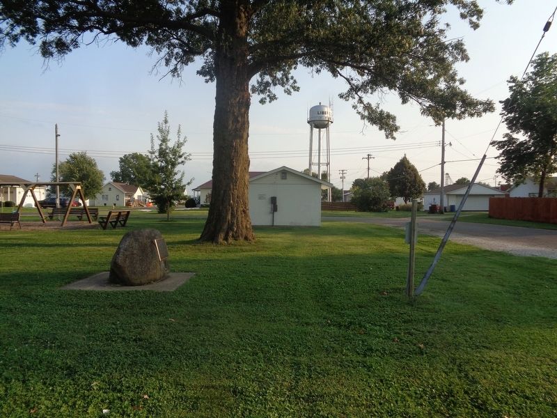
| 1 ► Illinois, Adams County, Liberty — Trail of Death — Regional Historic Trail — Indiana to Kansas — |
| On North Park Street at Hannibal Street, on the right when traveling north on North Park Street. | |||
| 2 ► Illinois, Adams County, Quincy — Archaic — A Time of Change — 3000 - 1000 B.C. — |
| On Indian Mounds Park west of South 5th Street, on the left when traveling north. | |||
| 3 ► Illinois, Adams County, Quincy — In Memory of the Potawatomi Indian "Trail of Death" — Indiana to Kansas, September 4 - November 4, 1838 — |
| On Maine Street west of 7th Street, on the right when traveling west. | |||
| 4 ► Illinois, Adams County, Quincy — Indian Mounds Park — Preserving a Legacy — |
| On Indian Mounds Park, 0.1 miles west of South 5th Street, on the right when traveling east. | |||
| 5 ► Illinois, Adams County, Quincy — Indian Removals - A Memorial — |
| On Quinsippi Island Road, on the right when traveling east. | |||
| 6 ► Illinois, Adams County, Quincy — Lincoln's Honored Friend — Looking for Lincoln — |
| On Maine Street, on the right when traveling east. | |||
| 7 ► Illinois, Adams County, Quincy — Marquette & Jolliet — Europeans Arrive — |
| On Indian Mounds Park just west of South 5th Street, on the right when traveling east. | |||
| 8 ► Illinois, Adams County, Quincy — Mississippian — The First Farmers — AD 1000-1300 — |
| On Indian Mounds Park, 0.1 miles west of South 5th Street, on the right when traveling west. | |||
| 9 ► Illinois, Adams County, Quincy — Paleoindian — The First Illinoisans — 12,000-8000 BC — |
| On Indian Mounds Park, 0.1 miles west of South 5th Street, on the left when traveling north. | |||
| 10 ► Illinois, Adams County, Quincy — Potawatomi Trail of Death — Mill Creek 1838 — |
| On Rock Quarry Road south of Illinois Route 104, on the left when traveling north. | |||
| 11 ► Illinois, Adams County, Quincy — Quincy — |
| On Indian Mounds Park, 0.1 miles west of South 5th Street, on the left when traveling east. | |||
| 12 ► Illinois, Adams County, Quincy — Woodland — Village Life and Mound Building — |
| On Indian Mounds Park west of South 5th Street, on the right when traveling west. | |||
| 13 ► Illinois, Alexander County, Cairo — Cairo Connection — Land & Water Routes — Fort Defiance Park — |
| On Washington Avenue (U.S. 60/62) west of U.S. 51, on the right when traveling east. | |||
| 14 ► Illinois, Alexander County, Cairo — Critical River Confluence — Where the Ohio & Mississippi Meet — Fort Defiance Park — |
| On Washington Avenue (U.S. 60/62) south of U.S. 51, on the right when traveling east. | |||
| 15 ► Illinois, Bond County, Greenville — Hills Fort — |
| On Hills Fort Avenue (County Road 500) west of Millersburg Road, on the right when traveling east. | |||
| 16 ► Illinois, Bond County, Greenville — History of Greenville-Bond County — |
| On 3rd Street (Illinois Route 127) at Main Street, on the right when traveling north on 3rd Street. | |||
| 17 ► Illinois, Bond County, Greenville — The Defense of Hill's Fort — |
| Near Museum Avenue, 0.6 miles east of Illinois Route 127. | |||
| 18 ► Illinois, Boone County, Belvidere — Burial Place of Big Thunder — |
| On North Main Street north of East Perry Street, on the right when traveling north. | |||
| 19 ► Illinois, Cass County, Beardstown — Captain Abraham Lincoln — Looking for Lincoln — |
| On Sangamon Street at N. Bay Street on Sangamon Street. | |||
| 20 ► Illinois, Champaign County, Homer — Potawatomi Trail of Death — Davis' Point Encampment — September 20, 1838 — |
| On County Route 1250 N west of County Route N 300 E, on the right when traveling west. | |||
| 21 ► Illinois, Champaign County, Sadorus — Potawatomi Trail of Death — Sadorus's Grove Encampment — September 22, 1838 — |
| On North West Street at North Front Street, on the left when traveling north on North West Street. | |||
| 22 ► Illinois, Champaign County, Sidney — Potawatomi Trail of Death — Sidney Encampment — September 21, 1838 — |
| On Dunlap Woods north of East Main Street, on the right when traveling north. | |||
| 23 ► Illinois, Coles County, Lerna — Thomas Lincoln, Kentucky Militiaman — |
| Near East Lincoln Highway Road west of County Road 1300E. | |||
| 24 ► Illinois, Cook County, Chicago, Bridgeport — Bridgeport and the Development of Chicago's Infrastructure — The Story of a Neighborhood — |
| On South Halsted Street north of West 34th Street when traveling north. | |||
| 25 ► Illinois, Cook County, Chicago, Forest Glen — Old Treaty Elm — |
| On Noth Kilbourn Avenue at North Rodgers Avenue, on the right when traveling south on Noth Kilbourn Avenue. | |||
| 26 ► Illinois, Cook County, Chicago, Lake View — Kwanusila — |
| On North Recreation Drive near West Addison Drive, on the right when traveling north. | |||
| 27 ► Illinois, Cook County, Chicago, Lake View East — Two Spirit — The Legacy Walk — |
| On North Halsted Street, on the right when traveling north. | |||
| 28 ► Illinois, Cook County, Chicago, Lincoln Park — Chicago is Community — Chicago es Comunidad — |
| Near West La Salle Drive (Illinois Route 64). | |||
| 29 ► Illinois, Cook County, Chicago, Lincoln Park — Chicago is Community — Chicago es Comunidad — |
| On North Boulevard. | |||
| 30 ► Illinois, Cook County, Chicago, Lincoln Park — Chicago is Connected — Chicago está Conectado — |
| On North Boulevard, on the right when traveling west. | |||
| 31 ► Illinois, Cook County, Chicago, Lincoln Park — Chicago is Curious — Chicago es Curioso — |
| On West La Salle Drive (Illinois Route 64) east of Clark Street, on the right when traveling east. | |||
| 32 ► Illinois, Cook County, Chicago, Lincoln Park — Chicago is Natural — Chicago es Natural — |
| Near North Boulevard. | |||
| 33 ► Illinois, Cook County, Chicago, Lincoln Park — Chicago is Resilient — Chicago es Resistente — |
| On North Clark Street near West La Salle Drive (Illinois Route 64), on the right when traveling north. | |||
| 34 ► Illinois, Cook County, Chicago, Lincoln Park — Chicago is Zhegagoynak — |
| On West La Salle Drive (Illinois Route 64). | |||
| 35 ► Illinois, Cook County, Chicago, Lincoln Park — The Richard M. and Shirley H. Jaffee History Trail — |
| On North Clark Street at La Salle Drive, on the right when traveling north on North Clark Street. | |||
| 36 ► Illinois, Cook County, Chicago, Lincoln Park — The Richard M. and Shirley H. Jaffee History Trail — |
| On North Boulevard at Clark Street on North Boulevard. | |||
| 37 ► Illinois, Cook County, Chicago, Near South Side — Battle of Fort Dearborn — August 15, 1812 — |
| On Calumet Ave at 18th Street, on the right on Calumet Ave. | |||
| 38 ► Illinois, Cook County, Chicago, Near South Side — Olmec Head #8 — |
| Near Special Olympics Drive north of East Solidarity Drive, on the right when traveling south. | |||
| 39 ► Illinois, Cook County, Chicago, O'Hare — Alexander Robinson — |
| Near East River Road, 0.1 miles north of West Lawerence Avenue. | |||
| 40 ► Illinois, Cook County, Chicago, Old Town Triangle — Chicago is Complex — Chicago es Complejo — |
| On West La Salle Drive. | |||
| 41 ► Illinois, Cook County, Chicago, Portage Park — Portage Park — |
| On North Central Avenue near West Irving Park Road (Illinois Route 19). | |||
| 42 ► Illinois, Cook County, Chicago, Portage Park — Portage Park — |
| On North Central Avenue near West Berteau Avenue. | |||
| 43 ► Illinois, Cook County, Chicago, Rogers Park — Indian Boundary Lines — |
| On North Rogers Avenue at North Clark Street, on the right when traveling west on North Rogers Avenue. | |||
| 44 ► Illinois, Cook County, Chicago, South Loop — Original Peoples Homeland — |
| Near East McFetridge Drive west of Special Olympics Drive, on the right when traveling west. | |||
| 45 ► Illinois, Cook County, Chicago, Streeterville — Catherine and Jean-Baptiste Point du Sable — Fur traders and farmers — Chicago Tribute — |
| On North Michigan Avenue when traveling north. | |||
| 46 ► Illinois, Cook County, Chicago, The Loop District — Fort Dearborn — |
| On East Wacker Drive at North Michigan Avenue on East Wacker Drive. | |||
| 47 ► Illinois, Cook County, Chicago, West Ridge — Indian Boundary Park — 1916 — |
| Near West Lunt Avenue west of North Western Avenue, on the right when traveling west. | |||
| 48 ► Illinois, Cook County, Chicago, West Ridge — Indian Boundary Village — |
| Near West Lunt Avenue east of North Rockwell Street, on the left when traveling east. | |||
| 49 ► Illinois, Cook County, Evanston — Archange Ouilmette — |
| On Sheridan Road at Central Street, on the right when traveling north on Sheridan Road. | |||
| 50 ► Illinois, Cook County, Forest View — Portage Creek Passage — |
| Near South Harlem Avenue (Illinois Route 53) south of Forest View Terminal Drive. | |||
| 51 ► Illinois, Cook County, Franklin Park — Burial Site of Josette Beaubien — |
| On North River Road, on the right when traveling south. | |||
| 52 ► Illinois, Cook County, Melrose Park — Historic Lake Street — |
| On Broadway Avenue at Rice Street, on the right when traveling north on Broadway Avenue. | |||
| 53 ► Illinois, Cook County, Morton Grove — American Indian - Potawatomi Tribe Eagle Dancer — |
| 54 ► Illinois, Cook County, Morton Grove — Indian Trading Post — |
| 55 ► Illinois, Cook County, Oak Park — Continental Divide — |
| On Oak Park Avenue at Ontario Street, on the right when traveling south on Oak Park Avenue. | |||
| 56 ► Illinois, Cook County, Oak Park — Continental Divide — |
| On Lake Street east of Forest Avenue, on the right when traveling east. | |||
| 57 ► Illinois, Cook County, Oak Park — Continental Divide — |
| On Berkshire Street at Elmwood Avenue, on the right when traveling east on Berkshire Street. | |||
| 58 ► Illinois, Cook County, Oak Park — Continental Divide — |
| On Chicago Avenue, on the right when traveling west. | |||
| 59 ► Illinois, Cook County, Oak Park — Continental Divide — |
| On North Avenue (Illinois Route 64) at Narragansett Avenue, on the right when traveling east on North Avenue. | |||
| 60 ► Illinois, Cook County, Oak Park — Mann Elementary — |
| On North Kenilworth Avenue, on the right. | |||
| 61 ► Illinois, Cook County, River Grove — History — |
| Near Ditka Drive, 0.1 miles south of Grand Avenue. | |||
| 62 ► Illinois, Cook County, River Grove — Rock Che-Che-Pin-Qua — |
| Near Ditka Drive near Grand Avenue, on the right when traveling south. | |||
| 63 ► Illinois, Cook County, Riverside — Old River-Crossing — |
| On Fairbank Road, 0.1 miles east of Millbridge Road. | |||
| 64 ► Illinois, Cook County, Riverside — Riverside As It Once Was — |
| On Fairbank Road, 0.3 miles west of Coonley Road. | |||
| 65 ► Illinois, Cook County, Sauk Village — Sauk Village — Sauk Trail was the Original Route of the Lincoln Highway — The Route Included Kalvelage Bridge — |
| On Sauk Trail, on the right when traveling east. | |||
| 66 ► Illinois, Cook County, Skokie, Niles Township — Historic Engine House — |
| On Floral Avenue north of Oakton Street, on the left when traveling south. | |||
| 67 ► Illinois, Crawford County, Hutsonville — Hutson Memorial — |
| On North 1550th Street north of 1600th Avenue, on the right when traveling north. | |||
| 68 ► Illinois, DeKalb County, Shabbona — Chief Shabbona — |
| Near Chief Shabbona County Forest Preserve, 0.5 miles south of Preserve Road. | |||
| 69 ► Illinois, DeKalb County, Shabbona — Shabbona — |
| On East Comanche Avenue (Illinois Route 30) at Indian Road, on the right when traveling east on East Comanche Avenue. | |||
| 70 ► Illinois, DuPage County, Downers Grove — The Indian Boundary Line — |
| On Maple Avenue at Belden Avenue, on the right when traveling east on Maple Avenue. | |||
| 71 ► Illinois, DuPage County, Naperville — Fort Payne — |
| Near S. Brainard Street, 0.1 miles south of East Chicago Avenue. | |||
| 72 ► Illinois, DuPage County, Oak Brook — The Indian Boundary Line — |
| Near 31st Street (County Route 34) 0.3 miles west of Illinois Route 83, on the left when traveling west. | |||
| 73 ► Illinois, Edgar County, Chrisman — Pontiac Peace Treaty — |
| On U.S. 150, 0.3 miles north of County Route 2500N, on the right when traveling south. | |||
| 74 ► Illinois, Grundy County, Morris — Indian Pole — |
| On Liberty Street just south of East Washington Street, on the right when traveling north. | |||
| 75 ► Illinois, Hancock County, La Harpe — Oatman Lilac Bush — |
| On West Main Street (Illinois Route 9) west of Center Street, on the right when traveling east. | |||
| 76 ► Illinois, Hancock County, Nauvoo — History Along The Mississippi River Parkway — |
| On Stone Arch Bridge Scenic Turnout west of Illinois Route 96, on the left when traveling north. | |||
| 77 ► Illinois, Hardin County, Rosiclare — The Ohio River Scenic Byway — These are some of the places to explore on the Ohio River Scenic Byway. — |
| On Main Street (Illinois Route 34) at 2nd Street, on the right when traveling east on Main Street. | |||
| 78 ► Illinois, Henry County, Kewanee — The Great Sauk Trail — |
| On East State Road, 0.1 miles east of Illinois 78, on the left when traveling east. | |||
| 79 ► Illinois, Iroquois County, Iroquois — Gurdon S. Hubbard Trading Post — |
| On Road 2200 North (County Route 31), on the left when traveling east. | |||
| 80 ► Illinois, Jersey County, Grafton — Illiniwek — |
| On Lodge Boulevard, on the right when traveling east. | |||
| 81 ► Illinois, Jersey County, Grafton — The Piasa Bird — |
| On Lodge Boulevard, on the right when traveling east. | |||
| 82 ► Illinois, Jersey County, Grafton, Quarry Township — Grafton — Meeting of the Great Rivers — |
| On West Main Street (State Road 100) at Mason Hollow Road, on the right when traveling west on West Main Street. | |||
| 83 ► Illinois, Jersey County, Grafton, Quarry Township — McAdams Peak — |
| Near Scenic Drive east of Illinois Route 100. | |||
| 84 ► Illinois, Jo Daviess County, Elizabeth — Galena, Illinois — |
| On U.S. 20, 0.9 miles west of West Headquarters Road, on the right when traveling west. | |||
| 85 ► Illinois, Kankakee County, Bourbonnais — Noël Le Vasseur — 1799-1879 — |
| On South Main Street (U.S. 52) just south of Main Street Northwest (Illinois Route 102), on the right when traveling south. | |||
| 86 ► Illinois, Kankakee County, Momence — Dixie Highway Connected Chicago to Miami in the Early Days of Automobile Travel — Momence: a hunter, trapper and fisherman's paradise along the beautiful Kankakee — |
| On Dixie Highway (Illinois Route 1) at West River Street, on the right when traveling south on Dixie Highway. | |||
| 87 ► Illinois, Knox County, Knoxville — The Indian Trails — |
| On East Main Street (U.S. 150) at East Public Square, on the right when traveling west on East Main Street. | |||
| 88 ► Illinois, Knox County, Lafayette — Fraker's Grove — |
| On Illinois Route 17, 0.6 miles west of Golf Course Road, on the right when traveling east. | |||
| 89 ► Illinois, LaSalle County, North Utica — Père Marquette — |
| On West Johnson Street at South Division Street, on the left when traveling west on West Johnson Street. | |||
| 90 ► Illinois, LaSalle County, Oglesby — René Robert Cavelier Sieur de La Salle — 1643-1687 — |
| 91 ► Illinois, LaSalle County, Oglesby — The Legend of Starved Rock — A story that has captured and will continue to capture imaginations of visitors for generations — You are now standing 125 feet above the Illinois River on the bluff known as Starved Rock — |
| 92 ► Illinois, Lawrence County, Sumner — Vincennes Tract — |
| On Cahokia Trace Lane (County Road 1120 N) at Red Hill Cross Road (County Road 390 E), on the right when traveling west on Cahokia Trace Lane. | |||
| 93 ► Illinois, Lee County, Grand Detour — La Sallier's Cabin — |
| On Lost Nation Road, 1 mile south of South Lost Nation Road, on the right when traveling south. | |||
| 94 ► Illinois, Lee County, Paw Paw — Homes of Chief Waubonsie and Madeline Ogee — |
| On Wheeler Street at Chapman Street, on the right when traveling east on Wheeler Street. | |||
| 95 ► Illinois, Lee County, Paw Paw — Old Chicago Trail — |
| On Chicago Road at Park Avenue, on the right when traveling east on Chicago Road. | |||
| 96 ► Illinois, Livingston County, Pontiac — A Bridge to the Past — From Route 4 to City Street — |
| On North Division Street north of West Jefferson Street, on the right when traveling south. | |||
| 97 ► Illinois, Livingston County, Pontiac — Fell Leads The Way — Looking for Lincoln — |
| On North Vermillion Street south of West Madison Street, on the left when traveling south. | |||
| 98 ► Illinois, Livingston County, Pontiac — Pontiac — The City of Pontiac is named for this Intrepid Warrior — |
| On West Washington Street at North Main Street, on the left when traveling east on West Washington Street. | |||
| 99 ► Illinois, Logan County, Elkhart — Heritage Corner — Village of Elkhart — |
| On Governor Oglesby Street at South Bogardus Street, on the right when traveling east on Governor Oglesby Street. | |||
| 100 ► Illinois, Logan County, Lincoln — Kickapoo Town — |
214 entries matched your criteria. The first 100 are listed above. Next 100 ⊳