Established in 1880 as a means of preventing Indian raids into Mexico. Raided by Apaches in 1881. Abandoned in 1893 after Western Texas had been permanently cleared of Indians. — — Map (db m73723) HM
Fort Peña Colorado, the last active fort in this area, on the old Comanche Trail, about 4 miles to the southwest was established in 1879.
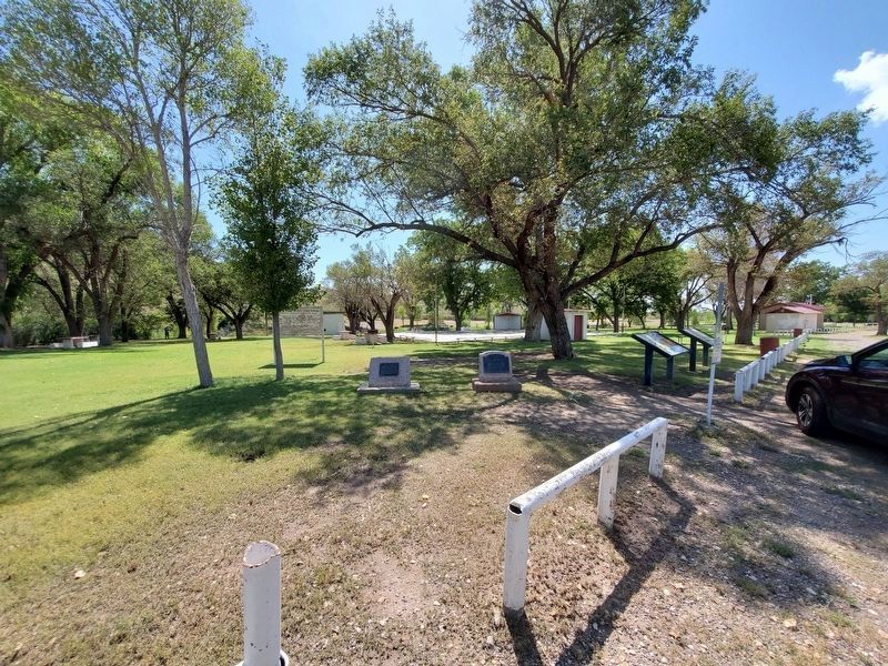
Marathon was founded in 1881. Named by an old sea captain, A.E. Shepard, for the Plain of Marathon, in . . . — — Map (db m26436) HM
Mercury, or Quicksilver, is derived from a red-colored ore known as cinnabar.
Cinnabar (sample at left) was used by Native-Americans as a durable pigment, and there are many places in Big Bend where traces of ancient drawings . . . — — Map (db m111500) HM
In an effort to establish a western trade route and expand Texas jurisdiction, Republic of Texas President Mirabeau B. Lamar sent an expedition of merchants, along with a military escort, to Santa Fe in 1841. The group left Brushy Creek north of . . . — — Map (db m155171) HM
(Right Panel)
A Land of Plenty
People have occupied this rugged country for around 12,000 years. During the late Pleistocene age, small bands of nomadic hunters known as Paleo-Indians were attracted to the Caprock escarpment. Here they . . . — — Map (db m200456) HM
Comanches traded with Comancheros
SW in the Valley of Tears between
Los Lingos and Cottonwood Creeks
Arrow Sculptor: Charles A Smith
— — Map (db m151468) HM
Comanche guides led early explorers Pedro Vial, Jose Mares & Francisco Armangual through this area 1787-1808
Arrow sculptor: Charles A. Smith — — Map (db m155175) HM
Indians had probably visited these clear, cool springs for centuries when, in 1847, Henry E. McCulloch established a Ranger camp here, on Hamilton Creek. A year later, Samuel E. Holland (1826-1917), a Georgian, decided while visiting the camp that . . . — — Map (db m27533) HM
Rich in history and folklore. A young geologic formation, only a few million years old. Bones of elephant, bison, bear, deer, other animals have been found here. When white men came to area in 1840's, Indians knew the caverns; Rangers once found and . . . — — Map (db m27594) HM
Jacob Wolf (1812-1874) and wife Adeline Faulkner Wolf (1814-1870) came from Tennessee to Texas about 1850. Obtaining land grant in Burnet County, they settled at Dobyville, and were pioneers, supplying their own provisions, buildings, medicines, and . . . — — Map (db m27738) HM
The harsh anti-Indian policies of President Mirabeau B. Lamar and Mexican efforts to weaken the Republic of Texas stirred Indian hostilities. Hatred increased after the Council House Fight in San Antonio, March 19, 1840, where 12 Comanche chiefs . . . — — Map (db m64063) HM
In 1791, Spaniard priests Manuel De Silva and Joseph Francisco Mariano Garza endeavored to spread the doctrines of Christianity among the native tribes along the Gulf Coast, now called Karankawa, with the added benefit of giving Spain a foothold . . . — — Map (db m117448) HM
Located within 100 yards from here is one of Calhoun County's essential springs called Six Mile Watering Hole. Though the number of springs in Calhoun County is small, the location of these springs has played a part in the history of this land for . . . — — Map (db m204939) HM
Planted on April 26, 2003, this oak tree is a direct offspring from the famous Treaty Oak in Austin, Texas where Stephen F. Austin is reputed to have signed the treaty establishing the boundary between the Native Americans and the first Anglo . . . — — Map (db m80851) HM
This Indian trading route to Arkansas and Oklahoma was laid out by Cherokees. A tribesman with a keen sense of direction pulled buffalo hides behind his horse to press down the tall grass. Groups of Indians followed blazing the trail, removing . . . — — Map (db m160947) HM
Quanah Parker Comanche Chief.
Honored in Red River war exhibit
Carson County Square House Museum
Arrow sculptor: Charles A. Smith — — Map (db m154107) HM
Comanches used Running Water & Frio
Draws in this area as trailways for
hunting & trade with Comancheros
Arrow Sculptor: Charles A Smith
— — Map (db m167621) HM
French trader Joseph Blancpain established a trading post in this vicinity in August 1754. He had been living in Natchitoches, Louisiana, where he was the owner of a mercantile store.
With a small group of men, Blancpain arrived in August and . . . — — Map (db m117185) HM
Two of the most misfortune-ridden outposts of Spain in Texas, “Our Lady of the Light” mission and its auxiliary fort, were founded near here in 1756 to guard against French encroachment from the east.
The two friars who were to . . . — — Map (db m117186) HM
For Weary Travelers
During the height of travel along El Camino Real de los Tejas, this site was a frequent rest stop or paraje. It was known as Paraje el Cerrito or Place of the Little Hill. It was probably a popular stop . . . — — Map (db m232415) HM
The Caddo workers who built the earthen mounds gathered the necessary soil from excavations, or "borrow pits", and carried it in baskets. It took many trips from the pit to the village to significantly increase the height of any mound.
Along . . . — — Map (db m232383) HM
This burial mound was about 20 feet tall and 90 feet in diameter when the village was abandoned. A series of archeological excavations beginning in 1939 determined that it was built in successive stages over a period of about 700 years, ending . . . — — Map (db m232392) HM
In 1836, General Sam Houston negotiated a treaty with the Cherokees in Texas allowing possession of the lands they occupied in east Texas. The leading figure among the Cherokees at that time was Duwali (also known as Bowl, Chief Bowles and Bold . . . — — Map (db m40654) HM
A Corridor for Commerce, Culture, and Change - Past and Present
You are standing at one small point on a legendary network of roads that arc across Texas - El Camino Real de los Tejas. The main overland route from Mexico, through . . . — — Map (db m232403) HM
This mound was originally at least three times its current length and reached 35 feet tall. It was the spiritual and political center of the village with buildings for worship or government. Archeological evidence suggests that periodically, the . . . — — Map (db m232376) HM
This Low Platform Mound did not have any buildings on it. Based on archeological evidence, it appears that there were important structures at the ground surface which were burned and then covered over to create a platform mound that was ramped . . . — — Map (db m232387) HM
Bulging out of the earth a few yards from this point, three prehistoric Indian mounds interrupt the prevailing flat terrain. Long overgrown with grass, the mounds and adjacent village (covering about 100 acres) constitute one of the major aboriginal . . . — — Map (db m219203) HM
The natural spring located near the village site feeds into the Neches River and is likely a primary reason the Caddo settled here. It provided a continuous supply of fresh water for the local residents. Village women collected water from the spring . . . — — Map (db m232372) HM
Originally established as Mission San Francisco de los Tejas in 1690 by Franciscan missionaries for the purpose of Christianizing and civilizing the Neches and other Indians of the region. Reestablished in 1716. Abandoned temporarily due to French . . . — — Map (db m121257) HM
Here at the opening of the 18th century stood a village of the Neches Indians. Their name was given to the river and later to a mission, San Francisco de Los Neches, established near by. With the Cherokees, the Neches Indians were expelled from . . . — — Map (db m121335) HM
Noted as interpreters and messengers of peace, the Delawares were chiefly instrumental in bringing other tribes to the General Treaty at Bird's Fort (in the present county of Tarrant) in 1843. — — Map (db m121258) HM
Along El Camino Real de los Tejas
On a good day, a Spanish carreta, or wooden freight wagon, could travel up to 18 miles before sunset along El Camino Real de los Tejas. In the 1750s, a driver might pass a group of Franciscan friars in charge . . . — — Map (db m232420) HM
The village surrounding Caddo Mounds was divided into two distinct living areas, one for the spiritual and cultural leaders and the other for the common villagers. The inner village surrounded the temple mounds and housed the village's spiritual and . . . — — Map (db m232374) HM
The Caddo village served as a major regional trade center, connected to other settlements by a series of long-distance trade routes. The people here exchanged goods with other groups nearby and from hundreds of miles away. The Caddo imported high . . . — — Map (db m232396) HM
On this nine mile long ridge there are two historic lookout points which command a view of 30 to 35 miles. Between this site, with an elevation of 713 ft., and Point Lookout (1/4 mi. NW), lies a narrow valley. An Indian trail and later a pioneer . . . — — Map (db m31698) HM
Cherokee County has a rich and varied history. Spanish and French explorers of the seventeenth century found Tejas and Hasinai Indians living in this area, and Spanish missions were established in the region.
Driven out of the United States, . . . — — Map (db m212151) HM
In the winter of 1819-1820 Chief John Bowles led about sixty Cherokee families from Arkansas to East Texas. Near this site a small settlement of about six families was established by a Cherokee leader named Little Bean. They remained until 1839, . . . — — Map (db m128988) HM
In the blue sand hills, Quanah Parker persuaded reluctant Comanches to return to Ft. Sill in peace, 1877 Arrow Sculptor: Charles A. Smith — — Map (db m174005) HM
Throughout this area during the last several centuries, rock ledges gave protection to Lipan, Kickapoo, Comanche, and Kiowa Indians. In one typical shelter archeologists found evidence of 3 periods of occupation, plus numerous intricate petroglyphs . . . — — Map (db m77615) HM
Archeological findings at an overhanging rock ledge on Walnut Creek show that the spot, midway between the Colorado and North Concho Rivers, was for hundreds of years campsite or village of nomadic Indians who sought the shelter, running water, . . . — — Map (db m95932) HM
On site of prehistoric Indian camps, in area where in 1850's Fort Chadbourne soldiers often skirmished with Indians.
One of the first settlements and second pioneer post office (established 1888) in county.
Named for the Comanche Chief . . . — — Map (db m82994) HM
Malissa (Dodson) Sides became the first person to be buried on this site in March 1891. Believed to have been half Native American, Mrs. Sides and her Cherokee half sister Ellen Murphy survived the U.S. government relocation of the tribe during . . . — — Map (db m201949) HM
By 1835, the under-funded provisional government of Texas offered to pay its soldiers with land. Surveying parties flooded the frontier, ingressing Native hunting grounds. Hard-fought battles and skirmishes brought no lasting victories to the . . . — — Map (db m244229) HM
Hispanic and Anglo settlers entered Texas to find a land well suited for cattle raising. English herding traditions from the East and Spanish ranching traditions from the South met in this region of vast open grasslands. Here English and Spanish . . . — — Map (db m214675) HM
The land surrounding this historic cemetery was part of a grant obtained by John McGarrah, a member of the Peters Colony who arrived in this area in 1843. McGarrah founded a trading post near this site, and soon the Fort Buckner settlement was . . . — — Map (db m162269) HM
McBain Jameson and Jeremiah Muncey settled in this vicinity in 1840 and 1842. While hunting in late 1844, William Rice and Leonard Searcy came to Muncey's hut and found the savagely slain bodies of Jameson, Muncey, Mrs. Muncey, and a small child, . . . — — Map (db m220380) HM
Comanches once hunted Buffalo on
Salt Fork of the Red and Buck Creek
in present day Collingsworth Co.
Arrow Sculptor: Charles A Smith
— — Map (db m152673) HM
United States Consul to the colonies in Texas, 1829-1832. A native of Philadelphia, Pa., he later joined Austin's Colony serving in campaigns leading to Texas War for Independence.
In 1837, with W.B. DeWees, he platted the town of Columbus.
In . . . — — Map (db m244149) HM
By March 1822, Stephen F. Austin had attracted about 150 colonists to Texas. The pioneers faced many hardships, including concern for their protection form Indians along the Colorado and Brazos rivers. In December of that year, Trespalacios, the . . . — — Map (db m29767) HM
John (1776-1823) and Elizabeth Plemmons (1778-1829) Tumlinson were born in Lincoln County, North Carolina and lived in Tennessee, Illinois, and Arkansas before coming to Texas with their seven children as members of Austin's Old Three Hundred . . . — — Map (db m29965) HM
Established by Franciscan Missionaries in 1757 for the purpose of civilizing and christianizing the Tonkawas, Mayeyes, and their associates • Formerly at Mission San Francisco Xavier on the San Gabriel river • Abandoned in 1758 — — Map (db m174649) HM
Panel 1
The first German settlements in Texas were Industry in Austin County, founded by Friedrich Ernst in 1831, Biegel in Fayette County, founded by Joseph Biegel in 1832, Cat Spring in Austin County, founded by the von Roeder, Kleberg, . . . — — Map (db m210312) HM
Ever wonder what it was like to live here thousands of years ago?
This drawing shows what a Native American campsite at Comal Springs might have looked like some 2,000 to 5,000 years ago. Digging at Comal Springs and elsewhere in central Texas, . . . — — Map (db m211855) HM
Established in 1756 on the Guadalupe River at or near present New Braunfels as an extension of the ill-fated Mission San Francisco Xavier de Horcasitas (1746-1755). Earlier located 100 miles northeast, San Francisco Xavier had been shaken by . . . — — Map (db m210305) HM
The Old San Antonio Road, popularly known as El Camino Real, is one of the state's oldest and most significant of the trans-Texas routes and most famous of the early historic trails.
Camino Real (royal road), variously known . . . — — Map (db m211947) HM
First settled in 1854 by five families, the county, created and organized 1856, was named for Comanche Indians, Lords of Texas frontier, who were losing hunting grounds to settlers.
First county seat was Cora. Comanche has been county seat . . . — — Map (db m98274) HM
Camped here in 1854 with his father, young Martin V. Fleming hid behind this tree and saved himself when hostile Indians rode through the grove. Years later paving contractors started to cut the oak, but were stopped by "Uncle Mart" with his . . . — — Map (db m72294) HM
One of boldest depredations in Texas history, made in May 1861, during the "Bright Moon." A braying mule wakened town after nearly all horses were stolen. Citizens spent rest of night molding bullets. Pursuit began at dawn, under command of . . . — — Map (db m72295) HM
Surveyed in 1850 by Army engineers, this was the first wagon road to penetrate this area. Point of origin was San Antonio, site of U.S. Army District Headquarters after annexation of Texas in 1846.
This segment of road extended from Fort Gates . . . — — Map (db m173689) HM
The buffalo were essential to the plains Indians. Native Americans used the bison for food and clothing, shelter, tools and ceremonial implements - nearly everything to survive physically and spiritually. Before their near extermination, an . . . — — Map (db m125929) HM
Originally established 1870, one-half mile north on banks of the Leon river. Named for George Lamkin, donor of land for townsite. Business firms included general store, blacksmith shop, gin, post office and drugstore. Despite several floods and . . . — — Map (db m162190) HM
Front
Cooke County
C.S.A.
Military, defense center in Civil War. Cooke voted 231 to 137 anti-secession, yet nine military units served Confederacy from here. In constant danger of Federal or Indian attack. Col. Wm. . . . — — Map (db m121778) HM
Founded 1850. Named for Gen. Edmund P. Gaines, who in 1836 aided Republic of Texas. Military supply headquarters during Civil War. Important in defense against Indian attacks and invasion. Center for agriculture, industry, oil. Home of famed . . . — — Map (db m97591) HM
Two long, narrow strips of timber extending parallel to each other from Oklahoma to Central Texas; form a marked contrast to adjacent prairie. The more fertile East Cross Timbers begin here in Cooke County. Area was famous pioneer landmark as well . . . — — Map (db m97590) HM
On Jan. 5-6, 1868, Chief Big Tree and 150 to 200 Kiowas raided Willa Walla Valley, Clear Creek and Blocker Creek. Burned homes; killed 13 people; scalped one woman alive. Captured 10 women and children; 3 escaped, 2 were ransomed. Raiders reached . . . — — Map (db m121774) HM
Born in Falls County. Son of early Texas settlers Albert G. and Elidia Anderson Gholson.
After 1858-1859 service with Texas Rangers, he re-enlisted in company under Capt. J.M. Smith, and in 1860 aided in the rescue of Cynthia Ann Parker, . . . — — Map (db m89697) HM
Formed from Bell County
Created February 4, 1854
Organized March 4, 1854
Named in Honor of
James Coryell
Born in Tennessee in 1796
Member of the Bowie Expedition
tο the old San Saba Silver
Mines in 1831
A Texas . . . — — Map (db m217503) HM
Quanah's tie to Paducah: cousin Charlie Hart – chore boy, trusted friend & Burnetts' Ranch manager
Arrow sculptor: Charles A. Smith — — Map (db m155161) HM
About 3,000 ft. elevation. Since 17th century, a landmark in travel from Texas points to Mexico and California. According to tradition, named by Spaniards for resemblance to ancient castles. Has associations with stories of lost trains of gold and . . . — — Map (db m203144) HM
A natural salt deposit, known and used for the past 300 years. On land grant from Mexico to Juan Cordova; name, misread on maps, is now unique to lake.
Apaches were encountered here by explorers in 1683. From days of early settlers, Mexicans . . . — — Map (db m118270) HM
On December 26, 1867, the 40 soldiers and officers of Company K, 9th Cavalry, were attacked at Fort Lancaster by an estimated 400 Kickapoo and their allies. The battle began when the teamster leading the horses to water, William Sharpe, was lassoed, . . . — — Map (db m201737) HM
First to set up a post office and to farm in Crosby County; first to break land and drill a water well on High Plains.
At start of Civil War, he was miner at Pinos Altos, New Mexico and joined in moves to take gold and silver mines for South. . . . — — Map (db m105193) HM
Trail followed by Gen. Ranald Mackenzie, U.S. 4th Cavalry in 1871 frontier campaign. He camped at Dewey Lake after brush with Indians.
In 1872, he was again ordered to ferret out the Comanches.
From his main supply camp on Brazos River . . . — — Map (db m105160) HM
Law and order for Plains area began here in 1879 with creation of Camp Roberts, first ranger station in Panhandle. Company C of the newly formed Frontier Battalion of Texas Rangers was located here and commanded by Capt. G. W. Arrington, Civil War . . . — — Map (db m105161) HM
The lands which now lie within the boundaries of the Figure 2 Ranch were occupied in the 19th century by nomadic Native American tribes. One of the last battles between Texas Rangers and Apache Indians occurred in the mountains west of this site in . . . — — Map (db m52722) HM
Only dependable water supply in miles of arid terrain. Used by Indians for centuries. Named for either Maj. Jefferson Van Horne (who passed here en route to establish fort at El Paso, in 1849), or for Lt. J.J. Van Horn (stationed here to fight . . . — — Map (db m73296) HM
In 1843, Sam Houston, President of the Republic of Texas, and fellow travelers camped under this and other oak trees at these springs and met with local Indian tribes, attempting to negotiate a peace treaty. The treaty, signed several months . . . — — Map (db m147427) HM
Native American tribes camped in this area and throughout Coppell as early as 3,000 BCE. They were nomadic tribes, traveling from one location to another, and they were particularly drawn to this area along Denton Creek because of the water source, . . . — — Map (db m233478) HM
Big Spring, a natural water feature located in the White Rock Creek Valley near its mouth on the Trinity River in Dallas County, was claimed in 1842 by John Beeman, the patriarch of the first family to settle permanently in the county. Prior to . . . — — Map (db m170308) HM
Ninety Cherokee Indians, led by Chief Bowles, immigrated to this area from Arkansas Territory in 1819, but were driven out 2 years later by hostile Indians who resented the intrusion. Remnants of group signed Treaty of Sept. 29, 1843, agreeing to . . . — — Map (db m164952) HM
This area was an important early campsite and watering spot for Indians and pioneer settlers. Two springs formed a natural pool which served as a landmark for wagon trains and cattle drives on the Shawnee Trail. In the 1850s the site was settled . . . — — Map (db m154570) HM
Before any European or American settlers entered Texas, Native American tribes passed through the Richardson area and likely camped around what is now known as McKamy Spring. These tribes met with settlers, one of the friendliest being the Yoiuane . . . — — Map (db m201975) HM
Comanches & Kiowas hunted Summer and Fall in this area due to its good water, tall grass & wild game
Arrow sculptor: Charles A. Smith — — Map (db m155114) HM
Comanches Kiowas & other Indians left tepee rings & arrowheads near Tierra Blanca & Palo Duro Creeks Arrow sculptor: Charles A. Smith Foundation Provided by Dan & Sharon Eytcheson – Owners Hereford Heritage Funeral Home Project by . . . — — Map (db m155115) HM
Delta County pioneer, born 1805. Settled in Texas, 1835, on brother Larkin Rattan's 1,000-acre land grant; later became site for city of Paris. Both Rattan families moved to Delta County in 1839. Hiram obtained two third-class land grants for . . . — — Map (db m119786) HM
During the construction of Lewisville Dam in 1950, a number of aboriginal artifacts were unearthed; archeologists conducted several excavations (1952-57) before the waters of Garza-Little Elm Reservoir covered the site. The excavations revealed 21 . . . — — Map (db m194718) HM
Extending 45 miles along the Guadalupe River Basin, Cuero I Archeological District was created to define and preserve cultural resources threatened by a proposed reservoir. Archeological investigation in 1972-73 revealed 352 significant prehistoric . . . — — Map (db m167233) HM
A beacon for early Texas pioneers. Because this hill could be seen for miles, it guided travelers from Old Indianola (on the coast) inland to Helena and San Antonio during the 19th century. On the hill, they discovered charred rocks and artifacts . . . — — Map (db m174511) HM
Privates Gregg, William Max, W. H. Kilpatrick and other soldiers who met death in this region while serving under General R. S. MacKenzie, Fourth U.S. Cavalry, 1871-1872 and 1874-1875. With no hope of honor if victorious; no dream of mercy if they . . . — — Map (db m104773) HM WM
Here behind extensive breastworks Major Thomas M. Anderson, Tenth U.S. Infantry, maintained a supply camp for the Cavalry under General Ranald S. Mackenzie, Fourth U.S. Cavalry, who in 1874-1875 forced the Indians of the region onto reservations and . . . — — Map (db m104771) HM
Quanah Parker & Charles Goodnight shared mutual respect, reflected in letters at Saints' Roost Museum.
Arrow Sculptor: Charles A Smith — — Map (db m152657) HM
US 66 snakes its way through 2448 miles of the American Midwest and southwest along its journey it crosses many territories of varying scenic terrains. Including in these territories are the lands of many Native American nations. . . . — — Map (db m163938) HM
County seat, Eastland County. Named for William M. Eastland—Texas War for Independence hero who was in Mier Expedition against Mexico, and was executed in "Black Bean" lottery at Rancho Salado in 1842.
Most noted early local people were . . . — — Map (db m105247) HM
A barbed, bristling flying wedge—the Comanches—rode into 18th century Texas, driving the Wichitas and Caddoes east, the Apaches west, becoming lords of the south plains. Harassed the Spanish and Anglo-Americans along frontier from Corpus . . . — — Map (db m73339) HM
Originally founded in 1613 at Isleta Pueblo, in New Mexico, and dedicated in 1621 as San Antonio de Isleta. Removed to El Paso area, 1680 (during Pueblo Revolt), by Tigua Indians who brought along the Patron Saint as they accompanied fleeing . . . — — Map (db m118309) HM
Approximate site of
the Mission and Pueblo of
San Antonio
de Senecú
Established by Don Antonio de Otermín and Father Fray Francisco Ayeta. O.F.M. in 1682 - Maintained by Franciscan missionaries for the civilizing and Christianizing of the . . . — — Map (db m37951) HM
643 entries matched your criteria. Entries 101 through 200 are listed above. ⊲ Previous 100 — Next 100 ⊳