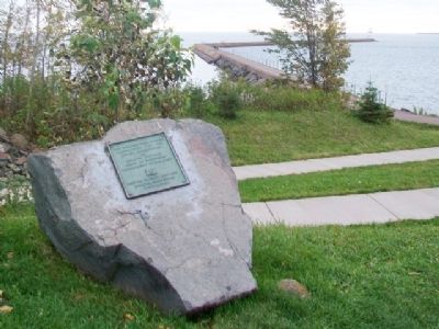
Constructed 1947 - 1951
under supervision
of
Duluth District
Corps of Engineers
Department of U.S. Army
Zenith Dredge Company
Duluth, Minnesota
Contractor — — Map (db m78821) HM
In front of you is one of six docks used for shipping iron ore from Agate Bay. Only three docks remain as of 1995. Agate Bay was the site of the first shipment of iron ore from Minnesota in 1884. Today over 10,000,000 ton of taconite or iron ore is . . . — — Map (db m204342) HM
After the Minnesota Iron Company began shipping iron ore from the Vermilion Range through the Two Harbors ore docks in 1884, this port far surpassed Duluth in importance. The increased traffic of ore boats, combined with commercial fishing, made . . . — — Map (db m78812) HM
You Are Here - The one acre site was purchased by the U.S. Government with construction of the lighthouse beginning in 1891. The Two Harbors Lighthouse Station is listed on the National Register of Historic Places.
Originally, a . . . — — Map (db m78817) HM
Willie Walleye, the 40-foot, 2½ ton ambassador for Lake of the Woods, has overlooked Baudette Bay since 1959. Arnold Lund's original idea was realized through the efforts of the Baudette Civic and Commerce Association. By April of 1958, Al . . . — — Map (db m180858) HM
The Zippel Town Site and Levee
Among the earliest white settlers in this area were Wilhelm F. (William) Zippel and his family, who started a fishery at the mouth of Zippel Bay between 1885 and 1887.
Experience the Big Lake: enjoy the . . . — — Map (db m211687) HM
Geologically young when compared with ancient rivers such as the Nile or the Amazon, the Minnesota River is only about 12,000 years old. It occupies a channel that was cut by the Glacial River Warren, when it drained Glacial Lake Agassiz, the . . . — — Map (db m65411) HM
The second highest point in southwestern Minnesota is about one kilometer north of here on the Bemis moraine, locally known as Buffalo Ridge. This ridge marks a drainage divide separating the watersheds of the Mississippi and Missouri Rivers. Lake . . . — — Map (db m228133) HM
It's mid-summer, 1929. You're standing here looking at a two-story wooden building with large rooms and lots of windows.
That building was the Mille Lacs Indian Boat Works, run by Trading Post owner Harry Ayer. From 1929 to 1939, a crew . . . — — Map (db m237792) HM
The center of Charles Lindbergh's grand boyhood adventures was the Mississippi River. Here he fished and swam, built and 'sailed" a raft, skipped across logjams, and looked across the water's wide expanse, dreaming about the future. It was in . . . — — Map (db m78225) HM
Young Explorer
Introspective and inventive, Lindbergh explored the rivers and woods, making his own fun most days. In the "usual good weather of a Minnesota summer," Lindbergh spent most of his time outdoors. He avidly collected rocks, . . . — — Map (db m78373) HM
This riverfront park is named after James Green, a Pennsylvanian, who, with his wife, Isabella, and three children, came here in 1848 from the Selkirk colonies (Winnipeg). Their arrival marked the beginning of permanent settlement at Little . . . — — Map (db m78713) HM
For many generations, Native people lived in this area along the banks of the upper Mississippi. Later, fur traders and Christian missionaries worked among the Indians. But as early as the 1830s, white settlers and soldiers from Fort Snelling . . . — — Map (db m78228) HM
The Little Falls Commercial Historic District is comprised of 32 contributing buildings that were constructed between 1887 and 1936, a time of tremendous growth for the city. The construction of the Little Falls dam in 1887-1888 spurred this . . . — — Map (db m78725) HM
The Little Elk River was known to the Ojibwe as Omushkoso-sibi, which translates to "Elk River." Elk were historically present in this area. The translation was modified to "Little Elk River" in the 1850s to avoid confusing it with another river . . . — — Map (db m225862) HM
In the late 1800s and early 1900s, these portions of the Mississippi and Little Elk Rivers were used to float logs to area sawmills, most notably Pine Tree Lumber Company in Little Falls.
Log jams were common and took large amounts of log . . . — — Map (db m225637) HM
In 1836 explorer Joseph Nicollet sketched a waterfall on Little Elk River just above this point. Twenty years later pioneer businessman William Sturgis established the town of Elk City, opened a general store and constructed a sawmill by the falls. . . . — — Map (db m224074) HM
Evidence found by archaeologists shows that tribal peoples frequented this low riverside ridge at least 5,000 years ago, perhaps using the area as a portage around rapids that existed on the Mississippi River here prior to the construction of the . . . — — Map (db m224235) HM
In September 1805, Lt. Zebulon Pike led 20 soldiers north from St. Louis, MO on an expedition to locate the headwaters of the Mississippi River, acquired a year earlier as part of the Louisiana Purchase. River levels and inclement weather slowed . . . — — Map (db m225471) HM
Motley began as a lumber and railroad town. Its location between two rivers ensured its future. Down these rivers logs were floated to sawmills built by Morrison on the Crow Wing and Curtis and Laurence on the Long Prairie. From there the rough-cut . . . — — Map (db m207230) HM
Henry and Sophia Smith flee to the Wright cabin
Shouts of terror and the crack of gun fire broke the early morning calm of August 20, 1862. Running in fear for their lives the Lake Shetek settlers passed this way, heading for shelter in . . . — — Map (db m228263) HM
After the Armistice was signed on November 11, 1918, marking the end of World War I, Fulda's brave young men returned home.
The community felt that a memorial in their honor was appropriate. With the Fulda Reading Club taking the initiative, . . . — — Map (db m233116) HM
The steamer West Newton left St. Paul on April 26, 1853, transporting the first soldiers to the site of the new post. It took four days to get from Fort Snelling to Fort Ridgely. John P. Owens, passenger and editor of The . . . — — Map (db m71504) HM
For centuries animals and people used the solid footing and shallow water at Traverse des Sioux as a natural river crossing.
In time the crossing became a place for people to meet and trade goods. European fur traders were quick to see the . . . — — Map (db m73945) HM
Because of its importance as a river crossing, Traverse des Sioux was a major distribution point for the fur trade.
As early as the 1770s, the Dakota were trading here for guns, blankets, and kettles. One prominent local trader was the . . . — — Map (db m76158) HM
About 150 feet North of this Park was the old boat landing.
Boat transportation from the earliest years of this area until the 1870's was the main source of commercial transportation.
The first steamboat to come up the Minnesota River was . . . — — Map (db m65784) HM
This ancient fording place, the "Crossing of the Sioux," was on the heavily traveled trail from St. Paul and Fort Snelling to the upper Minnesota and Red River valleys.
Here, on June 30, 1851, Governor Alexander Ramsey, Commissioner of Indian . . . — — Map (db m65557) HM
On July 23, 1851, a treaty was signed here that transferred millions of acres of Dakota land to the U.S. government. The treaty also resulted in the Sisseton and Wahpeton Dakota bands' movement to reservation lands along the Minnesota River.
. . . — — Map (db m79309) HM
Welcome to Minnesota (marker east side) • • • Known to her citizens as the North Star State or the Gopher State, Minnesota has never claimed to be the Land of the Giants. But two famous American giants do hail from Minnesota. The giant . . . — — Map (db m157792) HM
During the summer of 1858 gold was discovered in the bed of the Zumbro River at Rochester and near Oronoco. The news created a local sensation. On July 1, 1858, the Rochester Democrat reported: "The excitement in reference to the gold . . . — — Map (db m178512) HM
Rochester was built on a floodplain created by the South Fork of the Zumbro River and its tributaries. The first recorded flood in Rochester was in 1855 and historic floods occurred in 1866, 1882, and 1908. Rochester's worst flood happened in 1978. . . . — — Map (db m178691) HM
Silver Lake is a reservoir that was created in the 1930s by hand-digging a basin to hold water and then constructing a dam to back-up river water. It was built as a work relief project, providing work for over 400 unemployed men.
The land on . . . — — Map (db m178778) HM
For Minnesota's Nobel Prizewinning novelist Sinclair Lewis, Inspiration Peak more than lived up to its name. From its "bald top," he wrote, "there is to be seen a glorious, 20-mile circle of some 50 lakes scattered among fields and pastures, like . . . — — Map (db m120098) HM
Early traders followed a network of rivers inland from Lake Superior. John Sayer and his men canoed up the Brule River, down the St. Croix, and up the Snake River to get here.
When Sayer arrived here in 1804, the best road was a path in the . . . — — Map (db m206433) HM
Plotted in 1869, was named from the Chippewa word "Chengwatana" City of Pines. It was a rough lumberjack town in the early days. From here, logs were floated down the Snake River into the St. Croix River to Stillwater. A rich deposit of copper was . . . — — Map (db m44032) HM
Welcome to Minnesota (south side)Known to her citizens as the North Star State or the Gopher State, Minnesota has never claimed to be the Land of giants. But two famous American giants do hail from Minnesota. The giant lumberjack Paul . . . — — Map (db m162685) HM
The intersection of Phalen Creek and the Frost Avenue Bridge is indicative of constructed change for social, economic, and recreational activity over the years. The waterways in this area that connect Gervais Lake, Keller Lake, and Lake Phalen have . . . — — Map (db m135839) HM
This waterfall was originally constructed in the 1950's as a way to replenish the receding water level in Lake Phalen. Water was drawn from a well at the top of the falls which then flowed over a stone wall into the lake. Operation of the . . . — — Map (db m135561) HM
[1.] We entered a strange wilderness
[2.] We camped among Indian Nations
[3.] We trapped the land’s abundance
[4.] We labored with the Earth
[5.] We bridged great distances
[6.] Now we remember the . . . — — Map (db m76727) HM
A historical facsimile of the access stairs to the seaplane loading dock was constructed in the year 2009 as part of the Metropolitan Airports Commission's floodwall development project to protect the Downtown Saint Paul Airport. — — Map (db m232713) HM
This point commands a view of one of the great water courses of North America. The stream which once filled this valley, named the River Warren, was larger than any river on the continent to-day.
During the past million years, Minnesota has . . . — — Map (db m225300) HM
You are standing on a place that has been important to people for thousands of years. Phalen Creek and Trout Brook once flowed into a marsh here and then into the Mississippi River. American Indians lived nearby and buried their dead on the bluff . . . — — Map (db m230897) HM
Tatanka Oyate Makoce
Land of the Buffalo People[river valley map]
The Minnesota and Mississippi River Valleys have been home to the Dakota for hundreds of years, and the existence of our ancestors was sustained by their . . . — — Map (db m46170) HM
The river banks are more than a hundred feet in height and covered with a dense growth of primeval forest. They are very steep, often precipitous and abounding in picturesque features of jutting crags clothed with wild vines and shrubbery from . . . — — Map (db m227980) HM
Cast Iron • Rotation Speed 100 RPM
Weight 15 Tons • 4,500 Horsepower
This is one of four turbines Ford Motor Company installed 1924 at the hydro electric plant located below this lookout. The turbines were replaced between 1992 . . . — — Map (db m46518) HM
Since the advent of steamboats in 1812, this landing has served as a tie-up location for countless numbers of commercial river vessels, from paddle-wheelers to tugs. From here, thousands of barges can be seen passing by each year, quietly ferrying . . . — — Map (db m44376) HM
A dam and lock at Meeker's Island will be of immense importance to Minneapolis, as it will make St. Anthony Falls in reality the Head of Navigation on the Mississippi, and transfer the commercial prestige of this upper country from St. Paul to . . . — — Map (db m173764) HM
The Meeker Island Lock and Dam was the first lock and dam constructed on the Mississippi River between 1899 and 1907. The lock was in operation for 5 years, closing in 1912. The dam was then demolished. However, in low water conditions the 334 foot . . . — — Map (db m131185) HM
The Mississippi River’s many islands are well known to navigators, and
the roles of several as accessible and safe havens for villages, camps,
and forts have made
them significant in Minnesota’s past. Lt. Zebulon Pike
chose this island, later . . . — — Map (db m230738) HM
Historically, the Mississippi River was a free-flowing river until the locks and dams were constructed in the 1930s to provide a 9-foot shipping channel. While critical to commerce, this project transformed the river. The locks and dams created . . . — — Map (db m234988) HM
Before the advent of railways, the opening of navigation was anxiously looked for, the arrival of the first steamboat was an event attended with great rejoicing, … the feelings of the population were like those of a besieged . . . — — Map (db m213126) HM
Built in 1931, the Saint Paul Municipal Grain Terminal is listed on the National Register of Historic Places. It is one of Saint Paul's few remaining connections to the once-vibrant grain industry on the riverfront. At one time, the entire . . . — — Map (db m234311) HM
Historic Boiling Spring, 250 yards northwest, was long an Indian camping place and later a watering spot on the Fort Snelling–Dakota Road built in the 1850's. The road turned here to pass the spring, then called Big Spring. Settlers renamed it . . . — — Map (db m69605) HM
Long before Vicksburg was established a French man, Charles Patterson, set a trading post
along the Minnesota River to the east of this location. Known for his bearskin hat, and bear
considered sacred by the natives, Mr. Patterson became known as . . . — — Map (db m170342) HM
On a summer day in 1862 the Redwood Ferry landing on the Minnesota River below this point was the scene of the first attack against military troops in one of America's most tragic Indian wars.
Early in the morning of August 18, 1862, a large . . . — — Map (db m68897) HM
This water wheel was put to use about 100 years ago, (around 1900) in this creek to pump water to a storage tank in Peter and Gunhild (Enestvedt) Kittelsland's round barn. The tank was located up in the hay mow so the water had enough height for the . . . — — Map (db m71281) HM
When Beaver Was King Native Americans were key in the area fur trade by trapping furbearing animals. Beaver pelts were highly prized for their soft fur that made fashionable hats. Fur pelts were exchanged for guns, metal cooking . . . — — Map (db m212185) HM
Clifton, first townsite surveyed in the United States section of the North Shore, was platted
west of the mouth of the French River in 1855. The river was known to early explorers
as Riviere des Francais. Rumors of nearby copper deposits resulted . . . — — Map (db m43766) HM
Located down the steps on bricked Buchanan Street Plaza, adjacent to the kiosk, Harper's five medallions show the Great Lakes and the links that connect them. Flags from the nautical alphabet spell out the lakes' names. Can you identify them? . . . — — Map (db m204518) HM
Kirk St. Maur's Spirit of Lake Superior celebrates the Anishinabe (Ojibwa, American Indian) culture.
The artist's interpretation is based on illustrations and photographs from the Minnesota Historical Society Archives, Eastman . . . — — Map (db m204516) HM
Very early Duluth felt that future growth
would depend on having suitable harbor and
dockage. Winter storms wrecked breakwater and docks built outside Minnesota Point. St. Louis Bay offered a protected harbor, but access required a canal be . . . — — Map (db m2913) HM
Deck capstans were used on sailing ships centuries ago to handle anchor lines on the heaviest of the ship's tackle. This cast iron geared capstan was recovered from the sunken schooner Samuel P. Ely at Two Harbors, Minnesota, where the ship sunk in . . . — — Map (db m79002) HM
In recognition of his non-tiring commitment to the maritime community and service as Duluth Seaway Port Authority executive director for 24 years, 1979-2003.
A native of and lifelong resident of Northern Minnesota, Davis began his career as a . . . — — Map (db m5584) HM
Artist Richard Salews shows us a Great Lakes mariner steering his Mackinaw boat on a broad reach perhaps in the late 1800s. The 30-50 foot Mackinaws were used extensively on the lakes before steam and internal-combustion engines appeared. . . . — — Map (db m78875) HM
This plaque is dedicated by the people of Duluth to the memory of a fellow citizen, Coast Guard Boatswains Mate First Class, Edgar A. Culbertson, who on the night of April 30, 1967 gave his life attempting to rescue three teen-age brothers stranded . . . — — Map (db m2758) HM
This piece of float copper was dredged from the Keweenaw Waterway, Michigan, by the hydraulic dredge "New Jersey"; on May 27, 1932, while working under contract with the United States Engineers Office, Duluth. It was presented to the office by . . . — — Map (db m78985) HM
Honoring Lewis G. Castle
in recognition of his part as a volunteer leader in gaining the seaway and as the administer of the St. Lawrence Seaway Development Corporation.
The seaway, completed in 1959, represented decades of dreams, . . . — — Map (db m2910) HM
Unique apparatus invented by Duluth's Captain Alexander McDougall for use on his whaleback ships. About fifty appear to have been produced at the American Steelbarge Company Shipyard in Superior. This one was recovered in 1977 from the wreck of the . . . — — Map (db m79003) HM
This Navy-style stockless anchor is the type used on all modern ships and, at 3 tons, it is typical of those carried on 8-10,000 ton freighters. A usual rule of thumb provides that a vessel's anchor chain should be three times the depth of the water . . . — — Map (db m79001) HM
This propeller wheel is typical of those used to drive Lakes freighters. It measures 14 feet 5 inches in diameter and weighs over 11 tons; being made of a special bronze alloy, its value exceeds 10,000 dollars. The propeller was removed from the . . . — — Map (db m78977) HM
At three-thirty in the afternoon of Monday, November 27th, 1905, the steamship Mataafa passed under the newly built Duluth Transfer Bridge, and onto Lake Superior. The Mataafa was towing the schooner barge James Nasmyth, bringing their loads of iron . . . — — Map (db m199138) HM
Conventional ship's anchor used from about 1870 to 1910, from the Whaleback steamer Thomas Wilson, sunk a half mile outside Duluth Piers. Recovered in 1973 by the U.S.C.G. Cutter Woodrush with divers Elmer Engman, Dave Anderson, Dan Goman and Paul . . . — — Map (db m21027) HM
Hesperia, the name given to the Congdon's yacht, was a family name. Registered as a yacht in Lloyd's Register of American Yachts, 1911, the Hesperia was constructed of wood with a raised deck design. The boat was powered by an internal . . . — — Map (db m26552) HM
Originally the area below was called Oneota, one of several early towns which survived to form modern Duluth. Oneota was the site of the first sawmill in the region, built in 1855 at the present site of the iron ore docks. Among the early . . . — — Map (db m78736) HM
Perhaps no individual in the history of Duluth had such a dramatic influence on the port's infant development than Jay Cooke, a Philadelphia financier. Cooke's reign at the Head-of-the-Lakes was brief, but all-encompassing for commercial . . . — — Map (db m6379) HM
Rice's Point separates Duluth-Superior's outer from it's inner harbor, and is a focal point of Duluth's industrial activity. Many of the city's bridges can be seen, among them the Aerial Lift Bridge to the left, the John A. Blatnik Bridge straight . . . — — Map (db m4965) HM
Duluth-Superior harbor is the westernmost terminus of the St. Lawrence Seaway and the world's most inland seaport. Harbor commerce began when Daniel Greysolon Sieur Du Luht portaged across Minnesota Point in 1679 where the Duluth Aerial Lift Bridge . . . — — Map (db m4827) HM
The most characteristic feature of the Finnish homestead is the sauna (pronounced "sow-na"), a place for family and friends to share what they considered to be the "well spring" of life and health. To Finnish homesteaders, the sauna was more than . . . — — Map (db m127862) HM
Minnesota’s Seaport. More than three billion tons of iron ore, along with millions of tons of grain, lumber, fish, and coal, have passed through the Duluth-Superior harbor since the beginning of Minnesota’s Iron Age. The first ore from the rich . . . — — Map (db m3094) HM
1976
Stainless Steel
David von Schlegell (1920 – 1992)
The stainless steel sculpture functions as a metaphor, tying the horizontal lines of the land and Lake Superior, which are both very visible from this location, together . . . — — Map (db m4756) HM
The first steamboat Argo churned the muddy waters of the Rivière Saint-Pierre (St. Peter's River) in 1842, eventually arriving at Sakpe II's village of Tíŋta Otuŋwe. On July 22, 1850, the steamboat Yankee started at the . . . — — Map (db m213095) HM
American Indian and Dakota people lived in the river valley for centuries. Tíŋta Otuŋwe was a summer planting village on Mnisota Wakpa, which later was called the Rivière Saint-Pierre and is now called the Minnesota River. The 600 Dakota . . . — — Map (db m213157) HM
When glaciers melted, the meltwater created Lake Agassiz, which was bigger than the Great Lakes. The lake drained over the years, creating the massive River Warren. The river carved out the Minnesota River Valley and started from the bluffs by . . . — — Map (db m213089) HM
After the American Revolution, the 1783 Treaty of Paris, signed by those representing the American Colonies and Great Britain, sought to establish the boundary of the new country. In the middle of the continent the boundary was to run east to west . . . — — Map (db m69746) HM
Rice Lake was named for the wild rice that was harvested here until the late 1800s. Bountiful resources in the area provided a place Native Americans called home for thousands of years. The park was established in 1963 to meet the demand for local . . . — — Map (db m196839) HM
Browns Valley
The Minnesota River Valley Scenic Byway begins with the birth of the river at the Continental Divide north of here. The river winds through colorful prairie and hardwood forest, skirting by farmsteads as it starts its' journey to . . . — — Map (db m185217) HM
Ten thousand years ago, as the Ice Age was drawing to a close, Wisconsin's fast-flowing Chippewa River carried vast quantities of sand. But where the Chippewa entered the Mississippi, ten miles downstream from here, its current slowed and the . . . — — Map (db m52074) HM
On July 13, 1890, the steamer "Sea Wing", with covered barge alongside, and 215 passengers aboard was returning from a Sunday excursion down the Mississippi River to Lake City. At 8 p.m., Captain D.N. Wethern had guided the steamer 5 miles up Lake . . . — — Map (db m45462) HM
"City dwellers need go no farther than this if they seek romantic solitude,” wrote panorama artist Henry Lewis in 1848. “One cannot imagine a more lovely expanse of water than Lake Pepin in quiet, clear weather, and no wilder scene than . . . — — Map (db m45318) HM
Lake Pepin occupies the Mississippi Valley above this point for a distance of 22 miles. The lake is formed by the delta of the Chippewa River which enters the Mississippi directly east of this site.
The Chippewa, a relatively small river, has a . . . — — Map (db m45700) HM
This was once one of the busiest stretches on the Upper Mississippi River. Between 1830 and 1915, lumber companies in western Wisconsin floated millions of pine logs and pieces of cut lumber down the Chippewa River, which enters the Mississippi . . . — — Map (db m52718) HM
How do you move millions of logs harvested from the forests of northern Minnesota and Wisconsin? Rely on a river. From 1839 to 1914, the St. Croix was a crucial link between logging areas and markets.
Arcola witnessed this great movement of . . . — — Map (db m117734) HM
The St. Croix River Valley Forming a long stretch of the border between Minnesota and Wisconsin, the St. Croix is one of America's most scenic Wild Rivers. Its valley is sometimes referred to as the "New England of the West."
Along with . . . — — Map (db m233414) HM
The St. Croix River Valley, with its towering white pines forests and navigable waters, was originally home to the Ojibwe and Dakota Peoples. In 1837, the tribes ceded their lands to the U.S. government, and by 1839, logs harvested in northern . . . — — Map (db m147264) HM
Long before French and British fur traders arrived in the 1600s, Dakota and Ojibwe peoples lived throughout the region, hunting, fishing, ricing, and traveling in birchbark canoes. A profitable fur trade flourished as heavily-laden canoes of furs . . . — — Map (db m232072) HM
Waters from merging glaciers several thousand years' ago carved deep valleys for the St. Croix and Mississippi Rivers. Deprived of the glacial waters the rivers were so reduced in volume and carrying power that they were unable to maintain clear . . . — — Map (db m233489) HM
Both Native Americans and early pioneers used the St. Croix River and its tributaries as highways. Canoes were the prevalent mode of travel through the waterways. The Palmyra was the first steamboat to dip its paddles into the St. Croix River, . . . — — Map (db m148107) HM
Before Wisconsin became a state in 1848, controversy surrounded the location of its northwestern boundary. Interests in the St. Croix Valley wanted to be excluded from the new state. They anticipated having greater influence in a separate state . . . — — Map (db m233436) HM