By Duane Hall, August 4, 2015
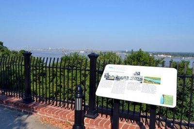
Bluff Park - Memorials and Louisiana Connections Marker
| Near S. Broadway Street south of Main Street, on the right when traveling south. |
| Near South Canal Street near John R. Junkin Drive (U.S. 84/425), on the right when traveling south. |
| On North Pearl Street at High Street, on the left when traveling north on North Pearl Street. |
| Near North Broadway Street near Jefferson Street, on the left when traveling north. |
| On Silver Street, 0.5 miles south of South Broadway Street, on the right when traveling south. |
| On Silver Street east of South Broadway Street, on the right when traveling east. |
| Near Jeff Davis Boulevard near South Temple Road. |
| On Natchez Trace Parkway (at milepost 8.7), 0.5 miles north of Blues Highway (U.S. 61), on the right when traveling north. |
| On State Highway 1, 0.6 miles north of Avondale Road, on the left when traveling north. Reported missing. |
| On South Commerce Street at East Main Street, on the left when traveling south on South Commerce Street. |
| Near Grand Gulf Road, 0.1 miles north of River Road. |
| Near Grand Gulf Road, 1.8 miles north of Frazier Road when traveling north. |
| On Grand Gulf Road, 1.8 miles north of Frazier Road when traveling north. |
| Near Grand Gulf Road, 1.8 miles north of Frazier Road when traveling north. |
| Near Grand Gulf Road, 0.1 miles north of River Road. |
| Near Grand Gulf Road, 1.8 miles north of Frazier Road when traveling north. |
| Near Grand Gulf Road south of River Road. |
| Near Grand Gulf Road, 0.1 miles north of River Road. |
| Near Grand Gulf Road at River Road. |
| Near Grand Gulf Road, 1.8 miles north of Frazier Road when traveling north. |
| On Church Street (U.S. 61) south of Carroll Street, on the right when traveling south. |
| On Old Port Gibson Road (Mississippi Route 462) at Old U.S. 61, on the left when traveling north on Old Port Gibson Road. |
| On Old Port Gibson Road at Old U.S. 61, on the left when traveling north on Old Port Gibson Road. |
| On Church Street (U.S. 61) at Walnut Street on Church Street. |
| On Rodney Road west of Flower Street, on the right when traveling west. |
| On Church Street (U.S. 61) south of Horton Drive, on the right when traveling north. |
| On U.S. 49 at State Route 1, on the right when traveling south on U.S. 49. |
| Near River Street, 0.1 miles east of McLeod Avenue, on the right. |
| On Loop State Highway 333 at E J Henry Road, on the right when traveling north on State Highway 333. |
| On Scenic Mississippi Route 333, 0.1 miles north of Grenada Lake Visitor's Center, on the right when traveling north. |
| Near Discovery Circle, 0.5 miles west of State Highway 607, on the right when traveling west. |
| Near Discovery Circle, 0.5 miles west of State Highway 604, on the right when traveling west. |
| Near Discovery Circle, 0.5 miles west of State Highway 607, on the right when traveling west. |
| On Bayview Avenue at Porter Avenue, on the left when traveling east on Bayview Avenue. |
| On Beach Boulevard (U.S. 90) at Porter Avenue, on the right when traveling east on Beach Boulevard. |
| On Beach Boulevard (U.S. 90) at Porter Avenue on Beach Boulevard. |
| On U.S. 90 at Porter Avenue on U.S. 90. Reported missing. |
| On Beach Boulevard (U.S. 90) at Porter Avenue, on the right when traveling east on Beach Boulevard. |
| Near Beach Boulevard (U.S. 90) 0.2 miles west of Oak Street. |
| On Cadet Street at East 1st Street on Cadet Street. |
| On Howard Avenue east of Reynoir Street, on the left when traveling east. |
| Near Main Street at Beach Boulevard (Highway 90). |
| On Cadet Street at East 1st Street, on the right when traveling north on Cadet Street. |
| Near Beach Boulevard (U.S. 90) at Porter Avenue. |
| Near Beach Boulevard (U.S. 90) at Porter Avenue. |
| On Bay Shore Drive at Boney Avenue, on the left when traveling west on Bay Shore Drive. |
| On Central Avenue, 0.1 miles south of Bay Shore Drive, on the right when traveling south. |
| On Race Track Road at Central Avenue, on the right when traveling west on Race Track Road. |
| On Jones Park Drive, 0.2 miles east of 25th Avenue, on the right when traveling east. |
| On Jones Park Drive, 0.2 miles east of 25th Avenue. |
| Near Friendship Oak Circle west of Beach Park Place, on the right when traveling west. |
| On Beach Boulevard East (U.S. 90) 0.1 miles west of East Azalea Drive, on the right when traveling west. |
| On Jeff Davis Avenue north of East 3rd Street, on the right when traveling north. |
| Near Ponce De Leon Boulevard south of Sandy Hook Drive, on the right when traveling south. |
| On Bolton-Raymond Road at East Madison Street (Old U.S. 80), on the left when traveling south on Bolton-Raymond Road. |
| On Old Port Gibson Road (Mississippi Route 462) at Cayuga Road, on the right when traveling north on Old Port Gibson Road. |
| Near Belmont Street (extended) west of Capitol Street when traveling west. |
| On Old U.S. 80, 0.5 miles west of Smith Station Road, on the right when traveling east. Reported missing. |
| On Adams Lane near State Route 467, on the left when traveling south. |
| On North Jackson Street south of State Route 12, on the left when traveling north. |
| On U.S. 49W north of Warren Street, on the right when traveling north. |
| On State Highway 465, 2 miles east of Section Road, on the left when traveling east. |
| On West Main Street at South Cummings Street, on the left when traveling west on West Main Street. |
| On East Main Street, 0.1 miles east of South Rose Street, on the right when traveling east. |
| On North Access Road at Campground Road, on the left when traveling north on North Access Road. |
| Near U.S. 90 at Beasley Road, on the right when traveling west. |
| Near Main Street (Mississippi Route 613) south of Robinson Avenue. |
| On Main Street (Mississippi Route 613) 0.1 miles north of Mc Innis Avenue, on the right when traveling north. |
| On Iberville Drive east of Ames Avenue, on the right when traveling west. |
| On Frederic Street at Live Oak Avenue, on the right when traveling south on Frederic Street. |
| On Beach Boulevard east of Oliver Street, on the right when traveling east. |
| On Beach Boulevard east of City Park Street, on the right when traveling east. Reported missing. |
| Near Frederic Street, 0.1 miles west of Magnolia Street, on the right when traveling west. |
| On Cypress Avenue west of Pascagoula Street, on the right when traveling west. |
| On Cypress Street west of Pascagoula Street, on the right when traveling west. |
| Near Cypress Street west of Pascagoula Street. |
| On Beach Boulevard east of Hague Street, on the right when traveling east. |
| Near Beach Boulevard, 0.3 miles west of Hague Street. |
| On Front Street west of Watts Avenue when traveling west. |
| On Beach Boulevard at Pascagoula Street, on the right when traveling east on Beach Boulevard. |
| On Bell Street west of Main Avenue (State Route 39), on the right when traveling west. |
| On County Route 7, 1 mile north of Road 244, on the right when traveling south. |
| On East Jackson Avenue (Mississippi Route 314) west of North 9th Street, on the right when traveling west. |
| Near 40th Avenue south of 8th Street. |
| Near 40th Avenue south of 8th Street. |
| On Brookhaven Street, on the right when traveling north. |
| On Main Street at South Church Street, on the right when traveling east on Main Street. |
| On South Spring Street south of Elliott Street, on the left when traveling south. |
| On East Main Street (U.S. 278) 0.1 miles east of East Elizabeth Street, on the right when traveling east. |
| On West Church Street at Dewey Street, on the left when traveling west on West Church Street. |
| Near U.S. 49E at Levee Road, on the right when traveling west. Reported missing. |
| On U.S. 82 at Levee Road, on the right when traveling west on U.S. 82. |
| On Fulton Street at West Market Street, on the left when traveling north on Fulton Street. |
| On Strong Avenue at Mary Street, on the right when traveling east on Strong Avenue. |
| On Fulton Street at Ramcat Alley, on the left when traveling north on Fulton Street. |
| On 2nd Avenue North at N. 6th Street on 2nd Avenue North. |
| Near Natchez Trace Parkway (at milepost 122), 1.1 miles south of Ratliff Ferry Road, on the left when traveling south. |
| On Mississippi Route 7, 1.5 miles south of Waterford Mountain Road, on the right when traveling south. Reported missing. |
205 entries matched your criteria. The first 100 are listed above.
Next 100 ⊳