After filtering for Virginia, 991 entries match your criteria. The first 100 are listed. ⊳
Waterways & Vessels Topic
By Michael C. Wilcox, July 14, 2013
Assateague Light House Marker
| 1 ► Virginia, Accomack County, Chincoteague — Assateague Light House — |
| Near Beach Access Road north of Boat Ramp Access Road, on the right when traveling south. | |||
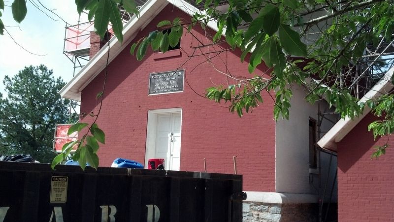
| 2 ► Virginia, Accomack County, Chincoteague — Assateague Lighthouse — Assateague Island National Seashore — |
| On National Seashore Lane at Stephen Decatur Hwy (Virginia Route 617), on the right when traveling west on National Seashore Lane. | |||
| 3 ► Virginia, Accomack County, Chincoteague — Boats and Bridges — |
| On Main Street just west of Mumford Street, on the right when traveling west. | |||
| 4 ► Virginia, Accomack County, Chincoteague — Bounty from the Sea — |
| Near Main Street at Post Office Street, on the right when traveling west. | |||
| 5 ► Virginia, Accomack County, Chincoteague — Chincoteague's Front Door — |
| On Main Street just west of Post Office Street, on the right when traveling west. | |||
| 6 ► Virginia, Accomack County, Chincoteague — Coast Guard Station — Assateague Island National Seashore — |
| On National Seashore Lane at Stephen Decatur Hwy (Virginia Route 611), on the right when traveling west on National Seashore Lane. | |||
| 7 ► Virginia, Accomack County, Chincoteague — Dollars from Decoys — |
| On Main Street just west of Post Office Street, on the right when traveling west. | |||
| 8 ► Virginia, Accomack County, Chincoteague — Fish So Fine — |
| On Main Street just west of Post Office Street, on the right when traveling west. | |||
| 9 ► Virginia, Accomack County, Chincoteague — Still Shining…After All These Years — |
| Near Beach Access Road north of Boat Ramp Access Road, on the right when traveling south. | |||
| 10 ► Virginia, Accomack County, Chincoteague — The Watson Light — Circa 1890 - 1932 — |
| On Main Street at Poplar Street, on the left when traveling west on Main Street. | |||
| 11 ► Virginia, Accomack County, Chincoteague — The Wild Ponies — |
| On Beach Access Road, 0.5 miles south of Wildlife Drive, on the right when traveling south. | |||
| 12 ► Virginia, Accomack County, Chincoteague — Tom’s Cove Shellfishing — Assateague Island National Seashore — |
| On National Seashore Lane at Stephen Decatur Hwy (Virginia Route 611), on the right when traveling west on National Seashore Lane. | |||
| 13 ► Virginia, Accomack County, Chincoteague — Welcome to Assateague Village — |
| Near Beach Access Road north of Boat Ramp Access Road, on the right when traveling south. | |||
| 14 ► Virginia, Accomack County, Chincoteague — You Had to Keep On — |
| On Main Street just east of Mumford Street, on the right when traveling west. | |||
| 15 ► Virginia, Accomack County, Onancock — Annie C. — Log Canoe — |
| Near Market Street at College Avenue, on the right when traveling west. | |||
| 16 ► Virginia, Accomack County, Onancock — Historic Cemetery — |
| On Market Street near South Street, on the left when traveling west. | |||
| 17 ► Virginia, Accomack County, Onancock — Log Canoe Annie C — Dimensions: Length on Deck 45', Ream 9'6" — |
| Near Market Street at College Avenue, on the right when traveling west. | |||
| 18 ► Virginia, Accomack County, Onancock — Steering the Annie C… — |
| Near Market Street at College Avenue, on the right when traveling west. | |||
| 19 ► Virginia, Accomack County, Onancock — The Cabin area… — |
| Near Market Street at College Avenue, on the right when traveling west. | |||
| 20 ► Virginia, Accomack County, Onancock — The knees and washboards… — |
| Near Market Street at College Avenue, on the right when traveling west. | |||
| 21 ► Virginia, Accomack County, Onancock — The Logs… — |
| Near Market Street at College Avenue, on the right when traveling west. | |||
| 22 ► Virginia, Accomack County, Onancock — Water: A Way of Life — |
| On Market Street, 0.1 miles west of Mt. Prospect Avenue, on the left when traveling west. | |||
| 23 ► Virginia, Accomack County, Parksley — WY-25 — Civil Air Patrol Coastal Base Four — |
| On Bennett Street (Virginia Route 176) just west of Dunne Avenue, on the right when traveling west. | |||
| 24 ► Virginia, Accomack County, Tangier — Banty's Wharf — |
| On Bannys Road at Factory Road, on the right when traveling south on Bannys Road. | |||
| 25 ► Virginia, Accomack County, Tangier — Chambers Lane — |
| On Main Ridge Road north of Chambers Lane, on the left when traveling south. | |||
| 26 ► Virginia, Accomack County, Tangier — Lee’s Bethel — |
| On Canton Road just south of Canton Road, on the right when traveling south. | |||
| 27 ► Virginia, Accomack County, Tangier — Parks Marina — |
| Near Parks Marina Lane west of Main Ridger Road, on the right when traveling west. | |||
| 28 ► Virginia, Accomack County, Tangier — Tangier Harbor — |
| Near Thomas Road. | |||
| 29 ► Virginia, Accomack County, Tangier — The Double Six — |
| On Main Ridge Road at Williard's Lane, on the right when traveling south on Main Ridge Road. | |||
| 30 ► Virginia, Accomack County, Tangier — The Emily Pruitt House — |
| On West Ridge Road south of School Lane, on the left when traveling north. | |||
| 31 ► Virginia, Accomack County, Tangier — The Patrick Benson House — |
| On Main Ridge Road south of Dise Lane, on the left when traveling south. | |||
| 32 ► Virginia, Albemarle County, Charlottesville — Ice House — Thomas Jefferson's Monticello — |
| Near Thomas Jefferson Parkway. | |||
| 33 ► Virginia, Albemarle County, Charlottesville — The Meadow Run Grist Mill |
| On Thomas Jefferson Parkway (Virginia Route 53) at Michie Tavern Lane (County Road 1102), on the right when traveling east on Thomas Jefferson Parkway. Reported permanently removed. | |||
| 34 ► Virginia, Albemarle County, Charlottesville, Rivanna Ridge — Old Springs — |
| Near Earlysville Road at Woodlands Road, on the right when traveling south. | |||
| 35 ► Virginia, Albemarle County, Charlottesville, Woolen Mills — The Woolen Mills — 🌲 🔥 🛤️ — |
| On East Market Street (County Road 1105) 0.2 miles south of Riverside Avenue, on the right when traveling east. | |||
| 36 ► Virginia, Albemarle County, Scottsville — GA-38 — Hatton Ferry — |
| On Irish Road (Virginia Route 6) at James River Road, on the right when traveling west on Irish Road. | |||
| 37 ► Virginia, Albemarle County, Scottsville, Hatton Grange — Ferries In Virginia/TheHatton Ferry/Heritage |
| On Hatton Ferry Road, 0.5 miles south of Hatton Ferry Lane, on the right when traveling south. Reported missing. | |||
| 38 ► Virginia, Albemarle County, Scottsville, Hatton Grange — Hatton Ferry — |
| On Hatton Ferry Road, 0.5 miles south of Hatton Ferry Lane. | |||
| 39 ► Virginia, Albemarle County, Scottsville, Hatton Grange — GA-37 — Hatton Ferry — |
| On Hatton Ferry Road, 0.2 miles south of Hatton Ferry Lane, on the left when traveling south. | |||
| 40 ► Virginia, Alexandria, Landmark — Cloud's Mill Race — |
| On North Paxton Street at Cloude's Mill Drive, on the right on North Paxton Street. | |||
| 41 ► Virginia, Alexandria, Landmark — Excavating Historic Ships — City of Alexandria — Est. 1749 — |
| Near Brenman Park Drive south of Duke Street (Virginia Route 236), on the left when traveling west. | |||
| 42 ► Virginia, Alexandria, Landmark — Ponding and Preservation — City of Alexandria — est. 1749 — |
| Near Brenman Park Drive south of Duke Street (Virginia Route 236), on the left when traveling west. | |||
| 43 ► Virginia, Alexandria, Landmark — Reconstructing the Past — City of Alexandria — Est. 1749 — |
| Near Brenman Park Drive south of Duke Street (Virginia Route 236), on the left when traveling west. | |||
| 44 ► Virginia, Alexandria, Old Town — A Rich History on the Alexandria Waterfront — |
| On The Strand just south of Prince Street, on the left when traveling south. | |||
| 45 ► Virginia, Alexandria, Old Town — A World War I Shipyard Transforms Jones Point — From Shoals to Ships — 1918-1921 — |
| 46 ► Virginia, Alexandria, Old Town — Map — African American Waterfront Heritage Trail — City of Alexandria, Est. 1749 — Alexandria Heritage Trail — |
| Near Thompsons Alley east of North Union Street, on the right when traveling east. | |||
| 47 ► Virginia, Alexandria, Old Town — Alexandria Waterfront — |
| On Pioneer Mill Way just east of The Strand, in the median. | |||
| 48 ► Virginia, Alexandria, Old Town — Battery Rodgers — |
| On South Lee Street at Green Street, on the right on South Lee Street. | |||
| 49 ► Virginia, Alexandria, Old Town — Colonel Michael Swope House — |
| On Prince Street just east of South Fairfax Street, on the right when traveling east. | |||
| 50 ► Virginia, Alexandria, Old Town — Early Alexandria and Keith's Wharf |
| Near Wharf Street east of Ford's Landing Way, on the right when traveling west. Reported unreadable. | |||
| 51 ► Virginia, Alexandria, Old Town — Electric Railway — City of Alexandria Est. 1749 — |
| On King Street at South Royal Street, on the right when traveling east on King Street. | |||
| 52 ► Virginia, Alexandria, Old Town — 2 — Fishtown — City of Alexandria, Est. 1749 — Alexandria Heritage Trail — |
| On North Union Street at Princess Street, on the right when traveling north on North Union Street. | |||
| 53 ► Virginia, Alexandria, Old Town — Foot of King Street — Alexandria Heritage Trail — City of Alexandria, est. 1749 — |
| On King Street east of Strand Street. | |||
| 54 ► Virginia, Alexandria, Old Town — 6 — George Henry, Enslaved Ship Captain — City of Alexandria, Virginia — Alexandria Heritage Trail — |
| On The Strand north of Prince Street, on the right when traveling north. | |||
| 55 ► Virginia, Alexandria, Old Town — E-86 — Historic Alexandria — |
| On King Street at North Fairfax Street, on the left when traveling east on King Street. | |||
| 56 ► Virginia, Alexandria, Old Town — In Memory of Captain Ryan Wojtanowski — 1953 to 2016 — |
| Near Wolfe Street, 0.1 miles east of South Union Street, on the right when traveling east. | |||
| 57 ► Virginia, Alexandria, Old Town — Industrialization of the Strand — Alexandria Heritage Trail — City of Alexandria, est. 1749 — |
| Near Strand Street just south of Prince Street, on the right when traveling south. | |||
| 58 ► Virginia, Alexandria, Old Town — Mountains of Materials and Massive Manpower — Fighting World War I — |
| Near Jones Point Drive, 0.3 miles east of South Royal Street, on the right when traveling east. | |||
| 59 ► Virginia, Alexandria, Old Town — ODBC — Making Waves on the Water… — |
| On The Strand at Prince Street, on the right when traveling north on The Strand. | |||
| 60 ► Virginia, Alexandria, Old Town — ODBC — Making Waves in Our Community… — |
| On The Strand just south of Prince Street, on the right when traveling north. | |||
| 61 ► Virginia, Alexandria, Old Town — Pioneer Mill — |
| Near Strand Street south of King Street, on the right when traveling north. | |||
| 62 ► Virginia, Alexandria, Old Town — Plundered! — Star-Spangled Banner National Historic Trail — National Park Service, U.S. Department of the Interior — |
| Near King Street at Strand Street, on the right when traveling west. | |||
| 63 ► Virginia, Alexandria, Old Town — Port City — City of Alexandria Est. 1749 — |
| On King Street (Virginia Route 7) west of South Fayette Street, on the right when traveling east. | |||
| 64 ► Virginia, Alexandria, Old Town — Potomac Connections — Tidewater and the Atlantic Coastal Plain — Potomac Heritage National Scenic Trail — |
| Near Jones Point Drive east of South Royal Street, on the right when traveling east. | |||
| 65 ► Virginia, Alexandria, Old Town — Raise the White Flag — Star-Spangled Banner National Historic Trail — War of 1812 — |
| On The Strand south of King Street, on the left when traveling south. | |||
| 66 ► Virginia, Alexandria, Old Town — River Ferries — City of Alexandria Est. 1749 — |
| On King Street at Strand Street, on the left when traveling west on King Street. | |||
| 67 ► Virginia, Alexandria, Old Town — 8 — Shipbuilding at Point Lumley — City of Alexandria, est. 1749 — Alexandria Heritage Trail — |
| On Duke Street east of The Strand, on the left when traveling east. | |||
| 68 ► Virginia, Alexandria, Old Town — Shipyard Park — Harborside — |
| Near Wolfe Street, 0.1 miles east of South Union Street, on the right when traveling east. | |||
| 69 ► Virginia, Alexandria, Old Town — Submarine Screw (Propeller) — USS Pompon (SS 267) — |
| On Thompsons Alley east of North Union Street, on the right when traveling east. | |||
| 70 ► Virginia, Alexandria, Old Town — The Alexandria Marine Railway |
| On Wharf Street east of Ford's Landing Way, on the right when traveling west. Reported unreadable. | |||
| 71 ► Virginia, Alexandria, Old Town — 4 — The Civil War and Battery Rodgers — Ford's Landing City Park — |
| Near Ford's Landing Way at Franklin Street, on the left when traveling south. | |||
| 72 ► Virginia, Alexandria, Old Town — The Civil War Comes to Alexandria — City of Alexandria Est. 1749 — |
| On North Union Street at Cameron Street, on the right when traveling north on North Union Street. | |||
| 73 ► Virginia, Alexandria, Old Town — 5 — The Domestic Slave Trade — City of Alexandia, Est. 1749 — Alexandria Heritage Trail — |
| On Strand Street just south of King Street, on the right when traveling north. | |||
| 74 ► Virginia, Alexandria, Old Town — The Edmonson Sisters — Alexandria Heritage Trail — City of Alexandria, est. 1749 — |
| On Duke Street (Virginia Route 236) at Holland Lane, on the right when traveling west on Duke Street. | |||
| 75 ► Virginia, Alexandria, Old Town — The History of the Pineapple — 🍍 — |
| On South Union Street just north of Wales Alley, on the right when traveling north. | |||
| 76 ► Virginia, Alexandria, Old Town — The Jones Point Lighthouse — Shedding Light on a Landmark — Jones Point Park, National Park Service, U.S. Department of the Interior — |
| Near Jones Point Drive east of South Royal Street, on the right when traveling east. | |||
| 77 ► Virginia, Alexandria, Old Town — The Lost Village of Cameron at Great Hunting Creek — Jones Point Park — National Park Service, U.S. Department of the Interior — |
| Near Jones Point Drive at South Royal Street. | |||
| 78 ► Virginia, Alexandria, Old Town — The Port City — City of Alexandria Est. 1749 — |
| On King Street at North Lee Street, on the left when traveling east on King Street. | |||
| 79 ► Virginia, Alexandria, Old Town — 7 — The River Queen — City of Alexandria, Virginia — Alexandria Heritage Trail — |
| On Prince Street east of The Strand, on the right when traveling west. | |||
| 80 ► Virginia, Alexandria, Old Town — War of 1812 — City of Alexandria Est. 1749 — |
| On King Street at South Union Street, on the right when traveling east on King Street. | |||
| 81 ► Virginia, Alexandria, Old Town — Waterfront Archaeology — Alexandria Heritage Trail — City of Alexandria, est. 1749 — |
| Near Strand Street just south of Prince Street, on the right when traveling south. | |||
| 82 ► Virginia, Alexandria, Old Town — Waterfront Walk — |
| Near The Strand at King Street, on the right when traveling north. | |||
| 83 ► Virginia, Alexandria, Old Town — Who Owns the River? — |
| Near Jones Point Drive east of South Royal Street, on the right when traveling east. | |||
| 84 ► Virginia, Alexandria, Old Town — Wilkes Street Tunnel — City of Alexandria Est. 1749 — Alexandria Heritage Trail — |
| On South Union Street, 0.1 miles south of Wolfe Street, on the right when traveling south. | |||
| 85 ► Virginia, Alexandria, Old Town — World War I-Era Rudder — Evidence of the Shipyard at Jones Point — |
| Near Jones Point Drive, 0.2 miles east of South Royal Street, on the right when traveling east. | |||
| 86 ► Virginia, Alexandria, Old Town North — Alexandria Canal (1843 - 1886) — Lock #3 — |
| On North Royal Street north of Montgomery Street, on the right when traveling north. | |||
| 87 ► Virginia, Alexandria, Old Town North — Alexandria Canal Turning Basin — (1843-1886) — Alexandria Heritage Trail, City of Alexandria, Virginia — |
| On Montgomery Street just west of North Pitt Street, on the right when traveling west. | |||
| 88 ► Virginia, Alexandria, Old Town North — Cross Canal — Historic Site — |
| On Montgomery Street at North Fairfax Street, on the right when traveling west on Montgomery Street. | |||
| 89 ► Virginia, Alexandria, Old Town North — Remnants of Lock #4 of the Alexandria Canal — |
| On North Pitt Street north of Montgomery Street, on the right when traveling north. | |||
| 90 ► Virginia, Alexandria, Old Town North — The Alexandria Canal Company, 1830 - 1886 — Alexandria Heritage Trail — City of Alexandria, Est. 1749 — |
| On Mt. Vernon Trail north of Montgomery Street, on the right when traveling south. | |||
| 91 ► Virginia, Alexandria, Old Town North — The Tale of Spa Spring — Alexandria Heritage Trail — City of Alexandria, Virginia — |
| On North Pitt Street just south of First Street, on the right when traveling south. | |||
| 92 ► Virginia, Alexandria, Old Town North — Tide Lock of the Alexandria Canal — |
| Near Montgomery Street east of Rivergate Place, on the right when traveling west. | |||
| 93 ► Virginia, Alexandria, Potomac West — History at Four Mile Run Park — La historia de Four Mile Run — |
| Near Commonwealth Avenue north of Luna Park Drive, on the left when traveling north. | |||
| 94 ► Virginia, Alexandria, Potomac West — Potomac Yard History — Town of Potomac — 1908 - 1929 — |
| On Mount Vernon Avenue south of East Uhler Avenue, on the right when traveling north. | |||
| 95 ► Virginia, Alexandria, Potomac Yard — Crossroads of Transportation — City of Alexandria Est. 1749 — Potomac Yard — |
| On Potomac Avenue east of Main Line Boulevard, on the right when traveling north. | |||
| 96 ► Virginia, Alexandria, Potomac Yard — Virginia's First Highways — City of Alexandria Est. 1749 — Potomac Yard — |
| On Potomac Avenue north of East Glebe Road, on the right when traveling north. | |||
| 97 ► Virginia, Alexandria, Rosemont — Fun in the Forest — Alexandria Heritage Trail — |
| Near Chinquapin Drive, 0.2 miles south of King Street (Virginia Route 7), on the right when traveling north. | |||
| 98 ► Virginia, Alexandria, Seminary Hill — Phoenix Mill — Alexandria Heritage Trail — City of Alexandria, est. 1749 — |
| On Wheeler Avenue west of Duke Street (Virginia Route 236), on the left when traveling west. | |||
| 99 ► Virginia, Alexandria, Taylor Run — Fighting Back — Star-Spangled Banner National Historic Trail — War of 1812 — |
| Near Callahan Drive at King Street (Virginia Route 7). | |||
| 100 ► Virginia, Alexandria, Taylor Run — Life of a Creek — Alexandria Heritage Trail — |
| Near Chinquapin Drive, 0.3 miles south of King Street (Virginia Route 7), on the right when traveling north. | |||
991 entries matched your criteria. The first 100 are listed above. Next 100 ⊳