3762 entries match your criteria. The first 100 are listed. ⊳
Bridges & Viaducts Topic
By cmh2315fl via Flickr (CC BY-NC 2.0), June 12, 2011
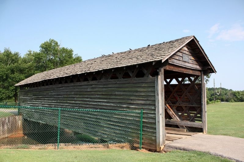
Coldwater Covered Bridge Marker
| 1 ► Alabama, Calhoun County, Oxford — Coldwater Covered Bridge — |
| Near Recreation Drive east of Mc Cullars Lane, on the left when traveling east. | |||
| 2 ► Alabama, Cherokee County, Centre — Pathkiller - Childers - Garrett Ferry — |
| On College Street (County Route 20) 0.1 miles south of South River Road, on the right when traveling north. | |||
| 3 ► Alabama, Colbert County, Sheffield — Old Railroad Bridge — |
| Near Ashe Boulevard 0.4 miles north of NE 16th Street. | |||
| 4 ► Alabama, Cullman County, Cullman — Alabama's Physical Diversity — |
| On County Road 1043. | |||
| 5 ► Alabama, Cullman County, Cullman — Brindley Bridge — Hugh Payne Brindley, Sr. — 1912 - 1965 — |
| On Eva Road Northeast (County Route 35) east of Scenic Dr NE, on the right when traveling south. | |||
| 6 ► Alabama, Cullman County, Cullman — Clarkson Covered Bridge — Sometimes Called Legg Bridge — |
| Near County Road 1043 west of County Road 1117, on the right when traveling north. | |||
| 7 ► Alabama, Dale County, Ariton — Veterans Memorial Bridge - 1921 / Grist Mill - Indian Battle - Recreation — |
| On U.S. 231 north of State Road 123, on the right when traveling north. | |||
| 8 ► Alabama, Dallas County, Selma — Edmund Pettus Bridge — National Historic Landmark — |
| On Broad Street (Business U.S. 80) at Water Avenue, on the right when traveling south on Broad Street. | |||
| 9 ► Alabama, Dallas County, Selma — Highlights of Selma History / William Rufus DeVane King 1786-1853 — |
| On Broad Street (U.S. 80), on the right when traveling north. | |||
| 10 ► Alabama, Dallas County, Selma — Site of Selma-Dallas County’s 1st Bridge 1884-1940 — |
| On Washington Street south of Water Avenue when traveling south. | |||
| 11 ► Alabama, Elmore County, Wetumpka — Wetumpka Historical Marker — |
| Near East Commerce Street at Court Street, on the right when traveling east. | |||
| 12 ► Alabama, Elmore County, Wetumpka — Wetumpka's Bridges — |
| On Orline Street 0.1 miles south of Hill Street, on the right when traveling south. | |||
| 13 ► Alabama, Henry County, Newville — Cureton Bridge / Cureton Bridge Post Office — |
| On Alabama Route 27 at County Road 7, on the right when traveling east on Alabama Route 27. | |||
| 14 ► Alabama, Henry County, Shorterville — Chattahoochee River Crossings — |
| On Hartford Road (Alabama Route 10) 0.6 miles east of County Road 46, on the left when traveling east. | |||
| 15 ► Alabama, Jackson County, Bridgeport — Bridgeport — |
| On Alabama Route 227 at Busbey Ave, on the right when traveling north on Alabama Route 227. | |||
| 16 ► Alabama, Jackson County, Bridgeport — Trail of Tears — |
| On Bradley Avenue 0.5 miles east of Hoffman Avenue, on the left when traveling east. | |||
| 17 ► Alabama, Jefferson County, Birmingham, Central City — The Rainbow Viaduct — Dedicated to the Brave Men of the 167th Infantry who fought to Preserve Our Freedom — |
| On Richard Arrington Junior Boulevard South north of 1st Ave South, on the left when traveling north. | |||
| 18 ► Alabama, Jefferson County, Hoover — Ross Bridge — |
| On Ross Bridge Parkway 2.7 miles north of State Highway 150, on the left when traveling north. | |||
| 19 ► Alabama, Jefferson County, McCalla — Tapawingo Bridge — 1902 — |
| Near Tannehill Road 0.5 miles north of Confederate Parkway, on the right when traveling north. | |||
| 20 ► Alabama, Jefferson County, Trussville — 1936 Rock Bridge — |
| On Cherokee Drive west of Pumphouse Rd, on the right when traveling east. | |||
| 21 ► Alabama, Jefferson County, Trussville — Civitan Park Bridge — |
| On Cherokee Drive north of Main Street, on the left when traveling north. | |||
| 22 ► Alabama, Lauderdale County, Florence — Ezra Lee Culver — City of Florence Walk of Honor — |
| Near Hightower Place south of Veterans Drive ( Route 133), on the left when traveling south. | |||
| 23 ► Alabama, Lauderdale County, Florence, East Florence — Wilson Dam — |
| On Hightower Place. | |||
| 24 ► Alabama, Lauderdale County, Rogersville — Wheeler Dam / Wheeler Reservoir/Locks — 1936 / 1836 — |
| On Wheeler Dam Highway (Alabama Route 101) 0.5 miles south of County Route 584, on the left when traveling south. | |||
| 25 ► Alabama, Lee County, Auburn — Chewacla State Park — (CCC) — |
| On Murphy Drive 0.2 miles east of Wrights Mill Road (County Road 33), on the right when traveling east. | |||
| 26 ► Alabama, Lee County, Opelika — Salem Shotwell Covered Bridge — |
| On Park Road 0.1 miles west of Rocky Brook Road, on the right when traveling west. | |||
| 27 ► Alabama, Limestone County, Elkmont — Sulphur Creek Trestle, 1864 — |
| On Upper Fort Hampton Road (County Road 49) east of Railroad Street, on the right when traveling east. | |||
| 28 ► Alabama, Madison County, Huntsville — C.B. "Bill" Miller Bridge — |
| On Heart of Huntsville Drive SW south of Constellation Drive, on the right when traveling south. | |||
| 29 ► Alabama, Monroe County, Goodway — Old Federal Road — |
| On Old Stage Road (County Road 5) 0.1 miles north of Hollinger Road, on the left when traveling north. | |||
| 30 ► Alabama, Montgomery County, Montgomery — Union Station & Riverfront Park / Lower Commerce Street |
| On Commerce Street, in the median. Reported missing. | |||
| 31 ► Alabama, Morgan County, Hartselle — Skirmish at Woodall's Bridge — April 7, 1864 — |
| On Main Street West (Alabama Route 36) at Springdale Drive SW, on the right when traveling west on Main Street West. | |||
| 32 ► Alabama, Pickens County, Pickensville — The Tennessee - Tombigbee Waterway — |
| Near Lock and Dam Road 0.5 miles south of Marina Parkway, on the right when traveling south. | |||
| 33 ► Alabama, Russell County, Phenix City — Before The Battle / Battle Of Girard — |
| On 14th Street at 5th Avenue, on the left when traveling west on 14th Street. | |||
| 34 ► Alabama, Russell County, Phenix City — Confederates Set Fire To Lower Bridge — |
| On Dillingham Street at Brickyard Road, on the left when traveling east on Dillingham Street. | |||
| 35 ► Alabama, Russell County, Phenix City — Horace King — |
| On Broad Street at Dillingham Street, on the right when traveling south on Broad Street. | |||
| 36 ► Alabama, Sumter County, Demopolis — The Rooster Bridge — |
| On U.S. 80 3 miles east of State Road 28, on the right when traveling east. | |||
| 37 ► Alabama, Sumter County, Livingston — Sumter County's Covered Bridge — |
| On Student Union Drive 0.5 miles south of University Drive, on the right when traveling south. | |||
| 38 ► Alabama, Tallapoosa County, Daviston — Miller Covered Bridge — 1908~1963 — Horseshoe Bend National Military Park — |
| Near Horseshoe Bend Road (Alabama Route 49) 2.1 miles north of Freeman Road, on the left when traveling north. | |||
| 39 ► Alabama, Tuscaloosa County, Northport — Home Guard Defended Covered Bridge / Bridging The Black Warrior River — |
| On Bridge Avenue when traveling south. | |||
| 40 ► Alabama, Tuscaloosa County, Tuscaloosa — Burns’ Shoals — |
| Near Greensboro Avenue north of 2nd Street (Jack Warner Parkway). | |||
| 41 ► Alabama, Tuscaloosa County, Tuscaloosa — Horace King — |
| Near Greensboro Avenue near 2nd Street (Jack Warner Parkway). | |||
| 42 ► Alabama, Tuscaloosa County, Tuscaloosa — The M & O Railroad Trestle — |
| On 2nd Street at 28th Avenue, on the right when traveling west on 2nd Street. | |||
| 43 ► Alabama, Winston County, Pebble — Kinlock — |
| On Kinlock Road, on the right when traveling south. | |||
| 44 ► Alaska, Denali Borough, Denali National Park and Preserve — Bridging the Gaps — Denali National Park and Preserve — National Park Service, U.S. Department of the Interior — |
| On Bus Concessionaire Road at Murie Road, on the right when traveling west on Bus Concessionaire Road. | |||
| 45 ► Alaska, Fairbanks North Star Borough, Fairbanks, Downtown — Bridge of Flags — 1959 ❤ 1984 — Celebrating 25 Years of Alaskan Statehood — |
| On 1st Avenue at Cushman Street, on the left when traveling east on 1st Avenue. | |||
| 46 ► Alaska, Fairbanks North Star Borough, Fairbanks, Downtown — Cushman Street — Historic Fairbanks — |
| On Cushman Street near 4th Avenue. | |||
| 47 ► Alaska, Juneau Borough, Juneau, Downtown Juneau — Calhoun Ave. Overpass — |
| On Calhoun Avenue north of West 4th Street, on the left when traveling north. | |||
| 48 ► Alaska, Juneau Borough, Juneau, Downtown Juneau — Marine Highway — Sea & Sky: Juneau's Links to the World — |
| Near Marine Way. | |||
| 49 ► Alaska, Ketchikan Gateway Borough, Ketchikan — Keeping the Catch! — |
| On Front Street at Water Street, on the right when traveling south on Front Street. | |||
| 50 ► Alaska, Valdez-Cordova Census Area, Chitina — Wooden Wonder — |
| On McCarthy Road (at milepost 29), on the left when traveling west. | |||
| 51 ► Alaska, Valdez-Cordova Census Area, Gulkana — Gulkana — (C'UUL C'ENA' IN AHTNA ATHABASCAN) — Lit. 'Eroded River' — |
| On Richardson Highway (State Highway 1/4 at milepost 126.6), on the left when traveling north. | |||
| 52 ► Arizona, Coconino County, Grand Canyon National Park — Kaibab Trail Suspension Bridge — National Historic Civil Engineering Landmark — |
| On Rim Trail north of Yavapai Point, on the right when traveling west. | |||
| 53 ► Arizona, Coconino County, Marble Canyon — John Deering — (Bih Bitoodnii Nez) — |
| Near U.S. 89A at milepost 537, on the right when traveling west. | |||
| 54 ► Arizona, Coconino County, Marble Canyon — Lafe McDaniel — |
| Near Navajo Bridge at U.S. 89A, in the median. | |||
| 55 ► Arizona, Coconino County, Marble Canyon — Navajo Bridge — |
| Near U.S. 89A at milepost 537. | |||
| 56 ► Arizona, Coconino County, Marble Canyon — Navajo Bridge — |
| Near U.S. 89A at milepost 538. | |||
| 57 ► Arizona, Coconino County, Marble Canyon — Navajo Bridge Erection Toggle Screw / Navajo Bridge — State of Arizona — 1927 / 1928 — |
| Near U.S. 89A at milepost 537. | |||
| 58 ► Arizona, Coconino County, Page — Glen Canyon Bridge / Cableways — Reclamation: Managing Water in the West — |
| Near U.S. 89. | |||
| 59 ► Arizona, Gila County, Roosevelt — The Bridge — 1987-1990 — Tonto National Forest — |
| On The Apache Trail (Arizona Route 88 at milepost 242) south of Route 188. | |||
| 60 ► Arizona, Greenlee County, Clifton — Jose (Joe) M. Subia Memorial Bridge — |
| On Black Hills Back Country Byway 1.9 miles north of High Tank Road, on the right when traveling north. | |||
| 61 ► Arizona, Maricopa County, Arlington — Historic Gillespie Dam Bridge — |
| On Old US 80 Highway (U.S. 80), on the left when traveling west. | |||
| 62 ► Arizona, Maricopa County, Arlington — Original 1927 Bridge Roller Bearing — Gillespie Dam Bridge Rehabilitation — 2012 Arizona Centennial Legacy Project — |
| On Old Highway US 80 (at milepost 22.5), on the left when traveling north. | |||
| 63 ► Arizona, Maricopa County, Carefree — The Old Verde River Sheep Bridge — |
| Near Bloody Basin Off-Road Trail, on the left when traveling east. | |||
| 64 ► Arizona, Maricopa County, Mesa — Prehistoric Irrigation in the Salt River Valley — |
| Near North Horne Avenue 0.4 miles south of East McKellips Road. | |||
| 65 ► Arizona, Mohave County, Hoover Dam — High on a Lonely Hill — The onset of World War II led to tightened security. — |
| On Hoover Dam Access Road, on the right when traveling west. | |||
| 66 ► Arizona, Mohave County, Hoover Dam — Then and Now — |
| On Hoover Dam Access Road, on the right when traveling west. | |||
| 67 ► Arizona, Mohave County, Lake Havasu City — British – American Friendship — |
| On McCulloch Boulevard 0.1 miles south of Route 95, on the right when traveling south. | |||
| 68 ► Arizona, Mohave County, Lake Havasu City — City Founders — Lake Havasu City, Arizona — |
| On McCulloch Blvd. 0.1 miles south of Route 95, on the right when traveling south. | |||
| 69 ► Arizona, Mohave County, Lake Havasu City — City of London — |
| On London Bridge Road. | |||
| 70 ► Arizona, Mohave County, Lake Havasu City — London Bridge — |
| On Arizona Route 95 south of McCulloch Blvd. N when traveling south. | |||
| 71 ► Arizona, Mohave County, Lake Havasu City — Robert P. McCulloch, Sr. — |
| On McCulloch Boulevard North, on the right when traveling west. | |||
| 72 ► Arizona, Navajo County, Holbrook — Little Colorado River Bridge — |
| On U.S. 180, on the right when traveling south. | |||
| 73 ► Arizona, Navajo County, Pinedale — The Mauretta B. Thomas Pinedale Memorial Bridge — |
| On Pinedale Road 0.5 miles south of Route 260, on the left when traveling south. | |||
| 74 ► Arizona, Navajo County, Winslow — The Winslow Bridge — |
| On 2nd Street (Arizona Route 66), on the left when traveling east. | |||
| 75 ► Arizona, Navajo County, Woodruff — Historic Woodruff Snowflake Bridge — Constructed 1917 • Relocated 1939 • Rehabilitated 2017 — |
| On Country Road 1.1 miles north of Woodruff Hay Hollow Road, on the right when traveling north. | |||
| 76 ► Arizona, Pima County, Tucson, Colonia Solana — Epes Randolph — August 16, 1856 – August 22, 1921 — |
| On South Randolph Way at East Camino Campestre, on the right when traveling south on South Randolph Way. | |||
| 77 ► Arizona, Pima County, Tucson, Downtown — Garcés Footbridge — Puente de Garcés — Historic Site — |
| Near West Broadway Boulevard. | |||
| 78 ► Arizona, Pima County, Tucson, Historic Fourth Avenue — Fourth Avenue Underpass — Constructed 2009 — |
| On North Fourth Avenue at East 9th Street, on the right when traveling south on North Fourth Avenue. | |||
| 79 ► Arizona, Pima County, Tucson, Historic Fourth Avenue — Historic Fourth Avenue Underpass — Constructed 1916 – Demolished in 2008 — |
| On North Fourth Avenue at East 9th Street, on the right when traveling south on North Fourth Avenue. | |||
| 80 ► Arizona, Pima County, Tucson, NEC Speedway & Kolb — Airmen Memorial Bridge — |
| Near Sabino Canyon Road at North Kolb Road, on the right when traveling north. | |||
| 81 ► Arizona, Pima County, Vail — Cienega Bridge — Built 1921 — |
| On East Marsh Station Road 3.3 miles east of Interstate 10, on the left when traveling east. | |||
| 82 ► Arizona, Yuma County, Wellton — Red Top Wash Bridge — |
| On Los Angels Avenue 2 miles east of Interstate 8, on the right when traveling east. | |||
| 83 ► Arizona, Yuma County, Yuma — "Ocean to Ocean" Highway Bridge — |
| Near Prison Hill Road 0.5 miles north of Harold C. Giss Parkway. | |||
| 84 ► Arizona, Yuma County, Yuma — Ocean-to-Ocean Highway Bridge — Constructed - 1915 & Rededicated - 2002 — |
| On Penitentiary Avenue 0.5 miles north of East 1st Street, on the right when traveling north. | |||
| 85 ► Arizona, Yuma County, Yuma — Site of Old Ferry Landing — Yuma Crossing — |
| Near Prison Hill Road 0.5 miles north of Harold C. Giss Parkway. | |||
| 86 ► Arkansas, Carroll County, Beaver — Beaver Bridge — |
| On Golden Gate. | |||
| 87 ► Arkansas, Conway County, Winrock — Davies Bridge: Symbol of a Legacy — |
| Near Red Bluff Drive. | |||
| 88 ► Arkansas, Conway County, Winrock — Special Places to See — |
| Near Petit Jean Mountain Road. | |||
| 89 ► Arkansas, Crawford County, Van Buren — Web of Enterprise — |
| Near North 3rd Street 0.1 miles south of Knox Street, on the right when traveling south. | |||
| 90 ► Arkansas, Desha County, Snow Lake — Snow Lake: Transformed by the Rail — |
| On Arkansas 44, on the right when traveling east. | |||
| 91 ► Arkansas, Fulton County, Mammoth Spring — What Am I Standing On? — |
| Near U.S. 63 at Main Street (State Route 9), on the right when traveling north. | |||
| 92 ► Arkansas, Grant County, Leola — 113 — Jenkins Ferry / Pontoon Bridge — |
| On Highway 46 2 miles south of Highway 291, on the right when traveling south. | |||
| 93 ► Arkansas, Greene County, Walcott — CCC Stone Arch Bridge — |
| On Arkansas Route 168 0.6 miles north of Route 141, on the right when traveling north. | |||
| 94 ► Arkansas, Hot Spring County, Malvern — 122 — Bridging the Ouachita River — |
| On Pavilion Road east of Martin Luther King Boulevard (Business U.S. 270), on the left when traveling east. | |||
| 95 ► Arkansas, Miller County, Texarkana — Old Broad Street Bridge — |
| On Hickory Street (U.S. 71) at E 3rd Street, on the right when traveling south on Hickory Street. | |||
| 96 ► Arkansas, Newton County, Jasper — Old Buffalo River Bridge — |
| On State Highway 7 0.2 miles south of County Road 80, on the right when traveling south. | |||
| 97 ► Arkansas, Phillips County, Helena — Does the river ever flood? — |
| On Elm Street. | |||
| 98 ► Arkansas, Phillips County, Helena — The Helena Bridge — |
| On Elm Street. | |||
| 99 ► Arkansas, Pulaski County, Jacksonville — A Gallant Charge — The First Iowa Cavalry Charges Burning Reed's Bridge — |
| On South First Street (Arkansas Route 161) 0.3 miles south of Carver Lane, on the right when traveling south. | |||
| 100 ► Arkansas, Pulaski County, Jacksonville — The Brigade Moved Forward — The Opening Movements of the Battle of Reed's Bridge — |
| Near East Trickey Lane at Military Road. | |||
3762 entries matched your criteria. The first 100 are listed above. Next 100 ⊳