By Mark Hilton, January 26, 2020
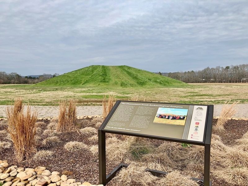
The Choccolocco Creek Archaeological Complex Marker with rebuilt mound in background.
| On McKibbon Street, 0.1 miles west of Ross Street, on the right when traveling west. |
| On East Ladiga Street east of North Center Avenue, on the right when traveling west. |
| On U.S. 431, 0.1 miles south of County Route 222, on the right when traveling south. |
| On 5 Points Fredonia Road (County Road 222) east of County Road 267, on the right when traveling east. |
| On Lafayette Street North (U.S. 431) just south of Alabama Avenue, on the right when traveling north. |
| On 1st Street Southeast at 2nd Avenue Southeast, on the right when traveling north on 1st Street Southeast. |
| On North Lanier Avenue at 1st Street, on the left when traveling north on North Lanier Avenue. Reported missing. |
| On Old Alabama Route 9 west of Sewell Ferry Road, on the right when traveling west. |
| On Cedar Bluff Road at West Main Street (Business U.S. 411), on the right on Cedar Bluff Road. |
| On Cedar Bluff Road (State Road 283) north of West Main Street (Business U.S. 411), in the median. |
| On County Road (County Route 43), on the right. |
| On West Main Street at Watson Drive, on the right when traveling west on West Main Street. |
| On County Route 99 at County Route 95, on the right when traveling north on County Route 99. |
| On Canyon Drive (Alabama Route 35) at Main Street (Alabama Route 68), on the right when traveling south on Canyon Drive. |
| On Alabama Route 273 near County Road 81, on the left when traveling north. |
| On Industrial Boulevard (Alabama Route 68) at Lokey Street on Industrial Boulevard. |
| On County Route 33 at County Route 29, on the left when traveling south on County Route 33. |
| On County Route 8, 3 miles east of County Route 45, on the left when traveling east. |
| On County Road 29 at County Road 27, on the left when traveling east on County Road 29. |
| On 2nd Avenue North, on the right when traveling east. |
| On U.S. 31, on the right when traveling north on U.S. 31. |
| On County Road 752, 0.2 miles south of County Road 480, on the right when traveling north. |
| On County Road 59, 0.1 miles south of U.S. 31, on the right when traveling south. |
| On U.S. Highway 84 (U.S. 84) 1.9 miles west of Lena Landegger Highway (County Road 39), on the right when traveling west. |
| On Alabama Route 69 at Hodge Road, on the right when traveling north on State Route 69. |
| Near Walker Springs Road (County Road 29) at Madison Road (Route 33). |
| On U.S. 84 at milepost 40 at Crescent Road, on the right when traveling east on U.S. 84. |
| Near Main Street at Court Street. |
| On Commerce Street (Alabama Route 177) at Magnolia Drive, on the right when traveling west on Commerce Street. |
| On Commerce Street (Alabama Route 177) at Magnolia Drive, on the right when traveling west on Commerce Street. |
| On Alabama Route 69 at Bolen Town Road, on the right when traveling south on State Route 69. |
| On Tallahatta Springs Road (County Road 44) 2.1 miles east of Elam Road (County Road 7), on the right when traveling east. |
| On Wilson Avenue at Nicol Avenue, on the left when traveling west on Wilson Avenue. |
| On West Bend Road (County Route 31) north of Jamestown Lane, on the right when traveling north. |
| On Morning Star Road (County Road 35) 4 miles south of U.S. 84, on the left when traveling south. |
| On Main Street at Rickwood Drive, on the left when traveling east on Main Street. |
| On Court Square at 1st Street North, on the right when traveling west on Court Square. |
| On Court Square (Alabama Route 9) at 1st Avenue North, on the right when traveling west on Court Square. |
| On 1st Avenue (Alabama Route 9) 0.1 miles north of 5th Street East, on the right when traveling north. |
| On Cheaha Road (Alabama Route 49) south of Nichols Street, on the right when traveling south. |
| On Mellow Valley Street (Alabama Route 49) at Main Street (Alabama Route 9), on the right when traveling south on Mellow Valley Street. |
| On Buford Street, on the right when traveling west. |
| On U.S. 84, on the right when traveling west. |
| On County Route 544, 0.3 miles north of County Route 552, on the left when traveling north. |
| On County Route 248, 1.2 miles north of Alabama Route 12, on the left when traveling north. |
| On Mulberry Lane, 0.4 miles east of Moody Lane, on the left when traveling east. |
| On Main Street close to 1st Street, on the right when traveling north. |
| Near Natchez Trace Parkway (at milepost 327.3), 1.3 miles east of N Pike (County Route 21), on the left when traveling east. |
| On LaGrange College Road south of Alabama Route 157, on the right when traveling north. |
| Near LaGrange College Road, 0.9 miles west of Alabama Route 157. |
| On Main Street at King Street (Old Alabama Route 20), on the right when traveling north on Main Street. |
| On Main Street at King Street, on the right when traveling north on Main Street. |
| On Shaw Road, 0.2 miles 6th Street, on the left when traveling north. |
| On Old Hwy 20 east of Morgan Drive, on the right when traveling east. |
| On George Wallace Highway (U.S. 43) at Lynwood Avenue (County Route 77), on the right when traveling north on George Wallace Highway. |
| On Bainbridge Road north of Bainbridge Circle, on the left when traveling north. |
| On S. Wilson Dam Highway, 1 mile Kimberley Drive. |
| On N. Montgomery Avenue near W 3rd St and N. Montgomery Avenue. |
| On East 4th Street at North Broad Street, on the right when traveling east on East 4th Street. |
| On South Main Street at West 6th Street, on the right when traveling south on South Main Street. |
| On Spring Park Road, on the left when traveling west. |
| On Brooklyn Road (County Road 6) west of County Road 42, on the left when traveling west. |
| On County Road 15, 1 mile south of County Road 5, on the right when traveling south. |
| Near County Road 15, 0.2 miles south of Doe Lane. |
| On County Road 5, 0.7 miles south of County Road 2, on the right when traveling north. |
| On Rural Street at Williams Avenue, on the right when traveling west on Rural Street. |
| On East Front Street at Depot Square, on the right when traveling west on East Front Street. |
| On Brown Hawkins Road at Fall Lane, on the left when traveling north on Brown Hawkins Road. |
| On Alabama Route 83 at Alabama Route 47, on the right when traveling north on State Route 83. |
| On Paul Road (County Road 82) east of Brooklyn Paul Road (County Road 8), on the right when traveling east. |
| On Alabama Route 41, 0.1 miles south of U.S. 84, on the right when traveling north. |
| On County Road 5, 0.2 miles south of County Road 37, on the right when traveling south. |
| On Alabama Route 9, 0.2 miles south of U.S. 280, on the right when traveling south. |
| On Alabama Route 22 west of Alabama Route 9, on the right when traveling west. |
| On North Court Square at Crescent Street, on the right when traveling west on North Court Square. |
| On 5th Street at 5th Avenue (U.S. 331) on 5th Street. |
| On River Falls Street (U.S. 84) 0.2 miles east of Heath Road (County Route 70), on the right when traveling east. |
| Near County Road 67 at U.S. 84, on the right when traveling west. |
| On Dozier Highway (U.S. 29) 0.1 miles south of School Street, on the right when traveling south. |
| On Dozier Highway (U.S. 29) 0.1 miles north of Sports Road, on the right when traveling north. |
| On U.S. 331 north of 9th Street, on the right when traveling north. |
| On Lee Street (State Road 10) at North Watts Avenue, on the right when traveling west on Lee Street. |
| On 3rd Street Northeast (U.S. 278) at 4th Avenue Southeast, on the right when traveling east on 3rd Street Northeast. |
| Near 9th Street Southeast at Main Avenue Southwest. |
| On Arnold Street NE close to 2nd Street NE, on the right when traveling west. |
| On 4th Street Southwest at 5th Avenue Southwest, on the right when traveling east on 4th Street Southwest. |
| On County Road 747, 0.1 miles south of County Road 1508, on the left when traveling south. |
| On 2nd Avenue Southeast north of 6th Street Southeast, on the right when traveling north. |
| On 1st Avenue Southeast at 4th Street Southeast, on the right when traveling south on 1st Avenue Southeast. |
| On Main Street Northeast (U.S. 31) south of Arkadelphia Road (State Route 91), on the right when traveling south. |
| On New Hope Road (County Road 1809) 0.2 miles south of County Road 1816, on the right when traveling south. |
770 entries matched your criteria. Entries 101 through 200 are listed above.
⊲ Previous 100 —
Next 100 ⊳