At the McLean house at Appomattox, two miles north, took place the meeting between Lee and Grant to arrange terms for the surrender of the Army of Northern Virginia. This was at 1:30 P.M. on Sunday, April 9, 1865. — — Map (db m34478) HM
Along the stage road and in the field before you, the artillery of the Army of Northern Virginia was surrendered. In all, 61 cannons with limbers and 13 caissons, one-fifth of the number Lee began the retreat with, were surrendered. A total of 2,576 . . . — — Map (db m195395) HM
The first school for African Americans in Appomattox County began near here. Before the Civil War's end, educational opportunities in rural Virginia were often limited for White residents and practically nonexistent for African Americans, . . . — — Map (db m181152) HM
Brothers Henry and Thomas Bocock built this house in 1848. Henry was the County Clerk of Appomattox (1845-1860). Thomas served as a U. S. Congressman from 1847 to March 1861, when he became the only Speaker of the Confederate House of . . . — — Map (db m234617) HM
Two miles north, at sunrise of April 9, 1865, Fitz Lee and Gordon, moving westward, attacked Sheridan's position. The attack was repulsed, but a part of the Confederate cavalry under Munford and Rosser broke through the Union line and escaped. This . . . — — Map (db m34477) HM
On 8 Apr. 1865, Gen. Robert E. Lee and his Army of Northern Virginia, retreating from Petersburg toward Pittsylvania County, reached the hills to the northeast. Gen. Ulysses S. Grant and his Federal army, pursuing Lee to the south, blocked him here. . . . — — Map (db m10224) HM
Here in the parlor of Wilmer Mclean's home on April 9 — Palm Sunday — 1865 Lee surrendered the Army of Northern Virginia to Grant. This act brought the Civil War to an end. — — Map (db m36254) HM
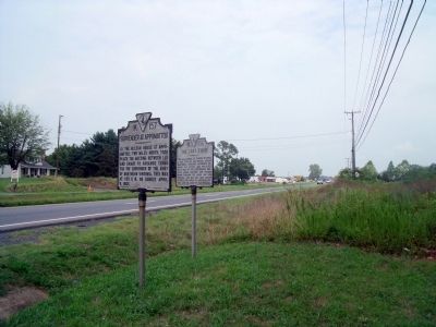
On April 10, 1905, some 3,000 spectators along with North Carolina Civil War veterans dedicated the only battlefield monument that is now part of Appomattox Court House National Historical Park. Governor Andrew Jackson Montague of Virginia and . . . — — Map (db m169564) HM
“As my decimated and ragged band with their bullet torn banner marched into its place, someone in the blue line…called for three cheers for the last brigade to surrender… [F]or us this soldierly generosity was more than we could bear. Many . . . — — Map (db m5965) HM
Confederate Infantry deployed along this road on the morning of April 9, 1865 prior to the Battle of Appomattox Court House. The battle fought near here would be the last for the Army of Northern Virginia. — — Map (db m84564) HM
One of the last battles of the Civil War in Virginia took place here early in the evening of April 8, 1865. Confederate Gen. Reuben L. Walker, who commanded 100 guns of Gen. Robert E. Lee’s reserve artillery, made camp here late in the afternoon. . . . — — Map (db m156547) HM
The road trace in front of you is the remnant of the Richmond-Lynchburg Stage Road – on April 9, 1865, the most important road in Virginia to Robert E. Lee. Along this road he planned to escape west, hoping eventually to turn south and join Joe . . . — — Map (db m5984) HM
The town of Diuguidsville established in 1792 by the Virginia General Assembly was named for William Diuguid 1717-1764 immigrant to Buckingham County in 1745 from Aberdeen, Scotland. He was a first cousin of Patrick Henry and father of Capt. William . . . — — Map (db m29954) HM
Appomattox County. Appomattox County was named for the Appomattox River, which runs through the county. The river is named for the Appamattuck tribe, which lived near the mouth of the river. The county was formed from parts of Buckingham, . . . — — Map (db m74018) HM
The South Side Railroad provided service
at Concord in 1854 when the track was
completed from Petersburg to Lynchburg.
During the Civil War, these rail lines were
important for transporting troops and supplies.
On 11 June, seven days before the . . . — — Map (db m64027) HM
Appomattox County. Area 342 Square Miles. Formed in 1845 from Buckingham, Prince Edward, Charlotte and Campbell, and named for an Indian tribe. This country was the scene of Lee's surrender, April 9, 1865.
Prince Edward . . . — — Map (db m30113) HM
You are standing where Gen. James Longstreet’s corps entrenched early in the morning of April 9, 1865, to protect the rear of the Army of Northern Virginia. Gen. Robert E. Lee and most of the army bivouacked about four miles south, just short of . . . — — Map (db m6051) HM
April 8, 1865. General Longstreet built breastworks here to protect the rear of Lee's army at Appomattox Court House. On the morning of April 9, General Lee arrived hoping to meet General Grant. After learning that he was approaching from . . . — — Map (db m6073) HM
Thomas S. Bocock, lawyer and politician, was
born in present-day Appomattox Co. (then
part of Buckingham Co.) on 18 May 1815. In
1846, he was elected to the U. S. House of
Representatives and served there until 1861.
In 1859, Bocock was . . . — — Map (db m64026) HM
One of the routes at this historic intersection is Glebe Road, developed in the 18-th century to connect Alexandria with northern Arlington. Columbian Turnpike was built in 1808 between the Long Bridge to Washington and the Little River Turnpike at . . . — — Map (db m59705) HM
On the night of June 1, 1861, a scouting party of Virginia militia attacked U.S. troops at Arlington Mill, which stood to your right. Co. E 1st. Michigan Volunteer Infantry Regiment was on picket duty at the mill guarding the Columbia Turnpike and . . . — — Map (db m206471) HM
"Before us is the broad and beautiful river, separating two of the original thirteen States, which a late President [Andrew Jackson]... desired to span with arches of ever-enduring granite, symbolical of the firmly established union . . . — — Map (db m142186) HM
Arlington Memorial Bridge spans the Potomac River, a boundary that once divided the United States. Built in 1932, the bridge connect Arlington House, the memorial to the General Robert E. Lee to the Lincoln Memorial. Lee and his family fled the . . . — — Map (db m142190) HM
[East face, top of the arch:]
McCLELLAN
Here rest 15,585 of the 315,555 citizens who died in defense of our country from 1861 to 1865.
"On fame's eternal camping ground their silent tents are spread, And glory guards with . . . — — Map (db m24587) HM
Historical Site Defenses of Washington 1861-1865 Fort Scott Here stood a detached lunette constructed in May, 1861, to guard the south flank of the defenses of Washington and named for General Winfield Scott, then General-in-Chief of the Army. . . . — — Map (db m5257) HM
The George Washington Carver Apartments, on this site from 1943 to 2015, were named for the prominent African American scientist and inventor, George Washington Carver and designed by Albert I. Cassell, a distinguished African American architect . . . — — Map (db m190464) HM
Here is what is left of Fort Richardson, a detached redoubt constructed in September, 1861, to cover the left flank of the newly built Arlington defense line, It was named for General Israel B. Richardson, whose division was then deployed to defend . . . — — Map (db m39726) HM
The Clarendon Elementary School was built in 1910 to serve the growing Clarendon neighborhood. The two-story symmetrical building was designed with a central hall and four classrooms on each floor. The school was renamed in 1925 to honor Matthew . . . — — Map (db m49434) HM
The land along Four Mile Run in this area belonged to George Washington and was known as Washington Forest. Later it became part of the Arlington estate. The Columbia Turnpike was built through here in 1808 to link the Long Bridge at Washington with . . . — — Map (db m56468) HM
In August 1861, while U.S. forces were constructing the Arlington line three miles to the east, the Confederates established a fortified outpost on the high ground about 200 yards west of here to guard the bridge by which the Georgetown-Falls Church . . . — — Map (db m160141) HM
In 1893 a branch post office at Lee Highway and Pollard Street was named Cherrydale, with reference to Dorsey Donaldson’s large cherry orchard in back of the present firehouse. Quincy Street was then known as Cherry Valley Road. Settlement in this . . . — — Map (db m55731) HM
Selina Norris lived at Arlington House and served as the personal maid and later head housekeeper for Mary Custis Lee. Norris was the second generation of her family to be enslaved by the Lee family, as were her children until their emancipation . . . — — Map (db m190468) HM
During the Civil War, the Union built a series of forts to defend Washington, D.C. By 1865 there were 33 earthen fortifications in the Arlington Line. Fort Cass (1861) was part of this defensive strategy. Built on top of the rise east of this . . . — — Map (db m5141) HM
During the Civil War, the Union built a series of forts to defend Washington, D.C. By 1865 there were 33 earthen fortifications in the Arlington Line. Fort Woodbury (1861) was part of this defensive strategy. Built east of this marker, this lunette . . . — — Map (db m5138) HM
This point has long been a vital gateway for commerce and travelers. In the early 1800s, the first Long Bridge connected Alexandria traders and Virginia farmers with Washington and Georgetown. Now, cars, trains, and the Metro carry people and goods . . . — — Map (db m134979) HM
" … a detail of men with axes was marched … to the place afterwards known as 'Fort Runyon' and proceeded to level the ground of a fine peach orchard of three hundred trees."
Emmons Clark,
History of the Seventh . . . — — Map (db m134984) HM
Following the end of the Civil War, Fort Runyon was dismantled, the garrison sent home, and the land returned to its owner, James Roach. Squatters — among them freed blacks — occupied the vacant fort, scavenging its timbers for building . . . — — Map (db m134989) HM
Fort Runyon once stood on this site. Built by Union troops at the start of the Civil War, the fort guarded access to the Virginia end of the Long Bridge, which led directly across the Potomac River to the heart of Washington, D.C. The fort . . . — — Map (db m134981) HM
7th Regiment New York Militia Infantry ★ May 1861 ★ Construction
2d New Jersey Infantry (three months) ★ May 1861
3d New Jersey Infantry (three months) ★ May 1861
21st New York Infantry ★ May - August 1861 . . . — — Map (db m134988) HM
Fort Runyon was the largest in area of 164 Civil War forts and batteries built in Virginia, Maryland, and the District of Columbia. The Defenses of Washington, as they were known, formed a 37-mile ring around the capital as protection from . . . — — Map (db m134983) HM
Virginians voted overwhelmingly for secession form the Union on May 23, 1861. Overnight, Union Army troops stationed in Washington, D.C., moved to occupy what is now Arlington County. The main body of the troops crossed the Potomac River via the . . . — — Map (db m134982) HM
The men who built Fort Runyon and were garrisoned there typified the soldiers of the Union Army. Their ranks were drawn from militia and all-volunteer regiments organized by the states and mustered into national service. They arrived in camp . . . — — Map (db m134986) HM
In August 1861, while U.S. forces were constructing the Arlington line three miles to the east, the Confederates established a fortified outpost on the high ground about 200 yards west of here, to guard the bridge by which the Georgetown - Falls . . . — — Map (db m68764) HM
Immediately to the west stood Fort Berry, a redoubt constructed in 1863 at the north flank of the defenses of Alexandria, but also flanking the Columbia Turnpike and the Arlington Line constructed in 1861. It had a perimeter of 215 yards and . . . — — Map (db m5154) HM
Dedicated in memory of the United States Colored Troops, citizens, freed slaves, and contraband of Freedman's Village by the descendants and friends. — — Map (db m15009) HM WM
Towering groves of oak and chestnut treats once shaded the grounds of Arlington House. A dark, leafy backdrop made the pale-colored bricks . . . — — Map (db m204428) HM
This garden fed the Custis and Lee families, their many guests, the enslaved house workers, and even the Federal Army. It provided for the family from early spring to late fall.
The harvest included fruits and vegetables such as berries, . . . — — Map (db m93092) HM
When the Civil War broke out, the Potomac River—to your right—became the dividing line between North and South. Shortly after Robert E. Lee resigned from the US Army in 1861, Union soldiers seized Arlington House.
Sixty years later, a nation . . . — — Map (db m204431) HM
In 1778, John Parke Custis purchased most of the 1,100 acres comprising this estate from the Alexander family. John's son, George Washington Parke Custis, came in 1802 and completed the house in 1818. He named it “Arlington” after the old Custis . . . — — Map (db m70738) HM
On May 24, 1861, Union troops crossed the Potomac River into Virgina and occupied the Arlington Estate. Officers lived in the house while hundreds of soldiers camped on the grounds. The Army crisscrossed the estate with roads and telegraph lines, . . . — — Map (db m194056) HM
Beneath this stone repose the bones of two thousand, one hundred and eleven unknown soldiers gathered after the war from the fields of Bull Run and the route to the Rappahannock. Their remains could not be identified, but their names and deaths are . . . — — Map (db m24595) WM
Panel 1: "Not for fame or reward, not for place or for rank; not lured by ambition or goaded by necessity; but in simple obedience to duty as they understood it; these men suffered all, sacrificed all, dared all, and died."
Panel . . . — — Map (db m11807) WM
Robert E. Lee, a soldier and scholar, once lived at Arlington House and managed the plantation on this land. After Lee took command of the Confederate Army of Northern Virginia, the Union Army seized his home. Union soldiers buried their casualties . . . — — Map (db m204425) HM
Abner Doubleday
Col. to Bvt. Major General
U.S. Army
Major General Volunteers
1819 1893
He was graduated at West Point
1842
1848 Mexican War
1852 Commissioner to Mexico
1854 Indian Hostilities in Texas
1856 Indian Hostilities . . . — — Map (db m99557) WM
Through the dark of night, an enslaved worker named Jim Parks could see the Union Army advancing. "Like bees-a-coming," 14,000 troops moved across the Potomac River. They captured Arlington House on May 24, 1861. The Union Army occupied this key . . . — — Map (db m204419) HM
On the high ground to the northeast stood Fort Whipple, a bastioned earthwork built early in 1863 to support the Arlington Line built in 1861. It had a perimeter of 640 yards and emplacements for 47 guns. After the War, Fort Whipple was maintained . . . — — Map (db m5140) HM
The dead from three years of Civil War filled all burial spaces in the area. In 1864, President Lincoln charged General Montgomery Meigs with locating a site for a new national cemetery. Arlington's high elevation and aesthetic beauty made it . . . — — Map (db m70711) HM
[on base of statue by Edward Clark Potter, south face:]
KEARNY
[west face:]
New Jersey honors her most distinguished soldier. Erected 1914
[north face:] Major General Philip Kearny
Born June 1, 1814 . . . — — Map (db m22087) WM
Selina Gray, her husband, and their eight children lived in the room to your right. She was Mrs. Lee's personal maid and later the head housekeeper. Her parents had been Mt. Vernon slaves, so she grew up steeped in the lore of George Washington. . . . — — Map (db m70500) HM
Selina Gray, the daughter of Leonard and Sallie Norris, was a second generation Arlington slave. For a number of years, Selina was the personal maid of Mrs. Robert E. Lee. By 1861, Salina had become the head housekeeper at Arlington. When Mrs. . . . — — Map (db m194390) HM
"Cherish these forest trees," Marquis de Lafayette, 1825.
William Howard Russell, a famous 19th century English correspondent, once described the forest before you as "some of the finest woods I have seen in . . . — — Map (db m194491) HM
Selena Gray was born into slavery in December 1823, the daughter of Leonard and Sallie Norris. She learned to read and write as a personal maid for Mary Lee. In the same parlor where the Lees wed, Selena married Thornton Gray, and enslaved stable . . . — — Map (db m213563) HM
Past the rose garden, about a 10-minute walk from here, rows of houses curved around the land once owned by the Lee family. This was Freedmen's Village, a temporary community of former slaves established in 1863. Most who lived here risked their . . . — — Map (db m204471) HM
1831 Mary Custis marries Robert E. Lee.
1862 Custis slaves emancipated.
1863 Freedman's Village established at Arlington.
1925 Congress authorizes restoration of Arlington House.
1955 Arlington House officially . . . — — Map (db m204429) HM
As Union force threatened to occupy northern Virginia in 1861, the Lee Family evacuated Arlington House. Looking Across the river, you can see the vantage point it offered to protect the capital city. The hilltop swelled with tents, cannons, wagons . . . — — Map (db m175213) HM
During the Civil War, many escaped and freed slaves traveled north seeking refuge in Union camps. Thousands crowded into the Federal City. The number of refugees quickly overwhelmed the area’s resources. Overcrowding and disease became prevalent. In . . . — — Map (db m5293) HM
After the outbreak of the Civil War, escaped slaves sought refuge at Union Camps and thousands crowded into the Federal City. In response to the unhealthy conditions in Washington, the government selected a site on Arlington Heights in May, 1863, to . . . — — Map (db m6409) HM
Arlington's first house of worship, the Chapel of Ease of Arlington Plantation, was near this location. George Washington Parke Custis built it about 1825 for his family, neighbors, and servants. Services were conducted by students from the . . . — — Map (db m30008) HM
Artist and landscape designer Walter Hood took inspiration for the design of the John Robinson, Jr. Town Square from the surrounding history of Green Valley. Over the course of six years, Hood engaged residents and community leaders in the design . . . — — Map (db m214447) HM
Here stood Fort Barnard, a redoubt constructed late in 1861 to command the approaches to Alexandria by way of Four Mile Run and Glebe Road. It was named for General J. G. Barnard, Chief Engineer of the Defenses of Washington. It had a perimeter of . . . — — Map (db m5158) HM
Freedman's Village, established by the federal government in 1863, was intended to provide temporary accommodation for newly freed slaves, but it survived as a community for over thirty years. When the government closed it, many residents . . . — — Map (db m130991) HM
Green Valley, formerly Nauck, is a traditionally African American neighborhood. Levi Jones first settled in this area and was later joined by other African American families such as Thornton and Selina Gray, William Augustus and Ellen Rowe, and . . . — — Map (db m214449) HM
A half-mile to the southwest stood Fort Runyon, a large bastioned earthwork constructed in May 1861 to protect the Long Bridge over the Potomac. Its perimeter, 1484 yards, was about the same as that of the Pentagon. After the construction of the . . . — — Map (db m5255) HM
Here stood Fort Tillinghast, a lunette in the Arlington Line constructed in August 1861. It had a perimeter of 298 yards and emplacements for 13 guns. A model of this fort, typical of all lunettes in the Arlington Line, can be seen at the Hume . . . — — Map (db m5147) HM
Cherrydale Station
The first steam locomotive reached Cherrydale and Thrifton (now Maywood) in the spring of 1904. There were two rail lines in Alexandria (now Arlington) County that served the young community. There were many stations along . . . — — Map (db m125007) HM
Historical Site Defenses of Washington 1861-1865 Fort Bennett Here stood Fort Bennett, a small outwork of Fort Corcoran, constructed in May 1861. With a perimeter of 146 yards and emplacements for 5 guns, it was designed to bring under fire the . . . — — Map (db m5104) HM
Nearby to the north stood Fort Strong, a lunette marking the north end of the Arlington Line constructed in August 1861. It had a perimeter of 318 yards and emplacements for 15 guns. — — Map (db m5112) HM
This spring and the property on which it is located is rich with the recorded history of Arlington. Its first owner, Thomas Owsley, patented the land in 1696. by law, Owsley would have been required to build a house on the land within one year, . . . — — Map (db m129247) HM
The oldest trees in this forest probably began growing around 1865. Before that time, most of the trees along Arlington's Palisades were cut down to establish a clear line of sight for the Civil War fortifications surrounding Washington. The most . . . — — Map (db m186870) HM
Historical Site Defenses of Washington 1861-1865 Fort Corcoran During the Civil War, the Union built a series of forts to defend Washington, D.C. By 1865 there were 33 earthen fortifications in the Arlington Line. Fort Corcoran (1861) was part . . . — — Map (db m5106) HM
Historical Site Defenses of Washington 1861-1865 Fort Haggerty Here beside the Georgetown-Alexandria road stood Fort Haggerty, a small outwork of Fort Corcoran, constructed in May 1861. With a perimeter of 128 yards and emplacements for 4 guns, . . . — — Map (db m5111) HM
Fort Ethan Allen's star-shaped design enabled soldiers to defend all sides of the fort.
Constructed primarily from earth and wood, Fort Ethan Allen was a bastion-style fort. Bastions are angular structures that jut out from the enclosing . . . — — Map (db m129227) HM WM
Fort Ethan Allen had emplacements for 36 guns.
The forts that formed the Defenses of Washington were placed at half-mile intervals, supplemented with artillery batteries and rifle pits, making a nearly continuous connection between . . . — — Map (db m129236) HM
No enemy could have gotten as close to Fort Ethan Allen as you are now.
A half-mile perimeter of earthen walls and deep ditches enclosed the fort. Inside, as many as 1,000 soldiers manned the fort's 36 gun emplacements. Some pieces of . . . — — Map (db m132581) HM
Fort Ethan Allen was a repeating station, transmitting messages back and forth to other nearby stations.
A series of signal stations linked the forts of the Defenses of Washington. The soldiers who relayed secret messages from station to . . . — — Map (db m129238) HM
Fort Ethan Allen was constructed during the Civil War to provide one of the last lines of defense against possible Confederate attacks aimed at Washington. The fort commanded approaches to Chain Bridge (over the Potomac River) from the south of . . . — — Map (db m2318) HM
Fort Ethan Allen was constructed during the Civil War to provide one of the last lines of defense against possible Confederate attacks aimed at Washington. The fort commanded approaches to Chain Bridge (over the Potomac River) from south of . . . — — Map (db m213839) HM
Historical Site Defenses of Washington 1861-1865 Fort Ethan Allen This embankment was the south face of Fort Ethan Allen, a bastioned earthwork built in September 1861 to command all the approaches to Chain Bridge south of Pimmit Run. The fort . . . — — Map (db m2317) HM
The earthen mounds that surround you are the remains of the fort's construction.
The model behind you re-creates Fort Ethan Allen as it was depicted in U.S. Army engineering drawings published after the Civil War. Use the drawing and model . . . — — Map (db m129237) HM
At the peak of the Civil War, as many as 1,000 soldiers were garrisoned at Fort Ethan Allen.
The men who built and defended the fort belonged to volunteer regiments recruited from New York, Massachusetts, and other northern states. While . . . — — Map (db m129240) HM
Fort Ethan Allen depended on more than its thick exterior walls to protect it from enemy attack.
Guards stationed outside the fort in sentry boxes checked unfamiliar wagons for valid passes before allowing entry to the fort. Inside, . . . — — Map (db m129242) HM
Fort Ethan Allen Chain Bridge Gulf Branch Sanctuary for Wildlife and not so wildlife herineafter referred to as…
The Sanctuary
…Historical Site of Civil War Fort Ethan Allen which commanded all the approaches south of Pimmit Run to . . . — — Map (db m129245) HM
Company M, 2nd New York Heavy Artillery, August 1865
The war ended in April 1865, but troops continued to occupy the fort temporarily. With their guns cleaned and polished, Company M would be mustered out in Washington, D.C., on September 29. . . . — — Map (db m129232) HM
Much survives of Fort Ethan Allen, a critical part of the Defenses of Washington, D.C., during the Civil War.
Fort Ethan Allen defended the southern approaches to Chain Bridge, one of the three Potomac River crossings that Confederate . . . — — Map (db m129223) HM
Here stood Fort Craig, a lunette in the Arlington Line constructed in August 1861. It had a perimeter of 324 yards and emplacements for 11 guns. — — Map (db m5150) HM
Immediately to the northwest stood Fort Albany, a bastioned earthwork built in May 1861 to command the approach to the Long Bridge by way of the Columbia Turnpike. It had a perimeter of 429 yards and emplacements for 12 guns. Even after Forts . . . — — Map (db m5258) HM
The mansion which formerly stood here was built in 1841 by James Roach, a prosperous contractor who supplied most of the brick and stone used in the construction of the Aqueduct Bridge and Alexandria Canal (under construction 1833-1843) and the . . . — — Map (db m55970) HM
Here the Arlington Line constructed in August, 1861, crossed the Georgetown-Falls Church road. 100 yards to the northwest stood Fort Morton, a lunette with a perimeter of 250 yards and emplacements for 17 guns; 200 yards to the southeast stood Fort . . . — — Map (db m5161) HM
The land that Ronald Reagan Washington National Airport occupies today was once part of a plantation. This hill and the ruins on it are all that remain of the house that stood here for nearly 190 years.
Abington, as this tract of land on the . . . — — Map (db m8377) HM
4594 entries matched your criteria. Entries 201 through 300 are listed above. ⊲ Previous 100 — Next 100 ⊳