After filtering for Ohio, 697 entries match your criteria. Entries 101 through 200 are listed.⊲ Previous 100 — Next 100 ⊳
Waterways & Vessels Topic
By Mike Wintermantel, February 8, 2015
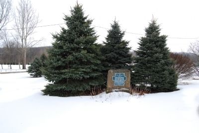
The Sandy and Beaver Canal Marker
| 101 ► Ohio, Carroll County, Malvern — The Sandy and Beaver Canal — |
| Near West Canal Street (Route 183). | |||
| 102 ► Ohio, Champaign County, St. Paris — Kiser Lake — Remote Monument, in a Rural State Park — |
| On State Park lane, off Kiser Lake Road (County Route 19), on the left when traveling west. | |||
| 103 ► Ohio, Clermont County, Batavia — Lake Allyn Site — Clermont County Bicentennial Marker — |
| On Lake Allyn Road at Olive Branch Road, on the right when traveling west on Lake Allyn Road. | |||
| 104 ► Ohio, Clermont County, Chilo — Chilo Lock & Dam #34 Powerhouse — |
| On County Park Road, 0.2 miles south of Ohio River Scenic Byway (U.S. 52), on the right when traveling south. | |||
| 105 ► Ohio, Clermont County, Chilo — Locking Through — Chilo: Living and Working with the Ohio River — |
| On County Park Road, 0.2 miles south of Ohio River Scenic Byway (U.S. 52), on the right when traveling south. | |||
| 106 ► Ohio, Clermont County, Chilo — Replacing Chilo — Chilo: Living and Working with the Ohio River — |
| On County Park Road, 0.2 miles south of Ohio River Scenic Byway (U.S. 52), on the right when traveling south. | |||
| 107 ► Ohio, Clermont County, Chilo — Search Lights — Chilo: Living and Working with the Ohio River — |
| On County Park Road, 0.2 miles south of Ohio River Scenic Byway (U.S. 52), on the right when traveling south. | |||
| 108 ► Ohio, Clermont County, Chilo — The Wakerobin — Chilo: Living and Working with the Ohio River — |
| On County Park Road, 0.2 miles south of Ohio River Scenic Byway (U.S. 52), on the right when traveling south. | |||
| 109 ► Ohio, Clermont County, Chilo — 2 — The Assistant Lockmaster’s House — Chilo: Living and Working with the Ohio River — |
| On County Park Road, 0.3 miles east of Green Street, on the right when traveling south. | |||
| 110 ► Ohio, Clermont County, Chilo — The Chilo Lock and Dam #34 Walking Tour — Chilo: Living and Working with the Ohio River — |
| On County Park Road, 0.2 miles south of Ohio River Scenic Byway (U.S. 52), on the right when traveling south. | |||
| 111 ► Ohio, Clermont County, Chilo — The Flood of 1937 — Chilo: Living and Working with the Ohio River — |
| On County Park Road, 0.2 miles south of Ohio River Scenic Byway (U.S. 52), on the right when traveling south. | |||
| 112 ► Ohio, Clermont County, Chilo — The Ohio River: Ever Changing — Chilo: Living and Working with the Ohio River — |
| On County Park Road, 0.3 miles east of Green Street, on the right when traveling south. | |||
| 113 ► Ohio, Clermont County, Chilo — 3 — The Ramp and Esplande — Chilo: Living and Working with the Ohio River — |
| On County Park Road, 0.3 miles east of Green Street, on the right when traveling south. | |||
| 114 ► Ohio, Clermont County, Chilo — Water Highways — Chilo: Living and Working with the Ohio River — |
| On County Park Road, 0.2 miles south of Ohio River Scenic Byway (U.S. 52), on the right when traveling south. | |||
| 115 ► Ohio, Clermont County, Loveland — 25th Anniversary — Lower Little Miami Scenic River — |
| On Little Miami Scenic Trail, on the left when traveling north on Little Miami Scenic Trail. | |||
| 116 ► Ohio, Clermont County, Miamiville — 10 — Miamiville — Fighting at the Bridges — John Hunt Morgan Heritage Trail — |
| On Glendale Milford Road (Ohio Route 126) east of Wards Corner Road, on the right when traveling east. | |||
| 117 ► Ohio, Clermont County, Miamiville — 9 — Miamiville — Derailment of the "Kilgour" — John Hunt Morgan Heritage Trail — |
| Near Glendale Milford Road (Ohio Route 126) east of Wards Corner Road, on the right when traveling east. | |||
| 118 ► Ohio, Clermont County, New Richmond — Capt. Ernest Wagner Park — |
| On Susanna Way, on the right when traveling east. | |||
| 119 ► Ohio, Clermont County, New Richmond — New Richmond Waterfront — Underground Railroad Site — Clermont Freedom Trail — |
| On Front Street at Walnut Street, on the right when traveling east on Front Street. | |||
| 120 ► Ohio, Clermont County, New Richmond — The United States Merchant Marine — |
| On Susanna Way, on the right when traveling east. | |||
| 121 ► Ohio, Clermont County, Williamsburg — In Recognition of 200 Years of Freedom and Dedication — Williamsburg, Ohio Bicentennial — 1796-1996 — |
| Near Gay Street east of North High Street. | |||
| 122 ► Ohio, Columbiana County, Calcutta — 4-15 — First Paper Mill / Little Beaver Creek Bridge |
| On Calcutta-Smith Ferry Road (County Route 430) 0.8 miles north of Harvey Avenue (Ohio Route 39), on the right when traveling north. Reported missing. | |||
| 123 ► Ohio, Columbiana County, East Liverpool — Lock 36 — |
| On Echo Dell Road (Local Route 929) north of Bell School Road (Local Route 1131), on the left when traveling north. | |||
| 124 ► Ohio, Columbiana County, East Liverpool — 16-15 — Ohio's Gateway — |
| Near Walnut Street. | |||
| 125 ► Ohio, Columbiana County, Hanoverton — 3-15 — Canal Tunnels — |
| On Lincoln Highway (U.S. 30) 0.7 miles east of Haessly Road, on the right when traveling east. | |||
| 126 ► Ohio, Columbiana County, Lisbon — Stone Lockplate — |
| On East Washington Street, on the right when traveling west. | |||
| 127 ► Ohio, Coshocton County, Coshocton — Capt. Bill Smart — |
| On North Whitewoman Street west of Ohio Route 16/83, on the left when traveling west. | |||
| 128 ► Ohio, Coshocton County, Coshocton — Ohio-Erie Canal and Walhonding Canal — |
| On North Whitewoman Street (County Road 495) north of Hydraulic Street, on the right when traveling north. | |||
| 129 ► Ohio, Coshocton County, Roscoe — Caldersburgh Pearl -2001 |
| On Whitewoman Street, on the left when traveling north. Reported missing. | |||
| 130 ► Ohio, Coshocton County, Roscoe — Jacob Welsh House - c.1840 — |
| On Whitewoman Street, on the right when traveling north. | |||
| 131 ► Ohio, Coshocton County, Roscoe — Old Warehouse — 400 Whitewoman Street North — |
| On Whitewoman Street, on the right when traveling north. | |||
| 132 ► Ohio, Coshocton County, Roscoe Village — 7-16 — Underground Railroad Agents in Coshocton County / Muskingum River Underground Railroad Corridor — |
| On County Road 495 at State Route 16, on the right when traveling west on County Road 495. | |||
| 133 ► Ohio, Crawford County, Galion — U.S.S. Constitution Cannon |
| On Ohio Route 309 at Crawford-Morrow County Line Road, on the left when traveling north on State Route 309. Reported missing. | |||
| 134 ► Ohio, Crawford County, Leesville — To the Memory of Colonel Wm. Crawford — |
| On Leesville Road, 0.4 miles east of Ohio Route 598, on the right when traveling east. | |||
| 135 ► Ohio, Cuyahoga County, Brecksville — Ohio & Erie Canalway — 110 Miles, Endless Possibilities — |
| Near Valley Parkway east of Riverview Road, on the left when traveling east. | |||
| 136 ► Ohio, Cuyahoga County, Brecksville, Sagamore Hills Township — Restoring The River — Removing Barriers — |
| Near Ohio & Erie Canal Towpath Trail south of West Aurora Road (Ohio Route 82), on the right when traveling west. | |||
| 137 ► Ohio, Cuyahoga County, Brook Park — John J. Donnelly — Rocky River Nature Center — Cleveland Metroparks — |
| Near Valley Parkway near Cedar Point Road, on the left. | |||
| 138 ► Ohio, Cuyahoga County, Chagrin Falls — 35-18 — The Chagrin River's "High Falls" — |
| On North Main Street. | |||
| 139 ► Ohio, Cuyahoga County, Cleveland, Central — 89-18 — Woodland Cemetery — |
| On Woodland Avenue (Ohio Route 87), on the right when traveling east. | |||
| 140 ► Ohio, Cuyahoga County, Cleveland, Downtown — Building Strong for Cleveland — |
| On East 9th Street, 0.1 miles north of Erieside Avenue (North Marginal Road), on the right when traveling north. | |||
| 141 ► Ohio, Cuyahoga County, Cleveland, Downtown — Cod's 7-Ton Gun — |
| Near Marjorie Rosenbaum Plaza just north of North Marginal Road, on the right when traveling south. | |||
| 142 ► Ohio, Cuyahoga County, Cleveland, Downtown — Com. Oliver Hazard Perry — |
| On Lakeside Avenue near West 3rd Street, on the right when traveling west. | |||
| 143 ► Ohio, Cuyahoga County, Cleveland, Downtown — Commodore Oliver Hazard Perry — 8-23-1785 to 8-23-1819 — Hero of Battle of Lake Erie — |
| On West Lakeside Avenue just east of West 3rd Street, on the right when traveling west. | |||
| 144 ► Ohio, Cuyahoga County, Cleveland, Downtown — Depthcharge damage to Cod's deck plates — |
| On Marjorie Rosenbaum Plaza north of North Marginal Road, on the right when traveling south. | |||
| 145 ► Ohio, Cuyahoga County, Cleveland, Downtown — Hanson Torpedo Truck — |
| On Marjorie Rosenbaum Plaza just north of North Marginal Road, on the right when traveling south. | |||
| 146 ► Ohio, Cuyahoga County, Cleveland, Downtown — Hardware Industry — Warehouse District Anthology — |
| On West 9th Street just north of West St. Clair Avenue, on the left when traveling north. | |||
| 147 ► Ohio, Cuyahoga County, Cleveland, Downtown — Mark 14 Torpedo — |
| On Marjorie Rosenbaum Plaza just north of North Marginal Road, on the right when traveling south. | |||
| 148 ► Ohio, Cuyahoga County, Cleveland, Downtown — Moses Cleaveland — |
| On East 9th Street, 0.1 miles north of Erieside Avenue (North Marginal Road), on the right when traveling north. | |||
| 149 ► Ohio, Cuyahoga County, Cleveland, Downtown — Moses Cleaveland Survey — |
| Near Robert Lockwood Jr Drive at West Superior Avenue, on the right when traveling south. | |||
| 150 ► Ohio, Cuyahoga County, Cleveland, Downtown — Ohio and Erie Canal — |
| On Merwin Avenue at West Street, on the right when traveling south on Merwin Avenue. | |||
| 151 ► Ohio, Cuyahoga County, Cleveland, Downtown — 75-18 — Rear Admiral Isaac C. Kidd — |
| On East 9th Street, on the right when traveling north. | |||
| 152 ► Ohio, Cuyahoga County, Cleveland, Downtown — Since 1775 — The Nation's Industrial Might — |
| On East 9th Street, 0.1 miles north of Erieside Avenue (North Marginal Road), on the right when traveling north. | |||
| 153 ► Ohio, Cuyahoga County, Cleveland, Downtown — The Early Years — Warehouse District Anthology — |
| On West 9th Street just north of West Lakeside Avenue, on the left when traveling north. | |||
| 154 ► Ohio, Cuyahoga County, Cleveland, Downtown — To Commemorate 300 Years of German Contributions — 1683-1983 — |
| On West Mall Drive south of Lakeside Avenue East, on the left when traveling south. | |||
| 155 ► Ohio, Cuyahoga County, Cleveland, Downtown — U.S.S. Cod — SS 224 — The Historic Submarine — |
| On Marjorie Rosenbaum Plaza just north of North Marginal Road, on the right when traveling south. | |||
| 156 ► Ohio, Cuyahoga County, Cleveland, Downtown — USS Cod Pearl Harbor Memorial — |
| On Marjorie Rosenbaum Plaza just north of North Marginal Road, on the right when traveling south. | |||
| 157 ► Ohio, Cuyahoga County, Cleveland, Hopkins — 121-18 — Puritas Springs Park / The Cyclone Roller Coaster — |
| On Puritas Avenue at West 194th Street, on the left when traveling west on Puritas Avenue. | |||
| 158 ► Ohio, Cuyahoga County, Cleveland, Tremont — Industrial River Valley — |
| Near Abbey Avenue just west of West 14th Street, on the right when traveling west. | |||
| 159 ► Ohio, Cuyahoga County, Cleveland, Tremont — Three Generations of Bridges — 1888-1943 — |
| On Abbey Avenue west of West 14th Street, on the right when traveling west. | |||
| 160 ► Ohio, Cuyahoga County, Independence — Alexander / Wilson Mill — Adapting with the Times — |
| On Ohio & Erie Canal Towpath Trail, on the left when traveling south. | |||
| 161 ► Ohio, Cuyahoga County, Independence — Floods and Repairs — Regulating Water Level — |
| On Ohio & Erie Canal Towpath Trail, on the right when traveling south. | |||
| 162 ► Ohio, Cuyahoga County, Independence — Lock 37 — Family Business — |
| On Ohio & Erie Canal Towpath Trail, on the left when traveling south. | |||
| 163 ► Ohio, Cuyahoga County, Independence — Mule Power — Towing Canal Boats — |
| Near Hillside Road at Canal Road, on the left when traveling west. | |||
| 164 ► Ohio, Cuyahoga County, Moreland Hills — 15-18 — Birthplace of James A. Garfield — |
| On S.O.M. Center Road. | |||
| 165 ► Ohio, Cuyahoga County, North Olmsted — 14-18 — Parker Ranch — Adele Von Ohl Parker — |
| On Mastick Road, 0.2 miles west of Clague Road, on the left when traveling west. | |||
| 166 ► Ohio, Cuyahoga County, Northfield — Frazee Family — Impact of the Canal — |
| On Ohio & Erie Canal Towpath Trail, on the left when traveling south. | |||
| 167 ► Ohio, Cuyahoga County, Northfield — Pinery Narrows — Bridging the Valley — |
| Near Valley Parkway, on the left when traveling east. | |||
| 168 ► Ohio, Cuyahoga County, Northfield — Restoring the Cuyahoga River — |
| On Valley Parkway east of Riverview Boulevard, on the left when traveling east. | |||
| 169 ► Ohio, Cuyahoga County, Northfield — Ride the Rails — |
| Near Station Road, on the left when traveling east. | |||
| 170 ► Ohio, Cuyahoga County, Shaker Heights — 67-18 — Horseshoe Lake — |
| On South Park Boulevard, 0.2 miles east of Lee Road, on the right when traveling east. | |||
| 171 ► Ohio, Cuyahoga County, Valley View — Hell's Half Acre — |
| Near Hillside Road west of Canal Road, on the left when traveling west. | |||
| 172 ► Ohio, Cuyahoga County, Valley View — Lock 38 — Boat Elevator — |
| Near Ohio & Erie Canal Towpath Trail at Hillside Road. | |||
| 173 ► Ohio, Cuyahoga County, Walton Hills, Sagamore Hills Township — Tinker's Creek is Gorgeous — Cleveland Metroparks — |
| On Gorge Parkway, 1 mile west of Egbert Road, on the right when traveling west. | |||
| 174 ► Ohio, Cuyahoga County, Westlake — 31-18 — Theodore Elijah Burton / Dover Farm — 1851–1929 / — |
| On Detroit Road (Ohio Route 254) just west of Walden Drive, on the right when traveling west. | |||
| 175 ► Ohio, Defiance County, Defiance — Flood Poles — Library Grounds — |
| On Fort Street at Washington Avenue, on the left when traveling east on Fort Street. | |||
| 176 ► Ohio, Defiance County, Defiance — 24 — Fort Starvation — Let's Get Historic — |
| Near Ohio Route 424 east of Independence Road, on the right when traveling east. | |||
| 177 ► Ohio, Defiance County, Defiance — Miami & Erie Canal Lock No. 37 — |
| On West 3rd Street (Ohio Route 424) just west of Clinton Street (Ohio Route 111), on the right when traveling west. | |||
| 178 ► Ohio, Defiance County, Defiance — Navy Armed Guard and Merchant Marine Memorial — |
| On Clinton Street (Ohio Route 18/424) just north of West 2nd Street (Ohio Route 18), on the right when traveling north. | |||
| 179 ► Ohio, Defiance County, Defiance — Pontiac Park — |
| On East River Road (Ohio Route 424) 0.1 miles east of North Clinton Street, on the right when traveling east. | |||
| 180 ► Ohio, Defiance County, Defiance, Noble Township — Buckeye Trail — |
| On East High Street, on the right when traveling east. | |||
| 181 ► Ohio, Defiance County, Independence — Lock No. 13 & Independence Dam / Two Canals — |
| On Ohio Route 424 at Independence Road, on the left when traveling west on State Route 424. | |||
| 182 ► Ohio, Defiance County, Independence — Site of Lock No. 13 — |
| On Ohio Route 424, on the right when traveling east. | |||
| 183 ► Ohio, Defiance County, Independence — Two Canals — Anthony Wayne Parkway — |
| On Ohio Route 424 at Independence Road, on the left when traveling west on State Route 424. | |||
| 184 ► Ohio, Delaware County, Delaware — Delaware Run Storm Net — |
| Near South Sandusky Street just north of Spring Street, on the right when traveling north. | |||
| 185 ► Ohio, Delaware County, Lewis Center — The Four Chaplains — |
| Near Columbus Pike (U.S. 23). | |||
| 186 ► Ohio, Delaware County, Powell, Liberty Township — Alligator Answers — |
| Near Ohio Route 257 north of Glick Road, on the left when traveling north. | |||
| 187 ► Ohio, Delaware County, Powell, Liberty Township — Bald Eagles in Ohio — |
| Near West Powell Road (Route 750) east of Ohio Route 257, on the right when traveling west. | |||
| 188 ► Ohio, Delaware County, Powell, Liberty Township — North American River Otter — Lontra canadensis — |
| On West Powell Road (Ohio Route 750) east of Ohio Route 257, on the right when traveling west. | |||
| 189 ► Ohio, Delaware County, Powell, Liberty Township — Trumpeter Swan — Cygnus buccinator — |
| Near West Powell Road (Route 750) east of Riverside Drive (Ohio Route 257), on the left when traveling east. | |||
| 190 ► Ohio, Delaware County, Powell, Liberty Township — Wetlands Conservation Projects — |
| Near West Powell Road (Ohio Route 750) east of Ohio Route 257, on the right when traveling west. | |||
| 191 ► Ohio, Erie County, Huron — Huron Block House — 1930s to Present — |
| Near Main Street near Huron Pier. | |||
| 192 ► Ohio, Erie County, Huron — 14-22 — Huron Lighthouses / Huron’s Maritime History — |
| On Main Street near Huron Pier, on the left when traveling north. | |||
| 193 ► Ohio, Erie County, Huron — Legacy of the Huron Docks — Self-Unloaders / Boats that Came to Huron — |
| Near Main Street north of Wall Street. | |||
| 194 ► Ohio, Erie County, Huron — Legacy of the Huron Docks — Early Boats / Wooden Steam Ships and Barges / Bulk Freighters / Whalebacks — |
| Near Main Street north of Huron Pier. | |||
| 195 ► Ohio, Erie County, Huron — The Legacy of the Huron Docks — 1906 Dock Improvements / New Electric Coal Dumper 1937 — |
| On Main Street at Wall Street, on the right when traveling north on Main Street. | |||
| 196 ► Ohio, Erie County, Huron — The Legacy of the Huron Docks — The Huron Iron Ore and Coal Docks / Men of the Docks — |
| Near Main Street at Cleveland Road West. | |||
| 197 ► Ohio, Erie County, Huron — 11-22 — The Wright House and the Underground Railroad/Old Main Street — |
| On Cleveland Road West at Main Street when traveling east on Cleveland Road West. | |||
| 198 ► Ohio, Erie County, Milan — Edison Recalls Milan / Birthplace of Thomas A. Edison — |
| On East Edison Drive, on the right when traveling south. | |||
| 199 ► Ohio, Erie County, Milan — 4-22 — Milan Canal Basin — 1839-1867 — |
| On North Edison Drive, 0.1 miles north of Front Street, on the left when traveling north. | |||
| 200 ► Ohio, Erie County, Sandusky — 17-22 — Cedar Point — “The Queen of American Watering Places” — |
| Near Cedar Point Road. | |||
697 entries matched your criteria. Entries 101 through 200 are listed above. ⊲ Previous 100 — Next 100 ⊳