3091 entries match your criteria. Entries 201 through 300 are listed.⊲ Previous 100 — Next 100 ⊳
Bridges & Viaducts Topic
By Joseph Alvarado, November 14, 2022
The Golden Gate Marker
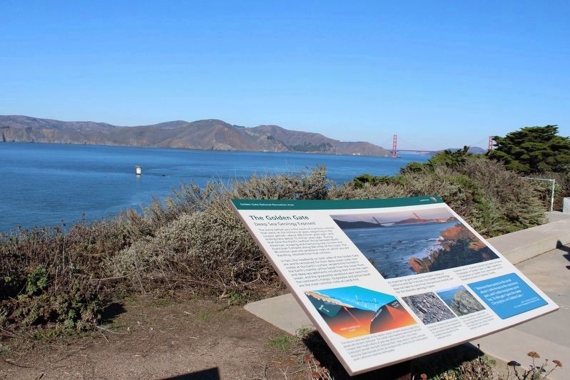
| 201 ► California, San Francisco City and County, San Francisco, Lincoln Park — The Golden Gate — Deep Sea Geology Exposed — |
| Near El Camino Del Mar near Seal Rock Drive. | |||
| 202 ► California, San Francisco City and County, San Francisco, Mission Bay — Peter R. Maloney (4th Street) Bridge — |
| On 4th Street, on the right when traveling north. | |||
| 203 ► California, San Francisco City and County, San Francisco, Presidio of San Francisco — A Bathtub for the South Tower — |
| Near Coastal Trail. | |||
| 204 ► California, San Francisco City and County, San Francisco, Presidio of San Francisco — A Lasting Monument — |
| Near Coastal Trail. | |||
| 205 ► California, San Francisco City and County, San Francisco, Presidio of San Francisco — All in a Day's Work — |
| Near Coastal Trail. | |||
| 206 ► California, San Francisco City and County, San Francisco, Presidio of San Francisco — Art Deco on a Grand Scale — |
| Near Coastal Trail. | |||
| 207 ► California, San Francisco City and County, San Francisco, Presidio of San Francisco — Battery Lancaster — |
| Near Coastal Trail. | |||
| 208 ► California, San Francisco City and County, San Francisco, Presidio of San Francisco — Bridging the Gate — the Beginning — |
| Near Coastal Trail. | |||
| 209 ► California, San Francisco City and County, San Francisco, Presidio of San Francisco — Engineering the Design — |
| Near Coastal Trail. | |||
| 210 ► California, San Francisco City and County, San Francisco, Presidio of San Francisco — Facts & Figures About the Bridge — |
| Near Coastal Trail. | |||
| 211 ► California, San Francisco City and County, San Francisco, Presidio of San Francisco — Fort Point Arch — |
| Near Coastal Trail. | |||
| 212 ► California, San Francisco City and County, San Francisco, Presidio of San Francisco — Hanging the Roadway Deck — |
| On Coastal Trail. | |||
| 213 ► California, San Francisco City and County, San Francisco, Presidio of San Francisco — Joseph Strauss Legacy Circle — |
| Near Lincoln Boulevard. | |||
| 214 ► California, San Francisco City and County, San Francisco, Presidio of San Francisco — Making the Impossible, Possible: The Story of the Golden Gate Bridge — |
| Near Coastal Trail. | |||
| 215 ► California, San Francisco City and County, San Francisco, Presidio of San Francisco — Men of Vision — |
| 216 ► California, San Francisco City and County, San Francisco, Presidio of San Francisco — Resisting the Twisting — |
| Near U.S. 101 at Lincoln Boulevard. | |||
| 217 ► California, San Francisco City and County, San Francisco, Presidio of San Francisco — Spinning the Main Cables — |
| Near Coastal Trail. | |||
| 218 ► California, San Francisco City and County, San Francisco, Presidio of San Francisco — Steel, Fog, Salt, Rust, and Paint — |
| Near Coastal Trail. | |||
| 219 ► California, San Francisco City and County, San Francisco, Presidio of San Francisco — Tall and Strong — |
| Near Coastal Trail. | |||
| 220 ► California, San Francisco City and County, San Francisco, Presidio of San Francisco — The Golden Gate Bridge — |
| Near Lincoln Boulevard. | |||
| 221 ► California, San Francisco City and County, San Francisco, Presidio of San Francisco — The Golden Gate Bridge: Vision, Genius and Expert Care — |
| Near Lincoln Boulevard west of Chrissy Field Avenue. | |||
| 222 ► California, San Francisco City and County, San Francisco, Presidio of San Francisco — The PG&E Tower — |
| On Golden Gate Bridge, on the right when traveling north. | |||
| 223 ► California, San Francisco City and County, San Francisco, Presidio of San Francisco — Types of Bridges — |
| Near Coastal Trail. | |||
| 224 ► California, San Francisco City and County, San Francisco, Presidio of San Francisco — Working Under Water — |
| Near Coastal Trail. | |||
| 225 ► California, San Francisco City and County, San Francisco, Presidio of San Francisco — World's Tallest Bridge Towers — |
| Near Coastal Trail. | |||
| 226 ► California, San Francisco City and County, San Francisco, Rincon Hill — Klockars' Blacksmith Shop — |
| On Folsom Street north of 1st Street, on the right when traveling east. | |||
| 227 ► California, San Francisco City and County, San Francisco, SoMa — Pause traveler and be greatful to Norton 1st — |
| Near Minna Street. | |||
| 228 ► California, San Francisco City and County, San Francisco, South Beach — The Bay Bridge — |
| On The Embarcadero near Beale Street. | |||
| 229 ► California, San Francisco City and County, San Francisco, South Beach — The Francis "Lefty" O'Doul Third Street Bridge — |
| Near Third Street south of Willie Mays Plaza. | |||
| 230 ► California, San Francisco City and County, San Francisco, Treasure Island — Signal — Tom Loughlin — 2019 — |
| On Avenue of the Palms at 9th Street, on the left when traveling north on Avenue of the Palms. | |||
| 231 ► California, San Francisco City and County, San Francisco, Yerba Buena Island — Defending the Bay for 150 Years — |
| On Treasure Island Road north of Macalla Road, on the right when traveling north. | |||
| 232 ► California, San Joaquin County, Clements — Mackville Road Bridge — |
| On Mackville Road near East Jahant Road, on the left when traveling south. | |||
| 233 ► California, San Joaquin County, Tracy — Lincoln Highway — 1913 - 1928 — |
| On 11th Street (California Route 205) east of Cable Road, on the right when traveling west. | |||
| 234 ► California, San Mateo County, Burlingame — Eugene A. Doran Memorial Bridge — 1922 – 1959 — One-Half Mile South — |
| Near State Highway 280. | |||
| 235 ► California, San Mateo County, Half Moon Bay — First Concrete Bridge Erected in San Mateo Co — 1900 — |
| On Main Street, on the left when traveling south. | |||
| 236 ► California, San Mateo County, Redwood City — A Feat of Gravity — The Hetch Hetchy Regional Water System — |
| 237 ► California, San Mateo County, San Mateo — History of San Mateo’s Bridges — |
| Near South Hart Clinton Drive. | |||
| 238 ► California, San Mateo County, South San Francisco — Cut Stone Bridge — |
| On Centennial Way Trail at Spruce Avenue, on the right when traveling north on Centennial Way Trail. | |||
| 239 ► California, Santa Cruz County, Felton — 583 — Felton Covered Bridge — |
| Near Covered Bridge Road, 0.5 miles south of Graham Hill Road. | |||
| 240 ► California, Santa Cruz County, Felton — Roaring Camp Covered Bridge — |
| 241 ► California, Santa Cruz County, Santa Cruz — The Wharf Links Land and Sea — Welcome to the Sanctuary Scenic Trail — |
| On West Cliff Drive at Gharkey Street, on the right when traveling north on West Cliff Drive. | |||
| 242 ► California, Shasta County, Anderson — Balls Ferry — |
| On Gover Road at Ash Creek Road, on the right when traveling south on Gover Road. | |||
| 243 ► California, Shasta County, Anderson — SHA-013 — The Flume — Point of Historical Interest — Dept. of Parks and Recreation – Reg. No. SHA-013 — |
| On Olinda Road, on the left when traveling west. | |||
| 244 ► California, Shasta County, Castella — 1 — Sims Bridge: A CCC First — |
| On Sims Road. | |||
| 245 ► California, Shasta County, Redding — Diestelhorst Auto Camp / Reid’s Ferry — |
| On Middle Creek Road at Benton Drive, on the right when traveling west on Middle Creek Road. | |||
| 246 ► California, Shasta County, Whiskeytown — Toll Bridge — Whiskeytown National Recreational Area — Tower House Historic District — |
| 247 ► California, Siskiyou County, Fort Jones — John F. Williams Memorial Bridge — |
| On Scott River Road (at milepost 18), on the right when traveling north. | |||
| 248 ► California, Siskiyou County, Tule Lake — Civilian Conservation Corps — |
| On Hill Road, on the right when traveling north. | |||
| 249 ► California, Siskiyou County, Weed — The Weed Arch — To the City of Weed from the People of Its Community — |
| On Main Street at South Weed Boulevard, on the right when traveling north on Main Street. | |||
| 250 ► California, Solano County, Vallejo — The Carquinez Strait: Gateway to California's Riches — |
| Near Dump Road at Lawes Street. | |||
| 251 ► California, Sonoma County, Glen Ellen — Historical Tid-bits about Glen Ellen — |
| On Arnold Drive west of Carmel Avenue, on the right when traveling west. | |||
| 252 ► California, Stanislaus County, Knights Ferry — 347 — Knight's Ferry — ← 1 Mile — |
| On State Highway 120 at milepost 16.4 at Kennedy Road, on the left when traveling west on State Highway 120. | |||
| 253 ► California, Stanislaus County, Knights Ferry — Knight's Ferry Bridge — National Historic Landmark — |
| Near Covered Bridge Road east of Sonora Road (Main Street), on the right when traveling east. | |||
| 254 ► California, Stanislaus County, Knights Ferry — Knights Ferry Covered Bridge — |
| Near Knights Ferry Road. | |||
| 255 ► California, Stanislaus County, Newman — Hills Ferry — Historic Landmark — |
| On River Road, on the right when traveling north. | |||
| 256 ► California, Tehama County, Tehama — The Tehama Railroad Bridge — |
| On C Street near Cavalier Drive, on the left when traveling east. | |||
| 257 ► California, Trinity County, Douglas City — Steel Bridge — |
| Near Steel Bridge Road, on the left when traveling north. | |||
| 258 ► California, Tuolumne County, Moccasin — 4 — Stevens Bar Bridge — |
| On Jacksonville Road at River Road, on the right when traveling south on Jacksonville Road. | |||
| 259 ► California, Yolo County, Davis — Davis Subway — Richards Blvd. Underpass — |
| Near Richards Boulevard, 0.5 miles south of 1st Street, on the left when traveling north. | |||
| 260 ► California, Yolo County, West Sacramento — Pony Express Bridge — |
| Near 2nd Street. | |||
| 261 ► California, Yolo County, West Sacramento — Tower Bridge — West Sacramento River Walk — |
| 262 ► California, Yolo County, West Sacramento — Tower Bridge — Gateway to the Capitol — |
| On Tower Bridge Gateway (California Route 275) at The American River, on the left when traveling east on Tower Bridge Gateway. | |||
| 263 ► California, Yuba County, Camptonville — Marysville to Virginia City in 32 Hours — 49 Miles Along Highway 49 — |
| On Alleghany Ridge Road at Highway 49, on the right when traveling north on Alleghany Ridge Road. | |||
| 264 ► California, Yuba County, Camptonville — Oregon Creek Covered Bridge — |
| On Alleghany Ridge Road. | |||
| 265 ► Colorado, Denver County, Denver, Central — Manny's Bridge — |
| On Wynkoop Street, 0.1 miles west of 15th Street, on the left when traveling west. | |||
| 266 ► Colorado, Fremont County, Cañon City — Bustling Center for Trade, Transportation, and Tourism — |
| On Royal Gorge Boulevard (U.S. 50) east of South 3rd Street, on the right when traveling east. | |||
| 267 ► Colorado, Fremont County, Cañon City — How the Bridge Became Royal — Royal Gorge Bridge & Park America's Bridge ™ — Come Across — |
| Near County Road 3A, 4.5 miles south of U.S. 50 when traveling south. | |||
| 268 ► Colorado, Fremont County, Cañon City — 141 — Royal Gorge — |
| On County Road 3A, 4.5 miles south of U.S. 24, on the right when traveling south. | |||
| 269 ► Colorado, Fremont County, Cañon City — Royal Gorge Bridge — |
| On County Road 3A, on the left when traveling east. | |||
| 270 ► Colorado, Fremont County, Florence — Rio Grande Railroad Viaduct — |
| On Colorado Route 120 south of Colorado Route 115, on the right when traveling south. | |||
| 271 ► Colorado, Fremont County, Penrose — Arkansas Valley Country — |
| On U.S. 50, 0.2 miles east of Phantom Canyon Road (County Road 67), on the right when traveling west. | |||
| 272 ► Colorado, Fremont County, Penrose — The Royal Gorge — |
| On U.S. 50, 0.2 miles east of Phantom Canyon Road (County Road 67), on the right when traveling west. | |||
| 273 ► Colorado, Gunnison County, Sapinero — Crossing the Canyon — |
| On U.S. 50, on the right when traveling west. | |||
| 274 ► Colorado, Jefferson County, Golden — Billy Drew Bridge — |
| Near 10th Street, 0 miles south of Illinois Street, on the right when traveling east. | |||
| 275 ► Colorado, Jefferson County, Golden — Bridge Load Ordinance Background — |
| On Washington Avenue. | |||
| 276 ► Colorado, Jefferson County, Golden — Ferrell/Berthoud Home (Miners Hotel) — |
| On Washington Avenue. | |||
| 277 ► Colorado, Jefferson County, Golden — Greeley’s Crossing — |
| On Washington Avenue. | |||
| 278 ► Colorado, Jefferson County, Golden — Horace Greeley’s Crossing Point — |
| Near Washington Avenue. | |||
| 279 ► Colorado, La Plata County, Durango — Baker's Bridge — |
| On County Highway 250, 0.5 miles east of U.S. 550, on the left when traveling east. | |||
| 280 ► Colorado, La Plata County, Durango — Florida River Railroad Bridge No. 437 — |
| On Ranchos Florida Drive, 0.2 miles east of County Highway 222, on the right when traveling east. | |||
| 281 ► Colorado, Montrose County, Cimarron — All Aboard — |
| On Morrow Point Dam Road, 1 mile north of U.S. 50, on the left when traveling north. | |||
| 282 ► Colorado, Montrose County, Montrose — Building a Dam — |
| Near East Portal Road. | |||
| 283 ► Colorado, Montrose County, Montrose — Light at the End of the Tunnel — |
| Near East Portal Road. | |||
| 284 ► Colorado, Montrose County, Montrose — The Gunnison Tunnel — |
| On West Main Street at Townsend Avenue, on the right when traveling north on West Main Street. | |||
| 285 ► Colorado, Morgan County, Fort Morgan — Rainbow Arch Bridge — |
| On State Highway 52, 0.1 miles north of Interstate 76, on the right when traveling north. | |||
| 286 ► Colorado, Pueblo County, Colorado City — Greenhorn Creek Bridge — The unusual bridge offered a window to travel on one of Colorado's earliest highways — |
| On State Highway 181 south of State Highway 165, on the left. | |||
| 287 ► Connecticut, Fairfield County, Newtown — Washington – Rochambeau Revolutionary Route — Housatonic Crossing — |
| On Church Hill Road (U.S. 6) at Queen Street, on the right when traveling west on Church Hill Road. | |||
| 288 ► Connecticut, Fairfield County, Shelton — Commodore Isaac Hull Bridge — |
| On Howe Avenue (Connecticut Route 110) at Kneen Street, on the right when traveling south on Howe Avenue. | |||
| 289 ► Connecticut, Fairfield County, Westport — The Post Road Bridge — |
| On Jesup Road at Taylor Place, on the right when traveling east on Jesup Road. | |||
| 290 ► Connecticut, Hartford County, Farmington — The Farmington Aqueduct — |
| Near Waterville Road. | |||
| 291 ► Connecticut, Hartford County, Hartford, Downtown — The Founders Bridge — |
| Near Columbus Boulevard at State Street, on the right when traveling north. | |||
| 292 ► Connecticut, Hartford County, Simsbury — Weatogue Bridge — |
| Near Old Bridge Road, 0.1 miles south of Drake Hill Road. | |||
| 293 ► Connecticut, Litchfield County, New Milford — Falls Bridge — |
| Near Still River Drive, 0.2 miles east of Pumpkin Hill Road, on the right when traveling east. | |||
| 294 ► Connecticut, Middlesex County, Clinton — The Hammock Marshes — |
| Near Osprey Commons South east of Beach Park Road, on the right when traveling east. | |||
| 295 ► Connecticut, Middlesex County, East Hampton — Comstock Covered Bridge — |
| On Colchester Avenue (Connecticut Route 16) at Browns Mill Road, on the right when traveling north on Colchester Avenue. | |||
| 296 ► Connecticut, New Haven County, Hamden — A. Frederick Oberlin Bridge — |
| On Whitney Avenue at Armory Street, on the right when traveling north on Whitney Avenue. | |||
| 297 ► Connecticut, New Haven County, Meriden — Red Bridge — |
| On Oregon Road at River Road (Connecticut Route 70), on the right when traveling south on Oregon Road. | |||
| 298 ► Connecticut, New Haven County, Milford — Jefferson Bridge — |
| On River Street, 0.1 miles north of West River Street, on the left when traveling north. | |||
| 299 ► Connecticut, New Haven County, Milford — King’s Bridge — 1711 — |
| On Maple Street, 0.1 miles west of North Street, on the right when traveling west. | |||
| 300 ► Connecticut, New Haven County, Milford — Memorial to Three Milford Men — 1639 1939 — |
| On River Street, 0.1 miles north of West River Street, on the right when traveling north. | |||
3091 entries matched your criteria. Entries 201 through 300 are listed above. ⊲ Previous 100 — Next 100 ⊳