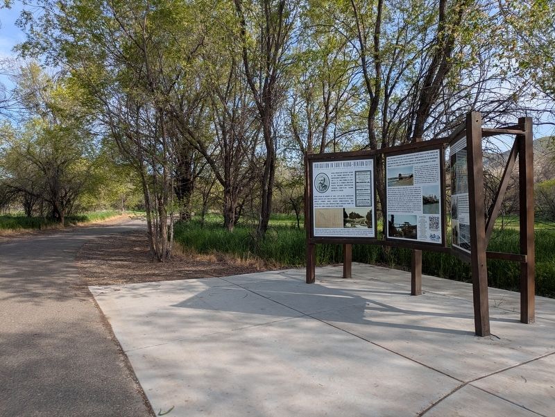
Near 14th Street 0.1 miles south of Chris Avenue, on the left when traveling north.
Kiona Irrigation District began as the Yakima Irrigating and Improvement Company (Y. I. & I.). The Y. I. & I. was formed in 1891 headed by a former Northern Pacific railroad construction engineer, soon-to-be Tacoma Mayor, H.S. Huson. Work began in . . . — — Map (db m297689) HM
Near State Highway 24 south of State Highway 243, on the right when traveling north.
National Historic Landmark
2008
National Park Service
United States
Department of the Interior
National Historic
Mechanical Engineering Landmark
Hanford B Reactor
Construction Begun: June 1943
Reactor Loaded: . . . — — Map (db m270292) HM
On Cemetery Road 1 mile west of Travis Road, on the left when traveling west.
The Horse Heaven Cemetery was established in 1893 by pioneers who settled the area. William Dennis donated the land for the cemetery, and he was the first to be buried here. The property was later deeded to Benton County, who owns the site today. . . . — — Map (db m299889) HM
Near North Gum Street (Washington Route 397) 0.2 miles north of East Columbia Drive, on the right when traveling north.
Originally dedicated the "Golden Rivet". It was the final link to the first transcontinental highway called the Yellowstone Trail.
National Register of Historic Places
National History Day of Washington
Historical Marker . . . — — Map (db m297290) HM
On Thomas S. ‘Tom’ Foley Memorial Highway (U.S. 395) at West Hildebrand Boulevard, on the right when traveling west on Thomas S. ‘Tom’ Foley Memorial Highway.
In memory of the 2,977 men and women who lost their lives on September 11th, 2001 External vertical support column salvaged from the World Trade Center — — Map (db m297375) HM WM
On North Clover Island Drive 0.5 miles north of West Columbia Drive, on the left when traveling east.
The image shown above depicts an early 1900’s photograph of Mabel and Dorothy Smith relaxing on the Columbia River. The photo inspired the adjacent bronze sculpture “Call of the River” as it seemed to epitomize the community’s relationship to the . . . — — Map (db m297288) HM
On Paul Parish Drive at North Edison Street, on the right when traveling east on Paul Parish Drive.
The first wagon road built by the federal government in old Oregon followed this shoreline. On Jan. 7, 1853 Congress passed "An Act for Construction of Military Roads in Oregon Terr." Jefferson Davis, Secretary of War, then issued instructions to . . . — — Map (db m297282) HM
On South Carmichael Drive at Vineyard Drive, in the median on South Carmichael Drive.
In honor of the first man from Kennewick to be killed in the Vietnam war, Corporal Gerald Carmichael, USMC. The Kennewick native was a student at Kennewick High before he joined the United States Marine Corps in February 1965. He went to Vietnam in . . . — — Map (db m298149) HM WM
On Thomas S. ‘Tom’ Foley Memorial Highway (U.S. 395) at West Hildebrand Boulevard, on the right when traveling south on Thomas S. ‘Tom’ Foley Memorial Highway.
On September 11, 2001, 2,606 people lost their lives at the World Trade Center. Hundreds were killed instantly by the impacts, while the rest were trapped and died when the towers collapsed. Of the people who were at or above the floors of . . . — — Map (db m297631) HM WM
On West Keewaydin Drive 0.1 miles South Auburn Street, on the left when traveling west.
These ancient Indian petroglyphs were recovered from Blalock Island near Paterson and encased in stone pillars by representatives of the Kiwanis Club of Kennewick. They were dedicated at the west end of Keewaydin Park September 1, 1939. These . . . — — Map (db m297442) HM
On West Keewaydin Drive 0.1 miles west of South Auburn Street, on the left when traveling west.
This is a piece of railing from the old Green Bridge that used to span the Columbia River between Pasco and Kennewick. The bridge was demolished in 1990 after the Cable Bridge was built to replace it. The 3,300 foot Green Bridge was dedicated in . . . — — Map (db m297438) HM
Near South Olympia Street at W 14th Ave, on the right when traveling south.
All Gave Some - Some Gave All
In honor of those who served in the wars of Iraq and Afghanistan, the veterans of Foreign Wars Post 5785 would like to thank you and offer this memorial as a tribute to your service in providing peace and security . . . — — Map (db m297381) WM
On West Keewaydin Drive 0.1 miles west of South Auburn Street, on the left when traveling west.
In 1996, while watching the “Water Follies”, two students discovered a skeleton on the Columbia River bank.
It appeared to be one of the oldest skeletons ever found in the Americas.
Through carbon dating the human remains were identified as a . . . — — Map (db m297441) HM
Near West 10th Avenue at South Union Street, on the left when traveling west.
Dedicated to those
men and women
who served
our country
in times of
peace and war
and especially
to those who
gave their lives
in that service
Plaque A nation that honors its veterans is a nation dedicated to the preservation . . . — — Map (db m297379) WM
On South Union Street 0.1 miles north of West 24th Avenue, on the left when traveling north.
Flag & Pole Dedicated to
U.S. Military Personnel
Past & Present Memorial Day, 29 May 2006 "Old Glory" provides a majestic yet solemn reminder
to Americans of the great price of freedom.
Today She proudly waves shadowing but . . . — — Map (db m297378) WM
On Paul Parish Drive at Columbia River Way, on the left when traveling east on Paul Parish Drive.
Central Plaque
★ In honor of those who served to forge the heritage of the United States Armed Forces.
★ In tribute to those who perished to provide peace and security for our nation.
★ In gratitude to those now . . . — — Map (db m297283) WM
On Columbia Park Trail 0.1 miles east of Route 240, on the right when traveling east.
In memory of all veterans of the United States of America especially those veterans who paid the supreme sacrifice for the freedom that you all enjoy — — Map (db m297285) WM
Near North Clover Island Drive 0.4 miles north of West Columbia Drive, on the right when traveling east.
Port of Kennewick has long been a champion for engaging with the Columbia River for commerce and recreation.
Founded in 1915, Port of Kennewick was the fifth public port district established in Washington State and the very first in eastern . . . — — Map (db m297287) HM
On North Gum Street (Washington Route 397) 0.2 miles north of East Columbia Drive.
Remember With Pride
Batty, Denny A. SP4 AR 12-12-67
• Black, Mark S. PFC MC 3-30-66
• Brooks, Guy F. SP4 AR 2-2-68
• Brown, Richard L. AMH3 NA 8-13-69
• Bruce, David H. LCPL MC 12-21-69
• Cain, Rodger K. SP4 AR 11-21-67
• Carmichael, . . . — — Map (db m297289) WM
This marker commemorates the
men and women who achieved
American independence.
These Patriots, believing in the
noble cause of liberty, fought
valiantly to found a new nation.
1775-1783
In honor of the 250th anniversary of the United . . . — — Map (db m291747) WM
On West Kennewick Avenue at South Auburn Street, on the left when traveling west on West Kennewick Avenue.
P.J. Murphy Building (Roxy Theatre)
101 W. Kennewick Avenue
The first theatre building in Kennewick was The Liberty Theatre, constructed in 1920 for P.J. Murphy. The Liberty became The Roxy in 1939 when the theatre changed hands. It . . . — — Map (db m297445) HM
On West Kennewick Avenue at South Dayton Street, on the left when traveling west on West Kennewick Avenue.
The First Methodist Church, led by Rev. E. H. Rubicam and five members, was established in Kennewick in 1902 on land donated by Howard Amon. A wood frame church that was constructed on the corner of Kennewick Avenue and Dayton Street in 1906. When . . . — — Map (db m297450) HM
On North Auburn Street at West Canal Drive, on the left when traveling north on North Auburn Street.
In the lore of Kennewick history, the Halloween 1906 shootout, that left four dead, remains a great mystery. The events that led up to the shootout began the night before Halloween, when two Kennewick stores were burglarized.
Town Marshal . . . — — Map (db m297449) HM
On McNary Road 1.8 miles east of Interstate I-82 when traveling east.
During the construction of McNary Dam a total of 3,271 of these 12-ton tetrahedrons were dropped into the Columbia River to complete the closure of the last cofferdam and divert the full flow of the river through the spillway. This method of closure . . . — — Map (db m299769) HM
Near Plymouth Park Road near Christy Road. Reported unreadable.
"I gave my hand to them all and made signs of my friendly disposition"
On October 19, 1805, William Clark and three men traveling ahead of the rest of the party arrived at a Umatilla village near here. Upon seeing Clark, the villagers . . . — — Map (db m158634) HM
On Dudley Avenue east of Market Street, on the right when traveling east.
Under the provisions of the National Historic Preservation Act of 1966, this property possesses exceptional value in illustrating American History and Culture Entered in the National Register of Historic Places December 12, 1976 by U.S. Department . . . — — Map (db m129388) HM
On 6th Street at Dudley Ave, on the left when traveling east on 6th Street.
Harvey R. Fox moved to Prosser in 1903. He established his first blacksmith shop on Stacey Street around 1905. October 27, 1925, Mr. Fox purchased this site from Willis Mercer and William Rothrock. In 1926 the original building, 30' X 50' with . . . — — Map (db m299901) HM
On Meade Avenue 0.1 miles north of 6th Street, on the left when traveling north.
B.J. Pacius established the Princess Theatre in 1919, renting various downtown spaces before Pearl Bros. Construction built Pacius a permanent Spanish Mission style facility on Meade Avenue. The Princess Theatre opened May 7, 1920, hosting silent . . . — — Map (db m299898) HM
On 7th Street at Sheridan Avenue, on the left when traveling north on 7th Street.
Construction of St. Matthew's Episcopal Church began in 1903 and its dedication took place in 1907. Church members spent four years raising the money necessary to build this church and history relates that the St. Matthew's priest spent the week . . . — — Map (db m302232) HM
On Grant Avenue at 10th Street, on the left when traveling north on Grant Avenue.
Standing at this site in 1886 one would have seen Colonel William Farrand Prosser negotiating with the chief of the Yakima Indian tribe camped along the Yakima River for Lewis Heinzerling to build his dream mill when this was still Washington . . . — — Map (db m299903) HM
On Meade Avenue south of 6th Street, on the right when traveling north.
Founded by Mr. Fred Long in 1901 as the Kash Savin Stor. Moved in 1909 to this Sixth and Meade building constructed in 1904 by E.W.R. Taylor. Renamed The Golden Rule Store between 1910 and 1912.
Mr. T. B. Sampson was employed by the Kash Savin . . . — — Map (db m129390) HM
Near Crimson Way 0.2 miles south of University Drive, on the left when traveling south.
Black pioneer George Bush (c. 1790 – 1863) helped establish one of the first non-indigenous American settlements in Washington. George, his wife Isabella and others traveled the Oregon Trail to escape discrimination in Missouri, only to arrive in . . . — — Map (db m297651) HM
Near Columbia Park Trail 0.5 miles east of Columbia Center Boulevard, on the right when traveling east.
During and following World War II sleek silver trailers offered a mere 147 sq. feet of living space to accommodate an average of 3.7 people. The trailers were designed as travel trailers, but because of a severe housing shortage, many people . . . — — Map (db m297279) HM
On Symons Street at Goethals Drive, on the right when traveling west on Symons Street.
Graduate of West Point Military Academy 1870. As a 1st Lt., he surveyed the Columbia River from Fort Spokane to the mouth of the Snake River, in 1881. As a Capt. and Co-chief engineer of the Portland District, in 1890, he directed the Survey of the . . . — — Map (db m300132) HM
On Harris Avenue 0.2 miles Newcomer Street, on the right when traveling north.
The rich history of this home begins with Edith Nelson, a nurse who cared for a wealthy infirmed gentleman in Chicago. Out of generosity, in 1910, he bought a 40-acre tract of land along the Columbia River for her parents, Mr. and Mrs. Neil Nelson. . . . — — Map (db m297650) HM
Near Columbia Park Trail 0.5 miles east of Columbia Center Boulevard, on the right when traveling east.
The Hanford Irrigation Canal referred to as the “Low Line Ditch” and also the “D Canal” received its water from the Coyote Rapids Pump Station at Coyote Rapids. Irrigation water was delivered from the main canal through several laterals supplying . . . — — Map (db m297278) HM
On Lee Boulevard at Amon Park Drive, on the right when traveling east on Lee Boulevard.
This is a replica of the original gateway to Amon Park, located approximately 25 ft southwest of this location from 1911 until demolition by the Manhattan Project in 1943. The new arch was constructed by the Richland Centennial Committee as part of . . . — — Map (db m297646) HM
On Lee Boulevard 0.2 miles east of George Washington Way when traveling east.
Howard S. Amon was born in Athena, Oregon, on August 18, 1877. In 1905, Howard and his father formed the Benton Water Company, as well as purchased land in the lower Yakima Valley including the Rosencrance property in Richland. The Amon family . . . — — Map (db m297633) HM
Near Stevens Drive 0.3 miles north of Swift Boulevard, on the right when traveling north.
This Sanctuary has been placed on the Washington Heritage Register by the Governor’s Council on Historic Preservation as of February 5, 2016. Built in 1964, the Sanctuary is tied directly to the “Manhattan Project” with the establishment of the . . . — — Map (db m297647) HM
On Bradley Boulevard 0.3 miles north of Columbia Point Drive when traveling west.
The Corps of Discovery and area tribes often had to make a series of translations to communicate. In an April 1806 visit that process included English, French, Mandan/Hidatsa, Shoshoni and Walla Walla.
"we found a Shoshone . . . — — Map (db m298307) HM
On Lee Boulevard 0.2 miles east of George Washington Way when traveling east.
Within a few years of the Corps of Discovery passage through the Columbia Basin, trappers and traders from the Northwest Company entered the area. A fort was established in Wallula in 1818, and men came to the Richland area to harvest grass . . . — — Map (db m297636) HM
On Lee Boulevard 0.2 miles east of George Washington Way when traveling east.
The Columbia River system drains 259,000 square miles of the northwest United States and Canada and carries an average of 190,000 cubic feet of water per second along its path from the Rocky Mountains in Canada and the United States to the Pacific . . . — — Map (db m297639) HM
On Port of Benton Boulevard at 11th Street, on the left when traveling north on Port of Benton Boulevard.
The historic event depicted in this bas-relief sculpture is of Enrico Fermi, Leo Szilard, Arthur Compton, and Eugene Wigner producing the first self-sustaining nuclear fission chain-reaction in Chicago Pile Number 1 on December 2, 1942. The . . . — — Map (db m298573) HM
Near Port of Benton Boulevard at Richardson Road, on the right when traveling north.
Commissioned: November 10, 1959 Decommissioned: May 3, 1969 USS Triton Sail Park Dedication: November 10, 2011 Port of Benton worked with the U.S. Navy to preserve the sail and conning tower. Operation Sandblast: February 24-April . . . — — Map (db m297652) HM
Near Bypass Highway (Washington Route 240) at Swift Boulevard, on the left when traveling north.
Vietnam In honor of those from our area who gave their lives for their country Mark Black • Guy F. Brooks • Richard Lee Brown • Davice R. Bruce • Gerald Carmichael • Gary Wayne Cockley • William H. Cook • Robert J. Cope • Duane Cottingham • . . . — — Map (db m297688) WM
On West Van Giesen Street (Washington Route 224) 0.1 miles east of South 35th Avenue, on the right when traveling east.
The mouth of the Yakima River, known in the native language as Táptat, has been an abundant natural resource for thousands of years, providing food, water and shelter for people and animals. Bountiful populations of salmon once sustained the . . . — — Map (db m297685) HM
Near Washington Route 225 1 mile west of Route 240, on the left when traveling south.
The Longmire Wagon Train
In 1853, Congress authorized the survey and construction of a road from the Snake and Walla Walla Rivers through the Cascade Mountains. Secretary of War Jefferson Davis ordered Captain George McClellan to construct . . . — — Map (db m297221) HM
Near West Van Giesen Street (Washington Route 224) at Bombing Range Road, on the left when traveling west.
Remember With Pride
Batty, Denny A. Sp4 Ar 12-12-67 •
Black, Mark S. Pfc Mc 3-30-66 •
Brooks, Guy F. Sp4 Ar 2-2-68 •
Brown, Richard L. Ams Ar 8-13-69 •
Bruce, David R. Lcpl Mc 12-24-69 •
Cain, Rodger K. Sp4 Ar 11-21-67 • . . . — — Map (db m297684) WM
Near Crow Butte State Park Road 2 miles south of Route 14, on the right when traveling west.
Crow Butte is considered by tribal people to be a traditional cultural property due to its use as a winter village, a fishing area, and a place of other traditional practices from pre-contact to contemporary times. Mostly Umatilla people populated . . . — — Map (db m299896) HM
Near Crow Butte State Park Road 2 miles south of Route 14, on the right when traveling west.
During the last Ice Age, rushing floodwaters traveled southwest across the Columbia Basin, scouring the bedrock. They converged into the Columbia River Gorge and eventually emptied into the Pacific. As the Missoula Floods passed through the area of . . . — — Map (db m299891) HM
On Crow Butte State Park Road 2 miles south of Route 14, on the right when traveling west.
With the arrival of the Lewis and Clark expedition in 1805, the Columbia River Plateau became a region of national importance. In the vicinity of Crow Butte, the expedition encountered and documented densely populated winter villages along both . . . — — Map (db m299894) HM
On Crow Butte State Park Road near Lewis & Clark Highway ( Route 14).
"a moonax which the nativs had petted"
When the explorers of the Lewis and Clark Expedition passed through this area in April 1806, they observed many animals. They noticed birds such as ducks, curlews, and killdeer and reptiles such as . . . — — Map (db m310701) HM
On Crow Butte State Park Road near Lewis & Clark Highway ( Highway 14).
"my legs and feet give me much pain"
On the return trip through this area in late April 1806, Lewis and Clark traded some of their party's canoes for horses. Some of the explores rode on horseback, but most trudged through the sandy, rock . . . — — Map (db m310704) HM
Near Douglas Munro Boulevard, on the right when traveling west.
Signalman First Class
Douglas A. Munro
U.S. Coast Guard
Cle Elum, Washington
On September 22, 1942 Coast Guard Signalman First Class Douglas A. Munro was in charge of Landing Craft evacuating 500 besieged Marines from the beaches of . . . — — Map (db m62785) WM
On East 1st Street at N Wright Ave, on the left when traveling east on East 1st Street.
Replacing the building destroyed in the 1918 fire, this sturdy brick box housed switchboards, operators, and maintenance crews until 1966. Cle Elum was a link on the "Old Transcontinental Lead" that connected Western Washington with the rest of the . . . — — Map (db m303155) HM
On Canyon Road (Washington Route 821) 12.2 miles south of Thrall Road, on the right when traveling south.
Fiery Floods
Twenty-five million years ago, this area was a land of meandering streams and lush, rolling hills. Then came the first lave flow. Long cracks or vents opened in the earth and lava flooded the land spreading like water. . . . — — Map (db m38486)
On South Canyon Road (Washington Route 821) 0.1 miles south of Thrall Road ( Route 821), on the left when traveling south.
For thousands of years, Native Americans and, later, wagons traveled from Yakima to Ellensburg using the Shushuskin Trail, over Ellensburg Pass. This was a rough, bumpy, winding trail that begged for an alternative by the mid-1910s, when automobiles . . . — — Map (db m306726) HM
Near Interstate 90 at milepost 126, 10.4 miles east of Main Street when traveling east.
Imagine standing here millions of years ago on the edge of a huge plain fringed by distant mountains. Cypress trees grow in the swamps. Maple, sycamore, ginkgo, sequoia, and fir cover the nearby hills and mountains. Ancestors of rhinoceroses and . . . — — Map (db m38446)
Built of cotton wood logs
from Yakima River Canyon
by
1843 Samuel Bedient Olmstead 1881
Union Soldier 1865
Descendant of Captain Richard Olmstead
Hartford Connecticut 1632
Cabin used as a fort during
the Nez Pierce Indian War . . . — — Map (db m235212) HM
Near Interstate 90 at milepost 126, 10.8 miles west of Vantage Highway/Main Street when traveling west.
It’s hard to imagine, but you are about to enter a fertile valley. Named for the Indians who lived here from time immemorial, the Kittitas Valley was the destination of many American settlers who came to the Washington Territory in the 1860s. Rich, . . . — — Map (db m113496) HM
On West Pennsylvania Avenue 0.1 miles west of North 1st Street ( Road 903), on the right when traveling west.
In 1886, Northern Pacific Railroad mining engineers located large seams of coal and the town of Roslyn was founded.
Coal mining, though dirty and dangerous work, attracted large numbers of immigrants to Roslyn – Serbians, Croatians, . . . — — Map (db m38422) HM
On Thorp Highway North 0.2 miles south of E Taneum Road, on the left when traveling south.
Irrigating the prairie
The Thorp and Splawn families settled on Taneum Creek, three miles northwest of Thorp, intending to raise cattle and farm the area’s rich soils.
The open, native bunchgrass prairie was too dry for farming. So, the . . . — — Map (db m301404) HM
On Thorp Highway North 0.2 miles north of Main Street, on the right when traveling north.
Built in 1883 by Oren Hutchinson and Gustave Huhn,
the mill ran continuously until 1946. Original mill
machinery hauled from the Dalles, Oregon by team
and wagon, water powered by turbine wheel. Flour
from this mill shipped to Pacific Rim . . . — — Map (db m301392) HM
Near Ginkgo Avenue 0.5 miles north of Vantage Highway.
The basalt you see in the dry distant hills and the rock under your feet holds a tale of dramatic change. The landscape tells a story of ancient floods, rivers of lava, and the impact of humans along the Columbia River. If you look carefully and . . . — — Map (db m82828)
Near Ginkgo Avenue 0.5 miles north of Vantage Highway.
Millions of years ago, some of the largest lava flows on earth poured over this area again and again. Enormous floods of molten lava flowed out from long, parallel vents, burying the area in more than 5,000 feet of basalt.
In all, more than 300 . . . — — Map (db m82825)
Near Ginkgo Avenue 0.5 miles north of Vantage Highway.
When Ice Age floodwaters rushed across Quincy Basin and down the Columbia River, they gouged chunks of basalt from the scabland cliffs in front of you. During the last Ice Age, this area was repeatedly swept by floodwaters that tore away layer after . . . — — Map (db m82829)
Near Ginkgo Avenue 0.5 miles north of Vantage Highway.
Raging Ice Age floodwaters carved spectacular features throughout eastern Washington, creating unique landscapes. Follow the path of the floods and discover more about this amazing story.
Under Water
During the largest floods, water . . . — — Map (db m82827)
Near Ginkgo Avenue 0.5 miles north of Vantage Highway.
After racing across eastern Washington, floodwaters converged on Wallula Gap, a single narrow outlet about 80 miles to the southeast. This natural constriction forced floodwaters to back up, creating a huge, temporary lake called Lake Lewis. Here at . . . — — Map (db m82830)
You are standing in the pathway of some of the largest floods ever known. They carved steep-walled canyons, sculpted immense waterfalls, and left behind landscapes found nowhere else on earth.
Massive Glacial Dams and Lakes
During the . . . — — Map (db m82826)
Near Ginkgo Avenue 0.5 miles north of Vantage Highway.
This landscape was built by ancient lava flows and sculpted by powerful Ice Age floods. Clues to this fascinating past are all around you.
Remains of a Fossil Forest
The park contains hundreds of pieces of petrified wood that were . . . — — Map (db m82824) HM
On Horsethief Lake State Park Road near Lewis and Clark Highway ( Route 14).
"large and comodious"
The explorers of the Lewis and Clark Expedition meet the people of Nix luv dix on October 24, 1805. Clark wrote, "The nativs of this village reived me verry kindly, one of whom envited me into his house, which . . . — — Map (db m310528) HM
Near Columbia Hills Historical State Park Road near Lewis and Clark Highway ( Route 14) when traveling south.
Trading as a Way of Life
Since time immemorial, American Indians have lived nearby, nest to the life-giving river. They have thrived on the abundant fisheries, the rich resources of the uplands, and an extensive trade network. Captain . . . — — Map (db m158325) HM
On Lewis and Clark Highway (Washington Route 14) near Columbia Hills State Park Road, on the right when traveling east.
Centuries before North America was colonized. Indian societies flourished on Columbia River shores. Annual return of the salmon provided nutrient-rich food, a valued commodity for bater, and spiritual renewal.
Men fish and hunt while women gather . . . — — Map (db m158630) HM
On Columbia Hills Historical State Park Road near Lewis and Clark Highway ( Route 14), on the left when traveling south.
Geologists say between 13,000 and 15,000 years ago a series of huge catastrophic floods scoured this landscape. Surging water and large pieces of ice ripped rock, sediment, and soil from everything that surrounds you. Horsethief Butte withstood the . . . — — Map (db m158359) HM
On Horsethief Lake State Park Road near Lewis and Clark Highway ( Route 14).
Welcome ...
to the homelands of the American Indian tribes of the Columbia River. Lewis and Clark encountered native people every day while traveling through this region. As you travel the Lewis and Clark Trail and across tidal homelands, . . . — — Map (db m310536) HM
On Horsethief Lake State Park Road. near Lewis and Clark Highway.
William Clark ---- Meriwether Lewis
" my friend ... If therefore there is anything...in this enterprise which would induce you to participate with me in it's fatigues, it's dangers and it's honors, believe me there is no man on . . . — — Map (db m310535) HM
Near Columbia Hills Historical State Park Road near Lewis and Clark Highway when traveling south.
"determined to attempt the Chanel"
If you stood here before the river was flooded by the Dalles Dam, you would be looking at the upper end of the Long Narrows. That farro stretch of the Columbia River posed a formidable challenge to the . . . — — Map (db m158323) HM
On Horsethief Lake State Park Road near Lewis and Clark Highway ( Route 14).
"great joy ... arrival of the salmon"
The main village of the Wishram people was located here. The tribe called their home Nix lit dix, "the trading place". The Lewis and Clark Expedition camped here on its way to the Pacific Ocean . . . — — Map (db m310532) HM
On Washington Route 14 at U.S. 197 on Washington Route 14.
"ill Suckcess in precureing horses"
The Lewis and Clark Expedition prepared to depart the river in this area while eastbound in April 1806. The explorers wanted to obtain horses and proceed overland to the Nez Perce villages. To acquire . . . — — Map (db m158360) HM
Near Columbia Hills Historical State Park Road north of Lewis and Clark Highway ( Route 14) when traveling south.
A Great Place to Live
Floods of lava and water formed the unique landscape of the Columbia River Gorge. Nearby, rock formations and sandy soils created a perfect site for a village. In the low land beyond this small plateau, . . . — — Map (db m158326) HM
Near Columbia Hills Historical State Park Road near Lewis and Clark Highway ( Route 14) when traveling south.
"Swelling, boiling & whorling in every direction"
The Lewis and Clark Expedition arrived here after shooting the rapids of the "Short Narrows." In that narrow section of the Columbia, the water squeezed through a channel of basalt . . . — — Map (db m158329) HM
Near Maryhill Museum Drive near Lewis and Clark Highway ( Route 14).
Two panels are found on this marker: Panel 1:
" I have scarcely experienced a day since our arrival without some novel occurrence or uncommon object." Meriwether Lewis
President Thomas Jefferson sent the Lewis . . . — — Map (db m310577) HM
On Stonehenge Drive 0.7 miles south of Lewis and Clark Highway ( Route 14), on the right when traveling south.
In 1908 Samuel Hill (1857-1931) bought 7,000 acres on these slopes. He planned a Quaker farming colony, surveyed a 34-block tounsite and built a church, hotel, store, offices, garage and shops. His engineers built ten miles of experimental roads; as . . . — — Map (db m301954) HM
Near Stonehenge Drive 0.8 miles south of Lewis and Clark Highway ( Route 14), on the right when traveling south.
The structure before you is the first monument in our nation to military personnel who gave their lives in World War I. Memorializing 13 young Klickitat County men, it also serves as lasting reminder of the works of Samuel Hill, patron of this . . . — — Map (db m256891) HM WM
On Indian Creek Road at State Highway 141, on the right when traveling west on Indian Creek Road.
This trail connects the Sandborn Road to the town of Husum. Originally named as the Weldon-Hyndman Road by the petitioners and builders, Elwin Weldon and Henry Hyndman. Prior to construction of this wagon road, the people of the Sandborn area used . . . — — Map (db m129500) HM
On Lewis and Clark Highway (Washington Route 14 at milepost 79), on the right when traveling east.
"hospitable and good humoered"
Friendly encounters between the Lewis and Clark Expedition and local tribes were frequent along this stretch of the Columbia River. On October 29, 1805, after stopping at small village near here, William . . . — — Map (db m310018) HM
Near Lewis and Clark Highway (Washington Route 14) near Old Highway 8, on the right when traveling east.
Geologist say that about fifteen million years ago, molten stone poured from cracks in the earth near the eastern border of today's Washington and Oregon. Layers of flowing lava spread west, coating 65,000 square miles with andesite and basalt up to . . . — — Map (db m158322) HM
On Lewis and Clark Highway (Washington Route 14) near Avery Road, on the right when traveling east.
Three Views of the River
When the Lewis and Clark expedition passed through the Short and Long Narrows of the Columbia in the early 1800s, the river looked dramatically different than it does today. The water was squeezed into narrow . . . — — Map (db m158633) HM
On Lewis and Clark Highway (Washington Route 14) near Avery Road, on the right when traveling east.
The Columbia River Gorge is a natural passage-way between rural inland farms and western shipping docks.
Transporting crops was difficult for early homesteaders who relied on wagons and steamboats. Water still provides a route, but modern barges, . . . — — Map (db m158631) HM
Near Lewis and Clark Highway (Washington Route 14) near Old Highway 8, on the right when traveling east.
Gray clouds, heavy with moisture from an absorbent journey across the ocean, drizzle inland from west to east. Bumping into the Cascade Mountains, the rise, cool, and drop a final deluge that soaks the fir forests on the west facing slopes. . . . — — Map (db m158320) HM
On Maryhill Museum Drove near Lewis and Clark Highway ( Highway 14).
Two panels are found on this marker: Panel 1:
"Perhaps the most desolate place in Oregon is Biggs ... great quantities of wheat were hauled down to Biggs for shipment." John Cradlebaugh, September 23, 1909
Often . . . — — Map (db m310584) HM
Near Maryhill Museum Drive near Lewis and Clark Highway ( Route 14).
Three panels make up this marker:
Panel 1:
In 1803, U.S. President Thomas Jefferson sent the Lewis and Clark expedition across a continent uncharted by Europeans or Americans. The adventure culminated in a journey down . . . — — Map (db m310541) HM
Near Maryhill Museum Drive near Lewis and Clark Highway ( Route 14).
"A legacy beyond its beautiful surroundings,"
The Oregonian, December 19, 1996
The historic Loops Road, located on Maryhill's ranch lands, was completed by Maryhill Museum founder Sam Hill in 1913. Today the remaining 3.6 mile . . . — — Map (db m310588) HM
Near Roosevelt Ferry Road near Lewis and Clark Highway ( Highway 14).
This boulder is and Erratic which was Ice-Rafted to this vicinity by waters of the last "Spokane Flood" approximately 19,000 years ago.
Other Erratics are found in the hills to the north which indicates flood depths of over 800 feet at this . . . — — Map (db m310610) HM
On Northeast Pioneer Place at Northeast Tohomish Street, on the left when traveling north on Northeast Pioneer Place.
1882 • Earliest burial.
1897 • A.H. and Jennie Jewett deed the property to the Board of School Directors of District #19.
1914 • Property deeded to City of White Salmon.
1922 • Last burial.
1955 • Property converted . . . — — Map (db m285044) HM
131 entries matched your criteria. The first 100 are listed above. The final 31 ⊳