87 entries match your criteria.
Wabash & Erie Canal Historical Markers
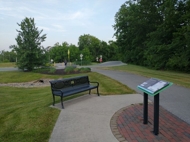
By Tom Bosse, June 2, 2023
The Towpath Trail History Marker
1 ► Indiana, Allen County, Fort Wayne — The Towpath Trail History — A portage, a canal and a railroad —  |
| On Towpath / Eagle Marsh Trail, on the right when traveling north. | |||
| 2 ► Indiana, Allen County, Fort Wayne — The Wabash And Erie Canal — |
| On S. Barr Street, on the left when traveling south. | |||
| 3 ► Indiana, Allen County, Fort Wayne, Nebraska — 02.1992.2 — Wabash and Erie Canal Groundbreaking — |
| On West Main Street at Growth Avenue, on the right when traveling west on West Main Street. | |||
| 4 ► Indiana, Allen County, Fort Wayne, Spy Run — The Wabash & Erie Canal — |
| Near S Clinton Street. | |||
| 5 ► Indiana, Allen County, Fort Wayne, West Central — Columbia Street — |
| On W. Columbia Street, on the left when traveling west. | |||
| 6 ► Indiana, Allen County, Fort Wayne, West Central — Old Aqueduct Club Memorial — |
| On West Main Street at Rockhill Street, on the left when traveling west on West Main Street. | |||
| 7 ► Indiana, Allen County, New Haven — 02.2003.1 — Gronauer Lock No. 2 — |
| On U.S. 24 at Harper Road, on the right when traveling east on U.S. 24. | |||
| 8 ► Indiana, Allen County, New Haven — The Wabash & Erie Canal — |
| On Broadway Street, on the right when traveling north. | |||
| 9 ► Indiana, Carroll County, Burnettsville — Burnett's Creek Arch — |
| On West Towpath Road west of Road N 200 W, on the right when traveling west. | |||
| 10 ► Indiana, Carroll County, Delphi — "Pull Me" Boat — Wabash & Erie Canal Park Village — |
| Near West North Washington Street at North Charles Street, on the right when traveling east. | |||
| 11 ► Indiana, Carroll County, Delphi — An Herb Garden — Fine Flavor for Food & Medicine for the Sick — Wabash & Erie Canal Park Village — |
| Near West North Washington Street at North Charles Street, on the right when traveling east. | |||
| 12 ► Indiana, Carroll County, Delphi — Bicentennial Garden — Wabash and Erie Canal Park Trail — Wabash & Erie Canal Park Village — |
| Near West North Washington Street just east of Charles Street, on the right when traveling east. | |||
| 13 ► Indiana, Carroll County, Delphi — Blacksmithing — Shaping Iron for Fittings to Run the Canal — Wabash & Erie Canal Park Village — |
| Near West North Washington Street at North Charles Street, on the right when traveling east. | |||
| 14 ► Indiana, Carroll County, Delphi — Broom Maker — Crafting Beautiful Objects from Broomcorn — Wabash & Erie Canal Park Village — |
| Near West North Washington Street at North Charles Street, on the right when traveling east. | |||
| 15 ► Indiana, Carroll County, Delphi — Cabin Homestead 1830s — A Source of shelter, food & economy — Wabash & Erie Canal Park Village — |
| On West North Washington Street at North Charles Street, on the right when traveling east on West North Washington Street. | |||
| 16 ► Indiana, Carroll County, Delphi — Canal Boats — Life On the Wabash & Erie Canal — Wabash & Erie Canal Park Village — |
| Near West North Washington Street just east of Charles Street, on the right when traveling east. | |||
| 17 ► Indiana, Carroll County, Delphi — Canal Bridges — Crossing the Canal in Carroll County, Indiana — Wabash & Erie Canal Park Village — |
| Near West North Washington Street at North Charles Street, on the right when traveling east. | |||
| 18 ► Indiana, Carroll County, Delphi — Canal Power — Animal: The Engine of the Canal and the Farm — Wabash & Erie Canal Park Village — |
| Near West North Washington Street at North Charles Street, on the right when traveling east. | |||
| 19 ► Indiana, Carroll County, Delphi — Canal Village — Life On the Wabash & Erie Canal — Wabash & Erie Canal Park Village — |
| Near West North Washington Street just east of North Charles Street, on the right when traveling east. | |||
| 20 ► Indiana, Carroll County, Delphi — Carrollton on the Wabash — |
| On County Road N 700 W north of County Road W 675 N, on the right when traveling north. | |||
| 21 ► Indiana, Carroll County, Delphi — Constructing the Wabash & Erie Canal — 468 Miles of Hard Labor — Wabash & Erie Canal Park Village — |
| Near West North Washington Street at North Charles Street, on the right when traveling east. | |||
| 22 ► Indiana, Carroll County, Delphi — Delphi — |
| On U.S. 421. | |||
| 23 ► Indiana, Carroll County, Delphi — Education Along The Canal — The One Room Log School House — Wabash & Erie Canal Park Village — |
| On W. North Washington Street, on the right when traveling east. | |||
| 24 ► Indiana, Carroll County, Delphi — Fouts Kitchen And Medical Plants Garden — Wabash and Erie Canal Park Trail — Wabash & Erie Canal Park Village — |
| On West North Washington Street at North Charles Street, on the right when traveling east on West North Washington Street. | |||
| 25 ► Indiana, Carroll County, Delphi — Interpretive Center — A Unique Configuration of 1850's Facades — Wabash & Erie Canal Park Village — |
| Near West North Washington Street just east of Charles Street, on the right when traveling east. | |||
| 26 ► Indiana, Carroll County, Delphi — Irish Canal Workers Cabin — |
| Near West North Washington Street at North Charles Street, on the right when traveling east. | |||
| 27 ► Indiana, Carroll County, Delphi — Lewis Thomas Jones — (1806 - 1885) — Wabash & Erie Canal Park Village — |
| Near West North Washington Street at North Charles Street, on the right when traveling east. | |||
| 28 ► Indiana, Carroll County, Delphi — Little Church On The Canal — Delphi in 1889 — Wabash & Erie Canal Park Village — |
| Near West North Washington Street at North Charles Street, on the right when traveling east. | |||
| 29 ► Indiana, Carroll County, Delphi — Loom House Weaver — The Essential Craft of the Canal Era — Wabash & Erie Canal Park Village — |
| Near West North Washington Street at North Charles Street, on the right when traveling east. | |||
| 30 ► Indiana, Carroll County, Delphi — Mentzer Tavern — Grantham's Overlook — |
| On Road N 700 W north of Road W 675 N, on the right when traveling north. | |||
| 31 ► Indiana, Carroll County, Delphi — Mule Barn — |
| Near West North Washington Street at North Charles Street, on the right when traveling east. | |||
| 32 ► Indiana, Carroll County, Delphi — Native Plants of the Canal — Wabash and Erie Towpath Trail — Wabash & Erie Canal Park Village — |
| Near West North Washington Street just east of Charles Street, on the right when traveling east. | |||
| 33 ► Indiana, Carroll County, Delphi — Paper Mill Complex — Canal Water Powers Paper Production — |
| Near Bicycle Bridge Road 0.1 miles west of West Monroe Street (Route 16), on the left when traveling west. | |||
| 34 ► Indiana, Carroll County, Delphi — River Travel — Travel Before the Building of Canals — Wabash & Erie Canal Park Village — |
| Near West North Washington Street just east of North Charles Street, on the right when traveling east. | |||
| 35 ► Indiana, Carroll County, Delphi — The Carrollton Bridge — |
| On County Road N 700 W north of County Road W 675 N, on the right when traveling north. | |||
| 36 ► Indiana, Carroll County, Delphi — The Cooper — Making Barrles to Move Produce — Wabash & Erie Canal Park Village — |
| Near West North Washington Street at North Charles Street, on the right when traveling east. | |||
| 37 ► Indiana, Carroll County, Delphi — The Depot — Restored Depot located across from Canal Lock — Wabash & Erie Canal Park Village — |
| Near West North Washington Street at North Charles Street, on the right when traveling east. | |||
| 38 ► Indiana, Carroll County, Delphi — The Guard Lock — Protecting the Canal from Flood Waters — Wabash & Erie Canal Park Village — |
| Near West North Washington Street at North Charles Street, on the right when traveling east. | |||
| 39 ► Indiana, Carroll County, Delphi — The Itinerant Worker's Cabin — Wabash and Erie Canal Park Trail — Wabash & Erie Canal Park Village — |
| Near West North Washington Street at North Charles Street, on the right when traveling east. | |||
| 40 ► Indiana, Carroll County, Delphi — The Paper Maker's Shop — Wabash and Erie Canal Park Trail — Wabash & Erie Canal Park Village — |
| Near West North Washington Street at North Charles Street, on the right when traveling east. | |||
| 41 ► Indiana, Carroll County, Delphi — The Post Office At Sleeth — Wabash and Erie Canal Park Trail — Wabash & Erie Canal Park Village — |
| Near West North Washington Street at North Charles Street, on the right when traveling east. | |||
| 42 ► Indiana, Carroll County, Delphi — The Wabash & Erie Canal — Operating The Canal — |
| On Road N 700 W north of Road W 675 N, on the left when traveling north. | |||
| 43 ► Indiana, Carroll County, Delphi — Trails to History — Welcome to Delphi — |
| On Bicycle Bridge Road 0.1 miles west of West Monroe Street (Indiana Route 18), on the right when traveling east. | |||
| 44 ► Indiana, Carroll County, Delphi — Wabash & Erie Canal — Commerce & Culture — Wabash & Erie Canal Park Village — |
| Near West North Washington Street at North Charles Street, on the right when traveling east. | |||
| 45 ► Indiana, Carroll County, Delphi — Wabash & Erie Canal — Commerce & Culture — Wabash and Erie Canal Delphi, Indiana Celebrating the Past Building for the Future — |
| On Old Camden Road at East Main Street, on the right when traveling north on Old Camden Road. | |||
| 46 ► Indiana, Carroll County, Delphi — Wabash & Erie Canal — Commerce & Culture — Wabash and Erie Canal Delphi, Indiana Celebrating the Past Building for the Future — |
| On Hoosier Heartland Highway (Indiana Route 25) at East Main Street, on the right when traveling north on Hoosier Heartland Highway. | |||
| 47 ► Indiana, Carroll County, Delphi — Wabash And Erie Canal — |
| On Bicycle Bridge Road just west of West Monroe Street ( Route 18), on the left when traveling west. | |||
| 48 ► Indiana, Carroll County, Delphi — 08.1992.1 — Wabash and Erie Canal — |
| On West Franklin Street. | |||
| 49 ► Indiana, Carroll County, Delphi — Welcome To Canal Park — Celebrating the Past Building for the future — Wabash & Erie Canal Park Village — |
| Near West North Washington Street just east of North Charles Street, on the right when traveling east. | |||
| 50 ► Indiana, Carroll County, Delphi — Welcome To Delphi — Trails to History — Wabash & Erie Canal Park Village — |
| Near West North Washington Street at North Charles Street, on the right when traveling east. | |||
| 51 ► Indiana, Carroll County, Delphi — Welcome to Delphi — Trails to History — Wabash and Erie Canal Delphi, Indiana Celebrating the Past Building for the Future — |
| On Old Camden Road at East Main Street, on the right when traveling north on Old Camden Road. | |||
| 52 ► Indiana, Carroll County, Delphi, Adams Township — Lock No. 32 Mary K's Overlook — Wabash Driving Loop — Wabash and Erie Canal — |
| On Local Road N700W at West Towpath Road, on the right when traveling south on Local Road N700W. | |||
| 53 ► Indiana, Cass County, Logansport — 09.1966.1 — Wabash & Erie Canal — |
| On North 5th Street at North Street, on the left when traveling north on North 5th Street. | |||
| 54 ► Indiana, Daviess County, Elnora — 14.2007.1 — Wabash and Erie Canal — |
| On State Road 58 west of State Road 57, on the right when traveling east. | |||
| 55 ► Indiana, Fountain County, Attica — 23.2023.1 — 1846 Canal Skirmish — |
| On West Washington Street east of South Market Street, on the right when traveling west. | |||
| 56 ► Indiana, Fountain County, Attica — 23.1997.1 — Attica & Covington Canal Skirmish — |
| On West Washington Street, on the right when traveling west. | |||
| 57 ► Indiana, Fountain County, Covington — Wabash - Erie Canal — 1846 - 1875 — |
| On North Portland Arch Road west of County Road W400N, on the left when traveling west. | |||
| 58 ► Indiana, Franklin County, Metamora — Whitewater Canal State Historic Site — |
| On U.S. 52 1 mile east of McGuire Ridge Road, on the left when traveling west. | |||
| 59 ► Indiana, Gibson County, Francisco — Wabash & Erie Canal — |
| On County Road 550E at County Road 175S, on the left when traveling south on County Road 550E. | |||
| 60 ► Indiana, Huntington County, Huntington — Burk’s Lock — 1835-1873 — |
| On East Park Drive (U.S. 224) at Warren on East Park Drive. | |||
| 61 ► Indiana, Huntington County, Huntington — 35.1973.1 — Canal Landing on Washington Street / Jefferson Park Mall — |
| On North Jefferson Street at East Washington on North Jefferson Street. | |||
| 62 ► Indiana, Huntington County, Huntington — Rock House — |
| On East Park Drive (U.S. 224) at Warren on East Park Drive. | |||
| 63 ► Indiana, Huntington County, Huntington — The Wabash & Erie Canal — Archbishop Noll Trail — |
| On Old US Highway 24 at Noll Plaza, on the right when traveling east on Old US Highway 24. | |||
| 64 ► Indiana, Huntington County, Huntington — The Wabash & Erie Canal Fulfilled George Washington's Dream — |
| On Hoosier Heartland Highway. | |||
| 65 ► Indiana, Huntington County, Roanoke — 35.1997.1 — Wabash & Erie Canal Lock 4 — |
| On E. First St at US 24 on E. First St. | |||
| 66 ► Indiana, Marion County, Indianapolis, Downtown — Huntington County — Organized in 1834 — Named for Samuel Huntington — |
| Near North Blackford Street north of Indianapolis Cultural Trail, on the right when traveling north. | |||
| 67 ► Indiana, Marion County, Indianapolis, Downtown — Parke County — Organized in 1821 — Named for Benjamin Parke — |
| Near North Blackford Street north of Indianapolis Cultural Trail, on the right when traveling north. | |||
| 68 ► Indiana, Marion County, Indianapolis, Mile Square — 49.1992.5 — Site of the Central Canal — |
| Near N. West Street. | |||
| 69 ► Indiana, Parke County, Montezuma — 61.1966.1 — Wabash & Erie Canal — |
| On U.S. 36 near Water Street, on the right when traveling west. | |||
| 70 ► Indiana, Pike County, Oakland City — 26.1976.1 — Wabash and Erie Canal Completed 1853 — |
| On State Road 57 north of County Road 150N, on the left when traveling north. | |||
| 71 ► Indiana, Pike County, Petersburg — 63.1992.1 — Wabash and Erie Canal — |
| On Main Street west of South 2nd Street, on the right when traveling west. | |||
| 72 ► Indiana, Tippecanoe County, Lafayette — John Purdue Block — |
| On North 2nd Street south of Columbia Street, on the right when traveling south. | |||
| 73 ► Indiana, Tippecanoe County, Lafayette — To Commemorate The Wabash and Erie Canal — Which Operated 1841 - - 1872 — |
| On Main Street west of North 4th Street, on the left when traveling west. | |||
| 74 ► Indiana, Tippecanoe County, Westpoint — Granville — Wabash and Erie Canal Town — |
| On County Road S 700 W at County Road W 75 S, on the right when traveling north on County Road S 700 W. | |||
| 75 ► Indiana, Vanderburgh County, Evansville — The Short Lived Canal — |
| On NW 4th Street at Vine Street, on the right when traveling north on NW 4th Street. | |||
| 76 ► Indiana, Vanderburgh County, Evansville — 82.1947.1 — Wabash and Erie Canal — |
| On NW 5th Street at Vine Street, on the left when traveling north on NW 5th Street. | |||
| 77 ► Indiana, Vanderburgh County, Evansville, Downtown — 1800 to 1850 — Growing into a City — |
| On South 7th Avenue west of Ohio River Scenic Byway, on the right when traveling west. | |||
| 78 ► Indiana, Vigo County, Terre Haute — Wabash and Erie Canal — |
| On Chestnut Street at North 2nd Street, on the right when traveling west on Chestnut Street. | |||
| 79 ► Indiana, Wabash County, Lagro — Kerr Lock — |
| On Washington Street at Canal Street, on the right when traveling east on Washington Street. | |||
| 80 ► Ohio, Henry County, Liberty Center — 24 — Lock 43 — |
| On Old U.S. 24 0.6 miles Local Road 26, on the right when traveling east. | |||
| 81 ► Ohio, Henry County, Texas — James Durbin — |
| On U.S. 24 at County Route 4, on the left when traveling west on U.S. 24. | |||
| 82 ► Ohio, Lucas County, Grand Rapids, Providence Township — 31-48 — Miami & Erie Canal — Ohio Historical Marker — |
| Near River Road (U.S. 24). | |||
| 83 ► Ohio, Lucas County, Maumee — Side Cut Locks |
| Near West River Road 0.5 miles south of Ford Street. Reported permanently removed. | |||
| 84 ► Ohio, Lucas County, Toledo, Point Place — 26–48 — Canal Terminus / Manhattan — |
| On East Manhattan Boulevard at Summit Street, on the right when traveling west on East Manhattan Boulevard. | |||
| 85 ► Ohio, Lucas County, Toledo, Warren Sherman — 20-48 — Toledo’s Canals — Ohio Historical Marker — |
| On Michigan Street at Jackson Street, on the left when traveling south on Michigan Street. | |||
| 86 ► Ohio, Lucas County, Waterville — 40-48 — John Pray - Founder of Waterville,Ohio / The Miami and Erie Canal — |
| On North 4th Street at Farnsworth Road (Ohio Route 64), on the right when traveling north on North 4th Street. | |||
| 87 ► Ohio, Paulding County, Junction — 4-63 — Miami-Erie and Wabash-Erie Canals — Junction, Ohio — |
| On County Road 111 at County Road 163, on the left when traveling west on County Road 111. | |||