Stats
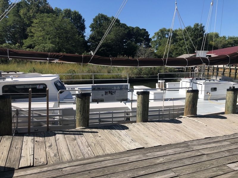
Like all Chesapeake skipjacks, the Dee of St. Mary's has a shallow draft to negotiate the waters along the shorelines and a wide bottom for stability. She is constructed mostly of white oak and spruce pine.
Rail skiffs were used almost exclusively for hunting rail birds in season in the early autumn. The marshes of the upper Patuxent River were once one of the most well known hunting grounds in the mid-Atlantic region. In use, a gunner stood in front, . . . — — Map (db m138595) HM
Founded by R.V. Truitt, 1925. Sponsored by Maryland Conservation Department since 1931, in cooperation with Carnegie Institution, Johns Hopkins and Maryland universities, Goucher, St. John's, Washington, and Western Maryland colleges "to afford a . . . — — Map (db m3456) HM
State of Maryland
Chesapeake Biological Laboratory
Established 1931
by the Conservation Department
for scientific research
in the marine life of Maryland
Albert C. Ritchie Governor •
R. V. Truitt . . . — — Map (db m287643) HM
This anchor has a deep connection to the Chesapeake Biological Laboratory and to the family of our founder, Dr. Reginald Truitt. The anchor was one of several belonging to generations of seafaring Truitts. Capt. Peter Truitt, Reginald Truitt's . . . — — Map (db m287645) HM
During the early colonial period, boatbuilders were in short supply. As most settlements were built along the Chesapeake's rivers and creeks, there was a great need for small boats of any kind. Colonists, using metal-edged tools, were able to refine . . . — — Map (db m138584) HM
Built in 1960 and re-dedicated in 1992 to honor pioneering entomologist Dr. Ernest Cory (1887-1979) who led the University of Maryland's Entomology Department for more than 40 years. CBL founder and first Director, Dr. R. V. Truitt, was a student . . . — — Map (db m287644) HM
Built in 1960 and re-dedicated in 1992 to honor pioneering entomologist Dr. Ernest Cory (1887-1979) who led the University of Maryland's Entomology Department for more than 40 years. CBL founder and first Director, Dr. R. V. Truitt, was a student . . . — — Map (db m287654) HM
In 1940, noted maritime historian Howard I. Chapelle documented a small flat-bottom, double-ended crab skiff at Deal Island, Maryland. This was one of the many varieties of Chesapeake crab skiffs noted by Chapelle in two articles written for . . . — — Map (db m138591) HM
This lighthouse, installed in 1883, originally stood 125 yards offshore at the entrance of the Patuxent River to the Chesapeake Bay. The foundation on which the cottage living quarters rest consist of seven wrought iron screw piles, hand bored into . . . — — Map (db m3457) HM
"The necessity of a light at this point is very great, as all vessels bound up or down the Chesapeake put in at this place during the winter to seek protection from floating ice; and as the entrance is formed by a low sand spit, . . . — — Map (db m60232) HM
British warships blockaded the mouth of the Patuxent River after the Chesapeake Flotilla and Royal Navy skirmished off Cedar Point to the south June 1, 1814. Drum Point to the north served as a major British anchorage. The British made mischief in . . . — — Map (db m81120) HM
Shamrock was built around 1908 near Poquoson, Virginia. She has the dimensions of a sailing "brogan," a predecessor to the larger bugeye, but was probably designed as a powerboat. By the time of her construction, few large log-hulled boats . . . — — Map (db m138587) HM
In recognition of the Founders of the
Calvert Marine Museum
Who shared the vision, dedication and commitment to mold their dream into reality.
Daniel Barrett Jr. • William L. Dovel • Alton S. Kersey • Joseph C. Lore Jr. • James LeRoy . . . — — Map (db m287734) HM
Named after the first governor of the state of Maryland, the bridge was opened December 17, 1977. It links Calvert County with St. Mary's County. The channel under the center span has a depth of 123'. The fixed bridge has a horizontal . . . — — Map (db m287630) HM
Penguin represents a once-numerous class of V-bottom boats known as Hooper Island launches, draketails, ducktails, or torpedo-sterns. Many were built on Hooper Island, Maryland, in the 1920s and 1930s; hence the name. The launches were . . . — — Map (db m138592) HM
Flat-bottom skiffs offer the advantage of simple design and low cost construction. This skiff was built around 1928 by Harry Humphreys of Rousby Hall, Maryland, a carpenter at M. M. Davis & Son shipyard, who intended it for local transportation and . . . — — Map (db m138568) HM
The Island Creek 18 was designed and built by boatbuilder George Surgent of St. Leonard, Maryland. The 18-foot centerboard sloop was based on the design of a traditional South Jersey beach skiff, but with a fiberglass hull with wooden mast, boom, . . . — — Map (db m287673) HM
Joseph C. Lore, Sr., began shipping seafood from Solomons Island in 1888 and established a packing house at this site in 1912. Three generations of Lore family packed and shipped Patuxent River oysters, crabs and fish until 1978. Present building . . . — — Map (db m3459) HM
Geda is a scaled-down version of a wide V-bottom boat once commonly found in the area of Tangier Sound. The boat was built by Leon Marsh of Rodes Point, Smith Island, Maryland, around 1955, but has its origins in earlier sailing crab scrapes. . . . — — Map (db m138576) HM
A jolly boat is a general purpose ship's boat usually carried about deck or on stern davits. This example was formerly carried by the 75-foot gasoline launch Chicago, built in 1916 by the St. Louis Boat Co. of Milwaukee, Wisconsin. . . . — — Map (db m138578) HM
Built in 2007 and re-dedicated in 2013 to honor Dr. L. Eugene Cronin (1907-1998), second Director of CBL.
This building provides running seawater laboratories for experiments on fish and shellfish. Researchers in this building use . . . — — Map (db m287637) HM
This building is named to honor CBL's second Director and "Admiral of the Chesapeake" Dr. Gene Cronin, whose lifelong passion for research, education and outreach on the Chesapeake Bay remains an example to all.
Dr. Cronin began . . . — — Map (db m287639) HM
Traditionally, Chesapeake V-bottom sailing craft were commonly referred to as "bateaux," a term not much used today. This bateau was built by Capt. Ed Leatherbury (1863 - 1952) of Shadyside, Maryland, in the early 1900s and was used as part of his . . . — — Map (db m138582) HM
1885 Marcellus M. Davis established his shipyard at this location, in 1913 the yard was moved to larger quarters across the harbor on Mill Creek. During the 1930’s, Davis’ yard produced many outstanding wooden yachts which brought international fame . . . — — Map (db m3460) HM
The name "Patuxent" is the diminutive for "Pautuckese," translated means "at the little falls" or "at the falls or rapids." In 1612, Captain John Smith named the river after one of the Werowances villages located along Battle Creek in Calvert . . . — — Map (db m287633) HM
Built in 1980 and dedicated in 1992 to honor Dr. Romeo Mansueti (1923-1964), a former CBL fishery scientist, naturalist, and biological illustrator.
This building is home to CBL's administrative offices. Housed within are the . . . — — Map (db m138619) HM
Set of cast iron gears formerly used to operate the marine railway at M.M. Davis and Son shipyard on Mill Creek, Solomons, Maryland: The gears were originally powered by steam and later converted to electricity. A heavy chain connected to a . . . — — Map (db m60231) HM
Terror reigned along the Patuxent River in 1814. British invaders plundered and burned towns and plantations on both sides of the river. Menacing warships within view on Somervell’s Island (present-day Solomons) blockaded the river’s . . . — — Map (db m81097) HM
Constructed in 1938, named in honor of Mrs. Edna Amos Nice, wife of then-Maryland Governor Harry W. Nice.
CBL student dormitory, computer center and offices for faculty and staff. — — Map (db m287648) HM
Constructed in 1938, named in honor of Mrs. Edna Amos Nice, wife of then-Maryland Governor Harry W. Nice.
CBL student dormitory, computer center and offices for faculty and staff. — — Map (db m287659) HM
This large, flat-bottom, oyster-tonging skiff was built by Ruby Dixon at Olivet, Maryland, in 1948. From 1959 until its donation in 1990, the skiff was owned by Melvin Owen Grover who used her to hand-tong for oysters in the Patuxent River. The boat . . . — — Map (db m138580) HM
Built in 1954. After acquisition by CBL in 1991, it was named after the Solomons Episcopal Rectory and Parish House formerly occupying the site part of which had been used by CBL founder Dr. R. V. Truitt as a research laboratory. . . . — — Map (db m138620) HM
The Patuxent Ghost Fleet was comprised of four German World War I prizes of war. These vessels were anchored and moored approximately at the base of the Thomas Johnson Bridge on the Calvert County side.
The first two ships, the SS Mount . . . — — Map (db m287626) HM
In an effort to centralize the wide-spread, air-testing facilities established before and during World War II, the U.S. Naval Air Station Patuxent River, Maryland was commissioned on April 1, 1943. In 1958, the famous Test Pilot School (TPS) was . . . — — Map (db m287635) HM
In 1939, the M.M. Davis shipyard of Solomons built a fleet of a wood pedal-powered pontoon boats called the Ped-L-Craft for the Pedal Boat Company of America. The Ped-L-Craft consists of a stable platform mounted on two pontoons and propelled by one . . . — — Map (db m138603) HM
Southern Maryland was a dangerous place to live in the hot summer of 1814. British raiding parties traveled the Patuxent River and swept through the countryside terrorizing civilians and taking provisions for British troops gathering in the area. . . . — — Map (db m81096) HM
John Ashcomb acquired a 360-acre patent known as Point Patience in 1661. The British burned the original house in 1780. After rebuilding, it was again burned by the British in 1814. The point itself is a long sandy neck that proved to be an . . . — — Map (db m287632) HM
The hull fragment from an unidentified bugeye was recovered from the Magothy River in Anne Arundel County, Maryland. The fragment forms part of the bottom of a seven- or nine-log bugeye of early vintage. Clearly evident is the slot in the center log . . . — — Map (db m138588) HM
Potomac River dory boats were one of the few V-bottom workboats built on the Chesapeake that were planked fore-and-aft on the bottom, rather than cross-planked. This type was developed on the Potomac River in the later 1800s for oystering under . . . — — Map (db m138581) HM
This nineteen-foot oystering and crabbing boat was built in 1983 by Francis Goddard of Piney Point, Maryland. Although of relatively recent origin, her design is traditional and she is one of the last of her type to be built in Southern Maryland. . . . — — Map (db m138602) HM
Dugout log canoes were used (and still are used) by many primitive societies throughout much of the world. The first colonists to the Chesapeake found the local Indian using the dugouts for transportation and fishing. A suitable tree trunk was . . . — — Map (db m138583) HM
Built in 2015, replacing the original 1973 building. The building was dedicated in honor of Dr. Reginald Van Trump Truitt (1890-1991), founder and first Director of CBL. As a zoologist at the University of Maryland, College Park, Dr. Truitt first . . . — — Map (db m287663) HM
Ernest H. "Dick" Hartge started building boats at Galesville, on the West River in Anne Arundel County, Maryland, in the 1920s. He later acquired a fleet of hire boats built and formerly owned by Ed Leatherbury of nearby Shadyside. Hartge moved to . . . — — Map (db m138600) HM
Built in the early 1890s as a general store and ice cream parlor run by Thomas and Bertie Saunders. In the 1930s it became a gathering place for local watermen. Acquired by CBL in 1994. — — Map (db m138617) HM
This 36-foot powerboat is a local type usually described as a Hooper Island "draketail" or "ducktail." It was developed in the early years of the twentieth century and known for its sleek lines and round, reverse-rake stern.
Built at Broomes . . . — — Map (db m138597) HM
The oldest structure in Solomons, dating from ca. 1780. Isaac Solomon, the island's namesake, lived here after he bought the island in 1865, establishing the first oyster cannery on the Patuxent River. Acquired by CBL in 1994. — — Map (db m138621) HM
Originally called Bourne's (1680), then Somervell's Island (1740). It became known as Solomon's Island (1867) because of Isaac Solomon's oyster packing facilities here. Shipyards developed to support the island's fishing fleet. The famed "bugeye" . . . — — Map (db m8929) HM
bay grasses help improve water quality, provide habitat for young fish and crabs, feed waterfowl and reduce coastal erosion.
In the 1930s, thick beds of bay grasses surrounded Solomons Island. But bay grasses have declined substantially over . . . — — Map (db m287636) HM
Built by Isaac Solomon in the 1870s as a duplex "company house" for oyster cannery workers. Later used to accommodate overflow patients from the Solomons Marine Hospital. Acquired by CBL in 1969.
Faculty and staff offices for . . . — — Map (db m287657) HM
The Ark of Hungerford Creek has its origin thousands of miles away in Stettin, Germany, with the construction in 1906 of passenger liner Kronprinzessin Cecilie for the North German Lloyd company. After a number of transatlantic voyages the . . . — — Map (db m138614) HM
The current Ark of Hungerford Creek originated in Stettin, Germany, as a lifeboat for the passenger liner Kronprinzessin Cecilie, built in 1906 for the North German Lloyd company. After numerous transatlantic voyages,the Kronprinzessin . . . — — Map (db m287731) HM
Screwpile lighthouses like Drum Point get their name from the pilings which were screwed into the seabed to support the lighthouse structure. This cast-iron auger and attached section of wrought-iron pile were recovered from the original site of . . . — — Map (db m138609) HM
The first frame bugeye, the Carrie, was built on Solomons Island in 1870. The bugeye was a Chesapeake Bay work boat. It was used in the oystering industry for hauling freight. The bugeye is a symbol of the Chesapeake Bay Heritage of Solomons . . . — — Map (db m138615) HM
The great depression in 1930 produced radical changes in tanker movements, creating a massive surplus of ships. Standard Oil (ESSO) chose the Patuxent River for lay-up because of its natural advantages. The location was Millstone Landing, . . . — — Map (db m287634) HM
The Calvert Marine Museum was founded and operated by volunteers in 1970. In 1991, CMM hired a full-time paid volunteer coordinator and created the volunteer council to support recruiting, training, retaining, and nurturing volunteers.
Today . . . — — Map (db m287736) HM
This flagpole is reputedly made from the mast of the sailing brogan James Aubrey. The mast was removed when the vessel was converted to power and used to transport students to the Solomons School from 1925 to 1935. The Solomons School is now . . . — — Map (db m138611) HM
Before the invention of the clock, the sundial was the only way of telling time. The earliest sundial dates from 1500 BC in Egypt. Here, we have created a human sundial. The compass rose in the center shows North from where you are standing. . . . — — Map (db m287739) HM
The three-log canoe such as this was the classic oystering tonging boat of the late nineteenth and early twentieth centuries. Watermen used long-handled tongs, in a scissors-like fashion, to scoop oysters from the shallower waters of the bay and . . . — — Map (db m138586) HM
What makes Solomons Island an island? A small body of water 103' by 23' named the Tide Box allows water to ebb and flood from the creek or "The Narrows" into the river, separating the island from the mainland, thus making Solomons Island an island. . . . — — Map (db m287627) HM
Bar Dog got its name from the oyster toadfish, called "bar dogs" by watermen. This is a rare two-log canoe, built in Virginia around 1870. At some point, the canoe was converted from sail to power. It had a Palmer Bros. marine engine when it . . . — — Map (db m138585) HM
This land-locked "boat" was built over 2011-12 in the form of a scaled-down classic Chesapeake bugeye. The two-masted bugeye was originally developed in the 19th century for oyster harvesting. Solomons built more bugeyes than anywhere else on the . . . — — Map (db m138564) HM
During the War of 1812 the young United States was embroiled in conflict with Great Britain. From 1812 to 1815 Americans fought to protect their rights and economic independence. They faced superior enemy forces on the homefront and the high . . . — — Map (db m287670) HM
In 1812, President James Madison declared war on Great Britain. In February 1813, a fleet of Royal Navy warships entered the Chesapeake Bay and commenced to pillage and burn the properties of the residents of tidewater Virginia and Maryland. . . . — — Map (db m287628) HM
This shed was built ca. 1900 at Otterpoint, Patuxent River. Orrie Laveille lived in this shed during the oyster season, from which he oystered on the Patuxent River. The shed was moved by barge around 1910 to Tongue Cove, Helen Creek by the Tongue . . . — — Map (db m138612) HM
Just as above and opposite Point Patience on the St. Mary's side of the Patuxent River under 126' of water is a submarine, designated the S-49. Construction began on October 22, 1920, by the Lake Torpedo Boat Company in Bridgeport, Connecticut, . . . — — Map (db m287629) HM
"The necessity of a light at this point is very great, as all vessels bound up or down the Chesapeake put in at this place during the winter to seek protection from floating ice; and as the entrance is formed by a low sand spit, which . . . — — Map (db m138607) HM
Luther E. Whittington built this rail skiff in 1926 for Clifton O. Whittington, who started as a professional "pusher" of rail skiffs on the Patuxent River in 1923. In the marshes, boats were pushed using a long push pole. Two oak paddles were also . . . — — Map (db m138596) HM
Wm. B. Tennison was built in 1899 by Frank Laird at Crab Island near Oriole, Maryland. Her hull is constructed in traditional Chesapeake log canoe fashion-nine large pine logs. Hollowed out and fastened together. She was built as a two-mastered . . . — — Map (db m60233) HM
Wm. B. Tennison was built in 1899 by Frank Laird at Crab Island near Oriole, Maryland. Her hull is constructed in traditional Chesapeake log canoe fashion — nine large pine logs, hollowed out and fastened together. She was built as a . . . — — Map (db m138608) HM
Chesapeake Bay sailing vessels typically carried a small boat, commonly referred to as a "yawl boat." This was used to help maneuver in and out of harbors, or other restricted waters, or when the wind dropped. This yawl boat was built in Deltaville, . . . — — Map (db m138594) HM
The Star-Spangled Banner National Historic Trail traces the War of 1812 in the Chesapeake. Along the trail you'll encounter tangible evidence of the war and stories that bring the people and events to life. Discover the far-reaching impacts . . . — — Map (db m307395) HM
As dawn approached on June 26th, 1814, the United States Chesapeake Flotilla and American shore batteries launched a poorly-coordinated attack against the British.
Under the cover of darkness, U.S. Army and Marine units, aided by 20 . . . — — Map (db m81031) WM
After encountering superior British naval forces, Commodore Barney retreated into the relative safety of St. Leonard Creek, which was easily defendable because of its narrow entrance and high banks. One June 8th, 9th, and 10th, the British sent wave . . . — — Map (db m81004) WM
Here, where St. Leonard Creek meets the Patuxent River, people lived and events took place that helped shape the region’s — and America’s — history.
Look downriver towards Solomons and see the Governor Thomas Johnson Bridge in the distance. . . . — — Map (db m94695) HM
Emphasizing functional requirements as well as traditional Chesapeake Tidewater architecture, Gertrude Sawyer designed 26 Colonial Revival buildings for Patterson’s Point Farm from 1932 to 1955. A graduate of the first class (1919) of the . . . — — Map (db m80972) HM
Birthplace of Thomas Johnson (1732–1819), member of Continental Congress 1774. Nominated Washington as Commander-in-Chief Continental Army 1775. First elected Governor of Maryland 1777. Associate Justice United States Supreme Court 1791. — — Map (db m3467) HM
For more than 300 years, farmers have grown crops in this field. In the 1980s, archaeologists noticed historic objects on the surface in one area of the plowed field. To learn more about early rural life in Maryland, they carefully collected the . . . — — Map (db m80921) HM
Town of St. Leonard was originally, in 1663, at mouth of St. Leonard Creek. By 1706, when chartered by Maryland General Assembly as a port of entry, it had been moved to head of creek near here. British forces burned its wharves and warehouses July . . . — — Map (db m3464) HM
Information about the people who lived here comes from the items that they left behind, such as objects discarded or lost. People also leave behind the remains of their buildings, as well as evidence of some of their daily activities. Archaeologist . . . — — Map (db m80904) HM
Before excavations began, archaeologist collected artifacts from the surface of the plowed field to determine the site’s size and age. Based on the location of these objects, researchers developed a plan to gain the maximum amount of information . . . — — Map (db m80915) HM
Some of the fiercest fighting of the war occurred here, where St. Leonard Creek meets the Patuxent River. During the summer of 1814, the British navy tried to flush out and destroy Commodore Joshua Barney’s Chesapeake Flotilla—a rag-tag assembly . . . — — Map (db m80899) HM
The Chesapeake has long been a place to enjoy. This small waterside bath house came complete with men's and ladies' changing rooms, electricity and plumbing, Unusual for any structure in this part of Calvert County in the early 1930s. This was Mr. . . . — — Map (db m95138) HM
Were There Indians in Calvert County? This is a common question. In the early 1600s A.D., there were several small, closely-related Indian chiefdoms in the area. The most influential group called itself “Patuxent,” a name we now use for . . . — — Map (db m80902) HM
Enter another world one that had existed in the Chesapeake Bay region long before Europeans came to settle here. Follow this trail to a re-created Native American Village, where you will learn about the Eastern Woodland people who lived . . . — — Map (db m80922) HM
Welcome to Jefferson Patterson Park and Museum (JPPM), State Museum of Archaeology, where we explore the changing cultures and environment of the Chesapeake Bay region over the past 12,000 years.
You can investigate the thousands of years of human . . . — — Map (db m80923) HM
“Ruffian, Patriot, and Philanthropist…” John Quincy Adams. Born in Calvert County, by 1813 John Stuart Skinner was a Purser for the U.S. Navy, in charge of purchases and accounts for the United States Chesapeake Flotilla. When the British . . . — — Map (db m81064) HM
Instead of this peaceful scene in front of you, imagine the air. hazy with smoke brightened by the flare of gunfire and rockets. Hear booming cannons, screaming rockets, yelling and shouting. Right here at the mouth of St. Leonard Creek is' where . . . — — Map (db m95871) HM
As wooden building posts decay in the ground, they form distinctly-colored soils that archaeologists call post molds. The location and spacing of post molds provide important clues about the size of a building, the arrangements of its rooms, and how . . . — — Map (db m80906) HM
In 2000, archaeologists at Jefferson Patterson Park and Museum examined three areas, including the hill directly ahead. The research was funded by the National Park Service’s American Battlefield Protection Program.
None of the artifacts . . . — — Map (db m81032) HM
During the Battles of St. Leonard Creek, the United States Chesapeake Flotilla consisted of the sloop Scorpion armed with four cannon, 13 barges with two cannon each, the one-gun row galley Vigilant, and a lookout boat and two gunboats, each armed . . . — — Map (db m80932) HM
Between 1767 and 1773, two neighbors-Thomas Johnson (father of Maryland’s first state governor) and Walter Smith-twice went to court to settle a dispute about the boundary of Smith’s plantation of St. Leonard. Many local residents were called to . . . — — Map (db m80954) HM
In June, 1814, Maryland's Commodore Joshua Barney commanded American flotilla of barges, gunboats and a sloop in attacks on superior British forces in Patuxent River and its tributary, St. Leonard Creek. After flotilla moved up Patuxent and was . . . — — Map (db m3463) HM
This polling house was built in 1926 and residents voted here until 1974. The Garden of Remembrance honors all those held dear in the hearts of area residents. It also honors First Ladies Mrs. John Quincy Adams and Mrs. Zachary Taylor, who were . . . — — Map (db m3469) HM
JPPM archaeologists had long known that a stone house foundation, overgrown with weeds, sat in the woods in front of you. But who had lived there was a mystery. Then in 1996, two former local residents---Daniel and Minnie Octavia Gross . . . — — Map (db m81090) HM
The History of the St. Leonard Garden of Remembrance (1990 - Present)
The Original Garden
The Road and Garden of Remembrance began in the spring of 1990 as a project of a committee of the St. Leonard Area Citizens Association . . . — — Map (db m181827) HM
You are now standing on the house site of Richard Smith, Sr., who in 1657 was appointed to fill the newly created office of Attorney General for Maryland.
The following year, this plantation---“St. Leonard’s---was used by the colonial General . . . — — Map (db m80970) HM
Underwater archaeology is often more difficult than terrestrial archaeology, especially when visibility is poor because of salty water. Side scan sonars and magnetometers (sophisticated metal detectors) are employed in the search for underwater . . . — — Map (db m80987) HM
The Honorable Thomas Parran (1860-1955)
Thomas Parran, the St. Leonard citizen who played a key role in the construction of the St. Leonard Polling House, was born on February 12, 1860, on the Chestnut Hill Farm (see map) in St. Leonard . . . — — Map (db m181801) HM
At Jefferson Patterson Park & Museum, living history is an important way to educate visitors about the museum’s important role in the War of 1812. Recognizing the importance of making history come to life, Richard Fischer, Jr. has been . . . — — Map (db m80951) HM
771 entries matched your criteria. Entries 101 through 200 are listed above. ⊲ Previous 100 — Next 100 ⊳