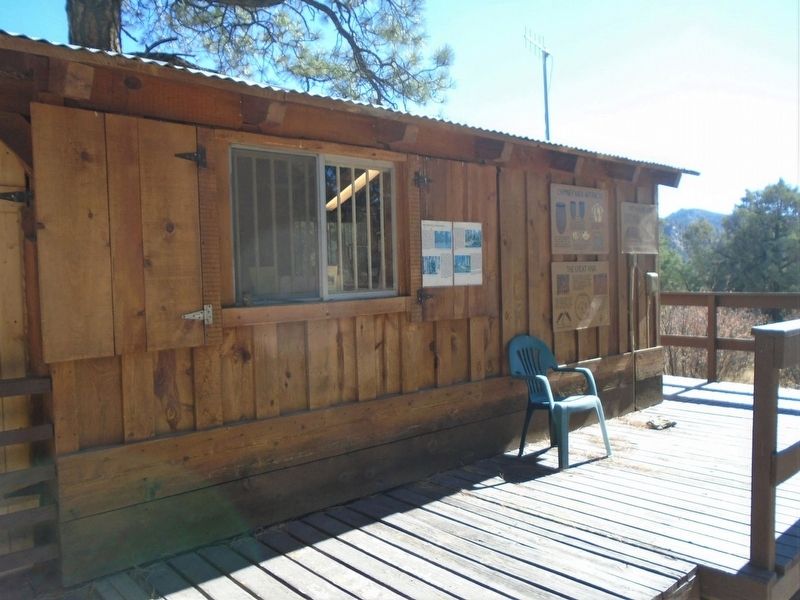
Kivas or Ceremonial Houses were not only used for religious ceremonies but may have been used for governmental and social events as well. Kivas varied in size and had flat or cribbed roofs.
The cribbed roofs of kivas were constructed of logs . . . — — Map (db m160561) HM
Rising from a 90-million-year-old seabed. Chimney Rock's twin towers stand 300 feet above the surrounding mesa. The Europeans who first saw them probably approached from due east, obscuring their view of the westernmost spire. As a result, Spanish . . . — — Map (db m293894) HM
This building, constructed in the late 1890s, houses Pagosa Springs' oldest business. David Lowenstein, the original proprietor, arrived in the San Juans in 1876. He and his wife, Fanny, reached Pagosa Springs on the first train in October of 1900. . . . — — Map (db m281892) HM
Commencing in 1905, George, James, and Elmer Hatcher operated a hardware store at this location. The store advertised sporting goods and funeral services. The existing building was constructed following the fire of 1943. The second geothermal well . . . — — Map (db m293891) HM
The Star Theatre occupied this site until 1919 and had been originally constructed as a part of the Archuleta Mercantile. After two fires, the Mercantile was reconstructed as the Metropolitan Hotel and the Star Theatre was resurrected as the . . . — — Map (db m293804) HM
A 1919 fire destroyed the original Archuleta Mercantile building at this site. From 1919 to 1920, Alexander Sullenberger, founder of the Pagosa Lumber Company, built the “strictly modern” Metropolitan Hotel and Star (Liberty) Theatre. The Hotel . . . — — Map (db m293888) HM
Pagosa Springs has a rich history, beginning with the Anasazi Indians. Later the Utes, Navajos and Apaches inhabited this beautiful corner of the Southwest. They also visited the great “Pagosah” hot springs which they believed had curative . . . — — Map (db m27527) HM
Geothermal Energy Early settlers in Pagosa Springs took full advantage of the comforts afforded by the mineral waters. Many built special bathing rooms attached to their homes, the better to soak in privacy; others (beginning in the 1900s) . . . — — Map (db m293893) HM
Questions Unanswered
A thousand years ago, a civilization flourished here. What pulled people here — and why did they leave after 200 years?
Why did they build so high above the fields in the valley, the water, and other resources? . . . — — Map (db m153328) HM
The Old Spanish Trail was neither entirely Spanish nor Particularly old. But the name seemed to fit this rugged road, which passed about thirty miles south of here as it stretched from Santa Fe to California. Franciscan pathfinders Dominguez and . . . — — Map (db m293895) HM
Learning About Our Past, Preserving Our Legacy
The extraordinary archaeological resources at Chimney Rock have helped illuminate the history of the ancestral Puebloans who lived here over a thousand years ago. They built structures from the . . . — — Map (db m153331) HM
"There really is a Place Called Baca County;
I think she’s mighty fine;
She was good enough for my dad’s kids;
Likewise she’ll do for mine;
Her sunrises are all colors;
Her sunsets are all the same;
The only thing she needs more . . . — — Map (db m106474) HM
The Cimarron Cutoff and Granada Road were branches of the Santa Fe Trail from Missouri to Santa Fe. The Aubrey and Penrose were other trails. From 1866-97 thousands of Texas cattle were driven to Montana on the XIT and National Cattle trails. — — Map (db m120040) HM
On November 15, 1806, Zebulon Montgomery Pike saw the mountain later named for him. His view was from the hills close to the Arkansas River in this vicinity.
From Pike's journal—
“When our small party arrived on the hill, they with one . . . — — Map (db m268907) HM
Dinosaur Freeway Geology of John Martin Reservoir
is part of the Dakota sandstone
formations which extend from Denver,
Colorado to Tucumcari, New Mexico.
In the Cretaceous period the region
was bordered with lakes, swamps . . . — — Map (db m181091) HM
This tablet is the
property of the State of Colorado
—
Boggsville
Established in 1866.
Named for Thomas O. Boggs,
first settler on this site.
Home of Kit Carson and
John W. Prowers, noted . . . — — Map (db m119664) HM
"...On crossing the river [Purgatoire] we found a large well-filled ranch...which had only just been built by two enterprising Yankees.:"
–William Bell, railroad surveyor, 1867
Boggsville was established in the early . . . — — Map (db m120701) HM
This region was once buffalo hunting grounds for the Cheyenne, Apache, Arapaho, Kiowa and Comanche. Tribes followed the buffalo throughout the plains and controlled the land. During this time, everything south of the Arkansas river was Mexico and . . . — — Map (db m120709) HM
The Arkansas River Valley is a historical frontier in both the American and European sense. Americans view the frontier as unsettled or a sparsely settled area lands on the edge of "civilization." To Europeans, frontiers are boundaries or borders . . . — — Map (db m120698) HM
(Left Panel)
Climbing -- A Longtime Boulder Passion
Scrambling, tramping, hiking, climbing, mountaineering...No matter the name, early Colorado Chautauquans reveled in their outings into the adjacent foothills. In 1908, . . . — — Map (db m88253) HM
The fountain was erected in 1936 by the Boulder Lions Club. Its smooth terra cotta cladding and strong vertical lines complement the 1933 Art Deco Style courthouse. The courthouse and fountain were designed by local architect Glen H. Huntington. . . . — — Map (db m87600) HM
Fourscore and seven years ago our fathers brought forth on this continent a new nation, conceived in liberty, and dedicated to the proposition that all men are created equal. Now we are engaged in a great Civil War, testing whether that nation, . . . — — Map (db m87645) HM
This sign marks the site of The Holiday Drive-In, which operated from 1953 until 1988. Drive-In theaters were popular in the 1950s and 1960s, especially among young families and amorous couples, where films could be viewed from the relative . . . — — Map (db m18299) HM
This building was the site of a continuously operated dry goods store from 1874 until the closing of Brooks-Fauber in 1986. It is one of the oldest commercial structures in the downtown historic district. — — Map (db m87716) HM
If you were here in 1908, you'd be singing, dancing or playing poker at the luxurious Crags Hotel. The Hotel's success was short lived. A fire destroyed the building in 1912.
Archaeologists who studied this site discovered significant . . . — — Map (db m185412) HM
Colorado's immense northern coal field, centered beneath these rolling hills, contributed to the early development and growth of Colorado and to the birth of nearby towns. Miners and mine owners in this area battled over issues of workers' . . . — — Map (db m120145) HM
This mural is a composite of two historical photographs. One is the 1862 image of our town's founder, Mary Miller with her husband, Lafayette, (D. 1878), for whom she named the town. Mary platted 150 acres and sank the first coal mine shaft in 1887. . . . — — Map (db m87606) HM
Beginning in 1860 as one log cabin on the south bank of the St.Vrain, just west of an
old trail which in 1862 became the route of the Overland Stage (and is now U.S. 287),
Burlington in 1863 began to grow. In 1869, to the three hotels and two . . . — — Map (db m199337) HM
The Denver-Boulder highway near this marker stands as a memorial to those men of vision who brought it into existence.
Planning for such a highway began in 1927 by Professor Roderick L. Downing, whose University engineering students later . . . — — Map (db m87611) HM
September 11, 2001 On the morning of Tuesday, September 11, 2001 terrorists struck the United States of America in a horrifying and coordinated attack that included the hijacking of four commercial jets. Three of these planes crashed into . . . — — Map (db m230956) HM WM
Front
Colorado's Northern Coal Field: Lest We Forget
Colorado's immense northern coal field, centered beneath these rolling hills, contributed to the early development and growth of Colorado and to the birth of nearby towns. . . . — — Map (db m119521) HM
DSP&P Historical Timeline: 1872: Governor John Evans, the 2nd territorial governor of Colorado, forms the Denver, South Park & Pacific Railway. 1873: Governor Evans forms a new company, the Denver, South Park & Pacific Railroad (DSP&P, . . . — — Map (db m293299) HM
Native peoples traveled through the Upper Arkansas Valley for centuries before European and American explorers.
Ute, Comanche and other tribes traveled on foot until the arrival of the Spanish and the introduction of the horse in the 1600’s. . . . — — Map (db m107827) HM
St. Rose of Lima Catholic Church was located at West Main and Gunnison streets, across from The Princeton Hotel, which was built in 1893. The hotel survived two fires and was rebuilt each time. The third fire, which was in 1936-37, destroyed the . . . — — Map (db m293249) HM
The Ute People made this land home. Next came Spanish military expeditions and French fur trappers. The fledgling U.S. sent its own explorers west into the Rocky Mountains in the early 1800s. In 1806 the Zebulan Pike expedition explored the Buena . . . — — Map (db m293270) HM
The beauty and majesty of the landscape intrigued locals and visitors from Buena Vista's earliest days. Early newspapers touted everything from the scenery to the local hot springs, encouraging outdoor recreation and tourism via stagecoach, rail, . . . — — Map (db m293277) HM
Farms and ranches dotted the upper Arkansas River valley as early as 1864. The Mahon, Loan, and Bard families established some of the first ranches, portions of which are now part of Buena Vista. The area's first farmer, Dr. Frank Mayol, raised . . . — — Map (db m293274) HM
With the discovery of gold in California Gulch in 1860, getting to Oro City (now Leadville) meant an opportunity for fame and fortune.
It would, however, be twenty years before railroad service traversed the Upper Arkansas . . . — — Map (db m107833) HM
In the late 1800’s, transportation of goods and people could be an arduous undertaking.
Gold and silver fever led many to endure travel up the Arkansas River from Canon City to Leadville.
Although arguably the largest and most notorious, . . . — — Map (db m107835) HM
Constructed in 1883 as the Bank of Buena Vista, the bank was transferred to the First National Bank of Buena Vista in 1884. The property was placed on the Colorado State Registry of Historic Properties by the Colorado Historical Society August 9, . . . — — Map (db m293199) HM
In Memoriam William Joseph Walsh ————— 41 Replacement Unit No. 41 Medical Corps who died September 29, 1918, serving his country during The World’s War 1914 1918 — — Map (db m293296) HM WM
Dominating the view to the west, the peaks of the Sawatch Range define the Continental Divide. Fifteen of the peaks in the Upper Arkansas River Valley are "fourteeners," boasting summits exceeding 14,000 feet.
Between the peaks, creeks flow . . . — — Map (db m158531) HM
Agriculture in the Upper Arkansas Valley was initially developed to meet the demand of area mining camps. The flood of fortune-seekers created a market for meat, flour, vegetables, and other foods.
French immigrant Frank Mayol, credited . . . — — Map (db m158536) HM
As trappers, miners, and settlers migrated west they encountered an arid environment. Early explorers referred to the West as the Great American Desert and many believed it could not be settled. Unlike the wetter eastern United States, . . . — — Map (db m158541) HM
"It is a town of only eight days' growth, but full of life.... There are now about 300 inhabitants, with fifty houses, tents, etc., and quite a number of buildings in process of construction, comprising one hotel, one boarding house, two . . . — — Map (db m281103) HM
Intersection of the centuries You're standing on more than the junction of US Highways 50 and 285. This place where the Sawatch and Sangre de Cristo mountain ranges meet has seen many travelers over the centuries. The Utes and . . . — — Map (db m281224) HM
With its rich farmland, natural hot springs, and proximity to busy mining districts, Poncha Springs seemed poised for prosperity. By 1880 the town of 3,000 was receiving eight daily stagecoach arrivals, the Denver & Rio Grande Western tracks were . . . — — Map (db m281068) HM
Not everyone who came to this junction of mountains and waterways kept moving. Prospectors and homesteaders put down roots here in about 1860. The first cabin, built by Nat Rich and Bob Hendricks, still stands in the town of Poncha Springs. In . . . — — Map (db m281265) HM
As settlements grew and the quest for gold and silver brought prospectors and miners, transportation for people and goods became critical. Entrepreneur Joseph Lamb started a ten burro pack train to carry goods from Cañon City to the Upper . . . — — Map (db m281236) HM
The Top of the Rockies Scenic and Historic Byway travels through spectacular scenery and is surrounded by some of the state’s highest peaks. In the nineteenth century, these mountains yielded some of Colorado’s biggest mining fortunes. On the . . . — — Map (db m281215) HM
The Jackson Hotel was built in 1878 by Henry A. Jackson who left his home in Kentucky looking for a place where his family could escape the turmoil of post-Civil War reconstruction. A former Memphis steamboat captain, Jackson found himself high and . . . — — Map (db m117048) HM
“The Colorado Rockies were once a great barrier to Western travel; then they became a great goal of Western travel.” — William M. Butler, Roof of the Rockies Of the 68 "fourteeners" — 14,000-foot-high mountains — in the continental . . . — — Map (db m281203) HM
Before the 1860s the Upper Arkansas Valley was crisscrossed by native peoples moving from summer to winter camps and by European and American explorers. The discovery of gold and other minerals in the Colorado Territory brought rapid change. . . . — — Map (db m293398) HM
Smokestack Construction Facts: Construction started: June 21, 1917 Construction completed: Nov 14, 1917 Last used: March 1920 Material: 264 standard gauge carloads of pressed, glazed brick and mortar. Chimney: Octagonal . . . — — Map (db m293380) HM
Chaffee County Courthouse built by Ray Lines Post 64 American Legion Architect De Morduant Approximate cost $120,000 Completed 1932 — — Map (db m293500) HM
[Roll of Honored Dead]
Frank J. Coscarelli • Jack Rundell • Joe A. Barnhill
Frank Holman • Roy J. Barnhill • John T. Fowler
Raymond Thorpe • John N. Maestas • Cyril J. Coster
Theodore D. Benjovsky • Laverne F. Knipp • Philip F. Scholl . . . — — Map (db m158549) WM
Frustrated in their attempt to climb Pike’s Peak on November 27, 1806, Zebulon Pike and his party of 15 trudged on through South Park looking for the Red River, southern boundary of the Louisiana Purchase. After crossing Trout Creek Pass, the . . . — — Map (db m127876) HM
Salida hosts the nation's oldest whitewater paddling festival the third weekend of every June. This four-day festival blends a world-class whitewater competition with raft racing and light-hearted events. FIBArk began in 1949 as a bet between two . . . — — Map (db m293297) HM
Following ancient paths The history of Chaffee County as part of the United States began in 1803, with the purchase of the Louisiana Territory from France. But human history was established here centuries earlier. Many of the hiking trails . . . — — Map (db m116085) HM
Salida sprouted within weeks of the arrival of the railroad. Homes and businesses couldn't be built fast enough, and many families spent time camped along the Arkansas River. In its first edition The Mountain Mail newspaper reported that . . . — — Map (db m293397) HM
Life changed rapidly in the Upper Arkansas River Valley with the arrival of European explorers and the United States settlers. Spanish presence in the area and their interaction with local Utes was recorded as early as 1626, but official . . . — — Map (db m293431) HM
Up, up, up the Pass! This popular walking and bike path follows a portion of the Monarch Spur, the railroad branch that crossed the Arkansas at the Salida railyards and stretched west to the mining camp of Maysville and up to the quarry below . . . — — Map (db m293396) HM
With the acquisition of the Louisiana Purchase in 1803, the United States had extensive new lands to explore. In search of a new border While Lewis and Clark engaged in their famous “Voyage of Discovery” along the Missouri River (1803-1806), . . . — — Map (db m293486) HM
As early as 1880, when gold, silver, copper, and iron mines began producing ore in Chaffee County, a local smelter was needed. Several small concentrating plants and smelters were built close to ore sources, but most were inadequate. The arrival . . . — — Map (db m293381) HM
A legacy of hard work and dedicated workers When operating, the smelter ran 24 hours a day. Work was physically demanding and often tedious, but the men were proud of their accomplishments. Many smelter workers and their families lived near . . . — — Map (db m293384) HM
Electricity was introduced in Salida in 1887 when a group of local townsfolk created The Electric Illuminating Company. In 1892 the then-named Salida Light and Power Company built a 1000-kilowatt steam generating plant at this location on the banks . . . — — Map (db m52403) HM
Salida Equal Suffrage League
formed by Carrie Chapman
Catt here at former Baptist
church in support of 1893
women's suffrage referendum. — — Map (db m250652) HM
The Arkansas River in the time of the Ute Indians fluctuated dramatically. In spring, snowmelt swelled the river, causing flooding and bank erosion. By mid-summer, the river shrank to a shallow stream. In the 1850s, silver and gold miners began . . . — — Map (db m293298) HM
Colorado’s National Guard regiment the 157th Infantry, served in World War II with the famed 45th (Thunderbird) Division. It saw 511 days of combat in Sicily, Italy, France and Germany. It made four amphibious landings, in Sicily, at Salerno and . . . — — Map (db m287893) HM
The Eastern Colorado Historical Society dedicates the replica of this bandstand to the people whose donations made it possible. It is also dedicated to the memory of old fashioned Saturday nights, and to the musicians and bandleaders, especially . . . — — Map (db m287897) HM
Cheyenne County pays tribute to all men and women who served honorably in the Armed Forces to preserve America’s freedom. “All Gave Some Some Gave All” “Freedom is not free” — — Map (db m287898) WM
The Mountain State reaches across the Great Plains to welcome you. This is the Smoky Hills Trail, a short cut found in 1860 from the Missouri River to the Pikes Peak and Cherry Creek gold diggings. On this route to the mountains wagon trains and . . . — — Map (db m287901) HM
Smoky Hill Trail
The Smoky Hill Trail was the most direct route to Denver and the goldfields of the central Rockies. Immigrants heading west through central Kansas followed the Kansas River, then headed up its Smoky Hill River branch into . . . — — Map (db m77898) HM
Named for the great western scout, guide, trapper, and Indian fighter. Located on famous trails – at the junction of the Smoky Hill stagecoach route and the Texas – Montana, Potter and Bacon, and Chisum cattle trails. On the old Kansas . . . — — Map (db m88444) HM
The Texas-Montana, Bacon and Potter, and J.S. Chisum trails converged in this vicinity. Over these routes great herds of Texas Longhorns, scions of hardy stock from Spain, moved northward. Big Springs, 2.4 miles west, was an important cattle . . . — — Map (db m87888) HM
In many American small towns, the railroad depot was the portal to the rest of the world. More than any other public building, the depot touched the lives of all people in the town. Everything important to the existence of the town came and went . . . — — Map (db m77890) HM
The Griffith Lode (2,500 ft. N.E.), later a silver producer, was discovered June 17, 1859, by George W. Griffith, for whom Georgetown was named. Town site claimed June 29, 1860. The Belmont Lode (5.7 miles S.W.), first important silver discovery in . . . — — Map (db m173244) HM
Thomas Cornish built this elaborate home that combines a French Mansard roof with
Italianate and Gothic Revival detailing. It is one of the last homes in Georgetown to display such exuberance in Victorian architectural styles.
Cornish came to . . . — — Map (db m152842) HM
This former bank building was the first of a row of buildings that William H. Cushman built along this block of Alpine Street. In 1871, he bought out the majority interest of another bank and reorganized it as the First National Bank of . . . — — Map (db m282668) HM
In the fall of 1872, William Cushman was busily erecting two fine brick buildings, one on either side of his bank building. This one, on the west, had its roof completed as workers laid the foundation for the other one. Undoubtedly Cushman leased . . . — — Map (db m173241) HM
William H. Cushman built this imposing brick Italianate commercial building in two phases. He completed the western part as a two-story structure in 1872. Three years later, Cushman built an adjoining three-story edifice on the corner lot; he . . . — — Map (db m173242) HM
Charles R. Fish, a local banker, built this fine structure for his Bank of Clear Creek County. Today the Fish Block is one of the more prominent and substantial brick commercial buildings in town. It is similar in design, though less elaborate in . . . — — Map (db m173243) HM
2521 entries matched your criteria. Entries 101 through 200 are listed above. ⊲ Previous 100 — Next 100 ⊳