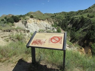
On E River Road, on the left when traveling north. Reported missing.
These soft sandstone deposits, built up by wind and water and then carved into strange and fantastic shapes by the same forces, have fascinated man for at least 5,000 years. Note the absence of carvings in the sculptured walls seen in this . . . — — Map (db m154309) HM
On 5th Street West just west of Ohmer Street, on the right when traveling west.
Pierre Bottineau, son of Charles Joseph Bottineau, a French-Huggenot and Marguerite Adhik Songab (Clear Sky Woman) a Lake of the Woods Chippewa, was born near the mouth of the Turtle River (twelve miles north of Grand Forks, North Dakota). . . . — — Map (db m231815) HM
On 5th Street West west of Ohmer Street, on the right when traveling west.
Erected in 1954 by the Bottineau County Old Settler’s Association and friends, as a memorial to our pioneer settlers who met the toil, trials, hazards and wants of life; who broke the sod with oxen or horses; built their homes of sod or logs as a . . . — — Map (db m231821) HM
On Theodore Roosevelt Expressway (CanAm Highway) (U.S. 85) 16.5 miles south of U.S. 12, on the left when traveling south.
Between 1874 and 1893, millions of head of cattle and horses went up the Great Western Trail from Texas through nine U.S. states into Canada. This famous trail lasted more years, carried more cattle, and was longer than any other cattle trail in . . . — — Map (db m299500) HM
On 1st Avenue Northeast at 1st Ave NE, on the right when traveling east on 1st Avenue Northeast.
The vast prairies of America have been described by many people as "an ocean of grass." This region of the country is considered either shortgrass or midgrass prairie, depending on the soil moisture, precipitation, and relative humidify in a . . . — — Map (db m113241) HM
On 2nd Avenue Northeast west of 2nd Avenue Northeast, on the left when traveling west.
Lewis and Clark and the Corps of Discovery passed north of this area in 1804-1806. The Homestead Act of 1862 brought white settlers from the eastern U.S. and emigrants from Europe to the American west and to this part of the Dakota Territory in . . . — — Map (db m298528) HM
On Fort Dilts Road, on the left when traveling west.
On this site in September 1864 an immigrant train, under the command of Capt. James L. Fisk, bound for the gold fields of Montana, was besieged by hostile Sioux Indians, despite the fact that an armed escort of 50 U. S. Cavalrymen had been provided . . . — — Map (db m33923) HM
On Main Street just south of 2nd Avenue West, on the left when traveling north.
World War I Walter Frye • Chester Haugerud World War II Delmar Souther • Lyal Fenster • Arthur Horntvedt • Kenneth Johnston • Oliver Hovland • Marvin Sorlie • Arvid Dahl • Arnold Dollarhide • Harold Haugstad • William . . . — — Map (db m202896) WM
North Dakota Veterans Memorial 1989 In this year of North Dakots's centennial, this monument is dedicated to all North Dakotans who served in the armed forces since statehood.The names of the men and women listed on this memorial gave their . . . — — Map (db m44701) WM
Near State Highway 1804 1.1 miles south of Double Ditch Loop, on the right when traveling north.
The first scholarly archaeological study of a Mandan earthlodge village village site was made in 1905 by Harvard University students George Will and Herbert Spinden. They excavated portions of six midden mounds, two houses, six cache pits, and the . . . — — Map (db m154677) HM
On River Road 0.2 miles north of Fraine Barracks Road, on the left when traveling north.
This was the site of one of the largest river warehouses built during the 1870s when river transportation was of primary importance. The warehouse was served by a spur track of the Northern Pacific Railway and until the railroad was built west of . . . — — Map (db m154055) HM
Presented by the French National Railroads
to the State of
North Dakota
in gratitude for the help given to France
by the American people — — Map (db m44706) HM
Bullboats, round-bottomed watercrafts, were used by the Mandans, Hidatsas, and Arikaras to transport goods and people
along waterways. Bullboats were indispensable for river traffic and for hauling loads of driftwood for cooking and heating
fires. . . . — — Map (db m164368) HM
On East Thayer Avenue at North 5th Street, on the right when traveling west on East Thayer Avenue.
In honor of United States military personnel and veterans from Burleigh County for their service to our great Nation Dedication Date August 18th, 2022 Duty Honor Country — — Map (db m235002) WM
Near East Main Avenue at North 1st Street, on the right when traveling east.
The State Historical Society of North Dakota acquired Camp Hancock in 1951 for preservation as a state historic site. Work began to repair fire damage on the lone remaining structure, the officers quarters from the 1870s, used later as the U.S. . . . — — Map (db m154548) HM
Near East Main Avenue (Business Interstate 94) at North 1st Street, on the right when traveling east.
When plans for the Church of the Bread of Life were accepted in August, 1879, the Episcopal congregation's building committee contracted to spend $2,500 to build a place of worship. The funds, raised by benefit suppers and entertainments, proved . . . — — Map (db m154545) HM
Dedicated to all men and women wounded in all our wars.My stone is red for the blood they shed. The medal I bear is my country's way to show they care if I could be seen by all mankind maybe peace will come in my lifetime. — — Map (db m44704) HM
Near North Dakota Route 1804 1.1 miles south of Double Ditch Loop.
Fortification systems attest to the fierce warfare between villagers and surrounding nomadic tribes that is reported in early historic records. Ditch 2 that you seen in front of you at Double Ditch appears to have combined mounds and the ditch, with . . . — — Map (db m154250) HM
Near State Highway 1804 1.1 miles south of Double Ditch Loop, on the right when traveling south.
Ditch 3 is more recent than Ditch 4 and was constructed in the AD 1500s. Ditch 3, with only a few bastions, encompasses 15 acres and, like Ditch 4, is not visible on the surface. It reflects a fallback to a slightly smaller community and simpler . . . — — Map (db m154708) HM
Near North Dakota Route 1804, on the right when traveling south.
Double Ditch Indian Village, overlooking the Missouri River, was a large earthlodge village inhabited by Mandan Indians between AD 1490 and 1785. The remains of earthlodges, midden mounds (trash heaps), and two fortification ditches are clearly . . . — — Map (db m154709) HM
On North Dakota Route 1804 1.1 miles south of Double Ditch Loop.
Double Ditch Indian Village, overlooking the Missouri River, was a large earthlodge village inhabited by Mandan Indians between AD 1490 and 1785. The remains of earthlodges, midden mounds (trash heaps), and two fortification ditches are clearly . . . — — Map (db m154710) HM
Near East Main Avenue at North 1st Street, on the right when traveling east.
The first non-Roman church service to be held in what is now Bismarck was the baptism of a son of Lt. Humbert of Camp Hancock by the Rev. J. Smith, and Episcopalian missionary This marked the beginning of Episcopalian services in the . . . — — Map (db m154650) HM
In front of you is a segment of the inner fortification ditch. Mandan villages usually were surrounded
by a ditch and wood palisade to keep out enemies. These villages also used natural features, such as
steep terrain and riverbanks, for added . . . — — Map (db m164478) HM
On this spot, July 31, 1863, occurred the first Masonic ceremony held in the present state of North Dakota. It was the Masonic funeral of Lieutenant Fred J. Holt Beaver, an Englishman and Oxonian, and a volunteer soldier, attached to the staff of . . . — — Map (db m234899) HM
On S 5th Street south of E Main Street, on the right when traveling south.
From approximately this spot on July 5, 1876, Colonel Clement A. Lounsberry, the founder of the Bismarck Tribune in a feat of newspaper enterprise that overcame many obstacles, flashed - - by telegraph - - to the New York Herald the first account of . . . — — Map (db m85829) HM
Geophysics applies the methods of physics to remotely investigate and define objects or materials
in the earth's subsurface without direct contact. Geophysical investigations do not disturb the
soil and cultural features, as do traditional . . . — — Map (db m164367) HM
Near Double Ditch Loop 0.5 miles north of Edgewood Drive, on the right when traveling north.
Glaciers altered river courses and molded the North Dakota landscape, creating the gently rolling, hilly terrain seen in most areas of the state today. Prior to about three million years ago, all the rivers in today's North Dakota flowed toward . . . — — Map (db m164376)
Near East Main Avenue at North 1st Street, on the right when traveling east.
Camp Hancock was the location of an infantry post from 1872 to 1877 and a quartermaster depot and signal office until 1894. The post was originally named Camp Greeley in honor of Horace Greeley, an editor of the New York Times and candidate . . . — — Map (db m154971) HM
The Mandans, as well as the Hidatsa and the Arikaras, built dome-shaped houses of logs and earth, known as earthlodges. All that remains of the earthlodges on the surface are circular depressions. The men usually decided how large an earthlodge . . . — — Map (db m154544) HM
While the Mandans relied heavily on the cultivation of plants, they
were also skilled hunters. Bison hunting was as important as farming
and bison were vital to the Mandan diet. Before the arrival of horses,
bison were stalked individually, or . . . — — Map (db m164358) HM
By the time Lewis and Clark began their epic journey, the Ward Indian Village site (renamed Chief Looking's Village in 2003) had been abandoned. The Mandan and Hidatsa were displaced north, reduced in number by smallpox and warfare. The journals . . . — — Map (db m270046) HM
Going Upriver:
21st October Sunday 1804 (William Clark):
“…passed just by above our Camp a Small river on the L.S. Called by the Indians Chiss-Cho-tar (the Heart River) — this river is about 38 yards wide Containing a good Deel of water— . . . — — Map (db m269935) HM
Near East Main Avenue at North 1st Street, on the right when traveling east.
This coal-fired steam locomotive was built by the Baldwin Locomotive works of Philadelphia, Pennsylvania for the Northern Pacific Railway in 1909. Numbered 2164 by the Northern Pacific, the locomotive and coal tender weigh 298,600 pounds, are 78 . . . — — Map (db m154970) HM
Near Double Ditch Loop 0.4 miles north of Edgewood Drive, on the right when traveling north.
Mandan origins and history have been passed on orally. These origin stories are memorized and passed from generation to generation, telling the history of a
people. These traditions provide information regarding the origins of sacred bundles and . . . — — Map (db m164357) HM
Life for these agriculturalists centered on the cultivation and trade of native corn, beans, squash, and sunflowers along with hunting. Women watched the skies
carefully for the arrival of flocks of geese and ducks, which signified the arrival of . . . — — Map (db m164355) HM
The raised areas you see around the village are midden mounds or earthen mounds ranging from one to ten feet high. There are more than 30 mounds surrounding the village. The Mandans at Double Ditch disposed of their trash in heaps such as the one in . . . — — Map (db m154930) HM
Missouri River The Missouri River valley provided water, food, and shelter for the Mandans. Abundant timber and game could be found in the wooded bottomlands, and bison flourished on the surrounding prairie grasslands. The terrace edge . . . — — Map (db m154068) HM
Pó is the root for fish in the Mandan language-pótande is the catfish. The Missouri River system, along with its larger
tributaries such as the Heart River, supported fisheries that the Mandans drew upon as part of their subsistence . . . — — Map (db m164371) HM
Sakakawea Sakakawea has become a recognized name as part of the Lewis and Clark expedition. Although her name is famous, few facts remain to document her life and contributions to the voyage. When Lewis and Clark met Sakakawea in 1804 she was . . . — — Map (db m43838) HM
Square Buttes is a prominent and imposing landmark along this stretch of the Missouri River. The buttes take their name from their corresponding physical characteristics and robust form that is visible on the horizon eight miles to the north. . . . — — Map (db m154069) HM
Near Double Ditch Loop 0.4 miles north of Route 1804, on the right when traveling north.
The stone shelter your are now standing by was constructed in the 1930s as one of many projects completed throughout the state by the Civilian Conservation Corps (CCC) and the Works Progress Administration (WPA). The CCC and the WPA were programs . . . — — Map (db m154396) HM
Near North Dakota Route 1804 0.9 miles south of Double Ditch Loop, on the right when traveling south.
Geophysical surveys and follow-up excavations have revealed that the village had four ditch fortification systems constructed over a period of 300 years. The fourth, or outermost, ditch had several well-defined bastions and was probably the oldest. . . . — — Map (db m154920) HM
On E Boulevard Avenue at N 6th Street, on the right when traveling west on E Boulevard Avenue.
Presented to the State of North Dakota by Harry Falconer McLean to honor the memory of the pioneers of the great Northwest. This plaque erected by the Bismarck Chapter Pioneer Daughters. < Back of Monument: > No trails too rugged, no . . . — — Map (db m85832) HM
Near State Highway 1804 at milepost 91 near Double Ditch Loop, on the right when traveling south.
As early as 1804, this village was noted by explorers Meriwether Lewis and William Clark during their expedition through this area.. Captain Clark wrote in his journal entry of October 22, 1804:
passed 2 old villages at the mouth of a . . . — — Map (db m284382) HM
Near State Highway 1804 at milepost 91 near Double Ditch Loop.
Archaeologists have discovered more of this village under the soil using magnetometry and electrical resistance surveys. These tools help to locate cultural features without disturbing the soil. Excavations, when combined with these geophysical . . . — — Map (db m284364) HM
On Double Ditch Loop 0.3 miles west of State Route 1804, on the left when traveling south.
The stone shelter you are standing by was constructed in the 1930s as one of many projects completed through-out the state by the Civilian Conservation Corps (CCC) and the Works Progress Administration (WPA). These two programs created during Great . . . — — Map (db m284356) HM
On Interstate 94, on the right when traveling west.
Apple Creek today is only a mere trickle compared to what it was during the time it was formed from a large sheet of glacial ice. Looking out over the valley one can almost imagine the enormity of this creek during its formation. This . . . — — Map (db m85839) HM
Near 171st Street Northeast 0.2 miles north of 30th Avenue Northeast, on the right when traveling north.
The fortification ditch and house depressions, as well as the site's location away from the Missouri River, immediately caught the attention of archeologists when the site was rediscovered in 1936. At that time, many people believed it was the . . . — — Map (db m154401) HM
Near 171st Street Northeast 0.2 miles north of 30th Avenue Northeast, on the right when traveling north.
This house was built in an oval-shaped pit about two feet deep and measured 16 by 23 feet in size. Before it was excavated in the late 1990s, remote sensing studies were conducted. Precise surface elevations were recorded and about 3,500 individual . . . — — Map (db m154406) HM
has been designated a
Registered National Historic Landmark
under the provisions of the Historic Sites Act of August 21, 1955. This site possesses exceptional value in commemorating and illustrating the history of the . . . — — Map (db m153165) HM
Near 171st Street Northeast 0.2 miles north of 30th Avenue Northeast, on the right when traveling north.
Menoken Village was a small community consisting of approximately 30 oval-shaped, earth-covered houses and a prominent fortification system. Once thought to have been a Mandan Village occupied at the time of early contact with Euroamericans, Menoken . . . — — Map (db m154254) HM
Near 171st Street Northeast 0.3 miles north of 30th Avenue Northeast, on the right when traveling north.
Menoken Village is a terminal Late Woodland (ca. AD 1200) settlement on Apple Creek, an eastern tributary of the Missouri River. Menoken is listed in the National Register of Historic Places. The site is also a registered National Historic Landmark . . . — — Map (db m154628) HM
Near 171st Street Northeast 0.2 miles north of 30th Avenue Northeast, on the right when traveling north.
Recovered stone, metal, and shell artifacts show that the people were involved in trade systems that spanned the continent. It is not clear how these systems worked. Residents at Menoken probably did not travel far beyond what is now central North . . . — — Map (db m154403) HM
On Main Street (County Road 10) at Bush Avenue North, on the left when traveling east on Main Street.
One of the original retail sites in Buffalo, this brick structure was built in 1902 by G. E. Batemen as a drugstore. This building was shortened in 1998. The interior was altered and remodeled as the use of the building changed. The false front and . . . — — Map (db m306101) HM
On Bush Avenue North at Third Street North, on the right when traveling south on Bush Avenue North.
The First Presbyterian Church of New Buffalo, Dakota Territory, was organized in 1880 and built their first church in 1886. A new church was built on this same site in 1928. Tudor style building was designed by architect William Kurke, who also . . . — — Map (db m278991) HM
On Main Street (County Road 10) just north of Bush Avenue North, on the left when traveling north.
T. A. Quirk & Company was organized in 1884 by Thomas A. Quirk. This Boomtown style office building was constructed in 1908. At one time the lumber yard had a lumber shed, a store, three storage sheds, and coal facilities on the south side of the . . . — — Map (db m306159) HM
On 34th Street South East 0.3 miles west of 137th Avenue South East, on the right when traveling west.
August 16, 1863, General Sibley marched over this spot with 3400 soldiers on his return after driving the Indians across the Missouri River. — — Map (db m169803) HM
On Pearl Street North west of Bush Avenue North, on the right when traveling west.
The High School is the last remaining example of non-residential Classic Revival style architecture in Buffalo. It was
designed by Architect A. J. O'Shea and built in 1916 by Meineke Building Company of Fargo at a cost of $20,000. The school closed . . . — — Map (db m278980) HM
On Main Street (County Route 10) west of Bush Avenue North, on the left when traveling west.
Donated by Beverly Sproul and her family to honor the men and women of the Buffalo Area who served in the Armed Forces.
John T. Backes •
Donald Deehler •
Clair N. Boyd •
Evan S. Brown •
Donald Burns •
Edwin F. W. Buttke •
C.L. . . . — — Map (db m278956) WM
On Wilcox Avenue North south of Third Street North, on the right when traveling south.
The original portion of the rectory was built in 1887 and the two story front section was added in 1895. The property was donated to the Buffalo Historical Society in 1995 and opened to the public in 1998 as the Margaret Fraase Library. The wood . . . — — Map (db m278986) HM
On 3rd Street North at Bush Avenue North, on the right when traveling west on 3rd Street North.
This classical revival home was built in 1901 for S. G. and Emma More. Architect Milton Earl Beebe designed this home using
2x6 foot balloon framing, clapboard siding and field stone foundation. The More family owned the entire block and built an . . . — — Map (db m278987) HM
On Wilcox Avenue North at 3rd Street North, on the right when traveling south on Wilcox Avenue North.
Built in 1885, this church was formerly the Calvary Episcopal
Chapel and the first church built in Buffalo. It was designed by
architect George Hancock who held ND architect license #1 and
was constructed of native prairie stone. The Buffalo . . . — — Map (db m278983) HM
On 4th Street at Bush Avenue North, on the right when traveling west on 4th Street.
The Peterson residence was built in 1915 by S. G. More, a prominent Buffalo banker, as a wedding gift for his daughter Edith when she married Arthur Peterson. The
Classic Revival style home was designed by Fargo architect A. J. O'Shea. Descendants . . . — — Map (db m278988) HM
On 3rd Street North at Bush Avenue North, on the right when traveling west on 3rd Street North.
This church was built in 1900 by the Hancock Brothers of Fargo and is an example of vernacular architecture. It was named after Buffalo businessman, Thomas A. Quirk, who donated most of the lumber. The Grotto and Cross were built with concrete and . . . — — Map (db m278990) HM
On Broadway North just north of 2nd Avenue North, on the left when traveling north.
George M. Black was an early merchant in Fargo, opening The Black Store on Broadway in 1912. In 1929, after witnessing the stock market collapse, he bet big on Fargo and sold his store to Sears Roebuck and Company. He used the proceeds to finance . . . — — Map (db m239934) HM
On 1st Avenue North at Broadway North, on the left when traveling east on 1st Avenue North.
In 1864, the Northern Pacific Railroad was charted to build a line from the Great Lakes to Puget Sound. The initial funding for construction would come from the sale of Northern Pacific bonds. However, in 1873 lack of funding halted construction, . . . — — Map (db m239986) HM
On Broadway North at 1st Avenue North, on the right when traveling north on Broadway North.
The new Fargo City Hall project began in 2016 and opened in 2018. The exterior of the building features 12 panels of art created by a local artist, Catie Miller, who shares her interpretation of Fargo's past, present, and future with a focus on . . . — — Map (db m240299) HM
On Main Avenue (U.S. 10) at 7th Street South, on the right when traveling west on Main Avenue.
This Northern Pacific depot, designed by nationally known architect Cass Gilbert, was built in 1898. A park with gardens and fountain surrounded it. No longer in use because of declining passenger traffic in the 1960's, the depot was in danger of . . . — — Map (db m240296) HM
On 4th Avenue North at Broadway North, on the left when traveling east on 4th Avenue North.
Eddie and Hildegarde Kraus began their careers in the entertainment industry as teenagers (he as a waiter in an Opera House, and she as a pianist and organist). Eventually, Eddie's career led to managing several Fargo-Moorhead theatres. As . . . — — Map (db m240096) HM
On Northern Pacific Avenue at Broadway North, on the right when traveling east on Northern Pacific Avenue.
On Thanksgiving Day, November 24, 1904, the Fargo Streetcar Railway accepted its first passenger. Fare was 5¢ per person and service was available from 6 AM to midnight every day, except Sunday, when hours were shorter. Seven cars were available . . . — — Map (db m239997) HM
On Northern Pacific Avenue at Broadway North, on the right when traveling west on Northern Pacific Avenue.
In 1881, wishing to reduce freight charges, 23 Fargo businesses pooled $100,000 to build a railroad line. It would originate from Fargo, and run south to Ortonville, Minnesota (117 miles away).
Construction of the line began in 1883, and on the . . . — — Map (db m305976) HM
On Main Avenue (U.S. 10) at Broadway South, on the right when traveling east on Main Avenue.
On this site, the afternoon of June 7, 1893, began what would later become known as The Great Fargo Fire. Originating at Herzman's Dry Goods Store, the fire spread its destruction north, east, and west from this location until it had consumed 31 . . . — — Map (db m305988) HM
On Broadway North at 6th Avenue North, on the left when traveling north on Broadway North.
For more than a century, the twin steeples of First Lutheran Church and the Cathedral of St. Mary have stood like beacons on north Broadway, illuminating the faith journeys of the prairie's immigrant people. The spires usher travelers into and out . . . — — Map (db m240098) HM
On Broadway North north of 4th Avenue North, on the left when traveling north.
Just like the name hints, the Ford Building was built in 1915 as a Ford automobile plant and showroom to service the Dakotas. Built in a Chicago style along the Great Northern Railroad tracks, this building boasted the perfect location to . . . — — Map (db m240297) HM
When autos appeared in the 1890s, only the wealthy could afford to buy them. But by the 1920s assembly lines made cars affordable for the middle class, and sales soared. At the end of the decade there were 25 million cars on the road and U.S. . . . — — Map (db m100837) HM
On North Broadway Drive just north of Main Avenue (U.S. 10), on the left when traveling north.
This caboose was built by the Great Northern in August 1942 and is one of 50 wood sided, cupola cabooses. It was constructed in the St. Cloud shops. The original number was X227 (the X stands for non-revenue) and it was acquired by Burlington . . . — — Map (db m239898) HM
On Northern Pacific Avenue at Broadway North, on the left when traveling west on Northern Pacific Avenue.
The Great Northern Railway started out in 1857 as the Minnesota & Pacific. It was not until 1890 that it became known as the Great Northern, and this name was given in honor of rails that crossed the great territory. The Great Northern entered . . . — — Map (db m240291) HM
On 1st Avenue North at Broadway North, on the left when traveling west on 1st Avenue North.
In the late 1800's, the Red River Valley was a boom in agricultural development. The introduction of the Bonanza Farms and the overall increase in farming of wheat created a preference for larger threshers and powerful engines grew. Machinery Row, . . . — — Map (db m239996) HM
On 1st Avenue North at Broadway North, on the right when traveling west on 1st Avenue North.
North Dakota State University is a land-grant institution, created under the Morrill Act of 1862. From its establishment in 1890, its mission has included research and education in scientific agriculture to benefit the public as well as students. . . . — — Map (db m240225) HM
On North Pacific Avenue at Broadway North, on the left when traveling east on North Pacific Avenue.
On July 2, 1864 President Abraham Lincoln signed an Act of Congress creating the Northern Pacific Railroad Company.
Following closely the route taken by a government expedition in 1854, the northern railroad route to the west coast would . . . — — Map (db m239998) HM
On 2nd Avenue South at 9th Street South, on the right when traveling east on 2nd Avenue South.
Original site of Gethsemane Episcopal Cathedral. Land purchased by General Cass from the Northern Pacific Railroad. Gethsemane Church was built in 1874 and replaced with Gethsemane Cathedral in 1900. The cathedral burned in 1989. The present . . . — — Map (db m305989) HM
On 2nd Avenue North at Broadway North, on the left when traveling west on 2nd Avenue North.
Osco Drug painted this advertisement after opening in 1942. This spot was originally filled by a window before Osco Drug moved in, so when the advertisement was revealed during this building's renovation in 2017, this portion of the advertisement . . . — — Map (db m239970) HM
On Broadway North at 1st Avenue North, on the right when traveling south on Broadway North.
Established in 1965 as the Red River Art Center in Moorhead, MN, the Plains Art Museum was given its current name in 1975. In 1996, the Museum moved across the river into North Dakota and embarked on renovating a former International Harvester . . . — — Map (db m240293) HM
On 4th Street North just south of 2nd Avenue North, on the right when traveling north.
The Native American Medicine Garden The concept for this medicine wheel garden originated with the sacred medicine wheel representing various symbolisms and teachings. It honors seasonal cycles, represents rituals, and expresses . . . — — Map (db m240295) HM
On 2nd Avenue North at Broadway North, on the left when traveling west on 2nd Avenue North.
While steamboats delivered and loaded cargo up and down the Red River, recreational use of the Red River blossomed. Sleigh races, ice-skating, skiing, toboganning, and ice fishing provided winter recreation. Boating, swimming, diving, and public . . . — — Map (db m240099) HM
On 2nd Avenue North at Broadway North, on the right when traveling west on 2nd Avenue North.
The story of the Red River Valley and Red River of the North began over 11,000 years ago when Lake Agassiz was formed. A glacier extended from Canada south and covered what is now the Red River Valley. As it began to melt and recede northward, . . . — — Map (db m239991) HM
On 1st Avenue North at Broadway North, on the right when traveling east on 1st Avenue North.
As the first settlers broke up the fertile Red River Valley prairie sod, flax was usually the first crop they sowed, followed by hard red spring wheat and barley. Crop agriculture was and continues to be a major economic force in North Dakota. . . . — — Map (db m240253) HM
On Main Avenue (U.S. 10) just east of 2nd Street South, on the right when traveling east.
[2020 marker] This replica Statue of Liberty was commissioned by Industrial Builders, the company that built the Veterans Memorial Bridge, to replace the statue originally donated in 1950 to The City of Fargo by the Boy . . . — — Map (db m209100) HM WM
On Broadway North at 4th Avenue North, on the right when traveling south on Broadway North.
Roberts Commons, or as the locals call it, RoCo, is the first mixed-use parking garage in Downtown Fargo. The Carnegie Public Library once stood at the site and during excavation for Roberts Commons, the brick foundation of the library was . . . — — Map (db m240298) HM
On 4th Street North just south of 2nd Avenue North, on the right when traveling north.
Sodbuster: San Isidro Sodbuster: San Isidro combines the artistic traditions of the American Southwest with imagery that represents the hardworking farmers of the Red River Valley. The term "Sodbuster" is a colloquialism for farmers, . . . — — Map (db m240401) HM
On 2nd Avenue North at Broadway North, on the left when traveling east on 2nd Avenue North.
At one time the Red River was home to over a dozen steamboats including the Anson Northup (later renamed the Pioneer), the International, the Selkirk, the Dakota, the Alpha, the Cheyenne, the . . . — — Map (db m239995) HM
On 1st Avenue North just west of Roberts Street North, on the right when traveling west.
Amendment ICongress shall make no law respecting an establishment of religion, or prohibiting the free exercise thereof; or abridging the freedom of speech, or of the press; or the right of the people peaceably to assemble, and to petition the . . . — — Map (db m239971) HM
On 4th Avenue North at Broadway North, on the right when traveling west on 4th Avenue North.
Throughout the years, entertainment has played a major role in the quality of life in our region. Early traveling Chautauquas brought education and entertainment to the prairie with oratory, musical and dramatic productions presented under imposing . . . — — Map (db m240080) HM
On Broadway North at 6th Avenue North, on the right when traveling north on Broadway North.
The Ford Building, designed in the Chicago School style of architecture by John Graham, was one of several similarly-designed Ford Branch Plants that were built throughout the United States in the early 1900s. Fargo was the 25th such branch. The . . . — — Map (db m240100) HM
Moorhead and Fargo were platted when the Northern Pacific railroad arrived at the Red River in 1871 less than one block north of here. The towns grew up at this intersection of river and rail. Steamboats traveling the shallow Red River stopped . . . — — Map (db m100836) HM
811 entries matched your criteria. Entries 101 through 200 are listed above. ⊲ Previous 100 — Next 100 ⊳