641 entries match your criteria. Entries 201 through 300 are listed.⊲ Previous 100 — Next 100 ⊳
Indiana Historical Bureau Markers
State historical markers commemorate significant individuals, organizations, places, and events in Indiana history. These markers help communities throughout the state promote, preserve, and present their history for the education and enjoyment of residents and tourists of all ages.
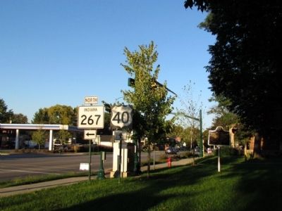
On E. Main Street (U.S. 40) at Avon Avenue (State Road 267), on the right when traveling east on E. Main Street.
has been the site of annual meeting of Religious Society of Friends since 1858. The Depository was erected to house Quaker records, 1873. Friends Central Academy served as secondary school, 1881-1919. — — Map (db m69404) HM
On S. High St at E. Main St, on the right when traveling north on S. High St.
Seth Hinshaw, (1787-1865), well-known abolitionist, operated a station of the Underground Railroad on this site, prior to the Civil War. He also operated a store in which he refused to sell goods produced by slave labor. In 1843, Hinshaw helped . . . — — Map (db m63804) HM
On North County Road 750E (County Road 750), on the right when traveling south.
Co-inventor of the airplane with his brother, Orville, he began studying flight, 1896; built first model airplane, 1899; began gliding, 1900; and achieved first successful powered flight at Kitty Hawk, North Carolina, December 17, 1903. — — Map (db m4664) HM
Here on July 4, 1894, Elwood Haynes made the first test run of an automobile which he designed and built. His car reached a speed of about seven miles per hour over a six mile course on the Pumpkinvine Pike. — — Map (db m1455) HM
On North Jefferson Street at East Washington on North Jefferson Street.
Canal Landing on Washington Street. The Huntington Landing started 120 feet west on Washington St and continued to the lock at Cherry St. The Wabash & Erie canal was 4 feet deep and 100 feet wide as this point. Other locks were at First St. . . . — — Map (db m65223) HM
On Henry St. near Charles St., on the left when traveling north.
Drover Town, the first addition south of the Little River was platted Aug. 22, 1857 by Henry Drover. It included about 20 of his 160 acres of woodland. Family first names were given to the streets. Additional subdivisions followed. Huntington's . . . — — Map (db m55693) HM
On West Park Drive (Business U.S. 24) 0.1 miles west of Dimond Street, on the right when traveling west.
Pioneering cryptanalyst Elizebeth Friedman was born in Huntington. She developed her skill in codebreaking while searching for supposed hidden messages Shakespeare’s plays at Riverbank Laboratories in Illinois in the 1910s. There, she and her . . . — — Map (db m238488) HM
On West Park Drive at SR 9, on the right when traveling east on West Park Drive.
The junction of the Wabash and Little rivers, 100 yards south, was the western terminus of the Maumee-Wabash long portage and, in 1835, of the first section of the Wabash and Erie Canal. During the 18th century French and English traders passed this . . . — — Map (db m45118) HM
On Wabash Road (U.S. 24) at N Marion Road (State Road 9) on Wabash Road.
Jean Baptiste Richardville
(Pe-she-wah), 1761-1841
last great chief of the Miamis, made the forks of the Wabash his principal residence. His mother was the influential Tau-cum-wah sister of Chief Little Turtle. — — Map (db m7541) HM
On Jefferson St. 0.1 miles north of Riverside Dr., on the right when traveling south.
Huntington's Ford and First Bridge. Pioneers forded Little River From Charles Street diagonally across just below the Island to the Court House. A dugout canoe, when hailed, carried pedestrians across for 50 cents. Reportedly Indians had used . . . — — Map (db m283084) HM
Huntington, the “Lime City.” so named for its many limestone quarries and kilns, the first kiln being built in this vicinity by Michael Houseman in 1843 or 1844. By 1885 there were 31 kilns in operation: eight were perpetual kilns, the . . . — — Map (db m7544) HM
On State Road 105 at State Road 124 on State Road 105.
(Side 1) Pioneer Medical Doctors. George A. Osborn, 1823-1902, Margaret Osborn, 1827-1914, Parents of Chase S. Osborn. The mother launched upon active practice here 1860. The father practiced in Ohio before 1850.
(Side 2) . . . — — Map (db m61750) HM
(Front Side)
Born 1810 in what is now Huntington County. She was a granddaughter of Miami Chief Little Turtle. Her second husband was Antoine Revarre; her son Anthony Revarre, lived with her near Roanoke and acted as interpreter since . . . — — Map (db m61120) HM
First lock west of summit level of Wabash and Erie Canal (connected Lake Erie with Ohio River in 1853). Known as Dickey Lock. Built as Lock 1, 1834-1835, of wood construction; renumbered Lock 4 as result of canal completion to Ohio line (1840). . . . — — Map (db m61119) HM
On East 3rd Street at N Main Street on East 3rd Street.
Side A A Warren Public Library Board was organized in June 1916 after a public fundraising campaign to buy books and periodicals. In 1917, a grant of $10,000 from the Carnegie Corporation was confirmed to support construction of a free . . . — — Map (db m41467) HM
On South Main Street (U.S. 50) at East Cross Street, on the right when traveling north on South Main Street.
In Memory of Col. John Ketcham
1782 - 1865
Fearless pioneer, Ranger, surveyor, public servant who dedicated this public square for seat of government of Jackson County, Ind. when Brownstown was founded April 8, 1816.
Time Capsule . . . — — Map (db m46756) HM
On Perry Street (State Road 235) at Main Street, on the right when traveling north on Perry Street.
West Lee Wright laid out Medora 1853. Sample of local shale was made into brick “excellent for building and paving” 1904. Medora Shale Brick Company organized 1904. Construction began by 1910, one south of here along Baltimore & Ohio . . . — — Map (db m74168) HM
On North Broadway Street (State Road 11) south of East 2nd Street, on the left when traveling south.
Side 'One'
On April 15, 1860 at the Seymour railroad depot, a shipping box was damaged while being transferred; McClure was discovered inside and immediately identified himself as a fugitive slave from Nashville, Tennessee. The box had been . . . — — Map (db m46663) HM
On South Walnut Avenue (State Road 11) at B. Avenue East, on the right when traveling south on South Walnut Avenue.
Activated December 1942 as U.S. Army Air Forces advanced training school for World War II twin engined pilots; graduated over 4000 by February
1945. Construction of 413 structures and four 5,500-foot runways supervised by U.S. Army Corps of . . . — — Map (db m13625) HM
On West Tipton Street (U.S. 50) at South Airport Road, on the left when traveling east on West Tipton Street.
Activated December 1942 as U.S. Army Air Forces advanced training school for World War II twin engined pilots; graduated over 4000 by February
1945. Construction of 413 structures and four 5,500-foot runways supervised by U.S. Army Corps of . . . — — Map (db m13626) HM
On A Avenue 0.1 miles west of 1st Avenue East, on the right when traveling west.
Despite fighting for democracy in WWII,
African Americans were denied their
rights at home. Here, Tuskegee Airmen
of the 477th Bombardment Group
protested discrimination by trying to
enter the white officers' club in
April 1945, resulting in . . . — — Map (db m250686) HM
On U.S. 50 west of Schleter Road (County Road E410N), on the right when traveling west.
800 feet northwest is the point which marks the junction of the Grouseland Treaty line of 1805 with the Fort Wayne Treaty line of 1809. These and other treaties permitted early white settlement of Indiana. — — Map (db m74056) HM
On State Road 135 at South Main Street (County Road S310W), on the right when traveling south on State Road 135.
Site in town of stockade built in 1812 on old Indian trail for protection of the settlers in this area. Garrisoned by Maj. John Tipton and his militia Rangers in 1813. Marker on the site. — — Map (db m167022) HM
Near U.S. 231 at County Road 1700N. Reported missing.
In December, 1679, Robert Cavalier, Sieur de La Salle, with thirty men crossed northwestern Indiana by way of the Kankakee River in an attempt to find a water route to the Pacific Ocean. — — Map (db m64157) HM
Fountain Park has been the site of annual Chautauqua sessions since 1895. The Chautauqua continues to promote traditional values and religious, social and educaitonal activities upon which it was founded. — — Map (db m3806) HM
On East Michigan Street at North Ohio Street on East Michigan Street.
Built 1897 by Challenge Wind and Feed Mill Company of Batavia, Illinois. Rare tower and wood tank structure is an original example of nineteenth century public water utility facility, construction methods, and technology. Tower has limestone . . . — — Map (db m1513) HM
On West Washington Street (U.S. 231), on the right when traveling west.
General Robert H. Milroy, 1816–1890, was appointed colonel of the 9th Indiana Infantry, later promoted to brigadier and major general. He saw extensive action in western Virginia. After the war he served as Indian agent in State of Washington. — — Map (db m2312) HM
On Washington Street (U.S. 231) at Front Street, on the left when traveling west on Washington Street.
Born February 17, 1892 in Rensselaer; became part of New York Tin Pan Alley music scene. Wrote for Broadway musicals such hits as "Second Hand Rose" (Grant Clarke, lyrics) for Fanny Brice (1921 Ziegfeld Follies) and "Zing! Went the Strings of . . . — — Map (db m27712) HM
On South College Avenue (U.S. 231) at East Drexel Parkway on South College Avenue.
Erected by the Bureau of Catholic Indian Missions with funds from Katharine Drexel and operated by the Society of the Precious Blood with federal funds, 60 Indian boys from distant reservations were annually trained here. — — Map (db m2311) HM
On W County Road 650N 0.4 miles east of N Country Road 750W, on the left when traveling east.
Early Quaker settlement established 1836; center of Underground Railroad activity. Meeting house erected here, 1840, on land donated by Enos and Margaret Lewis; used by Congregational Friends, by Spiritualist society, as school, community hall; . . . — — Map (db m214984) HM
On State Road 7 at West Main Street on State Road 7.
Confederate forces under Gen. John Hunt Morgan camped near Dupont the night of July 11. They destroyed railroad track, burned bridges, freight cars and a warehouse, and stole 2, 000 hams from Mayfield's pork house. — — Map (db m45875) HM
On Cragmont Street north of Presbyterian Avenue, on the right when traveling north.
Born in Madison 1839. Family home on West Main Street. Attended Hanover College 1856-1858 to pursue practice of law. Attended Kentucky Military Institute in Frankfort. Organized Madison City Greys 1858, which became part of Sixth Regiment Indiana . . . — — Map (db m206804) HM
On Ohio River Scenic Byway (State Road 56) at South Eagle Hollow Road, on the right when traveling west on Ohio River Scenic Byway.
Harris, a free African American, came to Madison, 1839, as the fight over slavery along the Ohio River became more violent. He worked as a teamster, farmer, and Baptist minister. His family owned land in Eagle Hollow and Madison. Harris's activities . . . — — Map (db m206771) HM
On East Vaughn Drive east of St. Michaels Avenue, on the right when traveling east.
The Eagle Cotton Mill began production
here in 1885, shipping goods such as
twine, candle wick, and fabric via the
Ohio River to national and international
markets. After an economic downturn
in the mid-1800s, the mill helped
rejuvenate . . . — — Map (db m206779) HM
Near State Road 250 0.1 miles east of N. Rector Road (County Road N700W), on the right when traveling east.
(Side One)
College developed 1854 from Eleutherian Institute, founded 1848. Thomas Craven and anti-slavery advocates in the area created and supported the institution for education of students of all races and genders. This structure, . . . — — Map (db m74046) HM
On Jefferson Street north of East 2nd Street, on the right when traveling north.
On September 6, 1814, the Indiana Territorial Legislature authorized the organization of the Farmers' and Mechanics' Bank of Madison. The bank operated on this site for about ten years when its charter was revoked. — — Map (db m180788) HM
On Jefferson Street (U.S. 421) at 5th Street, on the right when traveling north on Jefferson Street.
Free blacks settled in Madison as early as 1820. The growing black community began businesses and organized churches and schools in this area, later called Georgetown. Risking their own freedom, some free black residents here actively aided slaves . . . — — Map (db m206726) HM
On East Main Street east of West Street, on the right when traveling west.
Born in Louisville, Kentucky 1898; after father's death, moved with family to Madison. Graduated from Madison High School 1916. After voice training in Indianapolis and Chicago, began singing professionally. Won lead in road show of Florenz . . . — — Map (db m22056) HM
On Elm Street at West First Street, on the right when traveling south on Elm Street.
Rendered his most important public service during the Civil War when he loaned Governor Oliver P. Morton over $400,000 to equip Indiana's troops. He later arranged additional loans to save the credit of the state. — — Map (db m180779) HM
On Boyd Road (County Road N700W) 0.3 miles north of State Road 250, on the right when traveling north.
(Side One)
The Tibbets provided assistance to fugitive slaves here in their home (now part of National Park Service, Network to Freedom); John piloted them to the next safe haven. Both were members of Neil’s Creek Anti-Slavery Society . . . — — Map (db m74045) HM
Near State Road 250 at Boyd Road (County Road N700W), on the right when traveling east.
(Side One)
Born in Vermont 1804. Moved to Jefferson County 1834, where he owned land and had several manufacturing businesses. Active in Neil’s Creek Anti-Slavery Society and in forming Liberty Party for abolition of slavery. He and his . . . — — Map (db m74044) HM
On East Vaughn Drive at Jefferson Street, on the right when traveling east on East Vaughn Drive.
Madison Historic District, listed in National Register, 1973, in over 130 blocks contains hundreds of structures of every type, size, and period, 1812-1920, including many outstanding examples of major 19th century architectural styles. Madison is . . . — — Map (db m65654) HM
On West Street south of West Main Street, on the right when traveling north.
Born Staunton, Virginia 1813. Purchased Madison Courier 1849; transformed it from pro-Democratic to voice for newly forming Republican Party. Promoted the Union and objected to Fugitive Slave Law. Was active in Republican Party politics. . . . — — Map (db m22055) HM
On U.S. 421 2 miles north of East 733 North, on the right when traveling north.
Decorated soldier and marksman
Samuel Woodfill was born on a farm
near here in 1883. He joined the U.S.
Army in 1901 and saw action in the
Philippines. With American
Expeditionary Forces he fought in the
WWI Meuse-Argonne Offensive in
France. . . . — — Map (db m289219) HM
On N. Base Road 0.4 miles south of Washington Street.
Adam Kellar began constructing a stone mill race on Sand Creek, 1813, and opened grist mill, 1823. Mill was important to local economy and was an impetus for development: state road to mill established, 1834, and Brewersville founded, 1837. . . . — — Map (db m73975) HM
On U.S. 50 at County Road E325N, on the right when traveling east on U.S. 50.
Mother of President Richard M. Nixon was born on a farm four and a half miles southeast to which her grandparents came in 1854. Hannah's parents moved to California in 1897 when she was twelve years old. — — Map (db m74039) HM
On State Road 7 at County Road W500N, on the right when traveling north on State Road 7.
Territorial Governor, William Henry Harrison, in a treaty with Indians held at Vincennes, secured lands which for the first time opened the entire north bank of the Ohio River for settlement. — — Map (db m45881) HM
On Indiana 3 at Muscatatuck Park Road, on the right when traveling south on Indiana 3.
Recognized for its natural beauty and
recreational potential, Vinegar Mills
State Park opened in 1921 as Indiana's
fourth state park. Initially named after
a stone-cutting mill here, it became
Muscatatuck State Park in 1922. The
Works Progress . . . — — Map (db m289215) HM
On Indiana Route 7 at Muscatatuck Park Entrance Road, on the left when traveling north on Indiana Route 7. Reported missing.
Opened 1921 as Indiana's fourth state park for its natural beauty and recreation potential. Named Vinegar Mills State Park after stone-cutting mill in park. Renamed Muscatatuck State Park 1922. Stone shelters and stairways, fire tower, trails, . . . — — Map (db m45877) HM
On Jackson Street (State Road 7) at Perry Street, on the left when traveling east on Jackson Street.
Jennings County, formed 1816, named in honor of Jonathan Jennings: territorial delegate to Congress, 1809-1816; president of Indiana Constitutional Convention, 1816; first governor of state, 1816-1822; member of United States House of . . . — — Map (db m45807) HM
On Jackson Street (State Road 7) east of North Pike Street, on the left when traveling east.
During the Civil War, Confederate General John Hunt Morgan led a raid into southern Indiana, July 8-13, 1863. On July 11, he demanded the surrender of Vernon. Colonel Hugh T. Williams, Indiana Legion, replied that Morgan "must take it by hard . . . — — Map (db m48965) HM
On Jackson Street (State Road 7) at North Pike Street, on the left when traveling east on Jackson Street.
Side 'One':
Vernon platted 1815. Jennings County formed by Indiana General Assembly 1817; Vernon named county seat 1817. Madison-Indianapolis Railroad reached Vernon 1839; masonry arch, elevating track over Pike Street, remains. Vernon . . . — — Map (db m45809) HM
On N. Walnut St at W. King St, on the right when traveling south on N. Walnut St.
McNutt, born July 19, 1891 at 200 N. Walnut, was Indiana's 33rd Governor (1933-1937), state and national American Legion Commander, I. U. Law School Dean, High Commissioner and first U.S. Ambassador to Philippine Republic. Died March 24, 1955; . . . — — Map (db m66821) HM
On N. Yandes St south of E. Adams St, on the right when traveling south.
As Indiana's 42nd governor 1965-1969, championed equal opportunity in education and housing. Earned degrees from Franklin College and Harvard University. Deputy prosecutor of Johnson and Brown counties 1926-1929. Practiced law in Franklin, . . . — — Map (db m66820) HM
On S. Georgetown Rd at E County Road 775S, on the right when traveling south on S. Georgetown Rd.
(Front Side)
Prolific artist who helped develop and promote a style internationally recognized as distinctly American. Born 1849 near here; studied art in Indianapolis, New York, and Munich. Returned to New York in 1878; opened lavish . . . — — Map (db m66832) HM
On Center Street at East Main Street, on the left when traveling north on Center Street. Reported missing.
Trailblazing basketball coach Ray Crowe of Johnson County excelled at multiple sports at Whiteland High School and Indiana Central College in the 1930s before beginning a career in education. In 1950, he became head basketball coach at . . . — — Map (db m289108) HM
On Lyndale Avenue west of Short Street, on the right when traveling west.
"One of America's Clowns"
Comedian Richard "Red" Skelton was born here in 1913. As a teenager, performed locally in minstrel shows and as a clown in circus. By 1930s he performed on vaudeville stages; became famous for skits such as . . . — — Map (db m177921) HM
On North 1st Street at North 1st Street, on the left when traveling north on North 1st Street.
Built in 1787 by Major John F. Hamtramck under command of General Josiah Harmar. United States Army's most western outpost for several years. Named for General Henry Knox, first Secretary of War. — — Map (db m243615) HM
On Main Street at Main Street, on the right when traveling west on Main Street.
Bavarian Jewish immigrants Adam and Solomon Gimbel worked as peddlers before establishing a dry goods and clothing store here by 1848. Regular advertising and quality goods drew customers, and the business prospered. The company moved to . . . — — Map (db m272751) HM
On Main Street north of 5th Street, on the right when traveling north.
A state-of-the art facility, the Pantheon Theatre opened on May 16, 1921 with the Broadway show Midnight Whirl. It provided patrons with news and entertainment, including vaudeville acts and moving pictures likeBen-Hur. The . . . — — Map (db m177922) HM
On North 8th Street south of Broadway Street, on the right when traveling south.
Born circa 1801, Clark, a slave, was purchased in Kentucky in 1814 by B. J. Harrison, brought to Vincennes in 1815, and indentured as his servant. In 1816, G.W. Johnston purchased her indenture for 20 years. In 1821, Clark and attorney Amory . . . — — Map (db m306959) HM
On North 1st Street north of Seminary Street, on the right when traveling north.
Home of French fur trader Michel Brouillet (1774-1838). French Creole cottage (built circa 1806) is typical of "posts-on-sill" construction technique used by French settlers in Mississippi Valley during eighteenth and early nineteenth centuries. . . . — — Map (db m243614) HM
On Harrison Street north of North 1st Street, on the left when traveling north.
First resident Presbyterian minister in Indiana Territory, 1808. Headed the first school under the authority of the board of trustees of Vincennes University (a grammar school), 1811-1815. Served as member of board of trustees of Vincennes . . . — — Map (db m48966) HM
On North 7th Street at Seminary Street, on the left when traveling north on North 7th Street.
Designed by local architect John B. Bayard in Collegiate Gothic Style; built 1917-1918. Dedicated 1919, with 13, 518 books and 4, 207 registered borrowers, as Vincennes Public Library; Public Library located in City Hall since 1889. Modern . . . — — Map (db m23254) HM
On Park Street west of Harrison Street, on the right when traveling west.
Harrison became Governor of Indiana Territory 1800; he administered government of District of Louisiana 1804-1805. In Vincennes, he served as a contact during the expedition; surviving records document his support and his involvement in decisions . . . — — Map (db m23251) HM
On State Road 25 at Oak Street, on the left when traveling west on State Road 25.
Born in Mentone, Lawrence D. Bell (1894-1956) became one of America's foremost aviation pioneers. He founded Bell Aircraft Corporation in Buffalo, New York, 1935. Advanced aircraft manufactured included Bell helicopters, America's first jet, and . . . — — Map (db m45491) HM
On North Shore Drive 0.5 miles east of North Long Drive, on the right when traveling east.
Indians formerly wrapped their dead and secured them in the trees here. At the time of white settlement the wrappings were disintegrating and the bones were falling to the ground. — — Map (db m44937) HM
On Eli Lily Road 0.6 miles east of Warner Road, on the right when traveling east.
You are now entering Papakeechie's Reservation, 36 square miles. This Miami Chief, also known as Flat Belly, held this land from 1828 to 1834 when it was returned to the National Government. It was later owned by the Wabash & Erie Canal.
You . . . — — Map (db m44930) HM
Near Old U.S. 30 at Road 350 N, on the left when traveling west.
Built 1897 across Tippecanoe River by Bellefontaine Bridge and Iron Company of Ohio. Single-span 140-foot iron bridge is last remaining Pratt through truss bridge in county. U.S. Highway 30 bypassed it in 1924. Closed to vehicle traffic 1975. . . . — — Map (db m44919) HM
About 14,000 years ago melting blocks of ice from the last, or Wisconsin Glacier, formed the kettle-hole lakes of northern Indiana. The largest lake, Wawasee, and the deepest lake, Tippecanoe, are in Kosciusko County. — — Map (db m199375) HM
On South High Street at East Center Street, on the left when traveling north on South High Street.
This third county jail, including a sheriff’s residence, was built in 1870 by Richard Epperson. Chicago architect, George O. Garnsey designed it in Neo-Gothic Style. Rusticated stonework and turrets create the appearance of a small castle to provide . . . — — Map (db m1625) HM
On South Detroit Street at East Winona Avenue, on the right when traveling south on South Detroit Street.
1851-1876
One of the first secondary schools in the area. Built at the call of the Presbyterian Church by Robert Cowen and his wife Jane Cowen Headmistress. A fire of unknown origin burned the Seminary to the ground in December 1879. — — Map (db m1624) HM
On U.S. 20 0.5 miles east of State Road 3, on the right when traveling west.
The Fourier System of communal living was attempted here between 1843 and 1848. Approximately thirty families lived by rules established in councils of industry, commerce, justice and education. Their "new social order" was a failure. — — Map (db m44878) HM
On US-30, Lincoln Highway, Joliet Street (U.S. 30), on the right when traveling east.
The Lincoln Highway. United States' first transcontinental highway, constructed 1913-1928, from New York City to San Francisco. Dedicated to the memory of Abraham Lincoln. Conceived by Carl G. Fisher to encourage building "good roads." . . . — — Map (db m213119) HM
On West 15th Avenue at Madison Street, on the right when traveling west on West 15th Avenue.
Froebel opened here, 1912, as many European immigrants and southern blacks moved to Gary for jobs in steel mills. An experiment in progressive education, it served students of diverse backgrounds and the local community. Despite early status as . . . — — Map (db m200372) HM
On West 25th Avenue, on the right when traveling west.
As Gary grew in the early 1900s, African American students were segregated within white schools or overcrowded into small, separate schools. To compensate, officials transferred some Black students to Emerson High School in 1927. After over 600 . . . — — Map (db m200382) HM
On Colfax Street at King Street, on the right when traveling south on Colfax Street.
The Hagenbeck-Wallace Circus. The Hagenbeck-Wallace Circus, organized in 1907, became one of the largest and most recognized shows to tour the united States. Resembling a small city, by 1918, it featured over twenty tents, 1000 workers and . . . — — Map (db m238554) HM
On West 35th Avenue at Washington Street, on the right when traveling west on West 35th Avenue.
By 1921, Indiana University offered courses in Lake County, later establishing extension centers in the Calumet Region. As manufacturing jobs in the area drew Black Americans from the South and European and Latino immigrants. IU offered . . . — — Map (db m244325) HM
On Madison Street south of West 19th Avenue, on the left when traveling south.
Representative Katie Hall (1938-2012). Democratic leader Katie Hall was born in rural Mississippi and moved to Indiana in 1960. She taught in Gary before serving in the Indiana General Assembly, 1974-82. Hall became the first African American . . . — — Map (db m241795) HM
On Ellsworth Street at Ellsworth Street, on the left when traveling south on Ellsworth Street.
In need of their own place to worship in the segregated city of Gary, a group of Black professionals helped establish St. Augustine's Episcopal Mission in 1927. In the late 1930s and 1940s, Benedictine monks, assigned by the Episcopal Diocese of . . . — — Map (db m298694) HM
On Taft St at W. 10th Ave, on the right when traveling north on Taft St.
St. John's Church, the oldest surviving institution in Gary and north of the Little Calumet River, began with the work of the Rev. Henry Wunder in the early 1860's. He regularly came from Chicago by horse and buggy. Baptism records date from 1863; . . . — — Map (db m200365) HM
On East Massachusetts Street at West 15th Avenue, on the right when traveling east on East Massachusetts Street.
Stewart House was organized during depression of 1921 to provide social services for Gary’s black community. A vital neighborhood center for unemployed WWI veterans and southern blacks who migrated for jobs in steel mills, it helped thousands . . . — — Map (db m200378) HM
On Kenwood Street at Howard Avenue, on the right when traveling east on Kenwood Street.
Mt. Zion Missionary Baptist Church became a center for religious, political, social, and civic life for Hammond's African American community. Established by black members ca. 1919, the small congregation grew under long-serving pastor Rev. . . . — — Map (db m267379) HM
On Kleinman Rd 0.1 miles south of Ridge Rd (Business U.S. 6), on the left when traveling south.
Dutch immigrants after 1850 began moving to this area because of its similarities to their homeland. They helped to locate ditches to drain water from the extensive marshes, leaving rich land to expand successful horticultural activities. — — Map (db m64160) HM
Henry D. Palmer, M.D. (1809-1877) located at this site in 1836. First physician in Lake County, he was also counselor to the pioneers for 40 years and member of the underground railroad aiding escaped slaves. — — Map (db m27716) HM
On West 73rd Avenue at Broadway (State Route 53), on the left when traveling west on West 73rd Avenue.
Part of a transcontinental trail used by prehistoric peoples of North America, it passed through modern Detroit, Rock Island and Davenport in the Midwest. The trail was important into the 19th century. — — Map (db m254794) HM
On Joliet St (U.S. 30) 0.1 miles east of St. John Rd, on the right when traveling east.
Built, 1853, approximately one half mile south; closed, 1907; moved to this site and restored for educational and community uses, 1993-1994. One of twelve St. John Township schools; structure typical of early one-room school buildings in Indiana. — — Map (db m64172) HM
On West Lincoln Highway Highway (U.S. 30) at Janice Drive, on the right when traveling west on West Lincoln Highway Highway.
The Lincoln Highway. United States' first transcontinental highway, constructed 1913-1928, from New York City to San Francisco. Dedicated to the memory of Abraham Lincoln. Conceived by Carl G. Fisher to encourage building "good roads." . . . — — Map (db m213118) HM
On State Road 39 south of County Road W250S, on the left when traveling south.
Proposed in 1905 as a 742 mile, straight-line, high speed route, without crossings; estimated ten hours travel time at a cost of ten dollars. Just under twenty miles, between La Porte and Chesterton, were constructed, 1906-1911. — — Map (db m43376) HM
On State Road 2 at Colfax Avenue, on the right when traveling west on State Road 2.
Two Civil War training camps: Colfax and Jackson, were located near La Porte. The 9th and 29th Indiana Volunteer Infantry regiments were organized and trained here. — — Map (db m43375) HM
On Pine Lake Avenue north of Weller / Truesdell Ave., on the right when traveling north.
Side One
Northwest Territory formed 1787; Indiana Territory formed 1800. Admission of Ohio 1803 and formation of Michigan Territory 1805 established Indiana Territory's northern boundary at southern tip of Lake Michigan. When Indiana became . . . — — Map (db m43369) HM
On Harrison Street at Clay Street, on the right when traveling east on Harrison Street.
La Porte University. La Porte University was established in the early 1840s to include law, literary, and medical departments. The medical department, later Indiana Medical College, began classes by 1842. Its distinguished faculty attracted . . . — — Map (db m202849) HM
On Lincolnway west of Michigan Avenue, on the right when traveling west.
Side One
County formed by Indiana General Assembly and La Porte selected county seat 1832. Three courthouses built on this site: first 1833, second 1847-1848. Present courthouse constructed 1892-1894 of Lake Superior Red Sandstone; designed . . . — — Map (db m43373) HM
On Indiana Avenue south of Maple Avenue, on the right when traveling south.
Side One
La Porte's first public library was established 1896. La Porte City School Board was awarded $27, 500 Carnegie grant 1916; by 1919 local support had been secured to meet grant requirements. Architect Wilson B. Parker designed the . . . — — Map (db m43371) HM
On Madison Street at Madison Street, on the right when traveling west on Madison Street.
Meinrad Rumely (1823-1904), a German immigrant, founded a blacksmith shop here 1853, which grew into a dominant company through reorganizations and acquisitions. Rumely companies in La Porte benefited from available rail transportation plus . . . — — Map (db m43362) HM
On East Michigan Avenue (U.S. 35) at Carroll Avenue on East Michigan Avenue.
One of three Civil War training camps in La Porte County. Site is one fourth mile west. Named for Colonel Edward Anderson. Used 1863-1864 to train Indiana Union volunteers of the 127th, 128th, and 129th regiments. — — Map (db m969) HM
On East Michigan Boulevard (U.S. 12) at Pine Street on East Michigan Boulevard.
Assassinated President Abraham Lincoln’s funeral was April 19, 1865 at the White House. The funeral train left for Springfield, Illinois April 21 directed by military; stops en route allowed the public to pay homage. From Indianapolis, train . . . — — Map (db m60670) HM
On I Street north of Parkview Drive (U.S. 50), on the right when traveling north.
Courthouse square, part of original 1825 plat, surrounded by nineteenth and early twentieth century commercial buildings in various architectural styles. Limestone facing quarried and milled by local industry. Listed in National Register of Historic . . . — — Map (db m48967) HM
On 23rd Street west of P Street, on the right when traveling west.
(Side One)
Lawrence County Hospital Association was organized July 15, 1903 to build, maintain, and manage a hospital in Bedford. Opened first building 1904. State, district, and local Works Progress Administration officials and city and . . . — — Map (db m74128) HM
641 entries matched your criteria. Entries 201 through 300 are listed above. ⊲ Previous 100 — Next 100 ⊳