174 entries match your criteria. The first 100 are listed. ⊳
Lincoln Highway Historical Markers
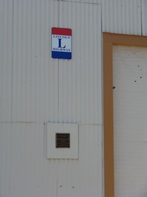
By Syd Whittle, June 14, 2009
Duarte Garage Marker and Lincoln Highway Sign
| 1 ► California, Alameda County, Livermore — Duarte Garage — Built 1915 — |
| Near Pine Street near L Street. | |||
| 2 ► California, Alameda County, Livermore — Duarte Garage — Built Circa 1915 by F.H. Duarte — |
| On Portola Avenue, on the right when traveling east. | |||
| 3 ► California, Contra Costa County, San Pablo — 512 — The Lincoln Highway in San Pablo — |
| On San Pablo Avenue at Church Lane, on the left when traveling north on San Pablo Avenue. | |||
| 4 ► California, El Dorado County, El Dorado Hills — 699 — Mormon Tavern — Overland Pony Express Route - California — |
| On PG&E-Clarksville Sub-Station Road, on the right when traveling west. | |||
| 5 ► California, Nevada County, Truckee — Donner Pass — Who Passed This Way — |
| On Donner Pass Road (Old Highway 40). | |||
| 6 ► California, Nevada County, Truckee — Donner Summit Canyon History — |
| On Donner Pass Road near Edie Court, on the right when traveling east. | |||
| 7 ► California, Placer County, Auburn — Lincoln Highway — |
| On Ophir Road near Werner Road, on the right when traveling west. | |||
| 8 ► California, Placer County, Cisco Grove — The Lincoln Highway — |
| 9 ► California, Placer County, Emigrant Gap — 4 — Lincoln Highway — Hwy 40 Scenic Bypass — |
| On Hampshire Rocks Road, on the left when traveling east. | |||
| 10 ► California, Sacramento County, Elk Grove — The Lincoln Highway — |
| 11 ► California, Sacramento County, Rancho Cordova — The Lincoln Highway — "America's First Transcontinental Road" — |
| Near Mills Station Road west of Mather Field Road, on the right when traveling west. | |||
| 12 ► California, San Francisco City and County, San Francisco, Lincoln Park — Western Terminus of the Lincoln Highway — |
| On 34th Avenue near El Camino del Mar, on the left when traveling south. | |||
| 13 ► California, San Joaquin County, Lathrop — America's First Coast-to-Coast Road — Historic Lincoln Highway — |
| On Harlan Road at Thomsen Road on Harlan Road. | |||
| 14 ► California, San Joaquin County, Tracy — Lincoln Highway — 1913 1928 — |
| On 11th Street (California Route 205) near North McArthur Drive, on the right when traveling east. | |||
| 15 ► California, San Joaquin County, Tracy — Lincoln Highway — 1913 - 1928 — |
| On 11th Street (California Route 205) east of Cable Road, on the right when traveling west. | |||
| 16 ► California, Yolo County, Davis — Davis Subway — Richards Blvd. Underpass — |
| Near Richards Boulevard, 0.5 miles south of 1st Street, on the left when traveling north. | |||
| 17 ► California, Yolo County, Davis — Lincoln Highway Marker — |
| On Russell Boulevard at B Street, on the left when traveling west on Russell Boulevard. | |||
| 18 ► California, Yolo County, Davis — Lincoln Highway Marker — |
| Near Russell Boulevard at Arthur Street, on the left when traveling west. | |||
| 19 ► District of Columbia, Washington, Northwest Washington, The Ellipse — Zero Milestone — President's Park — |
| On E Street Northwest west of 15th Street Northwest. | |||
| 20 ► Illinois, Cook County, Chicago Heights — Chicago Heights — Illinois — |
| On East Lincoln Highway (East 14th Street) (U.S. 30) at Lowe Avenue, on the right when traveling west on East Lincoln Highway (East 14th Street). | |||
| 21 ► Illinois, Cook County, Sauk Village — Sauk Village — Sauk Trail was the Original Route of the Lincoln Highway — The Route Included Kalvelage Bridge — |
| On Sauk Trail, on the right when traveling east. | |||
| 22 ► Illinois, DeKalb County, Malta — Illinois Lincoln Highway — The First Seedling Mile in the Country — |
| Near Malta Road (County Highway 31) 0.1 miles north of Lincoln Highway (State Route 38), on the left when traveling north. | |||
| 23 ► Illinois, DeKalb County, Malta — Illinois Lincoln Highway — Mobilizing the Country Changed Society — |
| Near Malta Road (County Highway 31) 0.1 miles north of Lincoln Highway (State Route 38), on the left when traveling north. | |||
| 24 ► Illinois, DeKalb County, Malta, Malta Township — Lincoln Highway — Village of Malta — Putting Malta on the map — |
| Near Malta Road (County Highway 31) 0.1 miles north of Lincoln Highway (State Route 38), on the left when traveling north. | |||
| 25 ► Illinois, DeKalb County, Malta, Malta Township — Lincoln Highway Seedling Mile — |
| Near Malta Road (County Highway 31) 0.1 miles north of Lincoln Highway (State Route 38), on the left when traveling north. | |||
| 26 ► Illinois, DeKalb County, Malta, Malta Township — Malta — The Seedling Mile — The Lincoln Highway in Illinois — |
| On Jefferson Street at North 3rd Street, on the left when traveling west on Jefferson Street. | |||
| 27 ► Illinois, DeKalb County, Malta, Malta Township — The Lincoln Highway – The nation's first coast-to-coast highway! — Rich in History and Culture — |
| Near Malta Road (County Highway 31) 0.1 miles north of Lincoln Highway (State Route 38), on the left when traveling north. | |||
| 28 ► Illinois, Kane County, Aurora — The City of Lights — Aurora, Illinois — |
| On North Broadway (Illinois Route 25) just north of East New York Street, on the right when traveling south. | |||
| 29 ► Illinois, Kane County, Geneva — The Lincoln Highway — Amenities Along The Highway — Geneva, Illinois — |
| On State Street (Illinois Route 38) at 2nd Street, on the left when traveling west on State Street. | |||
| 30 ► Illinois, Ogle County, Creston, Dement Township — Creston — Lincoln Highway Water Fountains — |
| On North Main Street just north of West North Street, on the left when traveling north. | |||
| 31 ► Illinois, Ogle County, Oregon — Illinois Lincoln Highway — Architecture Along the Highway — |
| On West Washington Street (Illinois Route 64) just east of South 5th Street, on the right when traveling east. | |||
| 32 ► Illinois, Ogle County, Oregon — Illinois Lincoln Highway — Art Along the Highway — |
| On West Washington Street (Illinois Route 64) just east of South 5th Street, on the left when traveling west. | |||
| 33 ► Illinois, Ogle County, Oregon — Lincoln Highway — City of Oregon — An Artist's Retreat — |
| On Washington Street (Illinois Route 64) just east of South 5th Street, on the left when traveling west. | |||
| 34 ► Illinois, Ogle County, Oregon — The Lincoln Highway - The nation's first coast-to-coast highway! — Rich in History and Cluture — |
| On West Washington Street (Illinois Route 64) just east of South 5th Street, on the right when traveling east. | |||
| 35 ► Illinois, Ogle County, Rochelle — "Fill 'er up!" — Illinois Lincoln Highway — |
| 36 ► Illinois, Ogle County, Rochelle — Better Roads for a Bright Future — Illinois Lincoln Highway — |
| 37 ► Illinois, Ogle County, Rochelle — City of Rochelle — Lincoln Highway — Hub City — |
| 38 ► Illinois, Ogle County, Rochelle — The Lincoln Highway - The nation's first coast-to-coast highway! — Rich in History and Culture — |
| 39 ► Illinois, Whiteside County, Fulton — Lincoln Highway — City of Fulton — Fulton Offers a Warm Welcome to Travelers — |
| Near 10th Avenue at 3rd Street, on the left when traveling west. | |||
| 40 ► Illinois, Whiteside County, Fulton, Fulton Township — Illinois Lincoln Highway — A Link to the West — |
| On 10th Avenue at 3rd Street, on the left when traveling west on 10th Avenue. | |||
| 41 ► Illinois, Whiteside County, Fulton, Fulton Township — Illinois Lincoln Highway — Speed Racer — |
| Near 10th Avenue at 3rd Street, on the left when traveling west. | |||
| 42 ► Illinois, Whiteside County, Fulton, Fulton Township — The Lincoln Highway – The nation's first coast-to-coast highway! — Rich in History and Culture — |
| Near 10th Avenue at 3rd Street, on the left when traveling west. | |||
| 43 ► Illinois, Will County, Crest Hill — Women on the Lincoln Highway — Crest Hill, Illinois — |
| On Plainfield Road (Lincoln Highway) (U.S. 30) just west of North Larkin Avenue, on the right when traveling west. | |||
| 44 ► Illinois, Will County, Frankfort — Frankfurt, Illinois — |
| On Lincoln Highway (Route 30) at Settlers Pond Drive, on the right when traveling east on Lincoln Highway. | |||
| 45 ► Illinois, Will County, Joliet — Route 66 Visitors Center — Joliet 66 Roadside Attraction — |
| On North Ottawa Street (Illinois Route 53) near Webster Street, on the right when traveling south. | |||
| 46 ► Illinois, Will County, Plainfield — Great American Crossroads in Illinois — Illinois Lincoln Highway — |
| On Lockport Street (Illinois Route 126) at Wood Farm Road, on the left when traveling west on Lockport Street. | |||
| 47 ► Illinois, Will County, Plainfield — Interurban Transportation — Illinois Lincoln Highway — |
| On Lockport Street (Illinois Route 126) at Wood Farm Road, on the left when traveling west on Lockport Street. | |||
| 48 ► Illinois, Will County, Plainfield — The Lincoln Highway - The nation's first coast-to-coast highway! — Rich in History and Culture — |
| On Lockport Street (Illinois Route 126) at Wood Farm Road, on the left when traveling west on Lockport Street. | |||
| 49 ► Illinois, Will County, Plainfield — Village of Plainfield — A Suburban Showcase — Lincoln Highway — |
| On Lockport Street (Illinois Route 126) at Wood Farm Road, on the left when traveling west on Lockport Street. | |||
| 50 ► Illinois, Will County, University Park — The Van Buren Sisters — |
| On Farmview Road just east of Surrey Lane, on the right when traveling west. | |||
| 51 ► Indiana, Allen County, New Haven — The Lincoln Highway — |
| On Lincoln Highway East west of Broadway Street, on the right when traveling west. | |||
| 52 ► Indiana, Elkhart County, Goshen — The Historic Goshen Police Booth — |
| On U.S. 33 at Lincoln Avenue, on the right when traveling south on U.S. 33. | |||
| 53 ► Indiana, Kosciusko County, Warsaw — Indiana ... Where It All Began! — |
| Near Old U.S. 30 at County Road N350W, on the right when traveling east. | |||
| 54 ► Indiana, Kosciusko County, Warsaw — The Lincoln Highway — |
| On N. Lake Street at Perry Street, on the left when traveling north on N. Lake Street. | |||
| 55 ► Indiana, Kosciusko County, Warsaw — The Lincoln Highway — The Path of Progress — |
| Near Old U.S. 30 at County Road N350W, on the right when traveling east. | |||
| 56 ► Indiana, Lake County, Dyer — The Ideal Section Of The Lincoln Highway — "The finest section of road in the world" — |
| On Joliet Street (U.S. 30) west of Northwinds Drive, on the left when traveling west. | |||
| 57 ► Indiana, Lake County, Dyer — The Lincoln Highway — Ideal Section & Monument — |
| On Joliet Street (U.S. 30) west of Northwinds Drive, on the right when traveling east. | |||
| 58 ► Indiana, Lake County, Dyer — 45.1996.2 — The Lincoln Highway / The "Ideal Section" — Approximate Western-extent of the "Ideal Section" — |
| On US-30, Lincoln Highway, Joliet Street (U.S. 30), on the right when traveling east. | |||
| 59 ► Indiana, Lake County, Schererville — Lincoln Highway - Ideal Section - 1923 — Prototype of construction technology intended to make it the finest road in the world — |
| On Joliet Street (U.S. 30) at Caroline Avenue, on the right when traveling east on Joliet Street. | |||
| 60 ► Indiana, Lake County, Schererville — The Lincoln Highway — America's first transcontinental highway passed 137 feet south of this spot — |
| On Joliet Street (U.S. 30) 0.2 miles east of Wicker Avenue (U.S. 41), on the right when traveling east. | |||
| 61 ► Indiana, Lake County, Schererville — 45.1996.1 — The Lincoln Highway / The "Ideal Section" — Approximate Eastern-extent of the 1.5 mile long "Ideal Section" — |
| On West Lincoln Highway Highway (U.S. 30) at Janice Drive, on the right when traveling west on West Lincoln Highway Highway. | |||
| 62 ► Indiana, LaPorte County, La Porte — The Lincoln Highway — America's First Paved Coast-to-Coast Highway — |
| Near Michigan Avenue at Washington Street, on the left when traveling north. | |||
| 63 ► Indiana, LaPorte County, La Porte — The Lincoln Highway in La Porte County — "Through the Door" — |
| Near Michigan Avenue at Washington Street, on the left when traveling north. | |||
| 64 ► Indiana, Marion County, Indianapolis, Downtown — Starke County — Organized in 1850 — Named for John Starke — |
| Near North Blackford Street north of Indianapolis Cultural Trail, on the right when traveling north. | |||
| 65 ► Indiana, Marshall County, Bourbon — The Lincoln Highway — America's First Coast to Coast Highway — |
| On South Main Street (Indiana Route 331) at Lincoln Highway (Center Street), on the right when traveling north on South Main Street. | |||
| 66 ► Indiana, Marshall County, Bourbon — The Lincoln Highway — Indiana: Two Distinct Routes - 1913 and 1928 — |
| On South Main Street (Indiana Route 331) at Lincoln Highway (Center Street), on the right when traveling north on South Main Street. | |||
| 67 ► Indiana, Marshall County, Plymouth — Historic Crossroads of America / The Lincoln Highway — |
| On E. Jefferson Street at Cleveland Street, on the right when traveling east on E. Jefferson Street. | |||
| 68 ► Indiana, Porter County, Valparaiso — The Lincoln Highway — |
| On Lincolnway west of Lafayette Street, on the right when traveling west. | |||
| 69 ► Indiana, St. Joseph County, New Carlisle — The Historic Lincoln Highway — Main Street Across America — |
| Near East Michigan Street (U.S. 20) east of South Arch Street, on the left when traveling west. | |||
| 70 ► Indiana, St. Joseph County, South Bend — 71.2010.1 — Lincoln & Dixie Highways — |
| On Washington Street at Michigan Street, on the left when traveling west on Washington Street. | |||
| 71 ► Indiana, Whitley County, Columbia City, Columbia Township — The Lincoln Highway — |
| Near West Jefferson Street, on the left when traveling east. | |||
| 72 ► Iowa, Carroll County, Arcadia — Influence of Railroads and Elevation — |
| On Lincoln Highway (U.S. 30) 0.3 miles east of Delta Avenue (County Road M68), on the left when traveling east. | |||
| 73 ► Iowa, Crawford County, Westside — Eugene Kock Memorial Park — |
| On Lincoln Highway (U.S. 30) just east of Main Street, on the right when traveling east. | |||
| 74 ► Iowa, Crawford County, Westside — Westside — |
| On Lincoln Highway (U.S. 30) east of Main Street, on the right when traveling east. | |||
| 75 ► Iowa, Greene County, Jefferson — Lincoln Highway — |
| On East Lincolnway Street. | |||
| 76 ► Iowa, Harrison County, Missouri Valley — 3389 Miles from New York to San Francisco... Join the Ride! — |
| Near Lincoln Highway (U.S. 30) just west of Monroe Avenue, on the right when traveling west. | |||
| 77 ► Iowa, Linn County, Lisbon — History of Our Town Lisbon, Iowa — |
| On North Washington Street (County Highway X20) just north of East Main Street (County Highway E48), on the right when traveling north. | |||
| 78 ► Iowa, Linn County, Lisbon — 1 — The Lincoln Highway — A Highway to Honor Lincoln — |
| Near East Main Street (County Highway E48) at North Washington Street (County Highway X20), on the right when traveling east. | |||
| 79 ► Iowa, Linn County, Mount Vernon — 2 — The Lincoln Highway — A Highway of Main Streets — |
| On 1st Street Southwest at Old Lincoln Highway (10th Avenue Southwest), on the left when traveling east on 1st Street Southwest. | |||
| 80 ► Iowa, Linn County, Mt. Vernon — 3 — The Lincoln Highway — "Seedling Miles" — |
| On West Mount Vernon Road (County Road E48) 0.1 miles south of Irish Lane, on the left when traveling south. | |||
| 81 ► Iowa, Tama County, Tama — The Historic "Lincoln Highway" Bridge — |
| On Lincoln Highway (Business U.S. 30) at East 5th Street, on the right when traveling east on Lincoln Highway. | |||
| 82 ► Nebraska, Buffalo County, Kearney — 488 — Buffalo County’s Lincoln Highway Seedling Mile — |
| On U.S. 30, on the right when traveling west. | |||
| 83 ► Nebraska, Dawson County, Cozad — 17 — The 100th Meridian — |
| On U.S. 30 at North Meridian Avenue, on the right when traveling east on U.S. 30. | |||
| 84 ► Nebraska, Hall County, Grand Island — 255 — The Lincoln Memorial Highway — |
| 85 ► Nebraska, Hall County, Grand Island — 482 — The Seedling Mile — |
| On Seedling Road, in the median. | |||
| 86 ► Nebraska, Keith County, Ogallala — Standard Oil Gas Station — “Hugh” — |
| On North Spruce Street near West 3rd Street, on the right when traveling south. | |||
| 87 ► Nebraska, Keith County, Ogallala — 8 — The Lincoln Highway — |
| On West First Street (U.S. 30). | |||
| 88 ► Nebraska, Kimball County, Kimball — 487 — Maginnis Irrigation Flume — |
| On Lincoln Highway (U.S. 30) just west of County Road 29, on the right when traveling east. | |||
| 89 ► Nebraska, Platte County, Duncan — Gardiner School — Platte County School District No. 8 — |
| On U.S. Hwy 30 Frontage Road (original Lincoln Hwy), 0.1 miles east of the intersection of 355th Avenue and 115th Street, on the left when traveling east. | |||
| 90 ► Nebraska, Platte County, Duncan — Lincoln Highway — |
| On Main Avenue at 9th Street, on the right when traveling north on Main Avenue. | |||
| 91 ► Nebraska, Platte County, Duncan — 462 — The Lincoln Highway - Gardiner Station Section — |
| On U.S. Hwy 30 Frontage Road (original Lincoln Hwy), 0.1 miles east of the intersection of 355th Avenue and 115th Street, on the left when traveling east. | |||
| 92 ► Nevada, Carson City — Lincoln Highway — First Marked Coast to Coast Federal Highway — |
| On North Carson Street (Lincoln Highway) (Business U.S. 395) at West Robinson Street, on the left when traveling north on North Carson Street (Lincoln Highway). | |||
| 93 ► Nevada, Churchill County, Middlegate — Middlegate Station — |
| Near Nevada Route 361 south of Lincoln Highway (U.S. 50), on the right when traveling south. | |||
| 94 ► Nevada, Douglas County, Spooner Summit — 261 — Spooner Summit — |
| On The Lincoln Highway (U.S. 50 at milepost 3.1), on the left when traveling west. | |||
| 95 ► Nevada, Elko County, West Wendover — Lincoln Highway — |
| Near Wendover Boulevard west of North Gene L. Jones Way, on the right when traveling west. | |||
| 96 ► Nevada, Eureka County, Eureka — 80 — Eureka Courthouse — |
| On Highway 50 near Ruby Hill Avenue. | |||
| 97 ► Nevada, Lyon County, Dayton — 3 — Lifeblood of the Mills — Dayton's History — |
| On Lincoln Highway (U.S. 50) south of 4th Avenue, on the right when traveling south. | |||
| 98 ► Nevada, Lyon County, Dayton — 2 — The Road to Nowhere — Dayton's History — |
| On Main Street just west of Lincoln Highway (U.S. 50), on the right when traveling west. | |||
| 99 ► Nevada, Lyon County, Dayton — 1 — Where Nevada Began — Dayton's History — |
| On Main Street just west of Lincoln Highway (U.S. 50), on the right when traveling west. | |||
| 100 ► Nevada, Lyon County, Fernley — America's First Transcontinental Highway — |
| On Farm District Road, 0.6 miles south of Farm District Road (Alternate U.S. 50), on the left when traveling south. | |||
174 entries matched your criteria. The first 100 are listed above. The final 74 ⊳