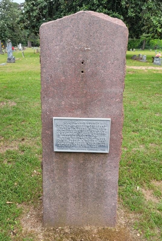
Replica, oldest Protestant Church in Texas. As Pilgrim Primitive Baptist Church, constituted July 28, 1855, in Crawford County, Ill.
Under guidance of Elder Daniel Parker, a "Moving Arm" of established church, 11 members entered Texas, Jan., . . . — — Map (db m245751) HM
Pioneer Baptist Minister
Born in Virginia
April 6, 1781 Died December 3, 1844
His Wife Patsy Dixon Parker
Born January 17, 1783 Died December 1, 1846 — — Map (db m245830) WM
In area known as Beaver Valley, settled about 1853 -- the year that pioneer P. G. Oldham built his home a half-mile northwest of this marker. This was on the Palestine-Athens Road, the route taken by mail hacks in early days. To the east was a . . . — — Map (db m155482) HM
The earliest marked graves in this cemetery date to the late 1850s. Although settlement of the Mound Prairie community occurred much earlier. Mound Prairie, once the home of a Baptist College known as Mound Prairie Institute, declined during the . . . — — Map (db m161101) HM
Murdoch McDonald was born in North Carolina on February 15, 1810, the son of Scottish immigrants. About 1832 he went to Georgia, where he met Dr. George Lester. In 1839, McDonald, along with Lester and his family, came to Texas. Settling in the . . . — — Map (db m136105) HM
A fort and stockade built about 1836 on the public square of the town of Houston (then in Houston County), as a protection against the Indians, by order of General Sam Houston, Commander-in-Chief of the Texan Armies. The town was abandoned in 1846 . . . — — Map (db m182048) HM
A stockade and blockhouse of the Republic of Texas. Built in 1835-1836 to protect settlers who founded Houston, a pioneer town, now in Anderson County.
Friendly Indians would come to trade at the site, but wary settlers often slept inside the . . . — — Map (db m182049) HM
Little is known about this Anderson County pioneer until he married Elizabeth Van Winkle in Crawford County, Illinois, in 1820. The Mains lived in the Illinois township of Palestine until 1833, when, drawn by a favorable change in the Mexican . . . — — Map (db m128935) HM
The crossroad of Crawford St. and the Wells Creek or Indian Creek has been a major part of Anderson County history.
1836 and earlier The Indians and settlers first traveled and traded along the creek making encampments and trading zones. . . . — — Map (db m232800) HM
Founded in 1840s as a ferrying point on the Caddo Trace; later became a major landing for flatboats and steamers on the Trinity River, where cotton and other products were shipped by a four-day trip to Galveston to be exchanged for flour, salt, . . . — — Map (db m232591) HM
One of last frontiers of Texas. Anglo settlement here lagged 60 years behind rest of state due to Indians and scarcity of water.
In 1886 O.B. Holt became first man to file for county land. First settlers included the Cowden brothers and Peter . . . — — Map (db m61375) HM
Named for old town of Florey, established as a post office 7 miles to the northeast in 1909, prior to the organization of Andrews County, June 1910.
In heart of the Means Oil Field, opened 1930, this park is at site of a 1934-1958 camp of . . . — — Map (db m61421) HM
In 1941 the Fullerton Oil Company of California struck oil near this site, and by 1945 more than 100 drilling rigs were in operation. The discovery brought great numbers of workers into the area, resulting in the establishment of the town of . . . — — Map (db m61418) HM
Founded when Andrews County was organized, in 1910, on land owned by Robert Madison Means (b. 1878). With his father, J.S. Means, "Bob" Means began homesteading here in 1899 and organized an abstract company in 1909. When Andrews battled Shafter . . . — — Map (db m61374) HM
First town in yet-unorganized Andrews County. Platted 1908.
Named for lake charted in 1875 survey of Col. Wm. R. Shafter, whose maps and victories over powerful Indians opened the Permian Basin to settlement.
Water trough built by John . . . — — Map (db m61420) HM
In 1875, Col. Wm. R. Shafter and a company of soldiers traveled from Fort Concho (where San Angelo is today) to Monument Springs, N. Mex., charting the arid plains, mapping all the vital watering places.
This marker is in the only town of . . . — — Map (db m61376) HM
Built in 1900, this is one of the
oldest houses in Andrews County.
S. H. Purcell, his wife, and two
relatives each filed on a section
of public land, building this home
where section-corners met, so
that each individual could fulfill
the . . . — — Map (db m164030) HM
Emporia Lumber Company co-owner S.F. Carter and M.T. Jones purchased over 5,000 acres of land in south Angelina County and established a company town named Emporia in 1893. The town included sawmill facilities, a railroad spur to ship lumber, . . . — — Map (db m37824) HM
The community of Prairie Grove began in 1845 and became a place for early settlers to gather. A cemetery began in 1849 when the young daughter of John M. and Caroline Stovall died. In the 1880s a school/church building was erected near the cemetery, . . . — — Map (db m79123) HM
Settlers attempted to form a townsite in this area in the 1890s, but it was not until the arrival of the railroad lines that it attracted a thriving population. Carved from virgin forests in the heyday of the southern pine timber industry and . . . — — Map (db m34882) HM
When Angelina County was organized in 1845, Alabama native Joseph Herrington (1823-89) was one of six men appointed by the legislature who set boundary lines and selected Marion as the first seat of government. That same year, at the age of 22, he . . . — — Map (db m32054) HM
Created and organized in 1846. Originally a part of Nacogdoches County. Bears the name of the river traversing the region. The following towns have served as the county seat; Marion,1846-1854; Jonesville,1854-1858; Homer, Feb. 3 - May 17, 1858, when . . . — — Map (db m29862) HM
City's hub, 1882-early 1900s, teeming with cotton buying, horse trades, band concerts, political rallies, switching railroad trains. Site of fire station, standpipe, 1933 memorial library named for lumberman J. H. Kurth (1857-1930), square was . . . — — Map (db m201867) HM
Founded 1882. Soon became a thriving sawmill community. Named for E.P. Lufkin, chief of crew that surveyed railroad through town. Has been county seat of Angelina County since 1892. Now a regional manufacturing and commerce center. Products include . . . — — Map (db m28715) HM
The Houston East and West Texas (HE&WT) Railroad came through Angelina County in 1882 and a community named Bitterweed Flat developed here. In 1913 W.E. Hoshall purchased land and timber rights in the area and began shipping logs from Hoshall Switch . . . — — Map (db m36108) HM
Regarded as the oldest Angelina County business in continuous operation, Kerr's began in 1870 as a general store in the early county seat of Homer (5 mi. SE). It was started by Civil War veteran Capt. Joseph Kerr (b. 1828), a native of South . . . — — Map (db m29153) HM
Members of the Mantooth family came to Angelina County in 1858. Albert Edwin (Eddie) Mantooth (1874-1969) was born in Homer, Angelina County, to Albert and Mary Richard Hall Mantooth. In 1897, Eddie married Sarah Annie Atkinson Mantooth (1879-1914). . . . — — Map (db m58779) HM
Italian-born Vicente Micheli (c.1755-1848) came to North America around 1770 via New Orleans and moved to the Spanish Territory of Texas by 1793. He settled first in Nacogdoches and later received a grant of land near this site. His grant was the . . . — — Map (db m160411) HM
Since the late 1800s, this cemetery has served the residents of the town of Pollok. Before the end of the 19th century, the Pollok community was established near a railroad. Here, Richard Blair built the settlement's first sawmill, setting Pollok's . . . — — Map (db m29229) HM
Located on Aransas Bay, the city of Fulton has a history closely associated with the fishing and shipping industry. The town was founded in 1867 by Geroge Ware Fulton, whose mansion is an important local landmark. Schools, churches, and businesses . . . — — Map (db m53694) HM
Fulton’s natural shoreline attracted a flourishing beef processing and distribution industry in the 1860s and 1870s. Piers and docks were built by landowners to facilitate the turtle, fishing, oyster, and shrimping industries. A steady growth began . . . — — Map (db m58917) HM
Because early Fulton was surrounded by ranches and could be accessed by water, the town became a leading packing center on the Texas coast. The industry flourished from 1868 to 1882. Initially, the packeries rendered cattle hides and tallow only and . . . — — Map (db m58918) HM
Seafood has always been a Fulton staple. As early as the 1880s, commercial fishing for trout, redfish, sheepshead, turtles, and oysters had become significant for Fulton’s economy. About 1888, David Rockport Scrivner opened Miller Brothers Fish . . . — — Map (db m58913) HM
Home of
George W. Fulton
Born at Philadelphia, June 8, 1810
Served in the Texan Army in 1836
A pioneer resident of Refugio County
After an engineering career
of distinction elsewhere,
he returned to Texas and
became a cattle . . . — — Map (db m53700) HM
Site of one of the homes of
James Power
Born in Ireland, 1789
Died in Live Oak Point, Texas, 1852
With James Hewetson
he was granted authority
January 11, 1828
to settle 200 families in Texas
Served Texas under three flags as . . . — — Map (db m53708) HM
In the mid-1920s, a camp known as the “Cool Coast Camp,” located just north of Fulton, was promoted as a resort. It boasted tree-shaded cabins and tents, with a 500-foot wharf with an open-air pavilion over the water. In the 1930s, the . . . — — Map (db m58916) HM
Mills Wharf, built by John Howard Mills in 1932, was a renowned center for waterfowl hunting and fishing from the 1930s until it was sold in 1960. It consisted of cottages, a cook house, a guide service office, a store, a tackle shop, and a unique . . . — — Map (db m63716) HM
Site of the town of
Lamar
Named for
Mirabeau B. Lamar
1798 – 1859
President of the
Republic of Texas
1838 – 1841
Established in 1838
Made a Port of Entry in 1839
Sacked by Union Troops
Feb. 11, 1864
Survived until . . . — — Map (db m53711) HM
Created September 18, 1871
from Refugio County;
Organized in 1871 with
Rockport as the County Seat.
Named for the River
Nuestra Señora de Aranzazu — — Map (db m53705) HM
Aransas County Judge W.H. Baldwin, who promoted Rockport as a deep water port, lived in this house in the 1890s. George A. Brundrett, Jr., was a Confederate veteran and cattle rancher on 15,000 acres on Matagorda Island; his family lived here from . . . — — Map (db m61067) HM
Dubbed “Nine Mile Point” by early settlers, this island was first used commercially by the Cushman Meat Packing Company in the late 1860s. Austrian Franz Joseph Frandolig, a horseman who had delivered cattle to Cushman & Co., homesteaded . . . — — Map (db m53760) HM
This 1874 house of longleaf pine features full-length gallery porches and such classical revival elements as square columns, dentils and brackets. It was built on Austin Street for the John Hynes family and designed by San Antonio architect Viggo . . . — — Map (db m207827) HM
Situated among hackberry, mesquite and live oak trees, this historic cemetery has served the McLester family for over a century. Charles H. McLester, an engineer on the San Antonio and Aransas Pass Railroad in Aransas County, and his wife, Eliza . . . — — Map (db m208010) HM
Born in 1846, Richard Henry Wood was one of the first residents of Rockport. In 1866,
Wood partnered with James Doughty and built the first cattle pens, warehouse and wharf at Rockport harbor. Wood ran his business until the 1919 hurricane . . . — — Map (db m193746) HM
The town of Rockport was founded by cattlemen J.M. and T.H. Mathis in 1867. Originally a part of Refugio County, it became county seat of newly formed Aransas County in 1871. Shipping and fishing provided the primary economic base of the town in its . . . — — Map (db m53704) HM
As Rockport grew as a center of commerce and a tourism destination in the 1880s, businessman Sam Smith, who owned several homes and businesses, donated the city’s first firefighting equipment. The unit cost about $1400 and consisted of a . . . — — Map (db m210843) HM
Shipbuilding was a natural industry for Rockport. The earliest recorded ship built here was the Connie, constructed in 1880 by Bludworth & Company. The Bludworth family specialized in building pleasure craft and scows.
In 1917, World War . . . — — Map (db m58824) HM
In early Rockport, many prominent families lived on what was called the Old Beach Road, now Water Street. Paved with white crushed shell, the road was lined with huisache, anacua, wild persimmon, prickly ash trees, dewberry vines, and stately homes. . . . — — Map (db m53767) HM
Landowner Charles E. Graham (1872-1937) in 1908 granted the Wichita Falls and Southern Railroad a route across his property and platted a town at this site. Anarene was named for his wife Annie Lawrence Graham, daughter of pioneer cattleman J. . . . — — Map (db m187146) HM
The result of a 1923 oil boom, development of a town at this site included some twenty-two businesses, including a food stand operated by a man with the nickname "Dad", which provided a name for the settlement. Located at this crossroads were a . . . — — Map (db m187230) HM
In 1901, after failing to locate suitable land in Oklahoma, the American Tribune New Colony Company of Indianapolis acquired over 59,000 acres in this area for an immigration project. A post office was established in March 1902, and by grand . . . — — Map (db m187227) HM
The town of Holliday was officially organized near Holliday Creek in 1890, when the city was platted. The Wichita Valley Railway was built through the area, and a post office was established. In that same year, Maggie Elizabeth Holt and H.W. . . . — — Map (db m128750) HM
In 1910, thirty years after the Texas Legislature created Archer County, the Gulf, Texas & Western Railroad began extending its track from Jacksboro to Seymour. That year the Trinity Townsite Company laid out a new town along the tracks on land . . . — — Map (db m187149) HM
German native John H. Meurer (b. 1850) settled his family in this area about 1900 when he became a land agent for H. J. Scott of the Clark and Plumb Company. In selling over 60,000 acres of land, Meurer helped to establish the towns of Windthorst . . . — — Map (db m157893) HM
Two of the most admired and beloved pioneer citizens of Armstrong County, Dr. Warner (1864-1934) was a country physician and his wife Phebe (Kerrick) (1866-1935) was an ardent humanitarian.
Natives of Illinois, they were married in Claude in . . . — — Map (db m96834) HM
Inheriting peacekeeping duty from 1874-90 ranchers, the early sheriffs of Armstrong County (organized 1890) won great public regard. With their families, these men lived in jail quarters and fed the prisoners. There was no salary; fees were earned . . . — — Map (db m96831) HM
Named for William H. Hamblen (1878 - 1952), who in 1890s pioneered a crude road (about 6 mi. N) into Palo Duro Canyon along old Indian trails. This cut 120 miles off settlers' trips to the courthouse in Claude, but was steep and dangerous. Hamblen . . . — — Map (db m23982) HM
Pioneered at this site, in dugout to the west. S.P. Hamblen (1846-1930) and wife Virginia (1861-1950) settled in Lakeview area (9 mi. S of Claude) in 1889. Hamblen helped establish Lakeview School, 1890. He engaged in farming and stockraising, and . . . — — Map (db m23990) HM
Founded when Fort Worth & Denver Railroad built into area (1887). Claude Ayers, engineer on first passenger train through here, suggested town be named for him — and citizens agreed.
Jerry Cavanaugh, first resident, gave land for town. . . . — — Map (db m96836) HM
Texas Ranger, Indian fighter. At age 19, on way to California gold fields, saw ranching possibilities. Settled and started ranch in Palo Pinto county, 230 miles southeast of here.
In Civil War, scout, guide and hunter for frontier regiment, . . . — — Map (db m49323) HM
Planned by R. E. Montgomery, son-in-law of Fort Worth & Denver City Railway Builder-President Gen. G. M. Dodge. Named for family friend. Promoted 1887, Washburn for a time was F.W. & D.C. Line's terminus. It had first newspaper on Plains— . . . — — Map (db m96646) HM
Near the Old San Patricio Trail, leading from San Antonio to McMullen and McGloin colony, in area of Gulf of Mexico. In this vicinity were stage stops at Belle Branch, Rock Spring, Rountree's, and Tordilla. Land was part of the Butler, Hickok, Tom . . . — — Map (db m56591) HM
As early as 1722 El Camino Real (The King's Highway) from the Rio Grande to San Antonio was well established in this area. The Spanish word "Atascosa," denoting boggy ground that hindered travel, gave region its name. The county was created in . . . — — Map (db m201987) HM
Jourdan Campbell (1867-1938) and his family moved to Atascosa County by 1870; his father John Campbell founded Campbellton. Jourdan married Alice Louise Marr in 1897 and the couple had eight children. Jourdan became County Commissioner in the 1890s, . . . — — Map (db m130161) HM
In 1909, Jourdan Campbell (1867-1938) and Theodore H. Zanderson (1854-1927) established the Jourdanton community, named for Campbell, on the eastern edge of their Toby Ranch property. Jourdan Campbell was born in Atascosa County, and was a merchant . . . — — Map (db m56595) HM
T.H. Zanderson and city namesake Jourdan Campbell bought the 40,000-acre Toby Ranch in 1907 and laid out the town of Jourdanton. The original plat included two blocks designated for use as a cemetery. The Artesian Belt Railroad built through the . . . — — Map (db m56665) HM
Established on land purchased in 1901, the town of Coughran was named for founder and early settler W. A. "Abe" Coughran. He persuaded the San Antonio, Uvalde and Gulf Raildroad to build tracks through his property. The town was platted in 1913; by . . . — — Map (db m56590) HM
Named for early Texas settler John Pleasants, by John Bowen (d.1867), San Antonio's first Anglo-American postmaster. Bowen, assisted financially by associate Henry L. Radaz, in Sept. 1858 founded this town at the juncture of Atascosa River and . . . — — Map (db m56599) HM
Between 1850 and 1860, Manuel, Enrique, and Francisco Esparza brought their families to settle in what is now Atascosa County. The brothers, along with their sister and mother, were within the walls of the Alamo when it fell to the Mexicans in March . . . — — Map (db m56608) HM
By 1855, settlers primarily from Alabama, Arkansas, Georgia, Mississippi, Missouri and Tennessee, as well as some of Spanish origin, were making their homes in this area and calling themselves Lucas Community because of their proximity to Lucas . . . — — Map (db m56611) HM
Amphion traces its beginning to the establishment of Atascosa County's first courthouse which is believed to have been constructed near this site at the county seat of Navatasco in 1857. Amphion, thought to have been named after a figure in Greek . . . — — Map (db m56582) HM
The family of William and Mary Allen Stiggins emigrated here from Prince Edward Island, Canada, in 1882. Included in the group were their daughter Mary Jane (1855-1935), who had studied medicine, and her fiancé Thomas Whittet (1838-1913), a former . . . — — Map (db m56633) HM
The town of Poteet traces its history to the 1880s, when Francis Marion Poteet (1833-1907) established a mercantile store northeast of this area. A blacksmith and farmer as well as a merchant, Poteet began providing mail service to his customers. . . . — — Map (db m56603) HM
This land had once been allocated in the 1700s as a ranch for Mission San Jose in San Antonio (20 mi. N), but in the 1820s was left unsettled. In 1828 prominent San Antonio resident Jose Antonio Navarro (1795-1871) beseeched the Governor of the . . . — — Map (db m111187) HM
First Scottish community in southwest Texas. Founded 1873 by brothers William F.M. Ross and John C. Ross. Born in north Scotland, they came to Texas in 1867. Here they were awarded a contract to carry U.S. Mail. On the route, they noticed fertile . . . — — Map (db m56606) HM
Texas statesman Jose Antonio Navarro (1795-1871) transferred land here along the Atascosa River to his eldest son Jose Antonio George Navarro. J.A.G. Navarro (b.1819) then gave 160 acres here to his daughter Maria Antonia Navarro (1845-1922) in . . . — — Map (db m63703) HM
A part of the grant to
Stephen F. Austin in 1821
Created a municipality under the
Mexican government in 1828
Became a county of the
Republic of Texas, March 17, 1836
Named in honor of
Stephen Fuller Austin, 1793-1836
Pioneer . . . — — Map (db m125601) HM
Brothers Thomas and James Bell came to this area from Florida in 1822 with Stephen F. Austin's colony and acquired about 2,000 acres of land in 1837. Thomas Bell offered a portion of his land at this site for a new townsite to replace San Felipe . . . — — Map (db m125599) HM
Bellville was founded as County Seat of Austin County in January 1848, on land provided by Thomas Bell, for whom the town was named. The railroad reached Bellville in 1879-80, and the population increased substantially in the ensuing years.
In . . . — — Map (db m157579) HM
Rebecca Cumings and her three brothers, James, John, and William, migrated to Texas from Virginia in 1821. As members of Stephen F. Austin's "Old 300" colony, they were given 20,000 acres here in return for the construction and operation of a mill . . . — — Map (db m157520) HM
The heritage of Bellville Methodist Church dates to 1822, when Thomas B. Bell came to Texas from Florida with Stephen F. Austin's Old Three Hundred colonists. He settled in an area west of the Brazos River, and donated fifty acres of land . . . — — Map (db m157592) HM
Johann Joachim Henrich Frederick (J. H.) Hintz (1841-1920), a native of Ziesendorf, Mecklenburg, Germany, immigrated to the U.S. with his family in 1855. The Hintzes settled in the Millheim area, and Joachim joined the Cat Spring Agricultural . . . — — Map (db m157511) HM
Michael Machemehl, a member of the German Forty-Eighters, came to America from Annaberg, Saxony in 1849 with his wife, Mary Bubash, and their son, Johann. Land purchased by the family consisted of 800 acres and was divided among father and son. The . . . — — Map (db m202592) HM
Frederick William (1800-1854) and Marie Louise Starke (1827-1894) Luhn purchased 697 acres here in 1848. When Frederick died in 1854, he was buried on this homestead just east of their log home. A year later, Marie married John Siegfried . . . — — Map (db m157513) HM
The son of a Prussian immigrant, Emil H. Harigel, Sr. (1859-1904) opened a hardware, tinware, and stove emporium in Bellville in 1881. Soon after, he constructed this residence for his wife, Nannie Louise (Lovette), and children. The home features . . . — — Map (db m201989) HM
Austin County pioneer and Texas War for Independence veteran, Elemelech Swearingen, was born in Shepherdsville Kentucky (Bullitt Co.) in 1805. He married Angelina Weeks (1811-1883) in 1827 and in 1831, moved with his family to Texas. The Swearingens . . . — — Map (db m202526) HM
In Jan. 1831 Charles Fordtran, a German of Huguenot descent, joined the colony of Stephen F. Austin. His first work was to survey land for Austin's partner, Samuel May Williams. He was given a league (4,428.4 acres) as his fee. Soon he brought in . . . — — Map (db m146168) HM
Christian Friedrich Ernst (Dirks) was born in Germany in 1796. Friedrich Ernst was inducted into the German Army in 1814 and served for five years. He married Louise Gesine Auguste Weber in 1819. They became the parents of Caroline, John . . . — — Map (db m165425) HM
Nicholaus Henniger (1794-1853) came to Texas from Germany in 1847 with his wife Fredericke and children Christian, Hermann, August, Caroline and Pauline. On his farm he built a log house, kept peace with passing Indians, and prospered as a . . . — — Map (db m96289) HM
Founded by Friedrich Ernst • Born at Varel, Oldenburg, Germany • Immigrated to America, 1829 and to Texas in 1831 • Died here in 1858 • The Town was laid out in 1838 — — Map (db m165426) HM
A native of Oldenburg, Germany, John Friedrich Ernst (1820-1863) emigrated to the United States with his family at the age of nine. In 1831, they traveled from New York City to Texas, finally arriving in what is now the town of Industry. The . . . — — Map (db m165424) HM
A native of Circleville Ohio, J.B. Pier came to Texas in 1835 with his wife Lucy (Merry). The Piers settled in this area near the site of the early Texas town of Travis. Pier served as a member of the Texas Army during the War for Independence. He . . . — — Map (db m202586) HM
People from Czechy began to come to America for liberty as early as 1633. First known Czech in Texas was Jiri Rybar (George Fisher), customs officer in Galveston in 1829. Others arrived individually for years before letters sent home by the Rev. . . . — — Map (db m165429) HM
First known as Duff's Settlement in honor of James C. Duff to whom the land was granted in 1841 • Settled by Germans after 1845 and renamed in honor of the German city of Ulm — — Map (db m176227) HM
Named for 1822 settler David Shelby, this town grew up at the mill of German pioneer Otto Von Roeder. The Ohlendorfs, Vogelsangs, Rothermels, and Vanderwerths arrived in 1845; other Germans came in ensuing years. The post office opened 1846 with . . . — — Map (db m96288) HM
3536 entries matched your criteria. The first 100 are listed above. Next 100 ⊳