After filtering for Maine, 200 entries match your criteria. The first 100 are listed. ⊳
Waterways & Vessels Topic
By Devry Becker Jones (CC0), November 11, 2021
Amitgonpontook Marker
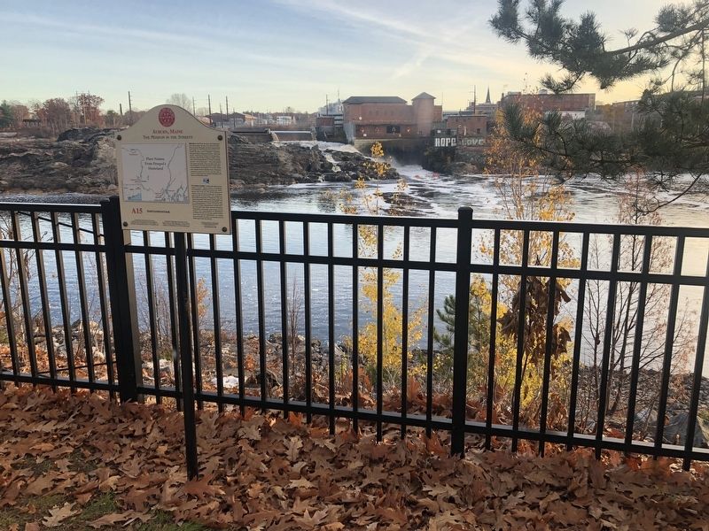
| 1 ► Maine, Androscoggin County, Auburn — A15 — Amitgonpontook — Auburn, Maine — The Museum in the Streets — |
| On Auburn Riverwalk, 0.1 miles north of Court Street (U.S. 202), on the right when traveling north. | |||
| 2 ► Maine, Androscoggin County, Auburn — A1 — Androscoggin Log Drives / Les Draves Sur L'Androscoggin — Auburn, Maine — The Museum in the Streets® — |
| On Auburn Riverwalk, 0.1 miles north of Great Falls Plaza, on the left when traveling east. | |||
| 3 ► Maine, Androscoggin County, Auburn — Bonney Park — |
| Near Main Street (Maine Route 136). | |||
| 4 ► Maine, Androscoggin County, Auburn — Bonney Park — |
| On Auburn Riverwalk just east of Main Street (Maine Route 136), in the median. | |||
| 5 ► Maine, Androscoggin County, Auburn — Cities of the Androscoggin — Lewiston-Auburn — |
| Near Main Street (Maine Route 136). | |||
| 6 ► Maine, Androscoggin County, Auburn — A14 — Ecology of the Riverbanks / La Biodiversité des Berges — Auburn, Maine — The Museum in the Streets® — |
| On Auburn Riverwalk, 0.2 miles south of Court Street (U.S. 202), on the left when traveling north. | |||
| 7 ► Maine, Androscoggin County, Auburn — A7 — Edward Little House 1827 / La Maison d'Edward Little 1827 — Auburn, Maine — The Museum in the Streets® — |
| On Main Street (Maine Route 136) just south of Vine Street, on the left when traveling north. | |||
| 8 ► Maine, Androscoggin County, Auburn — Festival Plaza — |
| On Main Street (Maine Route 136) 0.1 miles south of Court Street (U.S. 202), on the right when traveling north. | |||
| 9 ► Maine, Androscoggin County, Auburn — A4 — Great Falls Geology / La Géologie des Grandes Chutes — Auburn, Maine — The Museum in the Streets® — |
| On Auburn Riverwalk, 0.2 miles Court Street (U.S. 202), on the right when traveling north. | |||
| 10 ► Maine, Androscoggin County, Auburn — A3 — Hydroelectric Power / L'Énergie Hydraulique — Auburn, Maine — The Museum in the Streets® — |
| On Auburn Riverwalk just north of Great Falls Plaza, on the right when traveling north. | |||
| 11 ► Maine, Androscoggin County, Auburn — A11 — River Pollution and Restoration / Pollution et Restoration de la Rivière — Auburn, Maine — The Museum in the Streets® — |
| Near Auburn Riverwalk, 0.1 miles north of Main Street (Maine Route 136), on the right when traveling north. | |||
| 12 ► Maine, Androscoggin County, Lewiston — "Remember the Maine" — |
| On Main Street (U.S. 202) at Lincoln Street, on the right when traveling west on Main Street. | |||
| 13 ► Maine, Androscoggin County, Lewiston — L15 — 10,000 Years of Wabanaki History / 10 000 Ans d'Histoire Wabanaki — Lewiston, Maine — The Museum in the Streets — |
| On Auburn Riverwalk just east of Oxford Street. | |||
| 14 ► Maine, Androscoggin County, Lewiston — Androscoggin Gem — Androscoggin County — |
| On Main Street (U.S. 202) at Lincoln Street, on the right when traveling west on Main Street. | |||
| 15 ► Maine, Androscoggin County, Lewiston — L14 — Canal System / Les Canaux — Lewiston, Maine — The Museum in the Streets® — |
| On Beech Street at Oxford Street, on the right when traveling east on Beech Street. | |||
| 16 ► Maine, Androscoggin County, Lewiston — L1 — Early Industry / Les Débuts de L'Industrie — Lewiston, Maine — The Museum in the Streets® — |
| On Main Street (Route 202) at Lincoln Street, on the right when traveling west on Main Street. | |||
| 17 ► Maine, Androscoggin County, Lewiston — Map — Lewiston, Maine — The Museum in the Streets — |
| On Oxford Street just north of Beech Street, on the right when traveling north. | |||
| 18 ► Maine, Androscoggin County, Lewiston — Map — Lewiston, Maine — The Museum in the Streets — |
| On Lisbon Street (Maine Route 196) 0.1 miles south of Journal Alley, on the right when traveling north. | |||
| 19 ► Maine, Androscoggin County, Lewiston — Naval Air Station Gun — |
| On Main Street (U.S. 202) at Lincoln Street, on the right when traveling west on Main Street. | |||
| 20 ► Maine, Aroostook County, Fort Kent — Allagash and St. John Rivers — Northern Forest Canoe Trail — |
| Near Dufour Street north of Church Street, on the left when traveling north. | |||
| 21 ► Maine, Aroostook County, Fort Kent — One People in Two Countries / Une Vallée sans frontière — |
| On West Main Street (U.S. 1) at Clair-Fort Kent International Bridge, on the right when traveling west on West Main Street. | |||
| 22 ► Maine, Aroostook County, Fort Kent — When "going across" Was Like Crossing the Street — Lorsque « changer de pays » était comme traverser la rue — |
| On East Main Street (U.S. 1) at River Street, on the right when traveling south on East Main Street. | |||
| 23 ► Maine, Cumberland County, Brunswick — Androscoggin Swinging Bridge — National Register of Historic Places January 2004 — |
| 24 ► Maine, Cumberland County, Cape Elizabeth — Annie C. McGuire Shipwreck Memorial — |
| On Off Shore Road. | |||
| 25 ► Maine, Cumberland County, Cape Elizabeth — Bachelor Officers' Quarters — Fort Williams — 1899 - 1962 — |
| Near Shore Road south of Littlejohn Road, on the right when traveling north. | |||
| 26 ► Maine, Cumberland County, Cape Elizabeth — Bachelor's Officers' Quarters — |
| Near Shore Road south of Littlejohn Road, on the right when traveling north. | |||
| 27 ► Maine, Cumberland County, Cape Elizabeth — Coast Guard Day — Aug. 4, 1965 — |
| On Shore Road, on the right when traveling north. | |||
| 28 ► Maine, Cumberland County, Cape Elizabeth — Field Officer's Quarters — |
| Near Shore Road south of Littlejohn Road, on the right when traveling north. | |||
| 29 ► Maine, Cumberland County, Cape Elizabeth — Field Officer's Quarters — Fort Williams — 1899 - 1962 — |
| Near Shore Road south of Littlejohn Road, on the right when traveling north. | |||
| 30 ► Maine, Cumberland County, Cape Elizabeth — Fort Williams — |
| 31 ► Maine, Cumberland County, Cape Elizabeth — Gun Shed — Fort Williams — 1899 - 1962 — |
| Near Shore Road south of Littlejohn Road, on the right when traveling north. | |||
| 32 ► Maine, Cumberland County, Cape Elizabeth — Gun Shed — |
| Near Shore Road south of Littlejohn Road, on the right when traveling north. | |||
| 33 ► Maine, Cumberland County, Cape Elizabeth — Lighthouse Bicentennial — 1789 - 1989 Portland Head Light — |
| Near Shore Road south of Littlejohn Road, on the right when traveling north. | |||
| 34 ► Maine, Cumberland County, Cape Elizabeth — Looking East — Casco Bay — |
| 35 ► Maine, Cumberland County, Cape Elizabeth — Militia Storehouse — |
| Near Shore Road south of Littlejohn Road, on the right when traveling north. | |||
| 36 ► Maine, Cumberland County, Cape Elizabeth — Militia Storehouse — Fort Williams — 1899 - 1962 — |
| Near Shore Road south of Littlejohn Road, on the right when traveling north. | |||
| 37 ► Maine, Cumberland County, Cape Elizabeth — Mining Casemate — |
| Near Shore Road south of Littlejohn Road, on the right when traveling north. | |||
| 38 ► Maine, Cumberland County, Cape Elizabeth — Portland Head Light — |
| On Fort Williams Park. | |||
| 39 ► Maine, Cumberland County, Cape Elizabeth — U.S.S. Eagle 56 (PE-56) — 23 April 1945 — |
| Near Shore Road south of Littlejohn Road, on the right when traveling north. | |||
| 40 ► Maine, Cumberland County, Cape Elizabeth — U.S.S. Eagle-56 (PE-56) — |
| 41 ► Maine, Cumberland County, Naples — Songo Lock — |
| On Sebago Lake State Park Road, 1.9 miles east of U.S. 302, on the left when traveling north. | |||
| 42 ► Maine, Cumberland County, Portland, Cliff Island — Welcome to Cliff Island — |
| On Wharf Road just west of Sunset Road, on the left when traveling west. | |||
| 43 ► Maine, Cumberland County, Portland, Downtown — Asa Clapp / Asa William Henry Clapp / Mary Jane Emerson Clapp — |
| On Congress Street just north of Elm Street, on the left when traveling north. | |||
| 44 ► Maine, Cumberland County, Portland, East Bayside — 1 — Baxter Trail: Discover the Baxters' legacy in Portland — |
| On Back Cove Trail, 0.1 miles east of Baxter Boulevard when traveling west. | |||
| 45 ► Maine, Cumberland County, Portland, East Bayside — 1 — Franklin Street Wharf — Portland Freedom Trail — |
| On Commercial Street (U.S. 1) at Franklin Arterial (U.S. 1), on the right when traveling north on Commercial Street. | |||
| 46 ► Maine, Cumberland County, Portland, East Bayside — Hack Stand of Charles H.L. Pierre — Portland Freedom Trail — |
| On Middle Street at India Street, on the right when traveling west on Middle Street. | |||
| 47 ► Maine, Cumberland County, Portland, East Bayside — Rear Admiral James Alden — |
| Near Eastern Cemetery west of Montford Street. | |||
| 48 ► Maine, Cumberland County, Portland, East Bayside — Welcome to Back Cove Trail: An urban ecosystem / Explore: Portland's Magic Spaces — |
| On Back Cove Trail, 0.1 miles east of Baxter Bouleard, on the right when traveling east. | |||
| 49 ► Maine, Cumberland County, Portland, East End — Arctic Campaign Memorial — |
| Near Eastern Promenade Trail. | |||
| 50 ► Maine, Cumberland County, Portland, East End — Boxer and Enterprise — Historic Site — |
| Near Eastern Promenade Trail. | |||
| 51 ► Maine, Cumberland County, Portland, East End — Civil War guns — |
| On Eastern Promenade at Morning Street, on the right when traveling north on Eastern Promenade. | |||
| 52 ► Maine, Cumberland County, Portland, East End — Defending this vital harbor — |
| On Eastern Promenade at Morning Street, on the right when traveling north on Eastern Promenade. | |||
| 53 ► Maine, Cumberland County, Portland, East End — Honoring those who served — Welcome to the U.S.S. Portland Memorial — |
| On Eastern Promenade north of Morning Street, on the right when traveling north. | |||
| 54 ► Maine, Cumberland County, Portland, East End — Portland Maine Fort Allen Park USS Maine Memorial — |
| On Eastern Promenade at Vesper Street, on the right when traveling east on Eastern Promenade. | |||
| 55 ► Maine, Cumberland County, Portland, East End — Portland Maine Fort Allen Park USS Portland Memorial — |
| On Eastern Promendade at Vesper Street, on the right on Eastern Promendade. | |||
| 56 ► Maine, Cumberland County, Portland, East End — Portland Observatory — |
| On Congress Street near North Street, on the right when traveling north. | |||
| 57 ► Maine, Cumberland County, Portland, East End — Portland Observatory, Portland, Maine — Built 1807 — National Historic Civil Engineering Landmark — |
| On Congress Street just north of Kellogg Street, on the right when traveling north. | |||
| 58 ► Maine, Cumberland County, Portland, East End — Remember the Maine — |
| On Eastern Promenade at Morning Street, on the right when traveling north on Eastern Promenade. | |||
| 59 ► Maine, Cumberland County, Portland, East End — The poet & the view — |
| On Eastern Promenade at Morning Street, on the right when traveling north on Eastern Promenade. | |||
| 60 ► Maine, Cumberland County, Portland, East End — The story of Fort Allen Park — |
| On Eastern Promenade at Morning Street, on the right when traveling north on Eastern Promenade. | |||
| 61 ► Maine, Cumberland County, Portland, East End — The U.S.S. Portland at war — |
| On Eastern Promenade just north of Morning Street, on the right when traveling north. | |||
| 62 ► Maine, Cumberland County, Portland, East End — Why build Fort Allen? — |
| On Eastern Promenade at Morning Street, on the right when traveling north on Eastern Promenade. | |||
| 63 ► Maine, Cumberland County, Portland, Waterfront District — A Dirty History of Casco Bay — |
| On Commercial Street (U.S. 1A) just south of Franklin Street (U.S. 1A), on the left when traveling south. | |||
| 64 ► Maine, Cumberland County, Portland, Waterfront District — Casco Bay's four thousand years of sustainable, stable productivity — |
| On Commercial Street (U.S. 1A) just south of Franklin Street (U.S. 1A), on the left when traveling south. | |||
| 65 ► Maine, Cumberland County, Portland, Waterfront District — Today, you see a healthier Casco Bay / Take a closer look — |
| On Commercial Street (U.S. 1A) just south of Franklin Street (U.S. 1A), on the left when traveling south. | |||
| 66 ► Maine, Cumberland County, Portland, Waterfront District — Tug Stamford Propeller — |
| On Thames Street north of Hancock Street, on the right when traveling north. | |||
| 67 ► Maine, Cumberland County, South Portland — Coast Artillery Corps at Fort Preble — |
| On Fort Road near McKernan Drive, on the right when traveling north. | |||
| 68 ► Maine, Cumberland County, South Portland — Coast Artillery Corps Memorial — |
| On Fort Road just south of McKernan Drive, on the right when traveling north. | |||
| 69 ► Maine, Cumberland County, South Portland — East Yard — |
| On Slocum Drive west of Fort Road, on the right when traveling west. | |||
| 70 ► Maine, Cumberland County, South Portland — Fort Preble — |
| On Fort Road near Campus Center Drive, on the right when traveling north. | |||
| 71 ► Maine, Cumberland County, South Portland — Liberty Ship Memorial — |
| 72 ► Maine, Cumberland County, South Portland — Shipbuilding — |
| 73 ► Maine, Cumberland County, South Portland — Shipbuilding — East and West Yards — |
| On Slocum Drive west of Fort Road, on the right when traveling west. | |||
| 74 ► Maine, Cumberland County, South Portland — South Portland and Its Liberty Ships — |
| 75 ► Maine, Cumberland County, South Portland — South Portland's Ships for Liberty — |
| 76 ► Maine, Cumberland County, South Portland — Spring Point Ledge Light — |
| On Lighthouse Circle at Fort Road, on the right when traveling east on Lighthouse Circle. | |||
| 77 ► Maine, Cumberland County, South Portland — The Ugly Ducklings — |
| 78 ► Maine, Cumberland County, South Portland — The Work Force — |
| 79 ► Maine, Cumberland County, South Portland — The Yard — |
| 80 ► Maine, Cumberland County, South Portland — Voyages for Victory — |
| 81 ► Maine, Cumberland County, South Portland — West Yard — |
| On Slocum Drive west of Fort Drive, on the right when traveling west. | |||
| 82 ► Maine, Cumberland County, South Portland — WWII: On the Home Front — |
| 83 ► Maine, Hancock County, Bar Harbor — Acadia’s Founding Father — Acadia National Park — |
| Near Suier de Monts Road. | |||
| 84 ► Maine, Hancock County, Bar Harbor — Acadian Lights — |
| On Ocean Drive, on the right. | |||
| 85 ► Maine, Hancock County, Bar Harbor — Frenchman Bay — |
| On Paradise Hill Rd. | |||
| 86 ► Maine, Hancock County, Bar Harbor — Ocean Highways — Acadia National Park — |
| On Paradise Hill Road, on the left when traveling south. | |||
| 87 ► Maine, Hancock County, Bar Harbor — Picture Perfect? — Acadia National Park — National Park Service, U.S. Department of the Interior — |
| On Cadillac Summit Road. | |||
| 88 ► Maine, Hancock County, Bar Harbor — The Village Burying Ground — |
| On Mt. Desert Street (Maine Route 3) at School Street, on the right when traveling west on Mt. Desert Street. | |||
| 89 ► Maine, Hancock County, Bass Harbor — Bass Harbor Head Light — |
| On Lighthouse Road. | |||
| 90 ► Maine, Hancock County, Bass Harbor — Bass Harbor Head Light — |
| On Lighthouse Road. | |||
| 91 ► Maine, Hancock County, Bass Harbor — Bass Harbor Head Light Station — 1858 — |
| Near Lighthouse Road, on the left when traveling south. | |||
| 92 ► Maine, Hancock County, Bass Harbor — Mariners Beware! — Acadia National Park — National Park Service, U.S. Department of the Interior — |
| Near Lighthouse Road. | |||
| 93 ► Maine, Hancock County, Bucksport — Of Ships and Men — |
| On Main Street (Maine Route 15) at 1st Street, on the left when traveling north on Main Street. | |||
| 94 ► Maine, Hancock County, Bucksport — Penobscot River — |
| 95 ► Maine, Hancock County, Bucksport — River of Life — |
| Near Bucksport Waterfront Walkway, 0.1 miles east of Steamboat Wharf Lane, on the right when traveling east. | |||
| 96 ► Maine, Hancock County, Bucksport — Site of the First Sawmill — |
| Near Main Street (Maine Route 15) at Mill Street, on the right when traveling east. | |||
| 97 ► Maine, Hancock County, Bucksport — The Town of Bucksport — |
| 98 ► Maine, Hancock County, Northeast Harbor — Seawater Bay — Acadia National Park — |
| On Sergeant Drive, on the left when traveling north. | |||
| 99 ► Maine, Hancock County, Prospect Harbor — Down East Lights — |
| On Main Street (Maine Route 186) at Kelley Lane, on the right when traveling west on Main Street. | |||
| 100 ► Maine, Hancock County, Prospect Harbor — When the ocean was the great highway for travel — |
| On Main Street (Maine Route 186) at Kelley Lane, on the right when traveling south on Main Street. | |||
200 entries matched your criteria. The first 100 are listed above. Next 100 ⊳