Lewis and Clark explored the Missouri River in search of the "Northwest Passage."
"The object of your mission" wrote President Thomas Jefferson to Meriwether Lewis and William Clark "is to explore the Missouri River and such principal . . . — — Map (db m192786) HM
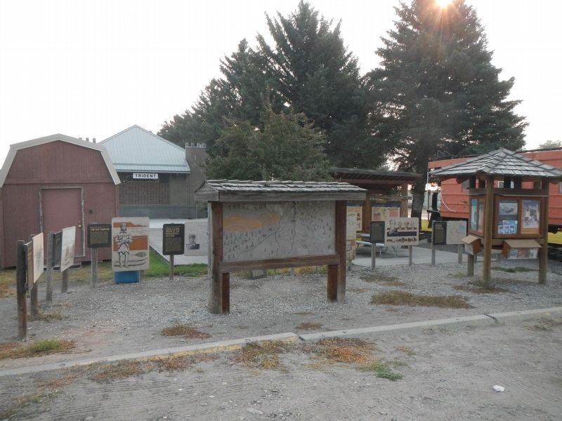
You are standing at the headwaters of the great Missouri River. The Jefferson and Madison Rivers converge with the Gallatin joining one mile downstream to become the Missouri River. Here, the famed explorers accomplished a major goal of their . . . — — Map (db m73542) HM
Approx.. 2 miles north on the Trident Road (#286) is the
confluence of the Jefferson and Madison Rivers. A mile
further downstream you can view the Gallatin River
merging to form the headwaters of the Missouri River, the
longest U.S. river. . . . — — Map (db m99206) HM
This statue was erected to commemorate Sacajawea and the Bicentennial of the Lewis and
Clark Expedition of 1803- 1806. She was a member of the Corps of Discovery and was invaluable as an interpreter in obtaining horses from her Shoshone people, . . . — — Map (db m98496) HM
Clad in buckskin, the trapper carried with him his knives, gunpowder and lead. a Hawken rifle, perhaps a pipe and a book. Except for flour and salt, he lived entirely off the land. He did his trapping in the spring and fall. During the summer, . . . — — Map (db m192788) HM
Many nations traveled and lived along these banks, giving their own names to
the river. “Missouri” is the official name given by the U.S. Geological Survey. It
dates back to French explorer Jacques Marquette’s journal and 1673 map of . . . — — Map (db m99215) HM
This region was alive with beaver, otter and game before the white man came. It was disputed hunting territory with the Indian tribes. Sacajawea, the Shoshone squaw who guided portions of the Lewis and Clark Expedition, was captured near here when a . . . — — Map (db m126978) HM
On their upstream journey in 1805, Lewis and Clark traveled through this area in two groups. On his return journey in 1806, Clark's group passed through the Headwaters area on their way to the Yellowstone River.
Sites depicted on this map . . . — — Map (db m206117) HM
This basin was settled by ranchers and homesteaders.
Bannock Indians had encampments here as late as 1913. Near
here is the west entrance to Yellowstone Park, the nation’s
first National Park(1872). West Yellowstone was founded in
1908 with the . . . — — Map (db m100066) HM
The 1804-1806 Lewis and Clark Expedition named this area "Phlosopher's River." Later it was called Windville. As a girl, Sacajawea, a Shoshone Indian, was captured near here by Minnataree Indians. Later she accompanied and interpreted for the Lewis . . . — — Map (db m193005) HM
The monument on the hill above was erected by the Great Northern Railway in 1925 to commemorate the farthest point north reached by the Lewis and Clark Expedition, 1804-1806. Captain Meriwether Lewis, with three of his best men, left the main party . . . — — Map (db m161235) HM
One of the most impressive geologic features in Montana is the mountainside north of you. Notice the prominent layer of white limestone half way up the mountainside. The rocks above this layer were deposited more than 50 miles southwest of here and . . . — — Map (db m161417) HM
On August 1st, 1805, William Clark celebrated his 35th birthday by shooting a bighorn sheep as he passed through the Jefferson River Canyon.
When the Corps of Discovery explored this area, bighorn sheep were common here. Later in the century . . . — — Map (db m141644) HM
Today as you travel in Lewis and Clark Caverns State Park you are likely to see mule deer, signs of elk and perhaps a black bear. This terrain was suitable for wildlife but when Lewis and Clark passed here in 1805 and 1806, these potential food . . . — — Map (db m141648) HM
On August 1, 1805, the Lewis and Clark Expedition camped at a point 200 yards west from this spot on the south bank of the river facing the mouth of the creek which flows into the river from the north. Meriwether Lewis and three others, on a . . . — — Map (db m128371) HM
The Lewis and Clark Expedition passed through this canyon of "nearly perpendicular rocks" during its journey up the Missouri in July 1805. Although the men grumbled about mosquitoes and prickly pear cactus, the Corp of Discovery was clearly . . . — — Map (db m141859) HM
"To pass across the Traveler's Rest Creek to the Missouri at the Mouth of the Dearbourn's River is 400 miles nearer that the route we Came..." Captain William Clark, Written at Fort Clatsop
As the Corps of Discovery wintered with the . . . — — Map (db m141921) HM
"previous to our departure saw a large herd of the Bighorned anamals on the immencely high and nearly perpendicular clift opposite to us; on the face of this clift they walked about and bounded from rock to rock with apparent unconcern where it . . . — — Map (db m141922) HM
"...from the singular appearance of this place I called it the gates of rocky mountains." Captain Meriwether Lewis, Friday, July 19, 1805
After the difficult portage around the five falls of the Missouri River, the Corps of Discovery . . . — — Map (db m141856) HM
" at the distance of 2 1/2 miles we passed the entrance of a considerable river on the Stard. side; about 80 yds. wide being nearly as wide as the Missouri at that place. it's current is rapid and water extremely transparent; the bed is formed of . . . — — Map (db m141857) HM
Wherever you are in Montana, you stand in the pathway of Lewis and Clark. Their 1804-1806 expedition was a grand adventure to investigate the people and resources of the newly acquired Louisiana Purchase and to seek a navigable passage across the . . . — — Map (db m141860) HM
"in the evening we passed a large creek about 30 yds wide which disembogues on the Stard. side; it discharges a bold current of water it's banks low and bed frormed (sic) of stones altogether; this stream we called Ordway's creek after Sergt. . . . — — Map (db m245681) HM
...we passed the entrance of a considerable river on the Stard side about 80 yds wide being nearly as wide as the Missouri at that place... This handsome bold and clear stream we named in honour of Secretary of war calling it Dearborn's . . . — — Map (db m141923) HM
"..to take a small party & to proceed on up the river, some distance before the canoes, in order to discover them (Indians), should they be on the river before the daily discharge of our guns, which was necessary in procuring substance, . . . — — Map (db m245679) HM
On this placer mining claim, gold was discovered on July 14, 1864 by John Cowand and John Crab of Georgia, Bob Stanley of London, England and D.J. Miller of California known as "The Georgians" who were returning from an unsuccessful prospecting . . . — — Map (db m187078) HM
"In commemoration of the intrepid explorers, comprising the Lewis and Clark Expedition who discovered this canyon and encamped here July 19-1805 on their westward voyage of trans-continental exploration enroute up the Missouri River bound for the . . . — — Map (db m148173) HM
Robert E. Fisk came to Montana with the 1866 Fisk Expedition organized by his famous wagon-master brother, James. The two brothers and other partners established the Helena Herald in November 1866. Robert, who was a printer before the Civil War, . . . — — Map (db m188333) HM
In the spring of 1864, John S. Cowan of Georgia, D.J. Miller of Alabama, John Crabb of Iowa, and Reginald (Bob) Stanley of Nuneaton, England, set out from Alder Creek to prospect along the Little Blackfoot River. They had no luck and moved on, . . . — — Map (db m187411) HM
For many thousands of years, travelers of every description have traversed the Blackfoot River corridor. As you drive Highway 200, alongside the boulder-strewn rapids of the fabled Blackfoot River, envision the journeys, some pleasurable, others . . . — — Map (db m219983) HM
What makes this place, the Blackfoot River and its surrounding bioregion, so special? The Blackfoot watershed - with its headwaters near here, atop the Continental Divide at Roger's Pass - embraces 1.5 million acres. This vast area offers prime . . . — — Map (db m220015) HM
In 1806, Lewis and Clark followed separate Indian "roads" back across the Continental Divide. Lewis traveled up the Blackfoot River and over Lewis and Clark Pass.
This easy route led Lewis to where the vast treeless prairie rises dramatically . . . — — Map (db m219988) HM
Wherever you are in Montana, you stand in the pathway of Lewis and Clark. Their 1804-1806 expedition was a grand adventure to investigate the people and resources of the newly acquired Louisiana Purchase and to seek a navigable passage across the . . . — — Map (db m220016) HM
Splitting Up the Corps
Captain Meriwether Lewis passed this way in the summer of 1806. Traveling east from their winter on the Pacific Ocean, co-commanders William Clark and Meriwether Lewis stopped near present-day Lolo, Montana. At a . . . — — Map (db m220034) HM
Bison! This great shaggy beast sustained the Indians of the Plains and adjacent areas for thousands of years. And in these parts we call Montana, an ancient network of trails led the Salish, Pend d'Oreille, and related Indian tribes, who . . . — — Map (db m220033) HM
On his return journey in July 1806 Capt. Meriwether Lewis crossed the continental divide at Lewis & Clark Pass about 2 miles west of here. He was now on land of the Louisiana Purchase and back in United States territory. He was following the ancient . . . — — Map (db m144054) HM
About 15,000 years ago, this area was covered by huge glaciers which formed unique geological formations throughout the valley called drumlins or hills composed of glacial till deposited beneath the glaciers.
Ice periodically dammed up the . . . — — Map (db m113518) HM
The land around Kootenai Falls has been explored and used for thousands of years by the Kootenai or Tunaxa People. The Kootenai tribe made up of seven bands, two in U.S. and five in Canada.
European traders and surveyors were lured to the region . . . — — Map (db m127287) HM
The Madison Valley was well known to mountain men and traders during the first half of the 19th century. Beaver loved the many creeks that emptied into the river and buffalo were common in the valley, making it popular for both Indians and trappers. . . . — — Map (db m141490) HM
The low gap in the mountains on the sky line south of here is Raynolds Pass over the Continental Divide.
Jim Bridger, famous trapper and scout, guided an expedition of scientists through the pass in June of 1860. The party was led by Capt. W. F. . . . — — Map (db m187603) HM
When Captain Meriwether Lewis and his men arrived in the Jefferson River Valley in August 1805, they explored the tributaries of the Jefferson River (today's Beaverhead River), which was named after President Thomas Jefferson. They named it . . . — — Map (db m193123) HM
Explorations of Lewis and Clark 1804-1806
Cartographic Reconstruction
UTM Zone 12
Map Number 262-263
With only a sextant, chronometer, and compass in hand, Captain William Clark was able to map the entire exploration, . . . — — Map (db m193068) HM
Which Fork to Take?
Meriwether Lewis, traveling ahead with 3 men, reached this spot two days ahead of William Clark and the main parry. After exploring the river courses, Lewis left a note telling Clark to stay on the Jefferson River. Clark . . . — — Map (db m128400) HM
August 1805 - The Corps of Discovery struggled upriver toward the Rockies. Illness and injury, along with the increasingly difficult river passage, had eroded the group's morale. But the afternoon of the 8th brought a much needed lift, when . . . — — Map (db m193127) HM
Beloved Members of the
Corps of Discovery
This Memorial was made
possible by the generosity of
the
People and Friends of Madison
County
Sculpted by Dick and Sandi Crane — — Map (db m193049) HM
In, early August, 1805, the Lewis and Clark Expedition, westward bound, came up the Jefferson River and passed through this area. The valley was an ancient travel corridor; Lewis noted the presence of an "old Indian road" near the Big Hole River. . . . — — Map (db m116997) HM
Meriwether Lewis, Touissaint Charboneau, Patrick Gass and George Drewyer, the vanguard of the Lewis and Clark Expedition and the first white men to enter this valley, camped on the east bank of the Beaverhead River, two blocks west of here, on . . . — — Map (db m128399) HM
Both before and since the passage of Lewis and Clark, the limestone outcrop in front of you served as an important landmark and meeting area. The Shoshone tribe, from whom Sacagawea had been kidnapped as a child, came to this area every summer. By . . . — — Map (db m193132) HM
As the Corps of Discovery approached this river valley, the convergence of several rivers presented Captains Meriwether Lewis and William Clark with a choice of routes. Lewis and a few men traveled ahead of Clark to investigate the various rivers. . . . — — Map (db m193124) HM
Wherever you are in Montana, you stand in the pathway of Lewis and Clark. Their 1804-1806 expedition was a grand adventure to investigate the people and resources of the newly acquired Louisiana Purchase and to seek a navigable passage across the . . . — — Map (db m143265) HM
Wherever you are in Montana, you stand in the pathway of Lewis and Clark. Their 1804-1806 expedition was a grand adventure to investigate the people and resources of the newly acquired Louisiana Purchase and to seek a navigable passage across the . . . — — Map (db m123023) HM
Native Travelers at Tmsmli
You are standing at the heart of a well-used campsite and gathering place used by people for thousands of years. Traveling along time-worn trails from the four directions, families, hunters and explorers came . . . — — Map (db m123237) HM
As researchers worked to pin-point the location of the Travelers’ Rest campsite, they had an unlikely ally -- an 18th century Prussian Baron.
During the Revolutionary War, Baron William Frederick Von Steuben, at the request of George Washington, . . . — — Map (db m123254) HM
The Lewis and Clark Expedition camped near here September 9 through 11, 1805, while traveling through the ancient territory of the Salish and Pend d'Orielle people. Since time immemorial, the tribes have known this place as Tmsmli (approximately . . . — — Map (db m123385) HM
West bound, the trip up Lolo Creek was the start of a remarkably arduous and life-threatening part of the expedition's journey. Eastbound, the passage down Lolo Creek represented victory over one of the most formidable barriers to cross-country . . . — — Map (db m123124) HM
Lewis and Clark’s “CORPS OF DISCOVERY” was the first major expedition launched by the United States to explore new lands with an emphasis on scientific inquiry. Lewis spent months being tutored in both physical and biological sciences in . . . — — Map (db m123129) HM
"Capts. Lewis and Clark parted here with their parties & proceed on" Sergeant John Ordway, Thursday July 3, 1806
An often overlooked aspect of the Lewis and Clark Expedition is the decision to separate when they left Travelers' Rest on . . . — — Map (db m123256) HM
The route that lies west of here, the Lolo Trail, was different from other east-west 19th century Americans trails. It did not witness a flood of cross-county migration. There were no covered wagons here.
Unmapped and shifting over time, it . . . — — Map (db m123123) HM
Bitter Root Chapter, Daughters of the American Revolution, Missoula, Montana dedicate this marker to Captains Lewis and Clark, Sacajawea, their inspiration and guide, and the brave men of the Trans-Mississippi Expedition who encamped on Lo Lo . . . — — Map (db m123243) HM
For may years, the campsite known as Travelers’ Rest was thought to be located at the confluence of today’s Lolo Creek and the Bitterroot River (1 1/2 miles east of where you now stand). It wasn’t until 1996 that members of the Travelers’ Rest . . . — — Map (db m123255) HM
The narrow river canyons upstream from here have a long and bloody past.
As the Salish, Nez Perce and other western mountain Indian tribes passed through these canyons enroute to buffalo hunting grounds east of the Rocky Mountains, they were . . . — — Map (db m123334) HM
(Three panels, presented left to right, form the marker.)
Many Cultures Forge Strong Communities
Welcome to Bonner and nearby communities, each built on the grit and dreams of self-made men and women. It you had walked into . . . — — Map (db m123099) HM
Long before railroads and highways, rivers were the lifelines of travel and trade. The Lewis and Clark Expedition named and described hundreds of rivers as they mapped their way west.
While the expedition camped about 10 miles south of here, . . . — — Map (db m123333) HM
Since the late 1400s and the time of Columbus, explorers from all over the world eagerly sought to discover the legendary water route, or "Northwest Passage," that was rumored to bisect the resource-rich interior of the North American continent. . . . — — Map (db m123330) HM
In August 1864,three emigrants, who came to Montana on the Bozeman Trail, arrived here and found men already hard at work mining the creek. The new arrivals decided to try their luck farther up the rugged gulch, finding pay dirt high up the side of . . . — — Map (db m46256) HM
Captain William Clark and his party rode from the west, following a creek downstream (now called Billman Creek) to the Yellowstone River. Looking to the south, they could see that the Yellowstone River emerged from between the Absaroka Mountains on . . . — — Map (db m231563) HM
This statue commemorates Sacajawea, whose loyalty, courage and, devotion were instrumental in the success of the Lewis and Clark expedition of 1803-1806.
Holding her infant son Jean Baptiste Charbonneau (nicknamed "Pomp" by Capt. Wn. Clark), she . . . — — Map (db m191659) HM
In his journals, Captain William Clark described the Yellowstone River, which he translated for the French name, Roche Jaune, as "...120 yds. Wide bold, rapid and deep." Clark and his party followed the Yellowstone River for 19 days to . . . — — Map (db m191657) HM
(Three panels make up this marker:) Yellowstone River:
Haven for Great Hers of Wildlife
July 24, 1806
"Saw emenc number of Deer Elk and buffalow on the banks. Some beaver...for me to mention or give an . . . — — Map (db m191921) HM
The area in front of you once served as south-central Montana's cultural crossroads. Especially between 1868 and 1875, this was a place where settlers and Indians traded goods and services, where the U.S. government sought (and failed) to convert . . . — — Map (db m193330) HM
On the return journey from the Pacific Ocean, Captains Meriwether Lewis and William Clark took separate routes in Montana. Lewis headed north to explore and Clark headed east toward the three forks of the Missouri/ At the three forks, Sacajawea . . . — — Map (db m191744) HM
The interstate highway nearby mirrors a path travelers have used for centuries. Even long before the days of Lewis and Clark, members of the Crow Tribe came to this area in an annual rendezvous that was central to their culture. The tribe's nomadic . . . — — Map (db m193329) HM
(Left panel:)
Early Exploration and Settlement:
John Colter, member of the 1804-1805 (sic) Lewis and Clark Corps of Discovery, in 1807 was the first known white man to have traversed through the area known as Yellowstone . . . — — Map (db m191799) HM
"Struck the Rochejhone 1/2 a mile below the branch we came down & 1 1/2 ms. below where it passes out of the Rocky mountains....The horses feet are very sore many of them Can Scercely proceed on over the Stone and gravel in every other respect . . . — — Map (db m205927) HM
Sacajawea and her son traveled with Captain William Clark down the Yellowstone River passing through this area on July 15, 1806. Sacajawea was a Shoshone teenager whose knowledge of native tribes, languages, and geographical landmarks of the area . . . — — Map (db m191658) HM
"I can See no timber Sufficient large for a Canoe which will Carry more than 3 men and Such a one would be too Small to answer my purpose." William Clark, Tuesday 15th July, 1806
In 1806, Captain William Clark and his party of . . . — — Map (db m205928) HM
In 1804-1806, Captains Meriwether Lewis and William Clark led the Corps of Discovery on an epic journey. Charged by President Thomas Jefferson to find a water route to the Pacific Ocean through the newly acquired Louisiana territory, they mapped the . . . — — Map (db m191229) HM
This river was named by Captain William Clark of the Lewis and Clark Expedition in honor of John Shields, a member of the party. Captain Clark and his men, guided by Sacajawea, the Shoshone woman, camped at the mouth of the river July 15, 1806, . . . — — Map (db m128299) HM
(There are three panels to this marker:)
A Dispute Over Horses and Guns
Meriwether Lewis and three men from the Corps of Discovery traveled through this area on July 26, 1806. During the journey, the men encountered eight . . . — — Map (db m220403) HM
Captain Meriwether Lewis of the Lewis and Clark Expedition, accompanied by three of his men, explored this portion of the country upon their return trip from the coast. On July 26, 1806, they met eight Piegans (Blackfeet), who Lewis mistakenly . . . — — Map (db m127282) HM
Seaman, Meriwether Lewis's faithful Newfoundland dog, often earned special attention in the journals of the Corps of Discovery.
"Last night we were alarmed by a large buffaloe Bull, which swam over from the opposite shore and coming . . . — — Map (db m219846) HM
(This marker is constructed of three attached panels:)
The Blackfoot River Corridor
Welcome to the Blackfoot Recreation corridor. The corridor stretches 26 mile along the Blackfoot River from Johnsrud Park to the Russel Gates . . . — — Map (db m219981) HM
One their return trip from the Pacific Coast, the Corps of Discovery split into two parties at Travelers Rest (just south of Missoula, Montana) on July 1, 1806. Clark proceeded south down the route they had come in 1805 along the Bitterroot . . . — — Map (db m144057) HM
In 1970, Congress enacted a Wilderness Act and designated 43,000 acres north of Terry in the badlands as a Wilderness Study Area. The Calypso Trail and Scenic View offer a grand look at the badlands area. Father DeSmet met with the Hunkpapa Sioux . . . — — Map (db m203104) HM
Not a War Party
On September 4th, 1805, T chliska-e-mee (Three Eagles) the father of Chief Victor and grandfather of Chief Charlo, left camp to scout the area, fearing there might be some Indian enemies around intending to steal horses, . . . — — Map (db m123624) HM
Wherever you are in Montana, you stand in the pathway of Lewis and Clark. Their 1804-1806 expedition was a grand adventure: to investigate the people and resources of the newly acquired Louisiana Purchase and to seek a navigable passage across the . . . — — Map (db m123630) HM
(Three panels, presented left to right, make up this marker)
While here at Ross' Hole, (Sula, Montana) on September 4th, 1805, William Clark wrote in his journal: "Those people recved us friendly, threw white robes over our sholders & . . . — — Map (db m123599) HM
Alexander Ross, of the Hudson Bay Company, with 55 Indian and white trappers, 89 women and children and 392 horses, camped near here on March 12, 1824, enroute from Spokane House near present Spokane, Washington to the Snake River country in . . . — — Map (db m123597) HM
1 • Stanley Fur trappers from the Hudson’s Bay Company were the first to discover Stanley Basin during 1824. Stanley was named for Captain John Stanley, a Civil War veteran who brought 23 prospectors into the basin searching for gold. . . . — — Map (db m144160) HM
A Customary and Proper Welcome
The Salish people gave the strangers many gifts during their brief encounter here at the Great Clearing.
They gave their guests roots, berries, animal furs, and vital information about the trails and . . . — — Map (db m123625) HM
“Our people were camped in a kind of prairie along the Bitterroot River, a few miles upstream from the Medicine Tree. The place is called Ross’ Hole now; the Indians then called it Kwtít Pupxm.” --Pierre Pichette, Salish Tribal Elder . . . — — Map (db m123622) HM
This marker is composed of three panels on a common support
The Mystery May Never be Solved
Experts disagree on the exact route Lewis and Clark took over this divide. No one knows where they camped on that cold snowy night . . . — — Map (db m109625) HM
Wherever you are in Montana, you stand in the pathway of Lewis and Clark. Their 1804-1806 expedition was a grand adventure to investigate the people and resources of the newly acquired Louisiana Purchase and to seek a navigable passage across the . . . — — Map (db m142981) HM
The Lewis and Clark Expedition passed by here, westward bound, in May, 1805. Fur trappers and traders followed them a few years later. Steamboats began making it from St. Louis up the Missouri as far as Fort Benton in the early 1860s. Wolf Point was . . . — — Map (db m142947) HM
Wherever you are in Montana, you stand in the pathway of Lewis and Clark. Their 1804-1806 expedition was a grand adventure to investigate the people and resources of the newly acquired Louisiana Purchase and to seek a navigable passage across the . . . — — Map (db m164417) HM
From July 28, 1806, when William Clark passed Rosebud Creek on his way down the Yellowstone, this river valley has served as one of the major avenues for development and trade in eastern Montana. Innumerable trappers and traders followed Clark's . . . — — Map (db m164409) HM
More than 240 miles (456 km) east of here, Silver Bow Creek tumbles west from the Continental Divide above Butte, Montana. Thus begins the Clark Fork River, which drains more than 22,000 square miles of western Montana before it flows into Idaho. . . . — — Map (db m45194) HM
David Thompson was the first Euro-American to record his travels along this stretch of the river. Early in 1809 he came through searching for an ideal site to establish a fur trading post. Later that fall he built the “Saleesh House” . . . — — Map (db m45195) HM