After filtering for South Dakota, 145 entries match your criteria. The first 100 are listed. ⊳
Parks & Recreational Areas Topic
November 6, 2021
Campbell Park Historic District Marker, from the north
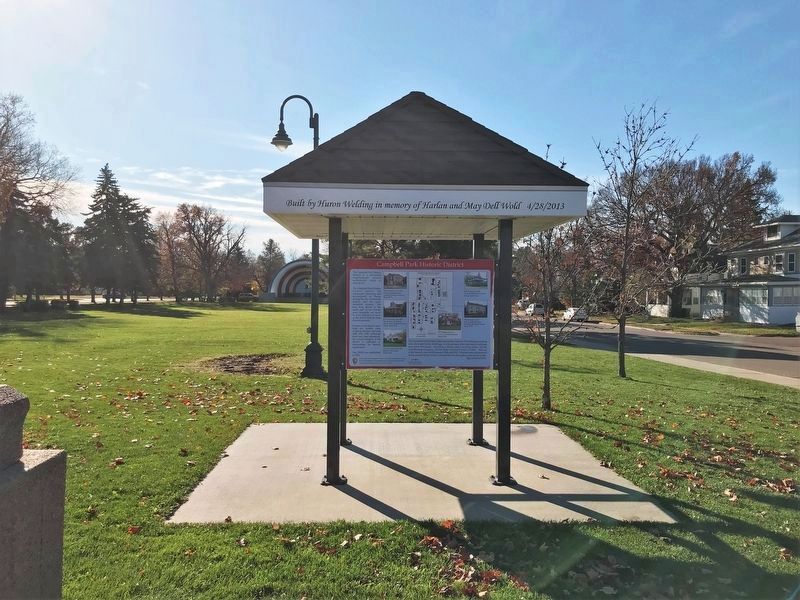
| 1 ► South Dakota, Beadle County, Huron — Campbell Park Historic District — |
| On California Avenue Southwest south of 5th Street Southwest, on the left when traveling south. | |||
| 2 ► South Dakota, Beadle County, Huron — Welcome to Legacy Park Garden! — |
| On Kansas Avenue at 5th Street Southeast, on the right when traveling north on Kansas Avenue. | |||
| 3 ► South Dakota, Brookings County, Brookings — Pioneer Park — |
| Near 1st Avenue at West 6th Street (U.S. 14), on the left when traveling north. | |||
| 4 ► South Dakota, Brookings County, Brookings — Recycling Trash Into Our Treasure — |
| Near 32nd Street South, 0.5 miles west of 22nd Avenue South, on the right when traveling west. | |||
| 5 ► South Dakota, Brookings County, Bruce, Oakwood Township — 2 — Hackberry — Station 2 — Tetonkaha Trail — |
| Near Oakwood Drive, 1.7 miles north of 204th Street (County Highway 6). | |||
| 6 ► South Dakota, Brown County, Aberdeen — Andrew Melgaard — |
| 7 ► South Dakota, Brule County, Chamberlain — Barger Park — Established 1989 — |
| On West Mott Avenue at North Courtland Street (South Dakota Highway 50), on the right when traveling west on West Mott Avenue. | |||
| 8 ► South Dakota, Brule County, Chamberlain — Mount Rushmore National Memorial — |
| On I-90 E, on the right when traveling east. | |||
| 9 ► South Dakota, Clay County, Vermillion — Prentis Park — |
| On North Plum Street at East Main Street, on the right when traveling north on North Plum Street. | |||
| 10 ► South Dakota, Codington County, Watertown — Forsburg Park Sundial — |
| On State Highway 20, 1 mile east of 351st Ave. | |||
| 11 ► South Dakota, Codington County, Watertown — Mellette Hill — |
| On Skyline Drive at 7th Avenue North West on Skyline Drive. | |||
| 12 ► South Dakota, Custer County, Custer — A Life of Peace and Solitude — |
| Near Badger Hole near Badger Clark Road. | |||
| 13 ► South Dakota, Custer County, Custer — 516 — Civilian Conservation Corps Camp — Camp SP-3 / Camp Narrows — French Creek — |
| On State Highway 87, 0.5 miles north of Lame Johnny Road, on the left when traveling north. | |||
| 14 ► South Dakota, Custer County, Custer — 527 — Civilian Conservation Corps Camp — |
| Near South Playhouse Road east of Needles Highway (State Highway 87). | |||
| 15 ► South Dakota, Custer County, Custer — Crazy Horse Memorial — |
| Near U.S. 385 south of Avenue of the Chiefs, on the left when traveling south. | |||
| 16 ► South Dakota, Custer County, Custer — Everything changes, or does it? — |
| Near Montgomery Street at North 10th Street. | |||
| 17 ► South Dakota, Custer County, Custer — South Dakota Game Fish & Parks — |
| On Scenic U.S. 16. | |||
| 18 ► South Dakota, Custer County, Custer — Stockade Lake Bridge — |
| On Stockade Lake Drive, 1 mile east of Lower French Creek Road, on the left when traveling east. | |||
| 19 ► South Dakota, Custer County, Custer, West Custer Township — Landscapes & Logging — Black Hills National Forest — Caring for the Land and Serving People — |
| On U.S. 385, 0.6 miles south of Medicine Mountain Road, on the left when traveling south. | |||
| 20 ► South Dakota, Custer County, Hot Springs — Bringing Back the Bison — Wind Cave National Park — |
| On U.S. 385, 3.5 miles north of 7-11 Road (County Road 101), on the right when traveling north. | |||
| 21 ► South Dakota, Custer County, Hot Springs — 520 — Civilian Conservation Corps Camp — |
| On U.S. 385, 1.9 miles north of 7-11 Road (County Road 101), on the right when traveling north. | |||
| 22 ► South Dakota, Custer County, Hot Springs — Stephen Tyng Mather — July 4, 1867 — Jan. 22, 1930 — |
| Near Wind Cave Road, 1 mile south of U.S. 385. | |||
| 23 ► South Dakota, Custer County, Hot Springs — Vanishing Prairie — Wind Cave National Park — |
| On U.S. 385, 3.9 miles north of 7-11 Road (County Road 101), on the right when traveling north. | |||
| 24 ► South Dakota, Custer County, Pringle — Discover the Black Hills National Forest — |
| On State Highway 89, 0.7 miles north of Prairie Schooner Road (County Road 318), on the right when traveling north. | |||
| 25 ► South Dakota, Custer County, Pringle, West Custer Township — Early Game Preserve — Wind Cave National Park — |
| On U.S. 385, 1 mile north of State Highway 87, on the right when traveling north. | |||
| 26 ► South Dakota, Dewey County, Gettysburg — Nača Inyanska Unwayu Onihan Owakpamni Tanni Oasnikiye — Naca' Monument and Old Agency Park — CRST Flora Stewardship Project — |
| On U.S. 212, 1.2 miles north of Old U.S. Highway 212, on the right when traveling east. | |||
| 27 ► South Dakota, Fall River County, Edgemont — Edgemont: Where the Trail Begins — |
| On 2nd Avenue (State Highway 471) north of G Street, on the right when traveling north. | |||
| 28 ► South Dakota, Fall River County, Hot Springs — Fire on the Edge — Where the Prairie Meets the Forest — Black Hills National Forest — |
| On State Highway 71, 0.1 miles south of Cascade Trail. | |||
| 29 ► South Dakota, Gregory County, Bonesteel — Legacy Park — Bonesteel Quasquicentennial — |
| On Mellette Street north of 1st Avenue, on the left when traveling north. | |||
| 30 ► South Dakota, Gregory County, Pickstown — Drums, Drills & Recreation — |
| Near Stone Church Drive east of Toe Road West, on the right when traveling east. | |||
| 31 ► South Dakota, Gregory County, Pickstown — Welcome to Randall Creek Recreation Area — Missouri National Recreational River Water Trail — |
| On Randall Creek Road. | |||
| 32 ► South Dakota, Hand County, Ree Heights — 620 — Ree Heights Roadside Park / Reading Brands — |
| On East 3rd Street (198th Street) at Carney Avenue, on the right when traveling east on East 3rd Street (198th Street). | |||
| 33 ► South Dakota, Harding County, Ludlow — Picnic Springs Campground — |
| On Foust Road (State Highway 799). | |||
| 34 ► South Dakota, Hughes County, Pierre — Farm Island Causeway — |
| Near Farm Island Road, 1 mile south of South Dakota Highway 34, on the right when traveling south. | |||
| 35 ► South Dakota, Hughes County, Pierre — Mateer Park — |
| On West Oak Street at West Broadway Avenue, on the right when traveling west on West Oak Street. | |||
| 36 ► South Dakota, Hughes County, Pierre — Much Was Accomplished — |
| Near Farm Island Road, 1 mile south of South Dakota Highway 34, on the right when traveling south. | |||
| 37 ► South Dakota, Hughes County, Pierre — Tichicala Cabin — Girl Scouts Dakota Horizons — |
| On West Missouri Avenue east of South Henry Street, on the right when traveling east. | |||
| 38 ► South Dakota, Hughes County, Pierre — Welcome to Steamboat Park! — |
| On South Poplar Street, 0.2 miles south of West Missouri Avenue, on the left when traveling south. | |||
| 39 ► South Dakota, Hutchinson County, Parkston — Parkston Athletic Park — |
| Near Othella St. | |||
| 40 ► South Dakota, Jackson County, Interior — A 75-Million-Year Walk — |
| On State Highway 240. | |||
| 41 ► South Dakota, Jackson County, Interior — Anatomy of a Badland — |
| On Enter The Door Trail. | |||
| 42 ► South Dakota, Jackson County, Interior — Badlands Oasis — |
| On Notch Trail. | |||
| 43 ► South Dakota, Jackson County, Interior — Bands of Time — |
| On State Highway 240. | |||
| 44 ► South Dakota, Jackson County, Interior — Dying to Become a Fossil — |
| On State Highway 240. | |||
| 45 ► South Dakota, Jackson County, Interior — It's a Dog's Life — |
| On State Highway 240. | |||
| 46 ► South Dakota, Jackson County, Interior — Mako sica — |
| On Enter The Door Trail. | |||
| 47 ► South Dakota, Jackson County, Interior — Reading the Rocks — |
| On State Highway 240. | |||
| 48 ► South Dakota, Jackson County, Interior — See Ya Later, Alligator — |
| On State Highway 240. | |||
| 49 ► South Dakota, Jackson County, Interior — The Big Badlands — Badlands National Park - 244,000 acres — |
| On State Highway 240. | |||
| 50 ► South Dakota, Jackson County, Interior — Titanic Discovery — |
| On State Highway 240. | |||
| 51 ► South Dakota, Jackson County, Interior — Under the Sea — |
| On State Highway 234. | |||
| 52 ► South Dakota, Jackson County, Interior — What a Find! — |
| On State Highway 240. | |||
| 53 ► South Dakota, Jackson County, Wall — Fight for Survival — |
| On State Highway 240. | |||
| 54 ► South Dakota, Jackson County, Wall — Off to the Races — |
| On State Highway 240. | |||
| 55 ► South Dakota, Jerauld County, Wessington Springs — Municipal Field House — |
| On 2nd Street Southwest, 0.1 miles east of Dakota Avenue South, on the right when traveling west. | |||
| 56 ► South Dakota, Jerauld County, Wessington Springs — Rube Goldberg Ski Lift Gadget — |
| On 228th Street (South Dakota Route 34) 0.3 miles west of Dakota Avenue South. | |||
| 57 ► South Dakota, Jerauld County, Wessington Springs — Stratton Park — |
| Near W Main St at Dakota Ave S. | |||
| 58 ► South Dakota, Jones County, Murdo — 193 — Reading Brands/Murdo Mackenzie Roadside Park — |
| On State Highway 248, 0.8 miles west of Business Interstate 90, on the right when traveling east. | |||
| 59 ► South Dakota, Lake County, Madison — Luce Historic Cabin Restoration Project — |
| On State Park Drive, 0.4 miles west of 234th Street (State Highway 236), on the left when traveling west. | |||
| 60 ► South Dakota, Lawrence County, Deadwood — Civilian Conservation Corps Camp — Camp F-20 / Park Creek — |
| On U.S. 385 at Galena Road (Forest Road 534), on the right when traveling north on U.S. 385. | |||
| 61 ► South Dakota, Lawrence County, Deadwood — Deadwood's First City Park — |
| On Sherman St. | |||
| 62 ► South Dakota, Lawrence County, Deadwood — George S. Mickelson Trail — |
| Near Charles Street (CanAm Highway) (U.S. 85) at Cedar Lane, on the right when traveling south. | |||
| 63 ► South Dakota, Lawrence County, Deadwood — Partners in Land Preservation — A Trail to Deadwood's Past — |
| Near Charles Street (CanAm Highway) (U.S. 85) at Stewart Street, on the right when traveling south. | |||
| 64 ► South Dakota, Lawrence County, Deadwood — Rev. L.R.S. Ferguson Ski & Sled Area — A Trail to Deadwood's Past — |
| On Charles Street (U.S. 85) at Stewart Street, on the left when traveling south on Charles Street. | |||
| 65 ► South Dakota, Lawrence County, Deadwood — Track or Trail: Sweat Equity Played a Role |
| Near Charles Street (CanAm Highway) (U.S. 85) at Cedar Lane, on the right when traveling south. Reported missing. | |||
| 66 ► South Dakota, Lawrence County, Lead — From Ruts to Rails — |
| On Englewood Road at Brownsville Road on Englewood Road. | |||
| 67 ► South Dakota, Lawrence County, Lead — George S. Mickelson Trail — Welcome to the Englewood Trailhead — |
| On Englewood Road at Brownsville Road on Englewood Road. | |||
| 68 ► South Dakota, Lawrence County, Lead — Homestake Hospital Site — |
| On West Main Street (CanAm Highway) (U.S. 85) at Siever Street, on the left when traveling east on West Main Street (CanAm Highway). | |||
| 69 ► South Dakota, Lawrence County, North Spearfish — 625 — Northern Hills Rest Area — |
| On Interstate 90, 1 mile west of Red Hill Road, on the right when traveling east. | |||
| 70 ► South Dakota, Lawrence County, Pluma — George S. Mickelson Trail — |
| On CanAm Highway (U.S. 85) north of U.S. 385, on the left when traveling north. | |||
| 71 ► South Dakota, Lawrence County, Spearfish — Spearfish Canyon Through Time — Bridal Veil Falls — |
| On U.S. 14A, 6 miles south of Business 90, on the left when traveling south. | |||
| 72 ► South Dakota, Lincoln County, Canton — Resolution Designating Jack Fox Park — |
| On North Broadway Street at East 4th Street, on the right when traveling south on North Broadway Street. | |||
| 73 ► South Dakota, Lincoln County, Sioux Falls — 1870s to the Present — Rich Farmland — |
| Near 480th Avenue (County Highway 135) 0.2 miles south of 269th Street (County Highway 102). | |||
| 74 ► South Dakota, Lincoln County, Sioux Falls — A Trading Center — |
| Near 480th Avenue (County Highway 135) 0.2 miles south of 269th Street (County Highway 102), on the left when traveling south. | |||
| 75 ► South Dakota, Lincoln County, Sioux Falls — Why the Name “Good Earth”? — |
| Near 480th Avenue (County Road 135) north of 270th Street, on the right when traveling north. | |||
| 76 ► South Dakota, Lyman County, Oacoma — Roland L. Dolly Memorial Recreational Trail — |
| On Shoreline Drive, 0.6 miles north of East Highway 16 (Interstate 90BL), on the right when traveling north. | |||
| 77 ► South Dakota, McCook County, Canistota, Greenland Township — Dam and Spillway — Lake Vermillion Recreation Area — |
| Near Adventure Drive east of North Drive, on the left when traveling east. | |||
| 78 ► South Dakota, McPherson County, Leola — Dan Ashe Waterfowl Production Area — Honoring a Commitment to Conservation of the Prairie Pothole Region — |
| On State Highway 10, 1 mile east of 350 Ave, on the right when traveling west. | |||
| 79 ► South Dakota, Meade County, Sturgis — Bear Butte — |
| On South Dakota Route 79. | |||
| 80 ► South Dakota, Meade County, Sturgis — Dr. F. V. Hayden — |
| On Centennial Trail (State Highway 79). | |||
| 81 ► South Dakota, Meade County, Sturgis — 436 — Thomas E. Odell — |
| On South Dakota Route 79. | |||
| 82 ► South Dakota, Meade County, Vale — Lakota Holy Man, Visionary, Ambassador, Healer and Storyteller — |
| Near Bear Butte State Park Drive, 1 mile north of U.S. 79, on the left when traveling north. | |||
| 83 ► South Dakota, Minnehaha County, Baltic — 655 — John Thompson, Pioneer / Early Settlers' Association — |
| On 254th Street (County Road 122) at Scandia Drive, on the left when traveling east on 254th Street. | |||
| 84 ► South Dakota, Minnehaha County, Brandon — McHardy Park — |
| Near South McHardy Road, 0.1 miles south of East Aspen Boulevard, on the right when traveling south. | |||
| 85 ► South Dakota, Minnehaha County, Dell Rapids — To Gina Smith Campbell — |
| On Beach Avenue, 0.2 miles south of East 3rd Street, on the left when traveling south. | |||
| 86 ► South Dakota, Minnehaha County, Garretson — Festival of Progress — |
| On Park Road. | |||
| 87 ► South Dakota, Minnehaha County, Garretson — Palisades State Park — Palisades Townsite / Patten's Mill / The Gristmill — |
| Near 255th Street west of 485th Avenue. | |||
| 88 ► South Dakota, Minnehaha County, Sioux Falls — "Mr. Soccer" Manfred Szameit — (1936-2003) — |
| On Park Access Road, 0.6 miles west of South Minnesota Avenue, on the left when traveling south. | |||
| 89 ► South Dakota, Minnehaha County, Sioux Falls — "RISE" and the Big Sioux River — |
| Near South Cliff Avenue, 0.2 miles south of East 41st Street, on the right when traveling south. | |||
| 90 ► South Dakota, Minnehaha County, Sioux Falls — A Park Born in Controversy / McKennan Park Zoo — McKennan Park Historic District — |
| Near South 4th Avenue west of East Park Drive, on the right when traveling south. | |||
| 91 ► South Dakota, Minnehaha County, Sioux Falls — Arrowhead Park — |
| On South River Bluff Road. | |||
| 92 ► South Dakota, Minnehaha County, Sioux Falls — Buffalo Bill — |
| On East 24th Street, 0.1 miles east of South Bruce Road, on the right when traveling east. | |||
| 93 ► South Dakota, Minnehaha County, Sioux Falls — Col. Melvin Grigsby (1845-1917) — McKennan Park Historic District — |
| On South 2nd Avenue, 0.2 miles north of East 26th Street, on the right when traveling north. | |||
| 94 ► South Dakota, Minnehaha County, Sioux Falls — E. A. Sherman — 1844-1916 — |
| On W Indian Mound Pl. | |||
| 95 ► South Dakota, Minnehaha County, Sioux Falls — Helen Gale McKennan — 1841 - 1906 — |
| 96 ► South Dakota, Minnehaha County, Sioux Falls — J. F. Maddox — |
| Near North Grange Avenue south of West 2nd Street, on the right when traveling south. | |||
| 97 ► South Dakota, Minnehaha County, Sioux Falls — Lady Liberty — |
| 98 ► South Dakota, Minnehaha County, Sioux Falls — Pillars of the Nation — McKennan Park Historic District — |
| On S 2nd Ave north of E 23rd St. | |||
| 99 ► South Dakota, Minnehaha County, Sioux Falls — Seed — |
| On South Perry Place, 0.1 miles north of State Highway 42, on the right when traveling north. | |||
| 100 ► South Dakota, Minnehaha County, Sioux Falls — Sertoma Park — |
| Near West 53rd Street east of South Oxbow Avenue when traveling east. | |||
145 entries matched your criteria. The first 100 are listed above. The final 45 ⊳