190 entries match your criteria. The first 100 are listed. The final 90 ⊳
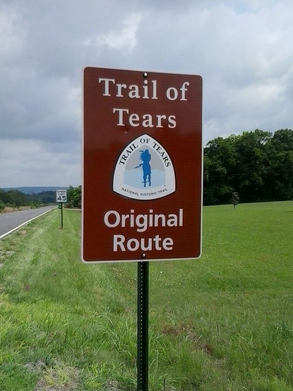
Trail of Tears Historical Markers
The Indian Removal Act of 1830 opened a dark chapter in American history. Thousands of Native Americans died during forced removal from their eastern homelands to the Great Plains, along what is now know as the Trail of Tears for many different tribes and nations.
One hundred feet east was one site where "The Trail of Tears" began. On May 23, 1838 the Indians of this general area, who had been held in a chestnut log stockade after being gathered by the U.S. Army, began their long trek to Oklahoma.
The . . . — — Map (db m114398) HM
Side A Prehistoric man arrived in this area bout 10,000 years ago.
Later Indian cultures left many stone artifacts and pottery vessels.
In the 1780s, a French trading post and Indian village were located near the mouth of Spring Creek. . . . — — Map (db m83389) HM
Side 1
Oka Kapassa (Ococoposa), meaning "Cold Water", was the Chickasaw name given to Spring Creek and to a trading post established near the Tennessee River about 1780. About 1817, Michael Dickerson and others were greeted at what by . . . — — Map (db m83393) HM
Panel 1
Tuscumbia and much of the Shoals area played an integral part in the "Trail of Tears" with the Tennessee River route and the overland routes. In 1825, the U.S. Government formally adopted a removal policy, which was carried out . . . — — Map (db m83403) HM
Under the provisions of the Cherokee Removal Act of 1830, a log stockade was built, “Two hundred yards Northeast of Big Spring.” The spring supplied abundant water for the Cherokees, the soldiers and livestock. Fort Payne was used as . . . — — Map (db m36743) HM
In 1837 Federal Troops arrived in this area to select a fort location for the collection, holding and removal of the Cherokee. Part of a much larger compound, this site contained a cabin seized by the troops for use as part of the fort. Today a . . . — — Map (db m100286) HM
The first detachment of 1,103 Cherokees to emigrate under their own officers, prior to leaving for the west held a final council at Rattlesnake Springs (near present-day Charleston, TN) and, by unanimous vote, declared their intentions to continue . . . — — Map (db m113846) HM
In 1838 U. S. soldiers and local militia rounded up over 1,100 men, women, and children in the Little River area during the forced removal of the Cherokee and Muscogee (Creek) Indians. Soldiers held some of them at Fort Likens and Fort Lovell east . . . — — Map (db m196860) HM
In May 1838 soldiers, under the command of U.S. Army General Winfield Scott, began rounding up Cherokee Indians in this area who had refused to move to Indian Territory in Oklahoma. About 16,000 Cherokees were placed in stockades in . . . — — Map (db m18047) HM
Thousands of Cherokee Indians passed through Waterloo in the 1830s when they were forced by the U.S. government to move West on the "Trail of Tears". Most came by boat from Tuscumbia and camped here to await transfer to larger steamboats. During the . . . — — Map (db m84301) HM
Form the late 1700's to 1807 a Cherokee Chief named Doublehead guarded this area, that was claimed by both the Cherokee and Chickasaw Nations as sacred hunting grounds against encroachment of white settlers.
Chief Doublehead had the reputation . . . — — Map (db m84646) HM
In May 1838 soldiers, under the command of U.S. Army General Winfield Scott, began rounding up Cherokee Indians in this area who had refused to move to Indian Territory in Oklahoma. About 16,000 Cherokees were placed in stockades in Tennessee and . . . — — Map (db m33318) HM
Early in the 1800's gold was found from Virginia to Alabama including a rich belt on Cherokee Indian land in what is now Dahlonega, GA.
causing a huge influx of miners and a land grab by new settlers.
Pressure and greed from politicians led to . . . — — Map (db m85838) HM
(Side A) This area's proximity to the Tennessee River and Indian trails made it a crossroads for early habitation, settlement, and trade. Archaeological studies reveal it was first inhabited about 12,000 years ago by Paleo-Indians. They . . . — — Map (db m33305) HM
Of the various detachments that removed the Cherokee People from their home lands in the southeastern United States, three of them landed in Decatur at what became Rhodes Ferry Park. Due to the difficulty of navigating the Muscle Shoals portion of . . . — — Map (db m140846) HM
Approximately one mile due east of this marker, back down the Old Federal Road, called by frontiersmen and Indians the Three Notched Trail or the Three Chopped Way, stood Fort Mitchell, an early 19th century American fort that in 1836 was one of the . . . — — Map (db m26100) HM
The Trail of Tears led thousands of Creek Indians through Tuscaloosa, capital of Alabama in 1836. Chief Eufaula addressed the legislature with these words:
"I come here, brothers, to see the great house of Alabama and the men who make laws and . . . — — Map (db m119308) HM
He extended state laws into Indian lands and actively encouraged illegal white settlement there. A treaty with the Creek Indians in 1832 forced them to leave the state and resulted in nine new counties in east Alabama. Their "Trail of Tears" took . . . — — Map (db m29028) HM
About 1800 near this spot white man established the first trail from East to West across Baxter County. Later some of the Cherokee Indians were moved to Oklahoma using this route which was known as the Trail of Tears. — — Map (db m62248) HM
"Decr 23rd 1837, Buried Rainfrogs daughter. Marched at 8 o'c A.M. halted at Reddix, 3 o'c. P.M. encamped and issued corn & fodder & beef, 16 miles today.
-B.B. Cannon, Detachment Leader
Not Far to Go
Here, members of William . . . — — Map (db m21085) HM
"Long time we travel on way to new land.... Womens cry... Children cry and men cry...but they say nothing and just put heads down and keep on go towards West. Many days pass and people die very much." -Recollection of a survivor of the Trail of . . . — — Map (db m35436) HM
Lewisburg A trading post and steamboat landing was founded near here in 1825 by Major William Lewis, his son Stephen D. Lewis and Dr. Nimrod Manifee. The location gave them land and river access. A town grew up around the trading post and . . . — — Map (db m237068) HM
Stout's Point provides a dramatic overlook of the Arkansas River, the water route
of the Congressionally-designated Trail of Tears National Historic Trail.
What is the Trail of Tears?
After passage of the Indian Removal Act of 1830, . . . — — Map (db m233662) HM
The Cherokee came from East Tennessee and North Carolina area. General Sam Houston was Governor of Tennessee until he resigned and joined the Cherokees in the Indian Territory, now Oklahoma. His wife Talahina, was the daughter of the Cherokee chief . . . — — Map (db m234420) HM
The next two (2) miles is a part of Military Road used in transporting Indians to Oklahoma Territory between 1832 and 1841. From a group of 16,000 Cherokees, 4,000 died enroute. Other tribes to move West were Chickasaw and Choctaw. The great war . . . — — Map (db m234419) HM
In 1831, a group of Native Americans collectively referred to as the Five Civilized Tribes: the Cherokee, Chickasaw, Choctaw, Muscogee, and Seminole, were living as autonomous nations in what would be later called the American Deep South. The . . . — — Map (db m234416) HM
After Congress passed the Indian Removal Act, May 28, 1830, the Government forceably relocated about 60,000 Indians from the southeastern U.S. to what is now Oklahoma. This included the five (5) civilized tribes Cherokee, Chickasaw, Creek, Choctaw, . . . — — Map (db m97912) HM
In 1807, citizens of Crystal Hill built a road to connect Cadron and Arkansas Post. From Cadron the road was built almost due east and continued until they reached the Wattensaw. At the Wattensaw swamps they found an Indian path that led south to . . . — — Map (db m116694) HM
"The steamer Warren brought news... of the loss of the steamboat Monmouth, and the death of at least one-half of her infamously crowded passengers. This fatal, and most appalling, accident arose from a collision between these two boats; but from the . . . — — Map (db m52028) HM
"I have no more land, I am driven away from home, driven up the red waters, let us all go, let us all die together and somewhere upon the banks we will be there."
—Sin-e-cha's Song, heard on several removal boats along the Trail of . . . — — Map (db m229331) HM
"The route which the Choctaws and Chickasaws will
travel, in emigrating to their new homes, is not yet, we
believe, fully determined on; but it is quite probable
that a large proportion of them will cross the Mississippi
at Helena, and White . . . — — Map (db m116572) HM
"Long time we travel on way to new land.... Womens
cry.... Children cry and men cry...but they say nothing
and just put heads down and keep on go towards
West. Many days pass and people die very much."
-Recollection of a . . . — — Map (db m116602) HM
The Indian parties followed an ancient trail that became known as the Southwest Trail. The primitive trail took the tribal groups by where you are standing. William S. Lockhart was the first permanent settler in the area, arriving in 1815, at a . . . — — Map (db m96596) HM
"The Cherokees have been kept on a small spot, surrounded by a strong guard… obliged to live very much like brute animals… exposed to wind and rain, and herd[ed] together… like droves of hogs…” —Reverend Butrick, June 1838 . . . — — Map (db m156907) HM
The removal of the Chickasaw from their southeast homelands began in the early 1800s. Government traders who forced tribal members into debt would demand tribal lands as payment. By 1818, the Chickasaw had unwillingly yielded property in Alabama, . . . — — Map (db m156906) HM
"No part of the land granted them shall ever be embraced in any… State; but the U.S. shall forever secure said Choctaw Nation, from and against all laws except such as… may be enacted in their own National . . . — — Map (db m156905) HM
The Muscogee (Creek) people are descendants of a remarkable culture that, before A.D. 1500, spanned the entire region now known as the southeastern United States. The Muscogee were not one tribe, but rather a union of several that evolved into a . . . — — Map (db m156904) HM
The Seminole people originated in Florida from the mixing of many indigenous groups throughout the southeast. Encroachment by white settlers and slave-hunters onto tribal territory started the Seminole wars in 1817. Sporadic warfare continued until . . . — — Map (db m156903) HM
The Indian Removal Act was signed by President Andrew Jackson on May 28, 1830. This act put in motion the systematic removal of the Choctaws, Muscogee Creeks, Chickasaws, Seminoles, and Cherokees from their ancestral homes in the east to Indian . . . — — Map (db m240074) HM
In the River Valley Below
With dramatic views of the river valley, Mount Nebo State Park
is an ideal spot to view the Arkansas River where thousands of
Native Americans passed during the forced removal from their
native lands. Below, a . . . — — Map (db m233689) HM
We the Numu, (pronounced Noom, which is our word for people) known
now as Owens Valley Paiute, are native to the broad and beautiful valleys
here. What you see may look stark and dry, but long before the whites came,
we understood this land . . . — — Map (db m195037) HM
Florida Seminole. After the Third Seminole War (1858), nearly 3,000 Indians were forcibly sent to the Oklahoma Territory. A small number of Seminoles continued to live in relative isolation in southern Florida into the 1900s. Flood control and . . . — — Map (db m167203) HM
Early Migrants More Than Snowbirds The earliest migrants to Florida, determined by archeological evidence, date back to 500 A. D. Among them were the Deptford People, the Weeden Island People, the St. John's People and the Timican . . . — — Map (db m167202) HM
Oklahoma Seminoles. The Seminole Nation in the State of Oklahoma is the largest of the three recognized Seminole governments in the United States. They are descendants of the 3,000 Seminoles who were forcibly removed from Florida in the middle . . . — — Map (db m167204) HM
Pilaklikaha
One mile east of here is the site of the town of Pilaklikaha, established in 1813 by Black Seminoles. Meaning "many ponds" in the Mikasuki language, Pilaklikaha was the largest and most prosperous Black Seminole town in Florida, . . . — — Map (db m114467) HM
A portrait of Dirt Town in the 1830s depicted the lifestyle of the majority of Cherokee communities. People led the life of subsistence farmers with simple log cabins, small cornfields and fruit orchards, and ranged livestock. Their lives . . . — — Map (db m221122) HM
One-half mile north is the site of Fort Buffington, built in the 1830’s by local militia. It was one of about 25 stockades in the Cherokee Indian Nation used by Federal and State troops during the Cherokee Removal in 1838. In May and June, 1838, . . . — — Map (db m51190) HM
Just East of the railroad from here and 200 yards North of Wauhatchie Spring and Branch, stood the home of Wauhatchie, Chief of the Cherokees. In the War of 1812 he served in a company of Cherokees under Capt. John Brown, Col. Gideon Morgan and Maj. . . . — — Map (db m57996) HM
Seventeen white families from Georgia and Alabama illegally took possession of Cherokee homes here in the Beaver Dam settlement in February 1830. Cherokee Chief John Ross responded by sending a mounted police force, the Light Horse Brigade, to evict . . . — — Map (db m197528) HM
The Cherokee Nation once spread across Georgia, North Carolina, Tennessee, and Alabama. It was home to thousands of men, women, and children. The 1830 Indian Removal Act required that the Cherokee surrender their land and move west. Many actively . . . — — Map (db m197525) HM
At this house’s core is the 1790s log home of Major Ridge (c.1771-1839), a leader in the Cherokee Nation. His 223-acre plantation supported numerous outbuildings, orchards and slaves while the family served as ferryboat operators and merchants. It . . . — — Map (db m14981) HM
General Winfield Scott put the Cherokee removal into action in 1838. The Cherokee remained in their homes despite continuous warnings and directives to gather at the forts. “Cherokees! The President of the United States has sent me with a . . . — — Map (db m171956) HM
In 1838, the majority of the Cherokees, approximately 12,000, were forced onto the “Trail of Tears”. Only about 8,000 made it to the new Cherokee Nation – what is now called Tehlequah, Oklahoma. After being imprisoned for several . . . — — Map (db m171953) HM
In 1838, 1100 Cherokee Indians
were assembled at this site in
preparation for the evacuation
to Oklahoma Territory on
The Trail of Tears — — Map (db m98987) HM
Home of the Cherokee Indian Chief Whitepath stood from 1800 to 1982, 338 yards S.W. of this marker. Aaron Pinson born Feb. 5, 1784 lived here from 1838 until his death Dec. 7, 1843 — — Map (db m98998) HM
During the early 1800’s, northern Georgia was heart of the sovereign, independent Cherokee Indian Nation. By this time Cherokee were the most progressive Indian tribe in North America. In 1821, they became the first American Indians with a written . . . — — Map (db m11567) HM
The New Echota Treaty of 1835 relinquished Cherokee Indian claims to lands east of the Mississippi River. The majority of the Cherokee people considered the treaty fraudulent and refused to leave their homelands in Georgia, Alabama, North . . . — — Map (db m10051) HM
This is the site of one the forts or stations used by the United States Government in Cherokee country in 1838 to round up the Cherokee Indians for their removal to western reservations. General Winfield Scott, commander of the troops used to . . . — — Map (db m30369) HM
Built of locally made brick in 1804, this house, the finest in the Cherokee Nation, was the home a Town Chief, James Vann, son of a Scotch trader, Clement Vann, and his wife, a Cherokee chieftain's daughter. Around his home were several of his . . . — — Map (db m18595) HM
Author of "Home, Sweet Home," suspected as a spy of the Cherokee Indians was imprisoned here in 1835, but released.
Erected by Old Guard of Atlanta Oct. 6, 1922;
Jos. A. McCord; Commandant — — Map (db m18592) HM
Here stood a Cherokee Indian stockade with blockhouse on hill, built by U.S. Government in 1836.
Capt. Samuel Fariss and a company of Georgia volunteers guarded Cherokee Indians here before their removal to the west.
This fort was . . . — — Map (db m12907) HM
This comfortable two-story log house was the home of Cherokee Chief John Ross from boyhood until he went west over the "Trail of Tears," losing his Indian wife enroute. Although only one-eighth Indian himself, Ross was the elected "Principal Chief" . . . — — Map (db m12673) HM
At this point, just north of the safest ford in the Chattahoochee River, the first white settlers in this area built their campfires in 1822. A trading post was soon established on the site and Indians traded gold nuggets and gold-dust to the . . . — — Map (db m43704) HM
Early removal plans called for transporting Cherokee by boat to Indian Territory. The first three detachments passed by here on steamships in the summer of 1838 as they descended the Ohio River. With low water levels and impassable shoals preventing . . . — — Map (db m161480) HM
Home to thousands of men, women, and children, the Cherokee Nation at the time of removal spread across parts of today's Georgia, North Carolina, Tennessee and Alabama. The 1830 Indian Removal Act required that the Cherokee and other southeastern . . . — — Map (db m161483) HM
Home to thousands of men, women, and children, the Cherokee Nation once spread across parts of Georgia, North Carolina, Tennessee, and Alabama. The 1830 Indian Removal Act required that the Cherokee and other southeastern tribes surrender their land . . . — — Map (db m154723) HM
In 1851, when the Illinois Central Railroad began surveying land in Union County, the county seat of Jonesboro was thought to be the logical choice for the location of the tracks. However, the city fathers declined to pay the required $50 surveying . . . — — Map (db m161071) HM
Home to thousands of men, women, and
children, the Cherokee Nation once spread
across parts of Georgia, North Carolina,
Tennessee, and Alabama. The 1830 Indian
Removal Act required that the Cherokee
surrender their land and move west.
In . . . — — Map (db m161434) HM
Union County was created January 2, 1818, when Illinois was still a territory. County commissioners established Jonesboro as the county seat on land donated by John and Juliet Grammer.
During the frigid winter of January 1839, thousands of . . . — — Map (db m161167) HM
At this point on the "Varmintrace" Road from Princeton toward Cumberland River the Cherokee Indians in 1838 camped on the 1200 mile "Trail of Tears." The enforced trek began in the Great Smoky Mountains and led westward to Indian Territory, costing . . . — — Map (db m123861) HM
By the early 1800's white settlers in present-day Georgia, Alabama, and Tennessee wanted the Cherokee farms, especially after the discovery of gold on Cherokee land. In 1830 the U. S. Congress passed the Indian Removal Act; in 1835 three hundred . . . — — Map (db m105690) HM
The Cherokee people once occupied much of the mid-Atlantic territory of North America. During the American Revolution they sided with the British against encroaching settlers and were forced to live in the mountains of Georgia, Tennessee, and North . . . — — Map (db m105691) HM
A camping ground, Oct. 1838, for a part of the Cherokee Indians who were forcibly moved from their homes in the Smoky Mountain region of N. Car. and Tenn. to Indian Terr., now Okla. Badly clothed and fed, hundreds became ill and many died, among . . . — — Map (db m88883) HM
In 1838 this lot, then in woods, was
used as camping grounds for 13,500
Indians removed along this route
from the southern states to
Oklahoma, in detachments of 1500.
Among those who died in camp
were two noted Cherokees
Chief . . . — — Map (db m88886) HM
Chief Whitepath served with Chief John Ross on the six-person Management Committee for Cherokee Removal and Subsistence, arranging for ration stops along the "Trail of Tears".
Cherokee Memorial Park in Hopkinsville, Kentucky, was one of the . . . — — Map (db m105687) HM
"We found them in the forest camped for the night by the road side under a severe fall of rain accompanied by heavy wind. With their canvas for a shield from the inclemency of the weather, and the cold wet ground for a resting place, after the . . . — — Map (db m174684) HM
Over 1,400 Cherokee men, women, and children from Peter Hildebrand's detachment spent two bitterly cold weeks camped in this area during the harsh winter of 1838-1839.
The detachments ahead of them had successfully crossed the icy Ohio River, . . . — — Map (db m174648) HM
Here, you leave the historic Trail of Tears original route. It turns to your right, across the creek onto private property, and continues to the Ohio River. The Cherokee crossed the river at Berry's Ferry, landing at Golconda. From there, they . . . — — Map (db m174687) HM
Mantle Rock is the largest freestanding arch east of the Mississippi River. It is 188 feet long and 30 feet high. Some of the plants found here are not known to grow anywhere else in Kentucky. This very beautiful and historic place has many . . . — — Map (db m159929) HM
Home to thousands of men, women, and children, the Cherokee Nation once spread across Georgia, North Carolina, Tennessee, and Alabama. The 1830 Indian Removal Act required that the Cherokee surrender their land and move west.
In 1838, more . . . — — Map (db m174647) HM
"...we have Suffered a great deal...The roads are in very bad Order as the ground was frozen very deep...We have been lying by about two weeks...The [river] has been full of large quantities of floating Ice...we must calculate on suffering a . . . — — Map (db m174656) HM
"The Indians as a whole carry in their countenances every thing but the appearance of happiness. Some carry a downcast dejected look bordering on the appearance of despair…" - New York Observer, January 26, . . . — — Map (db m174677) HM
This tree was only a seedling when the Cherokee paused here. Imagine the scene - it was a tree like this one that a weary Cherokee man sat against in a winter camp. His family struggled to make a simple, warm, resting place for his family elder, . . . — — Map (db m174682) HM
(top:)
With the black scorch of burned riverfront warehouses before them, the Cherokee on the Drane detachment moored at Paducah in July 1838. The waterfront was still recovering from a great fire two months earlier. The Cherokee . . . — — Map (db m154711) HM
Home to thousands of men, women, and children, the Cherokee Nation once spread across parts of Georgia, North Carolina, Tennessee, and Alabama. The 1830 Indian Removal Act required that the Cherokee and other southeastern tribes surrender their land . . . — — Map (db m154722) HM
In 1838 and 1839, twelve detachments with at least 11,000 weary Cherokee passed through Jackson, Missouri, on their journey to Indian Territory. Most of the groups followed the Northern Route of the Trail of Tears and came into town on Greensferry . . . — — Map (db m236844) HM
Home to thousands of men, women, and children, the Cherokee Nation once spread across parts of Georgia, North Carolina, Tennessee, and Alabama. The 1830 Indian Removal Act required that the Cherokee surrender their land and move west. In 1838, . . . — — Map (db m236826) HM
The Trail of Tear Redbud stands today as it did in 1838 when thousands of Cherokee Indians passed by as they were forced onto reservation land in Oklahoma. About 4,000 Cherokees died along the Trail of Tears. The Cherokee were forced into eastern . . . — — Map (db m236999) HM
Lebanon, lying 1,265 feet above sea level, in Missouri's Central Ozarks, was founded in 1849 as the seat of newly organized Laclede County. Southern settlers named the town for Lebanon, Tenn. The county name honors the founder of St. Louis. When . . . — — Map (db m44872) HM
They Passed This Way
Home to thousands of men, women, and children, the Cherokee Nation once spread across parts of Georgia, North Carolina, Tennessee and Alabama. The 1830 Indian Removal Act required that the Cherokee surrender their land . . . — — Map (db m213156) HM
This was a remote stretch of the Mississippi River when steamboats of Cherokee passed by on their way west to Indian Territory on the water route of the Trail of Tears. River traffic in 1838 was limited to the daylight hours because of snags and . . . — — Map (db m178285) HM
"Traveled 12 miles to Waynesville on Roberdeou Creek, a branch of the Gasconade—clear and present day..."
Dr. W. I. Morrow's diary, March 5, 1839
During the Trail of Tears, the only way Cherokee could cross the creek . . . — — Map (db m158042) HM
"...halted at Waynesville, MO o'c P.M. encamped and issued corn and fodder, beef and cornmeal. Weather extremely cold."
B. B. Cannon's diary, December 9, 1837
If you had been here the afternoon of December 9, 1837, you . . . — — Map (db m158038) HM
"This morning word came that a Cherokee woman was dying. I hastened to her tent...She was put in the wagon which carried her family when the detachment started, but soon expired."
Rev. Daniel S. Butrick diary, March 11, . . . — — Map (db m158035) HM
On December 9, 1837, United States Army Conductor, B.B. Cannon and 330 Cherokee Treaty Party "Volunteers" camped near this site. Ten additional detachments, led by Cherokees themselves, passed through here on the Northern Route of the "Trail of . . . — — Map (db m158046) HM
From 1837 to 1839, thousands of Cherokee traveled along local roads and through what is now Laughlin Park on their way to Indian Territory in the West. Some groups encamped here on their journey.
The Cherokee, or the "Principal People" or . . . — — Map (db m158039) HM
A marker, 200 feet to the south, recalls the death of White Buffalo Girl of the Ponca tribe. The death of this child, daughter of Black Elk and Moon Hawk, symbolizes the tragic 1877 removal of the Ponca from their homeland on the Niobrara River to . . . — — Map (db m182053) HM
Fort Delaney, the U.S. Army’s post for the 1838 forced removal of Cherokee citizens from the upper Valley River Valley, was located due south of here in present-day Andrews. East Tennessee Mounted Volunteers built the fort in October 1837, . . . — — Map (db m156070) HM
Welcome to Konehete, the Long Valley Place that white’s shortened to Valleytown, the first name of Andrews. For centuries, the Long Valley was home to Cherokee communities such as Little Tellico, Tomatla, Conostee, Quotoconechito, Nehowee, Dasetsi, . . . — — Map (db m156076) HM
190 entries matched your criteria. The first 100 are listed above. The final 90 ⊳