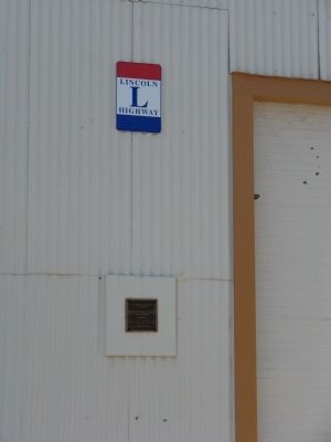
Service Station and Car Dealership
Situated on the Original Route
of the Lincoln Highway
————————
City of Livermore
Historic Preservation Site
Dedicated July 1996
Operated by
The . . . — — Map (db m19994) HM
In 1928, San Pablo Ave. (U.S. 40) became part of America's 3,384 mi.
'Lincoln' Transcontinental Highway.
Marker rededicated April 10, 1988. — — Map (db m153013) HM
At this site on the old Clarksville-White Rock Emigrant Road was Mormon Tavern. Constructed in 1849, this popular stage stop was enlarged and operated by Franklin Winchell in 1851. It became a remount station of the Central Overland Pony Express and . . . — — Map (db m12056) HM
For thousands of years, people have crossed the Sierra Nevada near this place called Donner Pass.
Traveling by foot, wagon, train or automobile, the journey has always been challenging.
By Foot
Long before it’s “discovery” by . . . — — Map (db m23571) HM
Welcome to Donner Summit Canyon
You are about to enjoy a wonderful experience with exquisite views, forests and trails. It is also the gateway to the most important square mile in California’s history! Donner Pass, located above the property, . . . — — Map (db m81978) HM
This monument was erected in recognition of the historical significance of this transportation corridor by the Placer County Water Agency and dedicated to the California Chapter of the Lincoln Highway Association. Ophir Road was formerly U.S. 40 . . . — — Map (db m129960) HM
The Lincoln Highway was the dream of Carl Fisher and Henry Joy. In 1912, Fisher proposed a "coast to coast highway - open to lawful traffic of all descriptions without toll charges." In 1913, the Lincoln Highway Association was born, and the dream . . . — — Map (db m149496) HM
History
"An uplifting of the soul is sure to follow this contact with Nature in her majesty, and Self becomes smaller and smaller as we realize the immensity of things in traversing this country." -- 1924 Complete Official Road Guide of . . . — — Map (db m105154) HM
The Lincoln Highway, a coast to coast all weather road from Times Square in New York to San Francisco’s Lincoln Park, was an idea whose birthday was the 10th of September 1912. This road which freed America from the clutches of changeable weather . . . — — Map (db m18026) HM
The Lincoln Highway was conceived in 1912 and promoted by American industrialists determined to create one transcontinental highway from existing paths, trails and city streets. Spear-headed by the Lincoln Highway Association, the route was . . . — — Map (db m214505) HM
You are standing at the western terminus of the Lincoln Highway, the first direct coast-to-coast highway from Times Square in New York City to Lincoln Park in San Francisco. It was conceived in 1912 by Carl Fisher (founder of the Indianapolis . . . — — Map (db m18145) HM
(First panel:)
America's first coast to coast road
Established 1913
(Second panel:)
1924-1967
Site of Original Wiggins
Trading Post serving travelers
along the Lincoln Highway — — Map (db m156556) HM
In the 1800's the United States was experiencing its industrial revolution. Inventors were running rampant. The new horseless carriage was the rage. America soon realized that the horse and buggy were a thing of the past. Bicyclists, having trouble . . . — — Map (db m214456) HM
In the 1800's the United States was experiencing its industrial revolution. Inventors were running rampant. The new horseless carriage was the rage. America soon realized that the horse and buggy were a thing of the past. Bicyclists, having trouble . . . — — Map (db m230997) HM
The Lincoln Highway is an iconic mishmash of roads across 13 states. Construction began in 1913. It was Carl Fisher's goal to make the most direct and safe route from coast to coast. The original route spanned more than 3,300 miles, from
times . . . — — Map (db m272616) HM
Built in 1917-18, this entrance to Davis is among the oldest surviving examples of I-beam construction on a railroad grade separation. The underpass was part of the Lincoln Highway. The bicycle bore was added in 1978. Listed in the National Register . . . — — Map (db m57189) HM
One of the markers erected by the California Automobile Association in the 1920s to designate the California portion of the Lincoln Highway from New York City to San Francisco. The Highway followed US 40 from Sacramento through Davis via Olive Dr. . . . — — Map (db m9040) HM
This is an original 1928 marker from the Lincoln Highway, the nation's first transcontinental road, which extended from Times Square in New York City to Lincoln Park in San Francisco. This segment of the highway, now known as the Avenue of the . . . — — Map (db m57102) HM
The U.S. Coast and Geodetic Survey determined the latitude, longitude and elevation of the Zero Milestone. Authorized by Act of Congress, June 5, 1920. Dedicated June 4, 1923.
Point for the measurement of distances from Washington on . . . — — Map (db m32486) HM
Blue Island sits atop a 6-mile long glacial ridge, left behind 14,000 years ago when the 5000-foot thick Laurentide ice sheet melted and retreated, also scraping out the basin of Lake Michigan, to a depth of 340 feet below sea level.
In . . . — — Map (db m297904) HM
Chicago Heights, an important stop on the Lincoln Highway, is known as the “Crossroads of the Nation” for its famed intersection of the Lincoln and Dixie Highways. The McEldowney Bridge, where the Lincoln Highway crossed Thorn Creek, included the . . . — — Map (db m170396) HM
In order to construct a paved highway across America it was necessary to english nationwide, public support for the first coast-to-coast roadway. It was decided the highway would be dedicated to the martyred President Abraham Lincoln. Naming this . . . — — Map (db m172987) HM
Portions of the Lincoln Highway were first established by identifying existing roads to be paved. The Sauk Trail from the eastern Illinois border westbound through Sauk Village was designated as a section of the original route, including the . . . — — Map (db m204975) HM
Work commenced in September of 1914 on the “First Seedling Mile” in Malta, Illinois. This construction was key to the Lincoln Highway, which runs from Times Square in New York City, to Lincoln Park in San Francisco.
Planned in 1913 by the . . . — — Map (db m230825) HM
Illinois, in the heart of the nation, has always been a
crossroads state. The country's great transportation arteries –
the Great Lakes, the Mississippi and Ohio Rivers, the railroads,
the interstate highway system – all intersect through . . . — — Map (db m230864) HM
The Lincoln Highway’s first Seedling Mile of paved highway was built in Malta. This strategically chosen location demonstrated the need for better roads, showing the stark contrast between travel on concrete versus mud. From concept to completion, . . . — — Map (db m233236) HM
Malta is proud to be the home to the “First Seedling Mile”
on the Lincoln Highway. This first strip of paved road was
made to use as a “show and tell” demonstration of the
advantages of travel on concrete verses mud, in an effort
to obtain . . . — — Map (db m230865) HM
The Lincoln Highway was the first transcontinental, hard surface roadway in the United States. The Highway traversed 3,384 miles and twelve states - beginning in New York City and ending in San Francisco. Planned in 1913 by the Lincoln Highway . . . — — Map (db m230868) HM
In 1913, Carl Fisher proposed the “Coast to Coast Rock Highway”. Eager to put America on wheels, executives from automobile and tire manufacturers quickly joined in the effort. At the inaugural meeting on July 1, 1913, the newly elected President, . . . — — Map (db m230819) HM
Aurora was the first city along the Lincoln Highway with street lights and was among the first in the nation to have them also. Yet again, enhancements to the highway spawned new commerce for communities along the road. With street lights, stores . . . — — Map (db m170198) HM
Geneva played an important role in connecting the cities of the Fox River Valley to the Lincoln Highway. The city was eager to cater to the newly motoring public by offering well-lit, paved streets, a stop-and-go light, and a motorcycle policeman . . . — — Map (db m94267) HM
Grand entrance gates located on the Lincoln Highway welcomed guests to Exposition Park. Unique attractions like the "world's largest" log cabin and the thrill of hot air balloon rides guaranteed fun for everyone who visited. — — Map (db m299077) HM
In cooperation with the Lincoln Highway Association the Boy Scouts of America placed a reported 3,000 concrete marker monuments along the Lincoln Highway in 1928. The markers were meant to immortalize the dream of the ideal highway and as a lasting . . . — — Map (db m299069) HM
The village of North Aurora offered the tourist traveling on the Lincoln Highway the beautiful scenery of the Fox River Valley and a one-of-a-kind attraction, Exposition Park. Located just inside North Aurora on the Lincoln Highway, Exposition Park . . . — — Map (db m299070) HM
The Lincoln Highway provided easy travel for the many who sought getaway destinations like Exposition Park. This beautiful 150 acre complex included: "the world's largest" fresh water swimming pool, an elaborate cottage-style hotel, midway rides, . . . — — Map (db m299076) HM
In 1913, Carl Fisher proposed the "Coast-to-Coast Rock Highway". Eager to put America on wheels, executives from automobile and tire manufacturers quickly joined in the effort. At the inaugural meeting on July 1, 1913, the newly elected President, . . . — — Map (db m299075) HM
In 1914 Kane County's first paved portion of the Lincoln Highway was comparable to a seedling mile. This stretch of concrete road was 18 feet in width, three-quarters of a mile in length, and constructed on the Lincoln Highway by the Loyal Order of . . . — — Map (db m299074) HM
The Lincoln Highway provided travelers easy access to vacation getaways along its route and corridor. Eye-catching roadside advertising directed motorists to the cultural activities of St. Charles and the scenic beauty and recreational opportunities . . . — — Map (db m258124) HM
The Boy Scouts of America completed the monumental task of simultaneously placing more than 3,000 Lincoln Highway Markers across the nation on September 1, 1928. The concrete markers were designed to immortalize the highway dream and as a memorial . . . — — Map (db m271921) HM
Illinois was the only state to have LH drinking fountains. They were donated by Carl Parker in memory of his mother, Amanda Sutherland Parker who had grown up in the Garden Plain area of Whiteside County. Originally the fountains were to be placed . . . — — Map (db m235450) HM
The sight of a Model T stuck in the mud was a common one throughout Illinois in 1920, as car ownership had grown the previous decade. Illinois' old country roads were intended for horses, not cars. Made of dirt, they were outright impassible a . . . — — Map (db m302977) HM
With the construction of the Lincoln Highway came many opportunities for community growth and recognition. Illinois was the only state to be awarded the Lincoln Highway drinking fountains by working to achieve the standards required. The fountains . . . — — Map (db m303004) HM
October 9, 1920, the celebration over the formal opening of the long stretch of pavement from DeKalb to Creston on Lincoln Highway attracted a large crowd. An estimated 300 automobiles were loaded to capacity in a parade that left DeKalb and . . . — — Map (db m303035) HM
In 1913, Carl Fisher proposed the "Coast-to-Coast Rock Highway". Eager to put America on wheels, executives from automobile and tire manufacturers quickly joined in the effort. At the inaugural meeting on July 1, 1913, the newly elected President, . . . — — Map (db m302900) HM
This early fountain was made in 1914-1915 when Lincoln Highway Fountains were placed in several towns. (Creston included) The fountain in Creston stood across the street on the sidewalk in front of the Fogleman Building where John Luxton's . . . — — Map (db m303125) HM
Improved roads in the 1900s, like the Lincoln Highway, contributed to the rise of Industrialism in America. This brought the period known as the Gilded Age. Business leaders amassed enormous wealth and built elaborate homes, theaters, local . . . — — Map (db m209415) HM
The Lincoln Highway is an example of the 1900s American cultural awakening. The end of the Victorian era brought progress and independence as people set out in their automobiles to venture across the country. The vision of the first . . . — — Map (db m209416) HM
Oregon has a rich art and cultural heritage that dates back to the days of the Lincoln Highway. Seeking peace and quiet from the hectic life of the city, motorists were now able to enjoy weekends and summers in nearby rural areas. Located on the . . . — — Map (db m209417) HM
In 1913, Carl Fisher proposed the "coast-to-coast Rock Highway". Eager to put America on wheels, executives from automobile and tire manufacturers quickly joined the effort. At the inaugural meeting on July 1, 1913, the newly elected President, . . . — — Map (db m209414) HM
The evolution of the road changed the look of America with the development of roadside industries. As motoring became a way o f life, the local filling station was welcomed sight to travelers. Service stations and garages along the Lincoln . . . — — Map (db m133512) HM
During the 19th century, cities usually had descent roads, but rural roads were often little more than muddy trails. Bicyclist's and railroad companies began calling for good roads in the 1880s, but American road building really took off in the . . . — — Map (db m133511) HM
Rochelle was a natural forefront to major automobile transportation and grew to earn the name of the "Hub City" because of its location at the intersection of several major transportation routes.
The "Hub" began with the railroads in . . . — — Map (db m133513) HM
In 1913, Carl Fisher proposed the "Coast-to-Coast Rock Highway". Eager to put America on wheels, executives from automobile and tire manufacturers quickly joined in the effort. At the inaugural meeting on July 1, 1913, the newly elected . . . — — Map (db m133510) HM
Fulton celebrates a rich Dutch heritage with its early immigrants being especially drawn to the area because of its position on the Mississippi River. The premium riverbank's natural bounty was a source for fishing, hunting, excursions, boating and . . . — — Map (db m230384) HM
“Let's try to get to the Mississippi River today,” said the Lincoln Highway driver. “The
Lyons Fulton Bridge is our link for the journey west.”
When the newly paved road connected to the Lyons Fulton Bridge it became the “Official Crossing” of . . . — — Map (db m230382) HM
The Lincoln Highway became the route of choice for transcontinental auto speed records, mostly sponsored by small automobile companies trying to compete with General Motors and Ford. The first was in 1916 when Bobby Hammond set the mark at six days, . . . — — Map (db m230383) HM
In 1913, Carl Fisher proposed the “Coast to Coast Rock Highway”. Eager to put America on wheels, executives from automobile and tire manufacturers quickly joined in the effort. At the inaugural meeting on July 1, 1913, the newly elected President, . . . — — Map (db m230372) HM
Anita King, a former race car driver turned movie star, was the first woman to drive solo cross-country on the Lincoln Highway. Nicknamed the "Paramount Girl", she left Los Angeles on August 25, 1915. Making public appearances along the route, she . . . — — Map (db m170397) HM
In July 1928, four Eagle Scouts were selected for a nationwide safety tour to promote the Lincoln Highway and the upcoming national scouting event in which the Lincoln Highway concrete markers would be installed. The Scouts, two Scoutmasters, and a . . . — — Map (db m172995) HM
A clearinghouse for information as you travel down the Mother Road, the Route 66 Experience has information on Route 66, Lincoln Highway and all of Joliet! Visit the Free Route 66 Experience with interactive features to entertain for hours! A key . . . — — Map (db m157506) HM
American commercial streets were already a wash with signage before the automobile was even invented. When automobiles became the preferred mode of travel the nation's streetscape marketing evolved to better reach the potential customers motoring . . . — — Map (db m279232) HM
Popularity of the Lincoln Highway was widespread among various organizations, at every level from national to civic as well as non-for-profits entities. Many groups supported the Lincoln Highway with projects and events in an effort to continue . . . — — Map (db m279235) HM
[Top plaque:]
One of the few remaining Lincoln Highway markers. Originally, 3,000 markers were placed along the highway by the Boy Scouts of America in 1928. The markers symbolized one of the nation's first cross-country highways.
This . . . — — Map (db m279211) HM
In 1913, Carl Fisher proposed the "Coast-to-Coast Rock Highway". Eager to put America on wheels, executives from automobile and tire manufacturers quickly joined in the effort. At the inaugural meeting on July 1, 1913, the newly elected President, . . . — — Map (db m279216) HM
Trolley cars were the first means of motorized public transportation within city limits as well as going to areas inaccessible by railroad. The trolley line that served New Lenox ran between Chicago Heights and Joliet. Although the trolley was . . . — — Map (db m278999) HM
The Village of New Lenox, originated as a small settlement along the shores of Hickory Creek, a winding tributary of the Des Plaines River southwest of Chicago. Settlers were attracted to the waterway, and its surrounding groves and fertile lands . . . — — Map (db m279237) HM
The two longest highways in America, the Lincoln Highway and Route 66 intersect in Plainfield and Joliet Illinois. This famous historic crossroads intersects for three blocks [in] the heart of downtown Plainfield with road signs to mark where both . . . — — Map (db m119937) HM
Prior to the onset of paved roads like the Lincoln Highway public transportation in the form of an electric passenger railroad known as interurban enjoyed widespread popularity. These light rail lines were mainly electrified operating with . . . — — Map (db m94170) HM
In 1913, Carl Fisher proposed the "Coast-to-Coast Rock Highway". Eager to put America on wheels, executives from automobile and tire manufacturers quickly joined in the effort. At the inaugural meeting on July 1, 1913, the newly elected President, . . . — — Map (db m94168) HM
Plainfield is reported to be the oldest community in Will County, situated along the DuPage River it quickly became a summer suburban vacation spot for much of northern Illinois. Before automobile travel on the Lincoln Highway became the preferred . . . — — Map (db m94175) HM
In 1916, Adeline and Augusta Van Buren set out to prove women could ride motorcycles across the country to serve as military dispatch riders. Even though their attempt was futile, they became the first women to make a solo coast-to-coast trek on the . . . — — Map (db m172993) HM
The Lincoln Highway was the first auto road across the United States. Promoted by Carl G. Fisher, of Indianapolis, the Lincoln Highway route was announced in 1913. From Times Square in New York City to Lincoln Park in San Francisco, the Lincoln . . . — — Map (db m197131) HM
Why Lincoln?
Neither Carl Fisher or Henry Joy ever met Abraham Lincoln but both had gown up in a nation that was still grieving over the death of the “Great Emancipator” and that was still searching for a fitting way to nationally honor the . . . — — Map (db m282521) HM
Goshen, Indiana
The Maple City
Until the early 1800’s, the original inhabitants of the Goshen area were the Potawatomi Indians. It was a little more than a decade after Indiana became a state in 1816, before pioneers began settling in the . . . — — Map (db m282524) HM
On September 1, 1912 at a dinner party for automobile manufacturers at the Deutsches Haus in Indianapolis, Carl G. Fisher, President of the Prest-O-Lite Company and father of The Indianapolis 500 unveiled his plan for a highway spanning the country . . . — — Map (db m72547) HM
Was the first "Coast to Coast" road covering 3,389 miles across the U.S.A.
The dream of Hoosier Carl G. Fisher, founder of the Indianapolis 500. The Lincoln Highway Association was established on June 1, 1913.
The Boy Scouts of America . . . — — Map (db m68035) HM
The Lincoln Highway was the first “Coast to Coast” transcontinental highway in the United States constructed from 1913 to 1928 beginning at Times Square in New York City and ending in Lincoln Park in San Francisco. The route spanned . . . — — Map (db m72548) HM
Austin F. Bement poses with his Packard, parked alongside of the "Ideal Section" in Dyer, Indiana, which runs from approximately Calumet Avenue in Dyer to Janice Drive in Schererville. Mr. Bement was Secretary of the Lincoln Highway Association. . . . — — Map (db m254706) HM
A model stretch of object-lesson road built by the Lincoln Highway Association with the co-operation and financial aid of the federal government, the State of Indiana, and Lake County, Indiana, with funds contributed by the United States . . . — — Map (db m256673) HM
Ideal Section
During the first few years of its existence, the Lincoln Highway Association (LHA) worked feverishly to promote the idea of a transcontinental highway. The excitement and enthusiasm of Americans for better roads became well . . . — — Map (db m213124) HM
Out of the Mud
The idea that America needed better roads did not originate with the invention of the automobile but with bicyclists known as "wheelmen. "Challenged by rutted roads of gravel and dirt and faced with antagonism from horsemen, . . . — — Map (db m256601) HM
The Lincoln Highway. United States' first transcontinental highway, constructed 1913-1928, from New York City to San Francisco. Dedicated to the memory of Abraham Lincoln. Conceived by Carl G. Fisher to encourage building "good roads." . . . — — Map (db m213119) HM
The "Ideal Section," a portion of the Lincoln Highway (US 30), was a prototype of construction technology intended to make it the finest road in the world.
The section begins one half mile west of US 41 and extends 1.3 miles westward to Bank . . . — — Map (db m213121) HM
This plaque is dedicated to the history of America's first transcontinental highway, which passed 137 feet south of this spot. A section of Macadam is displayed in the sidewalk. The highway in the Schererville area followed the Sauk . . . — — Map (db m204887) HM
Early History
Schererville can trace its history to the days of Native Americans and their trails across Northern Indiana.
• Much of the region was marsh and wetlands north of the Kankakee River and south of Lake Michigan.
• The best . . . — — Map (db m302179) HM
The Lincoln Highway. United States' first transcontinental highway, constructed 1913-1928, from New York City to San Francisco. Dedicated to the memory of Abraham Lincoln. Conceived by Carl G. Fisher to encourage building "good roads." . . . — — Map (db m213118) HM
Cyclists Initiate Road Advocacy - The idea that America needed better roads did not originate with the invention of the automobile, rather with bicyclists known as "wheelmen." Challenged by both rutted roads of gravel and the antagonism of . . . — — Map (db m301870) HM
How It All Began
The time was 1912. One million plus motor vehicles were in use in America, primarily in urban settings. To that time only eight recorded motor car travelers had ventured a trip across America. Paved roads were . . . — — Map (db m77213) HM
French fur traders came to Northwest Indiana in the 1600's. A natural opening through the forest served as a gateway to the prairies beyond. They called this opening, La Porte, meaning, “the door”, from which the county received its . . . — — Map (db m77215) HM
The low, swampy land along the Kankakee River was drained to contribute to Starke County's fertile soil of which 75 percent is used for farming. This tranquil land can be enjoyed by traveling scenic Lincoln Highway through the county. The peaceful . . . — — Map (db m238874) HM
The idea that America needed better roads did not originate with the invention of the automobile, but with bicyclists known as "wheelmen." Challenged by rutted roads of gravel and dirt and faced with antagonism from horsemen, wagon drivers, and . . . — — Map (db m184845) HM
The Lincoln Highway Association A New Generation The original Lincoln Highway Association dissolved, its final activities occurring in the early 1940s. As the interstate highway system and superhighways bypassed the small towns and . . . — — Map (db m244096) HM
(Side One)
Historic Crossroads of America
Marshall County has been called the Crossroads of America. The Lincoln Highway (the Lincoln’s second alignment constructed in the mid-1920s), the Michigan Road (Indiana’s first state . . . — — Map (db m75489) HM
The Lincoln Highway was the first “Coast to Coast” road covering 3,389 miles across the USA. It was the dream of Hoosier Carl G. Fisher.
In 1913. The Lincoln Highway Association (LHA) announced that . . . — — Map (db m244097) HM
—Lincoln Highway—
The Nation’s First Coast-to-Coast Auto Road
Once called the Main Street Across America, it all began on September 10, 1912, when a group of industrialists led by Carl Fisher of Indianapolis Motor Speedway fame, . . . — — Map (db m244095) HM
Lincoln Highway Association, formed 1913, promoted and procured a route from New York to California, Dixie Highway Association, formed 1915, worked similarly from Canada to Florida routes. Highways intersected here and . . . — — Map (db m53874) HM
This plaque is placed at the intersection of the Lincoln and Dixie Highways to commemorate the bicentennial celebration of Abraham Lincoln's birth and to honor the men who inspired the nation to create a coast-to-coast highway from New York to . . . — — Map (db m254681) HM
In 1915, Vice President Thomas Marshall traveled to Indiana to participate in dedication ceremonies in Hoosier cities that were celebrating the Lincoln Highway. In 1928 concrete markers provided by the Lincoln Highway Association were planted along . . . — — Map (db m228156) HM
218 entries matched your criteria. The first 100 are listed above. Next 100 ⊳