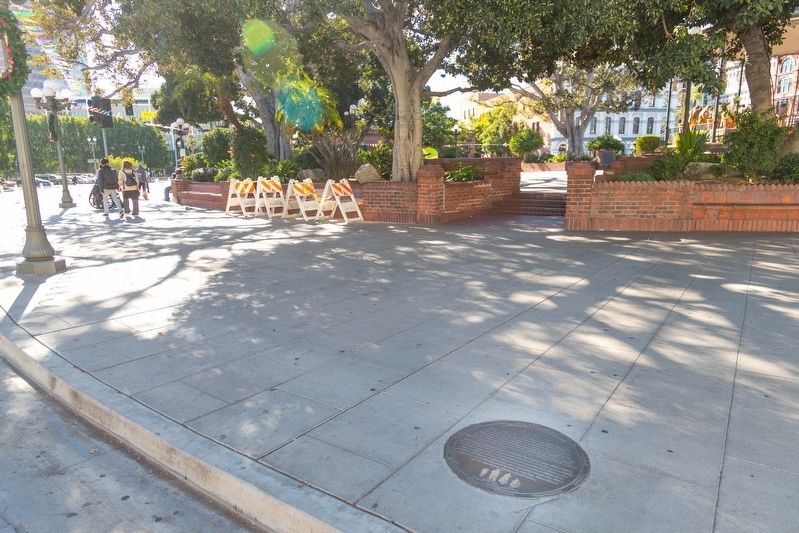
The Founders of the City of Los Angeles Lara · Mesa · Moreno · Rosas · Camero · Rosas · Navarro · Villavicencio · Rodriguez · Quintero · Vanegas
José Fernando de Velasco Lara came from Cadiz, Spain, and his wife, María Antonia . . . — — Map (db m162801) HM
The Founders of the City of Los Angeles Lara · Mesa · Moreno · Rosas · Camero · Rosas · Navarro · Villavicencio · Rodriguez · Quintero · Vanegas
Antonio Mesa and his wife, María Ana Gertrudis López came from Alamos, Sonora. . . . — — Map (db m162806) HM
The Founders of the City of Los Angeles Lara · Mesa · Moreno · Rosas · Camero · Rosas · Navarro · Villavicencio · Rodriguez · Quintero · Vanegas
José Moreno and his wife, María Guadalupe Pérez, came from Rosario, Sinaloa. José . . . — — Map (db m162803) HM
Known as the “finest hotel in Southern California,” the Pico House boasted “bathrooms and water closets for both sexes” on each floor. Pio Pico, the last governor of Mexican California, sold his land in the San Fernando Valley to raise money for . . . — — Map (db m162865) HM
The Founders of the City of Los Angeles Lara · Mesa · Moreno · Rosas · Camero · Rosas · Navarro · Villavicencio · Rodriguez · Quintero · Vanegas
Luis Quintero came from Guadalajara, Jalisco, and his wife, María Petra Rubio came . . . — — Map (db m162808) HM
The Founders of the City of Los Angeles Lara · Mesa · Moreno · Rosas · Camero · Rosas · Navarro · Villavicencio · Rodriguez · Quintero · Vanegas
Pablo Rodríguez came from Real de Santa Rosa, Jalisco, and his wife, María Rosalia . . . — — Map (db m162807) HM
The Founders of the City of Los Angeles Lara · Mesa · Moreno · Rosas · Camero · Rosas · Navarro · Villavicencio · Rodriguez · Quintero · Vanegas
Basilio Rosas came from Nombre de Dios, Durango, and his wife, Maria Manuela . . . — — Map (db m162859) HM
The Founders of the City of Los Angeles Lara · Mesa · Moreno · Rosas · Camero · Rosas · Navarro · Villavicencio · Rodriguez · Quintero · Vanegas
Alejandro Rosas, son of Basilio Rosas and Manuela Hernández, married Juana Maria . . . — — Map (db m162861) HM
The Founders of the City of Los Angeles Lara · Mesa · Moreno · Rosas · Camero · Rosas · Navarro · Villavicencio · Rodriguez · Quintero · Vanegas
In 1542, Captain Juan Rodríguez Cabrillo “discovered” California while . . . — — Map (db m162879) HM
The Founders of the City of Los Angeles Lara · Mesa · Moreno · Rosas · Camero · Rosas · Navarro · Villavicencio · Rodriguez · Quintero · Vanegas
The names of the eleven founders of Los Angeles, originally known as El Pueblo de la . . . — — Map (db m162787) HM
The Founders of the City of Los Angeles Lara · Mesa · Moreno · Rosas · Camero · Rosas · Navarro · Villavicencio · Rodriguez · Quintero · Vanegas
The Los Angeles pueblo encompassed a square of about five and a half miles on each . . . — — Map (db m162882) HM
The Founders of the City of Los Angeles Lara · Mesa · Moreno · Rosas · Camero · Rosas · Navarro · Villavicencio · Rodriguez · Quintero · Vanegas
José Vanegas came from Real de Bolaños, Jalisco, and his wife María Bonifanta . . . — — Map (db m162864) HM
The Founders of the City of Los Angeles Lara · Mesa · Moreno · Rosas · Camero · Rosas · Navarro · Villavicencio · Rodriguez · Quintero · Vanegas
Antonio Feliz Clemente Villavicencio was from the city of Chihuahua and his wife . . . — — Map (db m162867) HM
The Founders of the City of Los Angeles Lara · Mesa · Moreno · Rosas · Camero · Rosas · Navarro · Villavicencio · Rodriguez · Quintero · Vanegas
The village of Yangna is most closely associated with the founding of Los . . . — — Map (db m162868) HM
Through this spot flowed the Zanja Madre (Mother Ditch) which channeled the waters of the Los Angeles River to the citizens
of Los Angeles for 123 years, 1781-1904. — — Map (db m133400) HM
This church is a replica of Christ Church in Boston, long known
as Old North. It is a memorial to the early American patriots who
offered their lives and fortunes in the cause of liberty. Henry
Wadsworth Longfellow immortalized Paul Revere and . . . — — Map (db m212622) HM
Washington wears the uniform of the army
he had led through six bitter years of
war. In the midst of battle his fearless example
inspired his men; when hunger stalked his weary
troops, he shared their lot; when his own officers
betrayed him . . . — — Map (db m212621) HM WM
Founded by Father Junipero Serra July 14, 1774. Most picturesque setting. First mass was celebrated in presence of one Indian. Later congregation grew to a thousand neophytes. Famous for its fine horses and expert vaqueros. — — Map (db m154381) HM
Here June 3, 1770, landed Very Rev. Father Junipero Serra, O.S.F. and founded the following missions; San Diego, July 16, 1769, San Carlos Monterey, June 3, 1770, San Antonio de Padua, July 14, 1771, San Gabriel, Sept. 8, 1771, San Luis Obispo, . . . — — Map (db m63109) HM
The 13 Flags displayed along the top of the log stockade are like those carried by American troops during the REVOLUTIONARY WAR. These standards represent the home countries, colonies, divisions and regiments of the soldiers.
One of the first . . . — — Map (db m298503) HM
When the Spanish army and missionaries came to California in 1769, they made a route, El Camino Real, for travel between missions they established, stretching from San Diego to Sonoma. In the early 1900s, a group of women's clubs, among others . . . — — Map (db m189668) HM
Native Americans came to the region comprising Laguna Niguel at least 10,000 years ago. They settled near the ocean, in the valleys and along the streams that were rich with abundant fresh water and natural resources. These early dwellers . . . — — Map (db m299666) HM
On September 22, 1779, Juan Bautista de Anza, with a party of over 200 emigrants and soldiers, set out from the presidio at Tubac, Mexico, to found San Francisco. His party reached the San Gabriel Mission on January 4, 1776, after many miles of . . . — — Map (db m224291) HM
On the mesa one-half mile south of here the original Mission of San Juan Capistrano was founded Nov. 1, 1776.
Commemorated El Viaje De Portola April 1968 — — Map (db m188901) HM
San Clemente Island is the southernmost of the eight California Channel islands. The 56 square miles island received its named in November 1602 when Spanish explorer Sebastian Vizcaino sailed passed it while mapping the region. It represents . . . — — Map (db m190450) HM
As Governor of Baja California Portola was the military leader of the Spanish expedition into Alta California, which camped near the future site of the Mission on July 23, 1769 — — Map (db m199165) HM
A Spanish soldier station at San Juan Capistrano in the late 1700s. He was awarded a land grant in the San Juan Capistrano Area which remained in his family for 10 generations. — — Map (db m199168) HM
Ortega was the scout who blazed the trails for the 1769 Spanish expedition from San Diego to Sonoma, and discovered San Francisco Bay. — — Map (db m199145) HM
The two furnaces at this site, circa 1790's, are the oldest existing metalworking structures in California. They were used for the production of wrought iron, thereby introducing the natives living here to the Metal Age. Previously, only skills . . . — — Map (db m307668) HM
Sergeant Jose Francisco Ortega was the chief Scout for the Gaspar de Portola exploratory expedition in 1769. While exploring a route for Portola on their way to Monterey Bay, he was the first non-Native American to discover Capistrano Valley. Nearby . . . — — Map (db m188649) HM
The legend of the swallows return to San Juan Capistrano was passed down through generations of the early Indians that once inhabited this region. The earliest documentation of the swallows returning to San Juan Capistrano was recorded by Father . . . — — Map (db m276797) HM
The San Gabriel River flows 43 miles (69 km) through Los Angeles and Orange Counties, California in the United States. Measured to its highest headwaters in the Angeles National Forest, along, the Prairie Fork in the San Gabriel Mountains, the river . . . — — Map (db m214795) HM
Dedicated - June 18, 1950 A Memorial to Richard O'Neill California pioneer (1850) Alice O'Neill, his wife Jerome O'Neill Richard O'Neill Jr.
El Trabuco - Mission Viejo 1769 - Captain Gaspar de Portola, Padre Crespi and soldiers . . . — — Map (db m185388) HM
Spanish explorer Don Juan Bautista de Anza is the first European known to visit the area now known as Riverside. He passed through this region in 1774 and again in 1775-76 while seeking an overland roote from Sonora Mexico to the San Francisco . . . — — Map (db m304231) HM
Directly across the river from where you are standing was once part of William Alexander Leidedorff's Rio de los Americanos land grant. Born in 181 0on the island of Saint Croix to a mother of African descent and a Danish father, Leidensdorff . . . — — Map (db m259483) HM
Miguel Hidalgo y Costilla (1753-1811) Father of Mexico His battle cry for freedom on September 16, 1810 led Mexico to indenpendence from Spain and the end of colonialism. Statue donated by Alberto and Carmencita Heredia, and family, . . . — — Map (db m137649) WM
A prehistoric Indian village
called Atongai once existed
here. In 1776, famed Padre
Garces visited this settlement,
where in 1819 mission native
converts began building a
place for Christian worship. Their efforts
failed when they were killed . . . — — Map (db m166604) HM
In 1906 guidepost bells were placed along the El Camino Real to guide early travelers and to preserve this historic route which linked California missions beginning in 1769.
www.californiabell.com — — Map (db m270369) HM
Franciscans
• Founded 21 missions in California over a 65 year perios. They founded 1 mission in Baja California, San Fernando de Velicata (1769).
• The first Franciscan mission founded in California was San Diego de Alcala (1769), by . . . — — Map (db m312086) HM
To commemorate the discovery of California by Juan Rodriquez Cabrillo who landed on the shores of San Diego Bay September 28, 1542. — — Map (db m126875) HM
San Diego bay is a natural harbor. First sighted in 1542 by the Spanish explorer Juan Rodriguez Cabrillo, the bay was originally named San Miguel. Next visited in 1602, Sebastian Viscaino renamed the bay after a canonized priest, San Diego, from . . . — — Map (db m191983) HM
On Sunday, July 16, 1769 Fathers Junipero Serra, Juan Viscaino and Fernando Parron raised and blessed a cross to establish Alta California’s 1st Mission. Relocated from Presidio Hill to this site in August 1774 the Mission was the mother of those . . . — — Map (db m15262) HM
The earliest adobe buildings at Mission San Diego were built in the fall of 1774. It is believed that this room originally would have been two rooms that were part of the original convento wing of the quadrangle and was built in the late 1700's.
. . . — — Map (db m254269) HM
In this ancient Indian village of Cosoy Discovered and named San Miguel by Cabrillo in 1542 Visited and christened San Diego de Alcala by Viscaino in 1602 Here the first citizen Fray Junipero Serra Planted civilization in California Here he . . . — — Map (db m13055) HM
Traditionally the earliest planted tree in California. Directly in the rear, beneath the brow of the hill, lie the dead of the sacred expedition of 1769. Burial place of our first unknown soldiers. — — Map (db m11959) HM
Commemorating the visit of the officers and men
Buque Escuela Juan Sebastian de Elcano
in homage to their comrades-at-arms who at this place raised and defended the flag of Spain - 1797 to 1821
Dedicado en pax y amistad
San Diego, . . . — — Map (db m81237) HM
The first three sailing vessels to enter San Diego Bay came from the direction you are facing. They were the San Salvador, the Victoria and the San Miguel - Spanish vessels commanded by Juan Rodriquez Cabrillo. The San . . . — — Map (db m15439) HM
En homenaje a la expedición española
integrada por los buques
San Salvador, Victoria y San Miguel
que arribó a San Diego
el 28 de septiembre de 1542
a mando de
Juan Rodríguez Cabrillo
quien tomó posesión de estas . . . — — Map (db m296419) HM
The natural landscape of San Francisco has changed remarkably in the past two hundred years. Streams are now channeled underground, the shoreline is radically altered; native species have been pushed out or become extinct, while alien species from . . . — — Map (db m251036) HM
Defending from an Enemy that Never Came
Both Spanish and American militaries defended the deep water harbor just east of here with artillery mounted on this strategic bluff overlooking the harbor and bay. Neither ever fired a shot in anger; . . . — — Map (db m305089) HM
For the last 5,000 years this particular site served as a vantage point to the southeast, overlooking an ancient salt water bay fed by fresh water streams.
Standing on this bluff three to four hundred years ago, looking southeast, you would have . . . — — Map (db m93013) HM
Adobe House Site
This is the site of a Spanish and Mexican-era adobe house, dating from the 1810s to 1850s. The house is gone today, but the original stone foundation remains buried under the modern rock reconstruction you see. . . . — — Map (db m305916) HM
If you had visited El Polin in the early days you would have encountered an active community. The settlers spent most of the day outside since the houses were small and were used mainly for sleeping and storage. All family members, . . . — — Map (db m305961)
The Native People of the Peninsula The Yelamu were one of 50 independent Ohlone tribes related through culture and language. Ohlone peoples have lived in the Bay Area for several thousand years. The Yelamu, whose territory . . . — — Map (db m131189) HM
She secured her own lands and managed them herself… She had the native Spanish hospitality and dignity, which endeared her to her people to the end of the Mexican regime and secured for her an abiding place in the memories of the American . . . — — Map (db m309631) HM
Comandante’s Headquarters A.D. 1776
Officers’ Quarters
Under
Spanish Mexican & American Rule
Oldest Adobe Building in
San Francisco — — Map (db m284627) HM
The purpose of this monument is to forever stand as a tribute to our nation's Founding Fathers who created the two most important documents that laid the foundation of our country: the Declaration of Independence and the U.S. Constitution. This . . . — — Map (db m67581) HM
Lt. Colonel Juan Bautista de Anza by decree of Carlos III of Spain led an expedition to this site - the mission being to colonize the San Francisco Bay Area
De Anza Expedition 1775 - 1776 — — Map (db m312619) HM
In 1769 a Spanish expedition led by Gaspar de Portolá discovered Chumash Indians building tomols, or plank canoes on the beach below their village. The Indians were caulking their tomols with asphaltum that came from natural oil seeps in the sand. . . . — — Map (db m165568) HM
In 1906, guidepost bells were placed along the El Camino Real to guide early travelers and to preserve this historic route which linked California's missions beginning in 1769 — — Map (db m310315) HM
Under the command of Captain Gaspar de Portola, the first Spanish land
expedition made its way north along the California coast from San Diego in 1769, in search of Monterey Bay. Spain commissioned land exploration in the
hope of locating suitable . . . — — Map (db m310307) HM
Mission La Purisima Concepcion, founded in 1787, and Mission Santa Ines,
established in 1804, were both inland settlements, located near present-day
Lompoc and Solvang. Each of these missions also had an embarcadero, a
designated landing where . . . — — Map (db m310308) HM
One of the first ranchos created in California was Nuestra Señora del Refugio,
which permitted Jose Francisco Ortega, the retired commandante of Santa Barbara presidio, the use of mission lands along the Gaviota coast, beginning about 1797, . . . — — Map (db m310309) HM
Across this bridge lies California's eleventh mission and a glimpse of life during the 1820's. The Civilian Conservation Corps restored the buildings and grounds between 1934 - 1941. We hope you enjoy your visit to the past. — — Map (db m11116) HM
Mission La Concepcion Purisima de Maria Santisima (Mission of the Immaculate Conception of most Holy Mary) was founded by Father Presidente Fermn de Lasuen on Dec. 8, 1787 at what is now Locust Avenue and F Street. It was the eleventh of 21 . . . — — Map (db m70318) HM
The Mission residents lived in and around an enclosed, four-sided building built of adobe bricks and roofed with tiles. The central quadrangle measured between 300 and 375 feet on each side and was lined around the interior, with a covered walkway: . . . — — Map (db m311524) HM
This plaque honors the memory of
Fray Junipero Serra
"The Apostle of California"
who died 200 years ago after a life dedicated
to spreading the Gospel of Jesus Christ.
1784-1984
Presented by Serra International
15,000 Catholic . . . — — Map (db m311297) HM
For the purpose of better instruction, the Indian families were divided into three groups, and each-group housed separately. Thus the married couples with their children lived in the Indian village.
The young women were given a section of the . . . — — Map (db m311306) HM
Lt. Colonel Juan Bautista de Anza and party crossed this area in March 1776, enroute to select sites for the Presidio and Mission of San Francisco — — Map (db m310392) HM
First contact between the Spanish expeditions and the Ohlone tribes was usually friendly. These encounters, recorded in expedition diaries, indicated that throughout Ohlone territory, the Spanish were treated as "distinguished guests," suggesting . . . — — Map (db m197734) HM
Members of the Juan Bautista de Anza Expedition camped in this vicinity near Llagas Creek, March 24, 1776. The Anza Expedition led to the establishment of the Pueblo of San José de Guadalupe, Mission Santa Clara de Asis, Mission San Francisco de . . . — — Map (db m296845) HM
Lt. Colonel Juan Bautista de Anza by decree of Carlos III of Spain led and expedition near this site – The mission being to colonize the San Francisco Bay Area.
In the center of the marker is a circular motif, designed by Doris Birkland . . . — — Map (db m24727) HM
You are standing at the site of the third Santa Clara de Asís Mission.
Completed in 1784, this successful Mission was the center of religious, economic and political activity in Santa Clara Valley. Earthquakes and water damage led . . . — — Map (db m312351) HM
Preserved herein is a portion of the Original cross first erected by Fray Tomas de la Peña, O.F.M. before the entrance to the first Mission Santa Clara de Asis January 12, 1777. — — Map (db m195449) HM
St Clare’s Catholic Parish founded by the Franciscans, under Father Tomas de la Pena, in 1777. Parish came under the guidance of the Jesuit Fathers in 1851. Plaque marks the sixth site of Parish church.
1777 - 1977
Placed by the order of . . . — — Map (db m312673) HM
In front of you is the site of the fifth Santa Clara de Asis Mission.
Floods, earthquakes and fires forced the Santa Clara de Asis Mission to move five times.
Today each of the mission sites are commemorated on the Santa . . . — — Map (db m195448) HM
Lt. Colonel Juan Bautista de Anza by decree of Carlos III of Spain led an expedition to this site – The mission being to colonize the San Francisco Bay Area.
In the center of the marker is a circular motif, designed by Doris . . . — — Map (db m30323) HM
These school grounds were the center of Villa de Branciforte founded in 1797 by Governor Diego de Borica of California on orders from Spain through Viceroy Branciforte in Mexico. The settlement existed as political entity until American occupancy of . . . — — Map (db m2347) HM
You have entered the land of the Río Bravo del Norte, the northernmost outpost of sixteenth century Spain. To the Spanish people, the San Luis Valley was a wild and unexplored place known only to the Native people. Amidst the beauty and towering . . . — — Map (db m71878) HM
Isolated from the rest of Colorado, the San Luis Valley is often a forgotten place. For Native American tribes including the Utes, Apache, Navajos, and others, this Valley is a source of life - a place where humans and spirit enter and leave . . . — — Map (db m71875) HM
¡Bienvenidos! Caminantes!
Come! Take a walk with us. We know an old song, El Caminante, which tells of taking a long walk along the ancient roads. Like the first prehistoric inhabitants, you too are a ‘caminante’, or one who walks upon . . . — — Map (db m71877) HM
“Swift and wide ran the Rio Grande through the San Luis Valley. Untapped by irrigation, crossing the Rio Grande was a death defying experience for anyone who attempted it. The 1694 de Vargas entrada is the first record of a Spaniard successfully . . . — — Map (db m294497) HM
In 1776, Franciscan Fathers, Francisco Atanasio Dominguez and Silvestre Velez de Excalante and eight companions, explored what is now southern Colorado, Utah, and northern Arizona, as men of peace.
Between August and December, 1776, Dominguez . . . — — Map (db m153336) HM
On August 10, 1776, there passed by here the expedition of Fathers Francisco Atanasio Dominguez and Silvestre Velez de Escalante with eight companions. They were seeking a route to link the long established missions of New Mexico with Monterey, . . . — — Map (db m71613) HM
From this spot in the fall of 1776, you might have seen a small expedition crossing the plains below, heading west into Utah. The group was led by Atanasio Dominquez and Silvestre Velez de Escalante, two Franciscan friars attempting to find a . . . — — Map (db m154613) HM
We have here a happy intermixture of nations and languages. French, Spanish, Indian and English salute your ears at one and the same time, and I am often at my wit's end to understand all the appeals made to me by such a Babel-tongued . . . — — Map (db m191922) HM
For centuries the Arkansas was a divided river. Indian nations waged ongoing battles over this life-sustaining resource, vying for access to its water and its fertile hunting grounds. Over time an uneasy balance emerged — the Kiowas, Comanches„ and . . . — — Map (db m289599) HM
In the 1700s, this area of southern Colorado became a significant cultural crossroads for the Indian tribes of the high plains. Apaches and Kiowas, Utes and Comanches all pressed in to take advantage of the abundant buffalo and other game. This . . . — — Map (db m187029) HM
The Buffalo Symbol
The buffalo symbol, displayed in the walkways of this plaza, has been developed to symbolize the great importance that this animal had in Plains Indian cultures. For peoples such as the Arapahos and Cheyennes, who moved . . . — — Map (db m188267) HM
By 1700 Comanches moved south from the northern Rockies onto the plains of southern Colorado and northern New Mexico. They raided the Apaches and Spanish settlements from the late 1600s until 1779 when the Governor of New Mexico, Don Juan Bautista . . . — — Map (db m64775) HM
Discovered White River (which they called the San Clemente) and crossed it near here on Sept. 9, 1776. Seeking a route from Santa Fe to California, these Spanish explorers were the first white men to examine much of western Colorado. This . . . — — Map (db m163890) HM
Andover
The first settlement was made in 1713 in the
southeast part of the present town. Portions
of Lebanon, Hebron, and Coventry joined to
form the Ecclesiastical Society of Andover,
which was recognized by the General Assembly
in May, 1747. . . . — — Map (db m207748) HM
This half of a mill stone, from the early 1700's was used as a stepping stone (front step) for the original meeting house that was located on today's Hebron Road. It was most likely put in place soon after the frame was erected (1748-50) and . . . — — Map (db m207746) HM
Avon
This area, formerly Northington or the North Parish of Farmington, was settled in 1645non land that had belonged to the Tunxis Indians. It prospered as a farming community and, in 1830, after the construction and opening of the Farmington . . . — — Map (db m33019) HM