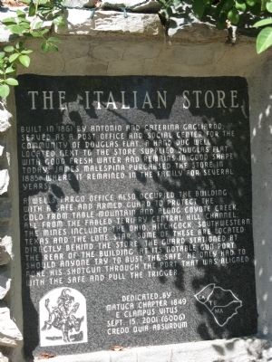
Built is 1861 by Antonio and Caterina Gagliardo. Served as a Post Office and social center for the community of Douglas Flat. A hand dug well located next to the store supplied Douglas Flat with good fresh water and remains in good shape today. . . . — — Map (db m58852) HM
Richest placer mining section, extending five miles, in Calaveras County. Received name from Chileans who worked gulch in 1848 and 1849, and scene of the so-called Chilean War. Largest known quartz crystals recovered from mine on south side of gulch. — — Map (db m11515) HM
A thriving mining camp on rich Pennsylvania Gulch in the 1850’s and 1860’s. Named for Alfred Brown, former owner of Table Mountain Ranch. Laws of Brownsville Mining District provided that each miner could own one wet and one dry claim, not to exceed . . . — — Map (db m11501) HM
Near this spot the “E.C.V. Saloon” stood in 1853. Believed to be the only E. Clampus Vitus (miners’ fun fraternal order) saloon officially recorded. — — Map (db m32875) HM
In this cemetery lie the remains of 600 Calaveras pioneers. All died in the once adjacent county hospital and were interred here between 1890 and the 1910’s. Mostly older men, they lacked the means to be buried in a church or town cemetery. Some . . . — — Map (db m19324) HM
Founded February 18, 1850. Became county seat of Calaveras County. Old court house, said to be constructed of lumber brought from China, is still standing but not on the original site. — — Map (db m152282) HM
Located on the Stockton-Murphy Road at the fourth crossing of the Calaveras River, this early mining settlement, once called Foremans, was famous in the 1850's for its rich placer ores. Later, it became an important stage and freighting depot and . . . — — Map (db m11969) HM
For more than 80 years, the area was known as Onion Valley due to the profusion of wild onions growing here. It was mainly used as a summer stock range. In the late 1860-70’s a sawmill was operated by C. Brown. Later a man called “Turkey” Johnson . . . — — Map (db m40974) HM
The store was built in 1851 and opened for business in 1852 by the Dinkelspiel family, who had recently emigrated from Germany. The buildings were made of rhyolite tuff blocks from the Altaville Quarry. The small adjoining building originally used . . . — — Map (db m11967) HM
One of California's important early day mining towns named by Mexicans meaning Little Valley. Gold was discovered here by the Murphy Brothers on 1849. It was originally called "Murphys' Old Diggings". This bell was cast at Troy N.Y. in 1853. . . . — — Map (db m6841) HM
Founded February 18, 1850. Became county seat of Calaveras County. Old court house, said to be constructed of lumber brought from China, is still standing but not on the original site. — — Map (db m149318) HM
Gwin Mine, Paloma, and Lower Rich Gulch were mined for placer in 1849. Quartz was discovered by J. Alexander in 1851. Property acquired by Wm. M. Gwin, California's first U.S. Senator, in 1851. The Gwin Mine closed, in 1908, yielded millions. — — Map (db m14449) HM
Named by famous scout Kit Carson while searching for pass over Sierras. One emigrant road forked at Big Meadows, and north branch came directly to West Point. A thriving trading post prior to gold discovery. Bret Harte, famous author, lived here for . . . — — Map (db m44371) HM
At this location, in 1878, a railroad station was established for the San Pablo and Tulare Railroad, which ran from Los Banos to Martinez, later to become part of the Southern Pacific Railway, for the purpose of taking on water, and became known as . . . — — Map (db m17325) HM
{pictured above on the marker (left to right), Don Fernando Pacheco, 1818-1884; Don Salvio Pacheco, 1793-1876; Don Francisco Galindo, 1820-1891}
In 1868 Don Salvio Pacheco; his son, Don Fernando Pacheco; and his son-in-law, Don Francisco . . . — — Map (db m17440) HM
Sutter’s Mill put Coloma on the map, but the very gold rush it triggered spelled ruin for Sutter’s vision of New Helvetia.
Dreams of a Better Life
Would you work pennies a day when the gold fields offered hopes of a better life? Most . . . — — Map (db m214702) HM
Located on this corner in 1853 was a sturdy, well proportioned 2-story hotel known as the American House. The proprietors, Marchant and Crocker, were proud of their hotel with its healthful location on “Piety Hill” opposite the Court H House. This . . . — — Map (db m17161) HM
This building, perhaps originally a livery stable, was the armory for the Coloma Greys, a local volunteer militia company. After the Greys disbanded in 1862, the building was used as a carriage house by Elias Weller, who lived in the large white . . . — — Map (db m17222) HM
Coloma’s first post office opened in 1849 when, against his wishes, John T. Little was appointed postmaster. In 1851 Coloma received tri-weekly mail service from Sacramento City. The post office, first designated as Culloma, California Territory, . . . — — Map (db m17180) HM
In 1885 Coloma’s three private school schools enrolled 187 pupils; two years later one large public school held 234 children. That school was housed in the original El Dorado County Courthouse on this site. The courthouse burned in 1915, and this . . . — — Map (db m17129) HM
When El Dorado County was organized in 1850 as part of the new State of California, Coloma was named the county seat. County offices were housed in simple frame structures until 1856, when a fine court house was built here on the public square. . . . — — Map (db m17141) HM
In the 1850s a black man known only as “Dukehart” operated a barbershop that straddled the creek at this location. Typical of many barbershops of this period, Dukehart’s establishment also provided hot baths for his customers. The water was carried . . . — — Map (db m17166) HM
Erected by the State of California in memory of James W. Marshall, 1810 - 1885, whose discovery of gold January 24, 1848 in the tailrace of Sutter’s Mill at Coloma started the great rush of Argonauts. — — Map (db m146477) HM
Built in 1854 by the Independent Order of Odd Fellows, this hall was also shared with religious organizations of the Coloma community. The I.O.O.F. was only one of the many fraternal lodges that were active during the 1850s in Coloma and in most . . . — — Map (db m17143) HM
Here in the Valley of the Cul-lum-mah Indians, James W. Marshall discovered gold on January 24, 1848, in the tailrace of Sutter’s sawmill. The Old Coloma Road, opened in 1847 from Sutter’s Fort to Coloma, was used by Marshall to carry the news of . . . — — Map (db m12272) HM
Probably the first structure on this site was Littner’s Exchange, which was later purchased and remodeled by the Bramer brothers. They operated the Orleans Hotel, Restaurant and Oyster Saloon until 1856 when Elias Weller bought the property and . . . — — Map (db m17176) HM
Like many ‘49ers, Samuel and Elias Weller soon quit mining and turned to less exhausting work. The Weller brothers operated two stores in town; one was primarily a tin shop. The brick buildings were called Coloma’s first fireproof structures. Their . . . — — Map (db m17355) HM
The Winters’ Hotel was the most ornate building in town. It was one of the earliest hotels here and the best known. A forty-niner later described it as “the hotel par excellence of the town; one could easily perceive that by its long white colonnade . . . — — Map (db m17221) HM
El Dorado, meaning “The Gilded One”, was first known as Mud Springs from the boggy quagmire the cattle and horses made of a nearby watering place.
Originally a important camp along the old Carson Emigrant Trail. By 1849 – 50 it . . . — — Map (db m13148) HM
Tahoe’s Only Island
Over the last 100 years, Tahoe’s only island has been known by a number of names. In 1866, a group of young vacationers dreamed up the first name, Coquette, a word referring to a flirtatious or seductive woman. Attracted . . . — — Map (db m275494) HM
Founded August 7, 1849 by George Phipps and party. Nicknamed Growlersburg from the heavy nuggets that “growled” in the miners’ pans. Georgetown was the hub of an immensely rich gold area. After the disastrous fire of 1852 the old town . . . — — Map (db m57962) HM
John Greenwood, a trapper and guide who came to California in 1844, established a here a trading post in 1849. The mining town of Greenwood, which developed during the Gold Rush, boasted a theater, 4 hotels, 14 stores, a brewery, and 4 saloons. . . . — — Map (db m10447) HM
This was the site of a change station of the Pioneer Stage Company in the 1850’s and 1860’s. During 1860-1861, the Central Overland Pony Express maintained here the first pony remount station east of Sportsman’s Hall. — — Map (db m57977) HM
The youngest town acquisition of El Dorado County owes its origin to the Placerville and Sacramento Valley Railroad. They established a station for neighboring Amador County at this crossing of the roads. The town started on the completion of the . . . — — Map (db m19317) HM
These headstones, removed from their gravesites as a result of vandalism, were found throughout the county on roadsides and in backyards. The headstones have been given a temporary resting site, here, until their rightful places can be located. — — Map (db m13613) HM
This city in the days of ’49
was called
“Hangtown”
This was the site of Elstner’s Hay Yard on which stood the ‘Hangman’s Tree’ where vigilantes executed many men for various crimes. The stump of the tree is under this . . . — — Map (db m10504) HM
[Marker facing Bee Street]
Placerville
Known as Hangtown
In the days of “49”
to
Sutter’s Fort
Sacramento
50 Miles
[Marker facing Coloma Street-State Hwy . . . — — Map (db m16024) HM
Gold Rush town and Western Terminus of the Placerville – Carson Road to the Comstock. Placerville was a relay station of the Central Overland Pony Express, April 4, 1860 – June 30, 1861. Here on April 4, 1860 the first east-bound pony . . . — — Map (db m57973) HM
The Druids of California
Erected
This Memorial
to
Frederick Sieg
Who Instituted
the Order
in this State
A. D. 1859
Presented to the City of Placerville
Sept. 5, 1926 — — Map (db m16460) HM
With the discovery of gold on January 24, 1848, Coloma Road became one of the primary routes to the gold fields of El Dorado County. The road started at Sutter’s Fort (New Helvitia), then proceeded to Willow Springs (near Folsom), Mormon Island, . . . — — Map (db m11282) HM
Past this point on the Old Coloma Road, running between Sutter’s Fort and his sawmill on the American River, James W. Marshall rode with the first gold discovered at Coloma on Jan. 24, 1848. Traveled by thousands to and from the diggings, this road . . . — — Map (db m11268) HM
This was the site of a popular roadhouse, where the ponies of the Central Overland Pony Express were changed during July 1, 1860 to June 30, 1861. From here the route of the pony riders continued westward to Folsom and eastward through Rescue, Dry . . . — — Map (db m10442) HM
This memorial is dedicated to over 5,000 Americans of Japanese ancestry who were confined at the Fresno Fairgrounds from May to October 1942. This was an early phase of the mass incarceration of over 120,000 Japanese Americans during World War II . . . — — Map (db m165490) HM
Due north of here, now covered by the waters of the lake, was the site of Millerton, first County Seat of Fresno County 1856-1874 — — Map (db m52442) HM
In 1891, a posse shootout forced the infamous Dalton Brothers gang from this mountain hideout. They made their way back to Kansas where they eventually met their fate in Coffeyville. The outlaws, long since gone, leave Dalton Mountain as their . . . — — Map (db m27962) HM
California's first drilled oil wells producing crude to be refined and sold commercially were located on the north fork of the Mattole River approximately three miles east of here. The old Union Mattole Oil Company made its first shipment of oil . . . — — Map (db m51955) HM
This is the culmination of a personal religious intensity few mortals will ever experience. Started as a temporary monument to God's love in 1984 by Leonard Knight, it grew into the worldwide phenomenon you see before you.
Born on November 1, . . . — — Map (db m114541) HM
Alarcon's mission was to provide supplies for Francisco Coronado's expedition in search of the fabled Seven Cities of Cibola. The Spaniards led by Hernando De Alarcon ascended the Colorado River by boat from the Gulf of California past this point, . . . — — Map (db m88572) HM
As Avi-Milikit of Quechen legends; Picacho noted Spanish arrival in 1640, lured Sonora miners after 1852, brought steamboats to its mining and milling port until 1910. Her mines were never worked to extinction, but Picacho became a squatter haven. . . . — — Map (db m51576) HM
Ballarat was born in eighteen ninety seven
following the discovery of the Radcliff Mine
in Pleasant Canyon.
Its namesake was the famous gold city
in Victoria Australia.
It was never a very large town.
It served Panamint Valley and Death . . . — — Map (db m159356) HM
Near this site lies the Intake of the Los Angeles
Aqueduct. The Aqueduct was constructed from
1907 to 1913 by William Mulholland, an Irish
immigrant and self-taught engineer; the 233-
mile long aqueduct would affect the future of
the Owens . . . — — Map (db m287581) HM
In June 1873 Colonel Sherman Stevens built a sawmill and flume on Cottonwood Creek high in the Sierras directly west of this spot. The flume connected with the Los Angeles Bullion Road. The lumber from the flume was used for timbering in the mine . . . — — Map (db m33877) HM
This historic crossroad has been used by Indians, Clampers, Death Valley 49ers, ranchers, farmers, settlers and tourists. The town was originally called Amargosa. In 1907, the name was changed to Death Valley Junction. At this junction, the Tonopah . . . — — Map (db m78583) HM
Near this monument, Jayhawker group of Death Valley Forty-Niners, gold seekers from middle west, who entered Death Valley in 1849 seeking short route to mines of Central California, burned their wagons, dried the meat of some oxen and, with . . . — — Map (db m89481) HM
Interbedded salt and water-bearing gravels are more than 1,000 feet thick beneath the Devils Golf Course. Great horizontal forces exerted by crystallizing salt, push these columns upward. Wind and rain carve them into fantastic shapes. — — Map (db m158905)
The Roaring '20s, like the 1990s and
early 2000s, fueled an age of excess and
speculation, setting the stage for Leadfield,
a town built on dreams of wealth.
Lead deposits attracted prospectors to Titus
Canyon as early as 1905, but . . . — — Map (db m195240) HM
For years, these moving rocks were a mystery. The tracks prove to
everyone that rocks slide, and all believed that high desert winds
must surely play a role. Many theories were proposed, but no one
had ever seen a boulder slide across dirt or . . . — — Map (db m270309) HM
On the marsh near this point borax was discovered in 1881 by Aaron Winters who later sold his holdings to W. T. Coleman of San Francisco. In 1882 Coleman built the Harmony Borax Works and commissioned his superintendent J. W. S. Perry to design . . . — — Map (db m158971) HM
In front of you is a dry lake bed - a playa - the
flattest of all natural surfaces.
Fine mud and silt, eroded from the surrounding
mountain, compose the playa. Water washes across the
playa, suspending the sediments in a
shallow, . . . — — Map (db m235586) HM
"...a curious dry lake, almost a perfect oval in shape, and
resembling a racetrack. The illusion is heightened by the
fact that an extraordinary rock formation near it appears
to be a grandstand for spectators." -Phil Townsend Hanna,
"Some . . . — — Map (db m270302) HM
The beauty, silence, and solitude of Racetrack
Valley and its dry lakebed, or playa, are almost
unworldly. Adding to its appearance is the mystery
of the moving stones, which leave furrows in the
dried mud of the lakebed as a record of . . . — — Map (db m270316) HM
Furnace Creek is a spring-fed stream flowing into Death Valley. Native Americans lived here centuries prior to its discovery by lost Forty Niners. In 1881, Aaron Winters found borax nearby, and sold his claims and water rights to William Tell . . . — — Map (db m159457) HM
Now a ghost town, Ballarat served nearby mining camps from 1897 to 1917. They produced nearly a million in gold. The jail & a few adobe ruins remain. Seldom Seen Slim, it's last resident, was buried in Boothill in 1968. It had a school but no . . . — — Map (db m159350) HM
3½ miles east of this point lies Ballarat. Established in 1897 as a mining camp and supply center for the gold and silver mines located on the western slope of the Panamint Mountains. It was named after a well-known gold producing area in . . . — — Map (db m159351) HM
Rich sliver ore was discovered in December 1872 at the head of Surprise Canyon 12 miles northeast of here. The United States Senators for Nevada, John P. Jones and William Morris Stewart, invested in and promoted the camp which drew a peak . . . — — Map (db m159349) HM
These days restaurants come and go in the blink of an eye. But every so often a venue dishes up just the right mix of food and ambiance. Ethel's Old Corral is a perfect example of a restaurant getting it right. Great food, entertainment, customer . . . — — Map (db m89308) HM
Originally known as Allen's Camp after Gabriel Allen, who in the 1870s had a cabin and stock pasture near here, the settlement was named Caliente when railroad construction reached this point in April 1875. The town became a railroad terminal for . . . — — Map (db m157683) HM
This spring was on the old Indian Horsethief Trail and later (1834) Joe Walker Trail. The famished Manly-Jayhawk Death Valley parties (1849-50) were revived here after coming from Indian Wells through Last Chance Canyon. This was also a station on . . . — — Map (db m117039) HM
In 1854 John C. Reid filed a squatter’s claim on this spot. This same year Kern County’s first school class was held here. In 1859 David Lavers, with his father and brother, John, built a hotel and stage barn on the Old Bull Road. The crossing was . . . — — Map (db m25323) HM
Wm. B. Rose, in 1875, a mile east; built an adobe stage station on the site of the Overland Mail Way Station established 1858. From 1853 to 1875 site was known as Rancho Canoa (trough). Originally vaquero camp of the Sebastian Indian Reservation. . . . — — Map (db m20196) HM
Gold deposits at Havilah were discovered in 1864. Havilah was the county seat between 1866, when Kern County was organized, and 1872, when the government was moved to Bakersfield. Havilah was an active mining center for more than 20 years, and . . . — — Map (db m252982) HM
Indian water hole on Joseph R. Walker trail of 1834 where Manly-Jayhawker parties of 1849 found their first water after five days of travel from Argus Range. During 1860's was site of stage and freight station from Los Angeles to Coso and Cerro . . . — — Map (db m50243) HM
Near this spot at the confluence of the north and south forks of the Kern River the Theodore Talbot Party of Captain John C. Fremont’s third expedition to the West camped for several weeks during December 1845 and January 1846. The river was named . . . — — Map (db m25092) HM
Located to the northwest of here, Isabella, a ranching and mining town, was named by Steven Barton in 1893, after Queen Isabella of Spain, Patron of Christopher Columbus. A post office was established here in 1896. In 1953 the community was moved a . . . — — Map (db m76872) HM
Rand Camp began as a tent city, erected by eager miners who rushed to the Mojave Desert following a major gold discovery in April 1895. A year later, the town of 1,500 had been renamed "Randsburg." Saloons sprouted, a U.S. Post Office was . . . — — Map (db m153141) HM
Gardner Field
1941 to 1945
985 Acres
350 Civilians Employed
3050 Soldiers Trained
8,916 Cadets Trained
Honoring Major John H. Gardner
Dedicated
to the memory of
John H. Gardner,
Major, Air Corps.
Born at . . . — — Map (db m285788) HM
The oldest settlement in Tehachapi Valley, known as 'Old Town,' was established here during the 1860s. It was long an important station on the road between Southern California and the San Joaquin Valley. The community began to decline when residents . . . — — Map (db m139964) HM
First Panel:
Wind Development
Why Tehachapi Pass?
1) Close to Energy Users
The proximity of Tehachapi Pass to the Los Angeles Basin makes it an attractive location for wind power development, as it reduces the length, . . . — — Map (db m63166)
Built it 1873 by John Elden, this stand of buildings served as store, restaurant, and lodging place on the stage route between Bakersfield and Glennville. In later years it became a stopping place for freighters and sheepmen who were on their . . . — — Map (db m25716) HM
Oldest building in Lake County. Erected of stone in 1853-4 by Robert Sterling, whose wife was first white woman in Coyote Valley. Rebuilt in 1894. Headquarters of the Guenoc Land Grant and the first store in the valley. — — Map (db m16127) HM
A Future President’s Ranch
By 1951, then actor Ronald Reagan purchased several parcels creating the approximately 357-acre ranch that spreads out before you and runs for 1.5 miles along Mulholland Highway. For the next ten
years, . . . — — Map (db m236739) HM
The 135 Deodar Cedar trees were planted in 1885 by the Woodbury Family, the founders of Altadena. First organized by F.C. Nash in 1920, the "Mile of Christmas Trees" has been strung with 10,000 lights each holiday season through the efforts of . . . — — Map (db m143798) HM
Cape of Good Hope (top photo)
The Stone Wall that can be seen below you to the right of
the road cut through the ridge is part of a sharp 200 degree curve.
This enabled the railway to cross from Las Flores Canyon (beyond
ridge) to . . . — — Map (db m247616) HM
In memory of
Cecil B. DeMille,
his Paradise Ranch
was given by
the Cecil B. DeMille Trust
with the hope that it would be a
Paradise for children. — — Map (db m218483) HM
The Tongva Native American Indian in prayer on top of The Electric Fountain is symbolic of an Indian rain prayer and pays homage to the area’s early inhabitants whose settlements, dating back to the 1500’s, were along the streams that flowed . . . — — Map (db m183120) HM
Burbank's first City Hall was built here in 1916. The building housed the offices of the City Council and City Manager, and was also home to the Police and Fire Departments. In 1943, these offices were relocated to the present-day City Hall across . . . — — Map (db m57665) HM
Domínguez Ranch House
Central portion built in 1826 by Manuel Domínguez.
Rancho San Pedro
Ten square leagues granted, provisionally by Governor Fages to Juan José Domínguez in 1784. Regranted by Governor Sola to Cristóbal . . . — — Map (db m64857) HM
Once a part of Rancho La Ballona, Main Street was so recorded in 1913, through the efforts of real estate developer Harry Culver, our city's founder. It was the hub of our city and the street address of the Harry Culver Co. In 1924, the 6-story Hunt . . . — — Map (db m51858) HM
The Lugos, a Spanish landgrant family, arrived in the pueblo de Nuestra Señora la Reina de Los Angeles in the 1700's and settled prior to 1900 on this site. This was originally a portion of Rancho La Ballona which was established by the Machados. . . . — — Map (db m51869) HM
The Trails Restaurant started small but vigorous in 1952 on land acquired in unincorporated territory along a two lane road known as Route 66. A welcome stop for travelers, the steak house earned a reputation for its hefty portions, thick soups, . . . — — Map (db m52460) HM
El Monte, on the bank of the San Gabriel River, played a significant part in California's early pioneer history. It was first an encampment on the Old Spanish Trail, an extension of the trail from Missouri to Santa Fe. By the 1850's some began . . . — — Map (db m162663) HM
The 27,000-acre Rancho was once part of an 18th-century Spanish land grant to soldier Manuel Nieto. The Monterey-style adobe was constructed in 1844 and served the Temple and Bixby families as headquarters for large-scale cattle and sheep . . . — — Map (db m50988) HM