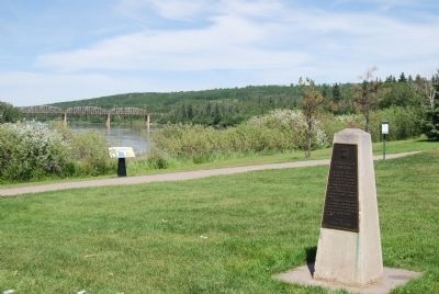
On 49 Avenue (Provincial Highway 55) at 48 Avenue on 49 Avenue.
This was once the "jumping off point" for the vast northland. Here in 1887 the first steamboat "Athabasca" was built to ply the river between Mirror Landing and Grand Rapids.
Steamboats superceded the canoe, York boat, and scow, and were . . . — — Map (db m8837) HM
A Zoo in Banff?
Between 1904 and 1937, Banff Central Park was home to a world-renowned zoo.
Visitors could see locally captured wildlife, such as bears and cougars, as well as birds and animals foreign to the Park, like 'Buddy' . . . — — Map (db m294229) HM
On Railway Avenue at Lynx Street on Railway Avenue.
Banff's first train station was actually located 1.5km east along the line from here. By 1888 it was deemed to be too far from the hot springs and a new log station was built at the site of today's station.
This new location for the train . . . — — Map (db m197062) HM
On Banff Avenue, on the right when traveling south.
Opened in 1895, the Banff Park Museum was moved into this building in 1903. Its cross-log motif exemplifies an architectural style common in the town at the time. Norman Bethune Sanson, the museum’s curator from 1896 to 1932, . . . — — Map (db m8836) HM
On Spray Avenue 0.5 kilometers south of Rundle Avenue, on the right when traveling north.
Banff Springs Hotel
This hotel is among the largest and most renowned of the fashionable resort hotels established along railway and steamship routes in Canada during the late 19th and early 20th centuries. Constructed by the . . . — — Map (db m100084) HM
Born in Ceylon and educated in Scotland and Germany, Gibbon studied painting before turning to journalism. As publicity agent for the Canadian Pacific Railway from 1913 to 1945 he combined advertising with the promotion of a Canadian identity, . . . — — Map (db m108632) HM
The Man Behind the Collection
Norman Bethune Sanson was the museum's curator as well as Banff's meteorologist for more than 30 years. He energetically expanded the museum's original collection, gathering unique flora and fauna . . . — — Map (db m294230) HM
Located at the top of Sulfur Mountain, the cosmic ray station was completed by the National Research Council in 1956, in preparation for International Geophysical Year (1957–1958) an undertaking involving 66 countries and a dozen scientific . . . — — Map (db m109422) HM
Near Cave Avenue 1.4 kilometers west of Banff Avenue.
The Cave and Basin Springs were brought to public attention after being located by CPR construction workers in 1883. These and the Upper Hot Springs soon drew private entrepreneurs and tourists. Growing support for public ownership prompted the . . . — — Map (db m108877) HM
On Tunnel Mountain Road, on the right when traveling east.
Tunnel Mountain - What’s in a name?
The original survey for the railroad provided for a tunnel through this small mountain which appeared to obstruct the Bow Valley. A subsequent survey rerouted the railroad to the north, thus the . . . — — Map (db m293643) HM
On Bow Valley Parkway (Provincial Highway 1A) 4.3 kilometers west of Banff-Windermere Highway (Provincial Highway 93), on the right when traveling west.
End of the Road On the night of July 14, 1915 sixty prisoners were marshalled off a Canadian Pacific train just west of here and escorted to a barbed wire compound at the end of the unfinished Banff–Laggan (now Lake Louise) road. So . . . — — Map (db m109003) HM
On Bow Valley Parkway (Alberta Route 1A) 4.3 kilometers west of Banff-Windermere Highway ( Route 93), on the right when traveling west.
During Canada’s first national internment operations in World War One, thousands of immigrants from the Austro-Hungarian Empire, the majority of Ukrainian origin, some citizens of Canada, were imprisoned as “enemy aliens”. Internment operations . . . — — Map (db m8827) HM
On Bow Valley Parkway (Provincial Highway 1A) 2.4 kilometers west of Banff Windermere Parkway, on the right when traveling east.
ENGLISH INSCRIPTION
Mountains create their own weather
As winds swirl around and rise above these massive barriers, clouds build up and bring the rain and snowstorms for which Storm Mountain was named.
Travellers . . . — — Map (db m82917)
On Lake Louise Drive just north of Sentinel Road. Reported missing.
Erected in honor of Sir James Hector K. C. M. C. Geologist and explorer to the Palliser Expedition of 1857 - 1860 by his friends in Canada, the United States & England. One of the earliest scientists to explore the Canadian Rocky Mountains. He . . . — — Map (db m70443) HM
Canadian Rocky Mountain Parks
World Heritage Site
The Canadian Rocky Mountain Parks were designated a site of outstanding universal value and placed on the World Heritage List on October 30, 1984.
Among the attributes that . . . — — Map (db m285692) HM
This renowned hotel had its origins in a simple log chalet built by the Canadian Pacific Railway in 1890. Early guests, including some pioneers of mountaineering in the northern Rockies, followed a packhorse trail from the station below. The advent . . . — — Map (db m109415) HM
Near Lake Louise Drive just north of Sentinel Road. Reported missing.
Prior to 1913 the Alberta-British Columbia boundary was defined by the divide or watershed of the Rocky Mountains. The discovery of valuable coal deposits and the availability of marketable timber and the incursion of railroads and roads required a . . . — — Map (db m70445) HM
Imagine arriving here in the 1880s…the smell of pine forest, the sound of avalanches from the mountains above, and the wonder of vast unexplored country ahead. Today, the ice-capped peaks, hidden valleys and turquoise lakes are as spectacular as . . . — — Map (db m100116) HM
Near Old National Highway 1A 3.2 kilometers east of Lake O'Hara parking lot, on the left when traveling east.
How many creeks do you know of that split, with each fork reaching a separate ocean, 4500 km apart. Here, Divide Creek forks on the boundary between Pacific and Atlantic watersheds, commonly called the Great Divide. Water in the left . . . — — Map (db m177899) HM
Rumbles of Excitement
Joyful arrivals, tearful departures, trains and telegrams coming and going. This Heritage Railway station was once a hub for locals and visitors alike.
The Station was built in 1910 by Canadian Pacific Railway to . . . — — Map (db m252885) HM
On Bow Valley Parkway (Provincial Highway 1A) 11 kilometers east of Banff-Windermere Highway (Provincial Highway 93), on the left when traveling east.
[English] The Bow Valley — Life flows through it The first car arrived in Banff in 1904 - on the railway tracks. The only other roads at the time were for horse-drawn carriages. But soon . . . — — Map (db m212533) HM
Coal mining in Canmore offered rare high quality coal and extremely dangerous mining conditions.
Anthracite coal, as found in Canmore, accounts for only one percent of the coal in the world. It is renowned for its purity and the heat it . . . — — Map (db m250743) HM
On Spur Line Trail at Higashikawa Friendship Trail, on the right when traveling west on Spur Line Trail.
In 1884 Canmore was just a whistle-stop on the newly built Canadian Pacific Railway when two prospectors unearthed black coal on the west side of the Bow River. Two years later, Queen Victoria granted a Charter to mine coal in the Canmore area . . . — — Map (db m197082) HM
On 1 Avenue at 1st Street, on the right when traveling west on 1 Avenue.
As a gateway to a major pass through the Rocky Mountains, the Bow Valley has been a transportation corridor since the time of the early Aboriginal groups, explorers, and fur traders. The arrival of the Canadian Pacific Railway in 1883 and the . . . — — Map (db m203491) HM
On Pyrogy Drive (Provincial Highway 882) at First Avenue North, on the right when traveling north on Pyrogy Drive.
A European food that was brought to Western Canada in the early 19th century by the working and poor people. It originated as a boiled dumpling, and later people added whatever they desired inside, and it became a pyrogy – pyrohy, sometimes called . . . — — Map (db m8813) HM
On 2 Street Southwest just south of 12 Avenue Southwest, on the right when traveling south.
To the imperishable glory
of
the men of this province
who fought and died
for
their king and country
in the Great War
1914 — 1918
Erected by Col. Macleod Chapter
I. O. D. E. — — Map (db m196990) WM
On 11 Street Southwest at 8 Avenue Southwest, on the right when traveling south on 11 Street Southwest.
[English] The scale and bold design of the Mewata Armoury exemplify the wave of national pride that greeted Canada's strong performance in the South African War. In western Canada this military enthusiasm led to a dramatic . . . — — Map (db m196993) HM
On 13 Avenue Southwest just west of 9 Street Southwest, on the left when traveling west.
This school was constructed in 1907-08 of locally quarried sandstone. It was the first purpose-built high school in Calgary. Originally called the Calgary Collegiate Institute it was later known as Central High School. Increasing student enrolment . . . — — Map (db m220897) HM
On 13 Avenue Southwest just west of 2 Street Southwest, on the right when traveling west.
[English] Born at Hopewell Hill, New Brunswick, Bennett moved to Calgary in 1897. A member of the legislature of the North West Territories (1898-1905) and of the Alberta Legislative Assembly (1909-11), he was elected to the Commons . . . — — Map (db m202450) HM
Near 17 Avenue Southwest at 6 Street Southwest, on the right when traveling east.
Western Canada College, a private boy's college, was founded on this site in 1903 on land donated by the Canadian Pacific Railway. The college closed in 1926 and the property was sold to the Calgary Public School system which constructed east and . . . — — Map (db m220896) HM
Near 7 Avenue Southwest just west of 4 Street Southwest, on the right when traveling west.
Annie Gale was a British immigrant to Canada who dove straight into community politics to improve the standard of living in her new home. In a matter of only ten years in Calgary, she accomplished many important social and political changes. . . . — — Map (db m221494) HM
Near 7 Avenue Southwest just west of 4 Street Southwest, on the right when traveling west.
Arthur Smith, OC, AOE, D.F.C, Order of Merit (Hungary), LLD (Hon.) was born in Calgary. In 1940, he enlisted in the military, serving as an RAF Bomber Command Pilot and receiving the Distinguished Flying Cross. Mr. Smith later held the offices of . . . — — Map (db m221499) HM
Near Macleod Trail Southeast just south of 7 Avenue Southeast, on the right when traveling north.
This has been the site of municipal administration since 1885. Construction of City Hall began in 1907, and after four years of controversy and escalating costs it finally reached completion in 1911. It was officially opened by Robert L. Borden, a . . . — — Map (db m221429) HM
On Macleod Trail Southeast just south of 7 Avenue Southeast, on the right when traveling north.
[English] Completed in 1911, this building reflected the city's urban aspirations during its pre-1914 development boom. Designed by Regina architect William M. Dodd in the Romanesque Revival style often favoured for large municipal . . . — — Map (db m202627) HM
On Macleod Trail Southeast just south of 7 Avenue Southeast, on the right when traveling north.
In memory of Lt. Col. R.L. Boyle officers N.C.O.s & men of the Tenth Battn. who fell at the Second Battle of Ypres April 22nd 1915 Erected by surviving members of the Battalion ————— To the honour and glory of God in memory of the . . . — — Map (db m221483) WM
On 7 Avenue Southeast at 1 Street Southeast (Macleod Trail), on the right when traveling west on 7 Avenue Southeast.
The first Anglican church in Calgary, the Church of the Redeemer opened just to the east of the present site in 1884. The much larger Cathedral Church of the Redeemer opened on July 30, 1905. This Gothic Revival style church is built of local . . . — — Map (db m220900) HM
On 7 Avenue Southeast at 1 Street Southeast (Macleod Trail), on the right when traveling west on 7 Avenue Southeast.
The Cathedral Church of the Redeemer was designated a Registered Heritage Site on September 16, 1974, under provisions of the Alberta Heritage Act, 1973. The first Anglican Church in Calgary was a frame building erected just east of this site in . . . — — Map (db m221143) HM
On 8 Avenue Southeast (Stephen Avenue) east of Centre Street South, on the left when traveling east.
Louis Henry Doll, a successful jeweller, completed what he called "Doll's Diamond Palace" in 1907. Deeply affected by the untimely death of his daughter in that same year, Doll lost interest in his business. In 1910, D.E. Black, a former apprentice . . . — — Map (db m220996) HM
Near 7 Avenue Southwest just west of 4 Street Southwest, on the right when traveling west.
Grant MacEwan, OC, AOE, was born in Manitoba but spent his formative years on his family’s farm near Melfort, Saskatchewan. Following undergraduate and graduate studies in Canada and the United States, he entered university life in 1928 serving as . . . — — Map (db m221496) HM
On 8 Avenue Southwest (Stephen Avenue) just west of Centre Street South, on the right when traveling west.
On this site a sandstone building was constructed by the Hudson's Bay Company in 1891. It was one of the earliest sandstone buildings to be erected in Alberta. The Royal Bank of Canada purchased the property in 1912 and established a branch in . . . — — Map (db m220999) HM
On 8 Avenue Southeast (Stephen Avenue) at Centre Street South, on the right when traveling west on 8 Avenue Southeast (Stephen Avenue).
First occupied by the Imperial Bank of Canada around 1910, this structure is one of the few remaining buildings associated with early Calgary commerce. In 1975, in keeping with its historic character, it became the headquarters of the Alberta . . . — — Map (db m221349) HM
On 8 Avenue Southwest (Stephen Avenue) east of 1 Street Southwest, on the left when traveling east.
James Lougheed (later Sir James) came to Calgary as a young lawyer in 1885 and later became leader of the Opposition in the Canadian Senate. He built a frame home for his family on this site. In the 1890's, after moving his family to a larger . . . — — Map (db m220862) HM
Near 7 Avenue Southwest just west of 4 Street Southwest, on the right when traveling west.
Maude Keen was born in Ontario, moving to Calgary to teach school in 1903. She married Harold Riley and they had three children. Soon after she joined the Local Council of Women, becoming an activist for dower rights and the right to vote for women . . . — — Map (db m221498) HM
On 8 Avenue Southwest (Stephen Avenue) west of Centre Street South, on the right when traveling west.
Built to convey an image of stability and permanence and designed in the Beaus-arts architectural style, this Molson Bank was one of four such institutions constructed in Alberta. In recognition of its historical and architectural significance, it . . . — — Map (db m220995) HM
On 1 Street Southeast (Macleod Trail) just south of 5 Avenue Southeast, on the right when traveling south.
In the boom years before World War I, many eastern companies established manufacturers' agents in the major western cities and employed salesmen to travel the region. The North-West Travellers Building, built in 1913, served as a centre for them. . . . — — Map (db m220992) HM
On Macleod Trail Southeast just south of 7 Avenue Southeast, on the right when traveling north.
The City of Calgary has named this place ‘Raoul Wallenberg Corner’. As a Swedish diplomat stationed in Hungary towards the end of World War II, Raoul Wallenberg saved some 100,000 lives. In so doing, he forfeited his freedom forty years ago today. . . . — — Map (db m221447) HM
Near 7 Avenue Southwest just west of 4 Street Southwest, on the right when traveling west.
James Lougheed was born in Ontario in 1854. After achieving a law degree from the University of Toronto, he moved west, settling in Calgary in 1885. There Lougheed started a legal practice in partnership with future Prime Minister R.B. Bennett and . . . — — Map (db m221495) HM
Near 4 Street Southwest just north of 7 Avenue Southwest, on the left when traveling north.
The first building on this site was Calgary's original court house erected in 1888 on 4th Street between 6th and 7th Avenues. The sandstone building served as a court house until 1915 when a new building in the southwest area of the block was . . . — — Map (db m221000) HM
On 6 Street Southwest at 7 Avenue Southwest, on the right when traveling north on 6 Street Southwest.
John Hunter was a noted patriarch of the Chiniki band of the Stoney Tribe in Morley, Alberta. He was recognized for his business and ranching acumen and among other tributes, was commemorated by the Calgary Stampede Board in 1951. Sculptor, . . . — — Map (db m220895) HM
On 8 Avenue Southwest (Stephen Avenue) west of Centre Street South, on the right when traveling west.
[English] Stephen Avenue is a superb illustration of the central role that retail streets have played and continue to play in the Canadian urban experience. As a well-preserved commercial street the avenue bears eloquent witness to . . . — — Map (db m220699) HM
On 8 Avenue Southwest (Stephen Avenue) east of 1 Street Southwest, on the right when traveling east.
This building, a typical structure in frontier Calgary, is the only wooden building remaining downtown that predates the great fire of 1886. It was built in 1885 as a general store for the American firm T.C. Power & Bro. and may have been utilized . . . — — Map (db m221264) HM
On 8 Avenue Southwest (Stephen Avenue) at 2 Street Southwest, on the right when traveling west on 8 Avenue Southwest (Stephen Avenue).
"16 log shacks, nine Indian tipis, and a Mounted Police fort." That was Calgary before the railway arrived in 1883. Thirty years later, enterprising Calgarians had created a city. English born William Roper Hull was a bold businessman well suited . . . — — Map (db m220858) HM
On 8 Avenue Southwest (Stephen Avenue) at 1 Street Southwest, on the right when traveling east on 8 Avenue Southwest (Stephen Avenue).
Office and retail space on Stephen Avenue was in high demand between 1909 and 1912. Calgary was the business centre of an expanding, prosperous region and business was booming. This was reflected in the impressive, modern buildings that appeared . . . — — Map (db m220868) HM
On 8 Avenue Southwest west of Centre Street South, on the right when traveling west.
This neo-classical structure was designed by William Dodd, architect of Calgary’s City Hall, and erected in 1900 of machine cut sandstone. Owned by Senator James Lougheed and named after one of his sons, the building once housed the offices of . . . — — Map (db m220809) HM
On 8 Avenue Southwest (Stephen Avenue) at 3 Street Southwest, on the left when traveling east on 8 Avenue Southwest (Stephen Avenue).
Calgarians first enjoyed electric street lighting in 1887. The 32 candlepower incandescent lights were a distant improvement over the candles, oil lamps or gas mantles used previously. In 1889 Pete Prince, manager of the Eau Claire and Bow River . . . — — Map (db m221492) HM
On 8 Avenue Southwest just west of 2 Street Southwest, on the right when traveling west.
Built by James Stuart Mackie a pioneer businessman, who came from England in 1882 and was Calgary’s Mayor in 1901. Designed by James Teaque the Edwardian skyscraper was one of Calgary’s first major office buildings. Completion however was delayed . . . — — Map (db m222195) HM
On 8 Avenue Southwest (Stephen Avenue) at 1 Street Southwest, on the right when traveling west on 8 Avenue Southwest (Stephen Avenue).
The clanging bell and rumbling wheels of the orange streetcar were welcome sounds to people headed for Stephen Avenue. This was Calgary's thriving commercial centre and a natural "meeting place." The trip to "town" became easier and the street even . . . — — Map (db m220894) HM
On 8 Avenue Southwest west of 1st Street Southwest, on the left when traveling west.
[English] Boasting an elegant facade and luxurious interior, this Neoclassical building is one of the last surviving examples of the “palace” style of cinema in western Canada. Owned by the Allen chain, a pioneer of film . . . — — Map (db m220807) HM
On 8 Avenue Southwest west of 3 Street Southwest, on the right when traveling west.
On this site The T. Eaton Co. Limited opened its first Calgary department store on February 28, 1929 ————— Demolished in 1988 portions of the building’s facade have been incorporated into the Calgary Eaton Centre which opened on August 8, . . . — — Map (db m221493) HM
On 8 Avenue Southwest (Stephen Avenue) at 2 Street Southwest, on the right when traveling east on 8 Avenue Southwest (Stephen Avenue).
Early Calgary developed in the flat, triangular shaped area bounded by the railway tracks and the two rivers. It was a compact community where homes and commercial enterprises were close together, as can be seen in this 1906 picture. On the . . . — — Map (db m221490) HM
On 7 Avenue Southeast just east of 1 Street Southeast (Macleod Trail), on the right when traveling west.
1578 The first Anglican Communion service held near Frobisher Bay by the Reverend Robert Woolfal 1878 The arrival of the Reverend George McKay at Fort Macleod as the first Anglican missionary in southern Alberta . . . — — Map (db m220997) HM
On 8 Avenue Southeast (Stephen Avenue) east of Centre Street South, on the left when traveling east.
This imposing structure reflects the commercial success of two of Calgary’s pioneer merchants, James Arthur Thomson and Melville Patrick Thomson. In recognition of its historical and architectural significance and the important role it has played . . . — — Map (db m220998) HM
Near 7 Avenue Southwest just west of 4 Street Southwest, on the right when traveling west.
William Ormond Mitchell was one of Canada's best loved storytellers. Who Has Seen the Wind (1947) has become the classic Canadian prairie novel selling almost a million copies since its publication, and Jake and the Kid became one of . . . — — Map (db m221497) HM
On 8 Avenue Southwest at 11 Street Southwest, on the left when traveling west on 8 Avenue Southwest.
Mewata Armouries were built in 1916-1918 as a training and recruitment centre for the volunteer militia. Frederick Dewis (right) joined the R.C.A.F. as a navigator in 1942. He went missing in action over Germany in 1944. Photo Credit: . . . — — Map (db m222472) HM
On 11 Street Southwest at 8 Avenue Southwest, on the left when traveling north on 11 Street Southwest.
First proposed before 1911, the Calgary Armoury was promoted by R.B. Bennett and Colonel Sam Hughes, Minister of Militia. In 1916 the city donated Mewata Park as a site for the armoury and construction began the same year. Completed in 1917, Mewata . . . — — Map (db m222137) HM
On 8 Avenue Southwest at 11 Street Southwest, on the left when traveling west on 8 Avenue Southwest.
Families and friends gather to remember their loved ones killed in military service. As of 2016, annual services are held at the Jubilee Auditorium, the Cenotaph in Memorial Park, and other locations around Calgary. Photo Credit: Glenbow . . . — — Map (db m222468) HM
On 11 Street Southwest just north of 8 Avenue Southwest, on the left when traveling north.
Dedicated to the Soldiers of the 103rd Regiment (Calgary Rifles), 10th Canadian Infantry Battalion (C.E.F.) and The Calgary Highlanders Who Have Served Canada in War and Peace — — Map (db m222177) WM
Near 9 Avenue Southeast 0.3 kilometers east of 6 Street Southeast, on the left when traveling east.
F Troop, under the leadership of Inspector Ephrem Brisebois, travelled to the confluence of the Bow and Elbow Rivers to establish an outpost part way between Fort Macleod and Fort Edmonton. The I. G. Baker and Company was hired to supply materials . . . — — Map (db m221791) HM
Near 9 Avenue Southeast 0.3 kilometers east of 6 Street Southeast, on the left when traveling east.
Calgary’s progress from police outpost to modern city has required difficult choices about our vision of success as a community. The development of our city can be traced through what we did with Fort Calgary and our river valleys. The railway . . . — — Map (db m222037) HM
Near 9 Avenue Southeast 0.3 kilometers east of 6 Street Southeast, on the left when traveling east.
While planning Calgary's 1975 Centennial Celebrations, Alderman John Ayer led a committee of citizens in a successful attempt to recover the City's birthplace — Fort Calgary. The City acquired the land, excavated the archaeological remains of Fort . . . — — Map (db m222014) HM
Near 9 Avenue Southeast 0.3 kilometers east of 6 Street Southeast, on the left when traveling east.
Names of Calgary streets, parks, buildings and landmarks honour and recall people and places from our fascinating history. George C. King Apartments and Footbridge George C. King was the first NWMP to set foot on the site where Fort Calgary . . . — — Map (db m221648) HM
Near 9 Avenue Southeast 0.3 kilometers east of 6 Street Southeast, on the right when traveling east.
The North West and Hudson's Bay fur trading companies sent traders and explorers into unknown territories to find new Aboriginal trading partners. David Thompson, often accompanied by his Métis wife Charlotte Small and their children, travelled . . . — — Map (db m221687) HM
Near 9 Avenue Southeast 0.3 kilometers east of Street Southeast, on the left when traveling east.
A real estate boom from 1907-1913 brought big opportunities for business and transportation. The NWMP Barracks were in a prime location and the Federal Government sold Fort Calgary to the Grand Trunk Pacific Railway. The first tracks were built in . . . — — Map (db m222036) HM
Near 9 Avenue Southeast 0.3 kilometers east of 6 Street Southeast, on the left when traveling east.
The Fort that would have been a freeway In the late 1960s Fort Calgary was occupied by the Canadian National Railway and a number of businesses, including MacCosham's Van Lines. A 1966 redevelopment plan for downtown called for . . . — — Map (db m222035) HM
On 9 Avenue Southeast at 6 Street Southeast, on the right when traveling west on 9 Avenue Southeast.
What would you do if you founded a city, and no one remembered where it began? In 1875, the North West Mounted Police (NWMP) established Fort Calgary at the confluence of the Bow and Elbow Rivers, laying the foundation for the city of . . . — — Map (db m221500) HM
Near 9 Avenue Southeast 0.3 kilometers east of 6 Street Southeast, on the left when traveling east.
The Métis, descendants of European fur traders and Aboriginal women, moved into this area in the late 1800s. They held large organized buffalo hunts to obtain hides and meat that they sold to the Hudson's Bay Company, settlers and Mounted Police. . . . — — Map (db m221699) HM
Near 9 Avenue Southeast 0.3 kilometers east of 6 Street Southeast, on the left when traveling east.
The Real People include the Siksika, Kainai and Piikani tribes of the Blackfoot Nation. The nomadic Nitsitapi who lived in this area hunted the buffalo and gathered the prairie vegetation for food, clothing, shelter, tools, medicines and . . . — — Map (db m221698) HM
Near 9 Avenue Southeast 0.3 kilometers east of 6 Street Southeast, on the left when traveling east.
One year after the train arrived, Calgary was incorporated as a town and in 1894 it became the first city of the North West Territories. Sandstone buildings replaced wooden stores and homes and Calgary became known as the Sandstone City. — — Map (db m221700) HM
Near 9 Avenue Southeast 0.3 kilometers east of 6 Street Southeast, on the left when traveling east.
Calgary began to change from a small community whose economy was based in ranching and agriculture. Entrepreneurs opened businesses like a brewery, sandstone quarries, and a steam tractor dealership. Calgarians enjoyed a zoo, city parks, schools, . . . — — Map (db m221802) HM
Near 9 Avenue Southeast 0.3 kilometers east of 6 Street Southeast, on the left when traveling east.
When he arrived in Calgary to take over as Commanding Officer, Captain Richard Burton Deane refused to live in the dilapidated Officers Quarters that he found at Calgary Barracks. He received permission from Ottawa to construct a new home that was . . . — — Map (db m221801) HM
Near 9 Avenue Southeast 0.3 kilometers east of 6 Street Southeast, on the left when traveling east.
In 1873, Prime Minister John A. Macdonald passed legislation that created the North West Mounted Police. This Police Force guaranteed Canadian sovereignty and prepared for the settlement of the land. — — Map (db m221750) HM
Near 9 Avenue Southeast 0.3 kilometers east of 6 Street Southeast, on the left when traveling east.
Officers led 300 enlisted men, Métis Guides, wagons and carts loaded with supplies, two nine pound field guns, beef cattle and haying equipment out of Dufferin, Manitoba in early July 1874 on their historic trek to the western prairies. By late . . . — — Map (db m221784) HM
Near 9 Avenue Southeast 0.3 kilometers east of 6 Street Southeast, on the left when traveling east.
In 1869, Canada bought Rupert's Land but failed to provide the area with any government presence. The illegal whiskey trade, the need to build a national railway, fear of American settlers laying claim to the land and the massacre of several . . . — — Map (db m221775) HM
Near 9 Avenue Southeast 0.3 kilometers east of 6 Street Southeast, on the left when traveling east.
The old fort was demolished and new log buildings with shingled roofs were constructed. Without the fort the name changed to Calgary Barracks. As headquarters for 'E' Division, Calgary was responsible for all the land north to Red Deer, south to . . . — — Map (db m221800) HM
Near 9 Avenue Southeast 0.3 kilometers east of 6 Street Southeast, on the left when traveling east.
A promise to connect British Columbia with the eastern provinces forced the government to build a national railroad. The Canadian Pacific Railway located its station west of the Fort in 1883 and sold the surrounding lots to eager Calgarians. The . . . — — Map (db m221799) HM
Near 9 Avenue Southeast 0.3 kilometers east of 6 Street Southeast, on the left when traveling east.
In the first half of the twentieth century, Calgarians struggled through two World Wars and the Great Depression. The construction of the CPR railcar repair shops and creation of the Glenmore Dam on the Elbow River employed many people when jobs . . . — — Map (db m221970) HM
On Bow River Pathway Bridge at Bowness 0.2 kilometers north of 52 Street Northwest, in the median.
Briefly called the Bowness Bridge during its construction in 1910-11, this structure has been known for many years as the Shouldice Bridge. Since its construction, the bridge has provided an invaluable transportation link between Bowness and . . . — — Map (db m196995) HM
On 25 Avenue Southwest 0.2 kilometers east of 1 Street Southwest, on the right when traveling east.
Before the Mission District became part of Calgary in 1907, it was the village of Rouleauville. The streets had names instead of numbers. Twenty-fifth Avenue was called Scollen Street in honour of a man who tried to bridge the divide between Native . . . — — Map (db m220899) HM
On Macleod Trail Southeast at 12 Avenue Southeast, on the left when traveling north on Macleod Trail Southeast.
The three buildings which originally occupied this location were developed by J.H. Curtis beginning in 1909. By 1914 two additional structures had been added with the entire complex being referred to as the Curtis Block. They made a significant . . . — — Map (db m222208) HM
On 50th Avenue at 50th Street, on the left when traveling south on 50th Avenue.
The Meeting Creek depot was built by the Canadian Northern Railway in 1913 to a “Standard Third Class” plan issued by the company. It is typical of many “combination” railway depots used throughout North America – providing facilities for passenger . . . — — Map (db m197015) HM
On 50 Street (Provincial Highway 2A) just south of 49 Avenue, on the left when traveling south.
In 1879, it was assumed by many that the Canadian Pacific Railway would be built north-west across the prairies and pass Fort Edmonton on its way through the Yellowhead Pass. A small land rush took place about the fort, and the Edmonton Settlement . . . — — Map (db m214848) HM
On 50 Street at 51 Avenue, on the right when traveling north on 50 Street.
In 1891 the Calgary and Edmonton railway line was completed and Siding 16 was created. Later, because of a suggestion by Father Lacombe, it was named Wetaskiwin, which in Cree means "the place where peace was made." The trains that travelled . . . — — Map (db m206513) HM
On 50th Avenue at 47th Street, on the right when traveling east on 50th Avenue.
[English] Rapid settlement of western Canada after 1900 created an urgent need for new judicial facilities. The Wetaskiwin Court House was one of the initial group of public buildings constructed in Alberta after the shift from territorial to . . . — — Map (db m197022) HM
On 50th Avenue just west of 50th Street, on the right when traveling west.
The red brick building that most people know as the Old Post Office was built by the Federal Government in 1911, but it wasn't Wetaskiwin first Post Office. Until the completion of the Calgary & Edmonton Railway line in 1891, mail was delivered by . . . — — Map (db m197029) HM
On 56th Street (Provincial Highway 2A) at 50th Avenue, on the right when traveling north on 56th Street.
Driving towards Wetaskiwin from any direction, the 10-storey water tower is the first visible sign of the City. Like the prairie grain elevators, water towers have long been the signature landmarks of communities. Unfortunately, most of them have . . . — — Map (db m197030) HM
On 50 Avenue at 50 Street, on the right when traveling east on 50 Avenue.
The original building at this location was destroyed by the disastrous fire of 1903, and the building that replaced it was a very small wooden structure. In 1907, it was occupied by two real estate firms, Smith and Gibbs, and Bradley and Nickerson. . . . — — Map (db m280600) HM
On Trans-Canada Highway (Provincial Highway 1) 2.2 kilometers west of Range Road 105, on the right when traveling west.
In 1882, part of the North West Territories was divided into the Districts of Alberta, Assiniboia, Athabasca and Saskatchewan. The old District of Alberta lies to the west of this cairn. In 1905, the provinces of Alberta and Saskatchewan were . . . — — Map (db m303393) HM
On Trans-Canada Highway (Provincial Highway 1) 2.2 kilometers west of Range Road 105, on the right when traveling west.
To the east of this cairn lies the old District of Assiniboia of the North West Territories. When, in 1905, Alberta and Saskatchewan became provinces in the growing Dominion of Canada, the District of Assiniboia was absorbed in the main by . . . — — Map (db m303200) HM
On Trans-Canada Highway (Provincial Highway 1) 2.2 kilometers west of Range Road 105, on the right when traveling west.
You have just entered the Eastern Irrigation District (EID), located within the Palliser Triangle (the semi-arid area of the western prairies). The Triangle, named after the Palliser Expedition of 1857-60, was thought to be of insignificant . . . — — Map (db m303398) HM
On Trans-Canada Highway (Buffalo Trail) (Provincial Highway 1/41) 0.5 kilometers east of Range Road 34, on the right when traveling east.
On 17 November 1879, Constable Marmaduke Graburn of the North-West Mounted Police (NWMP) was shot and killed approximately 55 kilometres southeast of here. A member of the Kainai Nation, Star Child, was arrested and tried for the murder in 1881. . . . — — Map (db m201753) HM
256 entries matched your criteria. The first 100 are listed above. Next 100 ⊳