
102 entries match your criteria. The first 100 are listed. ⊳
Entries Containing All of the Phrases «fairfax county» AND «virginia»
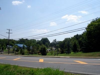
July 24, 2010
Historic Green Spring Marker
RANKED BY RELEVANCE
1 ► Virginia, Fairfax County, Alexandria, Lincolnia — B-260 — Historic Green Spring —  |
| On Braddock Road (Virginia Route 620) at Witch Hazel Road, on the right when traveling north on Braddock Road. | |||
| 2 ► Virginia, Fairfax County, Centreville — Z-169 — Fairfax County / Prince William County — |
| On U.S. 29 west of Bull Run Post Office Road (County Route 609), on the right when traveling west. | |||
| 3 ► Virginia, Fairfax County, Fairfax — Luther P. Jackson High School — |
| On Gallows Road (County Route 650) north of U.S. 50. | |||
| 4 ► Virginia, Fairfax County, Tysons — Freedom Hill Redoubt — Late-War Protection |
| On Old Courthouse Road (Virginia Route 677), on the right when traveling south. Reported missing. | |||
| 5 ► Virginia, Fairfax County, Oakton — T-46-a — Ira Noel Gabrielson — 1889–1977 — |
| On Hunter Mill Road (County Route 674) at Lynhaven Place, on the left when traveling north on Hunter Mill Road. | |||
| 6 ► Virginia, Fairfax County, Great Falls — River Crossing at Conn's Ferry — War of 1812 — |
| On Potomac Hills Street 0.6 miles east of Jeffery Road, on the left when traveling east. | |||
| 7 ► Virginia, Fairfax County, Oakton — Vale School/Vale Community House — |
| On Vale Road (County Route 672) at Fox Mill Road (County Route 665), on the right when traveling west on Vale Road. | |||
| 8 ► Virginia, Fairfax County, Fairfax — Fairfax County Courthouse — War on the Courthouse Grounds — |
| On Chain Bridge Road (Virginia Route 123) south of Main Street ( Route 236), on the right when traveling south. | |||
| 9 ► Virginia, Fairfax County, Centreville — A Place on the High Ground — Centreville Civil War Forts & Earthworks — |
| On General Johnston Place, on the right when traveling west. | |||
| 10 ► Virginia, Fairfax County, Fairfax — Fairfax County Memorial To Those Who Died In Service To Our Country — |
| On Chain Bridge Road (Virginia Route 123) south of Main Street ( Route 236), on the right when traveling south. | |||
| 11 ► Virginia, Fairfax County, North Springfield — Connecting Parks, Connecting Community — 🏞️ — |
| On Accotink Park Road 0.7 miles south of Southern Drive, on the left when traveling north. | |||
| 12 ► Virginia, Loudoun County, Leesburg — 8th Virginia Volunteer Infantry Regiment — |
| On Ball’s Bluff Road, on the left when traveling east. | |||
| 13 ► Virginia, Alexandria, Alexandria West — Protecting Threatened Species — Environmental Interpretive Series — |
| On Roanoke Avenue 0.2 miles east of Sheffield Court, on the left when traveling east. | |||
| 14 ► Virginia, Fairfax County, Burke — Copperthite Racetrack — |
| On Burke Road (County Route 652) near Burke Lake Road (County Route 645), on the right when traveling east. | |||
| 15 ► Virginia, Loudoun County, Lovettsville — Z-206 — Loudoun County / Maryland — |
| On James Monroe Highway (U.S. 15) 0.1 miles south of Lovettsville Road, on the right when traveling south. | |||
| 16 ► Virginia, Prince William County, Leesylvania — Leesylvania — |
| On Neabsco Road 0.1 miles east of Macedonia Drive, on the left when traveling east. | |||
| 17 ► Virginia, Fairfax — Northern Virginia Regional Park Authority — |
| On Pickett Road (Virginia Route 237) at Old Pickett Road, on the right when traveling south on Pickett Road. | |||
| 18 ► Virginia, Alexandria, Old Town — Alexandria, Virginia — Market Square — Alexandria Historic District — |
| On Cameron Street east of North Royal Street, on the right when traveling east. | |||
| 19 ► Virginia, Alexandria, Landmark — Bush Hill — Alexandria Heritage Trail — City of Alexandria, Virginia — |
| On Eisenhower Avenue 0.8 miles east of Metro Road, on the right when traveling east. | |||
| 20 ► West Virginia, Jefferson County, Millville — Keyes' Switch Engagement — The Last of the Loudoun Rangers — |
| On Millville Road, on the right when traveling south. | |||
| 21 ► Virginia, Manassas — Why the Forts? — May 8, 1861 — |
| Near Battery Heights Boulevard south of Quarry Road, on the right when traveling north. | |||
| 22 ► Virginia, York County, Yorktown — The Washington-Rochambeau Route to Victory — Yorktown Battlefield — Colonial National Historical Park — |
| On Fusiliers Redoubt ramp east of Colonial National Historical Pkwy, on the left when traveling east. | |||
| 23 ► Virginia, Fairfax County, Fort Belvoir — The Influence of the Fairfax Family — |
| Near Forney Loop, on the right when traveling east. | |||
| 24 ► Virginia, Alexandria, Seminary Hill — Within Its Walls — A Foundation for Education and Opportunity — |
| Near West Braddock Road 0.1 miles east of North Howard Street, on the left when traveling east. | |||
| 25 ► Virginia, Danville — Pittsylvania County — |
| On Sutherlin Avenue south of Main Street ( Route 293), on the left when traveling north. | |||
| 26 ► Virginia, Fairfax County, Fairfax — World War II and Korean Conflict Memorial — |
| On Chain Bridge Road (Virginia Route 123) south of Main Street ( Route 236), on the right when traveling south. | |||
| 27 ► Virginia, Alexandria, Oakcrest — A Crossroads Through Time — City of Alexandria Est. 1749 — Alexandria Heritage Trail — |
| On King Street (Virginia Route 7) 0.1 miles east of Marlee Way, on the right when traveling east. | |||
| 28 ► Virginia, Arlington County, Arlington, East Falls Church — Z-127 — Arlington County / Fairfax County — Area 31 Square Miles / Area 417 Square Miles |
| On Langston Boulevard (U.S. 29) near North Westmoreland Street. Reported permanently removed. | |||
| 29 ► Virginia, Fairfax County, Annandale — The Guinea Road Cemetery Reinterment — |
| Near Little River Turnpike (Virginia Route 236) east of Wakefield Chapel Road (County Route 710). | |||
| 30 ► Virginia, Fairfax County, Clifton — Enslaved Burial Ground at Bull Run Marina — |
| Near Old Yates Ford Road (Route 612) at Kincheloe Road, on the left when traveling west. | |||
| 31 ► Virginia, Fairfax County, Vienna, Hunter Mill District — A Fairfax Legacy — Ash Grove Historic Site — |
| On Ashgrove House Lane at Northern Neck Drive, on the left when traveling north on Ashgrove House Lane. | |||
| 32 ► Virginia, Prince William County, Bristow — Cemeteries — Bristoe Station — |
| Near Iron Brigade Unit Ave.. | |||
| 33 ► Pennsylvania, Chester County, Phoenixville, Schuylkill Township — Joseph H. DeCastro — United States Army, Union Army |
| Near McKinney Lane. Reported permanently removed. | |||
| 34 ► Virginia, Alexandria, Old Town — Early Alexandria and Keith's Wharf — |
| Near Fords Landing Way north of Wharf Street, on the right when traveling north. | |||
| 35 ► Virginia, Alexandria, Old Town — John Douglass Brown House — |
| On Prince Street at South Saint Asaph Street, on the right when traveling west on Prince Street. | |||
| 36 ► Virginia, Alexandria, Seminary Hill — This is Cameron Run! — |
| Near Eisenhower Avenue 0.4 miles west of Cameron Parke Court, on the right when traveling west. | |||
| 37 ► Virginia, Fairfax — Old Town Hall — Built 1900 — Old Town Fairfax — |
| On University Drive at Main Street ( Route 236), on the right when traveling north on University Drive. | |||
| 38 ► Virginia, Fairfax — Richard Ratcliffe’s Mount Vineyard Plantation |
| On Oak Street at Main Street (Route 236), on the right when traveling south on Oak Street. Reported permanently removed. | |||
| 39 ► Virginia, Fairfax — Richard Ratcliffe's Mount Vineyard Plantation — |
| On Oak Street just north of Main Street ( Route 236), on the right when traveling north. | |||
| 40 ► Virginia, Fairfax County, Annandale — T-41 — Little River Turnpike — |
| On Annandale Road at Little River Turnpike ( Route 236), on the left when traveling north on Annandale Road. | |||
| 41 ► Virginia, Fairfax County, Chantilly — Salisbury Plain — |
| On U.S. 50 at Chantilly Road, on the right when traveling west on U.S. 50. | |||
| 42 ► Virginia, Arlington County, Arlington, Boulevard Manor — Bluemont Junction, ca. 1934 — |
| On Washington and Old Dominion Trail south of 8th Road North, on the right when traveling north. | |||
| 43 ► Virginia, Fairfax County, Alexandria, Groveton — Missing Views, Lost Stories — A View for All Time — |
| Near Harrison Lane (County Route 723) at Huntley Meadows Lane, on the right when traveling south. | |||
| 44 ► Virginia, Fairfax County, Lorton — Mount Air Historic Site — Mount Air: The Story of a Home — |
| Near Fisher Woods Drive. | |||
| 45 ► Virginia, Richmond, Capitol District — Voices from the Garden — The Virginia Women's Monument — |
| On North 9th Street at Capitol Square, on the right when traveling north on North 9th Street. | |||
| 46 ► Virginia, Richmond, Capitol District — Voices from the Garden — The Virginia Women's Monument — |
| On Capitol Square east of North 9th Street, on the right when traveling east. | |||
| 47 ► Indiana, LaPorte County, La Porte — 46.2018.1 — La Porte University / Indiana Medical College — |
| On Harrison Street at Clay Street, on the right when traveling east on Harrison Street. | |||
| 48 ► Virginia, Alexandria, Seminary Hill — "The Fort" and "Seminary" Community — Civil War to Civil Rights — City of Alexandria, est. 1749 — |
| On West Braddock Road 0.2 miles west of Marlboro Drive, on the right when traveling west. | |||
| 49 ► Virginia, Arlington County, Arlington, North Highland — The Dawson-Bailey House — |
| On North Taft Street, on the left when traveling east. | |||
| 50 ► Virginia, Fairfax — Ratcliffe-Allison House (Earp’s) — Built 1812 — Old Town Fairfax — |
| On Main Street (Virginia Route 236) east of University Boulevard, on the left when traveling east. | |||
| 51 ► Virginia, Fairfax County, Alexandria, Mount Vernon — Original Mount Vernon High School — |
| On Richmond Highway (U.S. 1) at Gregory Drive, on the right when traveling north on Richmond Highway. | |||
| 52 ► Virginia, Fairfax County, Chantilly — Sully Historic Site — |
| On Historic Sully Way at Air and Space Museum Parkway, on the right when traveling south on Historic Sully Way. | |||
| 53 ► Virginia, Fairfax County, Herndon — Battle of Dranesville — “First Federal Victory South of the Potomac” |
| Near Leesburg Pike (Virginia Route 7). Reported permanently removed. | |||
| 54 ► Virginia, Fairfax County, McLean — Clemyjontri — |
| Near Georgetown Pike (Route 193) east of Chain Bridge Road, on the right when traveling east. | |||
| 55 ► Virginia, Fairfax County, Springfield — BW-4 — Orange and Alexandria Railroad — |
| On Accotink Park Road at Southern Drive on Accotink Park Road. | |||
| 56 ► Virginia, Falls Church — Rebuilding 1865 - 1890 / Turn of the 20th Century 1890 - 1920 — |
| On South Washington Street (U.S. 29) at Hillwood Avenue ( Route 338), on the right when traveling north on South Washington Street. | |||
| 57 ► Virginia, Norfolk, Martin Luther King Jr Plaza — KV-35 — Evelyn Thomas Butts — (1924-1993) — |
| On East Brambleton Avenue at Church Street, on the right when traveling east on East Brambleton Avenue. | |||
| 58 ► Pennsylvania, Philadelphia County, Philadelphia, William Penn Annex West — The Bond — |
| On North Broad Street (Pennsylvania Route 611) north of John F. Kennedy Boulevard ( Route 611), on the right when traveling north. | |||
| 59 ► Virginia, Alexandria, Old Town West — The First Parker-Gray School — Alexandria Heritage Trail — City of Alexandria, est. 1749 — |
| On Wythe Street just east of North Patrick Street (U.S. 1), on the right when traveling west. | |||
| 60 ► Virginia, Fairfax County, Clifton — Enslaved Burial Ground at Ford's Mill — Bull Run Occoquan Trail — |
| Near Wolf Run Shoals 1.2 miles south of Henderson Road. | |||
| 61 ► Virginia, Fairfax County, Herndon — C-24 — Laura Ratcliffe — |
| On Elden Street / Centreville Road (Virginia Route 228) south of Worldgate Drive. | |||
| 62 ► Virginia, Fairfax County, Herndon — The Battle of Dranesville — First Federal Victory South of the Potomac — |
| Near Leesburg Pike (Virginia Route 7) 0.2 miles west of Dranesville Manor Drive, on the left when traveling west. | |||
| 63 ► Virginia, Fairfax County, McLean — Z-128 — Arlington County / Fairfax County — Area 31 Square Miles / Area 417 Square Miles |
| On Chain Bridge Road (Virginia Route 123) 0.4 miles west of North Glebe Road ( Route 120). Reported missing. | |||
| 64 ► Virginia, Fauquier County, Goldvein — Mess Hall — The Gold Mining Museum — |
| On Gold Dust Parkway at Rock Run Road (County Route 615), on the left when traveling east on Gold Dust Parkway. | |||
| 65 ► Virginia, Loudoun County, Sterling — Z-143 — Loudoun County / Fairfax County — |
| On Harry Byrd Highway [Leesburg Pike] (Virginia Route 7) west of Dranesville Road ( Route 228), in the median. | |||
| 66 ► Virginia, Westmoreland County, Kinsale — Z-4 — Northumberland County / Westmoreland County — Area 205 square miles / Area 252 square miles — |
| On Cople Highway (Virginia Route 202) just west of the Hampton Hall Bridge over Hampton Hall Branch, on the right when traveling east. | |||
| 67 ► Frequently Asked Questions — HMdb FAQ |
| 68 ► Virginia, Alexandria, Seminary Hill — African Americans and the Civil War — Fleeing, Fighting and Working for Freedom — City of Alexandria, est. 1749 — |
| On West Braddock Road 0.2 miles west of Marlboro Drive, on the right when traveling west. | |||
| 69 ► Virginia, Fairfax County, Alexandria, Groveton — New Views, New Voices — A View for All Time — |
| Near Harrison Lane (County Route 723) at Huntley Meadows Lane, on the right when traveling south. | |||
| 70 ► Virginia, Fairfax County, Herndon — Mosby’s Herndon Station Raid — “My loss watching nothing.” — Mosby's Confederacy |
| On Station Street north of Elden Street ( Route 228), on the left when traveling north. Reported permanently removed. | |||
| 71 ► Virginia, Fairfax County, Herndon, Frying Pan Baptist Church and Cemetery — Frying Pan Meeting House — |
| On Centerville Road (County Route 657) at Frying Pan Road ( Route 608), on the right when traveling north on Centerville Road. | |||
| 72 ► Virginia, Loudoun County, Leesburg — Site of The Old Stone Church / Successors to the Old Stone Church — |
| On Cornwall Street just west of Wirt Street Northwest, on the right when traveling west. | |||
| 73 ► Virginia, Alexandria, Old Town — Port City — City of Alexandria Est. 1749 — |
| On King Street (Virginia Route 7) west of South Fayette Street, on the right when traveling east. | |||
| 74 ► Virginia, Arlington County, Arlington, East Falls Church — Original Federal Boundary Stone, District of Columbia, Southwest 9 — |
| On North Van Buren Street at 18th Street North, on the left when traveling south on North Van Buren Street. | |||
| 75 ► Virginia, Arlington County, Arlington, East Falls Church — Original Federal Boundary Stone, District of Columbia, West Cornerstone — |
| On North Arizona Street when traveling north. | |||
| 76 ► Virginia, Fairfax — City of Fairfax Community Services and Recreation — |
| On Pickett Road (Virginia Route 237) at Old Pickett Road, on the right when traveling south on Pickett Road. | |||
| 77 ► Virginia, Fairfax County, Alexandria — People and the Land — George Washington Memorial Parkway — National Park Service, U.S. Department of the Interior |
| On Fort Hunt Park Loop 0.4 miles west of George Washington Memorial Parkway, on the left when traveling east. Reported damaged. | |||
| 78 ► Virginia, Fairfax County, Centreville — Mount Gilead Historic Site — Centreville, Virginia — Its History and Architecture — |
| On Mt. Gilead Road at General Johnston Place, on the left when traveling west on Mt. Gilead Road. | |||
| 79 ► Virginia, Fairfax County, Chantilly — Leeton — Historic Centreville & Chantilly — |
| On Walney Road (Virginia Route 657) 0.1 miles Lewis Leigh Court, on the right when traveling north. | |||
| 80 ► Virginia, Fairfax County, Fairfax — Reid-Ballard House — Once a Prominent Landmark — Ox Hill (Chantilly) Battlefield — |
| Near Cedar Lakes Drive. | |||
| 81 ► Virginia, Fairfax County, Lorton — Irma Clifton — |
| Near Workhouse Way 0.1 miles north of Ox Road ( Route 123), on the right when traveling north. | |||
| 82 ► Virginia, Fairfax County, Lorton — Peter Wagener, III — |
| Near Richmond Highway (U.S. 1) at Old Colchester Road ( Route 611), on the right when traveling north. | |||
| 83 ► Virginia, Fairfax County, Lorton — Welcome to Colchester on the Occoquan — The Washington-Rochambeau Revolutionary Route — |
| On Old Colchester Road (Virginia Route 611) north of Greene Drive, on the right when traveling south. | |||
| 84 ► Virginia, Fairfax County, North Springfield — Connecting Communities and Parks — Gerry Connolly Cross County Trail |
| On Lake Accotink Access Road 1.2 miles west of Highland Street, on the left when traveling north. Reported permanently removed. | |||
| 85 ► Virginia, Fairfax County, North Springfield — Orange and Alexandria Railroad — Strategic Target — |
| On Accotink Park Road 1.2 miles west of Highland Street, on the left when traveling north. | |||
| 86 ► Virginia, Fairfax County, Oakton — T-55 — Florence Jodzies — (1887 - 1969) — |
| On Fox Mill Road (Virginia Route 665) at Helmont Drive, on the left when traveling north on Fox Mill Road. | |||
| 87 ► Virginia, Fairfax County, Springfield — Orange and Alexandria RR — Strategic Target |
| On Accotink Park Road, on the left when traveling east. Reported permanently removed. | |||
| 88 ► Virginia, Fairfax County, Tysons — A Union Spy of Color? — |
| On Old Courthouse Road (Virginia Route 677) west of Battery Park Street, on the left when traveling west. | |||
| 89 ► Virginia, Falls Church — The Zig Zag Sculpture — Martha Jackson Jarvis — |
| On Tinner Hill Road just south of South Washington Street (U.S. 29), on the right when traveling south. | |||
| 90 ► Virginia, Loudoun County, Aldie — T-24 — Fair Oaks — |
| On New Mountain Road (Virginia Route 631) 0.8 miles south of Lee-Jackson Memorial Highway (U.S. 50), on the left when traveling south. | |||
| 91 ► West Virginia, Kanawha County, Charleston — George W. Summers — |
| On Kanawha Boulevard West west of Park Avenue, on the left when traveling west. | |||
| 92 ► Virginia, Alexandria, Alexandria West — Cabin in Historic Fairfax County — City of Alexandria, est. 1749 — Alexandria Heritage Trail — |
| On Mark Center Avenue at Mark Center Drive, on the left when traveling west on Mark Center Avenue. | |||
| 93 ► Virginia, Fairfax County, Centreville — Historic Centreville Park — |
| On Mount Gilead Road 0.1 miles north of Braddock Road, on the right when traveling north. | |||
| 94 ► Virginia, Fairfax County, Fairfax — Fairfax County Courthouse — War on the Courthouse Grounds |
| On Chain Bridge Road (Virginia Route 236) south of Main Street ( Route 236), on the right when traveling south. Reported permanently removed. | |||
| 95 ► Virginia, Fairfax County, Fairfax — War Dogs — Always Faithful — |
| Near Virginia 608. | |||
| 96 ► Virginia, Fairfax County, Fairfax Station — Welcome to Fairfax Station — |
| On Fairfax Station Road west of Hill Street, on the right when traveling west. | |||
| 97 ► Virginia, Fairfax County, Lorton — Development of a Progressive-Era Model Penal System — Workhouse Prison Museum at Lorton — |
| On Workhouse Way 0.2 miles north of Ox Road ( Route 123). | |||
| 98 ► Virginia, Fairfax County, Lorton — In the Footsteps of History — Special Places on the Mason Neck — |
| On Old Colchester Road (Virginia Route 611) north of Greene Drive, on the right when traveling south. | |||
| 99 ► Virginia, Fairfax County, Tysons — Family Strength — |
| On Old Courthouse Road (Virginia Route 677) west of Battery Park Street, on the left when traveling west. | |||
| 100 ► Virginia, Prince William County, Dumfries — Dumfries - Love’s Tavern — |
| On N Main Street (U.S. 1) at Colonial Street, on the right when traveling south on N Main Street. | |||
102 entries matched your criteria. The first 100 are listed above. The final 2 ⊳
Thin black lines indicate changes in relevance. Between each pair of lines entries are ordered geographically but all have the same relevance.
* Inflectional forms of words are their plurals, singulars, and possessives as well as gramatical tenses and similar variations.
Nov. 19, 2026