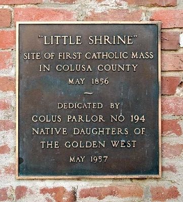
Site of the first Catholic mass to be said in Colusa County, May 1856. In 1864, a Catholic mission was conducted and a large wooden cross erected to commemorate the occasion. Masses, pilgrimages and visits were made here continuously thereafter. In . . . — — Map (db m6144) HM
This valley was settled in 1855 by Jack and David
Lett. The present lake spillway is the site of a
tunnel built by them to facilitate drainage. Both
brothers were killed in 1877, at the site of the
present camp grounds, in an attempt to . . . — — Map (db m241713) HM
President First Constitutional
Convention September 4, 1849.
A member of the Bear Flag Party
June, 1846. One of the founders
of Colusa 1850. Died Oct. 1854. — — Map (db m18130) HM
This historic Carnegie Library was built to serve the small, rural population of the surrounding area. It was dedicated on July 14, 1917, and has been in continuous use as a free public library since that date.
The Willows Chapter . . . — — Map (db m91797) HM
Early California pioneer,
member of original
Bear Flag Party
organized June 1846 in Colusi County, since changed to Colusa.
As first and only president of
"California Republic",
issued, on June 18, 1846,
historic proclamation.
Held . . . — — Map (db m172453) HM
Arrived via Panama route, San Francisco Oct. 10, 1849
Arrived Colusi County, July 6, 1850
Ferry boat captain, mail carrier, surveyor, editor, writer, legislator, Surveyor General of the United States, California State Treasurer, irrigationist, . . . — — Map (db m143420) HM
This 57 mm anti-tank gun M1 was one of 16,000 built
between 1941 and 1944 for the U.S. Army. Pulled by
an armored half-track, the M1 weapon used
armor-piercing ammunition and was widely used in
the European theater of operations. It . . . — — Map (db m173311) HM WM
{The marker consists of 3 plaques, the first reading:}
A millstone from the steam powered flour mill built in 1880 by Albert Papst. It is believed the stone came from France. Fire destroyed the four storied mill in 1881.
. . . — — Map (db m41834) HM
Location of the first frame house in Glenn County.
Erected in 1850 by Martin A. Reager and Andrew S.C. Cleek.
A stopping place for oxen teams, mule freighters and river boats.
Martin Reager farmed this land until 1864.
“Westward . . . — — Map (db m172452) HM
Dedicated to the Noah Simpson family, early
settlers of Stony Creek Valley. The steel girders that form the arch were part of
the original bridge constructed in 1885 and
used until 1961. This site overlooks the
location of the original bridge . . . — — Map (db m172451) HM
The first house in Glenn County, built about 1848 by Granville P. Swift, a member of the Bear Flag Party, who came to California from Oregon in 1844. The site is 150 yards east on the banks of Hambright Creek. The house was built of clay by . . . — — Map (db m143522) HM
The first operational air tanker was developed in Willows, by the Willows Flying Service in 1955, at the
request of the Fire Control Officer for the Mendocino National Forest. A Boeing Stearman 75 “Caydet” Agricultural
Aircraft was modified . . . — — Map (db m230783) HM
Site of American River Hospital
1962-2000
A general hospital which provided medical care for the people of Carmichael and the Sacramento area.
Dedicated by Friends of the American River Hospital
June 7, 2008 — — Map (db m294086) HM
This property was donated by Adolph and Catherine Van Maren to accommodate this one-room Sylvan School House constructed in 1862 and relocated to this site in 1927. This property was on the northeast side of the former Van Maren Ranch, which covered . . . — — Map (db m46664) HM
The San Juan High School District was formed in 1913 and named after the original San Juan Spanish Land Grant. The school served all students in the northern half of Sacramento County. Its first class was held in a temporary two-story elementary . . . — — Map (db m57263) HM
Land for the Sylvan Cemetery was donated to the community in 1862 by early settler Daniel Lewis. The first person to be buried in the cemetery was James Horton. Mr. Horton had reportedly come to the area to seek his fortune in gold but suffered an . . . — — Map (db m46465) HM
Sylvan School, built in 1862, was one of the first rural schools in Sacramento County, but was not the first school in Citrus Heights area. The first school was a private school located on the Cross Farm. At the time it was necessary for settlers . . . — — Map (db m262179) HM
The Rusch Home, built in 1916, is on the original site of the 480-acre Volle Ranch.
Fred and Julia Volle came across the plains by covered wagon in 1853. Before settling in Citrus Heights, they owned a small place on L Street in Sacramento . . . — — Map (db m46459) HM
Franklin Cemetery marks the final resting place of Alexander Hamilton Willard. He is remembered as a member of the Lewis and Clark Expedition, farmer, soldier in the Blackhawk War, and California pioneer. In 1852, 74-year-old Alexander, his wife and . . . — — Map (db m259189) HM
Franklin Cemetery marks the final resting place of Alexander Hamilton Willard. He is remembered as an explorer, farmer, soldier, California pioneer and second longest-lived member of the Lewis and Clark Expedition.
Willard was born in . . . — — Map (db m259191) HM
This survivor of the ill-fated Donner Party was the daughter of George and Mary Blue Donner. Born near Springfield, Illinois, in 1832. She arrived in California in December 1846 with her sister, Leanna Charity Donner, and was rescued by the first . . . — — Map (db m10521) HM
Gold South Of Elk Grove In 1847!
History books claim that gold was first discovered in the greater Sacramento area by James Marshall in 1848. There is another story that indicates that the first discovery of gold was a bit closer to Elk . . . — — Map (db m193829) HM
The Origins of Elk Grove's Name
There is some speculation on the origins of Elk Grove's name. Was it inspired by the elk that roamed the area or a city in Missouri?
Regardless of the source for his inspiration, James Hall settled in . . . — — Map (db m193864) HM
The first I.O.O.F. meeting was held on
May 2, 1878. The first Rebekah meeting
was held on May 2, 1888. On July 7, 1892
The original building burned and was
rebuilt with the I.O.O.F taking ownership.
A rededication of the hall was
held on March . . . — — Map (db m18031) HM
James W. Hall, his wife Sarah, sons John, Henry, Thomas, William, and daughter Anne, traveled west from McHenry County, Illinois to Hangtown (now Placerville) with the Upper Mississippi Ox Company. After traveling over 2000 miles, they arrived . . . — — Map (db m219688) HM
This is the site of the beginning of the conquest of California by the United States on June 10, 1846. American settlers led by Ezekial Merritt overpowered soldiers under Lt. Francisco Arce and took their Mexican Army horses from the corral of the . . . — — Map (db m11869) HM
Started at James Hall’s Hotel in 1850 (an outstanding brick building destroyed by the freeway) on Upper Stockton Road and moved a mile north to James Buckner’s Ranch a few years later. The town moved to its present site on the railroad in the 1870’s. — — Map (db m57984) HM
This site was a significant part of the original Elk Grove town site. The town was located at the intersection of Upper Stockton Road (present-day Highway 99) and Elk Grove-Franklin Road (present-day Elk Grove Boulevard) from 1857 to circa 1878. . . . — — Map (db m249586) HM
Rhoads School completed 1872. Located on the west side of Sheldon Road, now called Sloughhouse Road two miles south of Jackson Road. Replaced first Rhoads School located north side, near levee of Cosumnes River next to Rhoads south west property . . . — — Map (db m18018) HM
In 1908 Elk Grove acquired through the efforts of Miss Harriet G. Eddy, then principal of Elk Grove Union High School, the first county free library branch in California. Subsequently, California's county free library branch system has become one of . . . — — Map (db m11868) HM
In 1804-1806, Captains Meriwether Lewis and William Clark led the Corps of Discovery on an epic journey. Charged by President Thomas Jefferson to find a water route to the Pacific Ocean through the newly acquired Louisiana territory, they mapped the . . . — — Map (db m259206) HM
The Lincoln Highway, a coast to coast all weather road from Times Square in New York to San Francisco’s Lincoln Park, was an idea whose birthday was the 10th of September 1912. This road which freed America from the clutches of changeable weather . . . — — Map (db m18026) HM
Named in honor of Jim Jones whose love for the American River and fervor to protect its fisheries and flow levels greatly enhanced the river and parkway.
When this bridge was no longer needed for mining activities, Jim fought to save it so that . . . — — Map (db m377) HM
This memorial honors all American veterans who, although separated by generations, shared a common, undeniable goal – to valiantly protect our country’s freedom.
The memories of these American veterans will continue to live on whenever . . . — — Map (db m57280) HM
Charles A “Bud” Norris
Path of Honor
Honor * Respect * Remember
This path is dedicated to all veterans, past and present. As you walk this path, feel their presence and pay homage. Remember their sacrifice, devotion, and . . . — — Map (db m57282) HM
These boots are a lasting memorial to all of our Prisoners of War and those Missing in Action. Those that once wore them can only fill them. Let's not forget their sacrifice and devotion. They will be forever in our hearts and in our prayers. — — Map (db m52845) HM
This memorial is dedicated with appreciation to the firefighters, police officers, and emergency personnel who unselfishly gave their lives while aiding their fellow men following the unprecedented act of terrorism against this country on September . . . — — Map (db m52741) WM
On July 13, 1895, the electricity generated here and transmitted to Sacramento signaled the
start of a nationwide change in the way we would light our homes and power our civilization.
As this hydroelectric power plant was the first of its kind . . . — — Map (db m192580) HM
In 1973, the oldest depot in the West moved to a new home. Ashland Station, reportedly the oldest railroad depot west of the Mississippi, was transported across Rainbow Bridge to its present location at the Folsom Interpretive Area next to the . . . — — Map (db m11153) HM
In 1849, when Black miners discovered gold at Negro Bar, a battle raged at the California Constitutional Convention over whether California would enter the Union as a "free" or "slave" state. After much debate, California eventually entered as a . . . — — Map (db m259249) HM
Seeking a better life away from the wars and instability in their homeland, thousands of Chinese left for California when news of the gold discovery arrived in Guangzhou in 1848. By the end of 1851, as many as 25,000 Chinese people, mostly men, made . . . — — Map (db m259254) HM
By the 1920's this building housed a machine
shop, superintendent's office, and automotive
garage. The superintendent oversaw the
daily operation of the power plant complex,
directing the work of both power plant and
dam operators in . . . — — Map (db m192567) HM
In 1827 “Bible Totin” Jed Smith camped here in. In 1850 these diggings became known as Negro Bar, then named Granite City after the rocks, and in 1855 Joseph Folsom lent his name to this fair city.
Also in 1855 Folsom hired Theodore . . . — — Map (db m57985) HM
Folsom Dam and Reservoir are a component of the Central Valley Project, owned and operated by the Bureau of Reclamation, Mid-Pacific Region, Central California Area Office
Construction of Folsom Dam by the Corps began in . . . — — Map (db m17644) HM
Site of stables at Western terminus of Pony Express (1860-61), later used by blacksmith shops. Adjacent after 1892 fire, was built two - story Burke's Hall, a community center. Meeting place of Granite Parlor No.83, NSGW (1886-1958).
Dedicated . . . — — Map (db m77653) HM
“Education Doth Not A Scholar Make”
Near here was the first and only college ever in Folsom. It lasted two years (1958-60). Then is closed for a lack of students. Folks probably figured they were smart enough (?).
It was . . . — — Map (db m22984) HM
Gold Rush and Railroad town Folsom became the Western Terminus of the Central Overland Pony Express on July 1, 1860. The express mail had been run by pony to and from Sacramento. Beginning on July 1, 1860, the
Sacramento Valley Railroad carried it . . . — — Map (db m5090) HM
Completion of the Sacramento Valley Railroad from Sacramento to Folsom was completed here February 22, 1856, by enthusiastic residents of both cities. The new line, 22 miles in length was commenced February 12, 1855, and was built by Theodore . . . — — Map (db m15613) HM
The Folsom Veterans Memorial honors those brave individuals who serve our country and those who have fallen in service to our country. The memorial is composed of several distinct elements.
The Flag Court pays homage to all those who have served . . . — — Map (db m15619) HM
Two miles upriver, the Folsom Water Power Company dam diverted water from the American River into a canal for delivery to this forebay. Intentionally constructed at an angle to the canal, the forebay serves a number of different functions. Wood . . . — — Map (db m192550) HM
In Memory of J. Clifton Toney
Publisher of the Folsom Telegraph
1962 – 1976
His vision resulted in the
Development of the Sutter Street Mall — — Map (db m14378) HM
Dr. Jim And Bea Kuntz came to Folsom in 1963 with their three boys Jim,
Charles, and Jeffrey. Tim, their fourth son was born in Folsom at Twin Lakes
hospital. Dr. Kuntz had just finished his residency in family practice at
Indiana University when . . . — — Map (db m192734) HM
Dedicated to the memory of
WILLIAM ALEXANDER LEIDESDORFF
Early California pioneer, civic
leader, merchant, trader, and
owner of 35,000 acre rancho
“Rio de los Americanos” in the
Folsom area.
Born 1810 in Danish West . . . — — Map (db m15617) HM
Constructed in 1897, the lower powerhouse
is designed to produce additional electricity
during periods of drought. Due to the
25-foot drop from the main powerhouse to
the lower powerhouse, the same water could
be reutilized to generate an . . . — — Map (db m192735) HM
In July 1895, this was one of the few places
in California or the United States where you
could hear the hum and buzz of industrial
scale electricity being generated. Where
only a short time ago gold miners washed
pans of gravel in search of . . . — — Map (db m194136) HM
Early in 1848 W. Sidney S. Willis (ES) and Wilford Hudson, members of the Mormon Battalion, set out from Sutter’s Fort to hunt deer. Stopping on the South Fork of the American River, they found gold. They told their story on returning to the Fort . . . — — Map (db m261795) HM
Natomas Company activities started in this area in 1857 with the acquisition of 9,000 acres from the Joseph L. Folsom estate.
Early partners engaged in water, granite quarrying, agriculture, vineyards, gold mining, hydro-electric power and . . . — — Map (db m705) HM
On April 19, 1877, the Sacramento Valley Railroad consolidated with the Folsom and Placerville
Railroad to form the Sacramento and Placerville Pailroad. All machine work was transferred
to Sacramento and the Folsom machine shop closed in 1878. In . . . — — Map (db m143782) HM
In the 1850's, Horatio Gates Livermore and later his sons, Horatio P. and Charles E. pioneered the development of ditches and dams on the American River for industry and agriculture. One historic result was Folsom Power House, which began . . . — — Map (db m706) HM
Near this spot on Alder Creek stood Prairie City, a gold rush mining town and trade center for nearby Rhoad’s Diggings, Alder Creek, and Willow Springs Hill. Mining began in 1853 after water arrived via The Natoma Water & Mining Company ditch, . . . — — Map (db m254515) HM
The site of the Prairie City Cemetery that once served the bustling gold rush town of Prairie City was located during construction of the Prairie City Road and Highway 50 Interchange in May 1997. It was used between 1853 and at least 1872 and may . . . — — Map (db m254514) HM
Successfully transmitting electricity long
distance to Sacramento required the use of
voltage step up transformers. High voltage
Alternating Current travels farther with less
loss of power. The first transformers raised the
800 volt output . . . — — Map (db m192553) HM
Directly across the river from where you are standing was once part of William Alexander Leidedorff's Rio de los Americanos land grant. Born in 181 0on the island of Saint Croix to a mother of African descent and a Danish father, Leidensdorff . . . — — Map (db m259483) HM
Rhoads Diggings, approximately 1/2-mile northwest from this site, was the location of a rich, alluvial deposit of placer gold that Thomas Rhoads kept secret, but mined with success and great historical significance. In the spring of 1846, Thomas . . . — — Map (db m261810) HM
Completed in 1856, the Sacramento Valley Railroad from Sacramento to Folsom was one of the
first railroads constructed west of the Mississippi. The route was surveyed by Theodore Judah, a civil engineer from New York who envisioned a . . . — — Map (db m143784) HM
Site of the car/carpenter shop, constructed in 1863
as a workshop where railroad cars and other
rolling stock were built. The building was demolished in 1895
and the bricks were reused at the Folsom powerhouse. — — Map (db m143683) HM
This house was built around 1915 for the railroad section superintendent and his family. From here the superintendent oversaw Folsom Junction railroad operations until the late 1950's. The superintendent's house is listed on the National Register of . . . — — Map (db m209954) HM
Here you can see the right of way of the Sacramento, Placer and Nevada Railroad. It was designed by Theodore Dehone Judah (March 4, 1826 – November 2, 1863) as Chief Engineer. Conceived in 1854 and constructed in 1861, it ran about thirteen . . . — — Map (db m37132) HM
Over time there have been five turntables used to turn locomotives, (like the one pictured above),
around at the Folsom Rail Yard. The first turntable was put in place in 1856, with replacement
turntables constructed in 1867, 1882, 1891, and 1910. . . . — — Map (db m143675) HM
From 1856 to 1971, Folsom was a railroad town. For most of those years, the Folsom depot was the last stop from Sacramento.
Before the trains could return to Sacramento, the locomotives had to be turned around. Until 1913, they rotated . . . — — Map (db m37108) HM
On approximately this site, a freight warehouse and depot was constructed in April 1860.
The brick freight depot measured 30 feet by 100 feet and was leased by W. L. Perkins, a merchant specializing in freight. The building was used for the storage . . . — — Map (db m143681) HM
FISHER is a very popular American Black Bear
who resides at the Folsom City Zoo Sanctuary.
He's been a resident since 1995 and during his
years at the z0o sanctuary, he's contributed his
awesome bear skills!
Fisher was born in December, . . . — — Map (db m192705) HM
Rhoads Diggings, approximately 1/4-mile south from this site, was the location of a rich, alluvial deposit of placer gold that Thomas Rhoads kept secret, but mined with success and great historical significance. In the spring of 1846, Thomas and . . . — — Map (db m261811) HM
250 feet due west
from this point is an original corner
of the
Rancho Rio Delos
Americanos Land Grant
of 1844 and the most
Northwesterly corner
of the town site of Folsom
of 1855. On the right was the
mining camp of Negro Bar. On . . . — — Map (db m22981) HM
This sacred ground is one of three revered cemeteries * Young Wo, Sam Yup-Sze Yup, and Hakka * that served the Chinese community once located just north of here. One cemetery vanished during gold dredging activites; Only the Young Wo and Sam Yup-Sze . . . — — Map (db m16243) HM
For thousands of years, the American River has been an important place of habitation, resource gathering, and processing for the native Nisenan Maidu and Plains Miwok people. The daily lives of the Nisenan Maidu and Plains Miwok people were . . . — — Map (db m259479) HM
The City of Folsom has a rich history beginning with the 49ers during California's great gold rush. It was the site of the west's first railroad and the world's first long-distance transmission of electricity. For thousands of years prior, the area . . . — — Map (db m192774) HM WM
Born, Charlestown, N.H. Aug. 24, 1778; Died Franklin, Mar. 6, 1865 Last surviving member of the Lewis and Clark Expedition. He kept a journal and gave valuable service as a gunsmith. — — Map (db m10520) HM
In 1863 a ten mile long short line was built from Brighton Station on the Sacramento Valley RR to this here spot. It was called “Freeport” because it avoided the high charges for landing freight and passengers at the Sacramento City . . . — — Map (db m8869) HM
George Hack settled in the Sacramento River delta in 1855, seven years before the town of Freeport was established, and was a true pioneer farmer of the area. Hack operated a small dairy and grew a variety of crops on his ranch. His apricots, . . . — — Map (db m91789) HM
The ancestral land given to Miwok headman Aleck Blue at this cemetery by employer and friend Pio Valensin for the burial of himself and his lineal descendants is now recognized as rows 14 thru 18 oof the eastern side. Aleck was well known for his . . . — — Map (db m193827) HM
Old Liberty was a stagecoach stop in the north east section of San Joaquin County. It linked lower Sacramento to the gold country. As the weary pioneers would pass through Liberty they buried their loved ones here and several of them were children . . . — — Map (db m141106) HM
The original wooden water tower was built here in 1872. This water tower has stood as a beacon since 1936, connecting yesterday, today and tomorrow.
Dedicated as a Galt Historical Landmark
November 11, 1995 — — Map (db m72322) HM
In Memory
of
George A. Lippi
and Joseph F. Smith
First World War
and all others who gave
their lives and have
served their country — — Map (db m72339) WM
Alder Springs, south of this point, marks the Old Coloma Road, running between Sutter’s Fort and Culluh-mah (Coloma). Established in 1847, this road was used by James W. Marshall in January 1848 to bring the first gold from Sutter’s Mill to the . . . — — Map (db m11901) HM
The river before you is not the same river that flowed through here 200 years ago when the Nisenan Indians caught salmon and collected acorns along its bank. The river has been mined, dammed and surrounded by our cities, yet it still supports . . . — — Map (db m15836) HM
This building was built in 1926 after the Main Street fire. Originally it was a Chinese restaurant owned by Sun and Moy Kow. Later it became a cantina/dime a dance hall run by Joe Kum You and Joe Gung. It was common knowledge that some dancers were . . . — — Map (db m25906) HM
When gold was discovered in 1848, around 300,000 people came to
California from all over the world. The Sacramento and San Joaquin
rivers became highways to the gold country.
Fleets of sailing ships and steamboats brought people and . . . — — Map (db m185609) HM
This building dates from 1927 when it was rebuilt after a fire in 1926. The upper floor served the Chinese population as a center for religious and social activities.
The Toy family operated a store two doors west called The Quong Wo Sing Co. . . . — — Map (db m18271) HM
This hotel, the oldest operating in Isleton, opened in 1949. During construction it was discovered that his site was an old Indian burial ground. Manuel Valine was the first owner of this building that operated as a casino. Soon after the grand . . . — — Map (db m25744) HM
During the gold rush period of 1849 Isleton was a sea of swaying tules and peat bogs. Chinese immigrants lured to California for gold stayed on to begin a hand labor task of dredging and constructing levees. When the water was pumped out, these . . . — — Map (db m18205) HM
This dry goods store was owned by
Kumataro & Rika Nakano in
Isleton's thriving Japantown.
The store was closed in 1942
when Executive Order 9066
mandated the incarceration of
110,000 Japanese on the West Coast
in isolated internment . . . — — Map (db m161964) HM