611 entries match your criteria. Entries 401 through 500 are listed.⊲ Previous 100 — Next 100 ⊳
Civilian Conservation Corps (CCC) Historical Markers
Markers relating to the Great Depression-era New Deal federal work relief program that operated from 1933 to 1942 in the United States for unemployed, unmarried young men from relief families.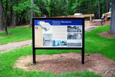
By Brian Scott, June 13, 2011
Parsons Mountain Marker
401 ► South Carolina, Abbeville County, Abbeville — Parsons Mountain — Land Renewed —  |
| On Campground Road. | |||
| 402 ► South Carolina, Charleston County, Sullivan's Island — Civilian Conservation Corps — |
| On Ion Ave. | |||
| 403 ► South Carolina, Colleton County, Edisto Island — The CCC: Building Parks for America — |
| Near South Carolina Route 174, on the right when traveling north. | |||
| 404 ► South Carolina, Greenville County, Greenville — Barracks in the Woods — |
| Near State Park Road. | |||
| 405 ► South Carolina, Greenville County, Greenville — Bull's Eye! — |
| Near State Park Drive. | |||
| 406 ► South Carolina, Greenville County, Greenville — Open to the Sky — |
| Near State Park Road. | |||
| 407 ► South Carolina, Greenville County, Greenville — Welcome to Paris Mountain State Park — |
| Near State Park Road. | |||
| 408 ► South Carolina, Greenville County, Greenville — What's So Special About this Bridge? — |
| Near State Park Road. | |||
| 409 ► South Carolina, Greenwood County, Hodges — Park’s / Greenwood County — |
| On Cokesbury Road (State Highway 254), on the right when traveling south. | |||
| 410 ► South Carolina, Greenwood County, Ninety Six — Lake Greenwood — A Changing Landscape — |
| Near State Park Road. | |||
| 411 ► South Carolina, Greenwood County, Ninety Six — New Priorities of Protection — |
| On State Park Road at Ware Street / Woodland Way ( Highway 702), on the right when traveling north on State Park Road. | |||
| 412 ► South Carolina, Greenwood County, Ninety Six — Ninety Six National Historic Site / Greenwood County — |
| On South Cambridge Street (State Highway 248) at County Route 225 on South Cambridge Street. | |||
| 413 ► South Carolina, Greenwood County, Ninety Six — Welcome to the Lake Greenwood State Recreation Area — |
| On State Park Road, on the right when traveling east. | |||
| 414 ► South Carolina, Horry County, Myrtle Beach — The CCC: Building Parks for America — |
| Near South Kings Highway (Business U.S. 17) near Mallard Lake Drive, on the right when traveling north. | |||
| 415 ► South Carolina, Oconee County, Mountain Rest — Andrew Pickens Ranger District / Oconee County — |
| On Andrew Pickens Circle, on the right when traveling north. | |||
| 416 ► South Carolina, Oconee County, Mountain Rest — Civilian Conservation Corps Monument — |
| On State Park Road. | |||
| 417 ► South Carolina, Oconee County, Mountain Rest — The Civilian Conservation Corps — 1933-1942 — |
| On State Park Road. | |||
| 418 ► South Carolina, Oconee County, Mountain Rest — Walhalla State Fish Hatchery — The CCC and Resource Conservation — |
| On Fish Hatchery Road. | |||
| 419 ► South Carolina, Oconee County, Walhalla — Oconee State Park — |
| On State Park Road. | |||
| 420 ► South Carolina, Oconee County, Walhalla — Oconee Station / Oconee County — |
| On Oconee Station Road. | |||
| 421 ► South Carolina, Oconee County, Walhalla — Patriot's Hall: Oconee Veterans Museum — Lest We Forget — South Carolina National Heritage Corridor — |
| On Short Street east of South Church Street, on the left when traveling east. | |||
| 422 ► South Carolina, Pickens County, Pickens — A CCC Classic — |
| On Table Rock State Park Road, on the right when traveling south. | |||
| 423 ► South Carolina, Pickens County, Pickens — Civilian Conservation Corps — 1933-1942 — |
| Near Table Rock State Park Road. | |||
| 424 ► South Carolina, Pickens County, Pickens — Parkitecture — |
| Near West Gate Road. | |||
| 425 ► South Carolina, Pickens County, Pickens — Table Rock State Park — |
| On TR Campground Road at West Gate Road on TR Campground Road. | |||
| 426 ► South Carolina, Pickens County, Pickens — The Civilian Conservation Corps — 1933 - 1942 — |
| On Table Rock State Park Road. | |||
| 427 ► South Carolina, Richland County, Columbia — Controversial Concrete — Sesquicentennial State Park — |
| On Two Notch Road 0.2 miles north of North Chelsea Road, on the right when traveling north. | |||
| 428 ► South Carolina, Richland County, Columbia — The CCC Building Parks for America — Sesquicentennial State Park — |
| Near Two Notch Road 0.2 miles north of North Chelsea Road, on the right when traveling north. | |||
| 429 ► South Carolina, York County, Blacksburg — Two Parks, One Mountain — |
| Near Park Road, on the right when traveling east. | |||
| 430 ► South Carolina, York County, Rock Hill — 46-35 — The CCC in York County / Tom Johnston Camp, (SCS#10), CCC — |
| Near South Herlong Avenue at Piedmont Boulevard, on the right when traveling west. | |||
| 431 ► South Dakota, Beadle County, Huron — 517 — Civilian Conservation Corps Camp — |
| On 3rd Street Southwest west of Livestock Avenue, on the right when traveling east. | |||
| 432 ► South Dakota, Bennett County, Tuthill — 540 — Civilian Conservation Corps Camp — |
| On U.S. 18 at 230th Avenue (State Highway 73), on the right when traveling west on U.S. 18. | |||
| 433 ► South Dakota, Brown County, Houghton — 515 — Civilian Conservation Corps Camp — |
| On 112th Street (State Highway 10) 1.3 miles west of 400th Ave., on the right when traveling east. | |||
| 434 ► South Dakota, Charles Mix County, Lake Andes — Civilian Conservation Corps Camp — |
| On 382nd Avenue 0.2 miles south of State Highway 50, on the right when traveling south. | |||
| 435 ► South Dakota, Custer County, Custer — 516 — Civilian Conservation Corps Camp — Camp SP-3 / Camp Narrows — French Creek — |
| On State Highway 87 0.5 miles north of Lame Johnny Road, on the left when traveling north. | |||
| 436 ► South Dakota, Custer County, Custer — 527 — Civilian Conservation Corps Camp — |
| Near South Playhouse Road east of Needles Highway (State Highway 87). | |||
| 437 ► South Dakota, Custer County, Custer — 531 — Civilian Conservation Corps Camp — |
| On Mt. Rushmore Road (U.S. 16) at Lightning Creek Road (Forest Road 288), on the right when traveling west on Mt. Rushmore Road. | |||
| 438 ► South Dakota, Custer County, Custer — Stockade Lake Bridge — |
| On Stockade Lake Drive 1 mile east of Lower French Creek Road, on the left when traveling east. | |||
| 439 ► South Dakota, Custer County, Hot Springs — 520 — Civilian Conservation Corps Camp — |
| On U.S. 385 1.9 miles north of 7-11 Road (County Road 101), on the right when traveling north. | |||
| 440 ► South Dakota, Custer County, Hot Springs — The CCC's Enduring Legacy — Wind Cave National Park — |
| On Wind Cave Road. | |||
| 441 ► South Dakota, Custer County, Pringle, West Custer Township — Early Game Preserve — Wind Cave National Park — |
| On U.S. 385 1 mile north of State Highway 87, on the right when traveling north. | |||
| 442 ► South Dakota, Day County, Waubay — Saving Men and Beasts — |
| On Waubay Refuge Entrance Road. | |||
| 443 ► South Dakota, Hughes County, Pierre — Boy Scout Cabin — |
| Near Farm Island Road. | |||
| 444 ► South Dakota, Hughes County, Pierre — CCC Camp S - 207, Farm Island, 1933 - 37 — |
| Near Farm Island Road. | |||
| 445 ► South Dakota, Hughes County, Pierre — Civilian Conservation Corps (CCC) — |
| Near Farm Island Road. | |||
| 446 ► South Dakota, Hughes County, Pierre — 506 — Civilian Conservation Corps Camp — |
| On State Highway 34 at milepost 214 at Whitetail Avenue, on the right when traveling east on State Highway 34. | |||
| 447 ► South Dakota, Hughes County, Pierre — Farm Island Causeway — |
| Near Farm Island Road 1 mile south of South Dakota Highway 34, on the right when traveling south. | |||
| 448 ► South Dakota, Hughes County, Pierre — Much Was Accomplished — |
| Near Farm Island Road 1 mile south of South Dakota Highway 34, on the right when traveling south. | |||
| 449 ► South Dakota, Jackson County, Interior — 510 — Civilian Conservation Corps Camps — |
| On State Highway 240 0.9 miles south of Interstate 90, on the right when traveling south. | |||
| 450 ► South Dakota, Lawrence County, Deadwood — Civilian Conservation Corps Camp — Camp F-20 / Park Creek — |
| On U.S. 385 at Galena Road (Forest Road 534), on the right when traveling north on U.S. 385. | |||
| 451 ► South Dakota, Lawrence County, Deadwood — 519 — Civilian Conservation Corps Camp — |
| On U.S. 385 at Roubaix Lake Road, on the right when traveling south on U.S. 385. | |||
| 452 ► South Dakota, Lawrence County, Lead — Civilian Conservation Corps Camp — |
| On U.S. 14A north of Roughlock Falls Road (County Highway 222), on the right when traveling north. | |||
| 453 ► South Dakota, Lawrence County, Nemo — 521 — Civilian Conservation Corps Camp — |
| On Nemo Road at Merritt Estes Road (County Road 208), on the right when traveling south on Nemo Road. | |||
| 454 ► South Dakota, Lyman County, Vivian — 514 — Civilian Conservation Corps Camp — |
| Near I-90 (Interstate I-90) 5.6 miles US 83 (U.S. 83), on the right when traveling east. | |||
| 455 ► South Dakota, Meade County, Sturgis — 512 — Civilian Conservation Corps Camps — |
| On South Dakota Route 34 at Custer Avenue, on the left when traveling east on South Dakota Route 34. | |||
| 456 ► South Dakota, Pennington County, Hill City — "Work Call" — |
| On East Main Street (U.S. 385) 0.4 miles north of Museum Drive, on the left when traveling north. | |||
| 457 ► South Dakota, Pennington County, Hill City — 524 — Civilian Conservation Corps Camp — |
| On U.S. 385 at Horse Creek Road, on the right when traveling south on U.S. 385. | |||
| 458 ► South Dakota, Pennington County, Hill City — Multiple Purpose Management in Action — |
| On U.S. 385 at Custer Crossing Road, on the right when traveling south on U.S. 385. | |||
| 459 ► South Dakota, Pennington County, Hill City — Newton Lake CCC Camp — |
| Near Deerfield Road 3.2 miles north of Main Street (U.S. 385), on the right when traveling north. | |||
| 460 ► South Dakota, Pennington County, Johnson Siding — 529 — Civilian Conservation Corps Camp — |
| On U.S. 385 0.1 miles north of Custer Gulch Road, on the right when traveling south. | |||
| 461 ► South Dakota, Pennington County, Mystic — 526 — Civilian Conservation Corps Camp — |
| On Tigerville-Mystic Road 0.8 miles north of County Road 242, on the right when traveling south. | |||
| 462 ► South Dakota, Union County, Alcester — 518 — Civilian Conservation Corps Camp — |
| On 479th Avenue (State Highway 11) at 301st St, on the right when traveling north on 479th Avenue. | |||
| 463 ► Tennessee, Blount County, Townsend — Civilian Conservation Corps — |
| On Cades Cove Loop Road, on the right when traveling east. | |||
| 464 ► Tennessee, Campbell County, Careyville — The Civilian Conservation Corps and Cove Lake State Park — |
| On Cove Lake Lane, on the left when traveling north. | |||
| 465 ► Tennessee, Coffee County, Manchester — The Civilian Conservation Corps — |
| On North Spring Street. | |||
| 466 ► Tennessee, Cumberland County, Crossville — 2C 23 — Cumberland Mountain State Park Bridge — |
| On Pigeon Ridge Road (State Highway 419) at Office Drive, on the right when traveling east on Pigeon Ridge Road. | |||
| 467 ► Tennessee, Davidson County, Nashville, North Capitol — The Tennessee Civilian Conservation Corps — |
| On 6th Avenue North, on the left when traveling north. | |||
| 468 ► Tennessee, Dickson County, Burns — The CCC at Montgomery Bell — |
| Near Jackson Hill Road. | |||
| 469 ► Tennessee, Dickson County, Burns — The Civilian Conservation Corps — |
| Near Jackson Hill Road. | |||
| 470 ► Tennessee, Dickson County, Burns — The Civilian Conservation Corps and Montgomery Bell State Park — |
| On Jackson Hill Road at Camp II Road, on the right when traveling south on Jackson Hill Road. | |||
| 471 ► Tennessee, Grundy County, Tracy City — A Vital Asset to the Region — Civilian Conservation Corps Company 1475, Camp S-67, Tracy City — |
| On Fiery Gizzard Road. | |||
| 472 ► Tennessee, Grundy County, Tracy City — The Civilian Conservation Corps and Grundy State Forest — |
| On Fiery Gizzard Road, in the median. | |||
| 473 ► Tennessee, Grundy County, Tracy City — The home of CCC Company 1475 — Site of Civilain Conservation Corps Camp S-67, "Camp Alvin C. York," from 1935-1938 — |
| Near Fiery Gizzard Road. | |||
| 474 ► Tennessee, Hamilton County, Chattanooga — The Civilian Conservation Corps and Booker T. Washington State Park — |
| Near Champion Road 0.1 miles south of Blue Oak Drive, on the right when traveling south. | |||
| 475 ► Tennessee, Hardin County, Shiloh — 4C 30 — Civilian Conservation Corps — Co. 2425 MP-3 — |
| On State Highway 22/142, on the right when traveling south. | |||
| 476 ► Tennessee, Lake County, Tiptonville — Civilian Conservation Corps and Reelfoot Lake State Park — |
| Near State Highway 21 at Lovell Road, on the right when traveling north. | |||
| 477 ► Tennessee, Monroe County, Tellico Beach — Nothing But Good — |
| On Cherohala Skyway, on the right when traveling west. | |||
| 478 ► Tennessee, Shelby County, Memphis, Downtown Memphis — Confederate Park — Reunions and Memorials — |
| Near North Front Street at Jefferson Avenue, on the left when traveling north. | |||
| 479 ► Texas, Angelina County, Lufkin — 6987 — Collins-Shotwell House — |
| On North Raguet Street (State Road 339 Spur) at W Grove Ave, on the left when traveling north on North Raguet Street. | |||
| 480 ► Texas, Angelina County, Lufkin — 14638 — The Civilian Conservation Corps and Forestry in Texas — |
| On Raguet Street, on the right when traveling east. | |||
| 481 ► Texas, Angelina County, Zavalla — 16536 — Camp Nancy — |
| On State Highway 69 at Massey Road, on the right when traveling south on State Highway 69. | |||
| 482 ► Texas, Bell County, Bartlett — 12974 — Site of Booker T. Washington School — |
| On Cryer Drive, on the right when traveling east. | |||
| 483 ► Texas, Burnet County, Burnet — 9725 — Longhorn Cavern Administration Building — |
| Near Park Rd 4 S. | |||
| 484 ► Texas, Cherokee County, Maydelle — 6899 — Mewshaw State Sawmill and Maydell CCC Camp — |
| On U.S. 84 at Farm to Market Road 747, on the right when traveling east on U.S. 84. | |||
| 485 ► Texas, Dallas County, Dallas — 13312 — Civilian Conservation Corps Company 2896 — |
| On East Lawther Drive, on the left when traveling west. | |||
| 486 ► Texas, El Paso County, El Paso, West Central El Paso — 13138 — Scenic Drive — |
| On Scenic Drive, on the right when traveling east. | |||
| 487 ► Texas, El Paso County, Socorro — 12342 — Rio Vista Farm — |
| On North Rio Vista Road, on the left when traveling east. | |||
| 488 ► Texas, Foard County, Crowell — Foard Co — Est. Feb. 21, 1891 — |
| Near Main Street (State Highway 6) at Commerce Street (U.S. 70), on the right when traveling north. | |||
| 489 ► Texas, Houston County, Ratcliff — 7035 — Ratcliff CCC Camp — |
| On Farm to Market Road 227 0.2 miles north of State Highway 7, on the right when traveling north. | |||
| 490 ► Texas, Houston County, Weches — 7021 — Weches CCC Camp — |
| On State Highway 21 0.9 miles west of County Road 1580, on the right when traveling west. | |||
| 491 ► Texas, Madison County, Madisonville — 11252 — CCC Camp Site — |
| On State Highway 21 0.1 miles Pine st, on the left when traveling west. | |||
| 492 ► Texas, Randall County, Canyon — 16005 — The Civilian Conservation Corps at Palo Duro Canyon State Park — |
| Near State Hwy Park Road 5 0.8 miles south of Texas Highway 217. | |||
| 493 ► Texas, Refugio County, Austwell — Building Aransas NWR (National Wildlife Refuge) — |
| On Hopper Road (Highway 2040), on the left when traveling south. | |||
| 494 ► Texas, Shackelford County, Albany — 16822 — Civilian Conservation Corps at Fort Griffin — |
| Near U.S. 283 at Park Road 58. | |||
| 495 ► Texas, Taylor County, Buffalo Gap — 12511 — The Civilian Conservation Corps at Abilene State Park — |
| Near Park Road 32 at Farm to Market Road 89. | |||
| 496 ► Texas, Trinity County, Groveton — 7960 — Groveton — |
| On First Street (U.S. 287) at Main Street, on the left when traveling east on First Street. | |||
| 497 ► Texas, Uvalde County, Concan — 14027 — Civilian Conservation Corps at Garner State Park — |
| On State Park Road 29 0.6 miles south of New Park Road 29. | |||
| 498 ► Utah, Garfield County, Bryce Canyon City — A Lasting Legacy — |
| On Bristlecone Point Loop Trail. | |||
| 499 ► Utah, Garfield County, Escalante — Building the Million-dollar Road — Civilian Conservation Corps — |
| On Utah Route 12 at milepost 69, on the left when traveling east. | |||
| 500 ► Utah, Garfield County, Escalante — 501 — Old Boulder Mail Trail — |
| On Utah Route 12, on the left when traveling east. | |||
611 entries matched your criteria. Entries 401 through 500 are listed above. ⊲ Previous 100 — Next 100 ⊳