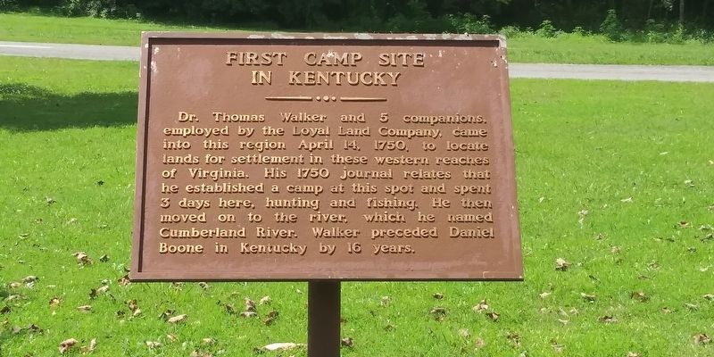
Dr. Thomas Walker and 5 companions.
employed by the Loyal Land Company, came
into this region April 14, 1750, to locate
lands for settlement in these western reaches
of Virginia. His 1750 journal relates that
he established a camp at this spot . . . — — Map (db m159751) HM
Rev. Hiram M. Frakes founded this Methodist Settlement in 1925. Begun in a cabin with 13 students, it became an institution for spiritual and educational development of mountain youth. Frakes guided and influenced the entire Middle Laurel Fork . . . — — Map (db m162490) HM
"Cumberland Gap is the strongest position I have ever seen except Gibraltar." These were Union General George W. Morgan's words after viewing the fortification around the Gap. On June 19, 1862, he wrote to Secretary of War Edwin M. Stanton, "The . . . — — Map (db m207707) HM
During the Civil War, Cumberland Gap was held alternately by Union and CSA armies. USA forces under Gen. George W. Morgan occupied it June 18 to Sept. 17, 1862. Cut off from supplies and surrounded, Morgan with 9,000 men retreated successfully to . . . — — Map (db m50230) HM
The next half-mile of trail follows the 1907 roadbed of an "Object Lesson Road." Early in the 20th century, most rural roads, especially here in the Appalachians, were little better than in the days of Daniel Boone. The U.S. Department of . . . — — Map (db m207716) HM
The trail ahead follows the 1907 roadbed of an Object Lesson Road. Early in the 20th century, most rural roads, especially here in the Appalachians, were little better than in the days of Daniel Boone. The U.S. Department of Agriculture sponsored . . . — — Map (db m207717) HM
Grave of Colonel Arthur Campbell (1743-1811). Statesman, revolutionary soldier, justice, legislator, county lieutenant. Sons, James and John killed in War of 1812. — — Map (db m57938) HM
Some of today's Cumberland Gap National Historical Park was created from land where homes, fields, and community buildings once stood. The view from here has changed dramatically over the past century.
Bartlett-Rhodes Park, named for two . . . — — Map (db m205050) HM
(side 1)
Cumberland Gap
Providing a viable transportation route through the rugged terrain of the Appalachian Mountains, the Cumberland Gap was valued by both Union and Confederate armies during the Civil War. Along with the East . . . — — Map (db m181079) HM
During the Civil War this earthwork - called Fort Rains by the Confederates and Fort McCook by the Federals - was one of many fortifications ringing Cumberland Gap. These defenses were considered too formidable to be taken by direct assault, which . . . — — Map (db m207773) HM
Where you see a picnic ground today, imagine a seven-sided structure made of earth and wooden walls, approximately 40 feet by 70 feet. The outer walls of this Civil War fort were approximately five feet high with an earth-covered powder magazine . . . — — Map (db m88656) HM
Where you see a picnic ground today, imagine a Civil War fort the size of four football fields side-by-side atop this knoll. The outer walls, made of packed earth faced with logs, rose 10 feet high. Like the other batteries, forts, and rifle pits . . . — — Map (db m205085) HM
At daybreak skirmishing parties of the enemy opened fire...from the adjacent hills....Minie balls are falling within our works. I have no artillery. The snow is falling thickly and the morning is dark. Our men are in the trenches....One man is . . . — — Map (db m207772) HM
For travelers who had to walk, the Appalachian mountains seemed like an impenetrable wall, 600 miles long and 150 miles wide. Here at Cumberland Gap you could find both a good way in and a good way out of that rugged labyrinth of ridges, coves, . . . — — Map (db m35880) HM
For travelers who had to walk, the Appalachian mountains seemed like an impenetrable wall, 600 miles long and 150 miles wide. Here at Cumberland Gap you could find both a good way in and a good way out of that rugged labyrinth of ridges, coves, . . . — — Map (db m205056) HM
For travelers who had to walk, the Appalachian mountains seemed like an impenetrable wall, 600 miles long and 150 miles wide. Here at Cumberland Gap you could find both a good way in and a good way out of that rugged labyrinth of ridges, . . . — — Map (db m205084) HM
For the North, Cumberland Gap was a natural invasion route into the South - providing access to vulnerable railroads and valuable minerals and salt works in East Tennessee and southwest Virginia. For the South, the Gap was a gateway for an . . . — — Map (db m207774) HM
The long crater you see here is all that remains of the Union warehouse that stood here in 1862. Advancing Confederates had to wait 18 hours as scattered munitions continued to explode unexpectedly. By then the once-surrounded Union garrison of . . . — — Map (db m177860) HM
Meriwether Lewis, coleader of the Lewis & Clark Expedition, with a party of Expedition veterans and a Mandan Indian delegation, went through Cumberland Gap in Nov. 1806 en route to Washington to report on the expedition. Over.
Cumberland . . . — — Map (db m33299) HM
Founded 1889, this nine-hole golf course is claimed to be the oldest continuously played course in the United States. This semi-private club today has a pro-shop, concessions, and club and cart rentals. — — Map (db m181084) HM
One of the oldest in US, founded 1889. The present nine-hole course located on site where original was laid out by the English developers who came 1886 and brought the golf game to this mountain region. In 1899, a financial crash in England took . . . — — Map (db m181083) HM
Designated by the Kentucky Society of Professional Geologists as a Distinguished Geological Site. Middlesboro is one of only a few cities on the North American Continent located in the basin of a meteorite impact structure.
Sometime over the . . . — — Map (db m33296) HM
English colony founded in 1886 by Alexander Arthur. Project financed by English company, the American Association, because of timber and rich mineral deposits here. Almost 100,000 mountainous acres in Va., Tenn., and Ky. purchased for the . . . — — Map (db m33297) HM
Alexander Arthur, 1846-1912, an outstanding figure in history of Middlesboro. He came here in 1885 to prospect, discovering coal and iron ore deposits. President of American Association, formed to carry out his plans for a mining and manufacturing . . . — — Map (db m33298) HM
Built about 1800 in Yellow Creek Valley, the second brick house in the county, and the oldest one still standing. The bricks were made from clay by slave labor. Home of Rev. John Calvin Colson, "Patriarch of Yellow Creek Valley," preacher, teacher, . . . — — Map (db m181081) HM
The impressive turreted building of the New South Brewery and Ice Company once stood in front of you. Manager William Wallbrecht and brewmaster Mr. Kumli employed dozens of area men to brew beer here. Their leading brands included Pinnacle, Crystal . . . — — Map (db m207778) HM
We started just as the sun began to gild the tops of the high mountains. We ascended Cumberland Mountain, from the top of which the bright luminary of the day appeared to our view in all his rising glory; the mists dispersed and the floating . . . — — Map (db m190762) HM
We started just as the sun began to gild the tops of the high mountains. We ascended Cumberland Mountain, from the top of which the bright luminary of day appeared to our view in all his rising glory; the mists dispersed and the floating clouds . . . — — Map (db m205083) HM
This is one of the finest examples of Carpenter Gothic architecture in the U.S. The cornerstone was laid in 1890 and the church was dedicated on February 11, 1891. The design is based o blueprints of St. Mary's Church in Middlesborough, England. . . . — — Map (db m181082) HM
We went four miles to a large Creek, which we called Cedar Creek,
being a Branch of Bear-Grass, and from thence Six miles to
Cave Gap, the land being Levil. On the North side of the Gap is a
large Spring, which falls, very fast, and just above . . . — — Map (db m210486) HM
Cumberland Gap, the break in the ridgeline you see ahead, is far more than just a pass through a long, rugged mountain barrier. For a generation of American pioneers this was the gateway from their old lives and limitations out to a frontier . . . — — Map (db m35899) HM
This area of the park was once home to dozens of people, with several homes and a school. Evidence of families who once lovingly cared for their homes and land is still visible; stone foundations and chimneys survive, daffodils and forsythia bloom . . . — — Map (db m207881) HM
Lee Branham • Stephen M. Fuson • Marty D. Williams • Steve D. Herrell • Joseph D. Herrell • Thomas M. Cadle • Roger L. Brock • Roland M. Daige • William D. Sweat • Carey Duval • Frankie Rush • Roy J. Lowe • Shelby J. Carter • Carrie C. Sutphin • . . . — — Map (db m214828) WM
The flames of [pro-Union] rebellion will flash throughout East Tennessee, the railroad will be destroyed, the bridges burned, and other calamities...will follow. Landon C. Hayes, letter to Confederate President Jefferson Davis, . . . — — Map (db m205086) HM
Two hundred years ago, pioneers poured through Cumberland Gap on their way west to a better life. But not all the traffic on the Wilderness Road was westbound. By the 1820s, drovers pushed huge herds of hogs and smaller herds of cattle and sheep . . . — — Map (db m167001) HM
A natural thoroughfare through the Appalachian Mountain barrier, Cumberland Gap assumed great strategic importance in the Civil War. Both sides sought to control the Gap. It changed hands three times, but no battles were fought. Troops garrisoned . . . — — Map (db m207711) HM
Before trucks and cars in the 1900s, before steam locomotives in the 1800s, before long-hunters' packhorses in the 1700s, there was long-distance traffic crossing the Gap—on foot—going both north and south. No one knows how many centuries Indians . . . — — Map (db m207718) HM
Watts Furnace. Stood ½ mile SW. A pair of blast furnaces built by the Watts Steel and Iron Syndicate, Ltd., 1890-93, and operated until 1898. Each iron shell stack was 75 ft. high with a maximum inner diameter of 17 ft. Using coke fuel and . . . — — Map (db m170830) HM
It will be 100 years or more before Cumberland Gap's restored Wilderness Road trail looks like it did in 1780–1810. The short segment of trail ahead is one of the few places where you can still see the original roadbed, unaltered by the . . . — — Map (db m241292) HM
This memorial is dedicated to the lasting memory of all the men and women who died in defense of the United States of America. dedicated Memorial Day, May 26, 1986
by the people of Bell County. Greater love hath no man than this, that a . . . — — Map (db m214833) WM
Chained Rock is a boulder formation of Pine Mountain, 2,200 feet above sea level. The Chain, 101 feet long with seen pound links, was carried here by a four-mule team in two trips. It is anchored to the rock with pegs 1½ × 24 inches concreted into . . . — — Map (db m181126) HM
One of the most important points on the Wilderness Road marked by Daniel Boone in 1775. Ford first used by Indians, then by early explorers and the Long Hunters. After Boone opened the way west, more than 100,000 settlers used the crossing as a . . . — — Map (db m35831) HM
On route of Gen. E. Kirby Smith's Confederate invasion of Kentucky, fall 1862, concurrent with that of Bragg to the west. At Richmond Smith defeated USA, then occupied Lexington, Sept. 2. The Battle of Perryville prevented CSA plan to take central . . . — — Map (db m181124) HM
Bell County formed from Harlan and Knox Counties, 1867. Named for Joshua Fry Bell, 1811-70, Congressman, Ky. Sec. of State, Comr. to peace conference in 1861 and State Legislator. He was g. grandson of Dr. Thomas Walker, explorer of Ky. . . . — — Map (db m35871) HM
Bell County, named for Joshua Fry Bell (1811-1870), was formed just after the Civil War in February of 1867 from portions of Harlan and Knox Counties. Pineville, the county seat, being so near the site where pioneers on the Wilderness Road crossed . . . — — Map (db m35875) HM
Near this site where the creek enters the river, on April 17, 1750, Dr. Thomas Walker first viewed the river he named for the Duke of Cumberland. Known as the "Narrows," this area became a significant gateway for travelers on the Wilderness Road. . . . — — Map (db m181163) HM
Following in Their Footsteps
The Wilderness Road was a 200-mil, overland route made famous by legendary frontiersman Daniel Boone. First mapped in 1750 by Dr. Thomas Walker, the route began as a series of braided trails, called traces, created by . . . — — Map (db m181125) HM
Opened Kentucky and the West to rapid settlement and major development. First wagon road built by Kentucky (1796), Crab Orchard to Cumberland Gap. A principal highway, maintained as turnpike (toll road) for 80 years. — — Map (db m212442) HM
The first to begin operations in Bell County, starting in 1889, with 1500 acres of coal land. Extension of the Louisville and Nashville Railroad to this area in 1888 marked the beginning of a new industrial era. This mine was not a financial . . . — — Map (db m35854) HM
This cemetery was established by pioneers traveling along Boone's Wilderness Road during the late 1700's and early 1800's. These first settlers camped in the bottomland that is now Wasioto Golf Course while preparing to cross the Cumberland . . . — — Map (db m181156) HM
The courthouse that stood here, 1899-1963, was a landmark of Kentucky's "feudin' 'n' fightin'." Stemming from Civil War, feuds and political disagreements, unnumbered slayings, ambushes, and assassinations occurred between 1870-1920. In 11 months, . . . — — Map (db m73893) HM
During the Civil War animosity between Union and Confederate sympathizers in Breathitt County led to deaths of 20 citizens and 44 CSA and USA men discharged or on furlough. They were killed in personal fights, ambushes, or by murders at their homes. . . . — — Map (db m146468) HM
Formed from parts of Estill, Clay, Perry Counties, 1839. Named for Gov. John Breathitt, who died in office, 1834. Breathitt born in Va. 1786. Family came to Logan County, Ky. 1800. Representative Ky. Legis. 3 terms, Lt. Gov. 1828, Gov. 1832-34. . . . — — Map (db m73891) HM
During World War I, this county attained national prominence by filling its quota of service men by volunteers. No men had to be drafted from Breathitt, the only county in U.S. with this record. During war 3,912 men registered, 405 volunteered, 324 . . . — — Map (db m73892) WM
In ancient days a stately column or pillar was used to honor those persons of nobility and dignity who contributed much to the community or state. A broken column was used to honor those who died or were struck down and cut off in the vigor of life . . . — — Map (db m73885) WM
Korean War 25 June 1950 - 27 May 1953 In honor of all Breathitt Countians who served in the Korean War era and especially those whose names are inscribed hereon who gave their lives to contain Communism and to preserve individual freedom in . . . — — Map (db m105814) WM
Kentuckys only medal of honor winner in World War I. Born at the head of Freeman fork of Longs Creek, Breathitt County, KY. Jan. 1. 1890. Single handedly destroyed three German machine gun nests. Killed 24 enemy soldiers near Bois De Froges France . . . — — Map (db m73884) WM
World War I April 6, 1917 - November 11, 1918 Dedicated to all Breathitt Countians who served “over there” in the “war to end all wars”. To all those who supported the war effort in any fashion and in memory of the following who gave their . . . — — Map (db m105815) WM
Samuel VanderMeer came here from New Jersey in 1923. “Uncle Sam” to generations of Ky. Youngsters, he became pastor of the Morris Fork Presbyterian Church in 1927, the year he married nurse Nola Pease. Missionaries, community builders. . . . — — Map (db m39151) HM
Part of Company I, 14th Kentucky Infantry, USA, attacked Confederates camped here, night of April 5, 1864. CSA loss: eight killed or wounded, three prisoners and 24 horses taken.
Gen. John H. Morgan’s CSA men, on tragic last raid into Kentucky, . . . — — Map (db m146426) HM
Matthew Sellers is among first to experiment with gliding and power flight. Did this research at his home and laboratory, 6 miles south, 1897-1911. Built most advanced wind tunnel of his day, 1903, to study lift and drag of various wing designs; and . . . — — Map (db m145292) HM
Retreating from Cumberland Gap General George W. Morgan’s Union force of 8,000 men camped here Sept. 1862. CSA Morgan’s Raiders harassed USA, 30 miles along here; skirmishing, felling trees across roads and preempting food and supplies. Covering 200 . . . — — Map (db m145350) HM
As Gen. George W. Morgan's Union force, 8,000 when here, retreated from Cumberland Gap, they were harassed from West Liberty by CSA Gen. John H. Morgan's Raiders. Failure of reinforcements to reach here caused Confederates to leave Oct. 1, 1862 and . . . — — Map (db m272680) HM
In their blue and gray uniforms for over forty years, Civil War veterans gathered here annually, around campfires, with song and story, friends and former foes, revived war memories, and always a pilgrimage to graves of their comrades in cemetery of . . . — — Map (db m73788) WM
For Col. William Grayson Carter, state senator, 1834-36. The 88th Ky. county formed, 32nd in size. Carter was created from Greenup and Lawrence. Noted in early years for 5 iron furnaces, its clay products, industry developed in late 1800's. Carter . . . — — Map (db m73789) HM WM
E. K. Railway purchased 25,000
acres of land in Little Sandy
Valley at close of the Civil War.
Tracks laid to this site June 10,
1871. Grayson was location of depot
and repair shops. Stinson Branch
was laid, 1893, with more straight
track . . . — — Map (db m144463) HM
Six miles south, site of famous iron
furnace, erected, 1848, by R. M.
Biggs and others. Operated 37 years,
averaging 15 tons pig iron daily
which was hauled by ox teams to
Ohio River for shipment. Iron
produced here was used for rails,
plows, . . . — — Map (db m144955) HM
Pactolus Furnace Built in 1824 by Joseph McMurtry and David L. Ward, on the site of an earlier bloomer forge. Its stone stack used charcoal fuel, and its air blast machinery was powered from a dam, 5 1/2 ft. high, in Little Sandy River. Capacity . . . — — Map (db m73787) HM
In memory of William Jason Fields, United States Representative 1911-1923, Governor of Commonwealth of Kentucky 1923-1927. Born Dec. 29, 1874, Willard Ky. -Carter Co. — — Map (db m196300) HM
Dedicated to the memory of our comrades who entered the service of their country. Those who were wounded and those who gave up their lives in the World War of 1917-1918.
Sponsored by Moore-Armstrong Post No. 138, American Legion; Willie C. . . . — — Map (db m164262) WM
Here the EK had a junction with
the Elizabethtown, Lexington &
Big Sandy Railway that connected with
the Ashland Coal and Iron Railway in
Denton. January 1882 both would
become part of Chesapeake & Ohio
Railway. The EK and C&O shared a
depot . . . — — Map (db m145351) HM
Created from parts of Carter,
Lewis and Elliott Counties with
county seat here by legislative
act signed Feb. 9, 1904, by Gov.
J.C. W Beckham for whom it was
named. C. C. Brooks appointed
County Judge. On April 29, 1904,
the Court of Appeals . . . — — Map (db m145288) HM
In memory of those who gave their lives for freedom.
Vietnam
Chaffins, Ernest Jr. -
Colecrove, Robert H -
Dickerson, George E -
Eden Chester W -
Fitch, William A -
Jackson Larry, R -
Littleton, David E -
Tackett, George E . . . — — Map (db m164373) WM
WIA programs are done by eastern Ky. Concentrated employment program, inc. Funded by Workforce Investment Act funded by U.S. Dept of Labor by Ky. Ed. Cabinet, Div. of Work Force Services. — — Map (db m164385) HM
“Honest Bill from Olive Hill.”
Home of Gov. William Jason Fields,
34th Governor of Kentucky, 1923-27.
Promoted Kentucky’s first grant of
Federal aid for road construction,
consolidation of schools, teacher-training colleges at . . . — — Map (db m145260) HM
Olive Hill is the birthplace of Tom T. Hall.
Born to Reverend Virgil L. and Della Lena Hall,
he used his God-given talents to become famed
as one of America's balladeers, telling in music
form the story of the common folk and the . . . — — Map (db m164383) HM
Built in 1848 by A. McCullough and Lampton Brothers. Its stone stack was 36 feet high. 11½ feet across inside at widest point, and burned “stone coal” rather than charcoal. It was served by its own railroad spur. In 1866 it produced . . . — — Map (db m144425) HM
In 1873, line was extended from
Grayson to Willard. Located here
were a turntable, water tower,
railroad scales, & engine house.
Near-by, the Lick Branch & Lost
Creek spurs, as well as EK coal
mines and coal camp existed. In
1892, an angry . . . — — Map (db m145353) HM
Saltpeter mined here from which gunpowder was made that was used by Kentucky riflemen during the war of 1812. There are remains of those works in cave, reputed rendezvous for counterfeiters in early years, artifacts and Indian graves found in cavern. — — Map (db m164261) HM WM
Saltpetre Cave is considered by many historians to be the site of the earliest industry in the area. The cave was used during the War of 1812 as a source of the major ingredient in making gunpowder. The site is currently listed on the National . . . — — Map (db m164394) HM
Since the early 19th century,
adventurers have been
attracted to the caves in this
area. For some there was a
need to enter the caves
because they provided raw
materials which improved daily
life. Others entered just for the
fascination of . . . — — Map (db m164392) HM
On these grounds of the Red Bird River Community Hospital of the Evangelical United Brethren Church Center is log cabin built before 1800. Erected by Dillion Asher. Born, 1774, died, 1844. Buried near log house. Asher was keeper of first toll-gate . . . — — Map (db m212438) HM
Gen. George W. Morgan's Union forces occupied Cumberland Gap June 18 to Sept. 17, 1862. Cut off from supplies and surrounded, Morgan with 9,000 men withdrew. They camped here Sept. 19-21, to perfect organization for march. Made fruitless supply . . . — — Map (db m73926) WM
For Gen. Green Clay, 1757-1826. Born in Va. Came to Ky., 1777. Va. Legislature, 1788-89, and Va. Convention that ratified Federal Constitution. From 1793 t0 1808 in Ky. House, Senate, Const. Conv. May, 1813,Gen Clay with 3000 Kentuckians, at Ft. . . . — — Map (db m49184) HM
On Oct. 23, 1862, 22nd USA Brig. including 1st, 2nd and 20th Ky. Infantry moved here in wake of retreating CSA forces. 500 men worked 36 hours to destroy salt works mainly owned by unionists but used by Confederates. Loyal USA citizens allowed to . . . — — Map (db m73925) WM
(Front): Gov. Bert T. Combs (1959-1963)
Accomplishments during Comb’s administration included highways connecting eastern and western Ky., expansion of state parks system, a statutory merit system for state employees, an end to . . . — — Map (db m49185) HM
Originally this site was probably a salt lick used by buffalo, which made the path to it. Indians used the path to make war between northern and southern tribes. Numerous early American explorers used the path as did hunters, who found animals . . . — — Map (db m87857) HM
Salt works established early 1790s; Clay County established here in 1807
The Goose Creek Salt Works dates from the mid 1790s when it was known as the “Langford Works” and was well known throughout Kentucky and in Tennessee and . . . — — Map (db m87858) HM
Was a legendary Cherokee Indian for whom this fork of the Kentucky River is named. He and another Indian, Jack, whose name was given creek to the south, were friendly with early settlers and permitted to hunt in area. Allegedly they were killed in . . . — — Map (db m87567) HM
(Side One)
Named in honor of first white man to settle on Red Bird River, at the mouth of Gilbert’s Creek. A veteran of Revolutionary War, John Gilbert came here to hunt and trap. He surveyed and claimed much of Clay, Leslie and Harlan . . . — — Map (db m87568) HM
The land for what became Oneida Baptist Institute was donated by Martha Coldiron Hogg and S.P. Hogg in September 1899. The school was founded by James Anderson Burns, December 20, 1899, as Mamre Baptist College to meet the social, educational, and . . . — — Map (db m39148) HM
This burial ground is the final resting place of seven unnamed soldiers who were killed in a Civil War skirmish here in late Sept. 1862, between forces of USA Gen. George W. Morgan and CSA Gen. John H. Morgan. Union forces retreating from . . . — — Map (db m164300) HM
Side 1
Gen. George W. Morgan's 9,000 USA force occupied Cumberland Gap June 18 to Sept. 17, 1862. Cut off from supplies, Morgan began 200-mile retreat. On way through here USA harassed by CSA Morgan's Raiders. Failure of reinforcements . . . — — Map (db m164301) HM
For John M. Elliott, born in Va., 1820. Came to this area, 1830. Admitted to bar, 1843. Ky. Legis., 1847-53. U. S. Congress, 1853-59. Ky. Legis., 186I, but expelled for his southern sympathy. Congress of Confederate States, 1862-65. Circuit Judge . . . — — Map (db m164303) HM
690 entries matched your criteria. The first 100 are listed above. Next 100 ⊳