76 entries match your criteria.
Historical Markers in Saint John, New Brunswick
By Cosmos Mariner, July 14, 2019
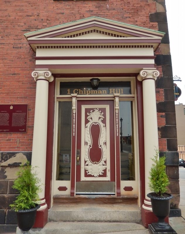
1 Chipman Hill Entrance
| 1 ► New Brunswick, Saint John County, Saint John — 1 Chipman Hill — |
| On Chipman Hill just south of Union Street, on the left when traveling north. | |||
| 2 ► New Brunswick, Saint John County, Saint John — A Legacy of Tea | Du thé en héritage — People Waiting Making Art Public | Rendre l’art public — Harbour Passage Trail — |
| On Market Square just east of Water Street, on the right when traveling east. | |||
| 3 ► New Brunswick, Saint John County, Saint John — A Portal to the New World — La porte du Nouveau Monde — Harbour Passage Trail — |
| On Water Street just west of Prince William Street, on the left when traveling south. | |||
| 4 ► New Brunswick, Saint John County, Saint John — An Island Abounding With Life — Une île pleine de vie — Harbour Passage Trail — |
| On Prince William Street at Saint James Street, on the left when traveling north on Prince William Street. | |||
| 5 ► New Brunswick, Saint John County, Saint John — Ancient Life — D’anciennes formes de vie — |
| Near Chesley Drive (New Brunswick Route 100) at Bentley Street, on the right when traveling north. | |||
| 6 ► New Brunswick, Saint John County, Saint John — Benedict Arnold — Rebel and Loyalist | Rebelle et loyaliste — |
| Near Lancaster Avenue, 0.2 kilometers east of Bridge Road (New Brunswick Route 100), on the left when traveling east. | |||
| 7 ► New Brunswick, Saint John County, Saint John — Canada’s Original City — La ville originale du Canada — |
| Near North Market Wharf close to Smythe Street. | |||
| 8 ► New Brunswick, Saint John County, Saint John — Carleton Martello Tower — Tour Martello Carleton — |
| Near Whipple Street near Lancaster Street. | |||
| 9 ► New Brunswick, Saint John County, Saint John — Centerbeam Place — |
| On Prince William Street at King Street, on the left when traveling south on Prince William Street. | |||
| 10 ► New Brunswick, Saint John County, Saint John — Charles Gorman — |
| Near Lancaster Avenue, 0.2 kilometers east of Bridge Road (New Brunswick Route 100), on the left when traveling east. | |||
| 11 ► New Brunswick, Saint John County, Saint John — Church of Saint Andrew and Saint David — Église Saint Andrew and Saint David — |
| On Germain Street close to Duke Street, on the left when traveling south. | |||
| 12 ► New Brunswick, Saint John County, Saint John — Clearing Customs in Style — Franchir les douanes avec grâce — Harbour Passage Trail — |
| On Water Street at Duke Street, on the right when traveling south on Water Street. | |||
| 13 ► New Brunswick, Saint John County, Saint John — Colonel Gabriel G. Ludlow — First Mayor of Saint John | Premier maire de Saint John — |
| Near Lancaster Avenue, 0.2 kilometers east of Bridge Road (New Brunswick Route 100), on the left when traveling east. | |||
| 14 ► New Brunswick, Saint John County, Saint John — Defending the Harbour — À la défense du port — Harbour Passage Trail — |
| On Union Street just west of Smythe Street when traveling west. | |||
| 15 ► New Brunswick, Saint John County, Saint John — Dock Street Generating Station — Le Centrale Dock Street — 1889-1976 — |
| Near Smythe Street. | |||
| 16 ► New Brunswick, Saint John County, Saint John — Electrifying the Uptown — L’électrification du centre-ville — Harbour Passage Trail — |
| Near Union Street just west of Smythe Street, on the right when traveling west. | |||
| 17 ► New Brunswick, Saint John County, Saint John — First Marine Compound Engine — La Première Machine Compound de Marine — |
| On Peters Wharf at Water Street, on the right when traveling east on Peters Wharf. | |||
| 18 ► New Brunswick, Saint John County, Saint John — First Steam Fog Horn — La Premiere Corne de Brume a Vapeur — |
| On Peters Wharf at Water Street, on the right when traveling east on Peters Wharf. | |||
| 19 ► New Brunswick, Saint John County, Saint John — Fishing the Harbour — La pêche dans le port — Harbour Passage Trail — |
| Near Chesley Drive (New Brunswick Route 100) at Bentley Street, on the right when traveling north. | |||
| 20 ► New Brunswick, Saint John County, Saint John — Fort Howe — Major Gilfrid Studholme — Indian Treaty of 1778/Le Traité Indien de 1778 — |
| On Magazine Street close to Metcalf Street. | |||
| 21 ► New Brunswick, Saint John County, Saint John — Fort La Tour — |
| Near Fort Latour Drive at Navy Way when traveling east. | |||
| 22 ► New Brunswick, Saint John County, Saint John — Fort La Tour — Le Fort La Tour — |
| Near Fort Latour Drive at Navy Way, on the right when traveling east. | |||
| 23 ► New Brunswick, Saint John County, Saint John — Fort La Tour — |
| Near Fort Latour Drive at Navy Way, on the right when traveling east. | |||
| 24 ► New Brunswick, Saint John County, Saint John — Fossil Hunters — Chasseurs de fossiles — |
| Near Chesley Drive (New Brunswick Route 100) at Bentley Street, on the right when traveling north. | |||
| 25 ► New Brunswick, Saint John County, Saint John — Founding of New Brunswick — La Fondation du Nouveau-Brunswick — |
| On Sydney Street close to Kings Square North, on the left when traveling north. | |||
| 26 ► New Brunswick, Saint John County, Saint John — Françoise Marie Jacquelin — and the Battle for Fort La Tour / et la lutte pour le fort La Tour — |
| Near Lancaster Avenue, 0.2 kilometers east of Bridge Road (New Brunswick Route 100), on the left when traveling east. | |||
| 27 ► New Brunswick, Saint John County, Saint John — George B. Oland — Moosehead Breweries / La Brasserie Moosehead — |
| Near Lancaster Avenue, 0.2 kilometers east of Bridge Road (New Brunswick Route 100), on the left when traveling east. | |||
| 28 ► New Brunswick, Saint John County, Saint John — Here Stood the House Occupied by Benedict Arnold — |
| On Canterbury Street just south of King Street, on the right when traveling south. | |||
| 29 ► New Brunswick, Saint John County, Saint John — Imperial Theatre — Le Théâtre Imperial — |
| On Kings Square South close to Sydney Street, on the right when traveling west. | |||
| 30 ► New Brunswick, Saint John County, Saint John — Irish Immigrant Memorial — |
| On Water Street, 0.03 kilometers north of Prince William Street, on the left when traveling south. | |||
| 31 ► New Brunswick, Saint John County, Saint John — John Robertson — Lord of the North / Le Lord du Nord — |
| Near Lancaster Avenue, 0.2 kilometers east of Bridge Road (New Brunswick Route 100), on the left when traveling east. | |||
| 32 ► New Brunswick, Saint John County, Saint John — K.C. Irving — |
| Near Lancaster Avenue, 0.2 kilometers Bridge Road (New Brunswick Route 100), on the left when traveling east. | |||
| 33 ► New Brunswick, Saint John County, Saint John — King Edward VII Memorial Bandstand — Kiosque À Musique Commémoratif Roi Edouard VII — |
| On Charlotte Street close to King Street, on the left when traveling south. | |||
| 34 ► New Brunswick, Saint John County, Saint John — King’s Square — Carré King’s Square — Established 1785/Fondé en 1785 — |
| On Charlotte Street close to King Street, on the left when traveling south. | |||
| 35 ► New Brunswick, Saint John County, Saint John — Koluskap and Beaver — Koluskap et le castor — |
| Near Lancaster Avenue, 0.2 kilometers Bridge Road (New Brunswick Route 100), on the left when traveling east. | |||
| 36 ► New Brunswick, Saint John County, Saint John — Land of the Dawn — La terre de l’aurore — |
| Near Lancaster Avenue, 0.2 kilometers east of Bridge Road (New Brunswick Route 100), on the left when traveling east. | |||
| 37 ► New Brunswick, Saint John County, Saint John — Loyalist House — La Maison Loyaliste — |
| On Union Street just west of Germain Street (Wellington Row), on the right when traveling east. | |||
| 38 ► New Brunswick, Saint John County, Saint John — Menahkwesk "Saint John" — |
| Near Fort Latour Drive at Navy Way when traveling east. | |||
| 39 ► New Brunswick, Saint John County, Saint John — Mills at Union Point — Les usines à Union Point — |
| Near Lancaster Avenue, 0.2 kilometers east of Bridge Road (Route 100), on the left when traveling east. | |||
| 40 ► New Brunswick, Saint John County, Saint John — Navy Island (Ouigoudy Island) — Harbour Passage Trail — |
| Near Chesley Drive (New Brunswick Route 100) at Bentley Street, on the right when traveling north. | |||
| 41 ► New Brunswick, Saint John County, Saint John — New Brunswick’s First School of Law — |
| On Canterbury Street close to Princess Street, on the left when traveling north. | |||
| 42 ► New Brunswick, Saint John County, Saint John — No. 2 Mechanics’ Volunteer Company Engine House — Caserne No 2 des Mécaniciens Pompiers Volontaires — |
| On Sydney Street close to Kings Square South, on the right when traveling west. | |||
| 43 ► New Brunswick, Saint John County, Saint John — Oland Family Breweries — |
| Near Market Square (North Market Wharf) just west of St. Patrick Street, on the right when traveling west. | |||
| 44 ► New Brunswick, Saint John County, Saint John — Partridge Island — L’île Partridge — |
| Near Smythe Street at North Market Wharf, on the right when traveling south. | |||
| 45 ► New Brunswick, Saint John County, Saint John — Prince William Street - Before and After the 1877 Fire — Rue Prince William - Avant et Après le Grand Incendie de 1877 — |
| On Prince William Street near King Street, on the left when traveling south. | |||
| 46 ► New Brunswick, Saint John County, Saint John — Prince William Streetscape — La Rue Prince William — |
| On Prince William Street at Princess Street, on the left when traveling north on Prince William Street. | |||
| 47 ► New Brunswick, Saint John County, Saint John — Rebels Attack — Les attaques des rebelles — |
| Near Lancaster Avenue, 0.2 kilometers east of Bridge Road (New Brunswick Route 100), on the left when traveling east. | |||
| 48 ► New Brunswick, Saint John County, Saint John — Robert Foulis — |
| Near Lancaster Avenue, 0.2 kilometers east of Bridge Road (New Brunswick Route 100), on the left when traveling east. | |||
| 49 ► New Brunswick, Saint John County, Saint John — Saint John – The Working Port — Saint John, port en activité — Harbour Passage Trail — |
| On Long Wharf, 0.1 kilometers west of Smythe Street, on the left when traveling west. | |||
| 50 ► New Brunswick, Saint John County, Saint John — Saint John 225th Anniversary Clock — |
| On King Street just east of Prince William Street, on the right when traveling east. | |||
| 51 ► New Brunswick, Saint John County, Saint John — Saint John City Market — Le Marché de Saint John — |
| On Charlotte Street at Market Street on Charlotte Street. | |||
| 52 ► New Brunswick, Saint John County, Saint John — Saint John Harbour Defensive Network — Réseau défensif du port de Saint John — Provincial Historic Site | Lieu historique provincial — |
| On Union Street, 0.03 kilometers west of Smythe Street when traveling west. | |||
| 53 ► New Brunswick, Saint John County, Saint John — Saint John’s First Wind Grist Mill — |
| On Kings Square South, on the right when traveling east. | |||
| 54 ► New Brunswick, Saint John County, Saint John — Saint John’s Original Burial Ground — Le premier cimetière de Saint John — |
| Near Sydney Street close to Kings Street East. | |||
| 55 ► New Brunswick, Saint John County, Saint John — Samuel de Champlain — Names St. John River on June 24, 1604 / Il nomme le fleuve Saint-Jean le 24 juin 1604 — |
| Near Lancaster Avenue, 0.2 kilometers east of Bridge Road (New Brunswick Route 100), on the left when traveling east. | |||
| 56 ► New Brunswick, Saint John County, Saint John — Scottish Strength — La puissance écossaise — |
| On Market Square at Water Street, on the right when traveling east on Market Square. | |||
| 57 ► New Brunswick, Saint John County, Saint John — Shedding Light on the Three Sisters Mystery — Faire la lumière sur le mystère des trois sœurs — Harbour Passage Trail — |
| On Prince William Street at Saint James Street, on the left when traveling north on Prince William Street. | |||
| 58 ► New Brunswick, Saint John County, Saint John — Simonds, Hazen and White — A Partnership / Un partenariat — |
| Near Lancaster Avenue, 0.2 kilometers east of Bridge Road (New Brunswick Route 100), on the left when traveling east. | |||
| 59 ► New Brunswick, Saint John County, Saint John — Sir Samuel Leonard Tilley — Father of Confederation / Père de la Confédération — |
| Near Lancaster Avenue, 0.2 kilometers east of Bridge Road (New Brunswick Route 100), on the left when traveling east. | |||
| 60 ► New Brunswick, Saint John County, Saint John — St. John’s (stone) Church — L’Église St. John — |
| On Carleton Street at Wellington Row, on the right when traveling west on Carleton Street. | |||
| 61 ► New Brunswick, Saint John County, Saint John — The "Three Lamps" — |
| On Prince William Street at Saint James Street, on the left when traveling north on Prince William Street. | |||
| 62 ► New Brunswick, Saint John County, Saint John — The Marco Polo — Le Marco Polo — |
| On Market Square near Chipman Hill, on the left when traveling east. | |||
| 63 ► New Brunswick, Saint John County, Saint John — The Great Fire of 1877 | L’incendie de 1877 — Trinity Royal — Saint John’s First Historic Preservation Area Premiere de conservation historique de Saint John — |
| On King Street at Germain Street, on the right when traveling east on King Street. | |||
| 64 ► New Brunswick, Saint John County, Saint John — The Landing of the Loyalists — Débarquement des Loyalistes — |
| Near Market Square at Water Street, on the right when traveling east. | |||
| 65 ► New Brunswick, Saint John County, Saint John — The Largest in British North America — La plus grande en Amérique du Nord britannique — Harbour Passage Trail — |
| On Water Street north of Prince William Street, on the left when traveling north. | |||
| 66 ► New Brunswick, Saint John County, Saint John — The Marco Polo / Le Marco Polo — The Fastest Ship in the World / Le navire le plus rapide du monde — |
| On Water Street north of Prince William Street, on the left when traveling south. | |||
| 67 ► New Brunswick, Saint John County, Saint John — The New Community of Saint John — La nouvelle localité de Saint John — |
| Near Lancaster Avenue, 0.2 kilometers east of Bridge Road (New Brunswick Route 100), on the left when traveling east. | |||
| 68 ► New Brunswick, Saint John County, Saint John — The Saint John Harbour Bridge | Le pont du port de Saint John — Connecting the City | Un accès à la ville — Harbour Passage Trail — |
| Near Navy Way, 0.1 kilometers east of Chesley Drive (New Brunswick Route 100), on the right when traveling east. | |||
| 69 ► New Brunswick, Saint John County, Saint John — The Shards of Time — by Peter Powning — |
| Near Fort Latour Drive, 0.2 kilometers east of Chesley Drive (New Brunswick Route 100), on the right when traveling east. | |||
| 70 ► New Brunswick, Saint John County, Saint John — The Tides of Fundy — Les Marées de Fundy — Harbour Passage Trail — |
| Near Navy Way, 0.1 kilometers east of Chesley Drive (New Brunswick Route 100), on the right when traveling east. | |||
| 71 ► New Brunswick, Saint John County, Saint John — The Troop Fleet in the Days of Sail — |
| On Prince William Street close to Duke Street. | |||
| 72 ► New Brunswick, Saint John County, Saint John — Thomas Stockwell Simms — T.S. Simms & Co., Brush Makers to the World / fabricant de brosses pour le monde entier — |
| Near Lancaster Avenue, 0.2 kilometers east of Bridge Road (New Brunswick Route 100), on the left when traveling east. | |||
| 73 ► New Brunswick, Saint John County, Saint John — Touch Two Ancient Continents — Toucher à deux anciens continents — Harbour Passage Trail — |
| Near Chesley Drive (New Brunswick Route 100) at Douglas Avenue, on the right when traveling north. | |||
| 74 ► New Brunswick, Saint John County, Saint John — West meets East — L’ouest et l’est se rencontrent — Harbour Passage Trail — |
| On Water Street just south of Princess Street, on the right when traveling south. | |||
| 75 ► New Brunswick, Saint John County, Saint John — William Kilby Reynolds — Buider, Reversing Falls Bridge / Bâtisseur du pont des Chutes réversibles — |
| Near Lancaster Avenue, 0.2 kilometers east of Bridge Road (New Brunswick Route 100), on the left when traveling east. | |||
| 76 ► New Brunswick, Saint John County, Saint John — Wolastoq Park — Le parc Wolastoq — |
| Near Lancaster Avenue, 0.2 kilometers east of Bridge Road (New Brunswick Route 100), on the left when traveling east. | |||