602 entries match your criteria. Entries 201 through 300 are listed.⊲ Previous 100 — Next 100 ⊳
Lighthouses Historical Markers
Lighthouses mark dangerous coastlines, hazardous shoals, reefs, rocks, and safe entries to harbors. Once widely used, the number of operational lighthouses has declined due to the expense of maintenance and have become uneconomical since the advent of cheaper electronic navigational systems. Many remain standing due to historic preservation efforts.
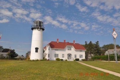
The waters off Chatham are notoriously dangerous because of the treacherous shoals and currents. The need for lights to warn mariners was recognized in early days of the country, and in 1806, nine years after the erection of the first lighthouse on . . . — — Map (db m154912) HM
”All the towers leaking bad. Everything all wet and in poor order
Log entry by Keeper Nathan Gill, 1874
Taking care of a lighthouse was demanding. The keeper was tasked with keeping the lights burning no . . . — — Map (db m141388) HM
Both the lighthouse standing here and the cliff in front of you have had to give away to the power of the Atlantic Ocean.
The first lighthouses built here in 1838 were placed over 600 feet east of where you are standing now. As ocean waves ate away . . . — — Map (db m63398)
These three lighthouses were part of the Nauset Beach Light Station, which originally stood a quarter mile away, overlooking the Atlantic Ocean. Nicknamed the Three Sisters, this trio of lights provided a landmark for sailors making their way along . . . — — Map (db m63400)
• Established – November 5 1816
• Keeper's house built – about 1876
• Fog bell installed – 1852
• Present fog signal building built – 1876
• Steam fog whistle installed – 1876
• Keeper's house added on to – Approx. 1900
• Present . . . — — Map (db m198218) HM
Since 1828 Nobska Light has provided a familiar beacon for "all who go down to the sea in ships". 87 feet above sea level, Nobska's flash every six seconds is visible 17 miles out to sea. This 28,000 candlepower light used a 1000-watt lamp magnified . . . — — Map (db m120715) HM
Hospital Point Light was constructed and first lighted in 1872 to help guide vessels into Salem and Beverly Harbors. The original two-story keeper's house and oil house are still being used.
The name Hospital Point stems from a smallpox . . . — — Map (db m21429) HM
This bell was used as the fog signal at Eastern Point Light House from June 1933 to Dec 1969.
Cast in Chelsea, MA. gold dust was sprinkled in the mold in order to obtain the right tone. — — Map (db m115484) HM
Before you stretches Ten Pound Island. In 1821 a lighthouse was built on the island to safely direct sailing ships into Gloucester Harbor. Some of America's greatest works of art were painted by Winslow Homer while staying at the keeper's house in . . . — — Map (db m36436) HM
Straitsmouth Island was first sighted in 1614 by Captain John Smith. He also spotted nearby Thacher and Milk Islands and named all three the Turks' Heads.
Lighting the Way
Built in 1834, the island's first lighthouse was 19 feet . . . — — Map (db m115515) HM
1789
President George Washington signs into law the creation of the U.S. Lighthouse Establishment under the first Secretary of Treasury, Alexander Hamilton.
1807
Congress establishes the U.S. Coastal Survey.
1842-1845 . . . — — Map (db m179350) HM
Rededicated September 6, 1986
This is a restoration of Historic Great Point Light destroyed by a raging storm on March 29, 1984. It was situated 800 feet east of this site. The rubblestone tower, lantern house, entry shelter and spiral staircase . . . — — Map (db m3814) HM
Dedicated to the memory of Joseph Antoine and Joseph Wilson, keepers of the first Minot Ledge Lighthouse who, while manning the Light on the night of Apr. 17, 1851, lost their lives when the lighthouse was swept into the sea during a violent . . . — — Map (db m42104) HM
On this site 3,514 tons of Quincy granite were hewn into 1,079 dovetailed blocks whose final weight totalled 2,367 tons.
On the two circular forms seen here, the cut stones were carefully assembled to assure perfect fit; then disassembled . . . — — Map (db m42102) HM
1835
Congressman John Quincy Adams, representing the Plymouth County District, recommended to the government that a lighthouse be built in Mattapoisett.
1837
Barnabus Hiller sold four acres at Ned's point to . . . — — Map (db m88157) HM
In 1776 an earthwork fort was erected at the gurnet for the protection of Plymouth Harbor. It mounted six cannons and was manned by militiamen from Plymouth, Kingston, Duxbury and nearby towns. The first lighthouse, built in 1768, stood alongside . . . — — Map (db m107428) HM
During the year 1810 the U. S. Congress voted [$]4000 to build a lighthouse at Scituate harbor. During the War of 1812 Abigail and Rebecca Bates, young daughters of the lighthouse keeper, prevented a British naval force from sacking the town . . . — — Map (db m23484) HM
When Copp’s Hill was first established as the “North Burying Ground,” it was just below the summit of one of Boston’s highest hills. Looking north over the colonial wharves one could see the towns of Charlestown and Chelsea and the confluence of the . . . — — Map (db m192057) HM
Little Brewster Island is home to Boston Light (1716), the oldest continually used light station in the U.S. The beacon beams light 27 miles out into the Atlantic. It's part of The Brewsters, a group of the outermost islands in the park. It's . . . — — Map (db m215585) HM
You can spend days relaxing on a remote beach, and nights listening to the sounds of the harbor from your campsite on Lovells Island. Tour the remaining gun batteries, bunkers, and foundations of Fort Standish. Pub on your water shoes and wade . . . — — Map (db m215584) HM
On December 12, 1891, the Lighthouse Board issued a "Notice to Mariners" informing them that a long sought steam-powered fog signal, featuring two 10-inch whistles similar to those then used on locomotives, had been installed at Point Betsie. . . . — — Map (db m98327) HM
Prior to 1892, large quantities of kerosene that fueled Point Betsie's beacon and apartment lamps, etc., was kept at the base of the lighthouses tower. As at other light stations, a separate building was erected here in 1892 to provide safer . . . — — Map (db m98330) HM
The Great Lakes region is one of the nation's most important centers of maritime commerce. Lighthouses helped mariners navigate these vast inland seas. In 1832, the U.S. Government built the first lights on Lake Michigan at two of its busiest . . . — — Map (db m68176) HM
The north pier lighthouses, built in 1907, guide ships to this port. The inner light replaced a smaller, wooden lighthouse in use since 1847. The north pier was then extended and the outer light tower was added, allowing mariners to find the harbor . . . — — Map (db m68152) HM
A U.S. lighthouse supply depot was built at St. Joseph in 1893. For a quarter century, this depot equipped all of Lake Michigan's lights with materials ranging from lenses to lamp oil. Operations of the St. Joseph Depot were transferred to Milwaukee . . . — — Map (db m68218) HM
The Mackinac Straits, with its narrow passage and the many reefs and shoals to the east and west, has been one of the most dangerous points on the Great Lakes for sailors since the late seventeenth century, evidenced by the many shipwrecks in the . . . — — Map (db m154598) HM
This light is opposite the turning point for ships making the difficult passage through the Straits of Mackinac, one of the busiest crossroads of the Great Lakes. McGulpin's Point light, two miles to the west, had been established in 1856, but it . . . — — Map (db m40053) HM
Unlike more remote or isolated stations surrounded by water, life at Point Iroquois included many land-based activities and contacts with neighbors. Lighthouse Service rules and regulations strongly encouraged self-sufficiency through the use of . . . — — Map (db m154409) HM
Side One:
Located where the St. Mary’s River enters Lake Huron from Lake Superior, DeTour Passage separates the Upper Peninsula from Drummond Island. It has long been a choke point for Great Lakes shipping. Anticipating increased traffic as a . . . — — Map (db m70781) HM
This light, the oldest active on Lake Superior, began operating in 1849, though the present tower was constructed later. Early a stopping place for Indians, voyageurs, and Jesuit missionaries, the point marks a course change for ore boats and other . . . — — Map (db m40054) HM
Sand Point Lighthouse
From 1868 to 1939 the Sand Point Lighthouse warned mariners of the spit of land extending into Little Bay de Noc at the entrance to Escanaba Harbor. The U.S. Congress authorized construction of the lighthouse in 1864, . . . — — Map (db m137333) HM
Skillagalee Island Light
Located 12 miles northwest of Cross Village. First established in 1850, the present Light was built in 1888. There are many shipwrecks near this island, in an area known as the "Graveyard of the Great Lakes."
Grays . . . — — Map (db m97851) HM
Post-war life at McGulpin Point With the turn into the 1800s, the social and economic systems in the Mackinaw area become more predictable. During this period Patrick McGulpin, now 60 years old, stopped having children and became a grandfather . . . — — Map (db m154820) HM
By the mid 1850's, shipping on Grand Traverse Bay had grown substantially. A Lighthouse on the northern tip of Old Mission Peninsula, to warn of the rocky point, was necessary. In 1859 Congress appropriated the funds, however the Light was not . . . — — Map (db m98186) HM
When lighthouses first operated, sperm whale oil used to fuel the lamps was kept in the basement. However, in the late 1800s, when kerosene was introduced as fuel for the lights, it was much too flammable and dangerous to store in the Lighthouse, . . . — — Map (db m98185) HM
The bathroom of earlier days was not much like the bathrooms of today. With no indoor plumbing, most privies or outhouses were holes in the ground with sheds and seats over them and were located several feet from the main home. When the hole . . . — — Map (db m98184) HM
The Pointe aux Barques Lighthouse and Lifesaving Station aided mariners for over a century, beginning in 1847. That year the United States Lighthouse Service built the first lighthouse on this site to mark the turning point of Lake Huron into . . . — — Map (db m41201) HM
Ottawa Point (now called Tawas Point) presents a hazard to navigation as it juts out into Lake Huron. It also shelters Tawas Bay, protecting ships from strong north or northeast winds.
In 1850, The Federal government set aside $5000 to build a . . . — — Map (db m123998) HM
It is respectfully requested that the Board take under consideration the advisability of erecting a set of quarters at this station for the assistant keeper.
Major Thomas Handbury
Corps of Engineers to Light-House Board
. . . — — Map (db m123996) HM
”Put oil in new Oil House, cleaned same.”
Lightkeeper Samuel Palmer, May 26, 1989
Fuel for the Tawas Point light was originally stored in an oil room in the keeper’s dwelling. During the 1870s the Lighthouse Service changed . . . — — Map (db m123993) HM
The New Light Keepers
The State of Michigan acquired Tawas Point Light from the U.S. Coast Guard in 2002. The light will be managed by the Department of Natural Resources, Parks and Recreation Division, and interpreted by the Department of . . . — — Map (db m123997) HM
The point is a “making point.”
Annual Report, U.S. Lighthouse Board, 1873
Throughout its recorded history, blowing, drifting sand has constantly extended Tawas Point. This lighthouse was built in 1876 because the end of the . . . — — Map (db m123999) HM
In 1850 the U.S. Lighthouse Service commissioned a light station to safely guide ships into Tawas Bay. The first light station was built in 1852 at the end of Tawas Point, then known as Ottawa Point. The prisms of its fifth-order Fresnel lens . . . — — Map (db m124079) HM
The point has steadily made to the southward and westward, and the extremity of it is now more than a mile from the light.
Report of the Light-House Board, 1873
Blowing, shifting sand on the point forced the construction of the . . . — — Map (db m123991) HM
The discovery of copper and dangers of navigation created a demand for lighthouses on Lake Superior. Built in 1848 and replaced by the present structure in the 1860s, the Copper Harbor lighthouse was among the first beacons on Lake Superior. Now . . . — — Map (db m153808) HM
In the mid-19th century, when roads to this area were almost non-existent, the infant community of Eagle Harbor saw a dramatic increase in waterborne commerce, including incoming settlers and supplies and outgoing shipments of copper and logs. . . . — — Map (db m152900) HM
A fog signal was installed in this building on November 30, 1895. Its purpose was to warn mariners of rock and reef along this treacherous Lake Superior coast. The invaluable signal was activated during periods of fog when the light in the tower was . . . — — Map (db m153149) HM
1858: Erected by U.S. Lighthouse Service
1899: Fog Signal Building constructed
1900: Converted to a two family dwelling
1916: Kitchen added
1952: Modernized and electrified porch wings added
1972: Building closed. Automatic Light Tower . . . — — Map (db m162126) HM
The Round Island Lighthouse, seen south of this site, was completed in 1895. Operating under the auspices of the United States Government, this facility was in continuous use for fifty-two years. It was manned by a crew of three until its beacon was . . . — — Map (db m35151) HM
Called Grande Pointe au Sable by French explorers and traders, Big Sable Point was an important landmark for mariners traveling a treacherous stretch of Lake Michigan shoreline between Big Sable Point and present-day Ludington. In 1855 . . . — — Map (db m41966) HM
Here the Petite Pointe Au Sable (little point of sand) juts into Lake Michigan. Increased shipping on the lake started after the Civil War, largely due to the expanding lumber industry. Consequently, this isolated point became the site of several . . . — — Map (db m107009) HM
Holland Harbor Lighthouse
The first lighthouse built at this location was a small, square wooden structure erected in 1872. In 1880 the lighthouse service installed a new light atop a metal pole in a protective cage. The oil lantern was . . . — — Map (db m41967) HM
Holland Harbor (Side 1) When seeking a location for his Netherlands emigrant followers in 1847, the Reverend A.C. Van Raalte was attracted by the potential of using Black Lake (Lake Macatawa) as a harbor. However, the lake's outlet to . . . — — Map (db m67577) HM
Presque Isle Harbor is one of Lake Huron's safest harbors of refuge. Its name comes from this peninsula which, translating from the French, is "almost and island." Indians and Frenchmen portaged across the peninsula to avoid several miles of open . . . — — Map (db m40149) HM
In 1869 the U.S. Congress appropriated $7,500 to build two range lights marking the channel into Presque Isle Harbor. Orlando M. Poe submitted plans in May 1870, and by August the range lights were in operation as seafarers aligned the lights to . . . — — Map (db m120784) HM
This lighthouse, built in 1870 by Orlando M. Poe, is one of three Great Lakes towers built from the same plans. It replaced the smaller 1840 harbor light. The conical brick tower rises 113 feet from a limestone foundation. The Third Order Fresnel . . . — — Map (db m40062) HM
Conveyed to Presque Isle Co. on November 23, 1998 from United States Coast Guard U.S. General Services Administration United States Department of Interior Commissioners Allan H. Bruder — Chairman Charles A. Rhode • Emil Plath Jr. . . . — — Map (db m154596) HM
Forty Mile Point Lighthouse
During the late 1800s, the U.S. Lighthouse Board created a system of coastal lights along Lake Huron's Michigan shore so that mariners would always be within sight of at least one.
With a light south of Forty . . . — — Map (db m221642) HM
This structure was the first to be built in 1896. It was used to house the laborers that erected the lighthouse. After the house was complete, it was used by the workers that were contracted to do maintenance work such as boiler inspection, etc. . . . — — Map (db m122171) HM
This harbor of refuge, named by the French and translated "Only Choice," is one of only a few along this shore of Lake Michigan. Located at 45º 55' 22" north latitude and 85º 54' 45" west longitude, the tower rises 78 feet-9 inches high and is . . . — — Map (db m165336) HM
(1) Manistique Light and Boardwalk
The East Breakwater Light , built in 1916, is 35 feet tall and stands at the harbor entrance of the Manistique River. Soon to be listed in the National Register of Historic Places, the Light . . . — — Map (db m105477) HM
This range light was originally located in American Waters, east of the mouth of the Detroit River, just north of the international border and north east of Pêche Island, Ontario, Canada
It was brought to Marine City in 1982 through the . . . — — Map (db m123840) HM
In 1825, a lighthouse was established near the mouth of the St. Clair River, at the southern end of Lake Huron. It sat just north of Fort Gratiot, a military outpost that would give the lighthouse its name. That light, of poor construction and . . . — — Map (db m241417) HM
Daily Duties of a Keeper......
• Hand carry fuel up to the lantern room and fueling the lamp.
• Trimming the wicks (later, replacing the mantles and pumping up the oil vaporizer).
• Regularly cleaning and polishing (with jeweler's . . . — — Map (db m76100) HM
Evolution of Lighting the Way
It has long been documented that the first shoreline lights were wood burning fires set on hillsides. Later, these wood fires were moved to the top of man-made towers. Wood however proved to be inefficient, as . . . — — Map (db m76076) HM
Dense fog on Lake Huron could spell disaster to vessels filled with passengers and valuable cargo. When fog was present and visibility was poor, mariners were forced to rely on sound to navigate their way into the St. Clair River. Early fog . . . — — Map (db m76083) HM
The first light was erected in 1872 at the end of a 225 foot wooden pier that had been in use since 1861. The square pyramid wooden structure consisted of two rooms mounted on a raised platform. The bottom room was for oil storage, the top room . . . — — Map (db m119263) HM
This lighthouse was built after a 1905 storm damaged 29 boats and resulted in more than three million dollars in damages.
Split Rock Lighthouse stands as a beacon to safety in the lake shipping industry. Construction began in 1909, with a . . . — — Map (db m203739) HM
Shortly after the first shipment of iron ore left Agate Bay, the U.S. Government developed a plan to improve the safety of the harbor. In 1887 construction began on the West breakwater. Also, one acre of land was purchased on which to build a light . . . — — Map (db m204339) HM
After the Minnesota Iron Company began shipping iron ore from the Vermilion Range through the Two Harbors ore docks in 1884, this port far surpassed Duluth in importance. The increased traffic of ore boats, combined with commercial fishing, made . . . — — Map (db m78812) HM
You Are Here - The one acre site was purchased by the U.S. Government with construction of the lighthouse beginning in 1891. The Two Harbors Lighthouse Station is listed on the National Register of Historic Places.
Originally, a . . . — — Map (db m78817) HM
The Harper family mansion had a spectacular view of the river from the bluff. The construction of the railroad and related development made its land valuable for commerce, and the house and its garden were destroyed to build a large warehouse (no . . . — — Map (db m104673) HM
Since its construction in 1848, this cast iron lighthouse has been the landmark for which Biloxi-bound vessels sail. Tended by the Younghans family, father, mother and daughter, from late 1866 until 1929. — — Map (db m22778) HM
Constructed in sections by the firm of Murray and Hazelhurst of Baltimore, Maryland, the Biloxi lighthouse arrived at this location aboard the brig General North and was erected in 1848. A cast iron sheath lined with locally made brick, the 48-foot . . . — — Map (db m95447) HM
In 1848, the United States Lighthouse Service erected the South's first cast-iron lighthouse, in
Biloxi on a low sandy bluff overlooking the Mississippi Sound. The tower was fabricated by the
Murray and Hazelhurst Vulcan Works of Baltimore, . . . — — Map (db m102221) HM
The original Round Island lighthouse was built in 1833 on Round Island for $5,895 by Marshall Lincoln and David Henshaw. It was constructed using methods similar to those used on the East coast rather than methods suitable for the Gulf coast and the . . . — — Map (db m102291) HM
Round Island is located in the shallow Mississippi Sound only 3 miles offshore of the entrance to the Pascagoula River. By the early 19th Century increasing coastal commerce had made the need for a lighthouse critical. This first Round Island . . . — — Map (db m102363) HM
The Round Island Lighthouse was built on the barrier island of the same name located off the mouth of the Pascagoula River. Replacing an earlier structure built in the 1830's, the lighthouse was completed in 1859 for a cost of $7,130.97. The . . . — — Map (db m102386) HM
Built in 1935 as a memorial to Mark Twain on his 100th birthday, the current lighthouse is the second to be built at this site.
• 1934 Construction on the Mark Twain Memorial Lighthouse began. The metal framework structure, covered . . . — — Map (db m131895) HM
Over the years, these grounds contained a variety of buildings that supported the Lighthouse operation. As you look around, envision the oil storage house with a greenhouse and sheds behind it, a square brick building housing the Weather Bureau . . . — — Map (db m46297) HM
Weather Bureau
The Department of Agriculture Weather Bureau constructed a two-story brick building on the west side of the site in 1901. The building was wedged onto a 100 × 50 foot plot, and apparently caused rancor between employees of . . . — — Map (db m190905) HM
When Absecon Lighthouse was first lit in 1857, a principal keeper and assistant keeper lived on site with their families. The dwelling for an assistant keeper was built during the original Lighthouse construction. Interior alterations in 1887 . . . — — Map (db m46288) HM
1854. After a decade of prompting from Jonathan Pitney, the "father of Atlantic City," the U.S. Congress appropriated $35,000 to build a lighthouse on Absecon Island.
December 5, 1854. The Camden and Atlantic Land Co. transferred the . . . — — Map (db m190910) HM
The light from Absecon Lighthouse first beamed out across the Atlantic Ocean in 1857. At that time, the Lighthouse consisted of the original keeper’s dwelling, a thirty-foot connecting passageway and the tower. In 1903, adding a two-story . . . — — Map (db m46304) HM
The ocean waters off Absecon Inlet were considered some of the most deadly along the East Coast. Between 1847 and 1856, at least sixty-four ocean-going ships were lost off the coast of Absecon Beach. Dr. Jonathan Pitney, who promoted the . . . — — Map (db m46273) HM
By 1872, the first life-saving station was in operation on the corner of the Lighthouse property. This simple building, with some periodic renovations, served until the second, larger and more ornate station was constructed in 1884.
The new . . . — — Map (db m46289) HM
Before construction of Absecon Lighthouse, many ships and many lives were lost off the coast of Absecon Island. Even though the beam from this light lessened these losses, other disasters plagued seagoing vessels. The anchor you see here, weighing . . . — — Map (db m46291) HM
USCS Steamer Robert J. Walker
1874 - 1860
More than 153 years after it was lost in a violent collision at sea, the wreck of the steamer Robert J. Walker was identified 12 miles off Absecon Lighthouse by maritime . . . — — Map (db m190904) HM
This iconic symbol of Brigantine, NJ is not an actual working lighthouse but rather a monument or tourist attraction used to help in the sale of real estate on the island. The Lighthouse, which was built in 1926 by The Island Development Company, . . . — — Map (db m190485) HM
Primary seacoast lights were located to warn mariners of their proximity to land, the presence of navigational dangers, and to help set their course. By 1852, however, lighthouses and lightships often looked so much alike that it was difficult to . . . — — Map (db m114571) HM
From the time the current lighthouse was built in 1859 to the time it was electrified around 1933, four keepers, their assistants, and their families lived and worked on this landscape by the sea.
The keepers and their periods of service . . . — — Map (db m114569) HM
Primary seacoast lights were located to warn mariners of their proximity to land, areas of danger, and to help set the course. Sandy Hook and Navesink Twin Lights marked the entrance to New York Harbor. Cape May and Cape Henlopen Lighthouses . . . — — Map (db m206412) HM
This structure was built in 1893 to house the kerosene used to power the light. Until 1893, the Lighthouse’s oil was stored in the vestibule house at the entrance to the tower. Moving it to a separate building reduced the risk of fire in the . . . — — Map (db m114573) HM
This structure was built in 1893 to house the kerosene used to power the light.
Lighthouses were generally powered by Sperm Whale oil until its price rose dramatically in the 1850s. In the mid-1870s, kerosene, which was less expensive than . . . — — Map (db m206416) HM
Construction of the Cape May Lighthouse is being supported in part by a National Maritime Heritage grant administered by the National Park Service, Department of the Interior.
This lighthouse was built in 1859 by the Army Corps of Engineers, . . . — — Map (db m206417) HM
For some 180 years, a lighthouse beacon has stood here at the southern tip of New Jersey, guarding the entrance to Delaware Bay. The present tower was constructed in 1859. Standing 157½ feet tall, it is the third lighthouse on this site, . . . — — Map (db m114572) HM
For almost two centuries, a lighthouse beacon has stood here at the southern tip of New Jersey, guarding the entrance to the Delaware Bay. The present tower was constructed in 1859. Standing 157½ feet tall, it is the third lighthouse on this . . . — — Map (db m206413) HM
602 entries matched your criteria. Entries 201 through 300 are listed above. ⊲ Previous 100 — Next 100 ⊳